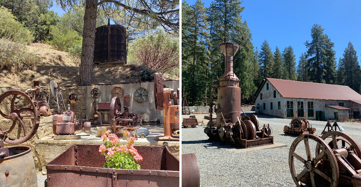
Rusting headframes rising over dry golden hills are easy to lose an afternoon to, and California’s gold country is full of these leftovers. Wooden towers, stone powerhouses, stamp mills and shafts vanish straight down into the dark.
I have spent a lot of weekends chasing them, spanning pine country and oak woodlands, always surprised by how ordinary these places feel until you learn what happened in them, and then everything shifts. Some sites still run their old machinery for visitors, others are nothing but foundations and gouged cliffs, and both kinds stick with you.
The silence in these places is heavy, broken only by wind and the occasional creak of old metal. Walking through them feels like stepping into a story that was never finished.
Rusted tools and broken brick lie where workers left them, and the ground still bears the scars of hydraulic mining. History you can walk through instead of read about is rare, and these nine stops make one unforgettable route.
1. Kennedy Gold Mine, Jackson, A Mile Straight Down
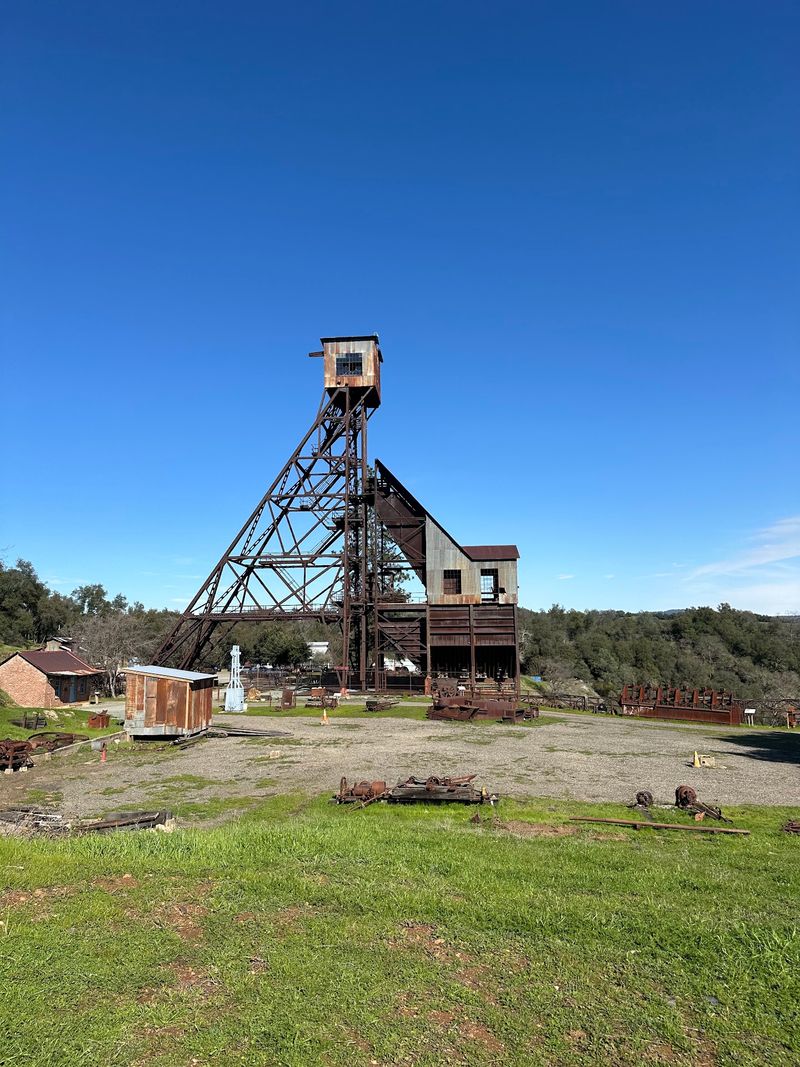
Drivers on Highway 49 have been craning their necks at that tall wooden headframe for generations, and I was no different. It marks one of the deepest mines on the Mother Lode, dropping a startling 5,912 feet, more than a mile below the surface.
Operations here began in the mid-1850s and ran, on and off, until 1942 when wartime priorities shut things down. In that stretch the mine produced an estimated 34.2 million dollars in gold.
What holds my attention on the grounds is the mix of big and small. There is the gleaming white office building, rebuilt after a 1928 fire, and then quieter things like the pay station, the safe and the engineer’s desk.
Two of the original four tailing wheels still survive nearby, part of a clever system that lifted crushed gravel up and over hills into settling ponds. Entrances to some of the 367 miles of abandoned, flooded tunnels are visible too, sealed but unmistakable.
The mine takes its name from Andrew Kennedy, an Irish immigrant who spotted a quartz outcropping in the late 1850s. A small building honors the 47 miners trapped in the neighboring Argonaut Mine in 1922, a rescue effort that drew worldwide attention.
Volunteers run the place, and their enthusiasm is contagious.
Address: 12594 Kennedy Mine Road, Jackson, CA 95642
2. North Star Mining Museum, Grass Valley, Where Water Powered Everything
Compressed air, of all things, is the star attraction at this squat stone building tucked below Grass Valley. I had no idea how central it was to hard rock mining until I stood next to the machinery that made it.
The powerhouse went up in 1895 and was restored later, which explains why the rock walls look so solid.
Inside, a water-powered Pelton wheel once drove the compressed air plant, sending power to equipment at both the Massachusetts Hill and North Star mines. That setup was genuinely cutting edge for its day and kept working until 1935.
The North Star Mine itself closed in 1956, the same year the nearby Empire Mine shut its gates.
Wandering the exhibits, I kept noticing details that made the work feel real, worn tools, lamps, drill bits, models showing how ore moved from rock face to mill. The museum’s whole purpose is explaining that process and, just as importantly, the people and towns that grew up around it.
Kids seem to gravitate toward the enormous wheels and gears, which is fair enough.
It is a compact stop, easy to pair with a longer day in the area, and the creekside setting is shady and cool even in midsummer. I lingered longer than planned.
Address: 933 Allison Ranch Road, Grass Valley, CA 95949
3. Kentucky Mine Historic Park & Museum, Sierra City, Listen to the Stamp Mill
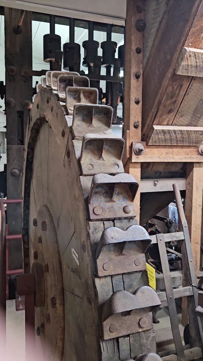
Nothing prepared me for the noise. When the stamp mill runs during a demonstration, ten 1,000-pound stamps pound away at quartz ore and the whole 70-foot wooden structure seems to shudder.
It is considered one of the best-preserved mills of the Gold Rush era, and the fact that it still operates makes it rare.
The site sits in thick Sierra forest below the Buttes, which gives the whole visit a cool, pine-scented feeling that the foothill sites simply do not have. A wooden trestle bridge still carries ore carts toward the mill, and the mine portal is right there in the hillside.
A cave-in limits entry to roughly 15 feet inside, but even that short distance gives you the damp, echoing feel of underground work.
Development started in the late 1850s, and the mine finally closed in 1953, years after a serious accident in 1944. The museum fills in the human side with artifacts from mining families and mountain communities.
One case stopped me completely, an exact replica of The Monumental, a 106-pound gold nugget found in Sierra County in 1869.
An operational Pelton water wheel shows how the whole operation was powered, and there is a generous picnic area if you want to stretch the afternoon out.
Address: 100 Kentucky Mine Rd, Sierra City, CA 96125
4. Gold Bug Park & Mine, Placerville, The City-Owned Tunnel
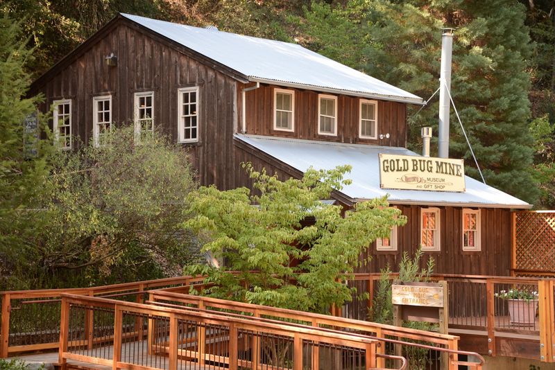
Here is an odd bit of trivia I enjoy repeating: this is the only gold mine in California owned by a city. Placerville hangs onto it, and visitors get to walk right into the rock.
Self-guided audio tours mean you set your own pace, which I appreciated, since I stopped constantly to look at drill marks in the walls.
The temperature inside drops fast and stays cool, so a light jacket is a smart move even on a scorching summer day. Water drips somewhere behind you, and the timbered ceiling feels much closer than you expect.
Outside, the Hendy Stamp Mill shows how ore was crushed once it came out, and a blacksmith shop rounds out the picture of how much skilled work a mine demanded.
Hattie’s Museum adds the domestic side, the objects and furnishings of everyday life in the mid-1800s.
What I like about the layout is how it connects the pieces. You see the hole, the machine that processed what came out of it, and the household that depended on both.
Two miles of hiking trails loop through the oaks and pines above the mine, and they are quiet enough that I ran into almost nobody on a weekday morning.
Good shoes help on the gravel.
Address: 2635 Gold Bug Lane, Placerville, CA 95667
5. Eagle and High Peak Mine, Julian, Southern California’s Gold Story
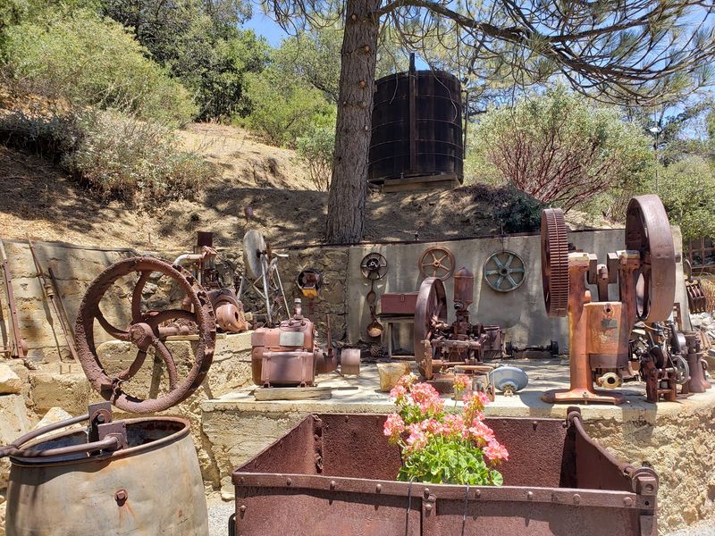
Most people drive up to Julian for mountain air and apple orchards, so it catches visitors off guard that a real gold mine sits a short walk from town. I certainly did not expect tunnels here.
Gold turned up in a seasonal creek in 1870, and prospectors soon traced a substantial quartz vein into the mountainside.
Two separate mines were registered that same year and later merged after World War I, which let crews burrow deeper into the rock. The Eagle became one of the most successful operations in the region, producing gold from 1870 all the way to 1934.
Tours lead you through the network of tunnels, and the passages are narrow enough that you understand quickly how physically punishing the work was.
Along the route there are historical artifacts, antique mining machinery and even some vintage cars parked around the property, which gives the whole place a slightly delightful jumble of eras. A mill used for breaking down large rocks is still visible, and during Julian’s boom years it reportedly ran up to 18 hours a day.
The mountain setting, with pines and big granite outcrops, feels nothing like the northern foothills.
I left thinking the Gold Rush story is far wider than the Sierra towns suggest.
Address: 2320 C St, Julian, CA 92036
6. Empire Mine State Historic Park, Grass Valley, Ruins, Roses and a Deep Dark Hole
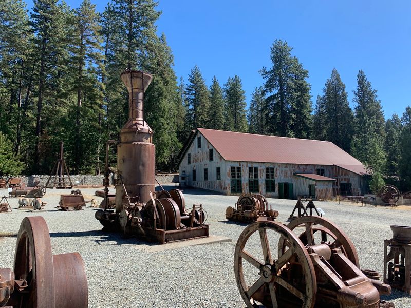
Peering down the lighted shaft was the moment that got me. The passage slopes away into blackness, and knowing it connects to 367 miles of flooded tunnels makes your stomach tighten a little.
This was one of the oldest, deepest and richest gold mines in the state, running from 1850 clear through to 1956.
Over that century-plus it produced 5.8 million ounces of gold, a number that is hard to picture until you see the machine shop and refinery that handled it. The mine manager’s office still stands, along with other mine buildings, and a hulking headframe looms above the mineyard.
A scale model in the mineyard office lays out the underground workings in three dimensions, and I studied it for ages.
The contrast on this property is the part nobody forgets. A short stroll from all that industrial iron sits the stone Bourn Cottage, the owner’s home, surrounded by restored gardens full of roses and clipped hedges.
Wealth on one side of the path, brutally hard labor on the other.
Trails wind through the surrounding woods if you want more time outdoors, and the whole site is easy to combine with other stops around town. Comfortable shoes and an unhurried schedule serve you best here.
Address: 10791 East Empire Street, Grass Valley, CA 95945
7. Marshall Gold Discovery State Historic Park, Coloma, Where It All Started
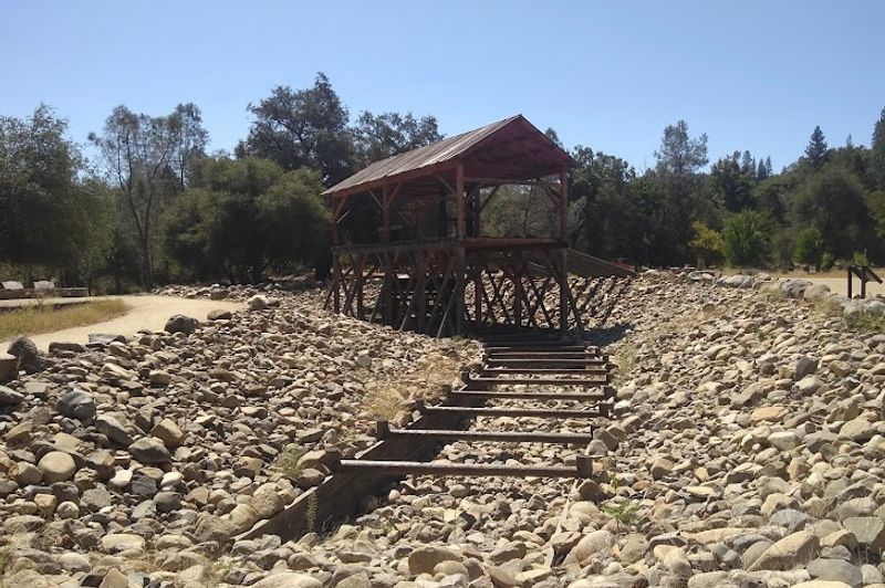
The American River runs green and fast past the spot where James W. Marshall found gold in 1848, and the ordinariness of it is almost funny.
A few flecks in a sawmill tailrace changed the entire future of California.
You can still see that tailrace, plus a replica of Sutter’s Mill built close to where the original stood.
The park takes in much of old Coloma, now a ghost town and a National Historic Landmark District. More than 20 historic buildings survive, including pioneer homes, a schoolhouse, general stores and structures tied to mining operations.
A blacksmith shop and a wonderfully dilapidated jail were my favorites, mostly because they look so lived-in.
Up on the hillside stands the Marshall Monument, California’s first historic monument, marking Marshall’s grave with a figure pointing toward the discovery site. The climb rewards you with a view over the whole valley.
Shaded lawns and big trees make this an easy place to spend a long, slow afternoon.
What struck me was how peaceful it all feels now, considering the stampede of people this small bend in the river set off. Bring a picnic, walk the town loop twice, and let the scale of it settle in.
Address: 310 Back St, Coloma, CA 95613
8. Malakoff Diggins State Historic Park, North Bloomfield, A Canyon Carved by Water
Cliffs in shades of orange, cream and rust rise across a pit so large it reads as natural canyon country until you learn people made it. High-pressure water jets did this, blasting entire hillsides apart.
Once the largest hydraulic mining operation in California and in the world, the site swallowed hillsides after gold was found in 1851 and hydraulic work began in 1853.
Crews moved a staggering 41 million cubic yards of earth here and recovered over 13.5 million dollars in gold. The resulting scar stretches roughly 7,000 feet long, up to 3,000 feet wide, and nearly 600 feet deep in places.
Remnants of the main Malakoff mine and five other claim sites are scattered through the park.
Then there is North Bloomfield itself, a preserved old town with homes, a drugstore, a church and a schoolhouse still standing along the dusty street. Poking through those buildings gave me a much clearer sense of the families who lived out here, far from anywhere.
All of it ended with the 1884 Sawyer Decision, which cut back large-scale hydraulic mining because debris was burying farmland downstream.
The drive in is winding and unhurried, the forest is tall and quiet, and the payoff view is genuinely jaw-dropping.
Address: North Bloomfield, CA
9. Stonewall Mine, Cuyamaca Rancho State Park, Foundations in the Oaks
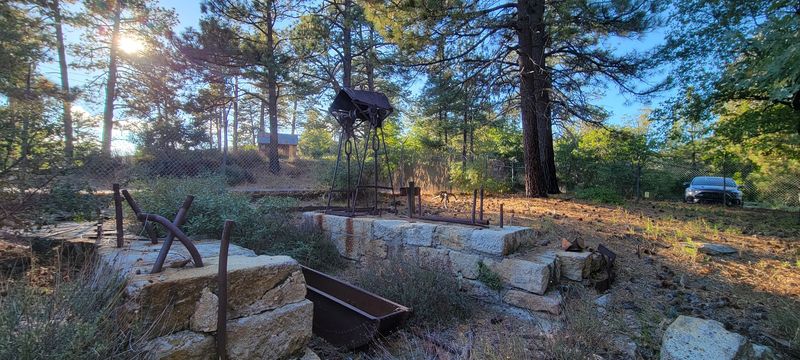
Ruins get under my skin more than restored buildings sometimes, and this quiet meadow in the Cuyamacas is a good example. Foundations, scattered relics and a filled-in shaft are mostly what is left, yet the place hums with history.
Gold surfaced here in 1870, and this became the most productive gold mine in San Diego County.
Activity peaked between 1870 and 1899, with the mine yielding over two million dollars in gold. A whole workers’ community grew alongside it, known as Cuyamaca City, and its outlines are still traceable on the ground.
Ralph Dyar bought the property in 1923, filled in the main shaft, and had many original buildings taken apart so the materials could be used elsewhere.
The few remaining structures were largely destroyed by the enormous Cedar Fire in 2003, which left the discernible foundations and mining relics you walk among today. Knowing that double loss makes the site feel fragile rather than sad.
Oaks, pines and mountain meadows surround a picnic area and an easy trail through the remains.
I ended up sitting on a stone footing for a while, listening to acorn woodpeckers and thinking about how thoroughly a boom town can disappear. Go early, when the light is soft and the meadow is still.
Address: Cuyamaca Rancho State Park
