Rusted stone towers rising between redwoods are easy to miss from a coastal highway. The turnoff comes up fast, and most drivers pass it without a second glance.
One minute the road is following the cliffs, and the next there is a parking spot under a bridge with the ocean behind and a redwood canyon rising straight ahead. About half a mile up the trail, four huge stone and iron towers appear between the trees, quiet and rusting and far bigger than expected.
A lime and lumber company built them in 1887, fed the fires with redwood trunks, and packed up and left by 1890. Three years of work, and the kilns are still standing while the forest has spent more than a century growing back around them.
The hike was supposed to be the point, but the history left a deeper mark. It is a reminder of how fast people can change a place, and how patiently a forest can answer.
Four Kilns That Outlasted the Company That Built Them
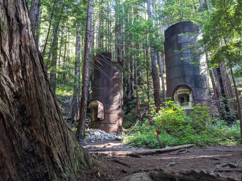
Nothing on the trail prepares you for the scale of them. The four kilns sit close together in a shaded pocket of the canyon, built from stacked stone and wrapped in iron, and the tallest structures at the park reach heights of around 100 feet.
Rockland Lime and Lumber Company put them here in 1887 to roast limestone at extremely high heat, a process that separates out pure lime.
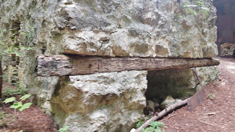
What surprised me most was how solid they still feel after so long. Iron rings have rusted into deep orange streaks, moss has settled into the seams, and ferns grow out of cracks near the base.
You can walk right up to them and look into the openings where the fires once burned.
There is a strange quiet around the site, partly because redwoods absorb sound and partly because the whole thing feels abandoned mid-sentence. The company closed in 1890 and simply walked away.
Interpretive signs nearby explain the process in plain language, which I appreciated more than I expected.
Give yourself twenty minutes here at minimum. The kilns reward slow looking, and photos never quite capture how tall they really are.
Three Years of Work That Reshaped a Whole Canyon
Three years sounds like nothing. Then you learn what the operation actually required, and the math gets uncomfortable.
Burning limestone into usable lime needs sustained, ferocious heat, and the fuel came from the redwoods growing right there in the canyon. Enormous trees were cut and fed into the fires.
Redwood also went into barrels, since the finished lime had to be packed and shipped without getting wet. So the forest served double duty as both fuel and packaging.
By 1890 both the accessible limestone and the nearby timber had run low, and the company shut down.
I stood near one kiln trying to picture the noise of it, the smoke, the sound of saws in a place that now feels almost soundproofed by trees. It is a useful reminder that wild-looking landscapes often have industrial pasts hiding in plain sight.
The lime itself ended up in cement used for buildings in San Francisco and Monterey, which means a piece of this canyon is still holding up walls hundreds of miles north.
That connection between a quiet Big Sur creek and two busy cities stuck with me longer than anything else.
The Limekiln Trail Does the Hard Work for You
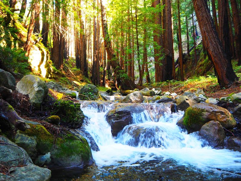
Getting to the kilns is easier than the setting suggests. The Limekiln Trail starts near the campground and follows the creek upstream, gaining elevation gently rather than punishing you for showing up.
Total distance out and back runs roughly a mile, depending on where you start and which spur you follow.
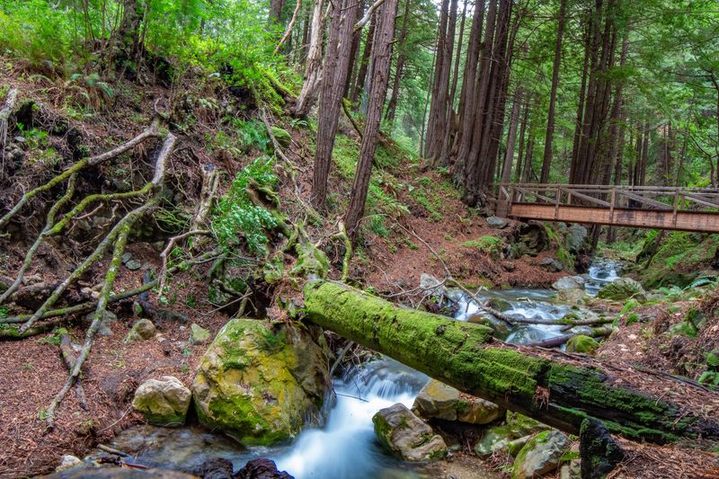
Small footbridges cross the water in a few places, and the creek stays close enough that you hear it the entire way. Redwoods lean in overhead, so the light arrives in patches.
Several hikers mention poison oak along the edges, and they are right, so staying on the packed dirt path is the smart move.
Footing gets slick where water seeps across the trail, especially after rain. Shoes with real grip beat sandals here by a wide margin.
Trail conditions do change. Storm damage and fallen trees have closed sections in the past, including the spur toward the falls, so checking with park staff at the entrance before you commit saves disappointment.
Even a partial walk through this canyon is worth it. I have rarely covered so little ground and felt like I saw so much.
A Nearly 100-Foot Waterfall Hiding Up the Side Canyon
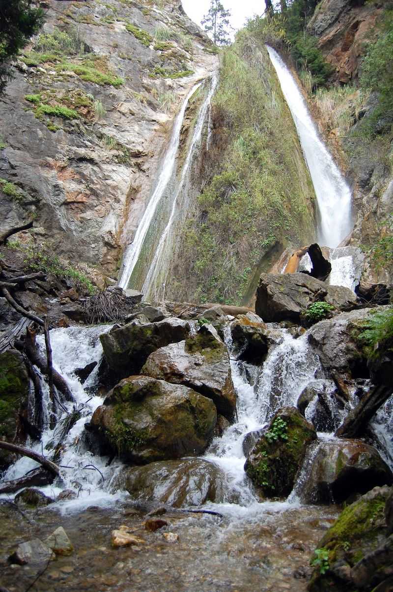
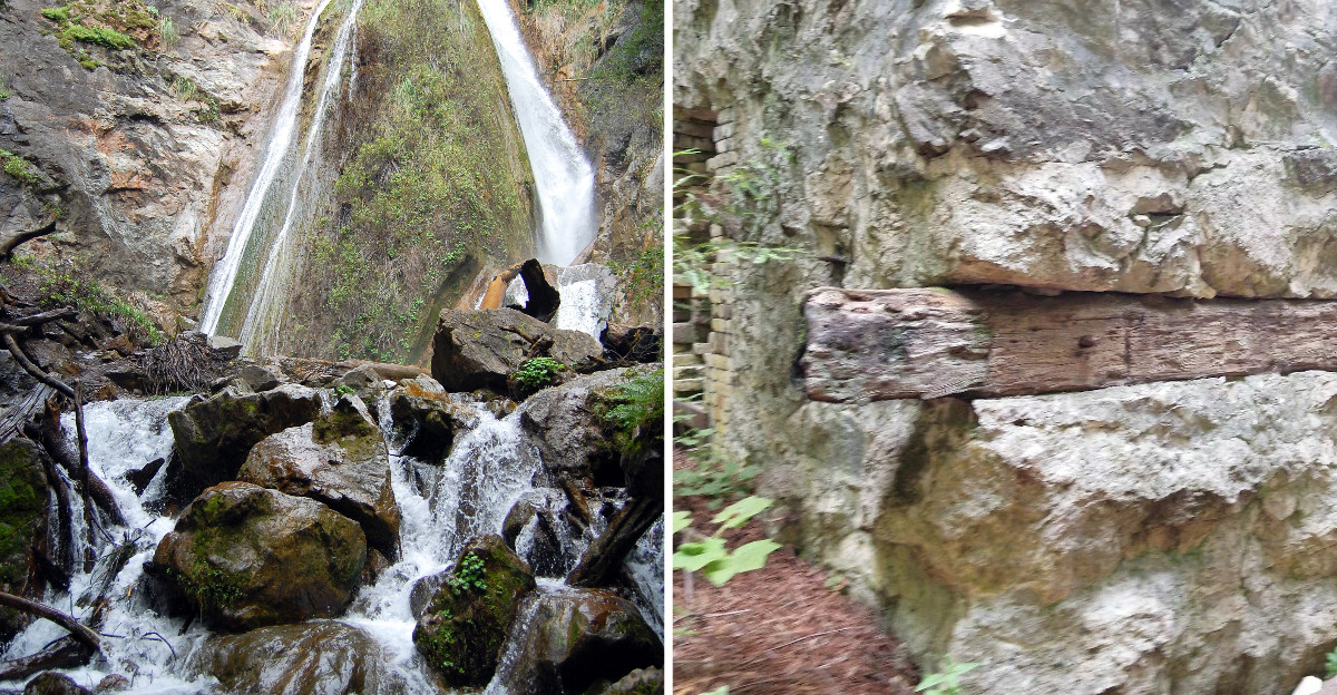
Limekiln Falls is the other headline attraction, and it takes a short branch off the main trail to reach. The water drops close to 100 feet down a pale, mossy rock face into a shallow pool.
Because the cliff is limestone, the falls spread and fan out rather than pounding down in one solid column.
Reaching the base involves a few creek crossings, and depending on water levels you may get your feet wet. Rocks in the streambed are genuinely slippery, so a hiking pole or a steady hand on a branch helps more than pride does.
Winter and spring bring the strongest flow, while late summer thins it out considerably.
Worth knowing before you drive: the waterfall route has been closed at times due to storm damage and fallen trees, and visitors have turned back at barriers. Park staff can tell you the current status when you arrive.
When it is open, the little amphitheater of ferns and dripping stone feels like a completely different climate from the sunny highway a few minutes away.
I would happily make the trip for the falls alone.
Old-Growth Groves That Were Nearly Logged Again
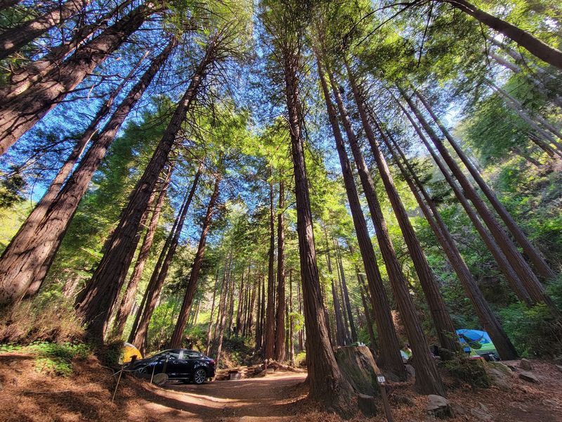
Here is the part of the story that could have gone very differently. The ancient redwood groves in this canyon survived the 1880s operation, then faced logging threats again a century later.
Conservation work through the 1980s protected them, and the land became Limekiln State Park in 1994, opening to visitors in September 1995.
Walking among those trunks, some wide enough that you cannot see around them, the save feels like an obvious win. The forest floor is soft with needles and sorrel, and the air holds that damp, cool smell redwoods seem to manufacture on their own.
Upper sections of the trail lead to quieter groves where the crowds thin out fast.
The park covers 711 acres and sits in one of the steepest coastal canyons in the continental United States, which explains why the walls rise so abruptly on both sides.
Shade and steepness together keep moisture trapped, and that is exactly what these trees want.
Second-growth redwoods now fill the areas cut for kiln fuel, growing steadily since 1890. Recovery here is measured in centuries, not seasons.
Beach Under the Bridge, Sand Meeting Redwoods
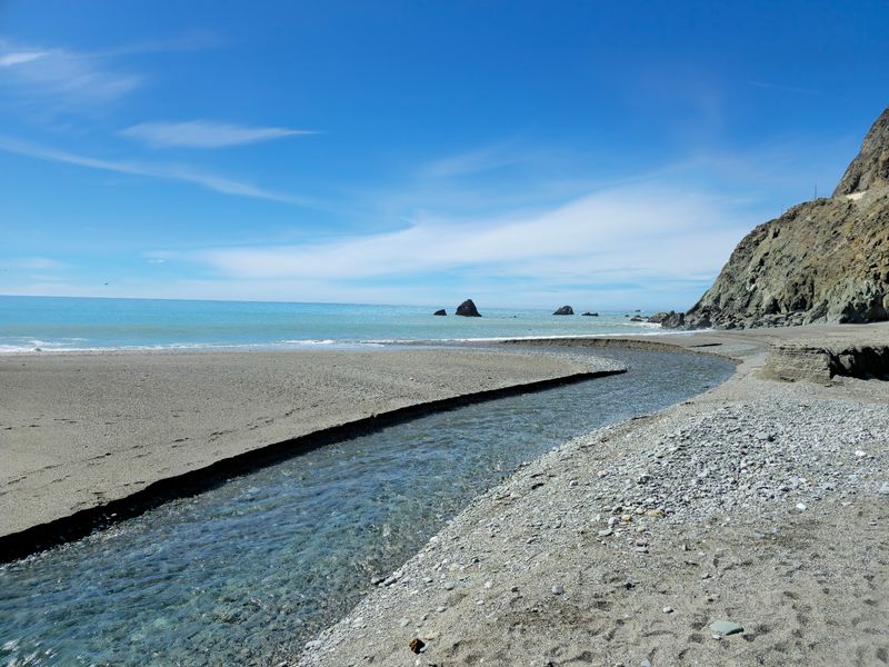
Two minutes from the parking area and suddenly there is surf. The beach sits at the mouth of the canyon, tucked beneath the Highway 1 bridge, where the creek runs out across the sand and into the Pacific.
Very few places let you stand between old redwoods and breaking waves without changing shoes.
Driftwood piles up along the tide line, and the bridge overhead frames the ocean in a way that makes for oddly good photographs. Compared with better-known Big Sur beaches, this one stays noticeably calmer.
Rinsing salt off in the freshwater creek afterward is a small pleasure I did not anticipate.
Wildlife watching from the shore can be excellent. Visitors regularly spot sea otters, seals, dolphins, whales during migration seasons, and plenty of seabirds working the swell.
Bring binoculars if you have them.
Sneaker waves and cold water mean swimming is not the point here. Sitting on a log with a sandwich, watching fog roll along the cliffs, absolutely is.
I ended up staying far longer than planned, which seems to be a pattern at this park.
Sleeping Between a Creek and the Surf
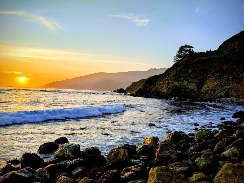
Falling asleep to two kinds of water at once is the selling point of camping here. The park has 24 sites split roughly between redwood canyon spots and ocean-facing spots near the bridge.
Creekside sites put running water a few steps from your tent door.
Reservations matter enormously. Summer weekends book out far in advance, while the off-season opens up considerably and can feel almost private.
Hot showers and clean restrooms are available, which campers consistently appreciate.
Big rigs should think twice. The access road and site layout suit tents and small trailers, and anything much over 20 feet will find options tight.
Raccoons patrol the campground at night with real determination, so food needs to be locked away rather than optimistically covered.
Most sites lack hookups, meaning your own power and water are worth packing. Camping availability has shifted in recent years as trails and facilities recover from storm and fire impacts, so confirming your stay before the drive is sensible.
Waking up, walking to the beach for sunrise, then hiking to the kilns before breakfast made for one of my better mornings in California.
Why This Small Park Sticks With You
Some places impress you with size, and others with contrast. Limekiln squeezes rusting industrial towers, ancient trees, a tall waterfall, and a pocket beach into 711 acres, all inside one of the steepest coastal canyons in the continental United States.
You can experience the whole range in a half day without rushing.
What makes it land emotionally is the timeline. A company spent three years here and consumed both the limestone and much of the surrounding forest, then vanished in 1890.
The forest has been quietly rebuilding ever since, and it is winning.
Standing among second-growth redwoods with a kiln at my back, the contrast felt less like a lecture and more like a small, hopeful fact. Damage is fast.
Recovery is slow but real.
Bring layers, since fog and sun trade places quickly, and wear shoes you do not mind getting damp. Check trail status, pack a picnic, and leave time to sit by the creek doing nothing.
If you are driving the Big Sur coast, this stop deserves more than a photo from the bridge.
Address: 63025 CA-1, Big Sur, California 93920
