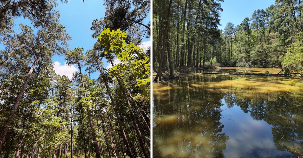
Texas is not always the first place people picture when somebody says “towering forest,” which makes walking beneath trees higher than a ten-story building feel like a pretty satisfying surprise.
In parts of the state’s wooded east, trails thread through pine and hardwood forests where mature trees can reach or exceed 100 feet, creating the kind of canopy that makes people instinctively stop and look straight up.
One state park even describes its woods as a “cathedral of trees,” with 100-foot pines surrounding a spring-fed lake and trails winding beneath them. The walking itself does not need a dramatic gimmick when the scenery is operating at that scale.
Texas has plenty of wide-open landscapes, but this kind of forest delivers the exact opposite experience: shade, towering trunks, pine needles, and trees that make everybody underneath look tiny.
The Sentry Pine And The Short Walk That Leads To It
Some trees make you stop mid-sentence. The Sentry Pine did that to me, mostly because it is impossible to see the whole thing at once without leaning back and squinting.
Getting there takes almost no effort at all. The Lightning Trail runs just two-tenths of a mile, making it one of the easiest walks in the park and a good choice for families with small kids or anyone who is not up for a long trek.
Park staff recognize the Sentry Pine as one of the tallest and oldest trees on the property, with more than a century of growth behind it. That means it was already standing when most of the surrounding forest was clear-cut in the early 1900s.
The bark is thick and plated, split into puzzle-piece sections that look almost like stonework up close. Run a hand along it and the texture feels nothing like the smooth young pines nearby.
Morning light works best for photos here, since the sun angles through the canopy rather than blasting straight down. Bring a wide lens if you have one, because standing back far enough is tricky in a dense stand of trees.
What struck me most was the silence around the base. Sound seems to get absorbed by all those needles overhead, and the usual highway hum fades to nothing.
Give yourself ten minutes here even though the walk is short. Rushing past a hundred-year-old tree feels like a small waste.
Eight Miles Of Trails That Range From Easy Strolls To Leg Burners
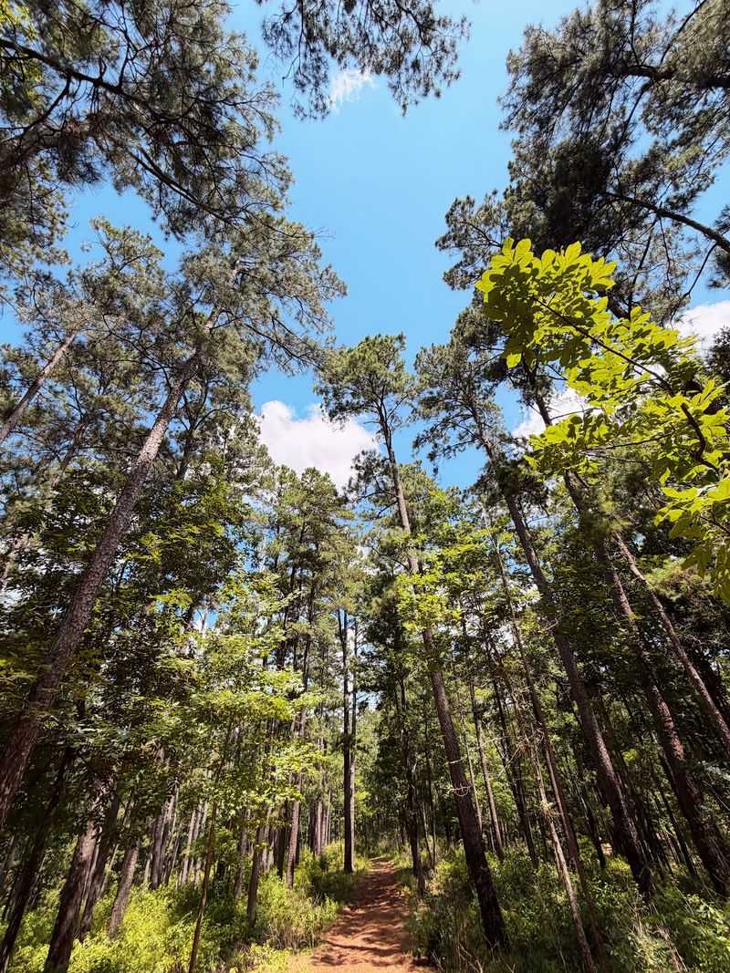
Eight-plus miles does not sound like much until the ground starts tilting. Mission Tejas packs a surprising amount of elevation change into a small footprint, and the Steep Ravine Trail earns its name honestly.
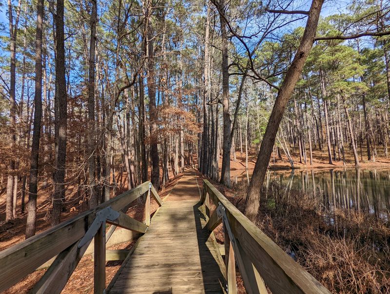
At 2.4 miles, Steep Ravine is the longest and toughest route in the park. It drops down into shaded hollows, then climbs back out, and it links up with the Hardwood Trail and the Weches Run for hikers who want to string together a bigger loop.
The Olen Matchett Trail is short but sneaky. Do not let the mileage fool you, because the grade through those forest highlands will get your heart going.
For an easier outing, the Nabedache Loop covers 1.1 moderate miles and passes traces of an old historic road. Other options include the Karl Lovett Trail, Big Pine Trail, Chimney Loop, Tejas Timber Trail, and the San Pedro Spur.
Interpretive signs pop up along several paths, explaining what grew here, who passed through, and how the land changed over time. Reading a couple of them turned a plain walk into something closer to a history lesson.
Trails are open to bikes as well as boots, though the rooty sections demand attention on two wheels. After rain, the clay turns slick and sticky in equal measure.
Wear shoes with real tread. Sandals and a steep ravine make a poor combination, as anyone who has slid down one can confirm.
A Log Mission Replica Built By Depression Era Hands
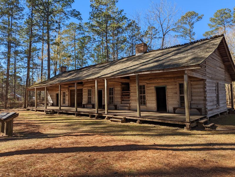
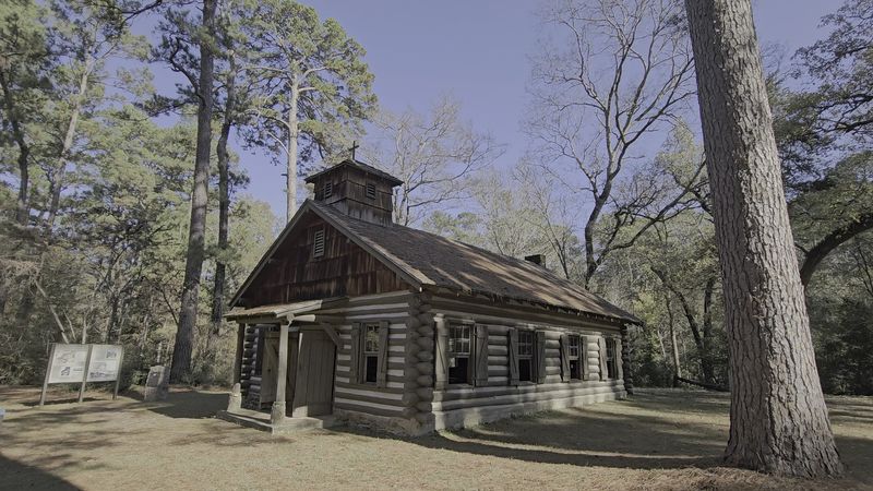
Rough-hewn logs, a wood-shake roof, and a fireplace built from petrified wood. The mission replica sitting in a clearing near the park entrance is the single most photographed thing here, and for good reason.
Civilian Conservation Corps Company 888 raised it between 1934 and 1935. The building honors the site where Mission San Francisco de los Tejas, the first Spanish mission in the province of Texas, was founded in 1690.
History behind it reads like a chess match. After the French pushed into Texas in 1685, Spain responded by planting a mission inside a Caddo village, aiming to hold territory and spread Christianity at the same time.
The replica is not a museum-perfect reconstruction, and it was never meant to be. Think of it as a memorial built in wood, designed to keep the memory of the original alive.
Double-hung windows and hand-notched corners give it a homespun look that fits the surrounding pines. The petrified wood fireplace is the detail most visitors miss, so walk around and check the chimney.
Standing in the doorway, the scale feels smaller than expected. Whatever grand image the word mission conjures, this building corrects it fast.
Land for the site was acquired in 1935, when 118 acres came under state care as San Francisco Mission State Forest. The name changed to Mission Tejas State Park in 1957.
Bring a camera at golden hour. The logs glow.
The Rice Family Log Home And Its 1828 Bones
Nearly two centuries old and still about 80 percent original. That statistic alone made me look at the Rice Family Log Home differently than the average roadside cabin.
Construction started in 1828 using local lumber cut and shaped by hand. Additions wrapped up around 1838, expanding the structure into something closer to a small inn.
Travelers on El Camino Real needed a place to stop, and this house served that role. Immigrants, adventurers, and locals moving along the Old San Antonio Road all found shelter under its roof.
Inside, wallpaper and paint from the 1890s still cling to the walls. Faded, yes, but genuinely there, which is rarer than most people realize in surviving pioneer buildings.
The house did not start out in the park. Descendants of the Rice family donated it to the state in 1973, and crews relocated it roughly 16 miles to its present spot.
School groups visit often, and it is easy to see why. Kids get a concrete sense of how families lived without electricity, plumbing, or insulation.
Look at the joinery where logs meet at the corners. Every notch was cut by someone with an axe and a good eye, no power tools involved.
Stand on the porch for a minute and think about who else has stood there. Traders, settlers, and tired travelers with a long road behind them and more ahead.
Following Ruts Left By El Camino Real De Los Tejas
Old roads leave scars, and some of those scars last 300 years. Along the Nabedache Loop, faint depressions in the forest floor mark where El Camino Real de los Tejas once ran.
Spanish explorers identified the route between 1686 and 1692. At full length it stretched roughly 2,500 miles, connecting Guerrero, Mexico, all the way to Louisiana.
For more than 150 years it functioned as the main artery between Mexico City and the province of Tejas. Goods, soldiers, priests, settlers, and news all moved along it.
Buffalo Soldiers traveled portions of the Royal Road in the late 1800s, adding another layer to its story. Business, settlement, and military movement all shaped the path over time.
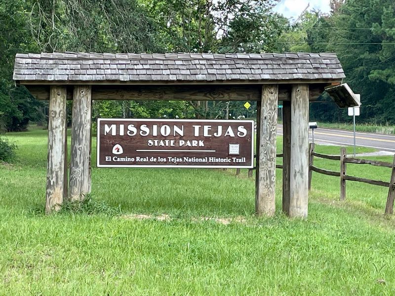
Mission Tejas State Park holds certification as an official site on the El Camino Real de los Tejas National Historic Trail. That designation is not handed out casually.
Honestly, the ruts are subtle. Nobody is going to mistake them for a highway, and you may need to read the interpretive sign twice before your eyes adjust to what you are seeing.
Once spotted, though, they are hard to unsee. A shallow groove running through the trees, worn down by generations of feet, hooves, and wooden wheels.
Walk it slowly. The Nabedache Loop is only 1.1 miles, so there is no reason to hurry past the oldest thing in the park.
Woodpeckers, White Tailed Deer, And Other Neighbors In The Pines
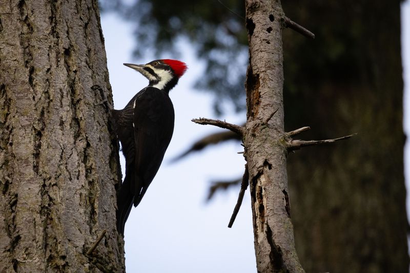
A pileated woodpecker sounds like someone knocking on a door with a hammer. Hearing one echo through the canopy here was the moment the forest stopped feeling like scenery and started feeling alive.
White-tailed deer are the most reliable sighting in the park. They graze along trail edges and in clearings, especially near dawn and dusk when foot traffic drops off.
Squirrels, raccoons, armadillos, and opossums round out the everyday cast. Bobcats, coyotes, and feral hogs also live here, though spotting them takes luck and quiet feet.
Birders have plenty to work with. Red-headed woodpeckers, Carolina chickadees, and tufted titmice stay year-round, while warblers pass through in waves during migration seasons.
Wild turkeys turn up in the early morning, moving through the understory in loose groups. They are surprisingly large and surprisingly good at vanishing.
Down near the streams and wetter pockets, great blue herons and green herons stalk the shallows. Wood ducks use those same waters, and tree frogs provide the soundtrack after dark.
Snakes and salamanders thrive in the damp spots too, so watch where hands and feet land when scrambling over logs. Most species want nothing to do with people.
Bring binoculars if you own a pair. The canopy is high, and a lot of the action happens well above eye level in those hundred-foot pines.
Casting A Line And Sleeping Under The Loblollies
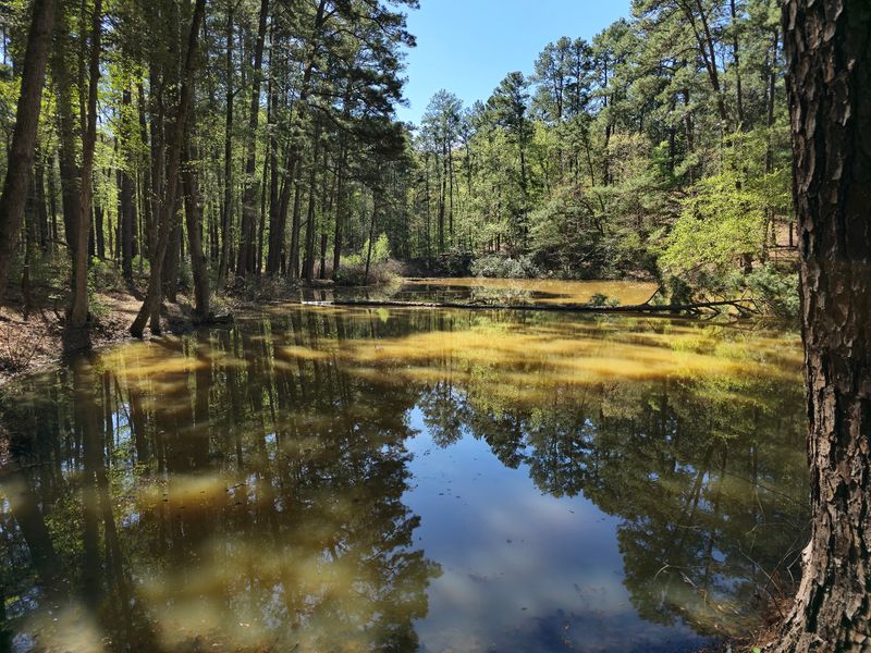
Fishing without a license sounds too good to be true, but inside Texas state parks it is simply the rule. At Mission Tejas that means grabbing a rod and heading to the pond near the picnic area without any paperwork.
Bass, catfish, and sunfish all live in the pond and in San Pedro Creek. Gear can be borrowed straight from the park headquarters, which removes the last excuse for not trying.
Camping stretches the visit into something better. More than twenty sites are available, ranging from primitive spots to sites with water and electricity hookups.
Restrooms with showers serve the campground, so nobody has to rough it entirely. Group sites and a pavilion handle larger gatherings, family reunions, and scout troops.
Night here has a texture to it. Pines block most of the horizon glow, tree frogs start up, and the temperature drops faster than expected once the sun clears the ridge.
Morning brings mist hanging low between the trunks. Coffee tastes better in that setting, though that may just be the atmosphere talking.
Reserve ahead during spring and fall, when East Texas weather cooperates and sites fill quickly. Summer humidity is real, so pack accordingly.
The picnic area near the pond makes a solid lunch stop even for day visitors. Shade is plentiful, tables are scattered, and the water keeps kids entertained.
Caddo Homeland, CCC Handiwork, And Those Mysterious Bathtubs
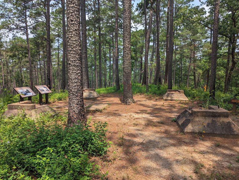
Concrete tubs in the middle of a forest. Nobody seems entirely sure what the CCC built them for, and the guesswork is half the fun of finding them along the Olen Matchett Trail.
Long before any of that, this land belonged to the Hasinai Caddo people. Interpretive exhibits in the park cover their culture and their complicated encounters with Spanish missionaries in the late 1600s.
Understanding that layer changes how the mission replica reads. The site was not empty when the Spanish arrived, and the story includes people who had lived and farmed here for generations.
Civilian Conservation Corps crews arrived in the 1930s and reshaped the property. Along with the mission building, they cut trails, laid out picnic areas, built a dam and pond, raised a pavilion, and constructed Park Road 44 and fire towers.
Replanting was their quietest achievement. After heavy clear-cutting stripped the region, CCC workers put pines back in the ground, and many of those trees now top 80 years old.
Programs run throughout the year, including history talks, guided nature walks, and pioneer skills demonstrations. Checking the schedule before a visit is worth the two minutes it takes.
Sitting on 660 acres at the northern edge of the Davy Crockett National Forest, the park layers three distinct eras into one walkable space.
Address: 19343 State Hwy 21 E, Grapeland, TX 75844
