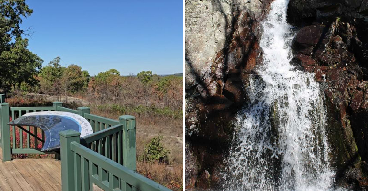
A three-mile loop is all it takes to check two major items off a Missouri hiking bucket list. The trail connects the state’s highest point with its tallest waterfall.
Taum Sauk Mountain rises 1,772 feet above sea level. Mina Sauk Falls tumbles 132 feet down a series of volcanic ledges.
After a good rain, the waterfall roars to life in a dramatic display. The path itself is rugged, with rocky switchbacks and steep descents.
It weaves through billion-year-old volcanic stone, windswept glades, and narrow rock corridors. The views are worth every step.
In Missouri, this is where the state’s highest ground meets its most spectacular cascade.
Standing On The Roof Of Missouri
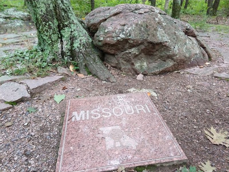
Here is the funny thing about reaching the highest natural point in Missouri: you barely have to work for it. Taum Sauk Mountain tops out at one thousand seven hundred seventy two feet above sea level, and the parking area sits so close to the summit that the walk out to the marker is short, paved, and genuinely easy for most people.
You will not be gasping for breath or scrambling over boulders to get there, which feels almost like cheating when you think about what a state high point usually demands. The marker itself is a simple stone with a plaque, sitting quietly under the trees rather than perched on some dramatic bare peak.
That surprises a lot of folks who expect a big open summit view, because the forest actually closes in around the spot. The real payoff is knowing that nothing else in the state stands taller than the ground under your shoes at that moment.
Bring a camera, because the plaque photo is basically required by law among people who collect high points. And if you have someone in your group who cannot handle a rugged hike, the summit walk is the part they can absolutely share with you.
Finding The Park Without Getting Turned Around
Getting here is half the fun, mostly because the drive gets prettier the closer you get and the cell signal gets worse at about the same rate. The park sits at Highway CC, Ironton, MO 63656, and the last stretch of road climbs and twists through the St. Francois Mountains in a way that already feels like the adventure has started.
My honest advice is to download your map before you leave town, because relying on live directions out here can get frustrating fast. Fill up your gas tank in a larger town too, since services thin out considerably once you are winding through these hills.
The road up to the summit area is paved but narrow, with some tight curves that reward taking your time rather than rushing. Big RVs and long trailers can technically make it, though drivers of those rigs usually say the climb keeps them alert.
Once you park, take a second to just stand there and listen, because the quiet up on that ridge is genuinely different from the quiet you get anywhere else in Missouri. That silence is the first real sign you have arrived somewhere special.
The Mina Sauk Falls Loop Trail
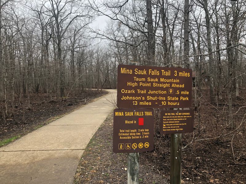
So the trail that gets you to the waterfall is a loop of roughly three miles, and it starts right near the high point viewing area, which makes the whole thing wonderfully convenient. It begins paved and friendly, almost lulling you into thinking the entire walk will be that gentle.
Then the pavement ends and the path turns into gravel, loose rock, and chunky stone steps that demand you actually watch where your feet land. Trekking poles help more than people expect, especially on the descent when gravity keeps nudging you forward faster than you planned.
Wear real hiking shoes with grippy soles, because sandals and smooth sneakers turn this trail into a much longer day than it needs to be. The route is marked, but the rocky sections can make the tread hard to read, so keep an eye out for the blazes.
Give yourself several hours rather than rushing, since the loop takes most hikers considerably longer than the mileage suggests. Water matters too, because there is no place to refill once you drop below the ridge and start winding down toward the creek.
Meeting Mina Sauk Falls Face To Face
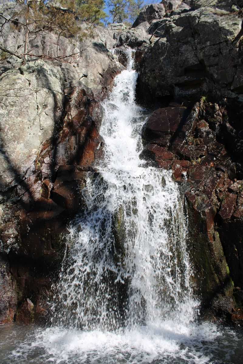
Mina Sauk Falls is the whole reason most people make this trip, and it holds the title of tallest waterfall in Missouri at one hundred thirty two feet. Rather than one dramatic plunge, the water steps and slides down a series of rugged rock ledges before landing in Taum Sauk Creek below.
That tiered shape is actually what makes it so photogenic, because you get layers of moving water instead of a single ribbon. The rock underneath is ancient volcanic stone, which gives the whole scene a rough, purplish, almost otherworldly texture.
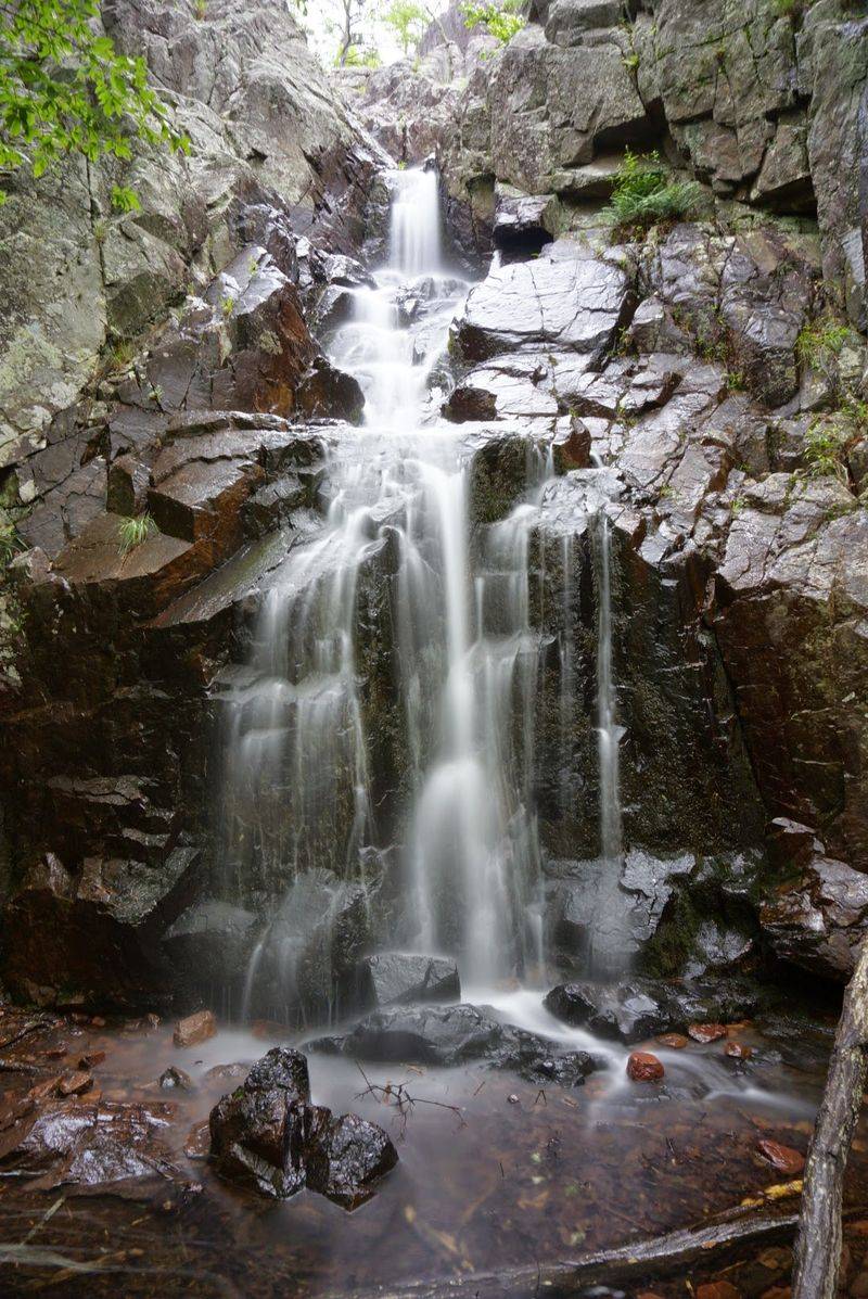
Here is the catch that trips up so many visitors: this is a wet weather waterfall, so it depends entirely on recent rain. Show up during a dry stretch and you will find damp rock, quiet pools, and a trickle rather than the roaring show you pictured.
The stones around the falls stay slick even when the water is low, so resist the urge to scramble out onto the ledges for a better angle. Plenty of people have learned that lesson the hard way, and the view from solid ground is genuinely excellent anyway.
Timing Your Trip Around The Rain
Want the waterfall at full volume? Then you need to become the kind of person who watches the weather radar before planning a hike, because that is genuinely the difference between a roaring cascade and a damp cliff.
The sweet spot is going a day or two after a good soaking rain, when the ground is saturated and everything upstream is still draining down toward the falls. Go too soon and the trail turns into a slippery mess, but wait too long and the show is basically over.
Spring tends to be the most reliable stretch, since Missouri usually gets plenty of moisture then and the creeks run generously. Late winter can surprise you too, especially when snowmelt and rain team up.
Summer is the gamble, because the heat dries things out quickly and the falls often go quiet for weeks at a time. That does not make the hike pointless, since the pools and the rock formations still look great, but manage your expectations.
Honestly, the flexible travelers get the best waterfall photos, because they wait for the forecast and then go. Rigid plans and wet weather waterfalls rarely get along.
A Hike That Earns Its Reputation
Nobody should tell you this loop is a stroll, because the trail drops steeply and the footing stays rocky for long stretches. The descent toward the falls is the part that surprises people most, since going down actually pounds your knees harder than climbing up does.
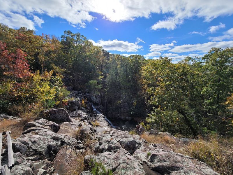
You will pass through thick oak and hickory woods, then suddenly break out into open glades where the rock lies bare and the view stretches across the St. Francois Mountains. Those glade sections get hot and exposed in warm weather, so a hat and sunscreen make sense even though most of the route is shaded.
The climb back up is the real test, and it comes at the end when your legs are already tired from the descent. Pacing yourself matters more than speed here, and taking breaks on the way up is completely reasonable.
Families with young kids sometimes turn this into an out and back rather than the full loop, which is a smart move. Sturdy footwear, plenty of water, and a snack in your pack will make the whole outing feel like an accomplishment instead of a slog.
Rock That Has Been Here Almost Forever
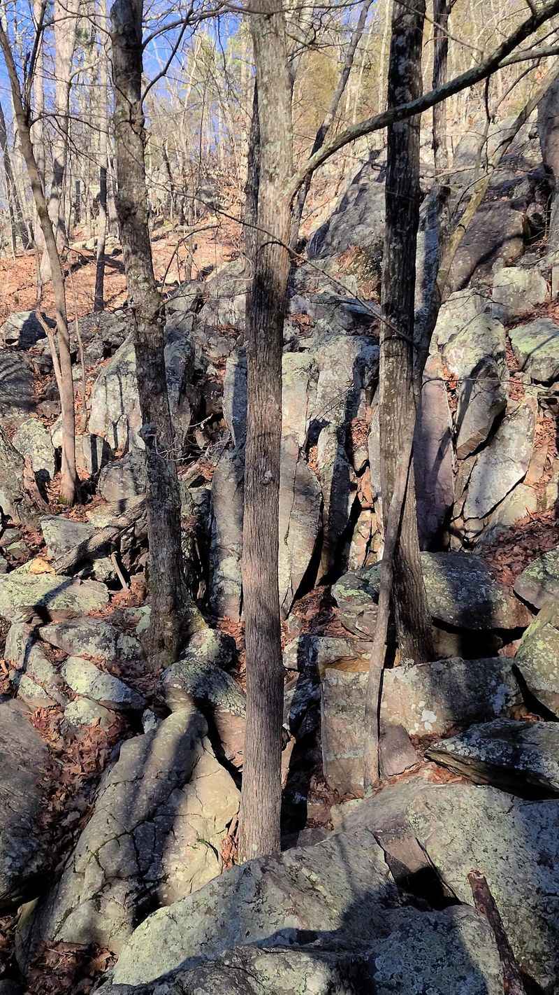
Geology nerds get genuinely excited about this place, and once you understand why, you kind of join them. The St. Francois Mountains are considered some of the oldest exposed landforms in North America, formed by ancient volcanic activity long before most of the continent looked anything like it does today.
What that means underfoot is rock that is dense, hard, and stubbornly resistant to erosion, which is exactly why these hills survived while everything around them wore down. The rhyolite and granite here show colors you rarely see in Missouri, ranging from dusty pink to deep purple.
These mountains were once islands surrounded by ancient seas, which is a wild thing to picture while standing on a dry glade in the middle of the country. The landscape has a rugged, almost western feel that catches first time visitors off guard.
Take a minute on one of the open glades and just look at the exposed bedrock beneath you, because that surface has been sitting there through more history than anyone can really wrap their head around. Understanding that backstory changes how the whole hike feels.
Picking The Season That Suits You
Spring and fall both make a strong case here, and which one wins really depends on what you are chasing. If the waterfall is your priority, spring generally delivers the fullest flow along with wildflowers scattered across the glades.
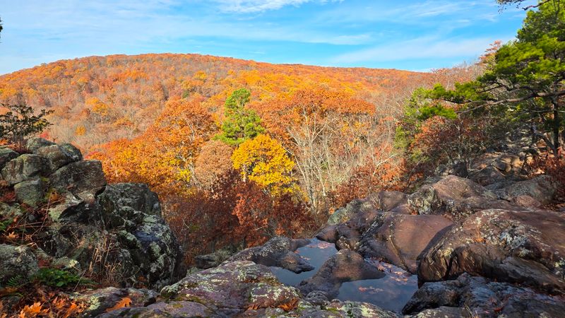
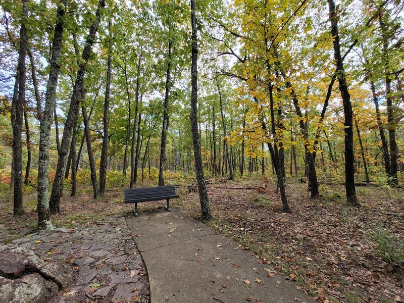
Fall flips the equation completely, because the oak and hickory forest turns into a wall of yellow, red, and rust colored leaves. The air gets crisp, the bugs disappear, and the climb back up the trail feels much less punishing without summer humidity pressing down on you.
Winter has its own quiet appeal, since bare trees open up long views that the leaves normally block, and an ice covered rock face can look spectacular. Just know that icy trails here get genuinely treacherous.
Summer brings green tunnels of shade along parts of the route, though the falls often run dry and the exposed glades get toasty. Early morning starts make a big difference during those warmer months.
Honestly, if you can swing two trips in different seasons, do it, because this pocket of Missouri looks like a completely different park depending on when you show up.
Camping, Picnics, And An Overlook For Everyone
For a place that feels this remote, the park is surprisingly welcoming once you look around. There are picnic facilities where you can spread out a lunch after the hike, and primitive campsites for anyone who wants to stay the night under some genuinely dark skies.
Stargazing up here is excellent because you are far from city glow, so pack a blanket and let your eyes adjust for a while. The campground stays basic rather than fancy, which is exactly the point.
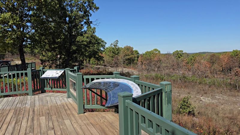
The accessible overlook near the high point deserves a special mention, since it opens up those sweeping panoramic views to visitors who cannot manage the rugged trail. That thoughtful touch means grandparents, small kids, and folks with mobility needs still get a real payoff from the trip.
Pack in whatever you need, including water and snacks, because there is no store waiting around the corner. Cell service is spotty at best, so tell someone your plan before heading out.
What sticks with most people afterward is how protected and unspoiled it all feels, and that is a credit to how Missouri has looked after this stretch of the Ozarks.
