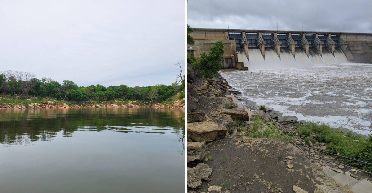
The first time I drove toward that corner of Oklahoma, I had no idea I was heading to a town that had picked itself up and walked away from its own address. Somewhere under the wide blue surface of a man-made lake sit the foundations of the original townsite, quietly holding the shape of streets nobody walks anymore.
Instead of vanishing when the dam was built, the community bought land about two miles west, hauled buildings up a hill, and started over near the cemetery. I keep thinking about how much stubborn hope that takes, packing up a whole life and rebuilding it on higher ground.
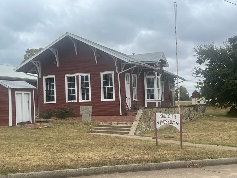
The old depot went with them, and now it sits on a hill, converted into a museum that holds the story of a town that refused to drown. What I found waiting for me was a tiny lakeside city of a few hundred people, with views that make you slow the car down and a pace that makes you forget about your schedule.
I walked through the museum, read the old photographs, and stood at the edge of the water, trying to imagine the streets below. Honestly, few places I have visited in this state feel this quietly extraordinary.
The Oxbow Bend Where It All Began
Long before the lake, there was a river bend. The original Kaw City took root in 1902 inside a fertile oxbow curve of the Arkansas River, and by all accounts it was farming country first.
Then came 1919, and everything changed. Oil was discovered nearby, and what had been a modest agricultural settlement turned into a busy oil town almost overnight, with the population climbing fast.
I find that part of the story oddly relatable, because boom towns always feel like they are holding their breath. Kaw City did not get to hold it for long.
A serious flood swept through in 1923 and damaged the business district, which was a rough hit for a young town still finding its footing. The Great Depression arrived not long after, and the combination thinned out both the money and the momentum.
Standing in the newer town today, it takes a minute to picture all of that happening down in the bottomland below. The land there is water now, so imagination has to fill the gaps.
What stuck with me is how ordinary the beginning sounds. Farms, a railroad, oil, a flood, hard years, a slow recovery.
Plenty of small American towns share that exact outline, and most of them are still sitting where they started. Kaw City is the rare one that had to make a much stranger decision later, and knowing the early chapters makes the move itself land harder.
Hauling Houses Two Miles Uphill
Moving a town is not a metaphor here. Residents of Kaw City bought a new townsite about two miles west of the original, up on higher ground near their existing cemetery.
Money was the first hurdle, as it usually is. A local banker and oilman named Dave Morgan provided financial assistance that helped make the relocation possible, which is a detail I keep repeating to people because it feels almost old-fashioned.
Then came the physical work. Homes and businesses were detached from their foundations and hauled to new lots, structure by structure, which is slow and nerve-wracking work even with modern equipment.
The first house in the new Kaw City went up in the summer of 1969. Mail delivery to the relocated community started on June 26, 1972, and honestly that date does something to me.
A postal route sounds like paperwork, but it is really the moment a place becomes official again. Letters arriving means the town exists.
Driving the newer streets, I noticed how the layout sits differently than an old river town would. Everything feels placed rather than grown, because it literally was.
Lots have breathing room, and the hill gives you glimpses of water between houses. There is no mistaking it for a settlement that developed slowly over a century.
What I admire is the ambition of the whole thing. They did not just save buildings, they saved the idea of living together in one specific place.
When Congress Signed Off On A Dam
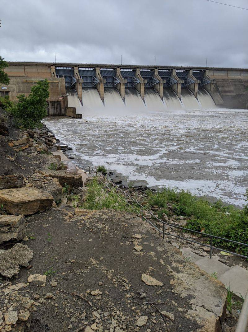
Kaw Dam is the reason any of this happened, and seeing it in person puts the whole story into scale. Congress authorized the project in 1962, and the Army Corps of Engineers held a groundbreaking ceremony in 1966.
The goals were practical ones. Flood control on the Arkansas River, plus improved navigation, which mattered a great deal to the region downstream.
Practical goals still have consequences, though. Building the dam meant the reservoir behind it would rise over the original Kaw City townsite, and there was no version of the plan that spared those streets.
I tried to imagine reading that news as a resident. You would know roughly when the water was coming, and you would know your house was in the way.
Some communities in that situation simply dissolve, with families scattering to nearby towns and the name fading off the map. Kaw City went the other direction and decided to move as a group.
The dam itself is worth a stop if you enjoy seeing infrastructure up close, because there is something humbling about standing near something that rearranged geography. Water spreads out behind it in long fingers and coves that were once fields and river channel.
Every time I looked at the lake afterward, I thought about the trade. A river town lost its ground, and a whole region gained protection from flooding.
Both things are true at once, and Kaw City lives right at that intersection.
A 1903 Depot That Refused To Drown
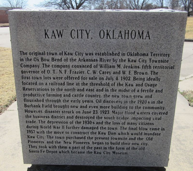
Of all the buildings that made the trip, the one I most wanted to see was the 1903 Santa Fe Railroad Depot. It survived the move and now houses the Kaw City Museum.
Depots meant everything to towns like this. Freight, mail, travelers, and the sense of being connected to somewhere else all came through those doors.
Saving it was clearly a choice about identity. You do not drag a railroad depot two miles uphill unless you have decided your history is coming with you.
The building carries a real distinction, too. It is listed on the National Register of Historic Places, and it stands as one of only two listed structures in Oklahoma relocated from their original sites specifically to make way for a lake.
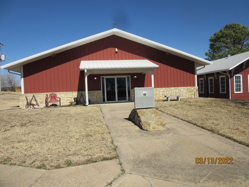
Inside, exhibits walk through the area’s past and the relocation story itself. I liked that the museum is housed in an artifact, since the container is part of the exhibit.
Small-town museums have a particular charm that bigger institutions cannot manufacture. Displays feel personal, arranged by people who knew the places on the labels.
Hours at community museums can vary, so checking ahead is smart before you plan your afternoon around it. That is true of most towns this size.
Sitting outside afterward, I kept looking at the depot’s lines and thinking about how many hands it took to keep it standing. Preservation here was not a grant application, it was a group effort with trucks.
What The Water Still Hides
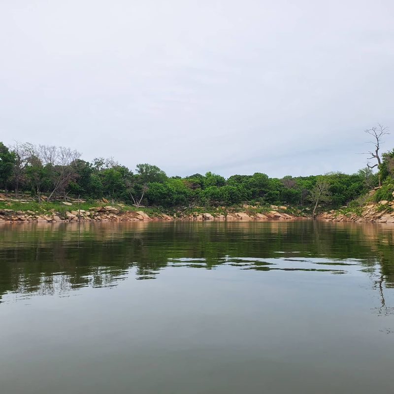
In 1976 the gates of Kaw Dam closed, and the lake filled to its planned level. That was the year the original townsite went under for good.
Most of the time, there is nothing to see. Just wind on open water and the long shoreline curving out of sight.
But water levels move, and during unusually low periods parts of the old town reappear. Building foundations and fragments of original streets have been spotted just above the waterline, which is an eerie thing to picture.
The cemeteries were handled before flooding, and that process was understandably delicate. The Kaw City Cemetery, including headstones and most caskets, was moved and reinterred in a designated section of Ponca City’s IOOF cemetery.
The Kaw Indian cemetery, originally across the river at Washunga, was relocated to Newkirk. Even so, erosion along the lake has at times exposed bones, casket fragments, and pieces of tombstones connected to the Washunga Cemetery.
Hearing that reframed the lake for me. It is beautiful and useful, and it also sits on top of something that mattered enormously to families.
Here is the detail I found most quietly moving. Some roads inside park areas near the new town follow the paths of streets from the old one.
So you can drive a route that existed before the water came, in a different place, on higher ground. The town copied its own map.
Lake Days, Statues, And The Kanza Story
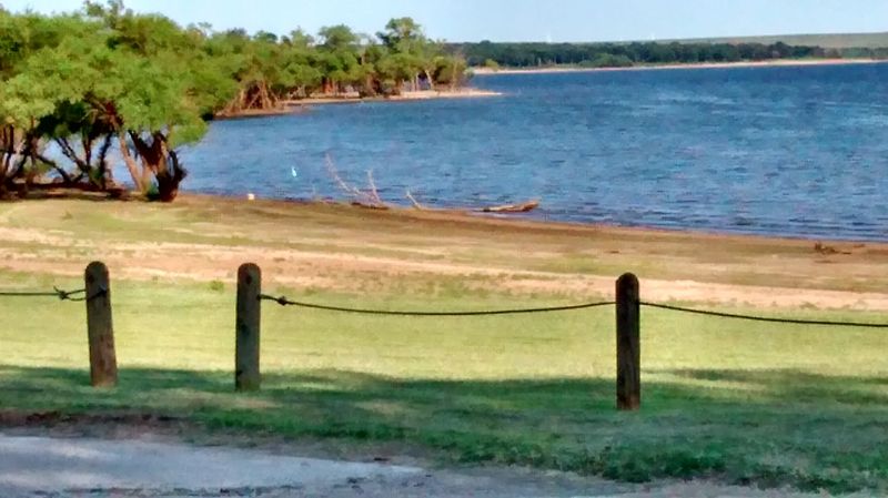
Present-day Kaw City sits on a peninsula reaching out into Kaw Lake, and that geography is the whole personality of the place. Water shows up in almost every direction you look.
Kaw Lake ranks as the ninth largest in Oklahoma by capacity, with coves, quiet shoreline, and plenty of room for boats. Anglers come for the catfish especially, and fishing talk is easy to overhear.
Pioneer Park gives you green space and shade, and Pioneer Cove Marina puts you right at the water’s edge. Both make for a low-key afternoon.
Culture runs deep here too. Kaw City is home to the headquarters of the Kaw Nation, and the Kanza Museum and Education Resource Center displays tribal art and historical artifacts.
Visiting there added the layer I most needed. The city’s name honors the Kanza, called the Kaw locally, and their history on this land stretches far beyond any townsite move.
Outdoor art surprised me more than I expected. The SouthWind Statue makes a strong impression, and the Deer Jumping Fence Sculpture adds a bit of personality along the way.
With roughly 325 residents counted in the 2020 census, this is a genuinely small town. Come with realistic expectations and it rewards you generously.
I left thinking Kaw City is less a destination than a story you can stand inside. A community moved itself, kept its depot, and built a new life above the water.
Address: Kaw City, OK 74641
