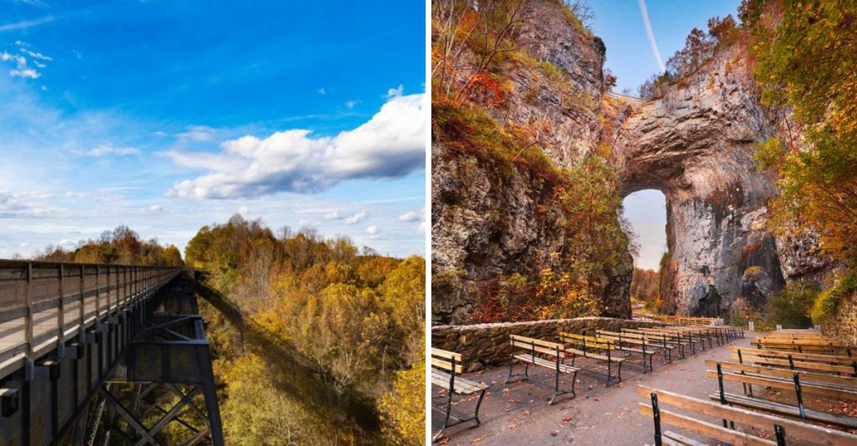
One Virginia walking path carries you across a bridge 125 feet above a river, and the surface under your shoes is flat crushed stone. That means you can float over a sea of orange treetops without climbing a single mountain.
Another easy route slips beneath a 215-foot stone arch. Legend says young George Washington carved his initials into its wall.
I love that a short stroll can come with a plot twist like that.
Fall makes these paths look like a film set. Golden leaves, misty ridges, and rushing water do the heavy lifting for you.
You just need comfy shoes and a little curiosity.
I picked routes with gentle grades, short loops, or smooth surfaces, so beginners can enjoy the show without gasping for air. Some even welcome strollers and wheelchairs.
Grab a jacket, too. Which scene would you step into first?
1. Limberlost Trail
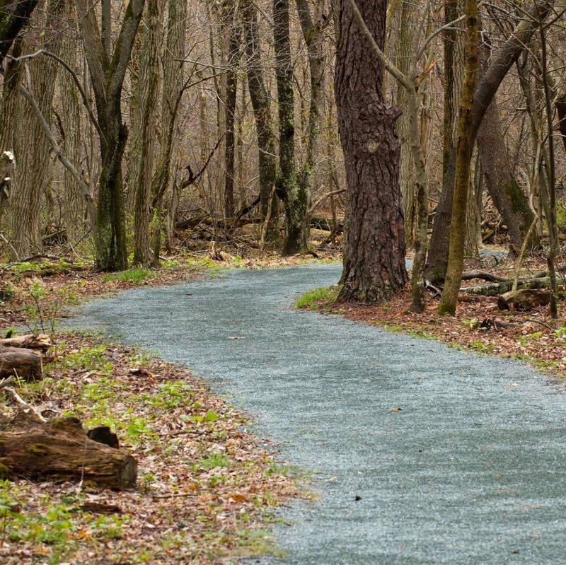
Most mountain trails make you earn the view, but this one hands it over on a gravel platter. Limberlost is an easy 1.3-mile loop with mostly flat ground and very little climbing.
The path is wide, clear, and well maintained. Strollers roll along without fuss, and the route is known as a wheelchair-friendly option in Shenandoah National Park.
You’ll reach it along the Skyline Drive corridor, so the drive itself becomes part of the movie. In autumn, the forest canopy around the loop turns into a moving backdrop of reds and golds.
Because the ground stays level, you can actually look up instead of staring at your feet. That’s a rare treat on a mountain trail, and it makes the scenery feel even bigger.
Families with little ones will appreciate how short the loop is. Grandparents, new hikers, and anyone nursing a sore knee can keep pace without feeling rushed or left behind.
Timing matters on popular fall weekends in Virginia. Sunday and Monday evenings tend to be quieter, which gives you a better shot at a peaceful stroll.
Treat it as the opening scene of a fall road trip. It’s short enough to pair with other overlooks along the drive on the same day.
Bring a light layer, since mountain air cools quickly once the sun drops. A snack, a water bottle, and a charged phone camera round out the kit nicely.
Address: 3655 US-211, Luray, VA 22835
2. Stony Man Trailhead
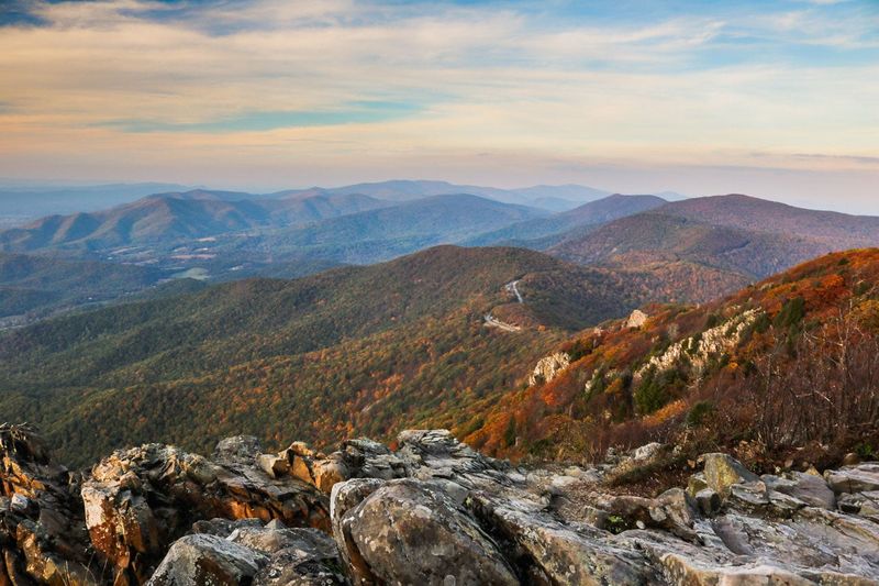
How often does the second highest peak in a national park ask for only about an hour of your time? Stony Man pulls off that trick with a 1.6-mile round trip and just 340 feet of elevation gain.
The trail starts at the Stony Man Parking Area at mile 41.7 on Skyline Drive. Parking there is free, which feels like a small bonus before the big reveal.
Part of the route follows the famous Appalachian Trail. So yes, you can tell friends you hiked the AT, and technically you won’t be lying.
Up top, the payoff is huge. You get wide views of the Shenandoah Valley and Massanutten Mountain, and fall color turns the whole scene into a painted backdrop.
Sunset here is a crowd favorite for good reason. Pack a headlamp if you plan to linger, because the walk back gets dark fast.
The area also has history beneath your boots. A copper mine once operated near the peak, and the mountaintop now shelters rare plant and animal species.
Leave your pup at home for this one, since pets aren’t allowed on the trail. Rangers protect the sensitive habitat near the summit, and that rule helps.
Saturday afternoons tend to get busy in autumn. Weekday mornings are often quieter, so an early start can give you the cliffs with fewer photobombers.
Address: Appalachian Trl, Luray, VA 22835
3. Abbott Lake Trail
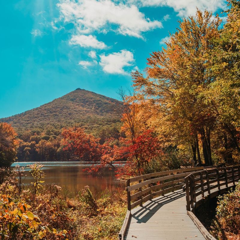
A mountain that admires itself in a mirror sounds like a fairy tale. At Abbott Lake, the Peaks of Otter do exactly that on calm days, reflecting across the water while you stroll the shoreline.
The trail is paved, flat, and loops right around the lake. That makes it one of the easiest ways to enjoy Blue Ridge Parkway scenery without a single steep stretch.
Fall is when this place really hams it up for the camera. Trees along the bank change color, and the lake doubles the show by copying it onto the surface.
You don’t need hiking boots or trekking poles here. Sneakers work fine, and the smooth surface lets you focus on the view instead of roots and rocks.
Campers nearby often use the loop as an after-dinner walk back to their sites. It’s a relaxing way to end a day in the mountains, especially as evening light softens the peaks.
Photographers, take note of the wind. Still mornings and quiet evenings usually give you the clearest reflections for that movie-poster shot.
The loop also works well as a warm-up for bigger Peaks of Otter adventures. You can stretch your legs here first, then decide how ambitious you feel.
Pack a jacket because mountain temperatures drop quickly in October. A thermos of hot cocoa wouldn’t hurt either, since lakeside benches invite a slow sip.
Address: Bedford, VA 24523
4. High Bridge Trail
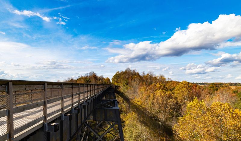
Walking 125 feet above the treetops usually requires a zip line and a waiver. On the High Bridge, you just need a flat path and a decent pair of walking shoes.
The bridge stretches over 2,400 feet across the Appomattox River. It’s the longest recreational bridge in Virginia and one of the longest in the country.
History gives the scene extra drama. The original bridge dates to the 1850s, and it became a major landmark during the Civil War.
Today the trail follows an old railroad corridor for more than 30 miles. Its finely crushed limestone surface stays wide and level, so hikers, cyclists, and horseback riders share it easily.
Autumn turns the valley below into a quilt of orange and gold. Standing in the middle of the bridge feels like hovering above the leaves, which is exactly the kind of shot directors love.
Farmville makes a fun pit stop along the way. You can wander town, grab a bite, and return to the trail with fresh energy.
Parking near some access points comes with a fee. Restrooms sit near certain lots, including the Camp Paradise area, so plan your breaks around those spots.
Repairs on the River Road bridge in Farmville have closed one section heading east. Check current park notices before you go, since the High Bridge stays reachable from other access points.
Address: Farmville, VA 23901
5. New River Trail State Park
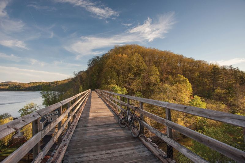
Fifty-seven miles of trail sounds intimidating until you learn it’s basically flat. New River Trail State Park follows an old railroad grade, so the climbs stay mild and the views do the talking.
The gravel path traces the New River through southwest Virginia. Along the way you pass cliffs, farms, and plenty of spots where the water sparkles below.
Trestles and bridges add a little thrill to the trip. Crossing them on foot or by bike feels like a scene from an old train movie, minus the train.
You don’t have to tackle the whole thing, of course. Pick a short out-and-back stretch, enjoy the scenery, and turn around when your legs say so.
Families have lots to work with here. Picnic tables, grills, public restrooms, and a playground make it easy to turn a hike into a full afternoon.
The park also supports tent camping and has a small store, a gift shop, and a nature center. Curious kids can learn about local wildlife before heading down the trail.
Bring the dog along, since pups are welcome. Anglers and kayakers can enjoy the river too, which keeps the whole crew entertained.
Weekends draw the biggest crowds, especially Saturday afternoons. Weekdays tend to be much quieter, giving you long stretches of autumn color to yourself.
Address: 116 Orphanage Dr, Max Meadows, VA 24360
6. Natural Bridge State Park
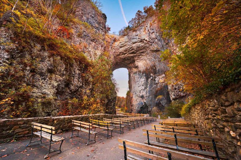
Legend says a young George Washington carved his initials into this stone wall. Thomas Jefferson later owned the bridge and the land around it, so the place has serious founding-father credentials.
The star of the show is a 215-foot natural arch. Standing beneath it feels a bit like being in a fantasy film, especially when fall leaves frame the rock.
Cedar Creek Trail is the beginner-friendly route here. It’s about 2.2 miles round trip and passes right under the bridge.
The trickiest part comes first, with a set of concrete stairs heading down. Save some energy, because that same long staircase waits for you on the climb back up.
Past the arch, the path follows Cedar Creek on level concrete and asphalt before turning to gravel. Keep going and you’ll reach Lace Falls, a 50-foot waterfall that tumbles in tiers.
Extra stops keep things interesting along the way. You’ll pass Saltpeter Cave and the Monacan Indian Exhibit, both great for curious minds.
The land stayed in private hands until 2014 and became a state park in 2016. An entry fee applies, and dogs are welcome on the trail.
Watch your step near the creek, since snakes sometimes share the path. Picnic tables and restrooms make it easy to rest before or after your stroll.
Address: 6477 S Lee Hwy, Natural Bridge, VA 24578
7. Scott’s Run Nature Preserve
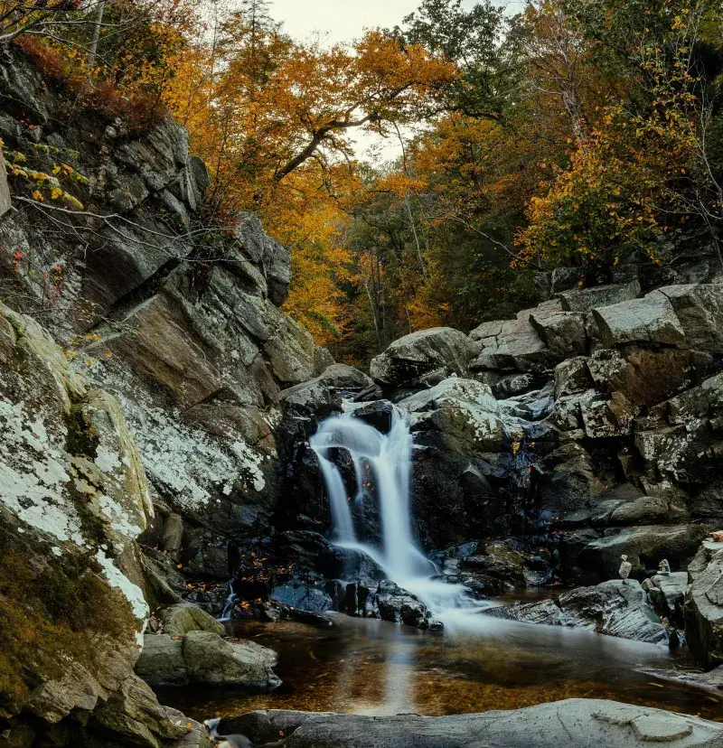
A waterfall just minutes from the Capital Beltway sounds like a prank. Scott’s Run Nature Preserve proves it’s real, with 336 riverfront acres of woods tucked beside the Potomac River.
Several trails wind through the preserve, so you can choose your own adventure. Short routes lead to the waterfall, where Scott’s Run spills toward the river.
Mature trees shade much of the walk. In autumn, that canopy turns golden overhead, giving the trails a storybook glow.
Trail markings, maps, and signs are clear, which helps first-timers stay on track. You won’t need a compass or a wilderness survival badge.
Some sections include hills that will get your heart pumping. Pace yourself, take breaks, and remember there’s no prize for reaching the falls first.
Creek crossings add a splash of fun to the hike. Wear shoes with good grip, since wet rocks can get slippery after rain.
Potomac views along the bluffs make great photo backdrops. Wildlife watchers should keep an eye out, too, because the woods are popular for spotting critters.
The preserve opens at 7 a.m. and closes at 6 p.m. daily. Dogs are welcome, so your four-legged buddy can join the Northern Virginia leaf-peeping party.
Address: 7400 VA-193, McLean, VA 22102
8. Great Falls Park
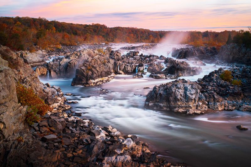
George Washington once dreamed of a canal that could move goods from the Potomac River toward the Ohio River Valley. Work on the Patowmack Canal began in 1785, and you can still walk along its remains today.
The Patowmack Canal Trail is wide, smooth, and easy. It follows the old canal past historic locks and the ruins of Matildaville, a town that grew up around the project.
The real headliner, though, is the water. Three falls overlooks give you front-row seats to the Potomac crashing through rocky channels.
Autumn adds a fiery frame to the scene. Wooded hills turn orange and red around the white water, and the result looks like an adventure movie poster.
Trails here are packed dirt and gravel rather than pavement. Comfortable sneakers with decent grip will serve you well.
Picnic areas and grills make it easy to plan a lunch break. Public restrooms and a playground help keep younger hikers happy, too.
Bring your dog along on a leash. The park opens at 7 a.m. and stays open until 9 p.m., which leaves room for an evening stroll.
Weekends get busy, especially Saturdays and Sunday afternoons. A weekday morning visit usually means calmer overlooks and more space for photos.
Address: 9200 Old Dominion Dr, McLean, VA 22102
9. High Bridge Trail Trailhead – Elam MP 17.9W
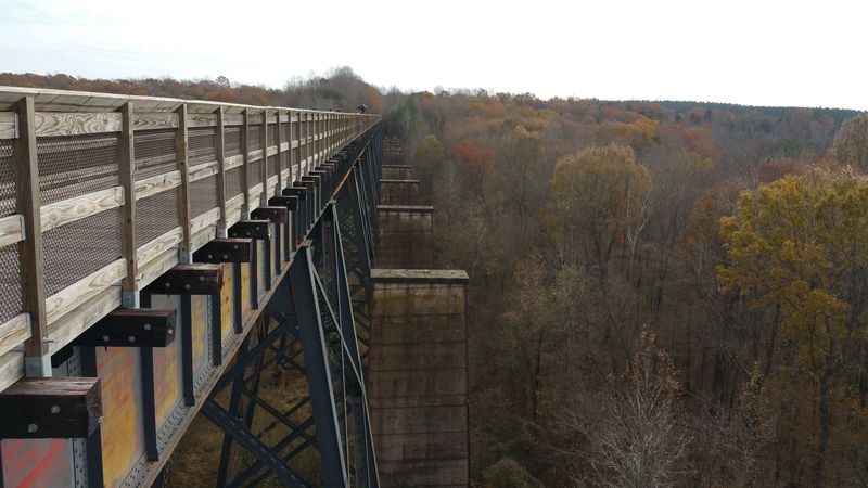
Mile markers usually feel like homework, but MP 17.9W is more like a secret door. The Elam trailhead near Pamplin drops you onto the western stretch of the High Bridge Trail.
Pamplin is a small railroad town in Appomattox County. That history fits nicely, since the trail itself follows an old railroad corridor.
This part of the route is great for an easy walk or bike ride. The surface stays flat and smooth, so beginners can cruise without worrying about hills.
In fall, trees lean over the path and form a tunnel of color. It’s the kind of scene that looks like a quiet road trip montage.
Kids handle this section well, and the trail is considered kid-friendly. You can walk as far as you like, then turn back whenever little legs run out of steam.
Dogs are welcome here, too. Bring water for your pup, since rural stretches don’t always offer convenient refill spots.
The trailhead opens at 7 a.m. and closes at 9 p.m. daily. Friday afternoons and Sunday afternoons tend to be some of the calmer times to visit.
Plan your trip with a park trail guide in hand. It shows mile markers and access points, which helps you pick a stretch that matches your energy level.
Address: 3443 US-460, Pamplin, VA 23958
10. High Bridge Trail State Park – River Road MP 1.2W
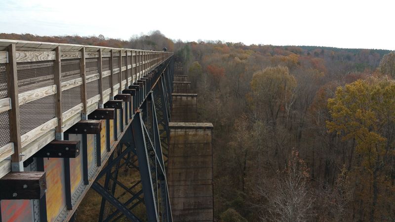
Yes, it’s technically an old train bridge turned into a path. That sounds simple until you’re standing high above a river valley wrapped in fall color.
The River Road access sits at mile marker 1.2W in Farmville. From here, you can head out on the flat, leveled trail that leads toward the famous High Bridge.
The route is labeled an easy, point-to-point trail. Walkers, joggers, and cyclists all share it, so stay aware and keep to one side.
Once you reach the bridge, expect a breeze. It can get a little windy up there, so a light jacket or windbreaker is a smart move.
The view below is the reason people make the trip. Treetops stretch in every direction from the deck, and autumn turns them into a patchwork of reds and yellows.
Hours run from 6 a.m. to 7 p.m. daily. Parking at this lot requires a fee, so have a payment method ready.
Dogs are allowed outside, which makes this a fun outing for pet owners. Saturday and Wednesday mornings tend to be busier, while Sunday and Monday mornings are usually calmer.
Repairs on the River Road bridge in Farmville have closed a section of trail heading east from Main Street. Check current park notices before you go so your Virginia movie scene isn’t cut short.
Address: 553 River Rd, Farmville, VA 23901
