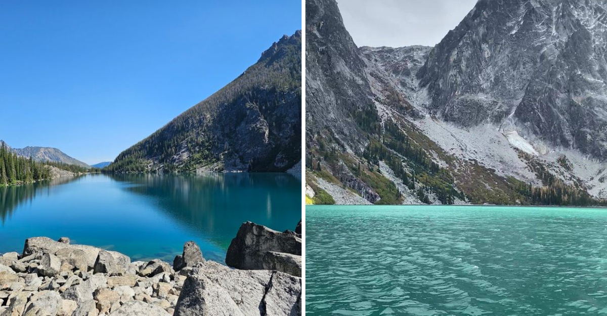
That moment right when you crest the final rocky switchback and the trees suddenly give way, a turquoise lake appears below you like something out of a dream.
Glacier-fed and ice-cold, it glows against a backdrop of raw granite walls that rise thousands of feet into the sky.
Jagged ridgelines mirror so perfectly on still mornings that the reflection looks painted.
I had seen photos before making the trip, but nothing quite prepares you for the real thing. The name actually comes from local jargon meaning cold water, which tells you everything you need to know about swimming here.
Blended with Washington wilderness area, this lake earns every step of the challenging hike it takes to reach it.
The Trail That Earns You Every View
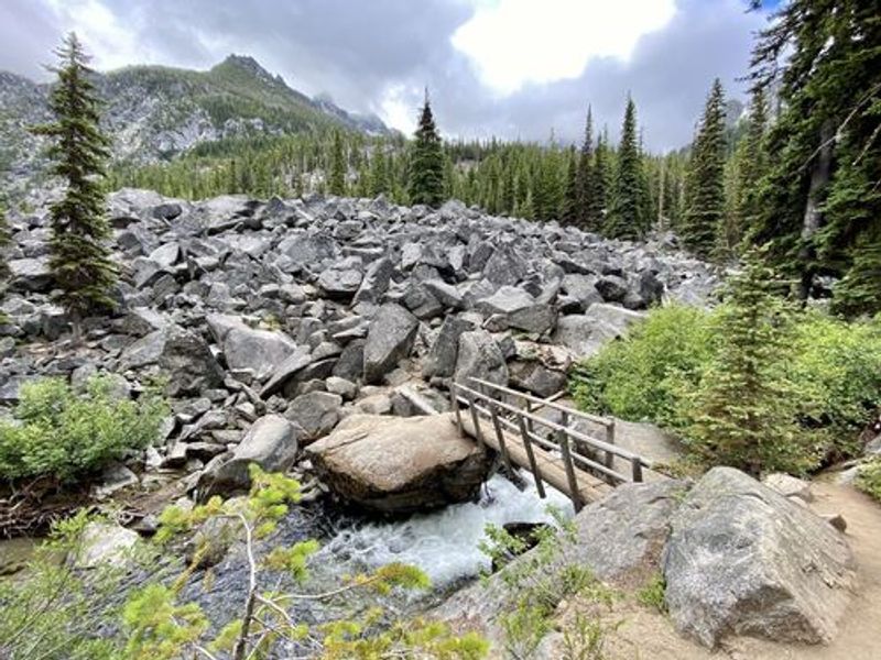
Nobody warned me about the roots. The first mile and a half out of the Stuart Lake Trailhead is actually pretty pleasant, a forested path running alongside Mountaineer Creek with a log bridge crossing that feels almost leisurely.
Then the trail shifts gears entirely, and you feel it in your quads almost immediately.
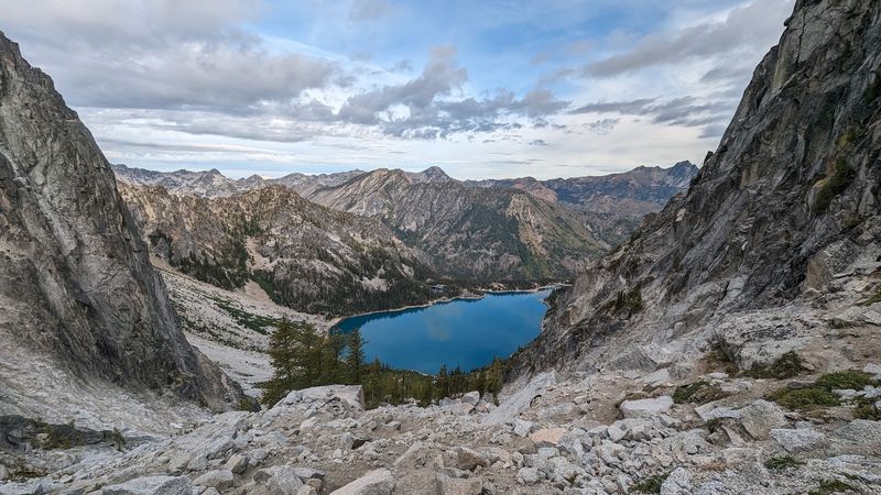
After crossing the bridge and turning left at the junction around mile 2.3, the path gets steep and stays that way. Large boulders, tangled roots, and relentless switchbacks fill the final push to the lake.
Trekking poles are not just helpful here, they are genuinely worth their weight in gold on the descent.
The round trip clocks in at roughly 8 to 8.5 miles with about 2,200 feet of elevation gain. Most hikers finish in four to eight hours depending on pace and how long they linger at the lake.
Starting before 7 a.m. is strongly recommended, especially on weekends, because the parking lot at the trailhead fills shockingly fast.
Good hiking boots with solid ankle support make a real difference on the rocky upper section. Bring more water than you think you need, some snacks that travel well, and a printed trail map since cell service disappears well before you reach the trailhead.
The trail is rewarding, not forgiving, but that contrast makes reaching the lake feel genuinely earned rather than just convenient.
Turquoise Water That Defies Explanation
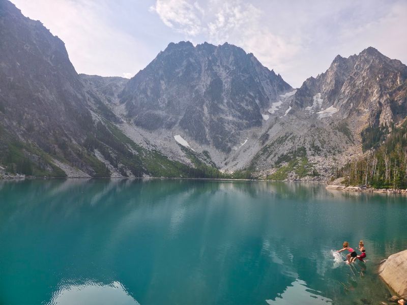
Color does a funny thing at Colchuck Lake. Depending on the light and the time of day, the water shifts between a vivid emerald green and a deep glacial turquoise that looks almost artificially bright.
It is the kind of color you keep second-guessing, wondering if your eyes are playing tricks.
The lake sits at roughly 5,500 feet in elevation and is fed by meltwater from the remnant Colchuck Glacier wedged between Dragontail and Colchuck Peaks above. That glacial origin is exactly why the water stays so achingly cold even during the warmest summer months.
People do wade in and occasionally take a quick dip, but refreshing might be a generous word for the experience.
The clarity of the water is just as striking as the color. On calm days you can see the rocky bottom clearly, the lake floor a mosaic of pale stone filtered through that luminous blue-green.
It genuinely looks like something rendered by a graphic designer rather than carved by geology over thousands of years.
Sitting on the boulders along the shoreline and just watching the light move across the surface is one of those quietly unforgettable travel moments. No soundtrack needed.
The lake does all the work on its own, shifting and glowing as the sun arcs overhead, each hour offering a slightly different version of the same breathtaking scene.
Dragontail and Colchuck Peaks Up Close
From the shoreline, looking south toward the far end of the lake, those two peaks feel almost confrontational in the best possible way. Dragontail Peak rises to over 8,840 feet, making it the second highest summit in the Stuart Range, and its north face drops in a sheer, dramatic wall that mountaineers have been studying for decades.
The name Dragontail comes from the jagged, tooth-like needles running along the crest southwest of the summit. Once you see them against the sky, the name makes complete sense.
Colchuck Peak stands beside it, slightly lower but no less striking, the two summits creating a natural frame for the glacier remnant tucked between them.
That glacier is a quieter detail that rewards a longer look. It is shrinking, as most alpine glaciers are, but it remains visible and adds a layer of geological weight to the scenery.
Knowing that the ice above is literally feeding the lake below creates a connection between the peaks and the water that feels almost elemental.
Aasgard Pass, the legendary and brutal route into the upper Enchantment Lakes, sits just to the left of Dragontail Peak. Most day hikers stop at Colchuck Lake and turn around, which is a perfectly satisfying choice.
But seeing that pass from below gives you a sense of just how vast and layered this wilderness really is, with the lake serving as only the beginning of something much larger.
Mirror Reflections on Still Mornings
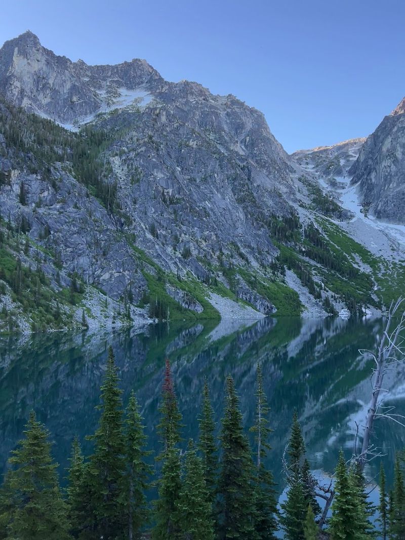
Arriving early at Colchuck Lake is not just about beating the crowds, though that is certainly a bonus. The real reason to push for a dawn start is the reflections.
On calm mornings, before any wind disturbs the surface, the lake becomes a near-perfect mirror and the peaks above appear twice, once in stone and once in water.
That doubled image is genuinely surreal. Dragontail’s north face, all that raw vertical granite, hangs inverted in the lake’s surface with the same crisp detail as the real thing.
The turquoise water makes the reflected peaks glow slightly warmer than the actual rock, giving the whole scene a quality that feels almost too beautiful to be entirely real.
I kept checking my camera screen wondering if the photo looked fake. It did not look fake.
It just looked like Colchuck Lake on a still morning, which apparently is what postcards aspire to be.
By mid-morning, any breeze that picks up will break the reflection into rippling fragments of color, still beautiful but different in character. The window for that glassy stillness is often short, sometimes just an hour or two after sunrise.
Photographers who know this place well plan their entire visit around catching that light. Even casual visitors who happen to arrive at the right moment tend to stop mid-sentence and just stare, because some things are simply better experienced without narration.
Larch Season and the Golden Transformation
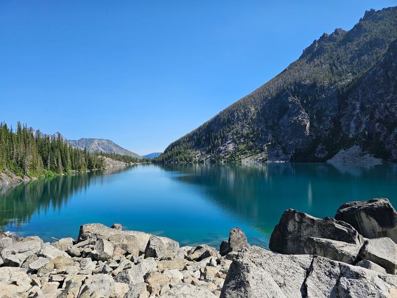
Most alpine lakes look their best in summer, when the snow has cleared and the skies are reliably blue. Colchuck Lake follows a different calendar.
Late September through mid-October brings what locals and regular visitors call larch season, and it transforms the entire basin into something that feels genuinely theatrical.
Western larches are unusual among conifers because they lose their needles each fall, but before they drop, they turn a vivid, warm gold that glows against the grey granite and the lake’s turquoise surface. The color contrast is extraordinary.
Pale blue water, amber trees, dark stone, and often a dusting of early snow on the upper peaks all layered into a single view.
The trade-off is crowds. Larch season at Colchuck Lake is one of the most popular hiking events in the entire Pacific Northwest, drawing visitors from well beyond Washington State.
Arriving before sunrise on a weekday is the most reliable way to find parking and enjoy a quieter experience on the trail.
Temperatures drop noticeably by October, so layering is essential. A light rain jacket, warm mid-layer, and waterproof boots handle most conditions you are likely to encounter.
Mosquitoes, which can be persistent in early July, are essentially gone by fall, which is another reason seasoned hikers prefer the autumn window. The hike feels different in that crisper air, quieter and more deliberate, and the lake rewards the effort with color combinations that summer simply cannot match.
Permits, Parking, and Practical Know-How
Getting to Washington’s Colchuck Lake requires a bit of planning before you even lace up your boots. From Leavenworth, head west on US-2 for about a mile, then turn left onto Icicle Road.
After roughly 8.5 miles, turn left onto Forest Service Road 7601, an unpaved road that is steep, rough, and about four miles long. A vehicle with decent clearance handles it better than a low-riding sedan, and slow driving saves your tires.
Parking at the Stuart Lake Trailhead costs five dollars per vehicle per day, or you can use a valid Northwest Forest Pass or America the Beautiful Pass. The lot fills fast, often before 8 a.m. on summer weekends, and overflow parking can stretch nearly a mile back down the road.
Arriving by 6 a.m. or earlier on busy days is not an exaggeration, it is genuinely necessary.
Free self-issued day-use wilderness permits are required and available at the trailhead. If you plan to camp overnight between May 15 and October 31, a separate overnight permit is needed and should be arranged well in advance.
Dogs and drones are both prohibited within the Alpine Lakes Wilderness, so leave them at home.
Restrooms are available at the trailhead but there is no potable water, so fill up before you leave town. Cell service is essentially nonexistent in the area, making a downloaded offline map or a printed trail map a practical necessity rather than an optional backup.
A little preparation goes a long way out here.
