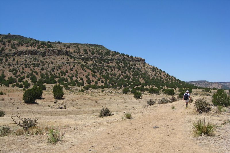
Some places do not look like much on a map, just a speck of land at the far edge of Oklahoma where the roads thin out and the towns disappear. Then you lace up your boots, start walking across open grass, and slowly realize you are heading toward the very top of the whole state.
The reward is a quiet stone marker, wide-open views, and a border with another state so close you could almost toss a pebble over it. It is free, it is humble, and it might be the most memorable walk you ever take in Oklahoma.
A Summit at the Edge of the Panhandle
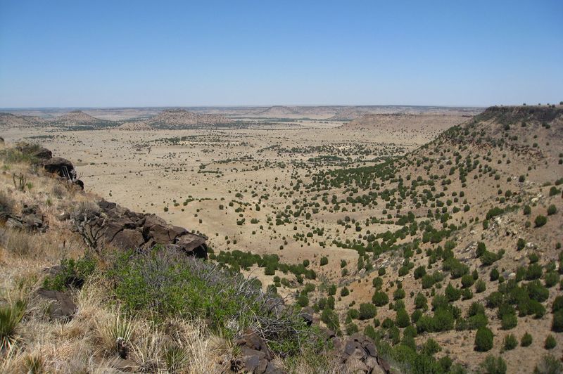
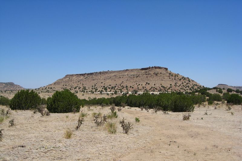
Picture the farthest tip of the Oklahoma panhandle, where the land stretches so wide it feels like the sky has room to breathe. Out there, a long, flat-topped ridge called Black Mesa rises above the grass, and its highest spot is the tallest ground in the entire state.
The summit sits at 4,973 feet above sea level. For comparison, much of central Oklahoma hovers around 1,000 to 1,300 feet, so standing up here puts you nearly a mile above the ocean.
It is classified simply as a mountain peak, though it looks more like a giant tabletop than a pointy mountain.
Getting to the top means walking. A trail of about 4.2 miles one way leads from a parking area to a stone monument marking the high point.
The round trip runs roughly 8.4 to 8.5 miles, which makes it a real day outing rather than a quick stroll.
What makes it special is not only the height. The summit lands just a short walk from the New Mexico line, inside a corner of the country where several states crowd together.
For Oklahomans who think their state is all flat farmland, this spot offers a delightful surprise.
Ancient Lava Beneath Your Boots
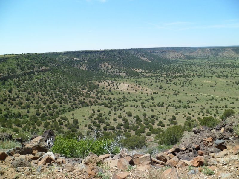
Thirty million years ago, the ground here looked nothing like a quiet prairie. Lava flowed across the region and later cooled into dark rock, and that hardened layer is what gives Black Mesa its name and its shape.
Because the black lava rock resisted wearing away better than softer ground around it, the mesa stayed tall while the surrounding land slowly eroded. That is why the top looks so flat.
You are basically walking on an ancient cap of stone that protected everything beneath it.
The mesa is part of a larger plateau that reaches beyond Oklahoma. In fact, Black Mesa straddles three states: Oklahoma, Colorado, and New Mexico.
Few landforms in Oklahoma can claim that kind of reach.
Here is a fun bit for curious kids on the trail. Pick up nothing, but look closely at the darker rocks along the path.
Many of them carry tiny holes and rough textures, small reminders of the volcanic past.
Geology fans often find this the most exciting part of the trip. Everyone else usually just enjoys knowing that the ground under their sneakers has a story far older than any town, road, or fence line in the panhandle.
Where the Rockies Meet the Prairie
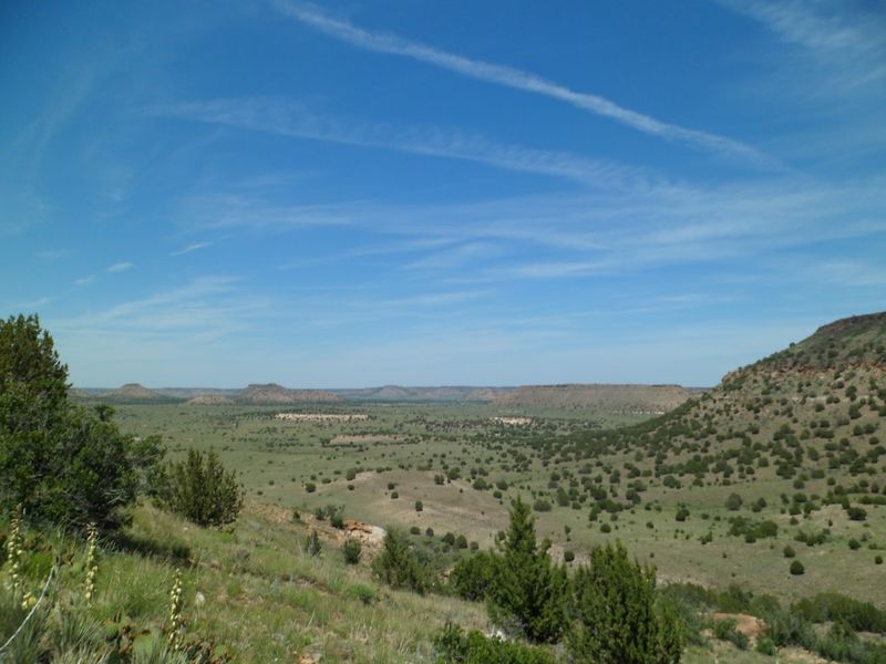
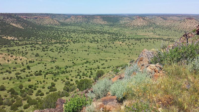
Stand on the trail and turn slowly in a circle. On one side, shortgrass prairie rolls out like a tan carpet, while on the other, rocky slopes and scrubby trees hint at mountain country to the west.
That mix is no accident. Black Mesa marks an ecological meeting point where the Rocky Mountains fade into the Great Plains.
Plants and animals from both worlds share the same small patch of ground, which is something you simply cannot find anywhere else in Oklahoma.
The land around the hike belongs to the Black Mesa Nature Preserve, which covers roughly 1,600 acres. The Nature Conservancy owns and maintains the land along the high point route, keeping it wild and protected for future visitors.
Inside the preserve live 23 rare plant species and eight rare animal species. Lucky hikers might spot golden eagles circling overhead, scaled quail darting through brush, antelope in the distance, or even bighorn sheep.
Bring binoculars if you have them. Slow down during the flat first stretch and scan the horizon.
Even if no wildlife shows up, the feeling of walking between two very different landscapes makes the miles pass quickly and gives the whole trip a sense of adventure.
The Easy First Miles Across the Grass
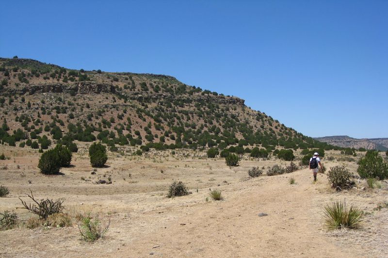
Good news for anyone nervous about the climb: most of the hike is pleasantly flat. The first 2.5 miles or so cross open shortgrass prairie, with the mesa sitting ahead like a destination on a postcard.
Visitors describe this portion as easy walking. The path is clear, the ground stays fairly level, and you can chat with your hiking partners without losing your breath.
Families often use this stretch to settle into a steady pace.
Shade, however, is basically missing. The prairie offers little cover from the sun, so a wide hat and sunscreen matter from the first step.
Wind can also sweep across the grass, especially in cooler months, so a light jacket that blocks wind is a smart addition.
One hiker suggested wearing bug repellent, and another reminded everyone to watch for snakes. Neither should scare you away, but both are worth keeping in mind as you walk.
Think of these opening miles as a warm-up. They give your legs time to loosen up and your eyes time to take in the scenery.
By the time you reach the base of the mesa, you will feel ready for the part that actually asks something of you.
Switchbacks Up the Mesa Wall
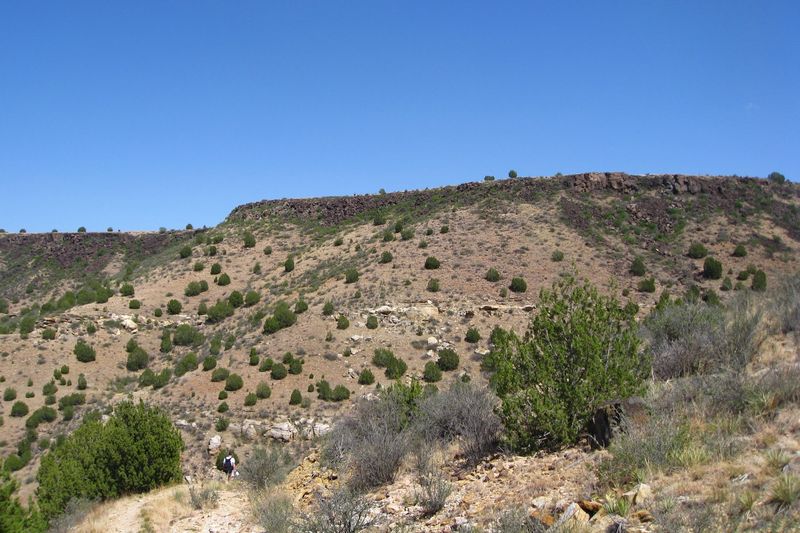
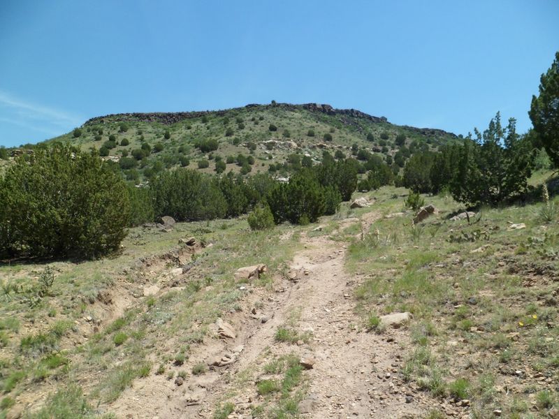
Then the trail tilts upward. After the long flat walk, hikers face a climb of about 600 to 650 feet spread over roughly one mile, winding up the side of the mesa on a series of switchbacks.
Some visitors say only about 0.6 miles of the route truly goes uphill, though that piece is somewhat steep. One dad who hiked it with his wife and daughter mentioned a few switchbacks that were not too bad.
Most people take breaks, sip water, and keep going.
Because of this climb, the overall route is often rated intermediate to expert level. Beginners can find it strenuous, but with preparation, families still make it to the top.
Take your time on the rocky footing. Trekking poles may help on the way down, when tired legs and loose stones can make the descent trickier than the ascent.
Every turn of the switchbacks opens up a bigger view of the prairie you just crossed. Glance back once in a while.
Seeing how far you have come is a great motivator, and the scenery from halfway up is reason enough to slow down and catch your breath.
Granite Marker on the Tabletop
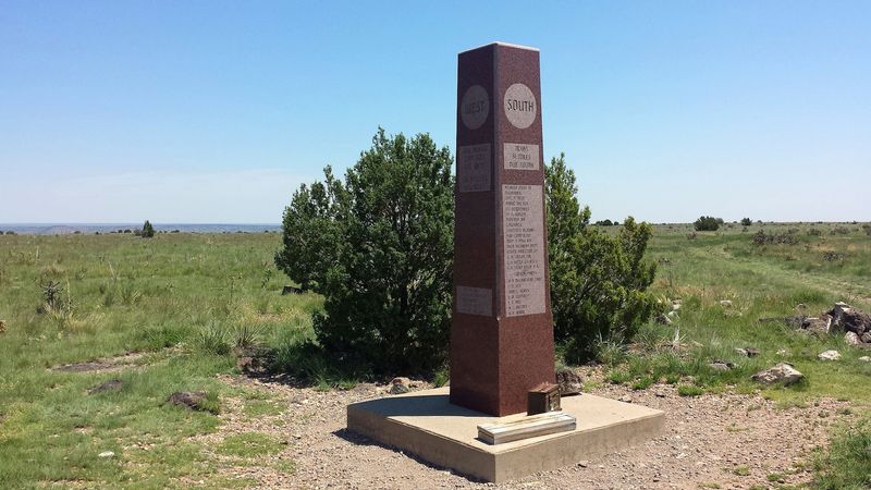
Once you crest the mesa, the trail levels off again, and the remaining walk across the top is easy. Eventually you reach a monument that marks Oklahoma’s highest point, the finish line hikers have been chasing for miles.
Visitors call it a nice monument, and it makes the perfect backdrop for a family photo. Many people treat this moment like a small celebration, snapping pictures, sharing snacks, and soaking up the fact that nobody in Oklahoma stands higher than they do right now.
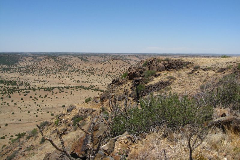
Views stretch in multiple directions. On a clear day, the flat land seems to roll on forever, broken only by distant mesas and long ridges.
It is quiet, too, with only the wind for company most of the time.
Collectors of state high points especially love this stop. One visitor called it a unique spot among the state high points, saying the remote setting makes the effort feel even more rewarding.
Plan to linger a bit. After roughly 4.2 miles of walking, you have earned a rest.
Find a comfortable rock, eat a sandwich, and let the big panhandle sky remind you why this trip was worth the long drive.
So Close to New Mexico You Can Almost Wave
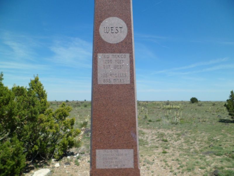
Here is the fact that wins every trivia night. The Oklahoma high point sits only about 1,299 feet east of the New Mexico line, which works out to roughly 0.2 miles.
That means after walking more than four miles to reach the summit, you end up just a short stroll from another state entirely. Visitors love pointing west and telling friends that New Mexico is right over there.
The corner gets even more interesting. Black Mesa sits in Cimarron County, the only county in the United States that borders four other states: Kansas, Colorado, New Mexico, and Texas.
Few spots anywhere pack so many state lines into one neighborhood.
There is also a tri-state marker where Oklahoma, Colorado, and New Mexico meet. It sits about 1.4 miles north of the high point monument, a separate landmark that curious explorers sometimes add to their list.
For kids learning geography, this place turns a map lesson into something real. Standing near a border you cannot see, with nothing but grass and rock in every direction, helps young hikers understand that state lines are invisible ideas drawn across a much older landscape.
Starry Skies Over Cimarron County
When the sun drops, Black Mesa puts on a second show. The area is known for exceptionally dark night skies, with almost no city lights for many miles in any direction.
Astronomy fans travel out specifically for the stars. On a clear night, the Milky Way can spread across the sky like spilled sugar, and constellations that hide behind city glow suddenly pop into view.
August is a favorite time for stargazers because of the Perseid meteor shower. Lying back on a blanket and counting shooting stars is a memory many families carry home long after the hike itself fades.
Keep in mind that the nature preserve is only open from dawn to dusk, so night viewing happens elsewhere, such as Black Mesa State Park, where camping is allowed. Pairing a day hike with an evening of stargazing at the park makes a fantastic two-part adventure.
Pack a red flashlight if you have one, since it helps protect your night vision. A warm layer is wise even in summer, as panhandle nights can cool down.
Then simply look up, stay quiet, and enjoy one of the darkest skies anywhere in Oklahoma.
Who Will Love This Trek
Solitude seekers, this one is for you. Black Mesa sits in a remote, desolate corner of the country, and visitors say there is nothing around for miles in terms of amenities.
That emptiness is part of the charm. Hikers who want quiet, wide views, and a break from crowds tend to fall hard for this place.
State high point collectors adore it, too, and one visitor even bumped into fellow travelers from their own home county in North Carolina, proving the trail draws folks from far away.
Families can absolutely enjoy it with good preparation. One father completed the hike with his wife and daughter and suggested allowing at least five hours for the round trip.
Kids who like a challenge often feel proud reaching the top.
Very young children or anyone with limited stamina may find the full 8.5 miles too much. A shorter walk across the flat prairie section can still offer a taste of the scenery.
Nature lovers, birdwatchers, geology buffs, and sky watchers all find something here. If you value simple, free, outdoor experiences over flashy attractions, this panhandle peak fits your style perfectly.
Planning Notes for a Smooth Visit
Bring water. Then bring more.
There are no water sources on the trail, and summer heat out here can be intense, so carrying plenty is the single most important tip.
The Black Mesa Nature Preserve is open dawn to dusk, and there is no fee to hike or get a permit. A restroom is available at the trailhead, which is handy before setting off.
Hours and access can change, so checking ahead is wise, since one past visitor found the area not open when they arrived.
Spring and fall usually offer the most comfortable temperatures. Summers run hot with little shade, while winters can turn cold and windy.
One experienced hiker recommended starting early and finishing by around 10 a.m. during warm months.
Camping is not allowed inside the preserve, but Black Mesa State Park sits about 15 miles away and permits camping. Staying there makes an early start much easier.
Pack sunscreen, a hat, a wind-resistant jacket, snacks, and bug repellent. Sturdy shoes help on rocky sections.
Since services are scarce, fill your gas tank and grab supplies before heading into the far western panhandle.
Worth Every Mile of the Long Drive
Yes, it is far. From Oklahoma City or Tulsa, the panhandle tip feels like the end of the earth, and the drive alone takes real commitment.
Still, people who make the trip tend to say the same thing: it was well worth it. Some come back a second time.
The combination of a free trail, ancient lava rock, rare wildlife, a monument at the state’s rooftop, and a border just 0.2 miles away creates a day that sticks with you.
There is something wonderfully Oklahoman about it, too. No gift shop, no ticket booth, no fancy visitor complex.
Just land cared for by conservation folks, a clear path, and a reward you earn with your own two feet.
If you plan for heat, wind, and distance, this hike can become a highlight of any western Oklahoma road trip. Add a night of camping and stargazing nearby, and you have a full adventure for almost no money.
So the next time someone says Oklahoma is all flat, smile and tell them about the morning you stood nearly a mile high, looking toward New Mexico, at the very top of home.
