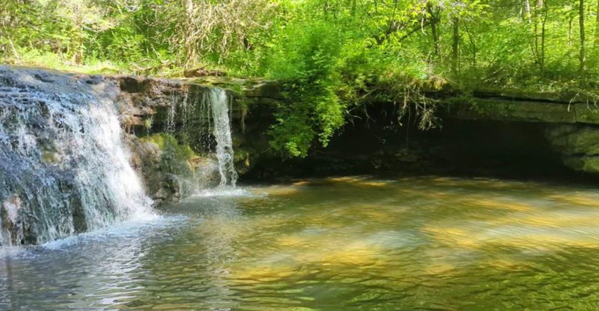
The trail looks wrong. Too flat.
Too ordinary. Then the ground drops away and there is water falling through the trees.
That is one of the better tricks Indiana keeps pulling on visitors. Beyond the cornfields and county roads, sandstone ravines hide waterfalls tucked into canyons, hollows, and wooded cliffs.
Some are small enough to surprise you. Others plunge dramatically into pools that look like they belong somewhere much farther west.
Getting to them is not always elegant. There may be mud.
There may be stairs. There may be a gravel road that makes you question the directions.
The waterfall usually makes up for all of it.
1. Hemlock Cliffs, English
The temperature drop is the first clue that something unusual is happening here. Descend into this box canyon inside Hoosier National Forest and the air cools several degrees, which explains why plants that belong farther north or east manage to survive in Crawford County.
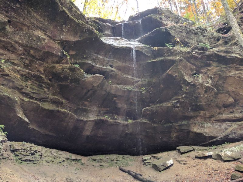
Sandstone walls rise on every side, many of them pocked and honeycombed where iron ore weathered out over thousands of years. Overhangs, sheer faces, and rock shelters line the roughly one-mile loop.
Those shelters carry real history. Archaeologists trace human use of the canyon back as far as 10,000 years, and walking beneath the same ledges gives the hike a hushed quality.
Waterfalls here run on the weather. After steady rain, thin ribbons pour off the rim; in August, they may vanish entirely, leaving mossy stains behind.
Keep an eye on footing, since the steeper sections turn slick fast. Look for wintergreen, mountain laurel, and French’s shooting star along the damp lower stretches.
Small caves and underground drainage through the Glen Dean Limestone add another layer to the geology, and the whole place feels far bigger than its acreage suggests.
Getting there takes patience. From English, head south on State Road 237 roughly five to six miles, turn west on Union Chapel Road for about 2.5 miles to the Eckert-Hatfield junction, then right on Hatfield Road 1.5 miles to a Forest Service road leading half a mile to parking.
2. Salamonie River Falls, Largo
Most travelers know Salamonie for its reservoir and boat ramps, which is exactly why the falls tucked into the surrounding state forest stay so quiet. Winding forest roads lead toward Hominy Ridge Lake, where a parking area, shelter house, and picnic tables mark the starting point.
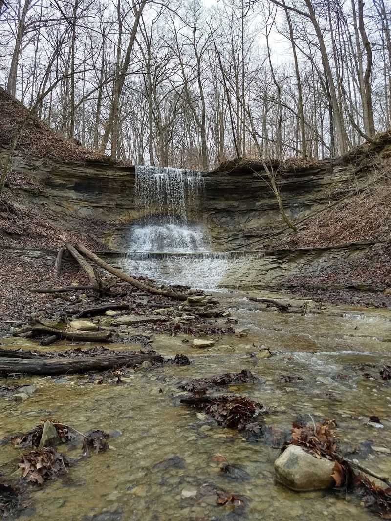
From the picnic ground, a short stroll reaches an overlook. The main cascade drops roughly fifteen feet over a rough, shelf-like ledge into a shaded gorge below.
Anyone wanting a closer look faces a steep hillside scramble. It rewards the effort with the sound of water echoing off the rock walls, something the overlook only hints at.
Flow changes dramatically through the year. Late summer can reduce the falls to a trickle, while deep winter sometimes freezes them into strange, sculpted columns of ice.
Along County Road 100 South, another small lot marks the trailhead for the Three Falls Trail, which links Kissing Falls and Hominy Ridge Falls within an easy walk of each other. Three waterfalls in one afternoon is a solid return for a place hardly anyone talks about.
Bluffs, ravines, and rolling elevation changes keep the hiking interesting, and deer and wild turkeys turn up regularly on the quieter stretches.
The forest office sits at 5400 E Salamonie Forest Road, Largo, IN 46941, a useful landmark before phone signal fades.
3. Silver Cascade Falls, Waveland

Hiking inside the creek itself is part of the deal at Shades State Park, and Silver Cascade Falls is the payoff. Water slides along the floor of a narrow ravine before tipping over a rocky lip, less of a plunge and more of a graceful skid.
Trail 1 begins near the dramatic Devil’s Punchbowl and runs about three quarters of a mile. Expect ladders, steps, wet feet, and moderate to rugged footing the whole way.
Sandstone bluffs tower above Sugar Creek here, and shaded side ravines keep the whole park several degrees cooler than the surrounding farmland. Canoeists drift past below while hikers pick their way through the gorges above.
Maidenhair Falls sits elsewhere in the park for anyone with energy to spare, and Lover’s Leap delivers the kind of overlook that makes people stop mid-sentence.
Neighboring Pine Hills Nature Preserve adds knife-edge ridges and some of the most unusual topography in the state.
Then there is the sky. Shades holds some of Indiana’s darkest night skies, drawing stargazers who set up telescopes once the trails empty out.
The park entrance is at 7751 South County Road 890 West, Waveland, IN 47989, roughly seventeen miles southwest of Crawfordsville off State Road 47. Sturdy shoes matter more than any other piece of gear.
4. Double Falls, Taswell
Turquoise water in southern Indiana sounds like an exaggeration until the pool at the base of Double Falls comes into view. Roughly twenty-five to thirty feet of water drops across two distinct ledges, landing in a cove ringed by limestone and shade.
Yellow Birch Ravine Nature Preserve protects 441 acres on the edge of Hoosier National Forest, and the terrain here is genuinely rugged. Bluffs, deep valleys, and towering rock shelters fill the property.
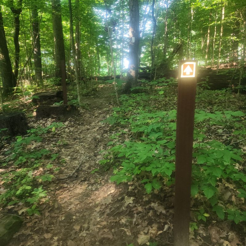
The trail is lightly maintained, and that is the appeal. Fallen trees, shallow stream crossings, and slick creek beds all factor in, especially after rain.
Massive ferns grow beneath a mature canopy, which is why so many hikers compare the walk to something out of the Pacific Northwest. The resemblance is not accidental.
Cool, narrow valleys create a microclimate that supports eastern hemlock and mountain laurel, species more at home in Appalachia.
Wild caves dot the preserve, and a natural rock bridge known as the Ravine Arch waits for those willing to wander.
To find it, drive south from Paoli on State Road 37, then west on State Road 64/37 before reaching English, continuing to Taswell. Turn south onto County Road 139, also called Trestle Road, and watch for a small gravel lot about a mile down on the right.
5. Muscatatuck Falls, North Vernon
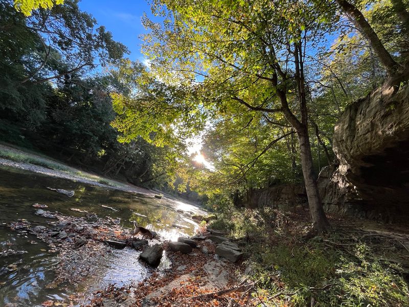
Two waterfalls, one river trail, and a historic mill at the start make Muscatatuck Park an easy afternoon to love. The route begins at the old Vinegar Mill and follows the Muscatatuck River, with moving water audible for nearly the entire walk.
Canyon Creek Falls shows up first. Rather than dropping in a single sheet, the water spreads wide and tumbles down natural stepping-stones, creating a staircase effect that photographs beautifully in soft light.
Push on roughly two miles and the trail reaches Muscatatuck Falls itself. Fed by a limestone spring, it plunges more directly into the basin below, a sharper contrast to the gentler cascade upstream.
Getting there is genuinely half the fun. Riverbank, bottomland woods, and rocky shelves trade places as the trail bends with the water.
North Vernon’s location keeps this one off most itineraries, so crowds rarely build up even on nice weekends. Solitude comes standard here.
Wildflowers arrive early in spring, and the canopy stays cool well into summer, making the hike comfortable when open trails feel punishing.
Bring water and expect a few uneven stretches near the falls, where spray keeps the rock damp year-round. For anyone assembling a waterfall road trip through southern Indiana, this park makes an ideal midday stop between bigger-name destinations.
6. Anderson Falls, Hartsville
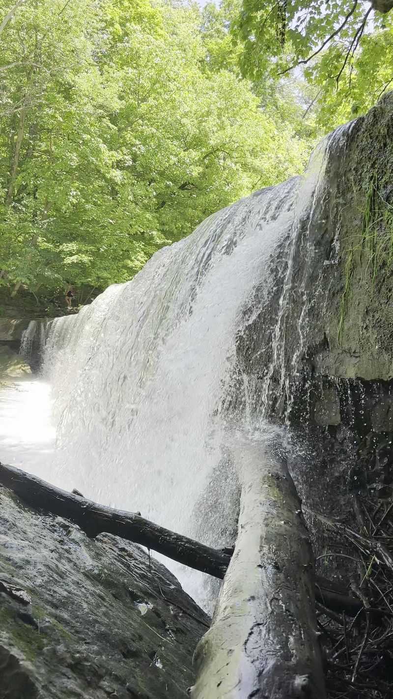
Width, not height, is what makes Anderson Falls memorable. The cascade stands only about twelve to fourteen feet tall yet stretches close to a hundred feet across, spilling in a broad curtain over the Fall Fork of Clifty Creek.
Reliability is the other selling point. Unlike seasonal cascades that disappear in dry spells, this one usually keeps a respectable flow all year.
Geology explains the shape. Tough Louisville Limestone caps softer Waldron Shale, and as the shale erodes, an undercut rock house forms beneath the falling water.
That same shale holds Silurian fossils, so fossil hunters tend to linger along the creek edges. Ancient sea creatures, pressed into rock, sitting in a Bartholomew County park.
The 44-acre preserve includes wooded trails and picnic spots, and the falls sit close enough to the road that reaching the base requires only a short walk down. Families with young kids manage it without trouble.
Photographers do well here in overcast weather, when the wide sheet of water and green shale read evenly without harsh shadows.
From Columbus, follow State Road 46 east about 8.5 miles, turn right onto County Road 925 East, which bends left and becomes County Road 200 North. After roughly 2.2 miles, turn left onto County Road 1140 East just before the creek.
Parking appears at 3699 N 1140 County Rd E, Hartsville, IN 47244.
7. Williamsport Falls, Williamsport
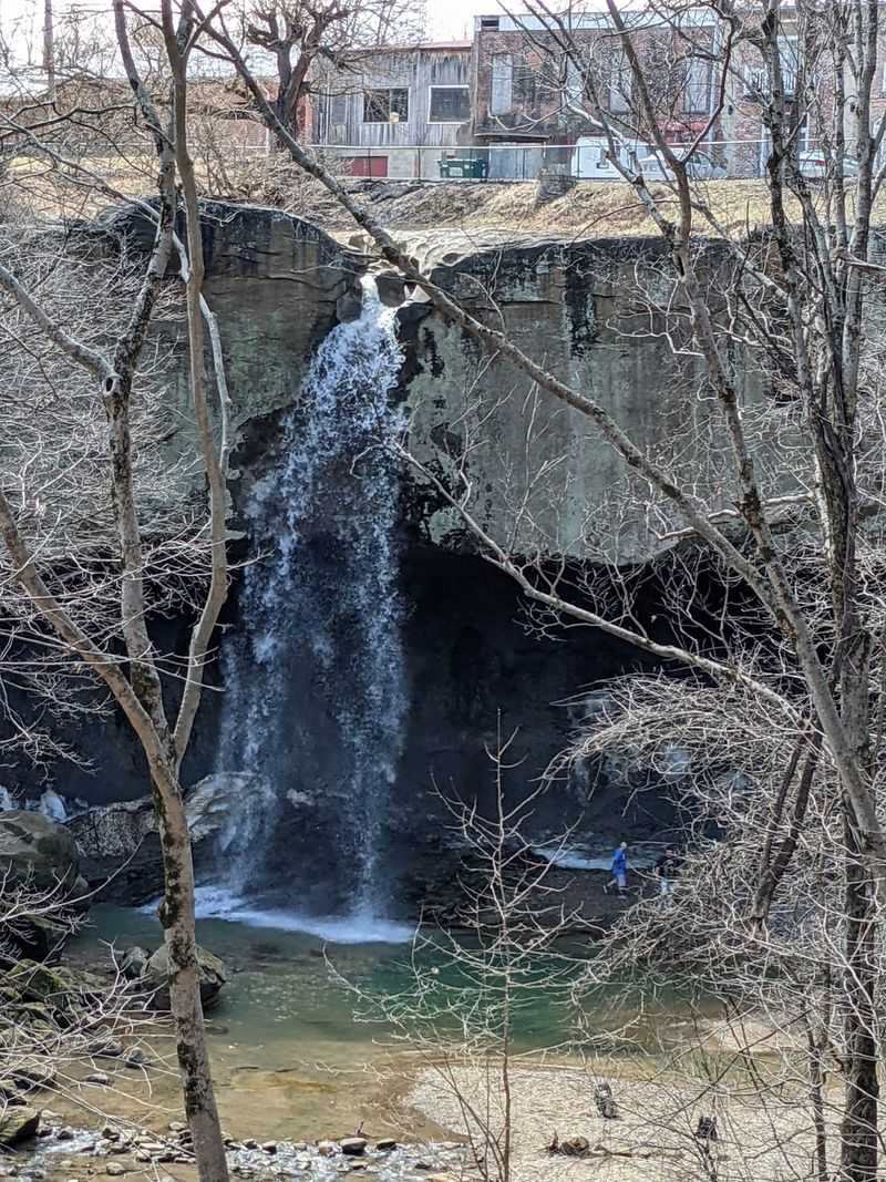
Indiana’s tallest free-falling waterfall hides behind a fire station and a handful of small businesses, which has to be one of the odder setups in American sightseeing. Water drops roughly ninety feet over a broad sandstone ledge right in downtown Williamsport, Warren County.
Fall Creek, a modest offshoot of the Wabash River, does all the work. In dry stretches it thins to a trickle over the rim.
Timing changes everything. Visit after heavy rain or spring snowmelt and the same ledge turns loud, misty, and genuinely powerful.
Below, an emerald lagoon collects at the base, and warm-weather visitors wade in to cool off. The rock amphitheater around it holds sound in a way that makes the falls seem larger than they are.
One of the best perks is being able to walk behind the curtain of water, looking out through the falling stream. Not many Midwestern waterfalls allow that.
Parking and the trailhead sit directly above the drop, so access takes almost no effort. A 1.6-mile loop known as the Williamsport Falls Loop circles the surrounding woods, thick with vegetation and songbirds once the leaves fill in.
Birdwatchers show up in spring for exactly that reason. Find the falls at 25 N Monroe Street, Williamsport, IN 47993, an address that still surprises first-time visitors.
8. Thistlethwaite Falls, Richmond
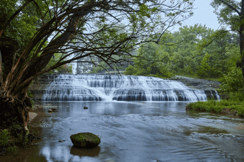
Here is a waterfall with a founding date. In 1854, industrialist Timothy Thistlethwaite blasted a new channel through bedrock to redirect the West Fork of the Whitewater River and power his sawmill, accidentally creating one of eastern Indiana’s most interesting cascades.
Nature took over from there. Nearly two centuries of water flow have smoothed and widened the ledge until the man-made origin barely shows.
The base is broad and shallow, which makes exploring the rock shelf easy on low-water days. Those same limestone layers are packed with marine fossils.
Roughly 445 million years ago, during the Ordovician period, a shallow sea covered this part of the continent. Brachiopods, bryozoans, and crinoids still turn up in the loose rock, and the site is part of the Whitewater Valley Fossil Hunt program.
Kids tend to lose interest in the waterfall the moment someone finds a fossil. Both attractions share the same short trail.
Navigation apps occasionally send visitors on a confusing loop, so watch for the gravel parking area and the bridge crossing above the falls as landmarks.
Springwood Park sits nearby for anyone wanting a longer stay, and the constant rush of water makes the setting feel far from the city streets just minutes away. The address is 65 Waterfall Road, Richmond, IN 47374.
9. Trail 6 Waterfall at Charlestown State Park
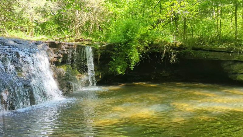
Few state parks in Indiana feel as underused as Charlestown, and the canyon waterfall along Trail 6 is the strongest argument for changing that. Park near the Ohio River overlook, across from the western trailhead, and the hike starts almost immediately downhill.
Trail 6 runs 2.3 miles as a loop and carries a rugged rating for good reason. Steep grades, roots, and rocky footing show up throughout.
Old-growth forest lines the route. Beech and tulip poplar grow tall enough that the canopy closes overhead, dimming the light and cooling the air as the trail drops deeper.
Then the canyon narrows and the sound of water arrives before the view does. The falls tumble over stacked rock ledges into a secluded pocket where sunlight only reaches midday.
Other water features round out a visit. A smaller seasonal cascade sits along Trail 2, a moderate 1.4-mile path better suited to shorter legs, and nearby Nine Penny Branch Nature Preserve holds another waterfall worth chasing.
That mix of difficulty levels means nobody has to sit in the car. Everyone finds a trail that fits.
Spring runoff produces the strongest flow, though the forest itself justifies the walk in any season. Bring traction, take the descent slowly, and save time for the river overlook afterward.
