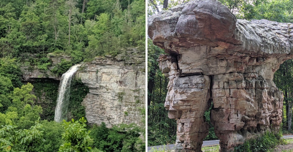
The river has terrible manners. Instead of going downhill like a normal river, it runs along the top of the mountain.
Then it carves a canyon. A very deep one.
In Alabama, that strange bit of geography created a 15,288-acre preserve filled with sandstone cliffs, waterfalls, swimming holes, and overlooks along an 11-mile scenic drive. The farther the road goes, the less believable the landscape becomes.
Jade-colored water sits between pale boulders. Hawks circle above the rim.
Fossils show up in the rock. Then fall arrives.
The trees turn red and gold. Suddenly the whole canyon looks even more dramatic.
It is a lot of scenery for a road people can drive straight through without realizing what they are seeing.
An 11-Mile Rim Drive That Keeps Handing Out Views
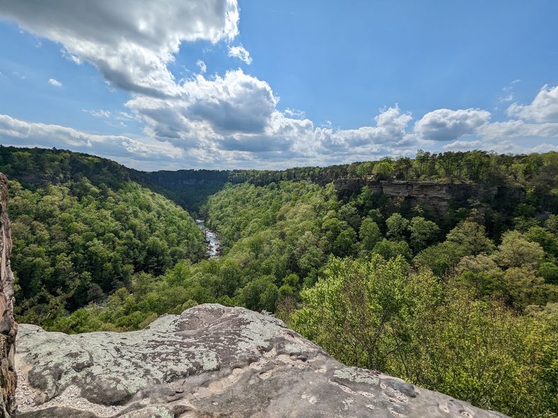
Few roads pay off this quickly. The Canyon Rim Scenic Drive, officially AL Highway 176, hugs the western edge of the gorge for roughly 11 miles and sets up overlook after overlook, each one a little different from the last.
Pull-offs appear often enough that the drive turns into a stop-and-go ritual. Park, walk a few steps, look down, repeat.
From the railings, the Little River shows up hundreds of feet below as a ribbon of jade and silver threading between pale boulders. Sandstone bluffs stack up on both sides, and hawks often glide on rising warm air at eye level, which is a strange and lovely thing to witness from solid ground.
Season changes everything here. Summer fills the canyon with dense green, while late October and early November swap it out for red, orange, and yellow that seems to glow when the light hits right.
Plan on at least two hours if stopping matters, and more if photography is involved. Guardrails exist at the developed overlooks, but rock near the edges can be slick after rain, so sturdy shoes beat flip-flops.
Cell service comes and goes along the parkway, which is a decent excuse to grab a paper map before setting out and simply follow the road wherever it bends.
Little River Falls, the Waterfall That Starts It All
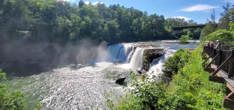
The canyon does not ease into things. It opens with a 45-foot curtain of water dropping over a wide sandstone ledge, and the sound reaches the parking lot before the view does.
Little River Falls sits just off Highway 35, with a paved lot and an ADA-accessible boardwalk leading to the viewing platform. Getting there takes minutes, not miles.
Water levels write the script. Winter and early spring bring serious volume, enough that mist drifts up over the railings and the whole ledge turns into one thundering sheet.
By midsummer the flow calms down considerably, and the shallow pools below become a favorite spot for wading. A swimming hole forms near the base when conditions allow, and families spread out on the warm rock slabs nearby.
Footing deserves respect. Wet sandstone gets unbelievably slick, and currents above a waterfall are stronger than they look from a distance, so staying within marked areas is simply smart.
Morning light works beautifully for photos here, and crowds tend to be thinnest early in the day. Bring water shoes if wading is on the agenda, since the riverbed is more pebble and ledge than sand.
Consider this stop the proper introduction to everything downstream.
137 Stone Steps Down to Little Falls Swimming Hole
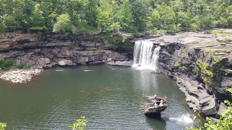
Locals have called it Martha’s Falls and Hippie Hole over the years, but the official name is Little Falls, and reaching it means earning it. The trail runs about three quarters of a mile and includes a descent of 137 stone stairs cut into the canyon side.
Going down feels easy. Coming back up is a different conversation entirely.
What waits at the bottom makes the climb worthwhile: a modest waterfall spilling into a wide, clear pool ringed by boulders that have been smoothed by centuries of moving water.
Summer turns the spot into one of the preserve’s most popular swimming areas, with flat rocks serving as natural benches for drying off.
Water clarity here is genuinely impressive, a reminder that the Little River carries an Outstanding National Resource Water designation for good reason.
Bring more water than seems necessary, especially in July and August when Alabama humidity turns the return trip into a workout. Shoes with grip matter on the stone steps, which can hold moisture long after rain.
Arriving early on weekends improves the odds of a quiet swim. Afternoons draw a livelier crowd, though the pool is large enough that everyone finds a rock to claim.
Pack out whatever comes in, since the canyon floor stays beautiful only when visitors help.
Grace’s High Falls and Its Disappearing Act
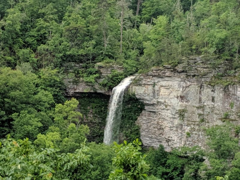
Timing decides whether this one shows up at all. Grace’s High Falls is seasonal, fed by rainfall rather than a steady stream, and after a dry spell the cliff face can look almost bare.
Catch it after a good soaking rain, though, and a 133-foot ribbon of water pours down the canyon wall in a single dramatic drop.
A viewing platform along the Little River Canyon Rim Parkway frames the whole thing from across the gorge, which gives a real sense of scale. Trees at the base look like shrubs.
The falls themselves stretch far taller than most people expect from Alabama.
Winter and early spring deliver the most reliable flow, and bare branches during those months clear the sightlines considerably. Late summer visitors may find only a damp streak on the rock, which is part of the deal with rain-dependent falls.
Bring binoculars or a zoom lens, since the viewpoint sits a fair distance away and details get lost to the naked eye.
Checking recent rainfall before the trip is the single best planning move here. A couple of stormy days beforehand can transform the entire experience.
Even when the water thins out, the overlook itself gives a wide, layered view of the canyon that few travelers regret stopping for.
Trails For Every Kind of Leg Day
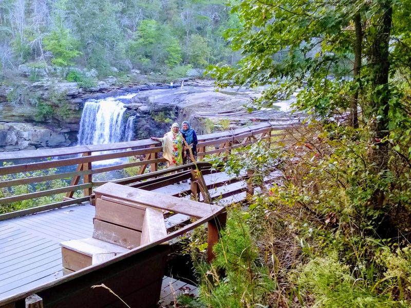
Hiking here ranges from stroller-friendly to seriously demanding, which makes the preserve unusually flexible for mixed groups. The Bridge Trail keeps things gentle, linking the Canyon Center to an overlook of Little River Falls without much elevation drama.
Beaver Pond Trail offers another relaxed option, looping through quiet pine forest to a pond built by actual beavers.
Step up a notch and the Little Falls Trail delivers a moderate descent to the swimming area. Step up several notches and the Eberhart Trail drops steeply into the gorge toward the river, passing leftover traces of the old Canyonland Park and Zoo along the way, which is an odd and memorable piece of local history.
Powell Trail follows a small stream down to the Little River, while the Canyon Mouth Trail runs alongside the water on flatter ground.
For long-distance walkers, the DeSoto Scout Trail stretches the farthest and connects into neighboring DeSoto State Park.
Loose rock and root-tangled sections are common, so trekking poles help on the steeper descents. Ticks are a real consideration in warmer months, and long socks solve most of that problem.
Start early, tell someone the route, and remember that canyon climbs always feel longer on the way out than they did going in.
Fossils, Sandstone, and a River That Runs on a Mountaintop
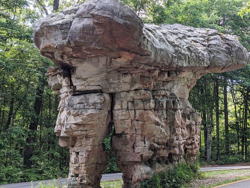
Geology nerds get spoiled here. The Little River is one of the very few rivers in the country that flows almost its entire length on top of a mountain, which is exactly as unusual as it sounds.
Over millions of years, that mountaintop river sliced downward through the Pottsville Formation, leaving cliffs and canyon walls that reach past 500 feet and, in places, beyond 600.
Look closely at the exposed rock and the story gets older still. Fossils embedded in the walls show that this ground once sat beneath a shallow sea during the Paleozoic Era, long before Lookout Mountain existed in any recognizable form.
Layered bands in the sandstone mark ancient shorelines and shifting sediment, stacked like pages nobody has bothered to close.
The preserve also protects rare, threatened, and endangered plants and animals, and the Little River ranks among the wildest and cleanest waterways in the Southeast.
Collecting rocks or fossils is off-limits inside the preserve, so photos are the souvenir of choice.
Overlooks along the rim make the best classrooms, especially in winter when leaves are down and the rock layers stand fully exposed. Reading an interpretive sign or two before the drive turns every pull-off into something more interesting than a pretty view.
Start at the Canyon Center, Then Chase Birds and Whitewater
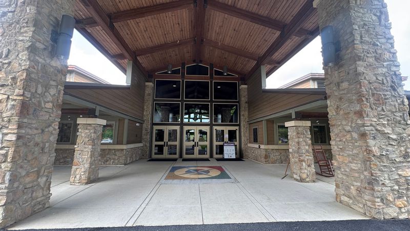
Smart trips begin indoors. The Little River Canyon Center at 4322 Little River Trail NE, also listed as 472 AL Highway 35, in Fort Payne, AL 35967, hands out maps, trail conditions, and current water information that shapes the rest of the day.
Exhibits explain the canyon’s formation, and staff can point out which falls are actually flowing that week.
From there the preserve opens up in a dozen directions. Bird watchers scan for Yellow-breasted Chats, Prairie Warblers, and raptors circling the rim, with spring migration bringing the busiest soundtrack.
Anglers work the clean water, while winter and spring transform the Little River into a whitewater destination that draws experienced paddlers from well beyond Alabama.
Cyclists have scenic pavement plus dirt tracks in the backcountry wildlife management area. Horseback riding is allowed back there too, and climbers and rappellers find plenty of vertical sandstone to work with.
Photographers rarely run short of subjects, whether the target is a misty bluff at sunrise or a secluded pool half-hidden by boulders.
Fill the tank in Fort Payne before heading out, since services thin quickly along the rim. Then pick one activity, leave room for a second, and let the canyon handle the schedule from there.
