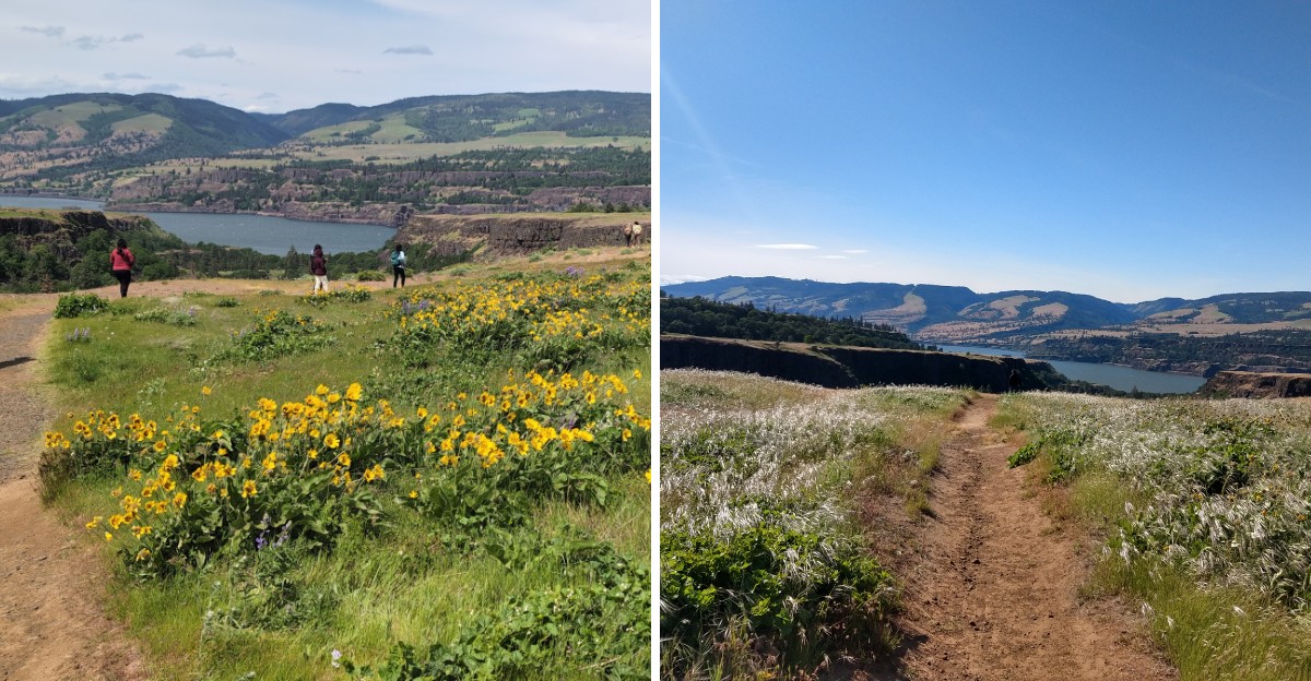
Hillsides don’t usually turn into a spectacle worth planning a trip around, yet wildflowers here manage exactly that once the right season arrives.
Color spreads gradually across the slopes, yellows and purples covering ground that looks completely different just weeks earlier before blooming began. The river stays visible below throughout the hike too, adding scale to a view that already feels dramatic on its own.
Timing a visit around peak bloom takes some attention, since the display rarely lasts more than a few weeks before fading back into ordinary hillside green. Hikers who catch it right often describe the timing as pure luck, though longtime visitors know roughly when to expect it each year.
Few landscapes transform this dramatically for such a short window. Oregon’s wildflower season here rewards anyone willing to check the calendar closely enough to catch it.
Rowena Crest Viewpoint and That Famous Looping Road
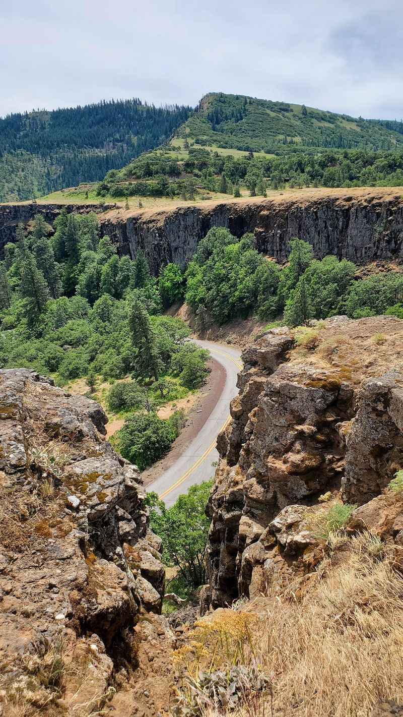
Before a single boot touches dirt, the drive itself steals attention. The Historic Columbia River Highway curls into a tight horseshoe loop at Rowena Crest, a piece of 1920s engineering that looks almost too graceful to be real from above.
Drivers slow down here whether they mean to or not. The overlook sits on a flat basalt shelf with guardrails, wind, and a view straight down the gorge toward Washington State.
Parking fills up on spring weekends, so arriving early matters more than people expect. Many visitors park at the crest lot and walk across the road to reach the trailheads on either side.
Photographers love the loop at sunrise, when low light rakes across the cliffs and the river turns pale gold. Even travelers with no plan to hike often stop, step out, and stand there for ten quiet minutes.
Wind gusts can be strong enough to push a car door shut, so hold onto hats, maps, and anything light.
Balsamroot Season Turns the Slope Gold
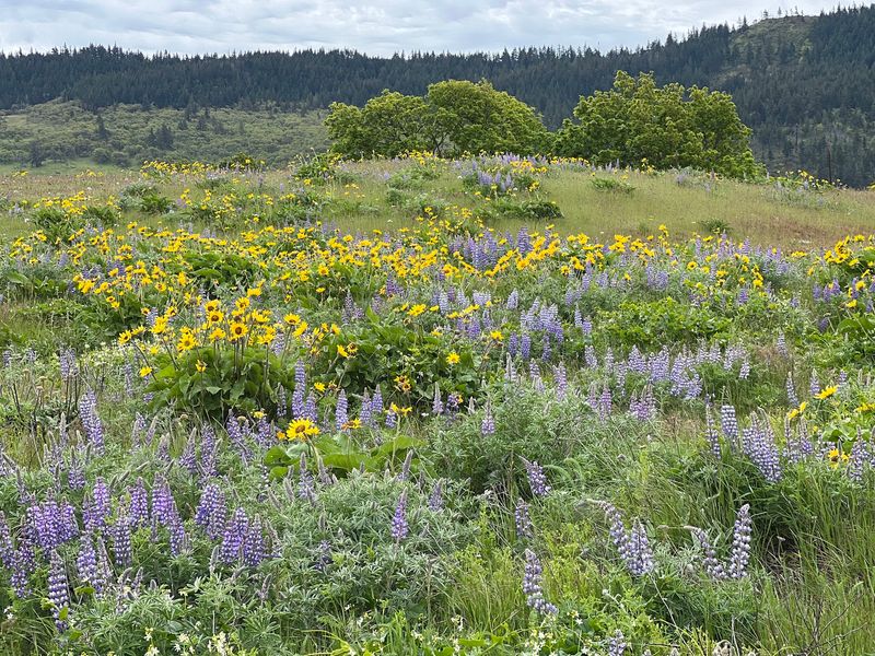
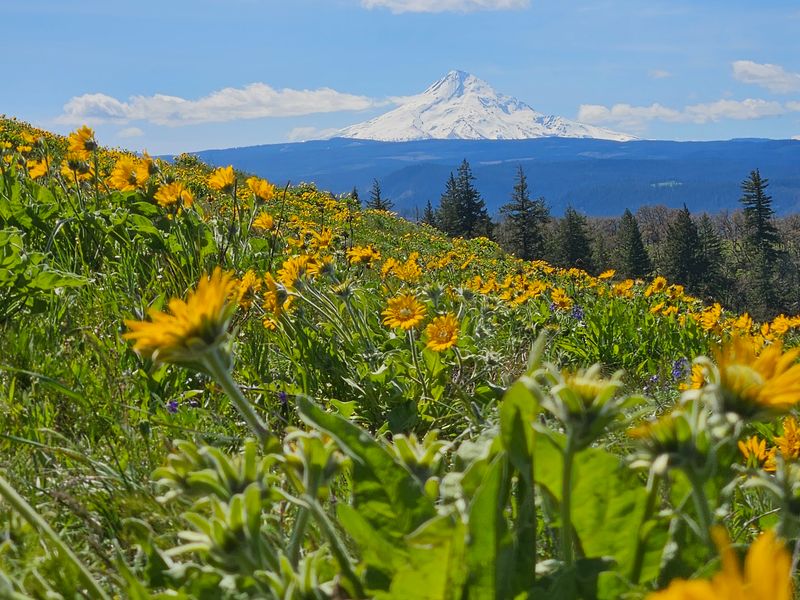
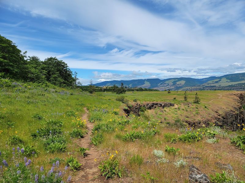
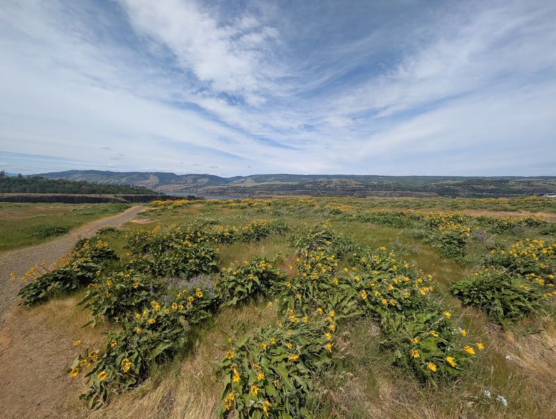
Yellow is the headline color here. Arrowleaf balsamroot blooms across whole meadows in mid to late April, and from a distance the hillside reads as one continuous wash of gold.
Purple lupine shows up alongside it, sometimes with orange paintbrush mixed in, and the combination is ridiculous in the best way. Visitors who time it right walk through flowers taller than their knees.
Bloom timing shifts every year depending on winter rain and spring warmth. Late April through the first week or two of May tends to be the strongest window, though early April can surprise people after a mild winter.
By mid May, some blossoms start to wither while others hold on, which still makes for a lovely walk.
Staying on the trail protects the display. The soil here is thin and slow to recover, and the preserve exists specifically to keep these rare plant communities intact. Photos taken from the path look just as good, honestly.
Rowena Plateau Trail for an Easy Wander
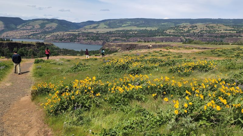
Not everyone wants a climb, and the plateau route respects that. Heading north from the parking area, the path runs roughly a mile out across open, treeless ground with a small optional loop near the end.
Elevation change is minimal, dropping a couple hundred feet toward the rim. Footing stays rocky and uneven in places, so shoes with decent grip help more than fashion sneakers.
Two small ponds sit along the way, and frogs often chorus from the edges until footsteps get close. Make a noise and the whole pond goes silent, which delights kids every single time.
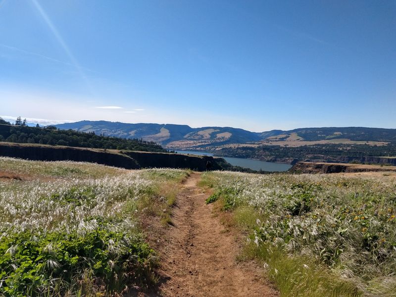
The payoff arrives at the cliff edge, where basalt drops toward the river and mounded landforms ripple across the plateau behind you.
Cliffs here have no railings. Families with small children should keep everyone close, since the ground slopes toward some serious drops without much warning. Budget an hour or two for a relaxed round trip.
McCall Point Trail and Its Honest Uphill
Anyone wanting to earn the view heads south instead, up the McCall Point Trail. The route runs roughly four to five miles round trip with about a thousand feet of climbing, which sounds modest until the sun gets involved.
Grades stay gradual through the lower section, then steepen through oak groves and switchbacks higher up. Most hikers finish in two to three hours with breaks, and breaks are easy to justify here.
The tread narrows past the first third, so yielding to descending hikers becomes part of the rhythm. Nobody seems to mind much.
What makes the climb unusual is that the scenery improves steadily rather than saving everything for the top. Each bend opens a wider slice of the gorge.
At the summit, a grassy knoll offers room to sit and take in Mount Hood to the south and Mount Adams across the river. The trail beyond the point stays closed for habitat restoration.
Two Volcanoes, One Ridge, Clear Skies Required
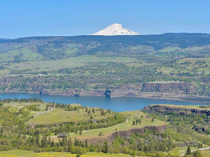
Weather decides how good this gets. On a clear day from the high point, Mount Hood rises white and sharp to the south while Mount Adams sits broad and heavy to the north, with the Columbia threading between them.
Some visitors catch Mount St. Helens in the mix too, a pale shape further west. Haze or cloud can hide all of it, so checking the forecast before driving out pays off. Morning light generally gives the crispest mountain definition, before afternoon heat builds haze over the river corridor.
Bring a camera with something wider than a phone lens if mountain photos matter, though phones handle the sweeping gorge shots surprisingly well.
Worth remembering: the plateau trail also delivers big river views without the climb, just without the volcano panorama. Different rewards, both valid.
Sitting up top with a snack while the wind pushes clouds across Hood ranks among the more satisfying ways to spend a spring morning in Oregon.
Come Prepared Because There Is Nothing Out Here
Here is the practical truth that catches people off guard: no restrooms, no portable toilets, no drinking water at the trailhead. None.
Plan accordingly before leaving Mosier or Hood River, because the nearest facilities sit a drive away. Carry more water than seems necessary, especially on the point trail.
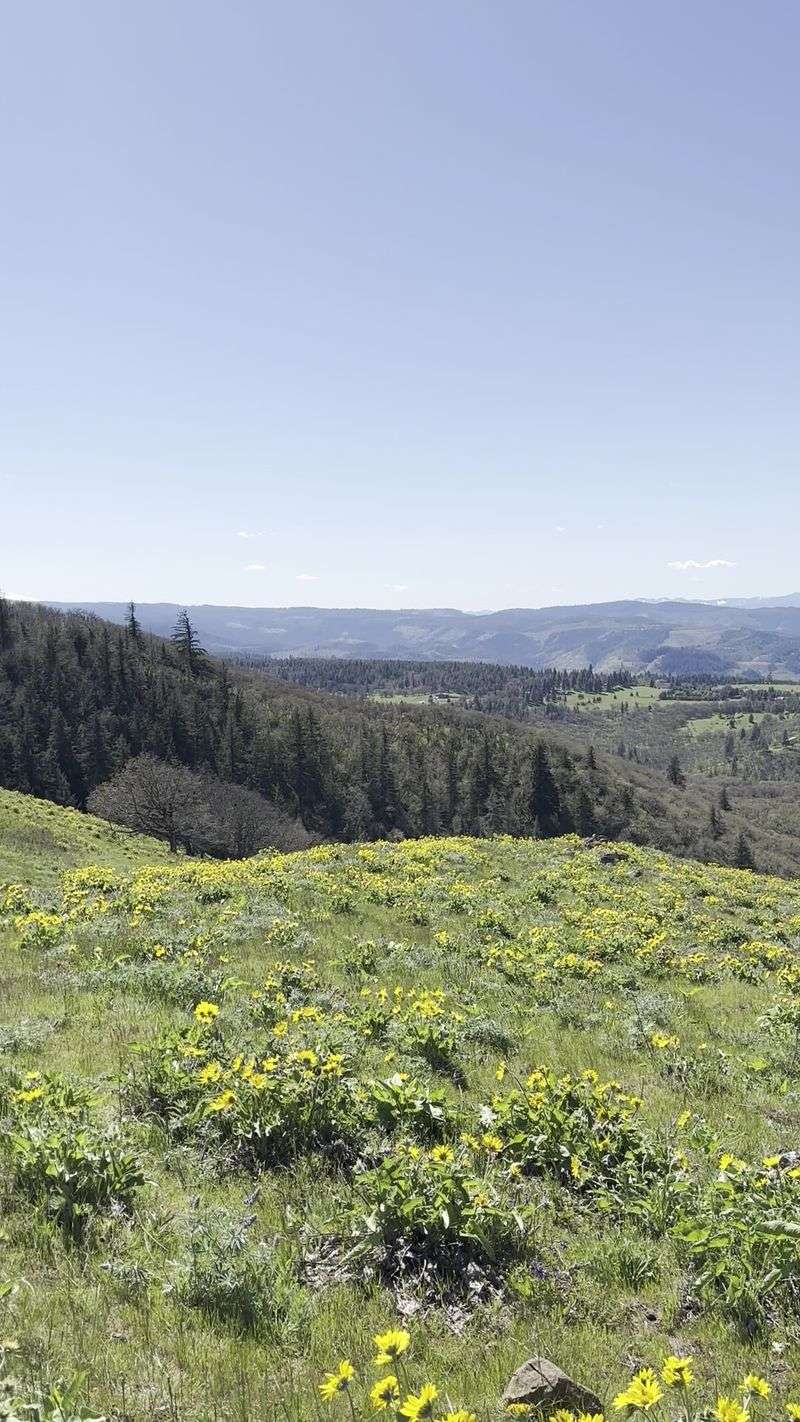
Shade barely exists. Most of the route runs across open meadow with full sun overhead, and a seventy five degree day feels considerably warmer on an exposed slope.
A wide brimmed hat, sunscreen, and sunglasses turn an uncomfortable hike into a pleasant one. Wind can be fierce enough to make a light jacket useful even when temperatures climb. Everything brought in needs to go back out, including snack wrappers and fruit peels. There are no trash cans.
Parking is free and no hiking permit is required, which is a nice change from other gorge trailheads. The tradeoff is self sufficiency, and it is a fair one.
Rattlesnakes, Poison Oak, and Paying Attention
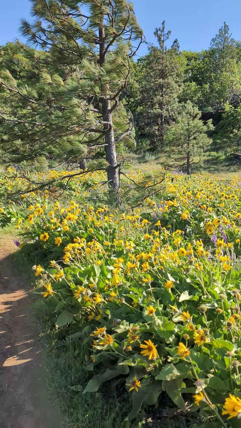
Dry grassland habitat means a few neighbors worth respecting. Rattlesnakes live here and occasionally sun themselves near the path, particularly in warmer months and shadier rocky sections.
Hikers who spot one simply give it space and continue. Snakes want nothing to do with people and usually announce themselves clearly. Poison oak grows thick in spots, especially where the trail dips into oak groves on the climb. Brushing past it in shorts leads to a very itchy week.
Learning the three leaf pattern before visiting saves grief later. Long pants help on the point trail. Ticks turn up in spring grasses too, so a quick check after the hike is a smart habit.
None of this should scare anyone off. Thousands of people walk these trails every spring without incident, and awareness handles almost everything. Keeping to the established path reduces the risk and protects the wildflowers at the same time, which makes it an easy choice.
Timing Your Visit to Dodge the Crowd
Word about this place got out long ago. On peak bloom weekends, the lot overflows and cars line the historic highway in both directions well past midday. Arriving by nine in the morning on a Saturday still leaves a decent chance at a space. Show up at one in the afternoon and expect a hunt.
Weekday mornings feel like an entirely different preserve. A Tuesday visit might mean passing only a handful of people the whole way. Sunrise hikers get the best of everything, cool air, soft light, and near empty meadows. Headlamps help for the first stretch in early spring.
Crowds thin noticeably the higher you climb, since plenty of visitors turn around once the grade kicks up. Fall and winter visits bring golden grasses, moody clouds, and almost nobody around. The flowers are gone, but the gorge views hold up beautifully in any season.
Hiking Here With Kids Without the Meltdown
Families do well here with a little planning. The plateau trail suits younger legs best, flat enough for preschoolers though rocky enough to warrant real shoes.
Kids around five and older generally handle the climb to McCall Point, especially with snack stops built in. Some three year olds manage it, but expect slow going and a possible piggyback finish.
Frog ponds, lizards, and the sheer number of flowers keep small hikers interested longer than a plain forest walk might. Cliff edges are the main concern. Hold hands near the rim and keep runners within reach, because there are no fences between grass and open air.
Since there is no water or restroom, pack extra of everything and handle bathroom logistics before arriving.
One more thing that trips people up: dogs are not allowed anywhere in the preserve, not even leashed. The rule protects fragile plants and ground nesting wildlife, so leave pets at home.
Where the Preserve Sits and How to Find It
Getting here is refreshingly simple from Portland, roughly an hour and a half east along Interstate 84 before taking the Mosier exit and following the Historic Columbia River Highway uphill.
The drive alone justifies the trip, twisting past orchards and through country that shifts from green to gold within a few miles. Hood River sits close enough for a meal before or after.
The Nature Conservancy manages the land, protecting rare plants that grow almost nowhere else, which explains the strict rules about staying on trail.
Both trailheads branch from the same area near Rowena Crest, one crossing the road toward the plateau and the other climbing south toward the point. Cell service can be spotty, so downloading directions ahead of time helps.
Find it at Tom McCall Preserve, Historic Columbia River Hwy, Mosier, OR 97040, and give yourself more time than planned, because nobody leaves this hillside quickly.
