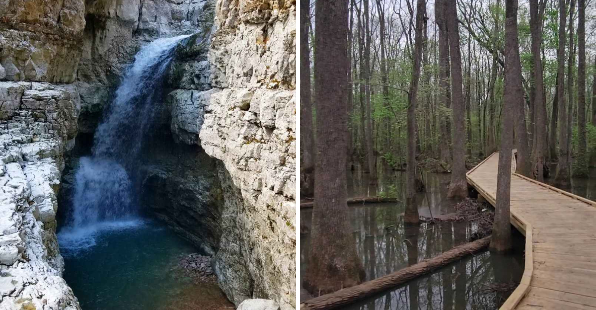
You take the turn because the road looks like it probably leads nowhere interesting. A little gravel, a faded sign, maybe a mailbox that looks like it belongs to somebody’s cousin, and then suddenly the trees open up to something you would never expect to find there.
That is the fun of the quieter nature preserves scattered across Alabama. You might follow a trail beside water sliding over sandstone, spot a rare fish in a clear creek, or find glowing insects lighting up the woods after dark.
Farther south, coastal dunes replace forest while ancient canyons wait in places most people never think to look. The catch?
These places usually require a little patience. Some sit beyond the busy routes, which is exactly why the parking lots stay small and the trails can feel wonderfully empty.
Ready to trade convenience for a little adventure? These 10 preserves are waiting down the less obvious road.
1. Turkey Creek Nature Preserve, Pinson
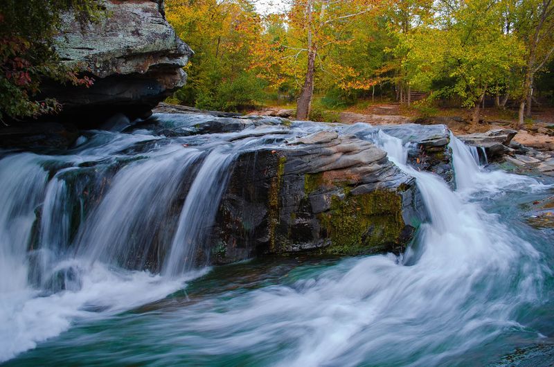
Water does most of the talking here, sliding across wide sandstone shelves and dropping into pools clear enough to count pebbles. The creek is famous among biologists for a very small reason.
The vermilion darter, a tiny orange and blue fish, lives in this watershed and nowhere else on Earth.
Roughly six miles of trails spread out from the entrance, and each one has its own personality. The paved Highland Trail climbs steadily through upland forest, short but honest about the elevation.
Boyscout Trail runs an easy third of a mile beside some of the prettiest water on the property.
Longer options include Thompson Trace at 1.4 miles and the Pineland Loop at 1.6 miles, both good for spotting wildlife when the woods are quiet. Narrows Ridge and Highlands are multi-use and get rocky, so ankle support helps.
Birders treat the preserve as a regular stop along the Appalachian Highlands Birding Trail, watching for tanagers and warblers during spring migration. A sandstone house from around 1930 and an old swing bridge add a little history between the swimming holes.
Summer weekends draw families to the falls, so early mornings on weekdays feel closest to solitude. Kayaking and fishing are both allowed.
Photographers love the light that filters through the gorge just after sunrise.
Address: Turkey Creek Road, Pinson, Alabama
2. Wehle Forever Wild Tract, Midway
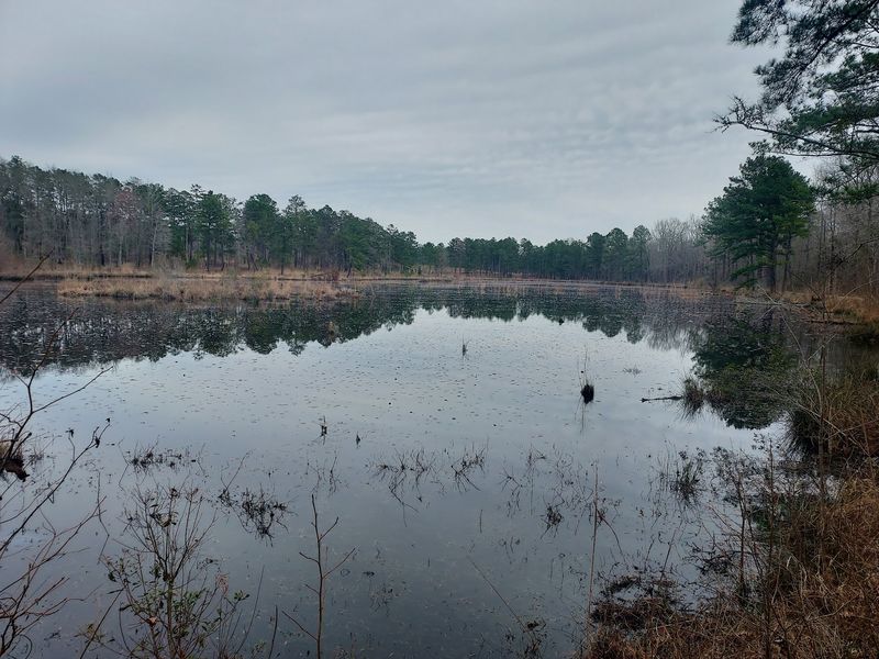
Bullock County rolls rather than climbs, and the pine savanna out here feels wide open in a way most Alabama forests do not. Fire keeps the understory grassy and bright.
Bachman’s sparrows sing from the pine uplands, which is reason enough for serious birders to make the drive.
Around 1,500 acres hold eight miles of hiking trails, most of them grass-covered old roads that are easy underfoot when dry. Wet weather changes that quickly, turning stretches into mud and shallow standing water.
Boots beat sneakers.
Two short loops circle the upland pine stands, good for a quick stretch after a long drive. The Pines and Bottomland Cutt-off Trail covers far more ground and shows the property’s range, dropping from open savanna into hardwood bottoms along shaded corridors.
More than 170 bird species have been documented on the tract, a number that surprises people expecting empty farmland. On scheduled open weekends, the Alligator Lakes Nature Trail opens up, and alligators, beavers, and wading birds all make appearances.
Hikers can use the Forever Wild trailhead seven days a week, while the conservation center itself keeps a limited schedule. Primitive campsites with power and water are available during those open weekends.
Canoeing on Blue Heron Lake can be arranged by request.
Address: Pleasant Hill Road, Midway, Alabama
3. Dismals Canyon, Phil Campbell
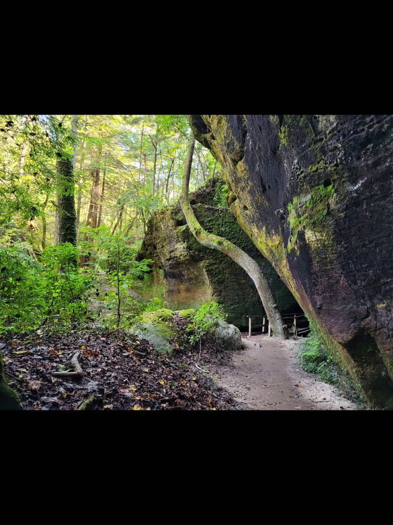
Eighty-five acres should not feel this otherworldly, yet the canyon floor manages it. Moss coats the boulders.
Hemlocks lean over a narrow branch of water that has been running through the same slot for thousands of years.
A 1.5-mile trail system loops the canyon bottom, using wooden walkways and stepping stones to cross the creek. Difficulty sits at moderate, mostly because of uneven footing and a few tight squeezes with names like Fat Man’s Misery.
Rainbow Falls and Secret Falls both show up along the route.
The real headliner comes out after dark. Dismalites, the larvae of a fungal gnat, glow blue-green along the damp canyon walls, and guided night tours are the only way to see them.
Very few places in the country host them.
Human history runs deep too. Rock shelters here sheltered Paleoamericans, and later the Cherokee and Chickasaw used the canyon.
A 138-foot eastern hemlock stands as a champion tree among the sandstone walls.
Recognized as a National Natural Landmark, the property remains privately owned and carefully protected. Cabins and campsites allow overnight stays for anyone wanting the glow tour without a long drive home.
Bring a light jacket, since the canyon runs cooler than the ridge above it.
Address: County Road 8, Phil Campbell, Alabama
4. High Falls Park, Grove Oak
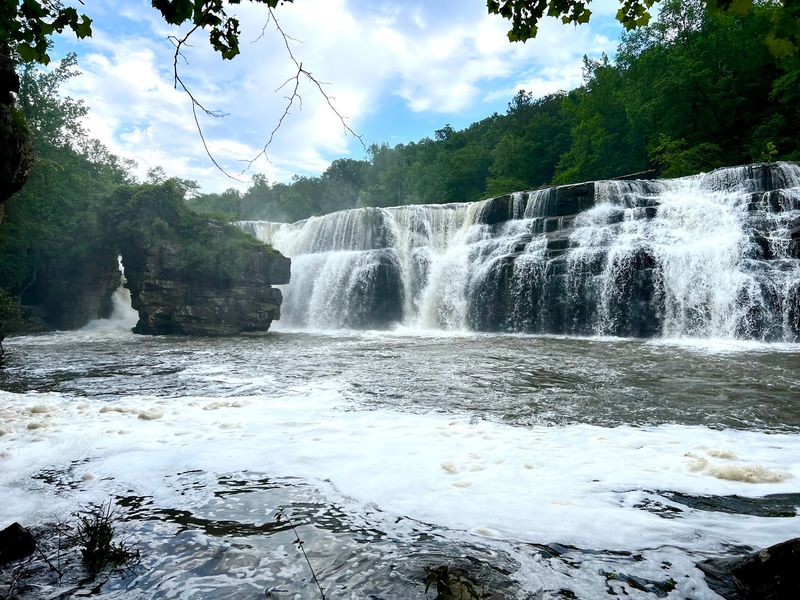
Sand Mountain keeps this one tucked behind pasture fences and horse country back roads, which is probably why crowds stay thin. Town Creek spills 35 feet over a ledge that can stretch more than 300 feet wide after heavy rain.
The sound carries well before the falls come into view.
Reaching the overlook takes almost no effort. A gravel and asphalt path runs about a tenth of a mile with no steep sections, making it workable for grandparents and toddlers alike.
Those wanting more can follow the three-quarter mile trail that winds around and through the park. A pedestrian bridge crosses the creek and delivers the angle most photographers come for, with the falls framed below.
Look near the base and a natural stone arch appears, carved by the same water that shaped the ledge. It is easy to miss when the flow is high.
Swimming happens in the pool below the falls, and a shallow wading area sits above the drop. Picnic tables, covered pavilions, restrooms, and a rustic playground round out the amenities, along with a ramp for kayaks and canoes.
Timing matters more here than anywhere else on this route. Late summer can slow the falls to a trickle, while spring turns the whole ledge into a curtain.
Address: County Road 144, Grove Oak, Alabama
5. Cane Creek Canyon Nature Preserve, Tuscumbia
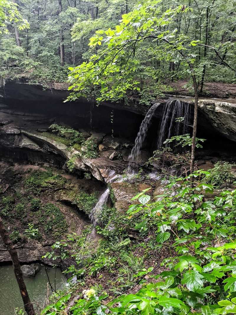
Signing a paper logbook at a small visitor station is not how most hikes begin, but that little ritual sets the tone for this 693-acre canyon. Hiking sticks lean in a barrel nearby, free to borrow.
Take one, because the descent into the canyon is steeper than the parking area suggests.
Somewhere between 15 and 25 miles of marked trails thread the property, depending on how the connectors are counted. Most rate moderately difficult thanks to steady elevation change rather than technical scrambling.
What makes the place unusually rich is geography. Several physiographic provinces overlap here, stacking plant communities that rarely share a hillside, which is why the wildflower displays draw botanists in spring.
Waterfalls slip over rock shelters, huge trees shade the drainages, and turtles and woodpeckers turn up without much searching. Old pioneer cabin sites add a quiet human layer to the woods.
Access follows a schedule worth checking before driving out. The preserve opens Friday through Sunday and on major holidays, skipping Thanksgiving and Christmas, with trail access ending in mid afternoon.
A picnic area near the trailhead makes a decent finish line. Plenty of visitors report having entire trails to themselves, which is rare for scenery this good.
Address: 251 Loop Road, Tuscumbia, Alabama
6. Beaver Dam Boardwalk at Wheeler National Wildlife Refuge
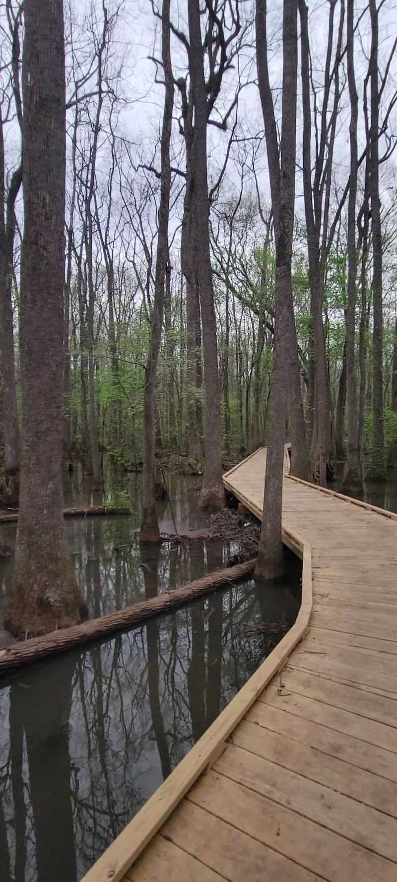
Swamps usually keep their secrets unless a canoe is involved. A one-mile boardwalk changes that, carrying walkers straight over black water and cypress knees without anyone getting wet past the ankles.
The route runs out and back, easy enough for young kids, and most people finish in about an hour. Slow down instead of rushing, because the wildlife shows up for those who stop moving.
Frogs call from the shallows. Turtles stack themselves on half-sunken logs and slide off one by one as footsteps approach.
All of this sits inside a refuge covering roughly 35,000 acres along the Tennessee River, a landscape better known to waterfowl than to weekend hikers.
Winter brings enormous numbers of migrating birds to the wider refuge, and the boardwalk offers a quiet corner away from the main observation areas.
Compared with Alabama’s busiest state parks, the crowds here are modest, partly because the refuge gets overshadowed by flashier destinations nearby. That works in favor of anyone who prefers birdsong to parking lot chatter.
Bug spray earns its keep from late spring through early fall. Boards can turn slick after rain, so watch footing on the shaded stretches.
Binoculars make the whole walk better, especially for spotting herons standing motionless in the reeds just off the rail.
Address: 3121 Visitor Center Road, Decatur, Alabama
7. Bon Secour National Wildlife Refuge, Gulf Shores
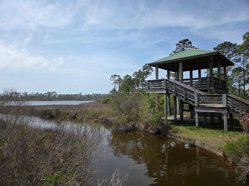
Gulf Shores has condos, traffic, and beach umbrellas by the thousand. Then there is this: about 7,000 acres of coastal barrier habitat left largely alone, with sand trails instead of sidewalks.
Four trails split up the terrain. The Jeff Friend Trail runs a universally accessible loop just under a mile through maritime forest and wetland edges along Little Lagoon, and it suits almost every fitness level.
Pine Beach Trail is the long one, four miles round trip through forest, scrub, and dunes before opening onto a quiet stretch of white sand. Loose sand makes the return leg feel longer than the map promises.
An observation tower along the way overlooks Gator Lake.
Gator Lake Trail covers two miles round trip on a dune ridge, while the Centennial Trail links the Jeff Friend and Pine Beach routes across shifting habitat.
Wildlife here includes nesting sea turtles, the endangered Alabama beach mouse, and more than 370 migratory bird species passing through with the seasons. Spring and fall migration turns the scrub into a birding hotspot.
Shade disappears fast on the dune sections, so carry more water than seems necessary. Sunrise walks beat midday every time.
Few coastal places in the state still look like this, which is the whole point of protecting it.
Address: 13900 Alabama Highway 180, Gulf Shores, Alabama
8. Walls of Jericho, Jackson County
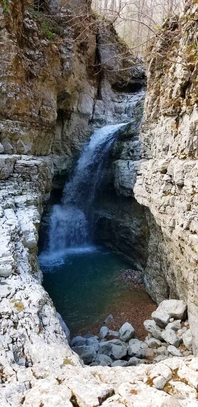
Serious hikers speak about this one with a certain respect, and the reason becomes clear about two miles in. The trail drops hard into a limestone canyon, following Hurricane Creek and Turkey Creek toward a bowl-shaped amphitheater where waterfalls pour down gray rock walls.
Six miles round trip sounds manageable until the climb out begins. Downhill first, uphill last, which is the least forgiving order possible.
Solid hiking boots are not optional.
The property covers more than 21,000 acres within the Skyline Wildlife Management Area, and much of it was privately held before the Nature Conservancy stepped in. That history helps explain why so few people know it.
Hurricane Creek holds the only known population of pale lilliput and Alabama lampshell mussels, plus three imperiled fish species. Birders come hoping for ruffed grouse.
At the bottom there are small caves to poke around, cold water to wade in, and flat rocks made for sitting still. Upper and lower trail options split near Clark Cemetery.
Bear Den Point Trail offers a 4.7-mile loop alternative for anyone wanting distance without the canyon descent. Two primitive camping areas operate first-come, first-served.
Cell service disappears out here. Tell someone the plan before heading in, and start earlier than feels necessary.
Address: Highway 79, Estillfork, Alabama
9. Chapman Mountain Nature Preserve, Huntsville
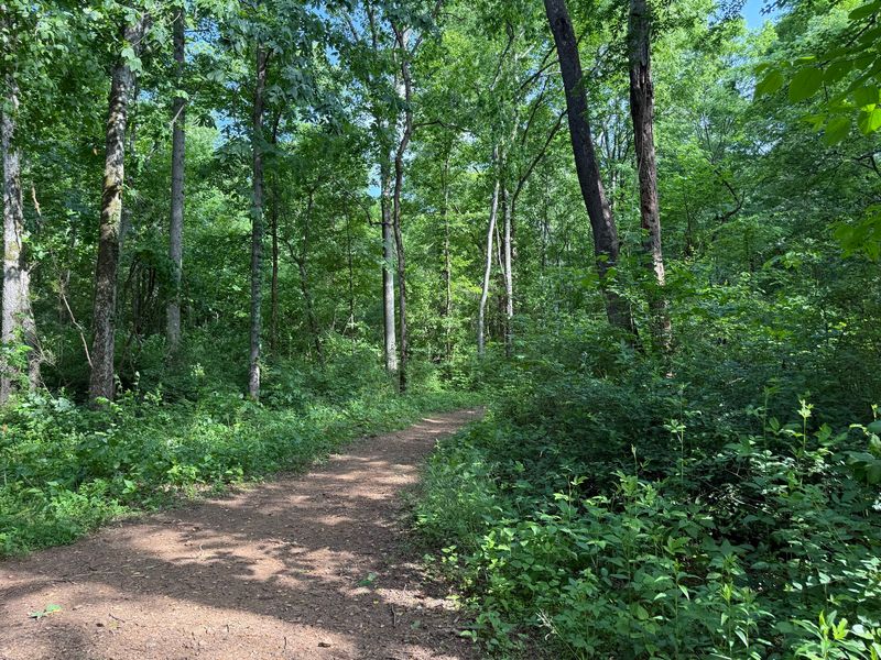
Gnome statues hiding in the leaf litter and a life-size Bigfoot figure standing among the hardwoods give this preserve a sense of humor most protected land lacks. Kids spot them first.
Adults pretend not to look.
Nearly 740 acres sit under the care of the Land Trust of North Alabama, with more than 4.5 miles of trail open now and a full ten miles planned. Everything is well marked, free, and available dawn to dusk.
The Moonshine Trail runs an easy half mile to a natural spring, a fitting name for these hills. Terry Trail stretches a mile past big hardwoods, mossy rock, and an old roadway, and includes a Big Tree Tour worth slowing down for.
Shorter connectors fill in the gaps. The Whole Planet Trail covers two-tenths of a mile through red buckeye, and the Amphitheater Trail leads to a rock formation shaped like a stage.
Chasco and Driskell offer easy loops of half a mile and a mile, while the 1.5-mile Bulldog loop ties into Terry Trail using neighboring Alabama A and M property.
A bird blind and habitat area make it a stop on the Alabama Birding Trail during migration. Mountain bikes and horses share the system, and a disc golf course occupies one corner.
Address: 1263 U.S. Highway 72 East, Huntsville, Alabama
10. Big Canoe Creek Nature Preserve, Springville
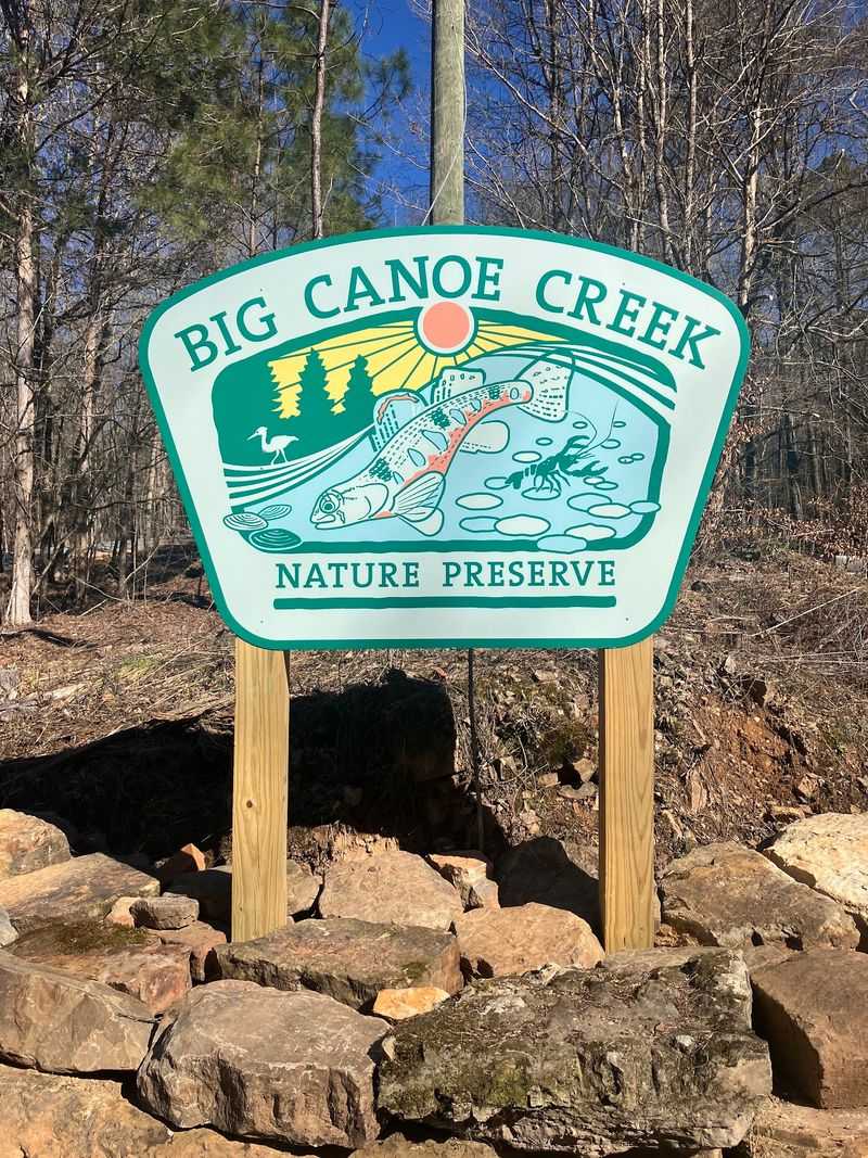
New arrivals to the protected lands map rarely look this good. Just 422 acres, four trails, and a creek that biologists rank among the more pristine waterways in the region.
The Creek Loop Trail keeps things reasonable at a moderate rating, with enough elevation change to remind legs they are working. Nothing here demands an all-day commitment, which makes it a solid choice for a half-day escape from Birmingham traffic.
Terrain shifts more than the acreage suggests. Deciduous woods give way to pine stands, then drop into lush creek bottoms before rising again toward ridge lines with long views through the trunks.
Big Canoe Creek itself is the reason the preserve exists. The watershed supports notable biodiversity, including aquatic species that depend on clean, undisturbed water, and protecting the corridor keeps that intact.
Alabama Forever Wild developed and manages the property, which explains the tidy trail markers and thoughtfully placed benches. A picnic area gives families a reason to linger past the hike.
Because it opened recently, word has not spread far, and weekday mornings can feel private. Spring brings wildflowers along the bottomland sections.
Sturdy shoes handle the rocky stretches best. Leave time to sit by the water before heading back out.
Address: 1215 Blount Boulevard, Springville, Alabama
