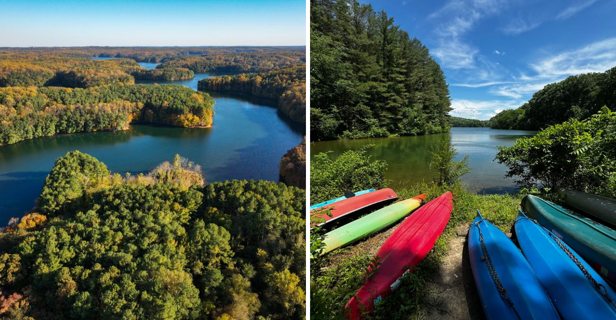
Maryland has plenty of lakes with pretty views, but this one comes with the kind of backstory that makes the calm water feel a little more mysterious.
Before the reservoir existed, the area was home to a community and woolen mill, and the town was eventually demolished as the North Branch of the Patapsco River was dammed to create the reservoir.
Today, visitors see a huge stretch of water and wooded shoreline, while an entire chapter of local life sits beneath the story of how it all came to be.
It is a strange reminder that some Maryland landscapes are not nearly as simple as they look, and this peaceful lake happens to come with enough forgotten history to make you look at the water a little differently.
The Town That Vanished Beneath the Water, Oakland Mills
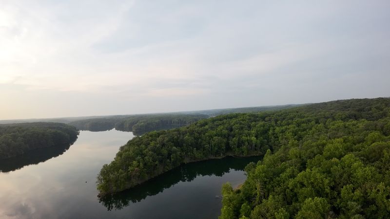
Before Liberty Reservoir existed, a town called Oakland Mills filled the valley with the sound of machinery, church bells, and everyday life.
It was a real working community, home to hundreds of residents who built their lives around the Melville Woolen Mills, one of the most significant industries in the region at the time.
People had schools, a post office, stores, and reportedly even a bowling alley hidden into this quiet Maryland valley.
The beginning of the end came when the Patapsco Water Basin Act was signed in 1931. That legislation gave Baltimore City the authority to acquire land for a new reservoir, and the clock started ticking for Oakland Mills from that moment forward.
Land purchases began in the 1930s, and a formal announcement about construction came in 1942.
By 1947, timber cutters arrived, stripping the landscape bare. The government purchased the Melville Woolen Mill in 1951, and the building was later dynamited.
Many homes and businesses were auctioned off in 1953, while some structures were reportedly still standing when the valley finally flooded. Families were uprooted and relocated, their connections to the land severed permanently.
Some houses and buildings were set on fire or demolished to clear the way. It is a sobering thing to think about while sitting on the reservoir’s quiet shoreline today.
A whole community, erased not by disaster but by planning, now rests somewhere below the surface where kayakers glide on sunny afternoons.
The Construction of Liberty Dam and How the Reservoir Filled
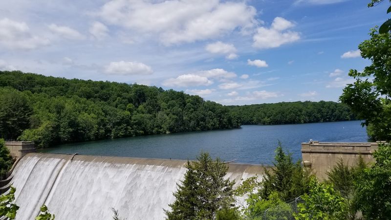
Dam construction at Liberty Reservoir began in 1951, and the project moved at a pace that reflected just how urgently Baltimore needed a reliable water supply. The dam itself was completed on July 8, 1954, a milestone that marked the physical end of Oakland Mills as a place anyone could return to.
Water began filling the reservoir that same July, slowly swallowing the valley floor.
The reservoir did not reach full capacity overnight. It took more than a year and a half before water finally overflowed the crest for the first time, which happened on February 6, 1956.
That moment must have felt significant to engineers and city planners, but for former residents of Oakland Mills, it probably felt like a final goodbye. The valley they grew up in was now permanently gone.
The scale of what was built is genuinely impressive. Liberty Reservoir spans roughly 3,100 acres and stretches about 11 miles in length.
At full capacity, the shoreline runs for 81 miles, which is a surprising number for a reservoir that many Marylanders have never even visited. The average depth sits at 59 feet, with some spots plunging down to 144 feet.
The North Branch of the Patapsco River serves as the primary water source, with smaller streams also feeding the system. Today the reservoir supplies drinking water to Baltimore City and several surrounding counties.
That is a massive responsibility for a body of water built on top of someone else’s home.
The Size and Scope of Liberty Reservoir, a Body of Water Worth Respecting
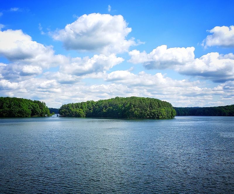
The sheer size of Liberty Reservoir catches people off guard. Most visitors arrive expecting a modest little lake, but what they find is an 11-mile-long body of water with a shoreline that stretches for 81 miles when the reservoir is at full capacity.
That is not a pond. That is a genuine wilderness of water sitting right in the middle of Maryland suburbia.
Spanning approximately 3,100 acres, the reservoir divides Baltimore County and Carroll County in a way that makes it feel like a natural boundary rather than a man-made structure. The average depth is 59 feet, which is deep enough to feel mysterious.
Some sections reach 144 feet down, and that fact alone gives the water a different kind of presence when you are floating on top of it in a small boat.
The North Branch of the Patapsco River is the main source feeding the reservoir, joined by several smaller tributaries that keep the water levels stable through the seasons.
The surrounding watershed land adds to the overall protected area, creating a buffer zone that keeps the water quality high and the scenery undeveloped.
Because the reservoir serves as a public water supply, the land around it is carefully managed and largely free of the commercial development you see near other recreational lakes. There are no waterfront restaurants or boat rental shops lining the shore.
What you get instead is pure, quiet nature, which is actually a rare thing to find this close to a major city like Baltimore.
The Oakland United Methodist Church and Cemetery, Ghosts on the Hillside

Most of Oakland Mills disappeared under the water, but one piece of the old community survived. The Oakland United Methodist Church and its cemetery still stand on the Carroll County side of the reservoir, perched on a hillside with a direct view over the water that now covers the town below.
It is one of the most quietly powerful places I have come across in Maryland.
There is something deeply moving about a church that outlasted its congregation, its town, and even the landscape that once surrounded it.
The cemetery beside it holds the graves of people who lived and died in Oakland Mills, people whose homes and daily routines are now submerged beneath millions of gallons of water.
The headstones remain, and so does the church, as if refusing to be forgotten entirely.
Visiting this spot feels different from a typical scenic overlook. The view is beautiful in the way that bittersweet things often are.
The water shimmers in the distance, birds drift overhead, and the trees press in close on all sides. But you know what you are looking at is not just a lake.
For anyone interested in the human history behind Liberty Reservoir, this church is the most tangible reminder that real people once called this valley home. It is accessible and worth seeking out, especially on a quiet weekday when you can stand there and actually absorb what happened here.
Some stories need a physical place to really land.
Old Liberty Road Turned Boat Ramp, History You Can Drive Down
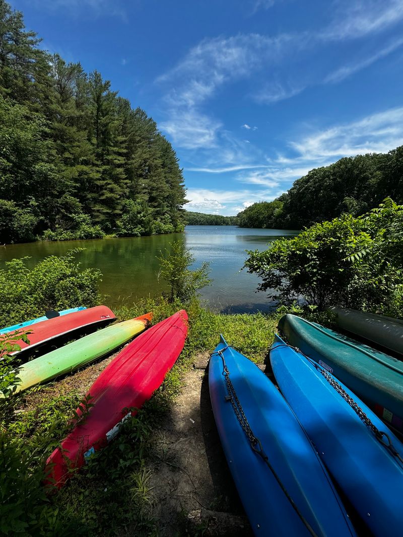
One of the strangest and most fascinating remnants of Oakland Mills is Old Liberty Road, a former public road that now serves as a boat ramp directly into the reservoir.
Drivers and paddlers who use it today are literally rolling down what was once a main street, following the same path that residents of the town once traveled by foot and by vehicle.
The road simply continues into the water. There is no dramatic marker or interpretive sign making a big deal of it, which in some ways makes it even more striking.
You back your kayak down the slope, slip into the water, and suddenly you are floating above what used to be a neighborhood. It is an oddly casual way to encounter such a loaded piece of local history.
I find that kind of layered geography endlessly interesting. The road itself is a physical record of the past, a clue that something existed here before the water came.
Most people launching their boats probably do not give it a second thought, and that is exactly what makes it worth pausing over.
Access to this boat ramp requires a seasonal permit from the City of Baltimore Reservoir Natural Resources Office, so it is not a free-for-all. The permit system helps protect water quality and keeps the area from getting overrun.
But for those who make the effort to get one, the experience of paddling out from Old Liberty Road carries a weight that no ordinary boat launch can match. It is history you can physically participate in.
Hiking and Mountain Biking Around the Reservoir Watershed
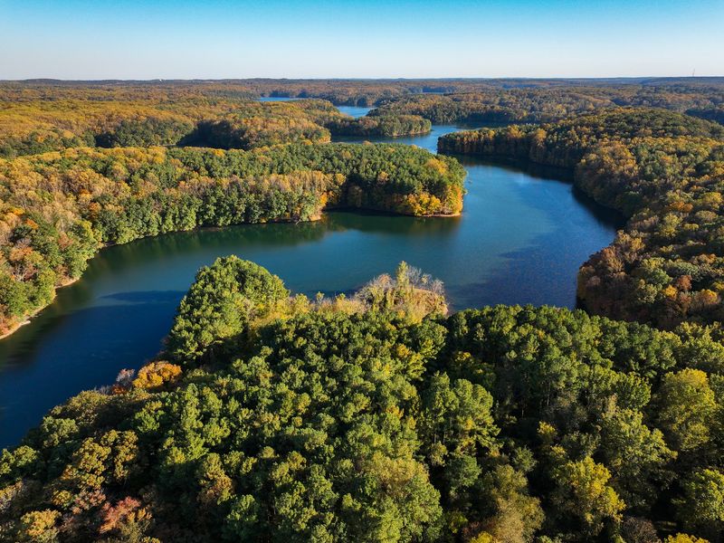
The land surrounding Liberty Reservoir is not just a buffer zone for water quality. It is a genuinely excellent place to spend a few hours outdoors, and the trail network here rewards people who bother to show up.
Fire roads wind through the watershed, open to hikers, mountain bikers, and horseback riders, offering a kind of quiet that is hard to find this close to Baltimore.
Mountain biking here has a loyal following among local riders who appreciate the mix of terrain. The unpaved roads range from flat and rolling to genuinely challenging, depending on which section you explore.
There is enough variety to keep things interesting whether you are a casual weekend rider or someone who takes their gear seriously.
Hikers get a different kind of experience. The forested paths feel removed from the outside world in a way that surprises people on their first visit.
You can cover several miles without hearing traffic or seeing another person, which is not something you can say about most green spaces in the Baltimore metro area. The reservoir itself occasionally appears through the trees, which gives the hike a sense of place and scale.
Horseback riding is also permitted on the fire roads, adding to the variety of ways people connect with this landscape. The overall vibe is low-key and unstructured, which suits the place perfectly.
No admission gates, no rental kiosks, no guided tour groups. Just trails, trees, and a massive body of water that carries more history than most people realize.
Fishing and Boating on Liberty Reservoir, What You Need to Know
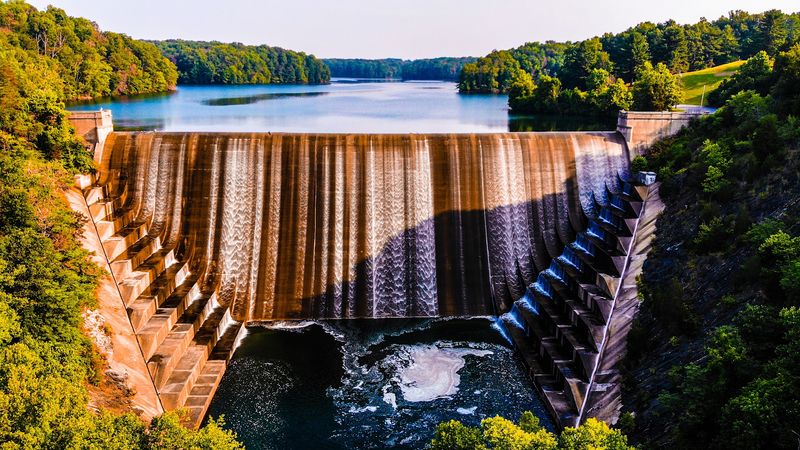
Fishing is one of the most popular reasons people visit Liberty Reservoir, and the water here has a reputation for being productive. The reservoir’s depth and size create a range of habitat types that support a solid variety of fish species.
Anglers who know the water tend to be loyal to it, returning season after season with the kind of quiet confidence that comes from experience.
Boating on Liberty Reservoir comes with specific rules that are worth knowing before you load up your vehicle and head out. Only rowboats, canoes, kayaks, and boats with battery-powered electric motors are permitted.
Gas-powered engines are not allowed, which keeps the water calm and the noise level low. Honestly, that rule makes the whole experience better for everyone on the water.
A seasonal permit from the City of Baltimore Reservoir Natural Resources Office is required before launching any boat. The permit process is manageable, and it helps the city monitor usage and protect water quality.
Plan ahead and get yours before your first visit, because showing up without one means you are not getting on the water that day.
The calm, motor-free environment makes the reservoir feel more like a wilderness paddle than a typical recreational lake. Early mornings are especially good, when mist sits on the surface and the shoreline is completely still.
Whether you are after largemouth bass, crappie, or just the experience of being on open water surrounded by undeveloped forest, Liberty Reservoir delivers something genuinely worth the trip.
Bird Watching and Nature Photography at Liberty Reservoir
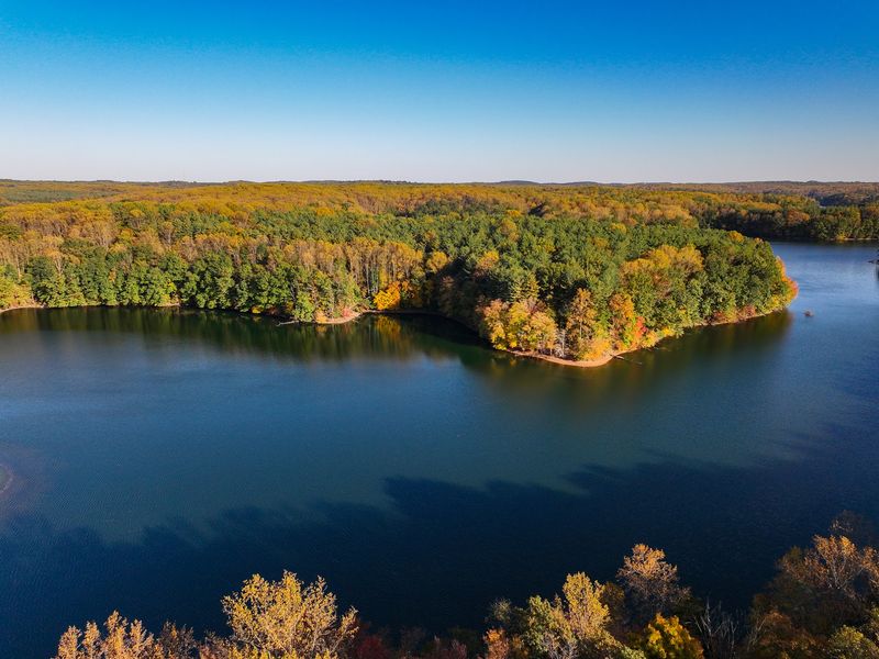
Liberty Reservoir has earned a solid reputation among birders in the Maryland and Washington D.C. area, and it is easy to understand why once you spend a morning here.
The combination of open water, forested shoreline, and protected watershed land creates a layered habitat that attracts a wide range of species throughout the year.
Serious birders and casual observers alike find something worth stopping for.
Waterfowl are a major draw, especially during migration seasons when the reservoir becomes a resting point for birds moving through the region. Ducks, geese, and various diving birds use the open water, while the wooded edges provide cover for songbirds, woodpeckers, and raptors.
The variety shifts with the seasons, which gives repeat visitors a reason to keep coming back.
For photographers, the setting is genuinely compelling. The long, narrow shape of the reservoir creates interesting compositions, and the undeveloped shoreline means there is no visual clutter in the background.
Early morning light hits the water in a way that makes even a simple shot of mist on the surface look like something worth printing. I have seen some impressive images come out of this place.
Patience is the main skill required here. The reservoir rewards those who slow down, sit quietly near the water, and wait.
The wildlife does not perform on a schedule, but when a great blue heron lands twenty feet away from you and just stands there, completely unbothered, it makes the wait feel entirely worthwhile. Bring good binoculars and a long lens if you have one.
How to Access Liberty Reservoir and Plan Your Visit
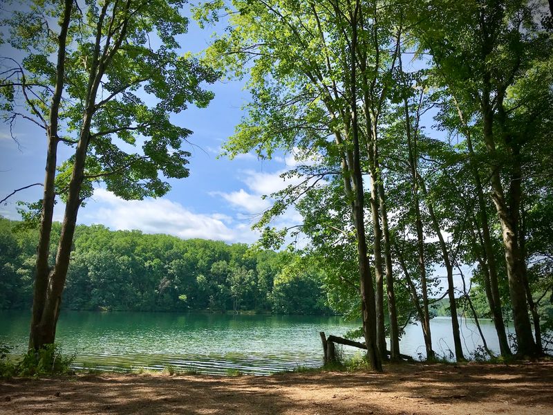
Getting to Liberty Reservoir is straightforward, but knowing which access point to use makes a real difference depending on what you plan to do.
The reservoir sits west of Baltimore and straddles the line between Baltimore County and Carroll County, so there are multiple entry points scattered around its perimeter.
A little planning before you go saves a lot of circling around on back roads.
One well-known access point is located at 2598 Bollinger Mill Road, Finksburg, MD 21048. Another entry point can be reached via 5685 Oakland Road, Eldersburg, MD 21784.
For those looking for parking near the trails, the area around 4891 Sykesville Road, Sykesville, MD 21784 is a useful starting point. Each spot gives you a slightly different experience of the reservoir, so it is worth looking at a map before deciding where to begin.
Swimming is strictly prohibited in the reservoir, and that rule is enforced. The water serves as a public drinking supply, so the restrictions are there for good reason.
Come prepared for hiking, paddling, fishing, or simply walking along the shore with a pair of binoculars around your neck.
There are no food vendors or facilities at most access points, so bring your own snacks and water. The experience here is deliberately low-infrastructure, which is part of what makes it feel like a genuine escape.
Liberty Reservoir rewards visitors who come prepared, stay curious, and take a moment to think about what is resting quietly beneath the water’s surface.
