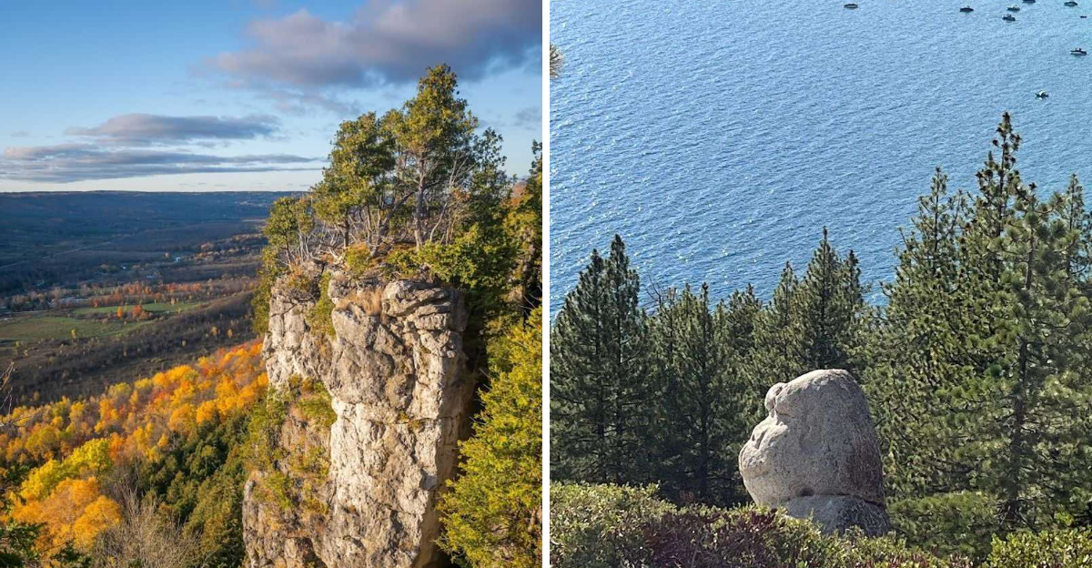
There is something about the Texas Hill Country that gets under your skin in the best way possible. The moment the highway starts to curve and the cedar-covered hills roll into view, the whole world feels a little quieter and a lot more beautiful.
I took this 30-mile stretch through Medina, Vanderpool, and Concan expecting pretty scenery, but what I found was something closer to a full reset. The route winds past apple orchards, hidden limestone grottos, and rivers so clear they look like glass.
Every stop along the way carries its own personality, its own little reason to pull over and stay a while. This drive is not just a road trip, it is a reminder that some of the most breathtaking places in the country are hiding in plain sight right here in Texas.
Love Creek Orchards and Its Famous Apple Pie

The smell hits you before you even open the car door. Something warm and spiced drifts through the air around Love Creek Orchards, and it takes about two seconds to realize it is coming from an apple pie fresh out of the oven.
This little roadside gem in Medina, Texas, has a way of stopping people in their tracks.
The orchard has built a well-earned reputation around its Grand Champion Apple Pie, and one bite tells you exactly why. Made entirely from scratch without a single preservative, the pie uses apples grown right on the property.
That kind of from-field-to-fork freshness is something you can taste in every forkful, from the buttery crust to the generously packed filling.
Beyond the famous pie, the shop offers apple strudels, turnovers, and a small cafe menu with savory bites like burgers and sandwiches. It is the kind of place where you plan to stay five minutes and end up lingering for half an hour.
The drive along Highway 16 North to get here is part of the charm too, tracing the Medina River through some genuinely gorgeous countryside.
Families tend to linger near the display cases, debating whether to get the strudel or the turnover or just go back for a second slice of pie. Honestly, it is a fair debate.
The atmosphere inside is unhurried and warm, which fits perfectly with the pace of this whole drive.
If you are starting your scenic loop early in the morning, this is the ideal first stop. Coffee, pie, and a view of rolling hills through the window is a pretty perfect way to begin any road trip.
Love Creek Orchards is one of those rare spots that feels both local and legendary at the same time. It earns its place at the top of this route without even trying.
Address: 14024 TX-16 N, Medina, TX 78055
The Lone Star Motorcycle Museum in Vanderpool

Vanderpool is a blink-and-you-miss-it kind of town, but hidden along Ranch Road 187 sits one of the most unexpected and genuinely fascinating stops on this entire drive. The Lone Star Motorcycle Museum does not announce itself loudly.
It just waits, quietly confident, knowing that anyone who steps inside is going to walk out with a new appreciation for two-wheeled history.
The collection spans over 60 motorcycles sourced from across the globe, with models dating back to the 1910s all the way through more modern designs. Seeing them lined up together is like flipping through a visual timeline of engineering ambition.
Each machine carries the personality of its era, from the stripped-down simplicity of early models to the bold, sculpted designs that came decades later.
What makes this stop feel special is the setting. The museum sits right in the middle of Texas Hill Country scenery that motorcyclists travel from hundreds of miles away to ride through.
Ranch Road 337 nearby is famously curvy and dramatic, which means the museum naturally attracts a crowd of enthusiasts who have just come off one of the best rides of their lives.
Even if motorcycles are not your usual thing, there is something undeniably cool about being surrounded by machines that have been ridden across different continents and different decades. The craftsmanship on some of the older models is remarkable.
You find yourself leaning in close to look at the details.
It fits perfectly into this route as a mid-drive breather, a place to stretch your legs, let your eyes wander, and appreciate something completely different from the natural scenery surrounding it.
The contrast between the rugged limestone hills outside and the polished collection inside is part of what makes the stop so memorable.
Small in footprint, big in character.
Address: 36517 Ranch Rd 187, Vanderpool, TX 78885
Lost Maples State Natural Area Where the East Trail Begins
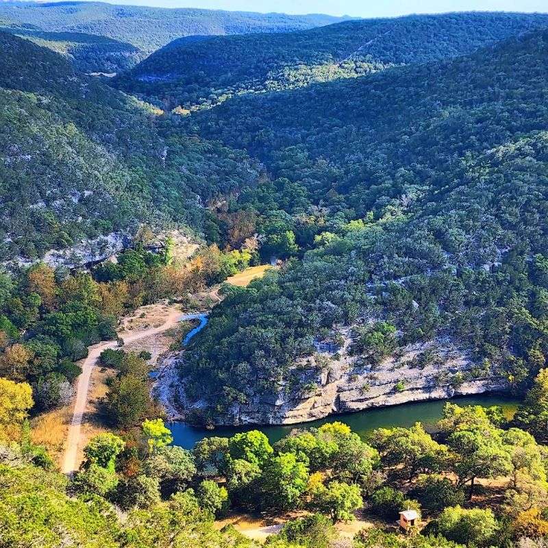
Few places in Texas feel as genuinely surprising as Lost Maples State Natural Area. The name alone raises questions, because maples are not exactly what most people associate with the Lone Star State.
Yet here, near the small town of Vanderpool, a grove of bigtooth maple trees has been quietly putting on one of the most spectacular fall color shows in the entire Southwest for centuries.
The East Trail is where many hikers choose to begin their experience with this park, and it earns its reputation as one of the more demanding day hikes in Central Texas. At 3.1 miles, it does not sound overwhelming on paper.
But the rocky slopes, significant elevation changes, and exposed limestone terrain make it a genuinely challenging and rewarding route.
As the trail climbs, the views start to open up in ways that feel almost cinematic. You get glimpses of the canyon below, the spring-fed Sabinal River threading through bald cypress and sycamore trees, and the broad Hill Country sky spreading wide in every direction.
The ascent takes roughly three hours at a comfortable pace.
Autumn is the most popular season here, and for good reason. The maple trees shift through shades of gold, orange, and deep red in a way that genuinely stops hikers mid-step.
But the park is worth visiting in any season. Spring brings wildflowers and rushing water, and summer mornings offer cool, shaded canyon stretches that feel like a different climate entirely.
The East Trail can also be combined with the East-West Trail to form a longer loop for those who want a full day in the park. Regardless of which route you choose, Lost Maples has a way of making you feel far removed from the ordinary world.
That feeling is the whole point of a drive like this one.
The Grotto, a Hidden Limestone Sanctuary
Not every great discovery on a hiking trail announces itself with a dramatic view or a towering rock face. Some of the best ones are quiet, hidden away, and easy to walk right past if you are not paying attention.
The Grotto inside Lost Maples State Natural Area is exactly that kind of find, and stumbling into it feels like the trail rewarding your patience.
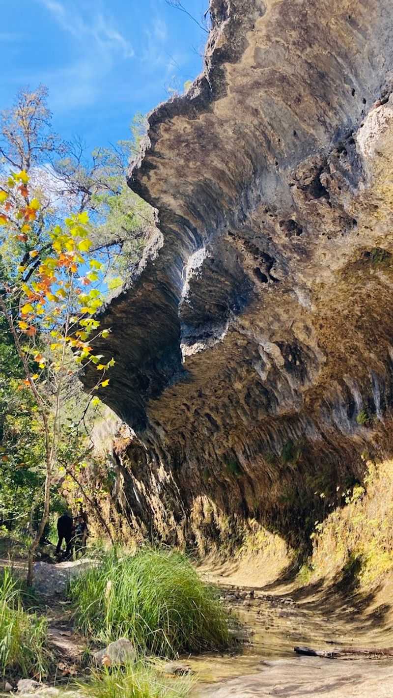
Hidden along the East Trail, this limestone alcove is defined by a broad overhanging bluff that creates a cool, shadowed pocket in the hillside.
Water seeps and drips steadily from the rock above, feeding a microhabitat that supports delicate maidenhair ferns and other moisture-loving plants that have no business thriving in the dry Texas Hill Country.
And yet here they are, impossibly green and soft against all that pale stone.
The temperature inside the Grotto drops noticeably compared to the exposed trail. On a warm afternoon, that shift is immediately noticeable, almost like stepping into a natural air-conditioned room.
The sound of dripping water adds to the atmosphere, steady and soft, turning the whole space into an unplanned meditation spot.
I found myself standing there longer than expected, not because there was anything to do, but because the place had a quality that made hurrying feel wrong. It is the kind of spot that reminds you why you lace up the boots and head out on the trail in the first place.
Not every reward comes in the form of a panoramic summit view.
The Grotto works as both a physical rest point and a sensory pause in the middle of a demanding hike. Bring water, sit on the cool rock, and let the sound of the dripping do its thing.
It is one of those small, perfectly formed moments that end up being the part of the trip you actually remember most vividly years later.
Monkey Rock, a Playful Formation Along the Trail
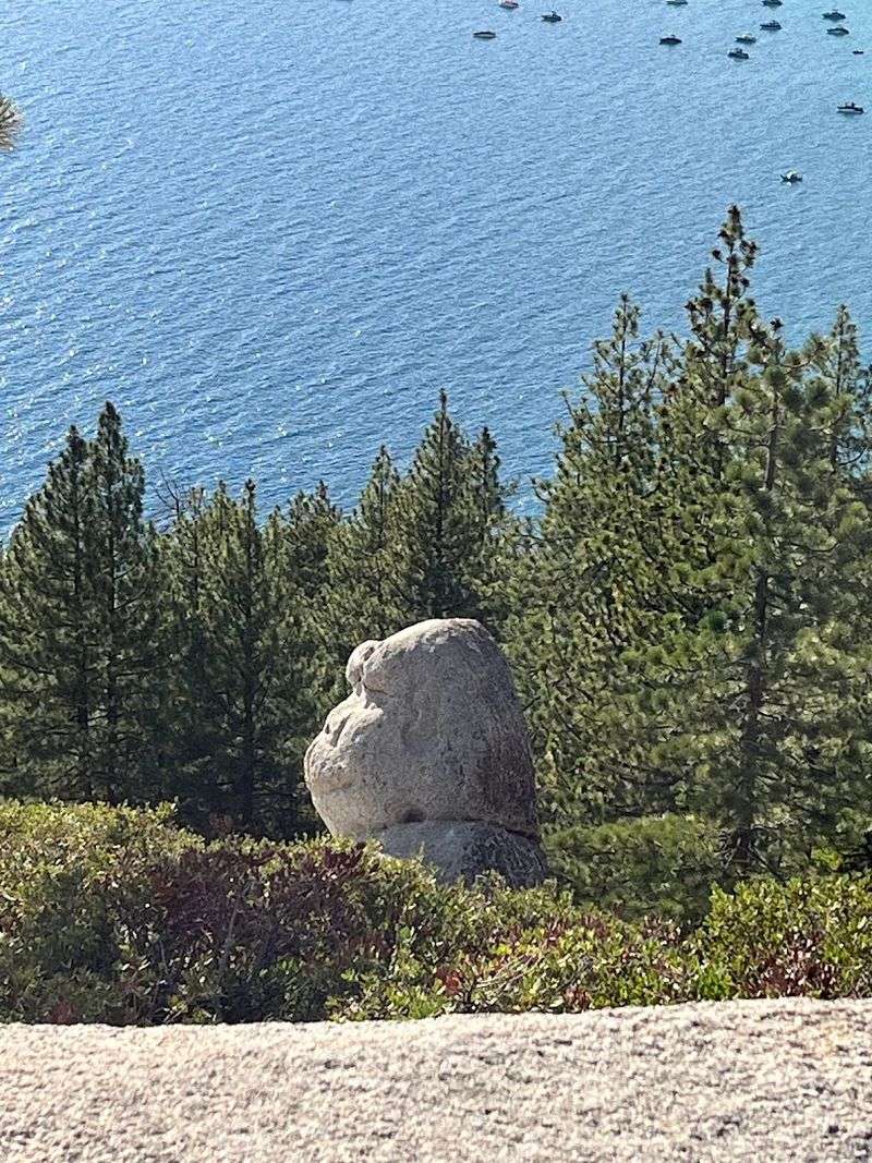
There is a moment on the East Trail when the landscape shifts from purely scenic to downright playful. Monkey Rock appears with almost no warning, a rugged limestone formation that has been catching hikers off guard and making them smile for as long as people have been walking this trail.
The resemblance to a monkey’s head is genuinely uncanny once you see it.
The formation rises as a layered cliff, with bands of sedimentary rock stacked in a way that took millions of years to arrange. Each visible layer tells a fragment of a much longer geological story, one that stretches back far beyond anything human-scale time can comfortably hold.
That context makes the playful shape feel even more remarkable, nature accidentally sculpting something whimsical while going about the serious business of geology.
Photographers tend to stop here for a while. The rock catches light well in the late morning, and the surrounding vegetation frames it naturally without much effort.
It is one of those trail landmarks that gives hikers a shared reference point, the kind of thing where people ask each other at the trailhead whether they made it to Monkey Rock yet.
Beyond its visual charm, the formation marks a meaningful point in the hike where the terrain starts to offer more dramatic views. The trail climbs nearby, and the reward for pushing past this point is a broader panorama of the canyon and valley below.
Monkey Rock functions almost like a trail milestone disguised as a quirky photo opportunity.
It adds something lighthearted to what is otherwise a challenging and physically demanding route. That tonal shift matters more than it might seem.
A trail that makes you laugh a little, even just for a moment, is a trail that keeps you moving with better energy. Monkey Rock delivers exactly that, a small burst of personality in the middle of a beautiful, rugged landscape.
Sabinal River Valley View That Stretches for Miles
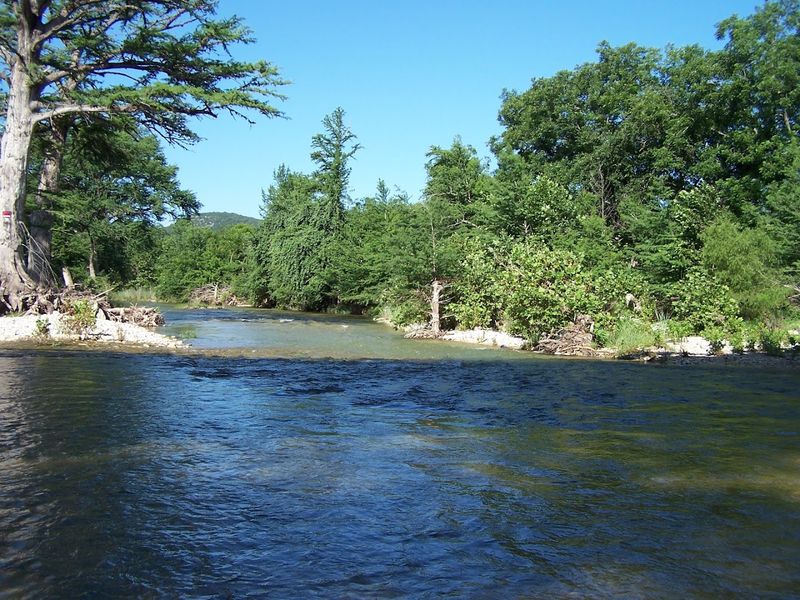
Some views earn their reputation through sheer scale. The Sabinal River Valley is one of those.
Seen from the overlooks along the East Trail at Lost Maples, the valley spreads out below in a way that makes you stop mid-breath and just take it in for a moment. Rolling hills, patches of woodland, and the faint silver thread of the spring-fed Sabinal River weaving through it all.
The Sabinal River itself is the quiet engine behind much of what makes this part of Texas feel so different from the rest.
Spring-fed and reliably clear, it moves through the landscape with a kind of steady purpose, carving out canyons and feeding the cypress and sycamore groves that line its banks.
From above, those tree lines trace the river’s path like a natural map drawn in green and gold.
The valley view is the payoff for the climb. After navigating rocky switchbacks and exposed limestone slopes, arriving at an overlook where the entire valley opens up feels genuinely earned.
That sense of effort rewarded is part of what makes this spot land so hard emotionally for hikers who make it to the top.
The surrounding area around towns like Utopia and Sabinal carries the same quiet energy when experienced from the road.
Driving through the countryside here feels unhurried and deeply Texan in the best possible sense, wide open space, long sight lines, and the occasional hawk riding a thermal high above the hills.
What the Sabinal River Valley does best is break expectations. Most people picture Texas as flat and dry.
This valley is neither. It is layered, lush in places, and shot through with the kind of natural beauty that makes you want to come back in a different season just to see how it changes.
Every overlook along this route offers a slightly different perspective, and each one is worth the pause.
Garner State Park and the Cool Frio River
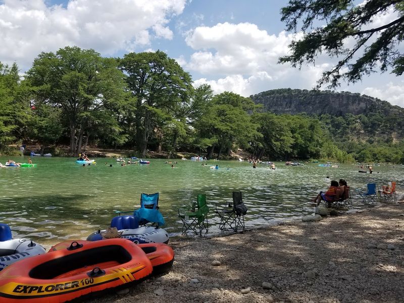
Cold water in Texas in the middle of summer is not something to take lightly. The Frio River at Garner State Park earns its name, which translates simply to cold in Spanish, and it delivers on that promise with remarkable consistency.
Spring-fed and brilliantly clear, the water hits you like a full-body refresh the moment you wade in.
Garner State Park covers 1,774 acres of Hill Country terrain near Concan, with 2.9 miles of Frio River running through its heart. The combination of limestone cliffs, natural swimming holes, and cypress-lined banks creates a setting that feels almost too good to be real.
It is one of the most visited state parks in Texas, and once you see it in person, that makes complete sense.
Swimming and floating downstream on inner tubes are the classic ways to experience the river here. Canoeing and kayaking are also popular, and the calm, clear water makes both accessible for most skill levels.
There is a rhythm to a day at Garner that is hard to replicate anywhere else, cool water, warm sun, and the kind of deep relaxation that comes from being genuinely away from everything.
The park also has over 16 miles of hiking trails ranging from easy riverside walks to more challenging routes with elevation.
Many of the original facilities were built by the Civilian Conservation Corps in the 1930s, and their craftsmanship is still visible in the stone structures scattered throughout the grounds.
That history adds a layer of texture to a park that already has plenty going for it.
Fall brings another dimension entirely. The cypress trees along the river turn a rich golden amber, and the crowds thin out enough to make the whole park feel more personal.
Any season works here, but there is something about arriving after a long morning of hiking and finding that cold river waiting that makes Garner State Park feel like exactly the right reward.
Address: 234 RR 1050, Concan, TX 78838
Old Baldy Lookout with Its Sweeping Hill Country Views
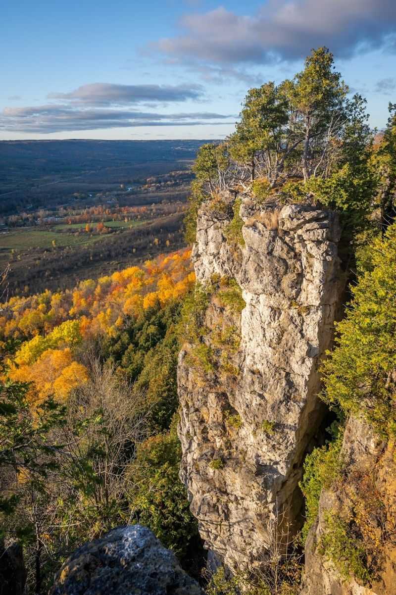
Old Baldy does not try to be subtle about what it is. The name says everything.
A bare, rocky limestone summit rising 1,849 feet above sea level, sitting above Garner State Park with the kind of quiet authority that only comes from a few million years of geological patience.
The trail to the top is short but honest, roughly half a mile to one mile depending on the route, with nearly 500 feet of elevation gain that your legs will absolutely notice.
The climb is steep and rocky in stretches, requiring some careful footing on loose stone sections. It is not a technical climb by any measure, but it is not a casual stroll either.
The effort level sits comfortably in the satisfying middle ground where you feel genuinely accomplished at the top without feeling completely wrecked.
And the top is worth it. From the summit, the Frio River Canyon unrolls below in a sweeping panorama that takes in miles of Hill Country in every direction.
The river itself looks deceptively calm from up here, a thin blue-green ribbon threading through limestone and cypress. The contrast between the bare rocky ground at your feet and the lush, textured landscape spreading out below gives the peak its distinctive character.
The bald appearance of the summit, stripped of trees and scrub by the thin soil and exposed rock, is what earned this hill its name. On a clear day, the views extend far enough that you start to feel the true scale of the Hill Country in a way that ground-level travel simply cannot provide.
That shift in perspective is one of the more quietly powerful things this drive offers.
Old Baldy is a fitting final chapter to this 30-mile route. After orchards, museums, hidden grottos, river swims, and canyon overlooks, climbing to this summit and seeing everything laid out below feels like the landscape offering one last, generous look at itself before you head back to the ordinary world.
