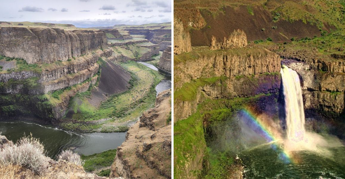
That road stretched through wheat fields and rolling brown hills, and I was half convinced my GPS was playing a joke on me. Then the gravel crunched under the tires, the land flattened out, and suddenly the ground just opened up.
A waterfall appeared like someone had cut a canyon straight into the earth and dropped a river through it. The sound hit me before the view did, a deep steady roar that you feel in your chest more than your ears.
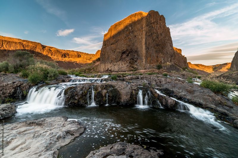
I had seen photos before visiting this Washington spot, but none of them came close to the real thing. The water drops nearly 200 feet into a basin carved by ancient floods, and the cliffs that frame it are layered with volcanic basalt that tells a story of eruptions and ice ages.
I stood at the rim and watched the spray rise and catch the light, and the whole scene felt like it belonged on another planet, or at least in the movies.
A place that makes you feel small in the best possible way is exactly what this one delivers.
The First Look Over the Canyon Rim
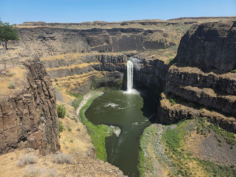
Nothing about the drive prepares you for the moment the canyon appears. One second you are looking at dry grass and fence posts, and the next you are peering into a chasm hundreds of feet deep.
The falls drop close to 198 feet into a churning circular bowl below, and the water never seems to pause. I stood at the railing for a long time just watching the current gather speed at the lip before it let go.
What surprised me most was the color. The basalt walls look almost black in shadow, streaked with green moss where mist reaches them, and the water turns milky white as it falls.
The main viewpoint sits less than a hundred feet from the parking area, which feels almost unfair for a view this big. You barely have to walk to earn it.
Give yourself time here. Most people arrive planning a quick photo stop and end up staying well over an hour, drifting between benches and railings.
Bring a jacket too, because wind funnels through the canyon and can turn a warm afternoon breezy in a hurry.
Ice Age Floods Wrote the Story in Stone
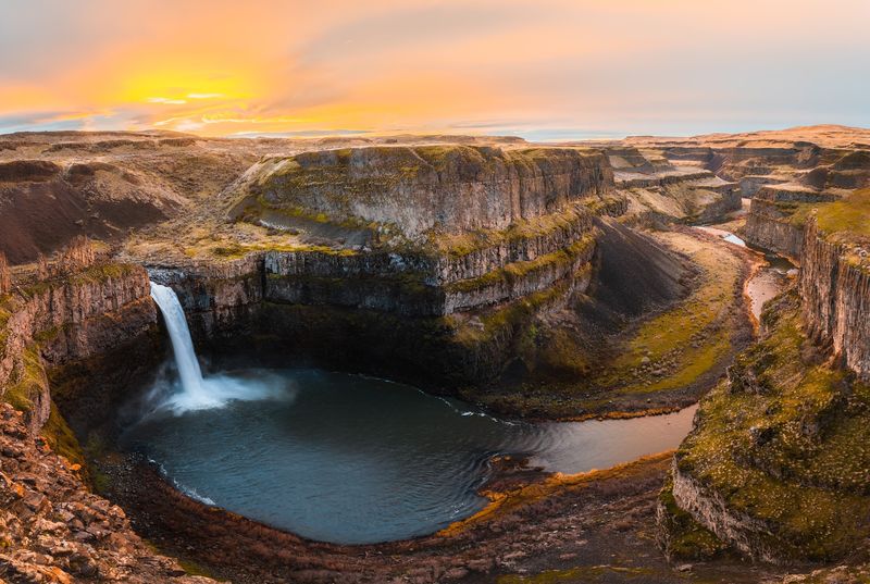
Reading the interpretive signs along the paved path changed how I saw the whole place. The canyon was not carved slowly by the modest river flowing through it today.
Around 13,000 years ago, ice dams holding back glacial Lake Missoula collapsed, sending unimaginable walls of water tearing across Eastern Washington. Those floods scoured out the channeled scablands, leaving coulees, dry falls, and gouged canyons behind.
Palouse Falls is one of the few waterfalls from that ancient flood path still running today, which makes it feel like a survivor.
The columnar basalt lining the walls came earlier still, from enormous lava flows that spread across the region millions of years ago. Cooling lava cracked into those neat vertical columns you see stacked like organ pipes.
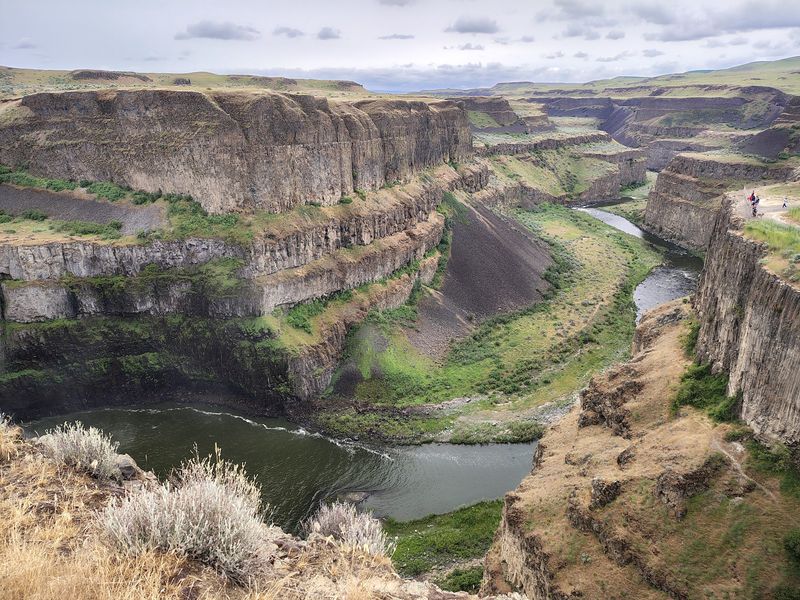
Depths in the canyon reach somewhere between 377 and nearly 400 feet, which is hard to process until you look straight down.
I found myself doing the math on how much water it would take to cut through solid rock like that. The answer is more than my brain could picture.
Geology nerds will be thrilled. Everyone else will just be quietly impressed.
Climbing to the Fryxell Overlook
My favorite stretch of the park is the short uphill push to the Fryxell Overlook. Part paved, part gravel, it gains just enough elevation to completely change the perspective.
From up there the falls stop being the only thing you see. The whole canyon system unrolls in both directions, with the Palouse River snaking downstream toward its meeting with the Snake River.
Look north and you can spot the upper falls, a modest 20-foot drop sitting about a thousand feet above the main cascade. It is easy to miss if nobody points it out.
Some sections of the path get steep and loose underfoot, so decent shoes make a real difference. A trekking pole would not be overkill for anyone unsteady on gravel.
I noticed the light shifting across the cliffs while I stood there, turning the rock from gray to warm bronze as clouds moved.
Hawks and other raptors ride the thermals above the canyon, circling without a single wingbeat.
The full loop around the viewpoints runs roughly a mile round trip. Short, but packed with more scenery than trails ten times its length.
Staying on the Marked Paths Matters Here
Respect for the edge is the unofficial rule at this park, and it is not hard to understand why. The cliffs drop away fast, and the rock near the rim can be crumbly.
Older accounts online mention scrambling routes down toward the base, but the park now steers everyone toward established viewing areas. Those unofficial paths are closed, and some land beyond the park boundary is private.
Honestly, I did not feel like I was missing anything. The designated overlooks deliver views that photographers travel across the state for.
Rattlesnakes turn up in the area, especially on warm days near rocky ground, so watching where you step is smart.
Dogs are welcome, which is great, though a leash is essential this close to steep terrain.
The paved section from the parking lot to the main overlook is ADA accessible, so families with strollers or anyone with mobility limits can still get the headline view.
Keeping to the trails also protects the fragile plants clinging to the canyon slopes. Small thing, big difference over thousands of visitors a year.
When to Show Up for the Best Show
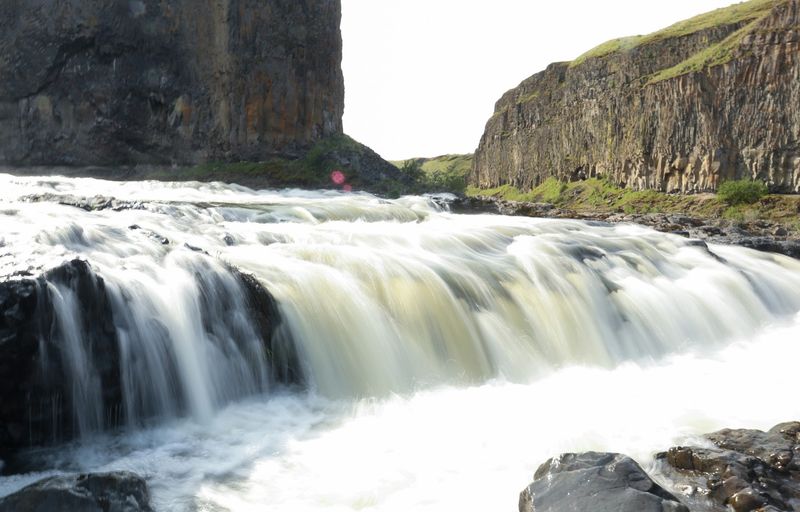
Spring is when the falls truly roar. Snowmelt and rain push the Palouse River to its fullest, and the volume of water pouring over the lip is genuinely startling.
The surrounding hills green up around then too, which makes a beautiful contrast against the dark rock.
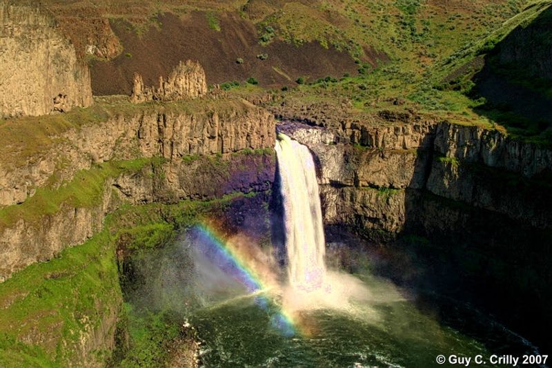
Mist rising from the plunge pool catches sunlight in the right conditions and throws rainbows across the canyon. I caught one for maybe fifteen minutes before the angle shifted.
Summer visits bring heat and dry wind, and the flow thins out, though the canyon still looks incredible in strong light. Winter can dust everything in snow, turning the whole scene stark and quiet.
Early morning and late afternoon give photographers the best shadows across those basalt columns. Midday light tends to flatten everything out.
Weekends and holidays draw the biggest crowds, but arriving near opening usually means having the railings mostly to yourself.
Park gates open at 6:30 AM and close at 8 PM, so plan around that window.
Weekday mornings in shoulder season are the sweet spot if you want silence with your waterfall.
Marmots, Hawks, and Picnic Tables
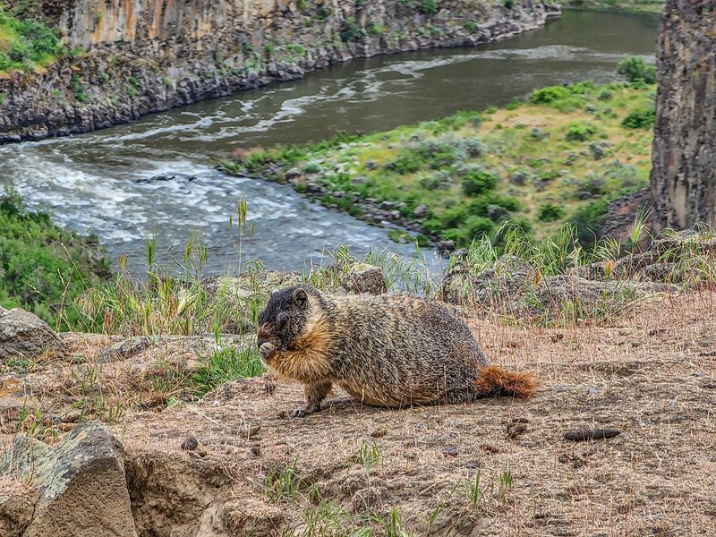
Somewhere between the parking lot and the overlook, a chunky marmot waddled across the grass in front of me like it owned the place. Apparently they do.
Yellow-bellied marmots are regulars here, and in spring the babies come out to tumble around the rocks. Visitors mention them constantly, and now I understand why.
Birds of prey circle overhead almost continuously, using the canyon’s rising air to hang motionless for minutes at a time.
The picnic area is better than I expected for such a remote park. Plenty of tables, a covered one, BBQ grates, and enough shade to make lunch pleasant.
Restrooms include both concrete pit toilets and portable units, and they are kept surprisingly clean by attentive park staff.
Packing food is a genuinely good idea. There is nothing nearby, and eating with a canyon view beats eating in the car.
Bugs can be a nuisance on still warm days, so a small repellent stick earns its space in your bag.
The park covers 94 acres as a day-use heritage site, so pack in and pack out.
Getting There Without a Headache
Here is the tip I wish someone had told me sooner: type Palouse Falls State Park into your GPS, not just Palouse Falls. The shorter search can dump you onto a farm track going nowhere useful.
The final couple of miles are groomed gravel. Dusty, a little washboarded, but perfectly fine for a regular car if you take it slow.
A Discover Pass is required for day-use parking, and there is an automated kiosk on-site if you do not already have one. Bring a card, since the machine takes plastic only.
Parking is decent but not endless, so busy weekends can fill the lot. Early arrivals rarely have trouble.
Cell service is patchy to nonexistent out here, which I honestly enjoyed. Download directions before you leave the highway.
Water is worth carrying, especially in summer when the dry air sneaks up on you.
Between November and March, check road and weather conditions before committing to the drive.
Address: 1991 Palouse Falls Rd, LaCrosse, Washington 99143
