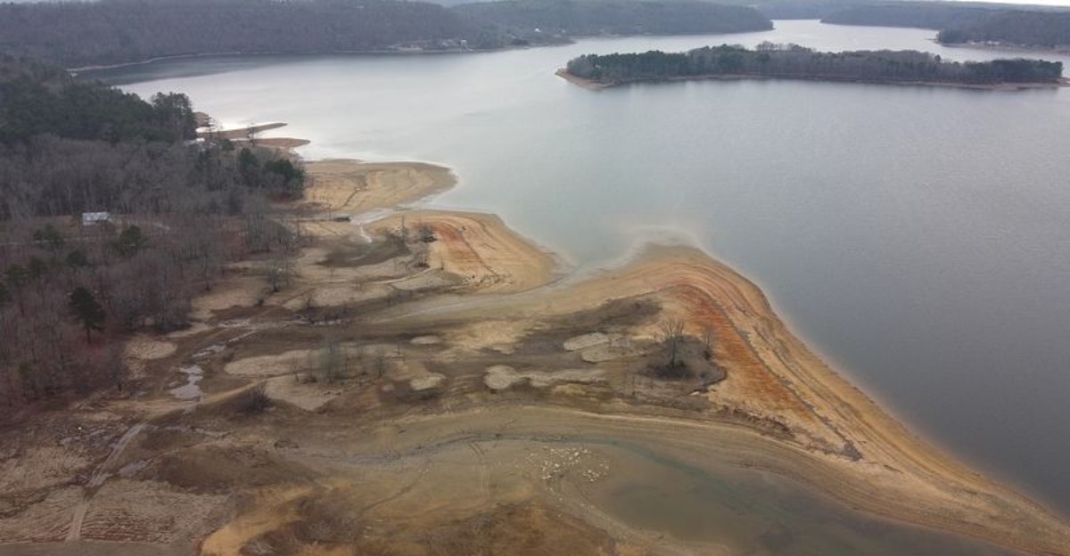
The road ends underwater. So does the driveway.
So does someone’s old car. That sounds like a very strange road trip, but it is exactly what happened when Falls City was flooded in 1961 after the Lewis Smith Dam transformed the valley into a reservoir.
Today, remnants of the Alabama community rest beneath more than 20,000 acres of water, including old foundations, roads, and an abandoned Studebaker. The lake’s surface tells a much prettier story.
Cliffs rise above quiet coves. Boats cross the open water.
Striped bass attract anglers from far beyond the area. Then you remember what is underneath.
Emerald Water That Looks Nothing Like A Southern Reservoir
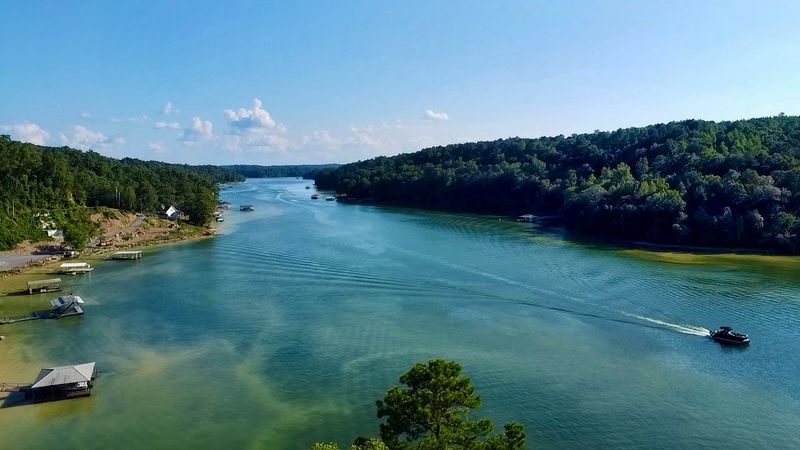
Most Alabama reservoirs run coffee-colored. Lewis Smith Lake breaks that rule completely.
The water arrives here from cold mountain streams rather than a silty river, so it stays green and glassy instead of muddy. Visibility often runs 10 to 15 feet, and in certain protected coves swimmers can see 40 feet down through the water column.
That clarity changes how a day on the lake feels. Anchor in a quiet finger of shoreline and the bottom shows up in soft detail, rocks, sunken logs, the occasional flash of a passing fish.
With more than 500 miles of shoreline folded into countless bays and channels, finding a private cove is easier than it sounds. Weekday mornings are the sweet spot, when the surface holds that mirror stillness and boat traffic has not woken up yet.
Water levels shift through the year, which is worth knowing before launching. Full pool sits at 510 feet, dropping to around 496 feet in winter as the dam prepares for spring rain.
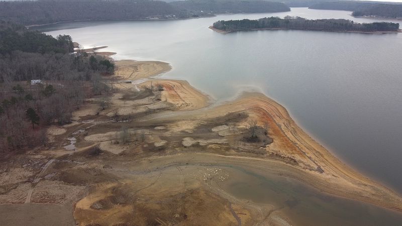
Lower water exposes sandstone ledges and gravel banks that stay hidden all summer. Some people prefer the lake in that stripped-down winter state, when the coves feel enormous and empty.
Bring polarized sunglasses. The color underneath is half the reason people keep coming back to this stretch of north Alabama.
A Ghost Town Named Falls City Sleeping Under The Surface
Before the dam, this valley had a name and a mailing address. Falls City opened its post office in 1853 and drew visitors who came to see Clear Creek Falls tumble through the woods.
By the time Alabama Power began buying land in the late 1950s, the community had already thinned out and was often described as a ghost town. Families still had to be relocated, and 78 graves from four cemeteries were carefully moved out of the future flood zone.
Then the water came. The falls disappeared, the roads disappeared, and the valley became a lake.
What remains below is genuinely strange to think about. Divers and longtime locals describe stretches of old roadbed, stone and concrete foundations, remnants of barns, and an abandoned Studebaker sitting quietly in the dark.
Occasionally, when water gets drawn down for dam inspection or maintenance, pieces of that older landscape edge back into daylight. Stumps, foundation lines, and old crossings surface for a few weeks before vanishing again.
Nobody needs scuba gear to appreciate the story. Cruising over a cove and realizing there is a former neighborhood 100 feet beneath the hull gives the whole trip a different weight.
History here did not get demolished. It simply got covered up.
Scuba Diving Into An Underwater Forest, With Serious Warnings Attached
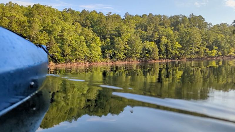
Ask any experienced diver about Smith Lake and the tone gets serious fast. The lake is regularly described as treacherous, and for good reason.
When the valley flooded, trees deeper than 60 feet were left standing. Some rise 50 to 100 feet, still holding petrified-looking pine needles and cones in water where sunlight never reaches.
That forest is beautiful and dangerous in equal measure. Entanglement risk is constant, made worse by decades of discarded fishing line wrapped around limbs and structures.
Below the thermocline, usually around 30 to 40 feet, everything turns cold and black. Temperatures drop to roughly 47 degrees at 116 feet, which puts hypothermia squarely on the list of concerns.
There are reports of divers accidentally swimming into submerged houses because visibility collapsed. Large striped bass weighing 25 to 30 pounds are drawn to dive lights and will bump into people, which is startling in the dark.
Local professionals generally steer recreational divers away from casual exploration, and public safety teams use sonar to pinpoint targets rather than wandering through the trees.
For training, North Alabama Dive Center at 1704 B 2nd Avenue SW in Cullman offers Open Water, Deep Diving, and Night Diving certifications, and lists Trident Marina and Indian Head Rock among frequently serviced sites. The Lakeside Life also handles certification, full face mask instruction, and underwater retrieval.
Striped Bass Big Enough To Rewrite Records
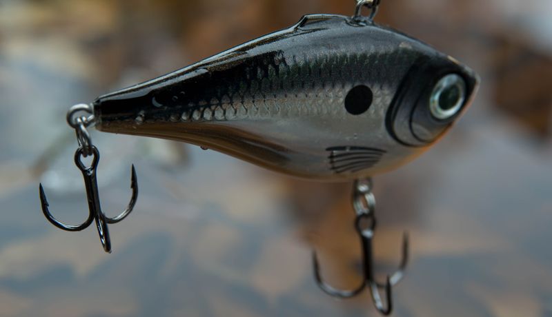
Anglers drive in from all over the Southeast for one fish in particular. Trophy striped bass here regularly push past 40 pounds, and the possibility of a 50-plus pound giant keeps guides watching their sonar screens a little longer than they should.
Cold, deep, oxygen-rich water is the reason. Stripers need those conditions to grow large, and Smith Lake supplies them year after year.
Early mornings in summer are prime, especially around points and creek mouths where baitfish stack up. Fall brings the fish shallower and the fight gets even better.
The lake is far from a one-species show, though. Largemouth bass, spotted bass, crappie, bream, and several catfish varieties fill out the roster, and spotted bass in particular thrive in the rocky, clear water.
Below the dam, the tailrace opens up an entirely different option. Cold water released from the reservoir supports rainbow trout, which means fly rods show up in a state most people associate with bass boats.
Clear water does add a challenge worth planning around. Fish here see line and lures more clearly than in murky lakes, so lighter line and natural colors tend to pay off.
Patience helps too. Smith Lake rewards anglers who slow down and read the depth rather than racing from cove to cove.
Cliff Jumping At Indian Head Rock And Castle Rock

Certain sandstone bluffs along the shoreline have earned local fame purely because people keep leaping off them. Indian Head Cliff delivers roughly a 30-foot drop, enough to make the walk to the edge feel meaningful.
Castle Rock raises the stakes considerably, with ledges ranging from about 40 to 50 feet above the surface. Boats gather below on warm weekends and the whole area takes on a friendly, cheering-section energy.
Depth matters more than bravery. Water levels shift seasonally, so what was safely deep in June may not be in late fall, and checking conditions before jumping is not optional.
Watching from a boat is a completely respectable choice. Half the entertainment comes from the hesitation, the countdown, and the enormous splash that follows.
Both spots sit on shoreline reachable by water, which is part of the appeal. Boat access makes them feel a little tucked away rather than commercialized.
Life jackets, sober judgment, and a clear landing zone free of swimmers are the basics. Rock edges get slick, and the climb down is often trickier than the climb up.
For anyone who grew up jumping into swimming holes, these bluffs hit a familiar nerve. Cold green water, warm sandstone, and that half-second of weightlessness before everything goes quiet underneath.
Bankhead National Forest And The Land Of A Thousand Waterfalls
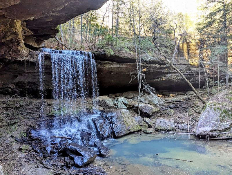
Right along the western edge of the lake’s watershed sits 180,000 acres of William B. Bankhead National Forest.
It is a fast pivot from open water to deep hardwood shade.
Trails wind through canyons, past bluff lines, and along creeks that run clear over sandstone. The Sipsey Wilderness sits inside the forest and carries the nickname Land of a Thousand Waterfalls, which is not much of an exaggeration after a good rain.
Spring is spectacular there. Water volume peaks, wildflowers show up along the trail edges, and the canyon walls stay cool even when the rest of Alabama is heating up.
Hikers should expect creek crossings and some route-finding, since a few paths are lightly marked. Sturdy shoes and a downloaded map save a lot of guessing.
Camping opportunities exist both in the forest and along the lake shoreline, which makes a two-part trip easy to plan. Paddle in the morning, hike in the afternoon, sleep somewhere with actual stars overhead.
Wildlife shows up regularly if the group stays quiet. Deer, wild turkey, hawks, and a loud chorus of frogs after dark all make appearances.
The contrast is what makes it memorable. Wide, sunlit water on one side and a mossy, dripping canyon on the other, all within the same short drive.
Easy Days At Smith Lake Park, Duncan Bridge, And Goat Island
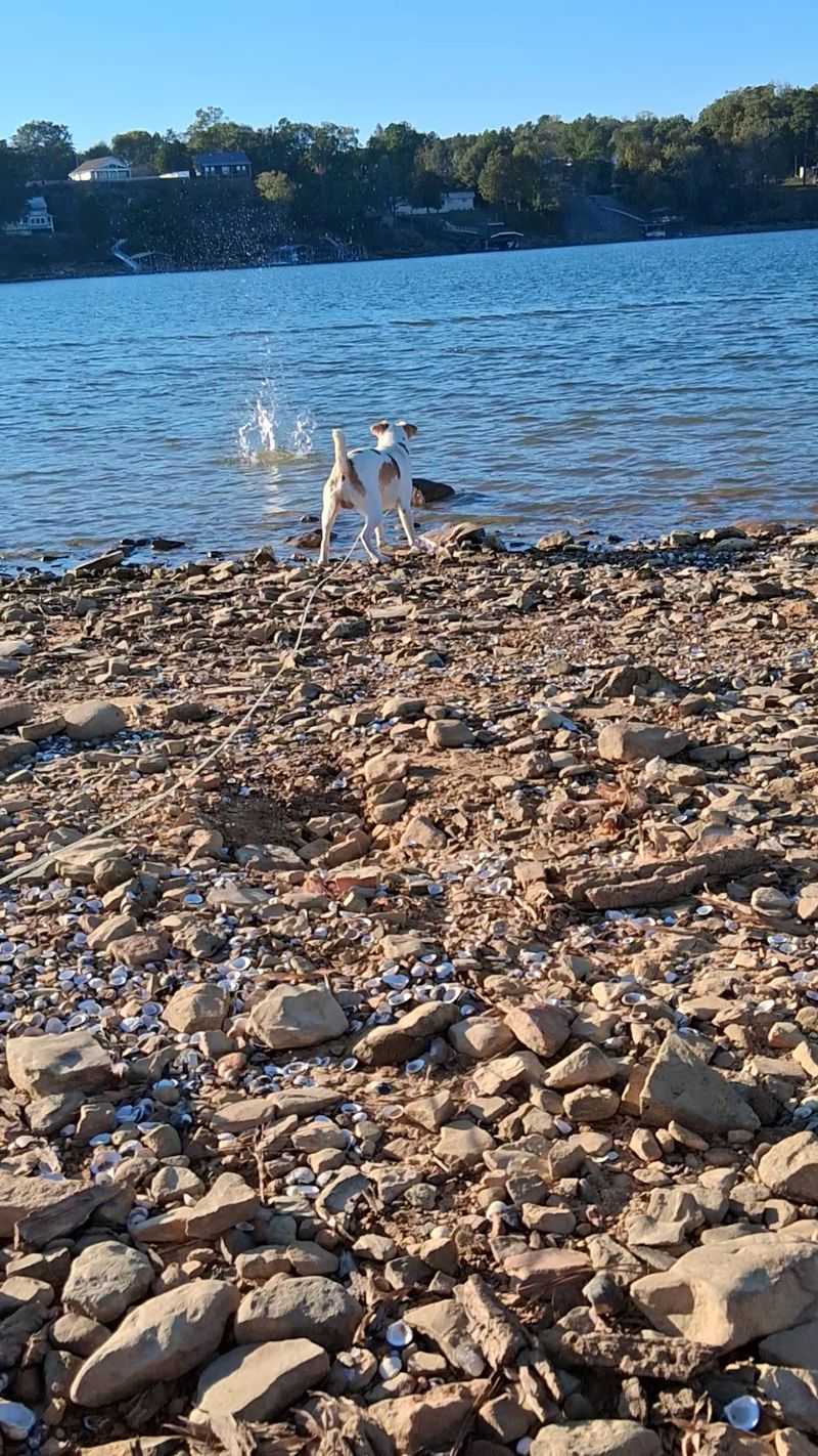
Not every visit needs adrenaline. Plenty of people come here for a folding chair, a sandwich, and a slow afternoon.
Smith Lake Park and the Clear Creek Recreation Area both offer sandy swimming beaches, fishing piers, picnic areas, and enough shade to make midsummer bearable. Bird watching is quietly excellent, especially early when herons work the shallows.
Kids tend to gravitate toward the swimming areas and stay there for hours. Parents tend to gravitate toward the picnic tables and stay there just as long.
The Lewis Smith Dam itself is worth a look, standing 300 feet tall and stretching 2,200 feet across as one of the largest earthen dams in the eastern United States. Seeing the scale of it explains a lot about how a whole valley disappeared.
Duncan Bridge is the other landmark people mention, mostly for the view of the water spreading out in both directions. Boaters use it as a natural meeting point.
Then there is Goat Island, a small patch of shoreline where goats are said to wander freely. It sounds like a tall tale until a boat drifts past and someone spots one on the rocks.
Between the parks, the dam, and the odd little island, the surface-level version of Smith Lake holds up just fine on its own.
