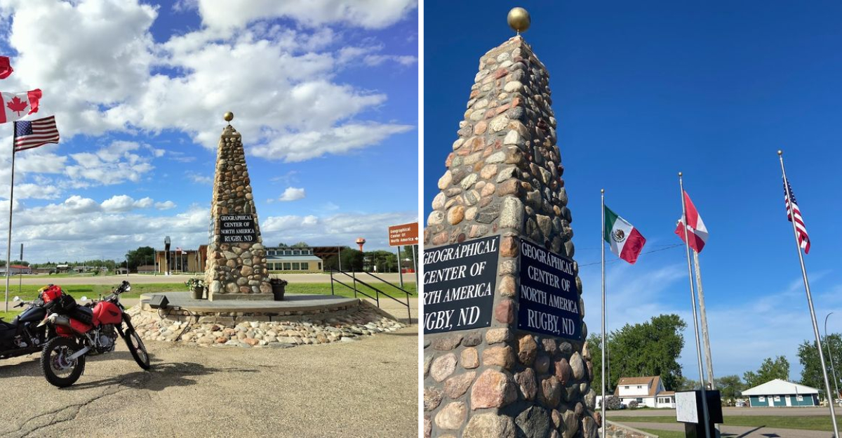
Standing in a small North Dakota town and realizing you might be at the heart of an entire continent carries a quiet thrill. That town has carried that identity for decades, thanks to a stone monument sitting right off a highway.
pot about 16 miles southwest of town, sitting beneath the surface of a small, unnamed lake.
The monument was built in 1932 and later moved in 1971, anchoring the town’s identity to a geographic claim that still sparks curiosity and debate.
What makes this place special is not just the science or the controversy, but the feeling you get when you stop, look around at the wide open prairie sky, and think about how far you are from every ocean.
I drove through on a road trip across the northern US, and honestly, that quick stop turned into one of the most memorable moments of the whole journey.
The Monument That Started It All
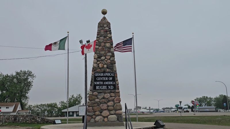
Most roadside monuments blend into the background after a while, but this one has a way of stopping you cold. The Geographic Center of North America monument sits in a parking lot off US-2 in Rugby, North Dakota, and it looks exactly like something you would expect from a small town that decided to plant its flag on a big idea.
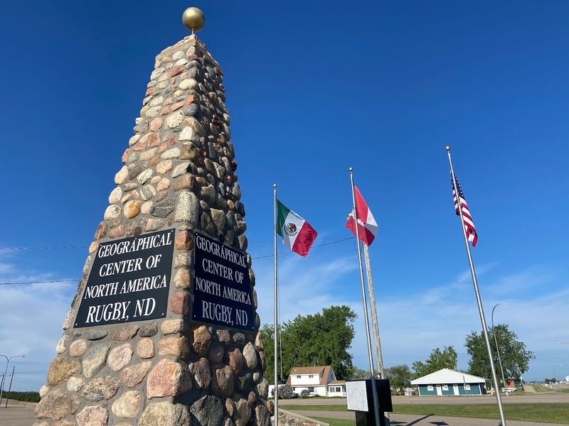
It is a sturdy stone cairn, modest in size but massive in meaning.
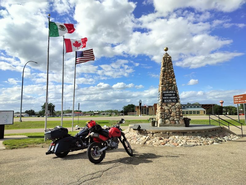
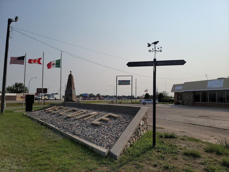
The monument was first erected in 1931 and then relocated in 1971 to its current spot. Three flags fly nearby, representing the countries that share the North American continent.
There is also a simple informational sign that gives you the backstory.
What I love about this stop is how unpretentious it is. There is no grand visitor center, no admission fee, and no long line.
You pull up, read the sign, take your photo, and feel a little stunned by the sheer geography of the moment. The monument is open 24 hours a day, every day of the year, which means even a late-night road tripper can check this one off the list without missing a beat.
How a Cardboard Cutout Changed the Map
The origin story behind this monument is one of the most charmingly low-tech moments in American geography. Back in 1927, Edward M.
Douglas of the U.S. Geological Survey set out to find the geographic center of North America.
His method? He cut out a cardboard shape of the continent and balanced it on the tip of a pin until it rested flat.
That balancing point landed at 48 degrees 10 minutes North latitude and 100 degrees 10 minutes West longitude. It was a clever idea, honestly, even if modern scientists would raise an eyebrow at the approach.
The USGS itself later acknowledged there is no universally accepted method for determining a geographic center, making every such designation an approximation.
Still, that calculation put Rugby on the map, literally. The town ran with it, eventually trademarking the phrase “Geographic Center of North America” for a period of time.
The story of how a pin and a piece of cardboard launched a town’s entire identity is the kind of quirky, only-in-America tale that makes road trips worth taking. It is a reminder that sometimes the most memorable history starts with the simplest tools.
The Lake That Holds the True Coordinates
About six miles west of the tiny town of Balta, North Dakota, there is a small, unnamed lake covering roughly 100 acres. It sits quietly in the middle of flat prairie farmland, completely unremarkable to anyone passing through.
But according to the original 1927 coordinates, this is where the true geographic center of North America actually falls.
There is no monument here. No sign, no parking lot, no flags.
The exact spot is underwater, which makes it one of the more poetic geographic footnotes in the country. The center of a continent, and it is submerged beneath a lake that does not even have a name on most maps.
Driving out toward Balta from Rugby gives you a real sense of just how vast and open this part of North Dakota is. The sky feels enormous.
The land stretches out in every direction without interruption. Knowing that somewhere beneath that quiet lake water lies the mathematical heart of the continent adds a layer of wonder to what might otherwise be a very ordinary stretch of highway.
It is the kind of thing that makes you pause and think about how much hidden significance the landscape around us carries every single day.
Rugby, North Dakota: A Town Built on a Big Claim
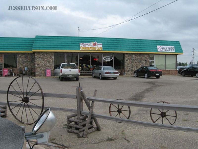
Rugby is the kind of town that feels genuinely lived-in, not performative. It sits along US Highway 2 in Pierce County and has a population of just over 2,700 people.
The geographic center claim has been central to its identity for nearly a century, and the town has leaned into that story with real pride.
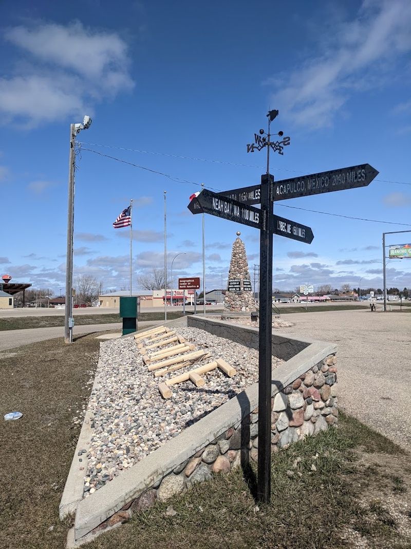
Beyond the monument, Rugby has gas stations, restaurants, and a few local spots worth checking out if you need to stretch your legs and refuel. The monument itself shares a parking lot with Rancho Grande, a Mexican restaurant that gets a mention from nearly every visitor who stops by.
That combination of landmark and lunch break is pretty hard to beat.
The town also sits in a region rich with prairie wildlife. A herd of bison roams about 20 miles south along the west side of the road, which makes the area feel like more than just a quick photo stop.
Rugby is not trying to be a tourist destination in any flashy way. It is just a solid, friendly North Dakota town that happens to sit near one of the most interesting geographic claims on the continent, and that quiet confidence is part of what makes stopping here feel worthwhile.
The Science of Center: Why It Is Complicated
Geography sounds straightforward until you try to find the middle of something as irregular as a continent. North America has a jagged coastline, island chains, and a shape that shifts depending on which landmasses you include.
That complexity is exactly why pinning down a single center point is so difficult.
The USGS has been clear about this: there is no universally accepted definition for a geographic center, and no entirely satisfactory method for calculating one. Different approaches yield different results.
A 2015 study by geographer Peter Rogerson proposed that the true geographic center of North America sits near Center, North Dakota, about 145 miles southwest of Rugby.
That means North Dakota has two competing center claims, which is either confusing or wonderful depending on how you look at it. For most visitors, the debate adds flavor rather than frustration.
The Rugby monument carries the weight of history and tradition, while the newer calculation carries the weight of modern methodology. Neither one cancels the other out.
Both are worth knowing about, and both point to the same basic truth: North Dakota sits at the heart of this continent in a way that most people never expect when they first look at a map.
What Visitors Actually Experience at the Monument
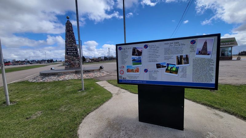
People who stop at the Rugby monument tend to share a similar reaction: it is smaller than expected, but the feeling it gives you is bigger than you think it will be. The stone cairn is not towering or dramatic.
It is honest and solid, sitting in a corner of a parking lot like it has been there forever, which, relatively speaking, it has.
Visitors consistently mention the photo opportunity as the main draw, and rightfully so. There is something satisfying about having a picture that proves you stood at the center of a continent.
Kids seem to get a kick out of it, and road trippers crossing the northern US treat it as a must-check box.
The spot is open around the clock, free to visit, and takes about five to ten minutes if you are just stopping for photos and a read of the informational sign. Nearby amenities make it easy to combine the stop with a meal or a gas fill-up.
The reviews from visitors skew overwhelmingly positive, with most people noting that even if the science is debatable, the experience of being there feels genuinely cool. Sometimes a place earns its reputation simply by being consistent, welcoming, and easy to love.
Planning Your Stop at the Center of the Continent
If you are planning a road trip across the northern United States, Rugby is one of those stops that earns its place on the itinerary without much effort. The monument sits right on US Highway 2, so there is no detour required.
You simply pull off, park, and you are there within seconds.
The best time to visit is during late spring through early fall, when the North Dakota weather cooperates and the prairie landscape looks its most dramatic under a big blue sky. Winter visits are possible since the site is open 24 hours year-round, but temperatures can drop well below zero, as more than one visitor has noted with a laugh in their reviews.
Rancho Grande restaurant is right next door if you want a sit-down meal. Gas stations are close by for fuel.
The surrounding area rewards curious travelers who want to explore further, with the unnamed lake near Balta just a short drive southwest for those who want to see the original calculated coordinates up close. Whether you spend five minutes or an hour in Rugby, the stop has a way of sticking with you long after you have driven on down the highway.
Address: 107 US-2, Rugby, ND 58368
