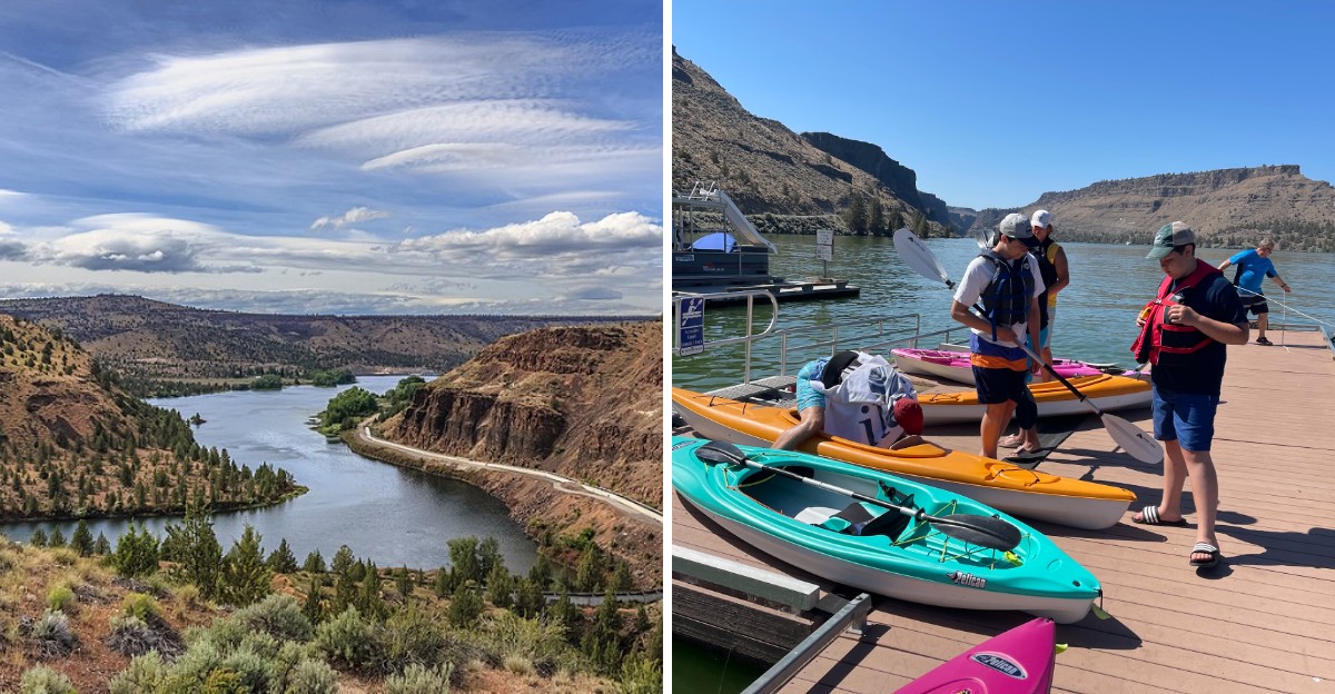
Nine hundred feet down, three rivers used to carve their own separate paths before a dam changed everything above them completely.
Cliffs rise dramatically around the water here, canyon walls hinting at just how deep the terrain drops beneath the surface most boaters glide across without a second thought. Houseboats drift lazily overhead now, sitting directly above what used to be a dry canyon floor.
Building a lake this dramatic took serious engineering most people never think about while swimming or fishing across the surface today. Depth alone makes the scenery feel different here, cliffs plunging steep enough that even experienced boaters occasionally pause just to take in the scale.
Few lakes hide this much vertical drama beneath calm water. Oregon’s canyon lake keeps that history submerged, three rivers still meeting quietly far below anyone paddling above.
Three Rivers, One Winding Canyon
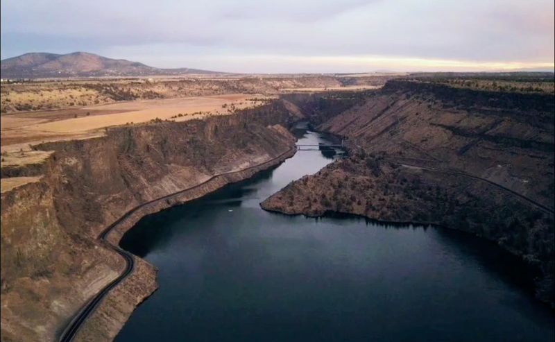
My first glimpse of the lake came from the canyon rim, and I honestly stopped talking mid-sentence. Far below, three long arms of water stretched out in different directions, each one tracing the path of an old river. The Deschutes, the Crooked, and the Metolius all flow into this single reservoir.
Each arm has its own personality. The Crooked River arm sits closest to the main day-use areas of The Cove Palisades State Park, so it tends to be busier with swimmers and boats.
The Deschutes arm runs south, while the long Metolius arm reaches west toward the Cascade Mountains and feels quieter and more remote.
Where the Metolius flows in, the water changes in a way that is easy to spot. Cold, clear river water slides into the greener, warmer lake, creating a visible line. Boaters love cruising up there on hot afternoons just to feel the temperature drop.
Grab a map before heading out. Knowing which arm is which makes planning a day on the water much easier, and it helps with finding a calmer cove.
How a Dam Filled a Dry Gorge
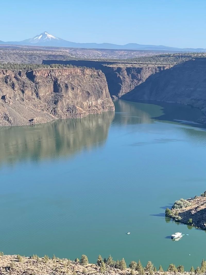
Here is a fact that surprises many visitors. Before 1964, there was no lake here at all, just a deep, dry canyon with rivers rushing along the bottom. Then Round Butte Dam was completed, and water slowly filled the gorge.
The dam is a large rock-fill structure on the Deschutes River, built to create hydroelectric power. It is now operated by Portland General Electric together with the Confederated Tribes of Warm Springs.
As the water rose, it covered parts of the canyon that had been carved over thousands of years, leaving cliffs that tower hundreds of feet above the surface.
A petroglyph boulder was saved before the flooding. It was moved from its original spot and now sits in The Cove Palisades State Park, where visitors can see ancient carvings up close. Pretty amazing, right?
More recently, engineers added a special tower near the dam to help salmon and steelhead move through the system again. It mixes water from different depths, which helps fish find their way. So the dam tells two stories, one about power and one about bringing wildlife back.
The Real Person Behind the Name
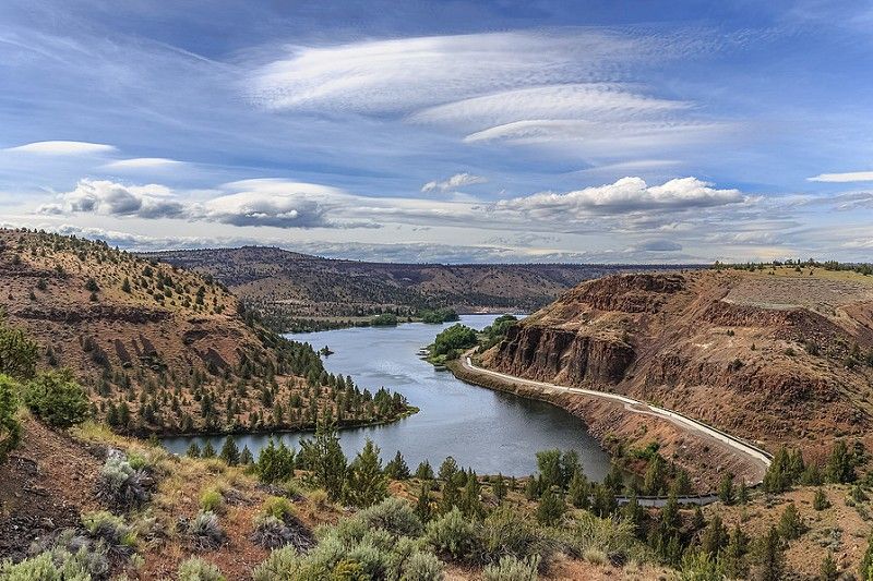
Every name has a story, and this one belongs to a real person from history. Billy Chinook was a Wasco man who traveled with explorer John C. Fremont in the 1840s. He served as a guide during an expedition through the Oregon region.
Later, Billy Chinook lived on the Warm Springs Reservation, which borders the lake today. Naming the reservoir after him is a reminder that this land had deep roots long before any dam was built. Native people fished, traveled, and gathered along these rivers for thousands of years.
I found it meaningful to learn this before visiting. It changed the way the canyon looked to me, less like a vacation spot and more like a place with layers of memory.
Part of the Metolius arm lies within the Warm Springs Reservation. That section has its own rules, and fishing there requires a tribal permit. Respect those boundaries and read posted signs.
The Museum at Warm Springs, a short drive north, is a great stop for anyone curious about the tribes and their long connection to this region.
Stripes of Ancient Lava in the Cliffs
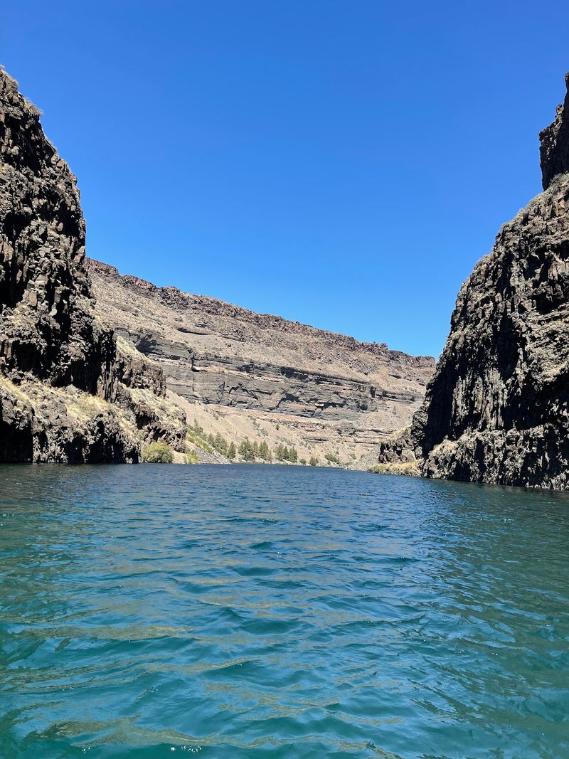
Those cliffs are not just pretty, they are basically a giant history book made of rock. Millions of years ago, lava flows spread across this part of Central Oregon. Layer after layer cooled and hardened, and the rivers slowly cut through them.
Look closely at the canyon walls and you will see stripes. Dark bands of basalt sit on top of lighter layers of volcanic ash and river sediment. Some sections show columns, tall rock shapes that formed as lava cooled and cracked.
One of the neatest details is intracanyon lava. Long ago, lava poured down into older canyons and filled them, and later the rivers carved new paths. Geologists visit to study how fire and water shaped this landscape over and over.
Boating along the base of the cliffs gives the best view. The rock rises straight up, sometimes glowing orange at sunset. On land, the Tam-a-lau Trail climbs to the top of a plateau, offering a closer look at the layers along the way.
Bring binoculars. Hawks and eagles often ride the air currents near the rim.
A Mesa That Stays Off Limits
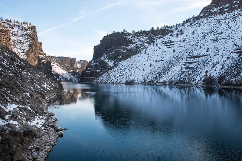
Right in the middle of the lake sits a tall, flat-topped mesa that looks like a fortress. Locals simply call it The Island, even though it is technically attached by a narrow ridge. And no, you cannot hike on it.
The top of The Island has been protected as a research natural area. Because it is so hard to reach, grazing animals never damaged the plants up there. Scientists use it to study what Central Oregon grasslands looked like long ago, before cattle and farming changed the land.
Honestly, I kind of love that some places stay off limits. It makes the view from below feel special, like peeking at a secret garden you are not allowed to enter.
The best way to appreciate it is from the water or from the Tam-a-lau Trail, which looks across at the mesa. The Island separates the Crooked River arm from the Deschutes arm, so boating around it shows off both.
Watch for golden eagles and other raptors, since the cliffs provide nesting spots. Keep a respectful distance during nesting season.
Chasing Kokanee and Bull Trout
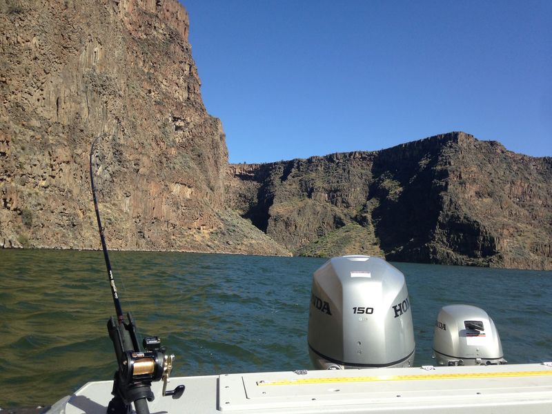
Ask anyone who fishes here, and kokanee will probably come up first. These small, landlocked salmon are the lake’s most popular catch, and they are delicious. Smallmouth bass hide along the rocky shoreline too.
The lake also holds bull trout, a threatened species in many places. Here, anglers can keep a limited number under special rules, which makes this one of the few spots in Oregon to catch them legally. Always check current Oregon Department of Fish and Wildlife regulations before casting a line.
Shore fishing can be tricky. Rocks and underwater plants love to snag hooks and lures, so expect to lose some gear. A boat opens up far better options, letting anglers troll deeper water where kokanee gather.
Remember the tribal permit rule on the Metolius arm within the Warm Springs Reservation. Early mornings and evenings tend to be the most productive times, and they are more peaceful too.
I think there is something relaxing about sitting in the canyon’s shadow, waiting for a tug, even if the fish are not cooperating. Patience pays off here.
Starry Nights at Lakeside Campgrounds
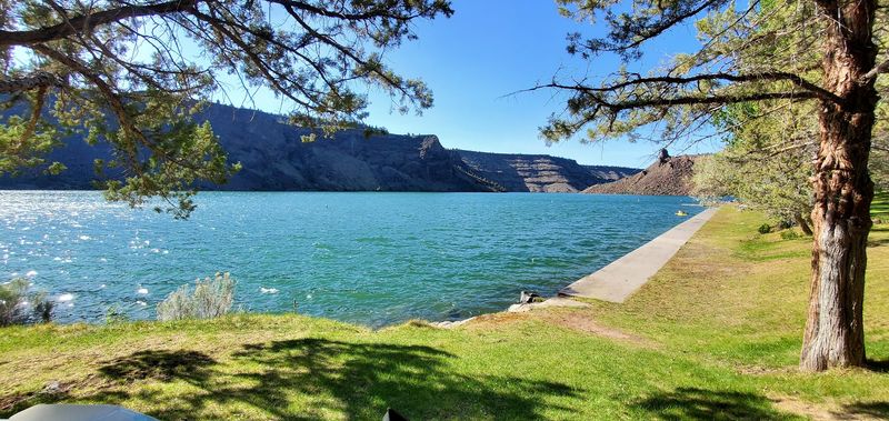
Few things beat falling asleep under a sky packed with stars, then waking to deer nibbling near the tent. Camping is a big part of life at the lake. Several campgrounds offer different styles of stays.
Inside The Cove Palisades State Park, the Crooked River Campground and Deschutes Campground have tent sites, RV spots, and cabins. Hot showers and regularly cleaned restrooms make longer stays much more comfortable.
A grassy, shaded area near the water gives kids a place to play, and a roped swim area sits close to the boat launch. Over on the Metolius arm, Perry South Campground is run by the U.S. Forest Service.
It has a rustic feel, with shady spots, a quieter pace, and easy boat access to nearby coves. Bring a water jug, since some sites sit a short walk from the nearest spigot.
Summer weekends fill up fast, so reserve early. Cell service can be spotty depending on the carrier, which honestly might be a nice break. Evening ranger programs sometimes run in the park during summer, sharing stories about wildlife, geology, and the night sky.
Cascade Peaks From the Canyon Rim
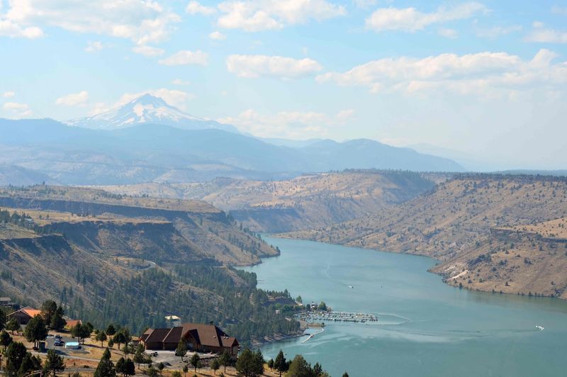
On a clear day, the Cascade Mountains line up along the horizon like a row of snowy giants. Mount Jefferson usually steals the show, with the Three Sisters and sometimes Mount Hood joining in. I could have stared for an hour.
Round Butte Overlook Park, near the dam, is one of the top viewpoints. It offers a wide look over the lake and the surrounding high desert, plus displays that explain how the dam and fish passage work. Picnic tables make it a great spot for a snack break.
The Cove Palisades also has several scenic pullouts along the road. That drive down into the canyon twists and turns with steep drops, so take it slow. Falling rocks can land on the road, and the curves demand full attention.
For the best light, visit in the early morning or near sunset. The basalt turns warm shades of gold and red, and the water reflects the colors back.
Wild horses and deer sometimes wander near the upper plateaus. Keep a camera ready, because the scene shifts quickly as shadows stretch across the canyon.
Smart Tips Before Heading to the Water
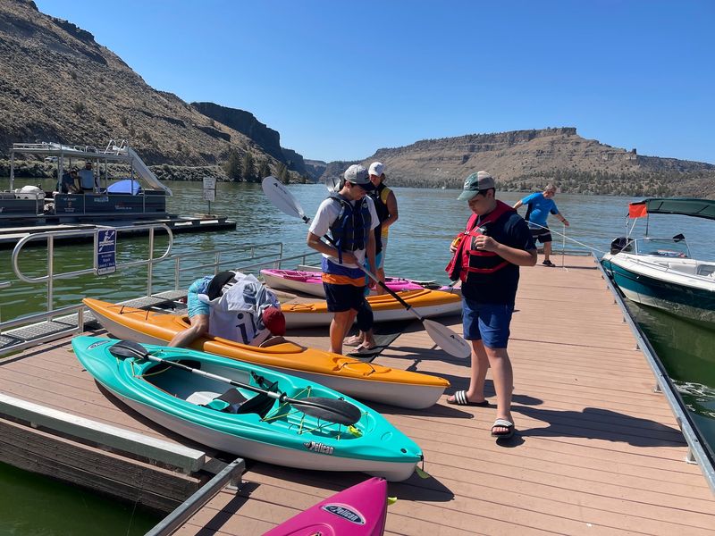
A little planning goes a long way at this desert lake. Summer brings hot, dry days, so pack plenty of water, hats, and sunscreen. Shade is rare on the canyon floor.
Blue-green algae blooms sometimes appear in warm weather. Before swimming, check the Oregon Health Authority website for current advisories, and keep pets out of affected water. Rattlesnakes live in the rocky areas too, so watch your step on trails and around campsites.
Cell coverage varies by carrier, and some spots have no signal at all. Download maps ahead of time. The marina store carries basic supplies like ice, snacks, and bottled water for anything forgotten at home.
Spring and early fall are lovely times to visit, with fewer boats and milder temperatures. Weekday mornings in summer also feel calmer than busy weekends. After a few days here, it is easy to see why so many visitors return year after year.
The lake sits in Oregon, USA, near the town of Culver, and the main entrance to The Cove Palisades State Park is at 7300 SW Jordan Road, Culver, OR 97734.
