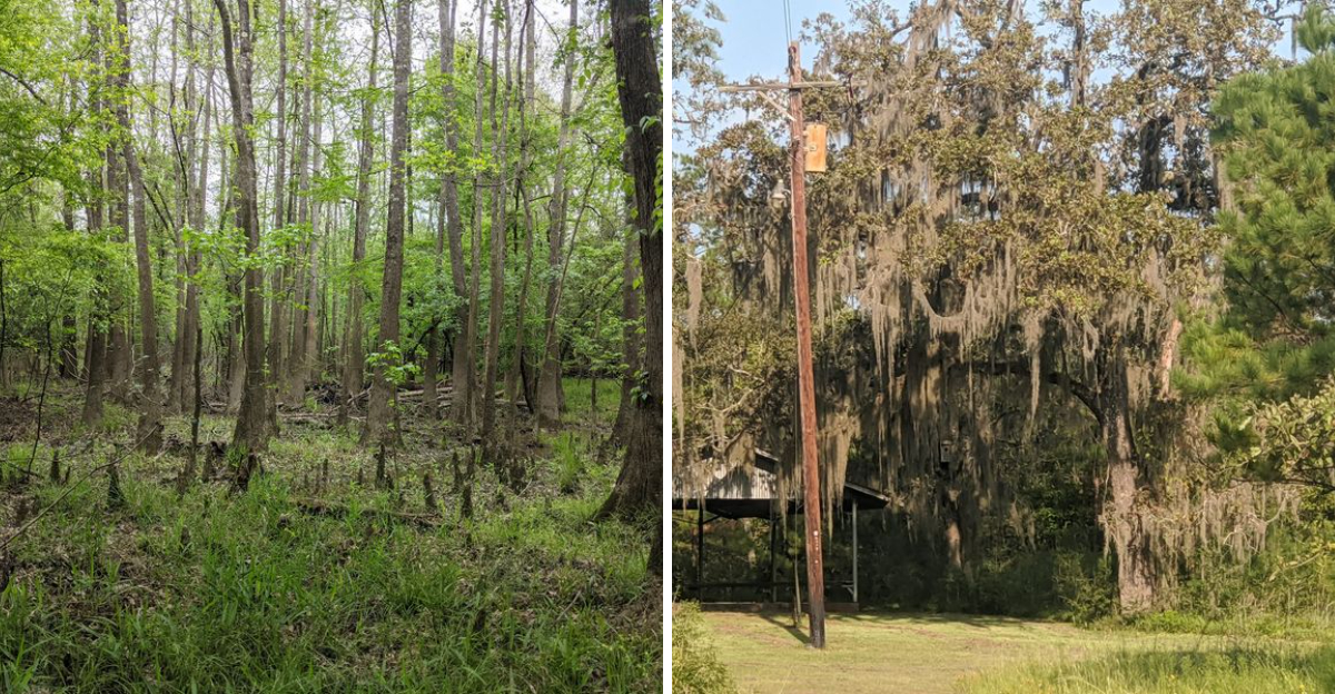
These trees were built for the long game. Longleaf pines can survive for centuries, with historic stands containing trees more than 250 years old, yet only a small fraction of the vast longleaf ecosystem that once covered the South remains today.
This Texas sanctuary protects 5,654 acres containing one of the state’s remaining longleaf pine communities, along with cypress sloughs, hardwood forests, wildflowers, more than six miles of trails, and habitat supporting hundreds of plant and animal species.
It is also actively managed with techniques such as prescribed fire because these unusual forests actually depend on regular fire to stay healthy.
Texas has plenty of old trees, but walking through an ecosystem that has lost roughly 95 percent of its historic range makes this forest feel considerably more important than an ordinary patch of woods.
Longleaf Pines That Outlive Generations
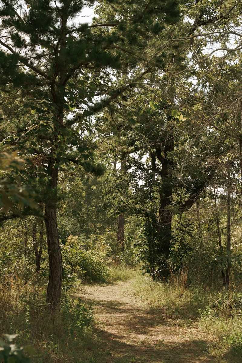
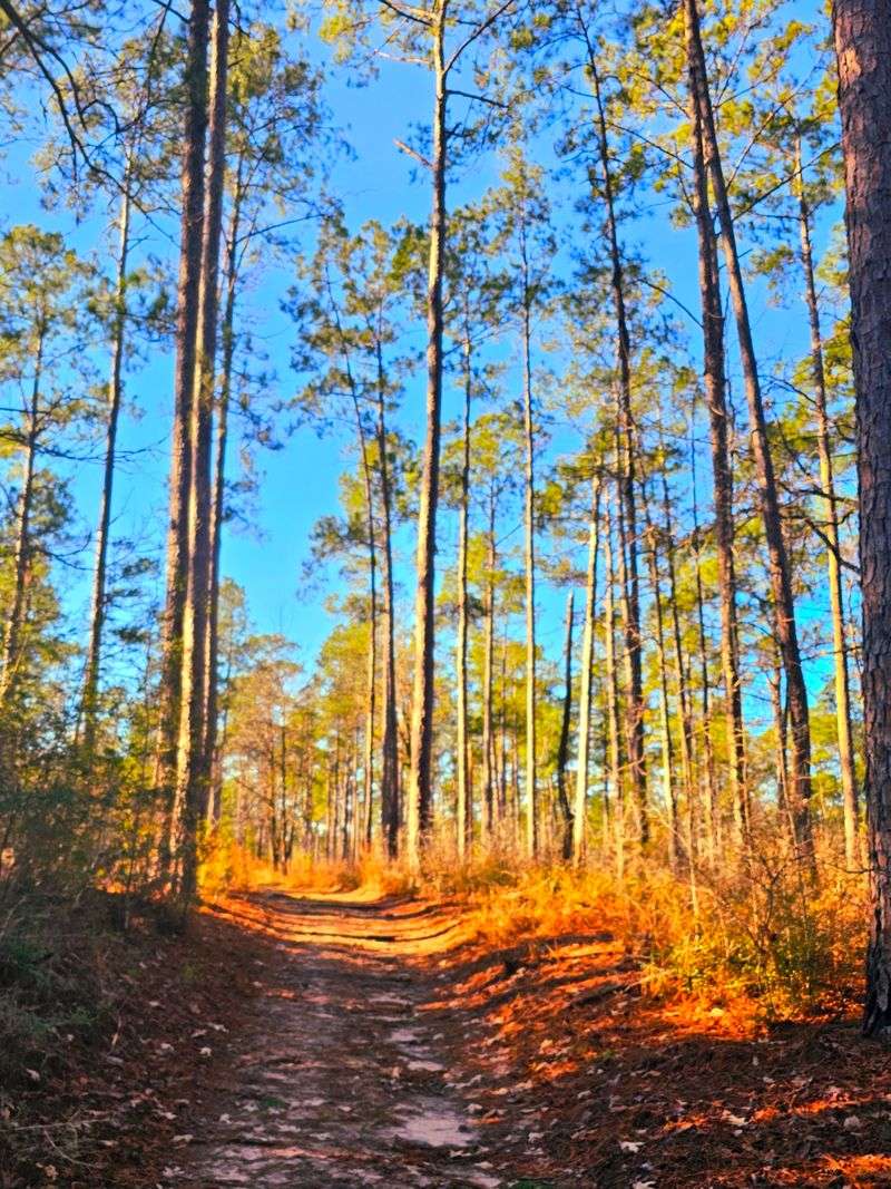
Some trees just make a person stop walking. The longleaf pines here do exactly that, rising in tall columns with tufted crowns that look almost tropical from below.
Known scientifically as Pinus palustris, these pines are famous for taking their time. A single tree can live more than 300 years, and certain specimens have reached roughly 450 years of age.
Many spend a full century simply growing toward their mature height.
What makes the sanctuary so meaningful is how rare this forest type has become. Longleaf pine woodlands once blanketed around 90 million acres across the southern United States, stretching from Virginia down through Texas.
Today, less than five percent of that original range survives.
The Nature Conservancy manages this 5,673-acre preserve as part of a broader push to bring the species back. Standing among the trunks, the scale of that loss becomes easier to grasp, and so does the value of what remains protected here.
Young longleafs are worth a second look too. In their early years they resemble clumps of green grass rather than trees, a stage that helps them survive fire while their roots dig deep.
Bring a camera with a wide lens if photography interests you, because capturing the height of these pines is genuinely tricky. Early morning light slanting through the trunks creates the kind of scene that photographs beautifully and feels even better in person.
The open understory means views stretch surprisingly far between the trees.
Where Nine Ecosystems Meet In One Place
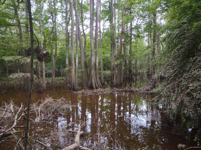
Rarely does a single preserve hold this much variety. Within a few miles of trail, the ground shifts from bone-dry sand to soggy bog, and the plant life changes right along with it.
The Big Thicket earned its name from early travelers who found the vegetation nearly impossible to push through. Sandyland sits inside that legendary region and shows off its diversity better than almost anywhere.
Count the habitats and the number climbs fast.
Wet pine savannas, bald cypress and water tupelo swamps, bottomland hardwood forests, American beech and southern magnolia slope forests, upland longleaf pine and oak stands, baygalls, mixed pine oak woods, xeric longleaf pine sandhills, and herbaceous seepage bogs all overlap here.
That mosaic is why biologists call the Big Thicket a biological crossroads. Species from the eastern woodlands, the southern swamps, the central plains, and the arid southwest all reach the edges of their range somewhere in this region.
Walking a single loop can feel like driving across three states.
Pay attention to the transitions rather than just the destinations. One moment prickly pear grows beside a pine, and a few hundred feet later the soil darkens and ferns take over.
Those boundary zones tend to be the most interesting spots for spotting unusual plants and wildlife. Slow down when the vegetation changes, because that shift usually signals a change in soil moisture, and moisture drives nearly everything that grows in this corner of Texas.
Ancient Sand From A Vanished Sea
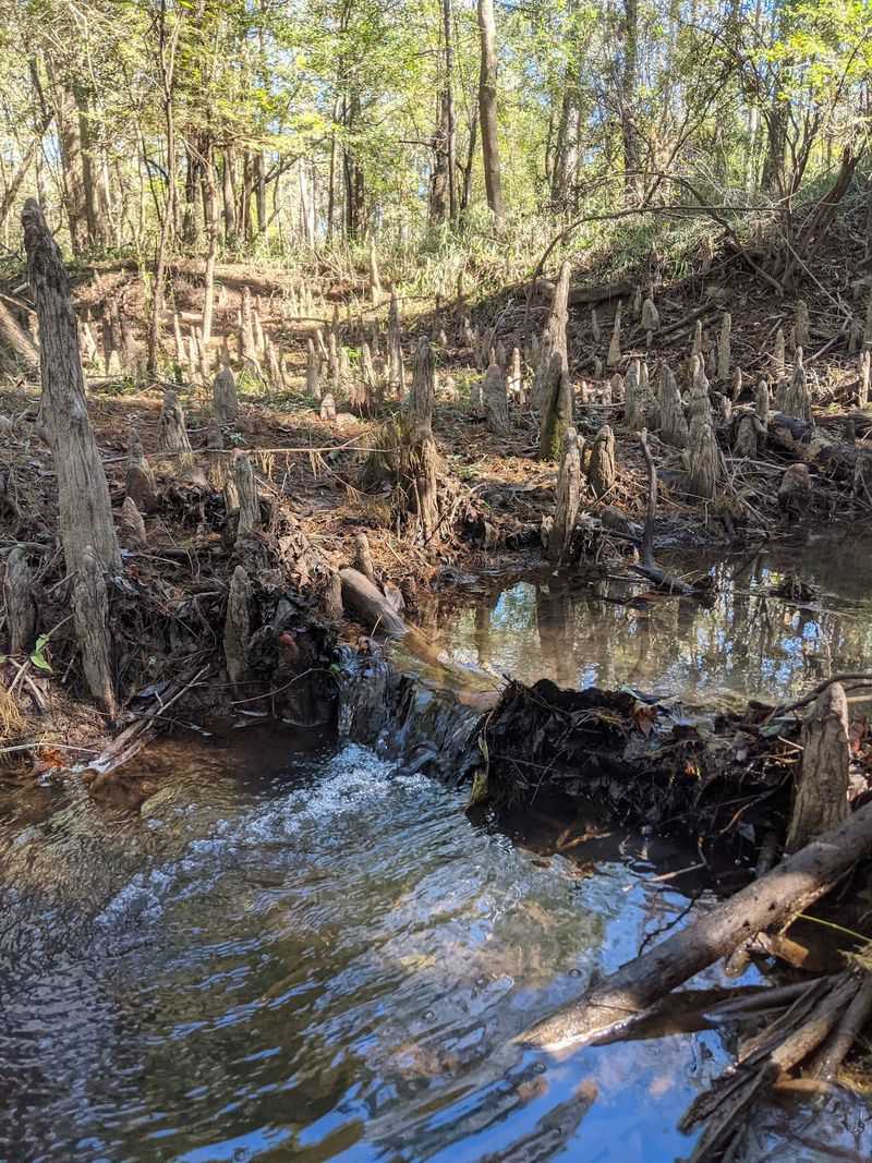
My shoes filled with sand about ten minutes into the walk, which turned out to be the perfect introduction to this place. The name Sandyland is not decoration.
All that pale, loose sand traces back roughly 93 million years to the Woodbine Group Formation, deposited when an inland sea covered this part of Texas. The sandstone and sand left behind still shape everything growing here today.
Beneath the surface sits an enormous aquifer, and it feeds springs and seeps scattered across the preserve. Water bubbles up in unexpected spots, creating small wet pockets in otherwise parched terrain.
The dryness of the uplands leads to a strange sight for East Texas. Prickly pear cactus and yucca grow right alongside towering pines, plants that seem like they belong several hundred miles west.
Sand drains fast, so even after rain the sandhills stay surprisingly dry.
Cutting through it all is Village Creek, which winds 8.5 miles across the preserve along the western edge. Its tannin-stained water eventually joins the Neches River and flows on toward the Gulf of Mexico.
That combination of dry sandhill and wet floodplain within walking distance is the whole story of this landscape in miniature. Wear shoes that can handle loose footing, since walking on deep sand takes more effort than expected.
Some sections genuinely feel like a beach hike, minus the ocean and plus a whole lot of pine trees overhead.
Rare Wildflowers Hiding In Plain Sight
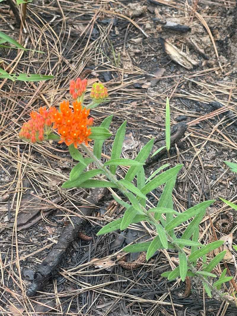
Look down often. That advice paid off repeatedly here, because some of the sanctuary’s most remarkable residents barely reach ankle height.
More than 700 plant species have been recorded inside the preserve boundaries, which is a staggering number for a property of this size. Wildflowers, ferns, grasses, and several pine species all share the ground.
Among the standouts is Texas Trailing Phlox, a federally endangered plant that depends on exactly this kind of protected sandy habitat. Finding it requires patience and a careful eye.
The preserve also shelters state-rare species including Scarlet Catchfly and White Firewheel, both of which add unexpected color to the understory. Neither one shows up in a typical Texas roadside meadow.
Carnivorous plants live here too.
The Big Thicket is well known for its insect-eating flora, and at least two such species grow within the sanctuary, usually near the boggy seepage areas where nutrients are scarce and catching bugs becomes a survival strategy. Pitcher plant bogs are the classic example.
Spring and early summer bring the strongest wildflower displays, especially in areas that have recently been burned. Fire clears the understory and lets sunlight reach the ground, which triggers a colorful response.
Photographers should consider bringing a macro lens or simply kneeling down with a phone camera. Many of these plants are small enough that a casual glance misses them entirely, and staying on the marked paths protects the fragile ones from being trampled.
Birdsong, Butterflies And Plenty Of Company
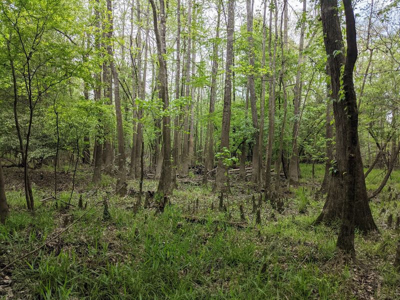
Sound arrives before sight in this forest. Long before a bird becomes visible, the canopy fills with layered calls that shift as the trail moves from pine uplands into creek bottoms.
Surveys have documented more than 200 animal species across the sanctuary. The breakdown includes 119 bird species, 29 reptile species, 28 mammal species, and 18 amphibian species.
Butterflies and moths steal the show on warm afternoons, with over 500 species identified in the surrounding area. Some drift through sunlit gaps in twos and threes, others cluster on damp sand near the creek.
Roadrunners occasionally sprint across the path, which never stops being entertaining.
Village Creek supports its own crowd, including 44 fish species and 14 kinds of freshwater mussel. Those mussels are a quiet indicator that the water quality here remains genuinely good.
Bird enthusiasts have extra reason to visit, since the preserve is listed as Site No. 17 on the Upper Coast Phase of the Great Texas Coastal Birding Trail. Early morning delivers the most activity by a wide margin.
Venomous snakes live here as well, so staying on designated trails and watching where feet land is simply smart practice. Closed-toed shoes handle that job far better than sandals.
Binoculars are worth the pack space, and a small field guide or bird identification app makes the experience richer. Moving slowly and pausing frequently reveals far more wildlife than marching through at a steady pace ever will.
Six Miles Of Trails With Very Different Personalities
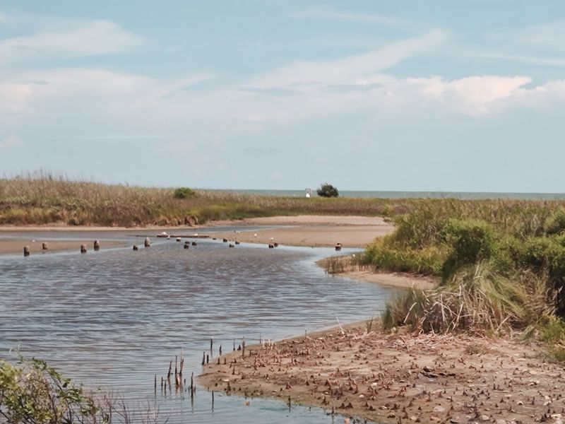
Choosing a route here depends entirely on how much effort sounds appealing. Over six miles of trail wind through the preserve, and the three main options feel nothing alike.
The Longleaf Nature Trail runs 0.8 miles as an interpretive loop marked with white blazes. Short, approachable, and packed with information about the pine community, it works well for families or a quick stop.
Stepping up in commitment, the Sandhill Loop Trail covers four miles through the quieter backcountry, marked in red. Deep sand dominates long stretches, and the sensation of hiking a beach without water is genuinely odd.
Legs feel that sand by the end.
The Floodplain Trail is the wild card, stretching 2.8 miles with blue blazes along Village Creek. Views along the water are lovely, but the route stays primitive, can grow overgrown, and sometimes holds standing water.
Carrying a compass or GPS on that one is a real recommendation rather than a formality. Trail conditions shift with rainfall, so recent weather matters.
Practical gear makes a big difference across all three. Closed walking shoes, long pants, insect repellent, sunscreen, and more water than seems necessary cover the basics for East Texas humidity.
Photographers and nature students tend to linger longest on the nature trail, while anyone wanting solitude should head for the sandhills. Combining a short loop with part of a longer one makes for a satisfying half day without turning the visit into an endurance test.
Village Creek And Its Tea Colored Water
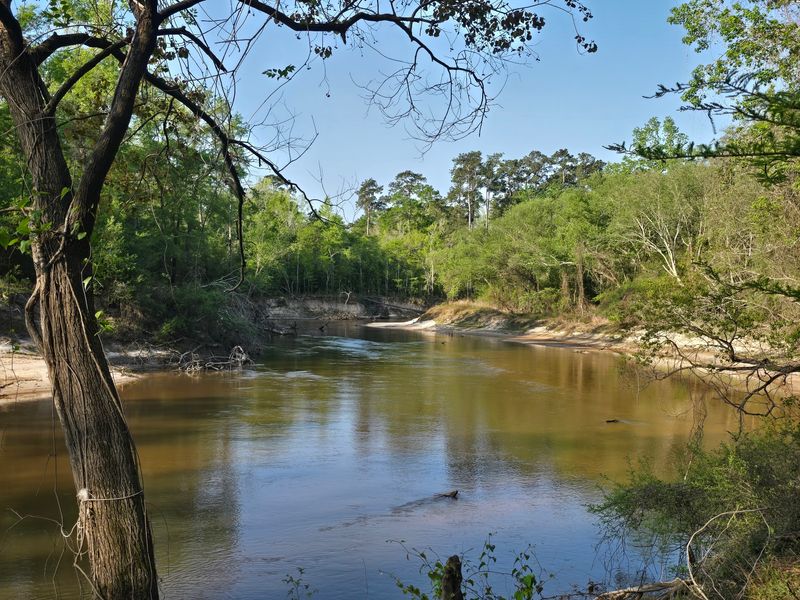
Tannic water looks like strong tea, and Village Creek delivers that effect beautifully as it slides past sandbars and cypress roots. The color comes from leaves and bark steeping in the current.
Flowing 8.5 miles through the sanctuary, the creek acts as both a natural boundary and the ecological backbone of the property. Everything downstream depends on what happens along its banks.
Its waters feed into the Neches River, which continues south toward the Gulf of Mexico. That connection links this quiet East Texas creek to a much larger watershed story.
Sitting near the bank for a few minutes rewards patience.
Fish break the surface, dragonflies patrol the shallows, and the combination of moving water and bird calls creates a soundtrack that beats any playlist. It is the kind of spot where time slips by unnoticed.
Paddling offers a completely different view of the preserve, and canoeing, kayaking, and fishing are all possible along this stretch. Rentals and shuttle arrangements come through local vendors rather than the sanctuary itself, so planning ahead helps.
Water levels fluctuate with rainfall, which affects both paddling conditions and how much of the floodplain stays walkable. Checking recent conditions before committing to a creekside route saves frustration.
The healthy mussel and fish populations found here reflect decades of protection along this corridor. Keeping the banks undisturbed and packing out everything brought in helps that continue, and honestly, the creek is prettiest when nothing human interrupts the view.
Fire, Restoration And The Work Behind The Scenes
Charred bark at the base of several pines caught my attention early on, and it turns out that scorching is intentional. Fire is a management tool here, not a disaster.
The Nature Conservancy has cared for the Roy E. Larsen Sandyland Sanctuary since the land was donated in 1977.
Restoring and maintaining the longleaf pine ecosystem sits at the center of that mission.
Prescribed burns keep the understory open, which longleaf pines need in order to regenerate. Without periodic fire, shrubs and hardwoods crowd out young pines and the whole system shifts.
Burned ground often bursts with wildflowers the following season.
Bird diversity benefits too, since many grassland and savanna species depend on open, sunlit forest floors rather than dense thickets. The results are visible to anyone paying attention.
Beyond fire management, the preserve functions as a demonstration site for land and water stewardship practices. Techniques tested here can guide restoration efforts elsewhere across the region.
Education plays a large role as well. Academic institutions bring students for field studies, and the property serves as an outdoor classroom for research and interpretive programming.
For visitors, the practical takeaway is simple. Burn operations occasionally close portions of the preserve, so checking the Nature Conservancy website before driving out prevents a wasted trip.
Seeing conservation actively happening rather than just described on a sign adds real weight to the visit. This landscape survives because people keep choosing to work at it, season after season.
Getting There And Making The Most Of It
Planning a trip here takes very little effort, which is part of the appeal. Gates open daily from sunrise to sunset, and there is no admission fee.
The entrance sits along Highway 327 west of Silsbee, an easy drive from Beaumont and reachable as a day trip from Houston. Signage marks the turn clearly enough.
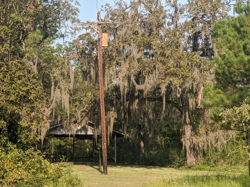
Near the parking area, a covered pavilion with benches and picnic tables provides a shaded spot to eat or regroup after a hike. It is a welcome sight on a humid afternoon.
Pack food and water, because services are limited nearby.
A few rules keep the preserve healthy. Pets are not permitted, camping is not allowed, and smoking is prohibited throughout the property.
Clothing choices matter more than usual in this environment. Long pants, closed walking shoes, sunscreen, and insect repellent make the difference between a pleasant outing and a very itchy drive home.
Groups can arrange interpretive programs, and the sanctuary regularly hosts field studies for schools and universities. Contacting the Nature Conservancy in advance is the route for organized visits.
Before heading out, a quick check for temporary closures is smart, since prescribed burns can shut down sections without much notice. Weather also affects the floodplain route heavily.
Morning visits tend to be cooler, quieter, and better for wildlife sightings. Give the place three or four hours if possible, because rushing through misses the small details that make this forest genuinely special.
Address: 4208 TX-327, Silsbee, TX 77656
