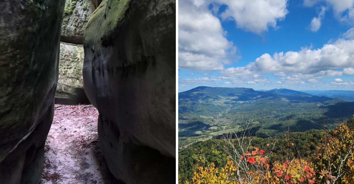
You climb through the forest, the trail steep enough to make your legs burn, and then you step through the trees and see it. A maze of sandstone, weathered and carved, stretching across the ridge like something from another world.
This Virginia hike leads to a geological wonder, a 400-million-year-old sandstone maze that sits above the mountains and offers views that make the climb worth every step. I walked through the narrow passages, running my hand along the rock, feeling the grooves that water and wind have worn into the stone.
The maze is disorienting, a labyrinth of walls and alleys that you can wander through without a clear path. When you find the high points, the views are spectacular, mountains rolling away in every direction.
Virginia has plenty of hikes, but this one is unlike anything else.
Unearthing a 400-Million-Year-Old Geological Marvel
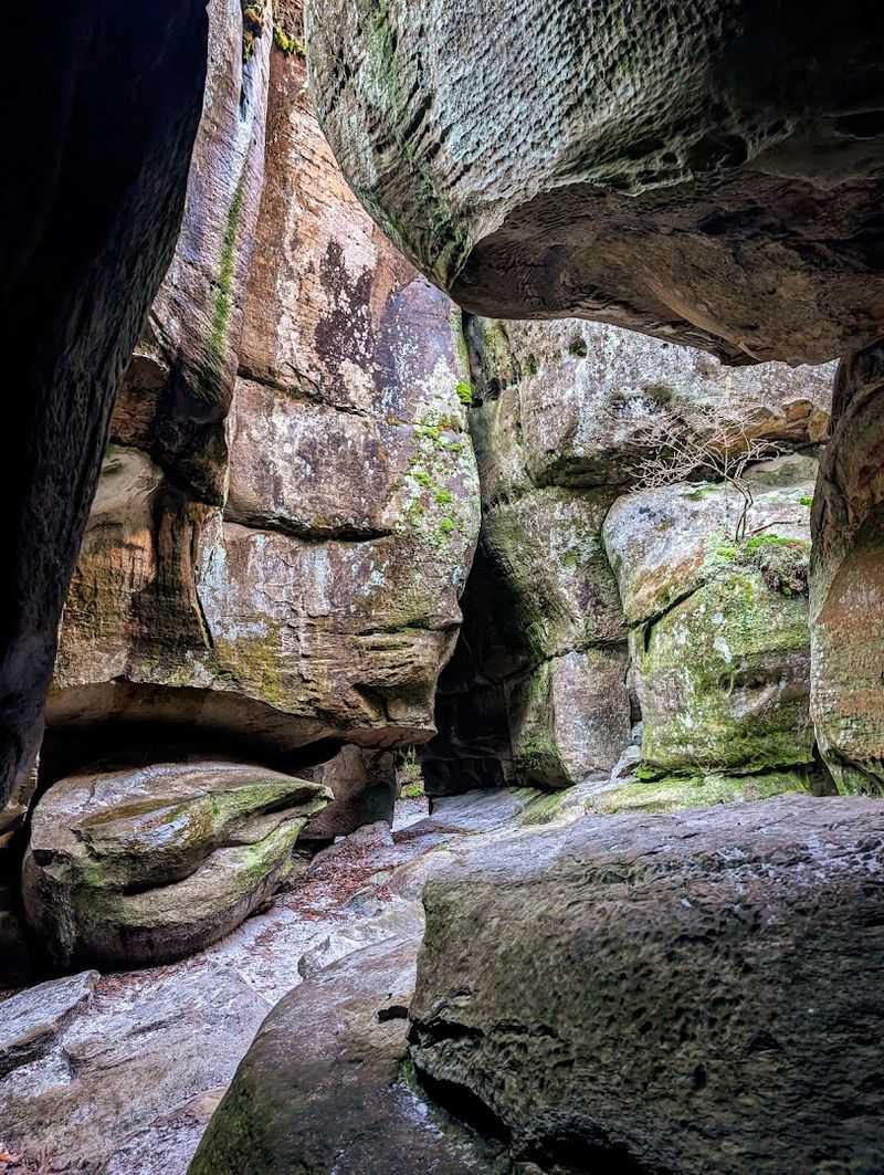
Four hundred million years is a number that genuinely breaks my brain every time I think about it. At The Channels Natural Area Preserve, you are quite literally walking on some of the oldest exposed rock formations in the entire Appalachian region.
The scale of that fact hits differently once you are standing inside the maze.
These sandstone formations were shaped by periglacial processes during the last ice age. Permafrost and ice wedging acted like slow, relentless chisels, expanding natural joints in the caprock and shattering the rock into the dramatic, angular corridors you see today.
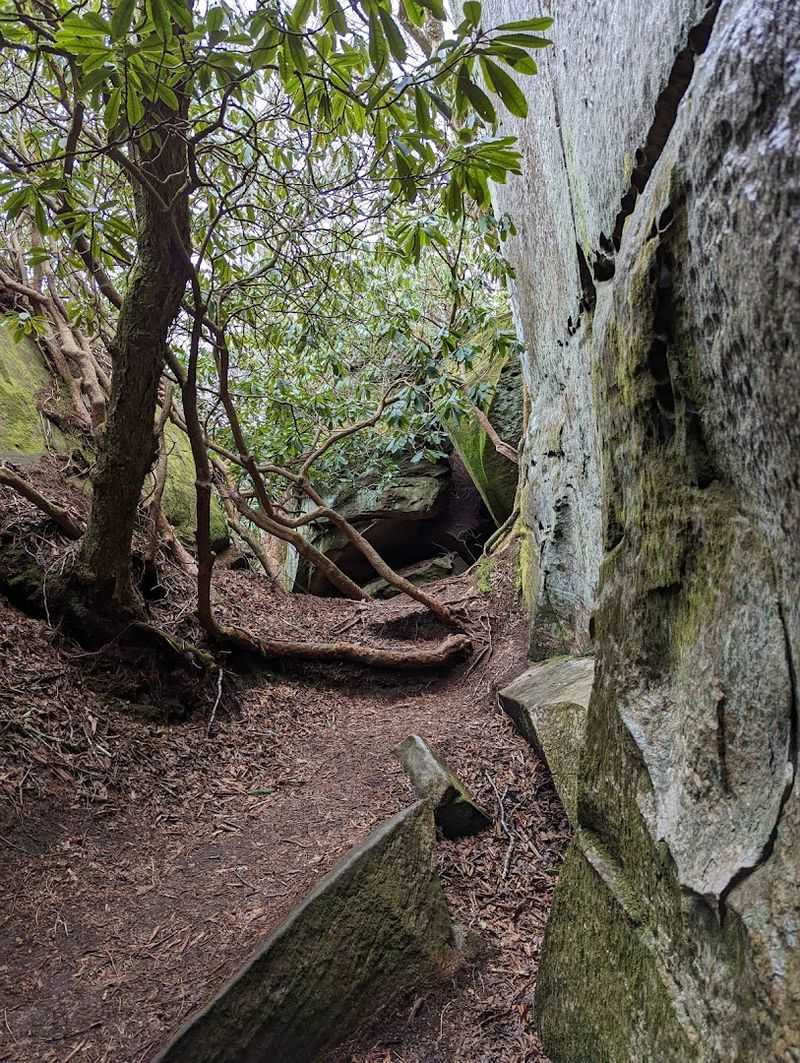
The result is a 20-acre labyrinth of towering boulders and narrow passageways that genuinely resembles the slot canyons of the American Southwest.
What makes this even more astonishing is its location. Virginia is not exactly the first state that comes to mind when you picture canyon-like rock formations, yet here they are.
They’re perched at the highest point of Clinch Mountain at roughly 4,200 feet.
The sheer improbability of finding this landscape in the heart of the Appalachian Mountains is exactly what makes The Channels Natural Area Preserve so unforgettable.
The Trailhead and Getting Your Bearings
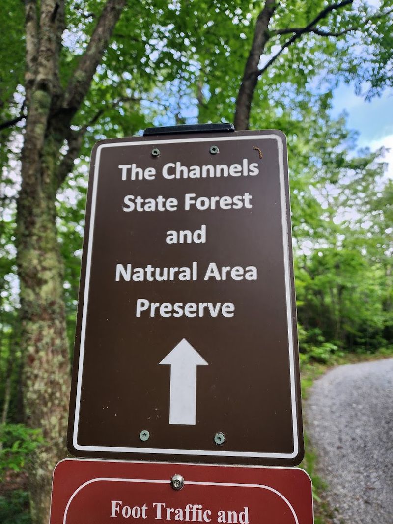
Arriving at the trailhead is the first small adventure of the day, and it sets the tone perfectly. The main parking area sits off Route 80 near Hayters Gap, and fair warning, this lot holds only about ten vehicles.
Arriving early is not just a suggestion here; it is practically a survival strategy.
Parking along Highway 80 is strictly prohibited, and enforcement is real. Mid-week mornings or late afternoons tend to offer the best chance of snagging a spot without the anxious wait.
Carpooling with friends is genuinely one of the smartest moves you can make for this particular hike.
Once parked, you will notice the trailhead signage right away. The map posted at the start can be slightly misleading about distances, so mentally prepare for a longer journey than it initially suggests.
There are no restrooms, no trash facilities, and no water sources along the trail, so everything you need must come with you.
For GPS navigation, plug in 4250 Hayters Gap Road, Saltville, Virginia, and it will guide you directly to the trailhead. The Channels Natural Area Preserve is managed by Virginia’s Department of Conservation and Recreation, and the preserve is open daily from 6 AM to 5 PM.
What the Brumley Mountain Trail Feels Like Underfoot
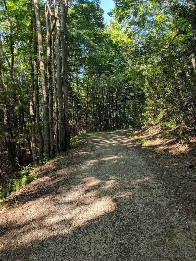
The trail begins with a wide, well-graded gravel fire road that feels almost too civilized for an adventure of this magnitude. That pleasant ease is intentional, giving your legs a chance to warm up before the terrain starts demanding more from you.
The forest closes in on both sides almost immediately, and the canopy overhead creates a cool, green tunnel effect that is genuinely gorgeous.
As the miles accumulate, the path transitions from gravel to natural dirt, and the gradient gradually increases. Dense rhododendron thickets line the route in the upper sections, their twisted branches creating a moody, almost enchanted atmosphere.
When they bloom in late spring, the whole experience takes on a vivid, almost surreal quality.
The final push toward the summit is where the trail earns its moderate-to-strenuous rating. Steeper pitches, exposed roots, and occasional muddy patches demand your full attention.
Sturdy hiking boots with solid ankle support are genuinely non-negotiable here, not a fashion choice.
The round trip covers approximately six to seven miles depending on your exact route and how deeply you explore the channels themselves. Take breaks freely, enjoy the forest sounds, and resist the urge to rush.
The reward absolutely justifies every uphill step.
Stepping Into the Heart of the Labyrinth
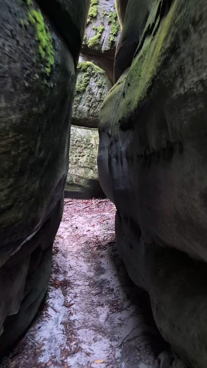
Nothing quite prepares you for the moment the labyrinth reveals itself. After miles of forested trail, the sandstone formations appear almost without warning, and the visual shift is so dramatic it genuinely takes a second to process.
One moment you are walking through trees, and the next you are peering into a network of narrow rock corridors that seem to stretch endlessly in every direction.
Descending into the channels requires a short but steep scramble, and that descent immediately immerses you in the maze. The walls rise on either side, blocking out much of the sky and creating an intimate, almost cave-like atmosphere.
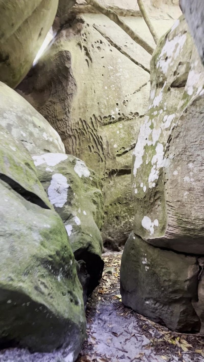
Squeezing through the tighter passages is one of those experiences that activates a deep, primal sense of exploration that no theme park can replicate.
Disorientation is genuinely part of the charm here, but a quick mental note of your entry point goes a long way toward keeping the adventure fun rather than stressful. Going with a companion adds an extra layer of enjoyment, and two pairs of eyes are always better than one when navigating the winding rock corridors.
At The Channels Natural Area Preserve, the maze covers roughly 20 acres, and there is always another passage to discover around each corner.
The Microclimate Inside the Rock Maze
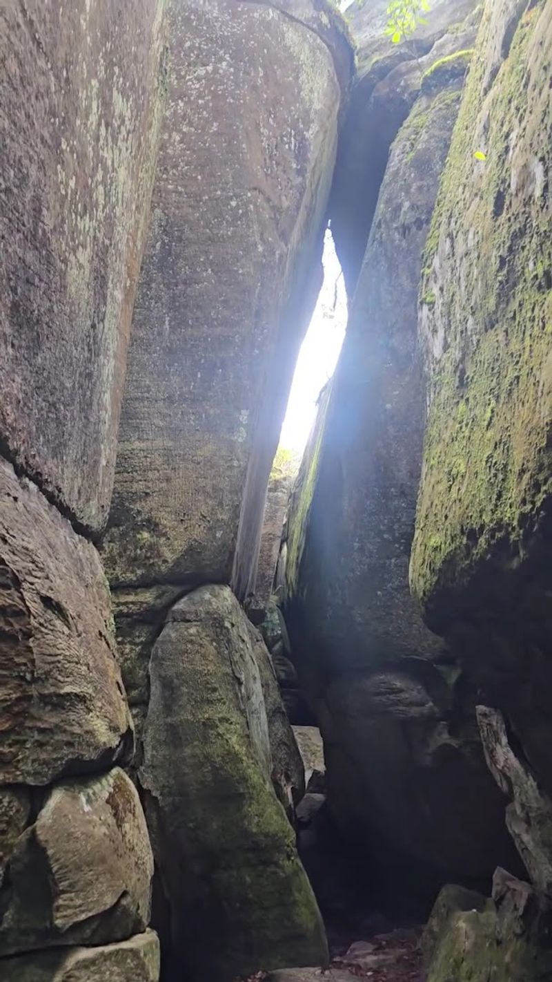
Stepping between the towering sandstone walls feels like walking into a natural refrigerator, and on a warm summer day, that sensation is nothing short of magnificent. The deep crevices block direct sunlight almost entirely, creating a microclimate that runs noticeably cooler than the surrounding mountain air.
This is not just a pleasant bonus; it is a genuine scientific phenomenon worth appreciating.
The persistent shade and moisture trapped within the channels allow mosses and lichens to thrive in thick, velvety layers across every surface. The rock walls glow with shades of deep green, silver-grey, and rust-orange, giving the interior an otherworldly, almost bioluminescent quality in the right light.
Photographers absolutely lose their minds in here, and honestly, rightfully so.
Snow and ice regularly linger inside the deepest crevices long after temperatures outside have climbed well above freezing. This insulating effect makes the channels a genuinely different environment in every season, offering a fresh visual experience whether you visit in summer, autumn, or early spring.
The combination of cool air, textured stone, and living color creates an atmosphere unlike anything else in Virginia. Pausing inside the maze and simply absorbing the sensory details is one of the most rewarding moments this hike has to offer.
Panoramic Views From Middle Knob Summit
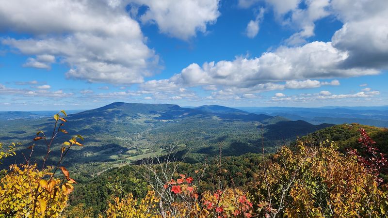
Emerging from the shadowy corridors of the sandstone maze and stepping onto the open summit of Middle Knob is one of those full-body exhale moments. The views are genuinely stunning, unfolding in every direction across a seemingly endless expanse of forested Appalachian ridges and deep mountain valleys.
Virginia’s high country looks impossibly beautiful from up here.
On a clear day, the panorama stretches far enough to pick out distant peaks in multiple directions. Mount Rogers and Whitetop Mountain, Virginia’s two highest summits, are visible on clear days, and the rolling topography between here and there paints a picture of pure Appalachian grandeur.
This is the kind of view that makes the burning legs and muddy boots feel like an absolute bargain.
The rocky outcrops near the summit provide natural seating that might as well have been purpose-built for lunch breaks. Spreading out a snack on a flat boulder with that panorama in front of you is a simple pleasure that somehow feels deeply earned.
Bring more food than you think you need, because the elevation and fresh air have a way of sharpening appetites considerably.
Sunset visits, when the timing aligns with the preserve’s closing hours, cast the entire landscape in warm amber light that makes the sandstone formations glow like embers.
The Historic Hayters Knob Fire Tower
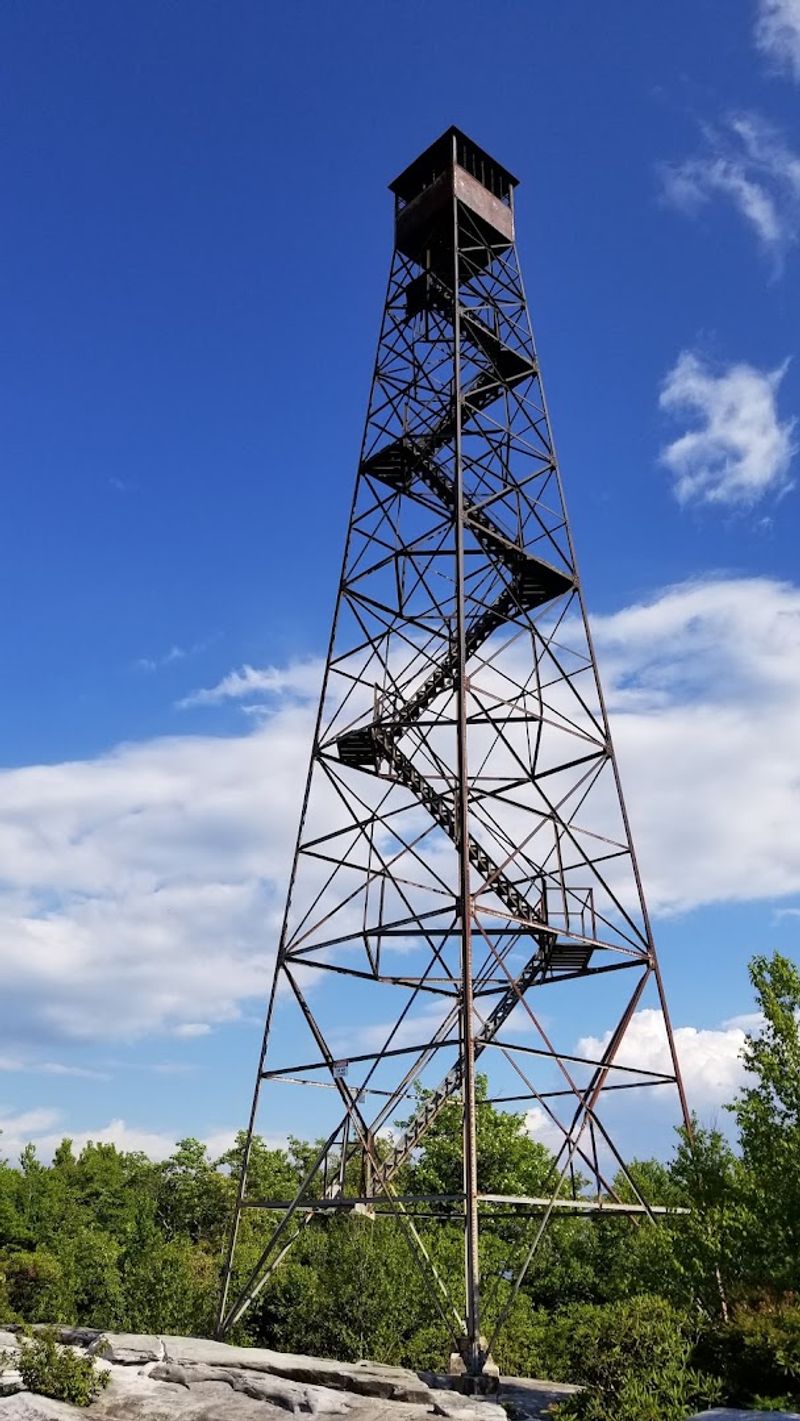
Standing sentinel on the summit of Middle Knob, the old Hayters Knob Fire Tower carries the quiet dignity of something that has seen a great deal of history. Built by Franklin Roosevelt’s Civilian Conservation Corps in 1939, this iron structure served as an active fire lookout for over three decades before being decommissioned in 1970.
It cannot be climbed today, but its presence alone adds tremendous character to the mountaintop scene.
The CCC’s legacy is woven deeply into Virginia’s outdoor recreation infrastructure, and this tower represents one of the more tangible reminders of that era. Reading the interpretive signage near the base connects the landscape to its human history in a way that makes the summit feel like more than just a pretty viewpoint.
There is genuine depth here, both geological and historical.
Photographically, the tower makes for a compelling compositional element against the sweeping backdrop of the Appalachian ridgeline. The weathered metal contrasts beautifully with the organic textures of the surrounding forest and rock formations, and the structure takes on completely different moods depending on the light and season.
Plan to spend a few minutes at the tower before descending into the channels, and take a moment to appreciate the generations of forest rangers who once scanned this same horizon for smoke.
Wildlife and Wildflowers Along the Route
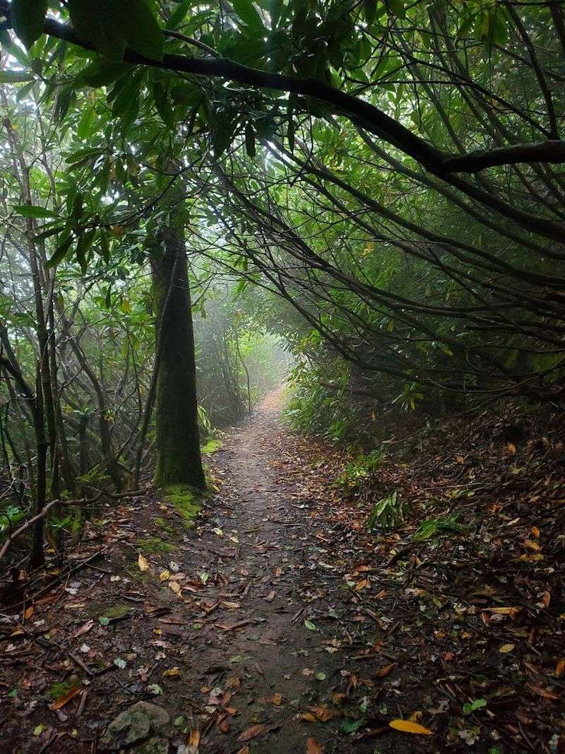
The trail to The Channels Natural Area Preserve is not just a geological journey; it is a full-on immersion in Appalachian biodiversity that rewards patient, observant hikers at every elevation. The forest transitions through distinct ecological zones as you climb, shifting from cove hardwoods in the lower sections to northern hardwood and conifer communities near the summit ridge.
Rhododendron and mountain laurel dominate the mid-elevation sections, and when they bloom in late spring, the trail becomes one of the most visually spectacular walks in all of Virginia. The dense, arching thickets create natural tunnels of pink and white blossoms that feel genuinely magical.
Timing a visit to catch peak bloom is worth planning around if your schedule allows.
Bird activity along the trail is consistently impressive, particularly during spring migration. Scarlet Tanagers flash through the canopy like small flames, and the flute-like call of the Veery echoes through the hollows in early morning.
Ruffed Grouse occasionally burst from the undergrowth, startling even experienced hikers with their explosive wingbeats.
Black bears are present in this part of Virginia, so maintaining awareness and making moderate noise on the trail is simply good practice. Rare plant species also find refuge within the preserve’s protected boundaries, making every careful step feel like an act of ecological respect.
Practical Tips for a Smooth Adventure
A hike this rewarding deserves proper preparation, and a few practical details can make the difference between a triumphant adventure and a miserable slog. Water is the single most important item to pack, full stop.
There are zero water sources along the trail, and the elevation gain combined with mountain air will deplete your hydration faster than expected.
Trekking poles earn their keep on this particular route, especially on the descent from the summit back through the rocky, root-laced terrain. Hikers with knee sensitivities should absolutely consider bringing poles and wearing supportive braces.
The downhill sections are manageable but demand attention, particularly in wet conditions when exposed roots and sandstone surfaces become genuinely slippery.
Bug repellent belongs in your pack from late spring through early fall, with mosquitoes reportedly fierce in July and bees abundant during rhododendron bloom. Neither poses serious danger, but both can significantly affect your enjoyment of an otherwise perfect day.
The preserve operates daily from 6 AM to 5 PM, so plan your start time to ensure a comfortable return before closing. Arriving before 9 AM on weekends virtually guarantees a parking spot.
Downloading an offline map before leaving cell service range is a genuinely smart move, as connectivity on the upper mountain is unreliable at best.
Plan Your Visit to The Channels Natural Area Preserve
Planning a trip to The Channels Natural Area Preserve is genuinely straightforward once you know the key details, and the payoff for a well-organized visit is enormous. The preserve sits in Washington County, Virginia.
It is tucked into the dramatic topography of Clinch Mountain near the small community of Rosedale.
The surrounding region is classic southwest Virginia countryside. It’s full of quiet roads, forested ridgelines, and the kind of unhurried atmosphere that makes you breathe more deeply the moment you arrive.
The most popular trailhead, accessed via Hayters Gap Road, is the logical starting point for most visitors. GPS coordinates of 36.8704, -81.9786 will place you accurately on the map, and the address 4250 Hayters Gap Road, Saltville, Virginia works reliably for most navigation apps.
Remember, only ten marked parking spots are available, and roadside parking is strictly enforced with towing.
Autumn is an exceptional time to visit, when the hardwood forest ignites in full fall color and the cooler temperatures make the climb genuinely comfortable. Spring rhododendron season runs a close second for sheer visual drama.
The Channels Natural Area Preserve is managed by the Virginia Department of Conservation and Recreation, and admission is completely free. Pack your curiosity, respect the leave-no-trace principles, and go find your own favorite corner of this extraordinary sandstone world.
