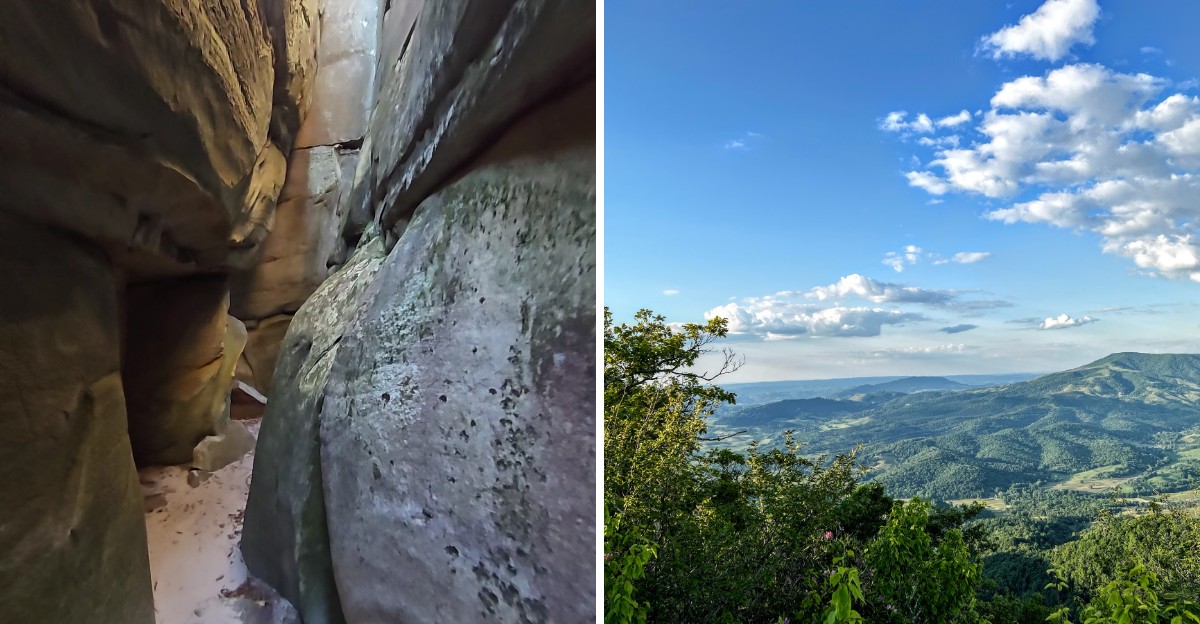
Some trails feel like a walk through the woods. This one feels like a journey into another world.
The sandstone maze at the end of this Virginia trail is 400 million years old, and walking through it is an experience that is hard to describe without sounding like you are exaggerating. The rocks are weathered into shapes that seem almost deliberate.
The passages narrow and widen without warning. The light shifts as you move, changing the way everything looks.
It is not a long hike, but it is not easy either. There is some climbing and some scrambling, and you should be prepared for uneven footing.
The payoff is worth it. The maze is unlike anything else in the state, and the surrounding views are impressive.
If you are looking for a hike that feels like an adventure rather than a stroll, this Virginia trail delivers. Bring sturdy shoes and a camera.
You will want to remember this one.
A Stone Labyrinth Older Than Dinosaurs
Long before any dinosaur stomped across the planet, the sandstone here was already taking shape. Geologists date the rock to roughly the Silurian era, which makes it wildly old by any measure.
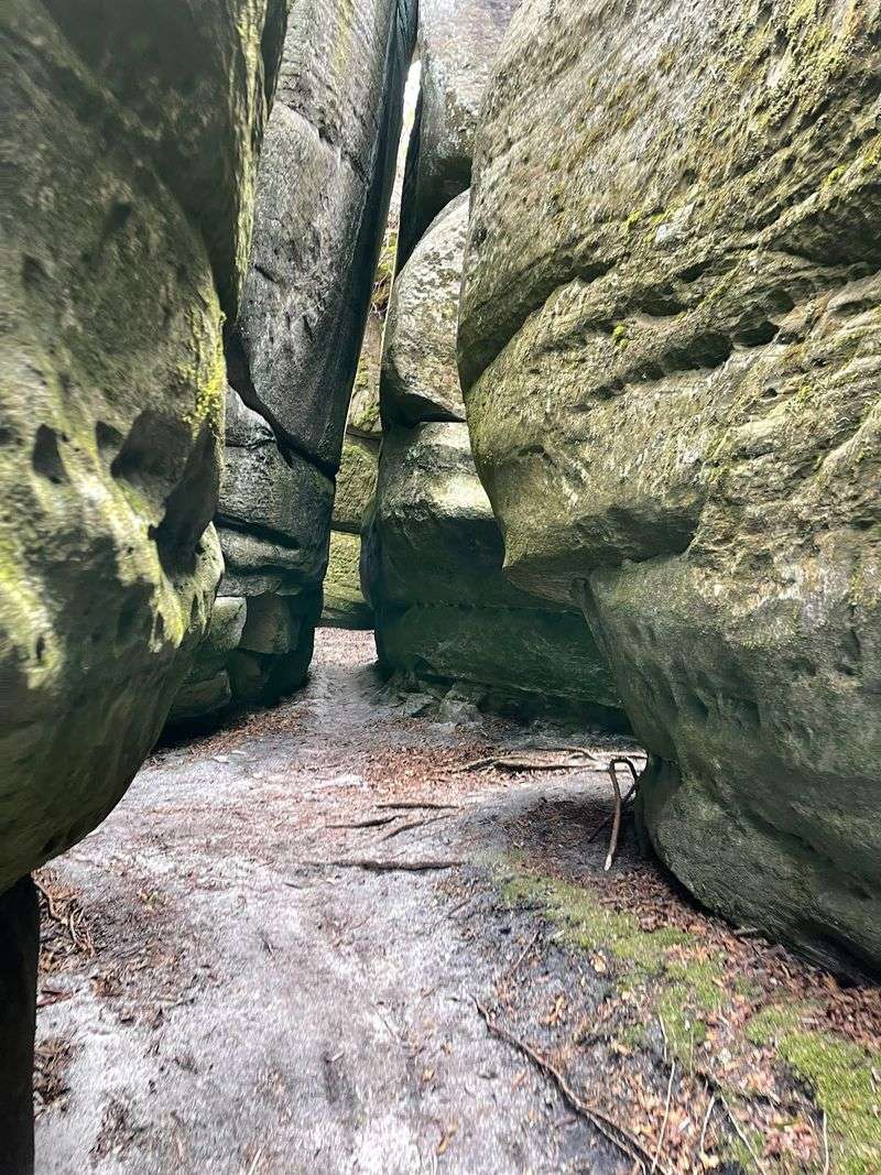
The Channels Natural Area Preserve protects this ancient maze on the crest of Clinch Mountain. Picture tall slabs of rock split apart by narrow corridors, some barely wide enough for your shoulders.
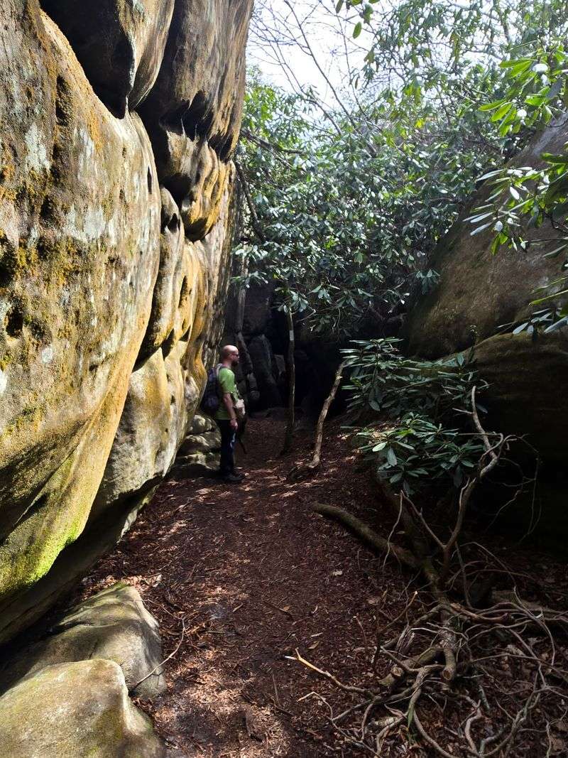
Moss coats the walls, ferns poke out of cracks, and the air feels cooler the deeper you wander.
How did it form? Scientists believe the rock cracked during cold periods of the last Ice Age, when freezing and thawing pried the stone apart.
Over thousands of years, those cracks widened into the passageways you see today.
Walking through feels a bit like stepping into a storybook. One turn opens to blue sky, while the next drops you into shadowy, quiet halls of stone.
Bring curiosity and a good sense of direction. The paths twist and loop, so it is easy to lose track of where you entered.
Kids and grown-ups alike tend to turn into explorers here. Honestly, it is hard not to feel like the hero of your own fantasy adventure.
Why Your Alarm Clock Matters Most
Sleeping in is the fastest way to miss out. The parking area for The Channels Natural Area Preserve is a small pull-off along Route 80, and it only holds a handful of cars.
Rangers enforce the limit seriously. Parking along the road is not allowed, and vehicles that break the rules can be ticketed or towed.
That sounds strict, but it keeps the trail peaceful and never jammed with crowds.
So what is the smart move? Arrive early in the morning, especially on sunny weekends.
Weekdays are even better if your schedule allows it.
Got a group? Carpool, because every seat counts when space is this tight.
Showing up with four cars for four friends is a recipe for disappointment.
If the lot is full, you can wait for someone to finish their hike and leave. Packing a book or a snack for the wait keeps the mood cheerful.
A backup plan also helps. The surrounding Saltville area has other scenic spots, so a full lot does not have to ruin your day.
Think of the tiny lot as a bouncer at an exclusive club. Get there first, and the whole mountain feels like your private hangout.
Trust the Saltville Address, Not Your Gut
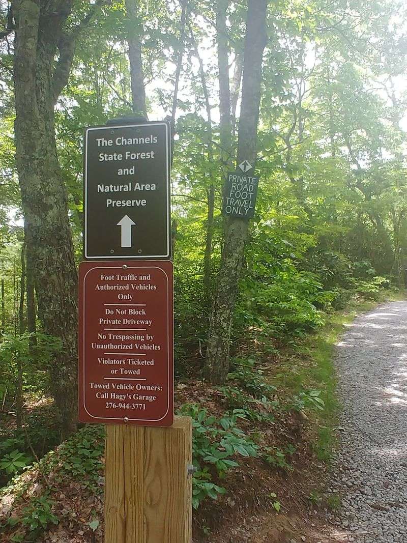
Navigation apps can play tricks on you around here. There is another access point to the larger Channels area near Rosedale, and some GPS directions send hikers there by mistake.
Your best bet is to plug in the preserve name tied to the Saltville location. The correct trailhead sits right beside State Route 80, also called Hayters Gap Road.
Here is a quick sanity check. If your map is steering you down a long, bumpy gravel road to reach the parking, something is off.
The real lot is a pull-off directly on the paved highway.
Cell service in these mountains can fade in and out. Download offline maps before you leave town, and screenshot the directions just in case.
Getting lost on a rural Virginia back road is a classic rite of passage, sure. Still, burning an hour on the wrong side of the mountain might cost you a parking spot.
Double-checking the route takes two minutes at home. That small effort saves a lot of frustration and keeps your adventure on track.
Once you spot the trailhead sign and kiosk, take a deep breath. The hard part of finding it is over, and the fun is about to begin.
The Gravel Warm-Up Act
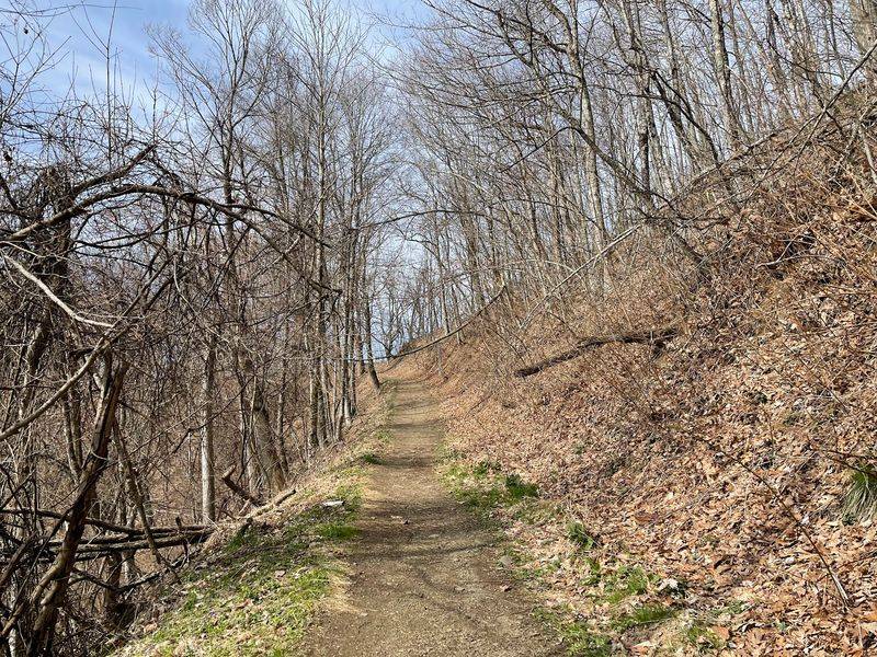
Every great show has an opening act, and this one is made of gravel. The first stretch of the hike follows an old road bed that climbs steadily through the woods.
Let’s be honest, it is not the most thrilling part. Loose stones crunch under your boots, and the scenery stays fairly similar for a while.
Still, there is a bright side. The wide path makes chatting with friends easy, and it gives your legs a chance to warm up before the real climb.
Footwear matters a lot here. Sturdy hiking shoes with good grip will keep your ankles happy on the rocks.
Thin sneakers can leave your feet sore by the halfway mark.
Got a dog tagging along? Little paws may find the sharp gravel uncomfortable, so keep an eye on your pup and take breaks.
The total out-and-back trip runs several miles with steady elevation gain. Plan for a good chunk of your day, and do not rush.
Think of this section as the trailer before the movie. It might feel slow, but every step brings you closer to the stone wonderland waiting up top.
Climbing Into Cooler Air
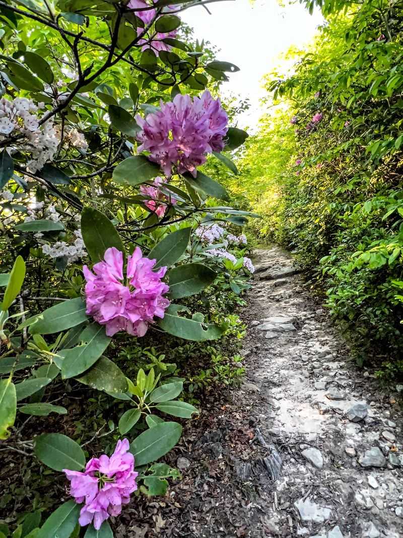
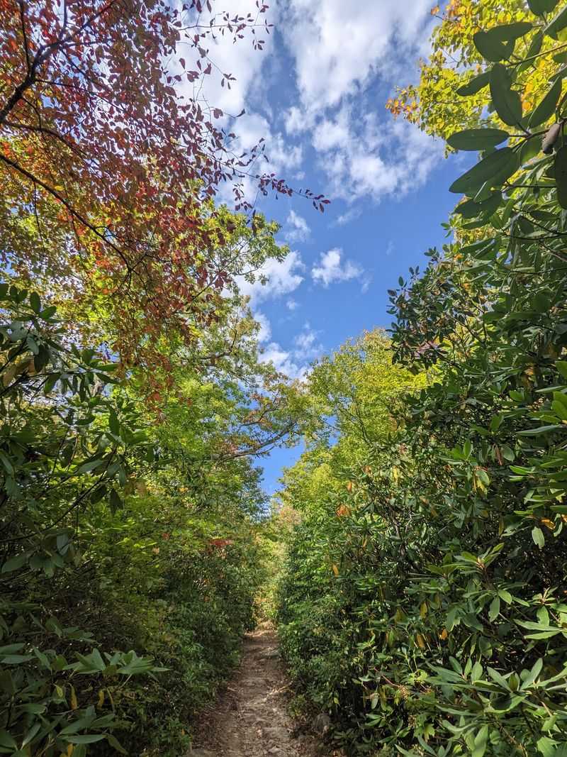
Huffing and puffing is part of the deal. Once the gravel ends, the path turns into a well-kept footpath that keeps heading uphill toward the ridge.
Most of the climb is steady rather than brutal. A short section gets noticeably steeper, so slow down and find a comfortable rhythm.
Watch your step in autumn. Fallen leaves love to hide rocks and roots, turning an easy stride into a surprise stumble.
Good news arrives as you gain height. The air often feels cooler near the top, which is a real treat on a sticky summer day.
Trail markers are fairly clear, so following the route is not tricky. Near the upper section, the trail splits, and the Channels Spur Trail leads you toward the rock maze.
Pace yourself and drink water often. Hydration breaks double as perfect moments to look back and see how far you have climbed.
Hikers of many ages and fitness levels make this trip. With patience and good shoes, the uphill push becomes less of a battle and more of a satisfying challenge you will brag about later.
Saluting the Old Fire Tower
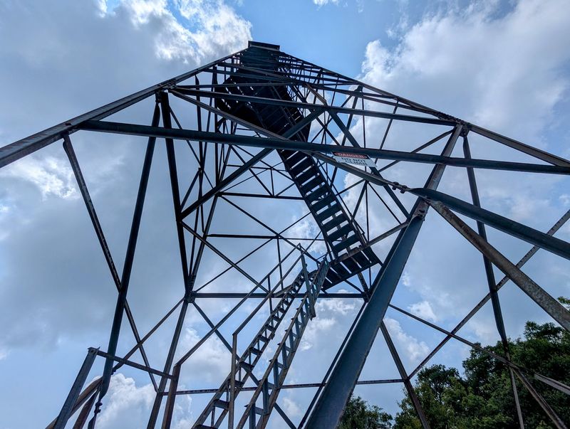
Rising above the treetops like a rusty sentinel, the old Clinch Mountain fire tower marks your arrival near the top. You will pass beneath it on the way to the maze.
Fire towers once played a big role in protecting forests. Lookouts would watch for smoke and send warnings before small blazes became disasters.
Tempted to climb it? Please don’t.
The trailhead information makes clear that the tower is off limits, and safety rules exist for a reason.
Admiring it from the ground works just fine. The steel frame against the sky makes a striking photo, especially with puffy clouds drifting behind it.
Here is a handy clue. The rock channels begin just past the tower, so seeing it means your big reward is moments away.
Pause for a snack and a stretch nearby. Your legs have earned a breather, and the excitement of what comes next deserves a fresh burst of energy.
Somehow the tower adds a touch of mystery to the scene. Standing beside a relic of mountain history before stepping into an ancient maze feels like walking through layers of time.
Getting Gloriously Lost Among the Boulders
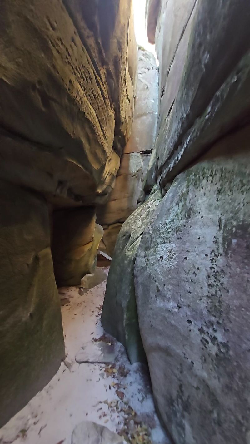
Here comes the magic moment. Stepping into The Channels Natural Area Preserve’s rock maze feels like crossing into another world entirely.
Corridors split, turn, and connect in surprising ways. Some passages open wide, while others squeeze so tight you might turn sideways to slide through.
It is not technically a deep slot canyon like those out west. Even so, the twisting walls deliver that same thrilling sense of discovery.
Take your time exploring every corner. Many hikers spend a good while wandering, and there is always another nook waiting around the bend.
Safety deserves a quick word. Around the top, deep openings drop into the crevices, so watch where you place your feet and keep little ones close.
Wet rock can be slick, too. Skipping the trip right after heavy rain makes the scramble much safer and more fun.
My honest favorite part is looking up from a narrow passage and seeing a slice of bright sky framed by stone. That view alone makes the long climb feel worth every sweaty step.
Treat the maze like a giant playground, but respect it like a museum.
Views That Steal Your Breath Twice
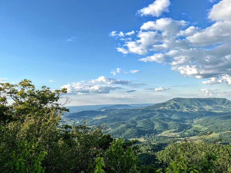
Your lungs already worked hard on the climb, and now the scenery takes another shot at them. On clear days, the views around the summit stretch over rolling Southwest Virginia ridges.
Layers of blue mountains fade into the distance like waves frozen in place. Valleys and farmland tuck between them, painting a peaceful picture.
Timing changes everything here. Crisp autumn mornings often bring sharper views, while hazy summer afternoons soften the horizon into dreamy shades.
Bring a picnic to enjoy the scene properly. A sandwich tastes far better with a mountain panorama as your dining room.
Leave no trace behind, though. Pack out every wrapper and bottle so the preserve stays beautiful for the next adventurer.
Photographers, prepare for a field day. The contrast between gray stone, green moss, and wide blue sky makes almost every frame look like a postcard.
Linger as long as your schedule allows. Moments like this, sitting high above the world with nothing but wind and birdsong, are exactly why people lace up hiking boots in the first place.
Wildflowers, Chipmunks, and Seasonal Surprises
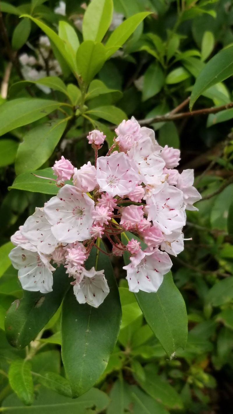
Nature puts on a different costume every few months at this preserve. Each season brings its own reason to visit.
Spring may be the showstopper. Around late April and early May, flowering trees can bloom along parts of the trail, creating a colorful tunnel overhead.
Summer brings deep green shade and that welcome cooler air near the ridge. Fall follows with fiery reds, oranges, and golds splashed across the slopes.
Keep your eyes peeled for wildlife. Deer, chipmunks, and a chorus of songbirds call these woods home, and quiet hikers often spot them.
The plant life is fascinating too. Mosses, ferns, and unusual growth cling to the rocky habitat, which is part of why the area is protected as a natural area preserve.
Respect the creatures you meet. Watch from a distance, skip feeding animals, and stick to marked paths so delicate plants can thrive.
Winter visits are possible, but ice and snow can make the rocks risky. Check weather forecasts carefully before heading out in colder months.
Pick your season, and the mountain will happily show off.
Pack Smart and Point Your Wheels to Saltville
Preparation turns a good hike into a great one. Plan on spending several hours on the trail, especially if you love poking around the maze.
Water is your best friend. Carry more than you think you need, since there are no refill stations along the route.
Snacks keep energy levels up for the climb back down. Trail mix, fruit, and sandwiches all travel well in a daypack.
Visit a restroom before you start, because facilities are not available at the trailhead. Comfortable layers help too, since the temperature can shift as you climb.
Sturdy shoes, a small first aid kit, and a charged phone round out the essentials. Download offline maps before signal disappears.
Ready to see it for yourself? The Channels Natural Area Preserve sits at 4250 Hayters Gap Rd, Saltville, VA 24370.
The Virginia Department of Conservation and Recreation manages the site and shares helpful updates online.
Honestly, I think every Virginia adventurer owes themselves this trip at least once. So grab your boots, set that early alarm, and go find your own wardrobe door.
The ancient maze is waiting, and it has been patient for a very, very long time.
