A 511-foot railroad tunnel from 1899 sits in the middle of the woods, and you can pedal straight through it. No train ticket required, just a bike and a little nerve in the dark.
That tunnel is one of two on a single West Virginia path. The route also crosses dozens of bridges and drops 732 feet so gently you barely notice.
Start at the right end, and gravity does a quiet favor for your legs all day.
I like how this place mixes old railroad grit with river scenery. Black bears roam nearby.
Cell service often vanishes, which sounds scary until you realize nobody can email you.
I can’t imagine a better excuse to unplug for a weekend. So where exactly does this old line run, and which end should you start from?
An Old Freight Line Turned Into A 78-Mile Backyard
Seventy-eight miles is a long way to wander without a single traffic light. The Greenbrier River Trail stretches that full distance between Cass and North Caldwell in West Virginia.
It runs as a lineal state park, which basically means a park shaped like a ribbon. The West Virginia state park system manages it, and the route passes through Pocahontas and Greenbrier counties.
The river stays close for much of the ride. You can follow its bends for hours, with farms, woods, and mountains taking turns in the scenery.
Hikers, cyclists, and horseback riders all share the path. In winter, ski-touring joins the list when snow cooperates, which adds a fun twist to a summer favorite.
Marlinton is the largest town sitting directly on the trail. It makes a handy home base, with places to eat, sleep, and restock before heading back out.
The surface is mostly hard-packed crushed limestone. Some stretches feel rougher, while about four miles through Marlinton are paved.
For parents planning a getaway, that variety matters. You can choose a short family spin or a multi-day adventure for yourself, all on the same easygoing grade.
Timber, Coal, And The Railroad That Built The Route
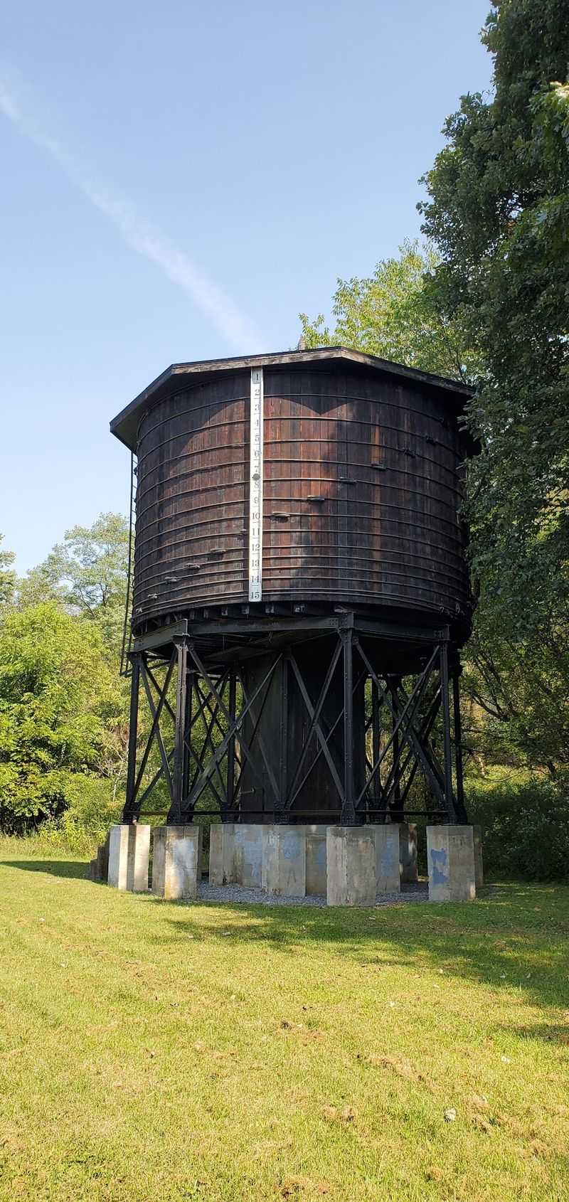
Long before bikes rolled here, steam trains hauled timber out of these hills. The Chesapeake and Ohio Railway built its Greenbrier Division in the late 1890s, finishing around 1900.
The line carried timber, coal, and other goods from this rugged region. Little towns along the river grew up with the rhythm of the railroad.
Then the timber boom faded. Freight traffic slowed after World War II, and the C&O ended operations on the line in the late 1970s.
Here is the happy part of the story. The tracks came up in 1979, and the right-of-way was donated to the State of West Virginia.
The old railbed reopened as a recreational trail in 1980. A major flood in 1985 caused serious damage, but repairs brought the path back to life.
Plenty of folks who grew up around Pocahontas County may still remember the trains. Today, interpretive signs and historical markers keep that heritage visible along the way.
I love that the route never really stopped working. It just traded lumber cars for families, anglers, and riders who are happy to move a lot slower.
Two Century-Old Tunnels Waiting In The Woods
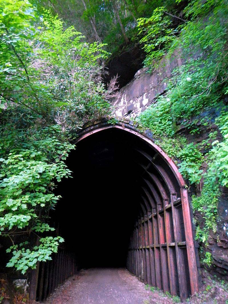
Few trails can brag about a tunnel older than most family photo albums. The Greenbrier River Trail has two of them.
Sharps Tunnel stretches 511 feet and dates to 1899. It sits roughly ten miles north of Marlinton, so it makes a fine goal for a half-day ride.
Droop Mountain Tunnel follows close behind in the history books. It measures 402 feet and was built in 1900.
Both tunnels come straight from the railroad days. Workers carved them so trains could cut through stubborn ridges instead of curving around them.
Riding through feels like a small adventure. The light at the far end gives the trip a storybook moment that kids and grown-ups both enjoy.
A small light is a smart idea for the darker stretch. Your eyes will thank you, and so will anyone riding toward you.
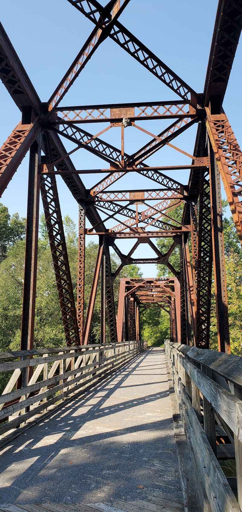
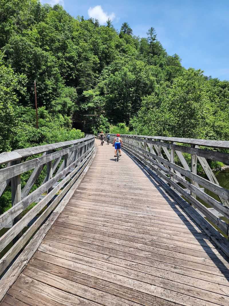
Bridges add even more drama to the route. The trail crosses roughly 35 to 37 of them, many with river views that beg for a quick stop.
Between tunnels and trestles, the old engineering steals the show. Snap the photo, then keep pedaling toward the next one.
Start In Cass And Let Gravity Do The Work
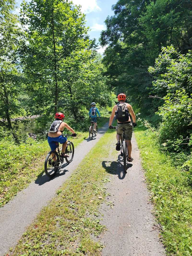
Direction matters more than you might expect on this trail. The route drops 732 feet from north to south, spread across all 78 miles.
That works out to a soft downhill when you begin at Cass. Most riders barely feel the slope, but tired legs notice the difference by afternoon.
Going the other way is a different story. Heading north means a slow, steady climb, and it can wear down young riders faster than parents plan for.
Picking the right starting point is the easiest win of the trip. It costs nothing, and it keeps everyone in a much better mood.
Cass sits at the northern terminus, near Cass Scenic Railroad State Park. North Caldwell anchors the southern end, a few miles from the services in Lewisburg.
Shuttles and car swaps can help with one-way rides. Some riders simply pick an out-and-back segment instead, which keeps things flexible.
For a family, a short downhill chunk can feel like a victory lap. For adults, the full run makes a satisfying multi-day challenge without brutal climbs.
Either way, plan the route before you unload the bikes. Your future self will be very grateful.
Rods, Paddles, And Swimming Holes Along The River
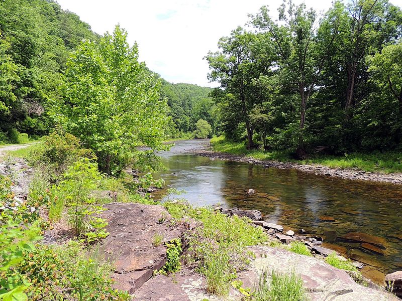
Bring a fishing rod and the trail suddenly doubles as a river access road. The Greenbrier River runs beside the path for much of its length.
Fishing, canoeing, and swimming are all popular here. It’s easy to park the bikes, grab a snack, and scramble down to the water.
That mix makes the trail more than a workout. You can spend a morning riding and an afternoon cooling off in the river.
Parents especially might appreciate the variety. One person can cast a line while another reads on the bank, and nobody feels shortchanged.
The river also sets the mood for the entire ride. Its bends and shallow riffles keep the scenery changing from mile to mile.
Fall brings bright leaves, while summer offers shady stretches and inviting water. Each season shows off the valley a little differently.
A spring event adds even more fun. A mini triathlon with kayaking, biking, and running is held on the last Saturday in April to help raise money for trail maintenance.
Paddle, pedal, and run for a good cause. That’s a pretty great way to say thanks to the trail.
Campsites, Shelters, And Bears Who Like Snacks
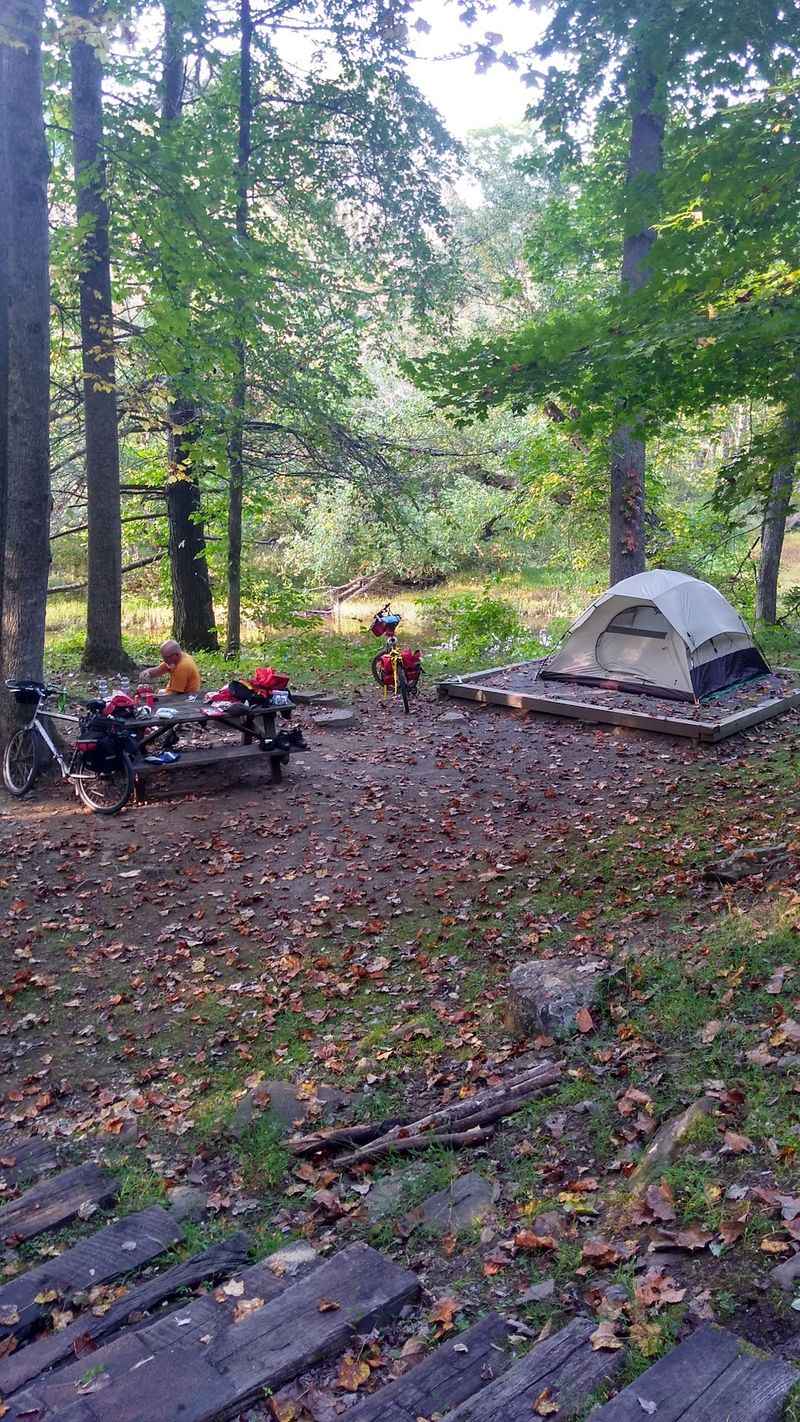
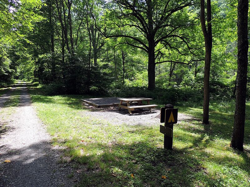
Sleeping beside an old railroad line sounds romantic, and it can be surprisingly simple. The trail offers 16 primitive campsites along the way.
Some include three-sided shelters for extra cover. Many sites also provide restrooms and water, which makes overnight trips far easier to plan.
Around 50 to 60 picnic tables dot the route too. That means lunch with a river view is rarely far off.
Now for the neighbors. Black bears are a common sight along the trail, so careful food storage is a must.
Pack snacks in sealed containers and keep a clean camp. Bears are curious, and a forgotten granola bar counts as an invitation.
Other wildlife shows up as well. Deer, birds, and plenty of forest critters add to the feeling of being far from town.
Parts of the trail lie within the National Radio Quiet Zone. Cell service may disappear completely, so download maps and share plans ahead of time.
Honestly, the silence is part of the charm. A night under the stars with no buzzing phone might be the best reset in West Virginia.
State Parks And Trail Towns Worth A Detour
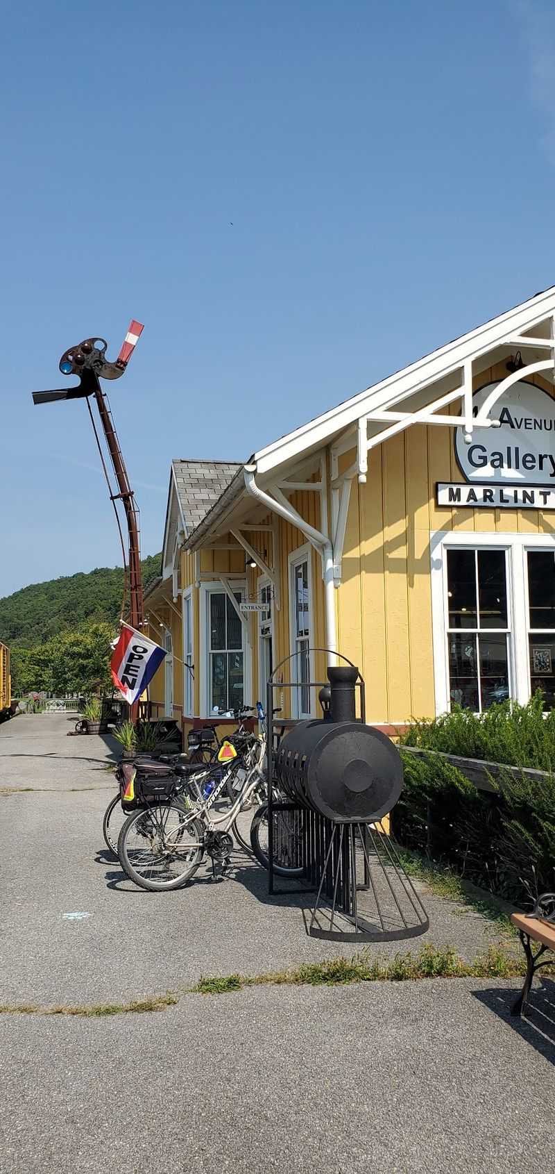
Few trails come with this many neighbors worth meeting. The route passes through or near Watoga State Park, Cass Scenic Railroad State Park, and Greenbrier State Forest.
Seneca State Forest and Calvin Price State Forest sit nearby as well. That’s a lot of protected land for one weekend.
Cass makes a natural bookend for railroad fans. The scenic railroad park keeps the region’s train story rolling in a very literal way.
Marlinton deserves time too. As the largest town on the trail, it offers lodging and resupply, plus bike rentals that make spontaneous rides easy.
Seebert and Renick also serve as useful stops. Each gives you a chance to refuel and refill bottles before the next stretch.
The trail has 14 designated trailheads in total. Main access points sit in Cass, Marlinton, Seebert, Renick, and North Caldwell.
Lewisburg, a few miles from the southern end, adds more services. It’s a handy place to finish a long ride with a hot meal.
For budget-minded families, so many access points help a lot. You can choose short segments, skip pricey gear, and still enjoy a full adventure.
Honors, Hours, And A Few Smart Planning Notes
Awards tend to stack up on a trail like this. The Greenbrier River Trail was named a Millennium Legacy Trail and joined the Rails to Trails Conservancy Hall of Fame.
Backpacker Magazine rated it among the top 10 hiking trails in the United States in 2012. It also became a National Recreation Trail in 2021.
The trail is generally open year-round from 6 a.m. to 10 p.m. Management information is tied to 4800 Watoga Park Road, Marlinton, WV 24954.
Check closures before you go. Bridge redecking work has temporarily shut sections between Seebert and Buckeye, and between Stillwell Park and Marlinton.
Those closures cover all activities, including hiking, biking, and horseback riding. Crews need the space, so plan around them.
Bring layers, water, and a light for the tunnels. Cell service may fade, so offline maps are smart.
So is it worth the trip? For anyone craving quiet miles, river views, and a dose of West Virginia railroad history, I believe the answer is an easy yes.
Start at Cass, pack the snacks carefully, and let the old C&O line lead the way.
