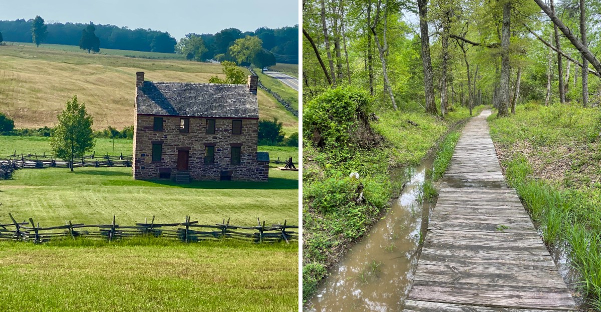
A plan once called for 37 data center buildings right next to a famous battlefield. Together they would have covered more than 22 million square feet and needed 14 electrical substations.
That’s a lot of humming boxes beside fields where soldiers clashed in 1861 and 1862.
Neighbors in Virginia didn’t shrug it off. Homeowners, preservation groups, and regular residents fought the plan in meetings and in court.
One county hearing ran about 27 hours, which sounds exhausting even with snacks.
I like how this story ended. A court ruled the rezoning void, and the last developer dropped its appeal in July 2026.
The fields stayed open, the trails stayed quiet, and the history stayed put.
I believe that makes this park even more worth a visit now. So what exactly did all those people save?
The Plan Was Big Enough To Make Your Electric Bill Nervous
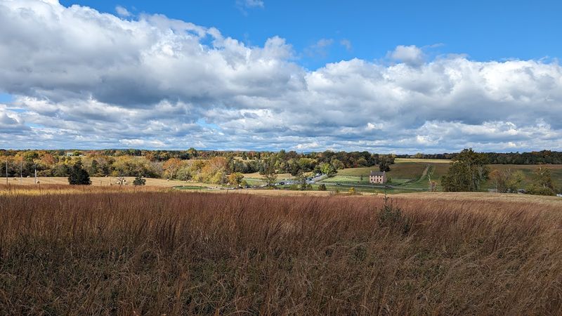
Nine gigawatts of electricity. That was the estimated appetite of the Prince William Digital Gateway, a project planned right beside Manassas National Battlefield Park in Virginia.
Developers wanted up to 37 data center buildings on roughly 2,100 acres along the Pageland Lane corridor. Some reports put the land closer to 1,750 acres, but either way, it was huge.
Supporters expected it to become the largest data center complex anywhere on the planet. The buildings would have totaled more than 22 million square feet of space.
The site also needed 14 on-site electrical substations to keep everything running. That’s a lot of steel and wiring for land bordering quiet, historic farm fields.
Two companies led the charge. Quality Technology Services, known as QTS and owned by Blackstone, partnered with Compass Datacenters on the plan.
Data centers store the photos, videos, and apps we all use every day. So the need is real, and Northern Virginia already hosts plenty of them.
The big question was location. Many residents felt a battlefield edge was simply the wrong spot for a project this massive, and they weren’t shy about saying so.
A 27-Hour Meeting Proved These Neighbors Meant Business
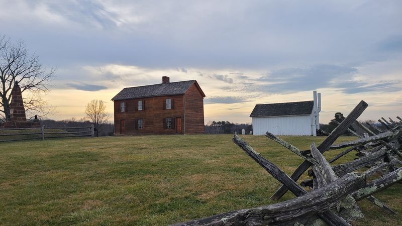
Most public hearings wrap up before dinner gets cold. The one held by the Prince William County Board of Supervisors in December 2023 lasted about 27 hours.
Residents lined up to speak for and against the rezoning. When the marathon finally ended, the board approved it by a narrow 4-3 vote.
That vote followed an earlier change to the county’s comprehensive plan in November 2022. On paper, the project now had a green light.
Opponents didn’t fold, though. A wide coalition formed, and it included some serious names in preservation.
The American Battlefield Trust joined in, along with the National Parks Conservation Association and the Piedmont Environmental Council. The Coalition to Protect Prince William County and the National Trust for Historic Preservation stood with them too.
Local homeowners associations played a big role as well. The Oak Valley Homeowners Association became one of the groups pushing back.
I can’t imagine sitting through 27 straight hours of testimony. Still, that kind of stamina says a lot about how much this land meant to the people living near it.
The vote felt like a loss at the time. As it turned out, the story was far from finished.
One Missed Notice Brought The Whole Project Crashing Down
Sometimes the smallest detail wins the day. In this case, it was a public notice that didn’t go out on time.
Lawsuits arrived in January 2024, just weeks after the rezoning vote. The challengers argued the county skipped proper notice and put the historic landscape at risk.
A lower court agreed with the residents. The county then spent nearly two million dollars in taxpayer funds defending its decision.
In March 2026, the Virginia Court of Appeals weighed in with a unanimous ruling. Judges said the rezoning decisions were void from the outset.
The reason came down to timing. The Board of Supervisors failed to give legally required notice before a key rezoning vote.
By April 2026, the county and Compass Datacenters chose not to appeal again. QTS kept going and tried the Virginia Supreme Court.
Then, on July 2, 2026, QTS officially withdrew its appeal. That move ended the Prince William Digital Gateway after years of back-and-forth.
Preservationists celebrated, and honestly, who could blame them? Now the focus has shifted to caring for the Pageland Lane corridor in conservation-friendly ways.
Your Visit Should Start With The Glowing Map Indoors
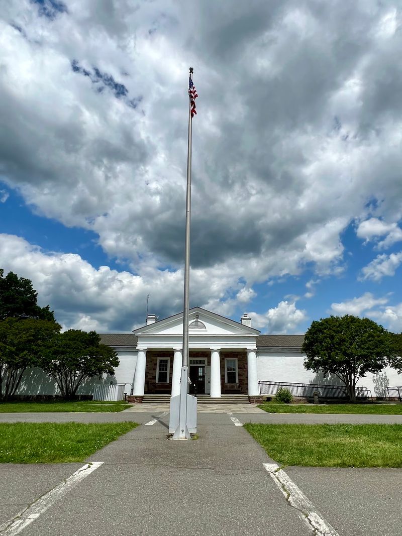
Lights blink across a large map while a narrator walks you through the fighting. That electronic battle map is one of the most popular stops at the Henry Hill Visitor Center.
You’ll find the center at 6511 Sudley Road, Manassas, VA 20109. It sits right on the battlefield, so the real ground is just outside the door.
A small museum fills in the story with displays about both clashes at Manassas. It’s detailed without feeling like a textbook dropped on your head.
There’s also a film of roughly 40 minutes in the theater. Watching it first helps the open fields make much more sense later.
The visitor center typically opens at 9:30 a.m. and closes at 5 p.m. Hours can shift, so a quick check before you go is smart.
Staff members can point you toward trails, tours, and ranger talks. They know this park inside and out.
Think of this stop as your cheat sheet. Spend a little time here, and every cannon and fence line outside will tell you a much clearer story.
A Famous Nickname Was Born On This Very Hill
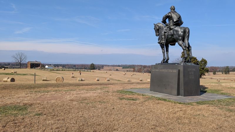
Thomas J. Jackson walked onto Henry Hill as a general.
He walked off with the nickname Stonewall, one of the most recognized in American history.
It happened during the First Battle of Manassas on July 21, 1861. Many folks also know that fight as the First Battle of Bull Run.
Today, a large statue of Jackson on horseback stands on the hill. It’s hard to miss, and it makes a striking photo against the open sky.
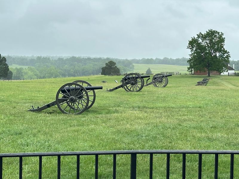
Rows of cannons line the area too. Split-rail fences stretch across the grass, giving the scene an old-fashioned look.
Henry Hill sits right beside the visitor center. That makes it an easy first walk, even for little legs.
Interpretive signs explain who stood where and why it mattered. Reading a few of them turns a pretty field into a real place with real choices.
Here’s a fun detail to share in the car. The two sides often named battles differently, which is why Manassas and Bull Run both show up in history books.
Stand on the hilltop for a minute. The view alone is worth the short stroll.
Old Stone Buildings Are Still Standing After All These Years
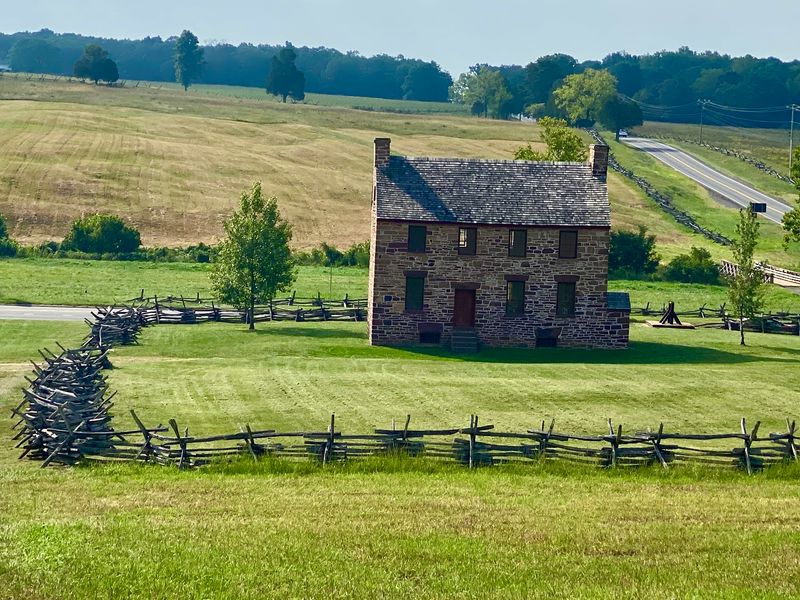
Some buildings have seen a lot. The Stone House at Manassas National Battlefield Park served as a Union field hospital during both battles.
It still stands today, and it’s one of the park’s most recognized landmarks. Its sturdy walls make it look ready for another century.
Not far away, you’ll spot the Stone Bridge. Soldiers blew it up in 1861, and it was rebuilt in the 1880s.
Walking across or near it, you’d never guess it once lay in pieces. The bridge now anchors a pleasant loop trail along the water.
Then there’s the Dogan House. In 1862, Union soldiers used it as a snipers’ nest during the second battle.
These original structures matter because they stayed put while everything around them changed. They give you something solid to connect with the stories.
Kids especially love spotting real buildings from the 1800s. It feels a bit like finding a time capsule in the middle of a field.
Bring a camera and some curiosity. Each building has its own chapter, and together they make the park feel wonderfully real.
Lace Up Because These Trails Go On For Miles
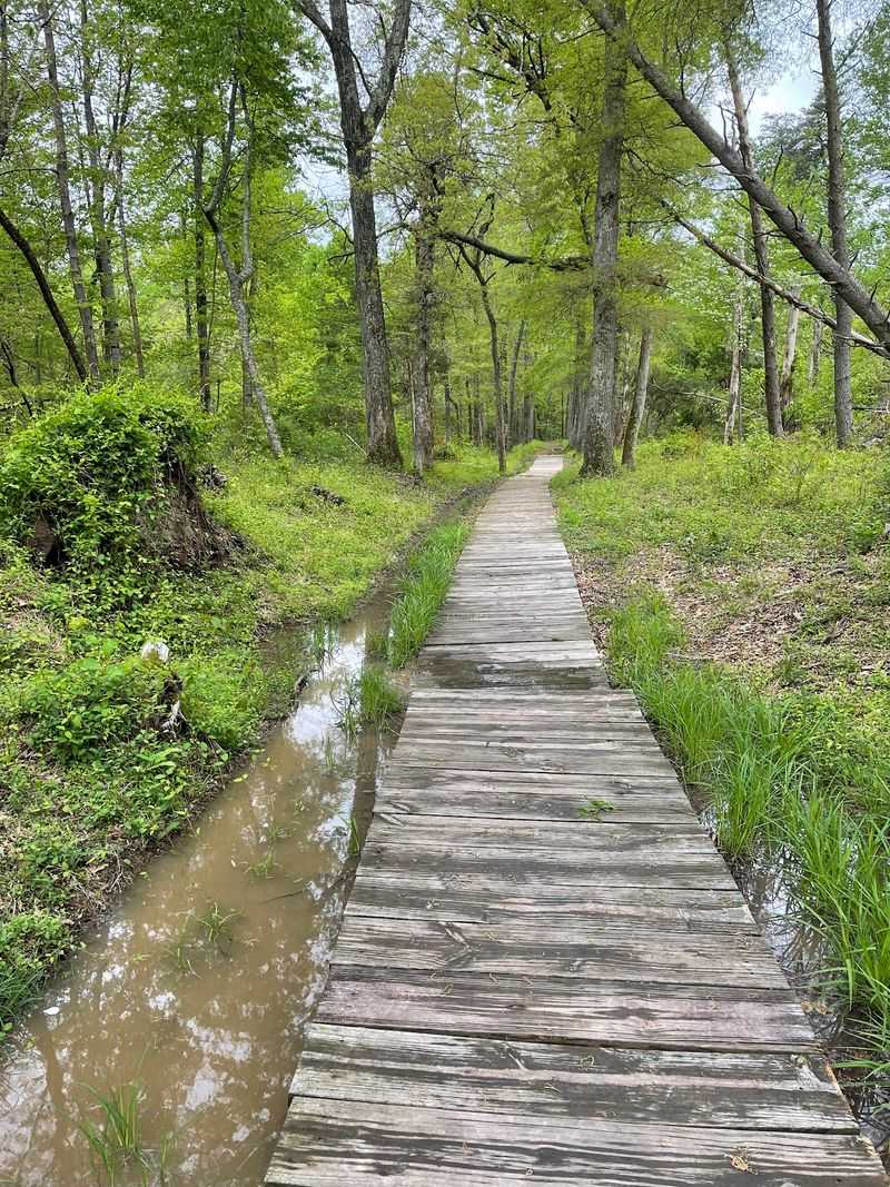
Hikers, rejoice. This park offers walking trails that wind through open meadows, quiet woods, and historic ground.
The First Manassas Trail and the Second Manassas Trail are the big ones. Each covers roughly five to six miles of easy-to-moderate terrain.
Feeling ambitious? You can combine the two for a full day on foot.
Shorter options work well too. The Stone Bridge Loop makes a nice outing when you only have an hour or so.
Horse riders get their own paths as well. Horse trails run through the park, including a long stretch on the southern side.
Not up for a long walk? A driving tour connects key sites, so you can hop out at each stop.
Markers along the routes explain what happened at each spot. It’s basically a history lesson with bonus exercise.
A few practical tips go a long way here. Pack plenty of water, and bring bug spray in summer because mosquitoes love these fields.
Wear comfy shoes, too. The landscape stretches far, and you’ll want to keep going once you start.
Rangers Turn A Quiet Field Into A Story You Won’t Forget
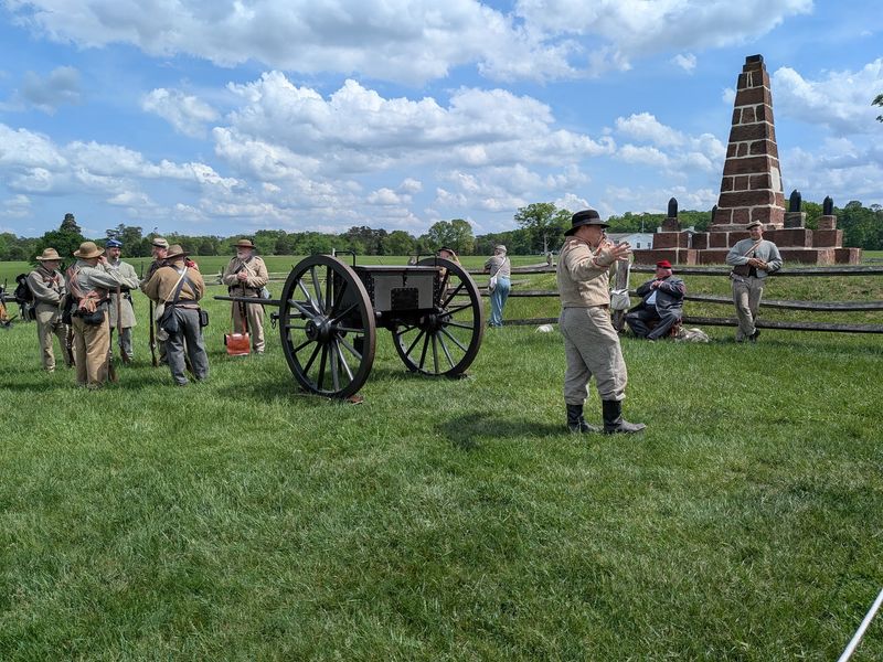
Ask almost anyone about the best way to see this place, and the answer often points to the rangers. Guided walking tours bring the open ground to life in a way signs can’t.
Rangers lead groups across the fields and explain what unfolded at each stop. Their tours make tricky movements and decisions surprisingly easy to follow.
Living history demonstrations add even more color. Costumed interpreters show how soldiers dressed, drilled, and handled their equipment.
Special events pop up during the year too. Horse-drawn artillery demonstrations have rolled across the original grounds, which is quite a sight.
Young visitors can earn a badge through the Junior Ranger program. Scout Ranger activities give scout groups something fun to work toward as well.
Lectures and talks happen throughout the year for curious grown-ups. You’ll leave knowing far more than you expected.
Program schedules change with the seasons. Checking ahead helps you plan your day around a tour or demonstration.
Join even one guided walk if you can. A good ranger can make a calm meadow feel full of voices again.
Plan A Day Here And Thank The Neighbors Who Saved It
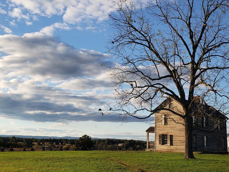
Just under 30 miles from Washington, D.C., Manassas National Battlefield Park makes an easy day trip. That close location is also why developers wanted the land next door.
The park covers more than 5,000 acres in Prince William County, Virginia. It was set aside to protect the ground from two major battles in 1861 and 1862.
The grounds open daily from dawn until dusk. The park closes on Christmas Day, so plan around the holidays.
Picnic areas make lunch simple. Pack a meal, find a shady spot, and enjoy the wide views.
Summer can get hot here. Bring a full water bottle and maybe a small fan, since shade is limited in the open fields.
As you walk, glance toward the western edge near Pageland Lane. That’s the area where the giant data center campus would have risen.
Instead, preservation groups are now working on long-term, conservation-friendly plans for that corridor. The view you enjoy today exists because ordinary people refused to give up.
Not a bad reason to visit. Come for the history, and stay for the quiet that neighbors fought so hard to keep.
