Fenced-off shafts in the ground once swallowed men, mules, and steam engines for decades. The drive up into the mountains promised nothing more than pine trees and a quiet lake, and then a small brown sign pointed me toward something unexpected.
This was the most productive gold mine in California, pulling roughly two million dollars in gold out of the hills between 1870 and 1908. What surprised me most was how peaceful it feels now, with wild turkeys wandering past stone foundations that once held roaring machinery.
A whole town stood here, complete with a school, a store, and a cemetery, and almost all of it has vanished into the grass. An afternoon spent walking the short loops and reading the old photos in the little cabin exhibit passed quickly.
The past and the present share the same ground here, and the quiet makes it easy to imagine what was lost. Old equipment, weathered stone, and openings in the earth offer small clues to the scale of the operation.
It takes only a few steps beyond the lake to realize how dramatically this quiet corner once looked.
A Lost Mule Started the Whole Gold Story
Some of the biggest discoveries happen by accident, and that is exactly how gold turned up here. In March 1870, a farmer named William Skidmore was out hunting for a lost mule in the Cuyamaca Mountains when he noticed a gold-bearing ledge in the rock.
The claim that followed got the name Stonewall Jackson, and soon after, the Hensley Mining District took shape around it.
I love that detail because it makes the whole place feel human rather than heroic. No grand expedition, no map, just a guy looking for his animal and glancing down at the right moment.
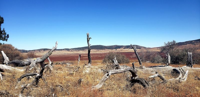
Standing near those rocky slopes today, it is easy to see why the gold hid so long. The hillsides are covered in grass, oaks, and pine, and the quartz veins only show themselves in scattered outcrops.
The geology here is gold-bearing quartz wrapped inside quartz diorite and schist, which is typical for this corner of the mountains.
Reading the interpretive signs first helped me understand what I was seeing later. Without that context, the stone piles just look like stone piles instead of the start of San Diego County’s richest gold story.
Two Million Dollars Pulled From These Hills
Numbers usually bore me, but the totals from this mine stuck in my head all the way home. Between 1870 and 1908, Stonewall Mine produced an estimated two million dollars in gold, making it the most productive gold operation in San Diego County.
That kind of output was not a lucky streak. It came from years of steady, exhausting labor deep underground.
The busiest stretch happened under Robert W. Waterman, who owned the mine from 1886 to 1892.
His years alone accounted for $909,442 in gold, nearly half the mine’s lifetime total.
Between 1888 and early 1892, workers hauled out 57,754 tons of gold ore valued at $906,063.
What I find striking is the contrast between those figures and the silence of the site today. Where crushing machinery once pounded rock into powder, I heard birds and wind in the pines.
Bring a notebook if you like history, because the exhibit cabin has dates and photos worth jotting down. I ended up sketching a rough timeline just so I could picture the busiest years while I walked the trail.
The Governor Who Sank a 600-Foot Shaft
Ownership of the mine bounced around quite a bit in its early years. Almon P.
Frary, Wallace Leach, and Dr. J.R. Fulton all held pieces of it before the most famous name arrived.
Robert W. Waterman bought in during 1886, and he was no ordinary investor.
He served as California’s Lieutenant Governor and later became Governor while owning this very mine.
Under his direction the operation went industrial. A new shaft was sunk past 600 feet, and a 20-stamp mill went up in 1890 to crush ore faster than ever before.
Think about that depth for a second. Six hundred feet is taller than most skyscrapers you have walked past, only pointed straight down into solid rock.
Peering through the fencing at the shaft area gave me a strange, respectful chill. I kept imagining the rattle of cages lowering men into the dark before sunrise.
One review I read mentioned a visitor whose great-great-grandfather managed the mine during Waterman’s ownership. Family ties like that still connect people to these ruins, which makes the place feel less like a museum and more like a neighborhood memory.
When Lake Water Ended the Digging
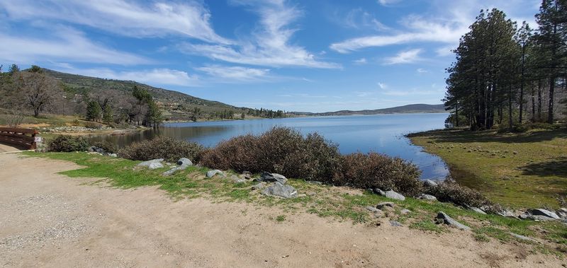
Water, not gold shortage alone, wrote the final chapter here. Operations largely stopped in 1893 once the reachable ore ran out, and flooding made deeper work miserable.
Tunnels had pushed close to nearby Lake Cuyamaca, and in 1892 the workings flooded badly.
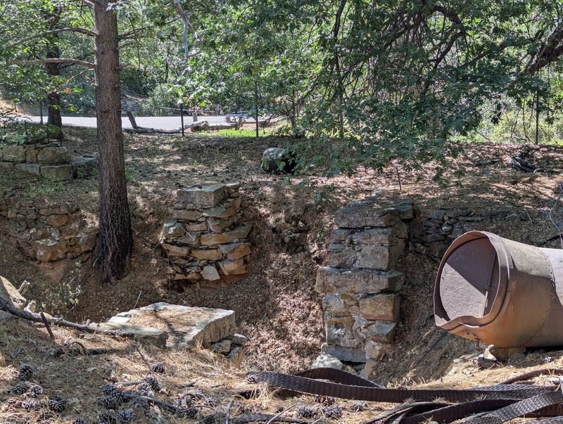
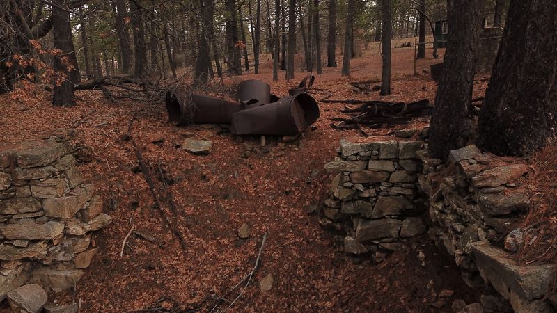
You can still find the stone foundations of the old boiler house and pumping station, which is my favorite part of the whole site. Steam engines once sat there generating power and pumping water out of the shafts around the clock.
Seeing those low stone walls with the lake glinting just beyond makes the cause and effect obvious in a way no textbook could manage.
A later revival attempt came in 1926 from Ralph M. Dyar, who had purchased the property in 1923.
That effort failed and the main shaft collapsed, closing the story for good.
Dyar sold his holdings to the State of California in 1933, which led directly to the creation of Cuyamaca Rancho State Park.
So the mine’s ending gave us the park. That trade feels like a pretty good deal to me.
Cuyamaca City, the Boomtown That Disappeared
Hundreds of people once lived within shouting distance of the shaft, and almost nothing shows it now. The settlement went by Stratton first, then took the name Cuyamaca City as it grew.
Bunkhouses and cabins housed the miners, while a boarding house eventually turned into a hotel for visitors and officials.
There was a superintendent’s house, a school for the children, a library, a general store, and a cemetery. Everyday life happened here, not just labor.
Walking across the open ground, I kept trying to place the school in my head. Kids ran around these hills while their parents worked hundreds of feet underground.
Most of the original buildings came down after Dyar’s 1923 purchase, with the materials reused for his own home. The 2003 Cedar Fire destroyed more of what survived.
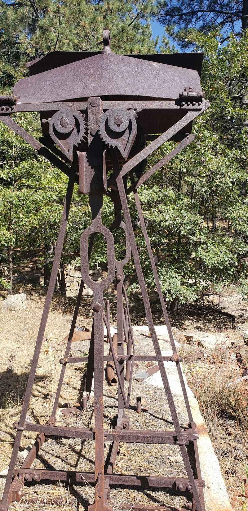
Only some stone ruins and foundations remain, along with scattered machinery and the fenced shaft.
Bring a little patience for this section. The story lives in gaps and faint outlines rather than standing walls, and slowing down is the only way to notice them.
The Little Cabin Museum Worth Twenty Minutes
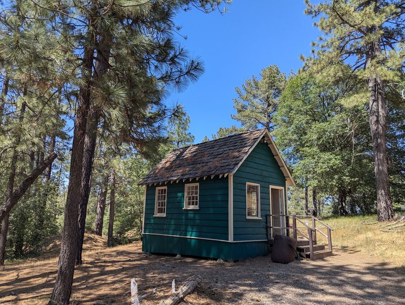
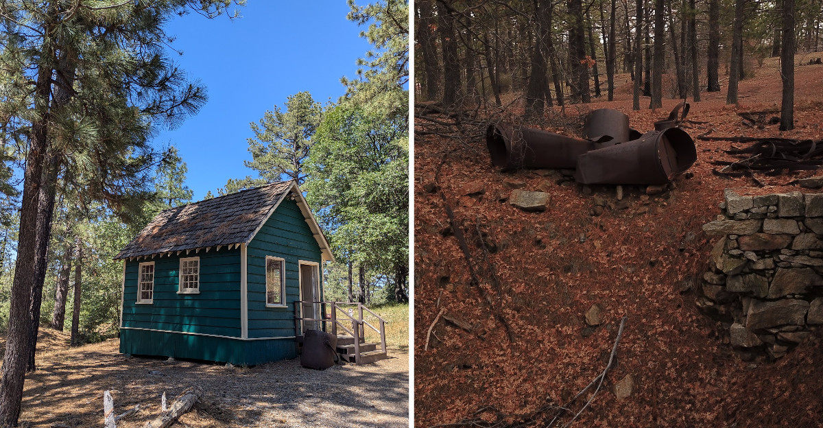
Do not skip the cabin. It looks modest from the outside, and inside it holds old photographs, information panels, and a small diorama that suddenly makes the scattered ruins readable.
I walked in expecting a quick glance and stayed far longer, comparing the old images to the empty hillside outside the door.
Seeing photos of the mill buildings and the town standing tall changes how you look at every stone pile afterward. The diorama especially helped me figure out where things once sat.
Outside there is a parking lot, restrooms, and picnic tables, which makes the whole stop very easy with kids or older family members.
Plenty of visitors treat it as a lunch spot, and honestly that works beautifully. Eating a sandwich at a table surrounded by mining history beats any roadside stop.
Restrooms are not always unlocked, so plan accordingly before you drive up the mountain.
My advice is simple. Read the exhibit first, then walk the loop, because the ruins mean about three times more once you know what used to stand there.
Short Loop Trails, Deer, and Wild Turkeys
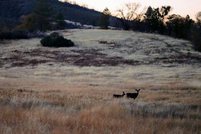
Wildlife stole the show during my visit, which I did not expect at an old industrial site. Mule deer grazed near the meadow edge, and a small group of wild turkeys strutted across the path like they owned the place.
The loop trail here is short and gentle, easy enough for almost anyone.
Paths lead past old shaft entrances and stone remnants, with views stretching toward Lake Cuyamaca. Longer routes connect toward the lake itself if you want more mileage.
Morning is the best time to come, hands down. Sunlight pours across the hills, the air still carries a chill, and the site feels genuinely quiet.
Photographers will find plenty here, from weathered machinery to wide mountain backdrops.
I met no one on the trail for a solid stretch, which is rare so close to San Diego. That solitude is part of the charm.
Bring water, sturdy shoes, and a hat, since shade comes and goes. Stay behind the fencing around the shaft, because these are real mine openings and not decorations.
Address: Cuyamaca Rancho State Park, Julian, California 92036, USA
