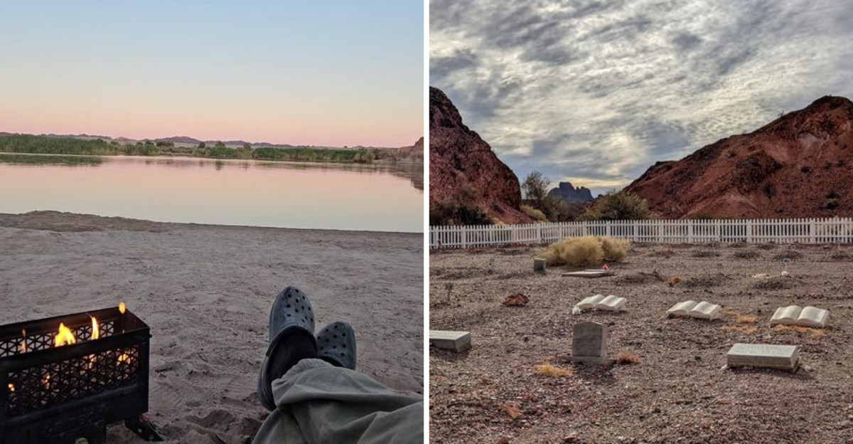
Hand-cut stone walls still stand after more than a century of desert sun, holding the shape of a town that once sat on this quiet bend of the Colorado River in California. I had heard that a whole community used to live here, with stores, schools, and even a polo field, and I honestly had to read it twice before I believed it.
I rattled down miles of dirt road expecting nothing but heat and cactus, then the river appeared like someone had spilled green paint across the sand. What kept me quiet was the old stamp mill, its walls still standing where miners once worked the ore.
There is something about a place that was once loud with hundreds of people and is now loud only with birds and wild burros, the silence carrying more weight than the noise ever did.
I came for the history and left thinking about how fast a whole town can vanish, swallowed by water and time.
The Long Dirt Road That Filters Out Everyone Else
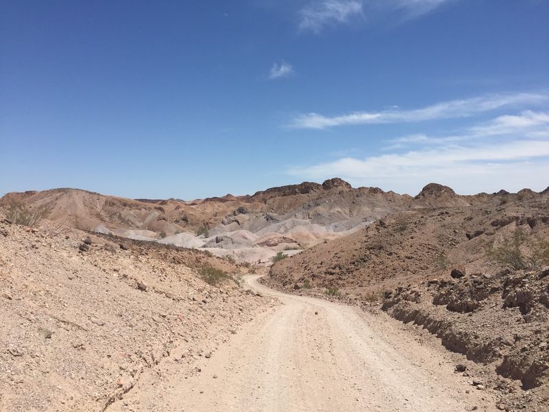
Twenty-one miles sounds like nothing until you are doing it at 15 miles per hour with washboard ruts shaking your mirrors. The first four miles out of Winterhaven are paved and easy, almost misleading.
After that, the pavement quits and the desert takes over completely.
My advice is simple and comes from watching other people learn it the hard way: go slow. Drivers have shredded tires out here, and the roadside sometimes shows evidence of it.
Sandy patches, loose gravel, and shallow washes all show up without warning, so a high clearance vehicle makes life much easier.
Plenty of regular cars do make it to the main campground when conditions are dry and the driver pays attention.
Around mile nine the scenery genuinely changes. Rocky ridges close in, the road starts climbing, and you get long views over volcanic hills that look like crumpled paper.
Cyclists have ridden it too, gaining roughly 1,600 feet round trip, which sounds heroic to me and slightly painful.
Check the weather before leaving, because rain can turn those washes into problems fast. Fill your tank in Winterhaven or Yuma, since the nearest gas or store is an hour behind you once you commit.
Honestly, that rough road is why the place still feels untouched.
Ruins of the Neahr Stamp Mill, Built by Hand in Stone
Built in 1877 and 1878 from hand-cut native rhyolite stone, the lower stamp mill is the single most recognizable thing left of Picacho. Workers shaped local volcanic rock into thick walls that have outlasted almost everything else in town.
I ran my hand along one of those blocks and felt the tool marks still there.
What makes it hit harder is knowing what the mill was for. Ore came down from the hills and got crushed by heavy iron stamps, a process loud enough to hear across the whole camp.
At one point the operation grew to a 450-ton stamp mill, and pieces of that machinery still lie scattered nearby like a puzzle nobody finished.
Rust, stone, and broken concrete sit side by side.
Standing among the ruins, it is easy to picture the noise and dust of a working day here in the 1880s. Then you turn around and there is only the river, some cattails, and a hawk circling.
Look but do not climb or collect anything, since the ruins are fragile and legally protected.
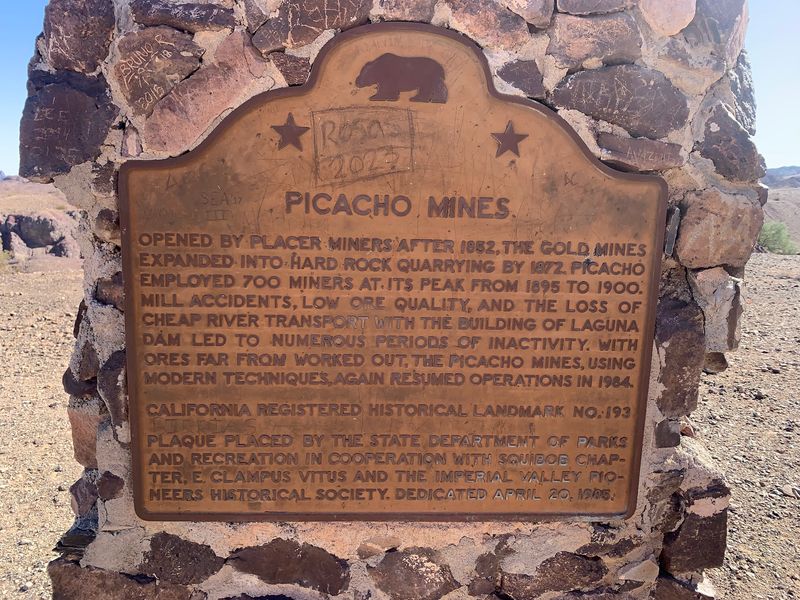
Picacho is registered as California Historical Landmark number 193, and this mill is the reason most history lovers make the drive at all. It is the town’s last real signature.
Stamp Mill Trail and the Hunt for Leftover Clues
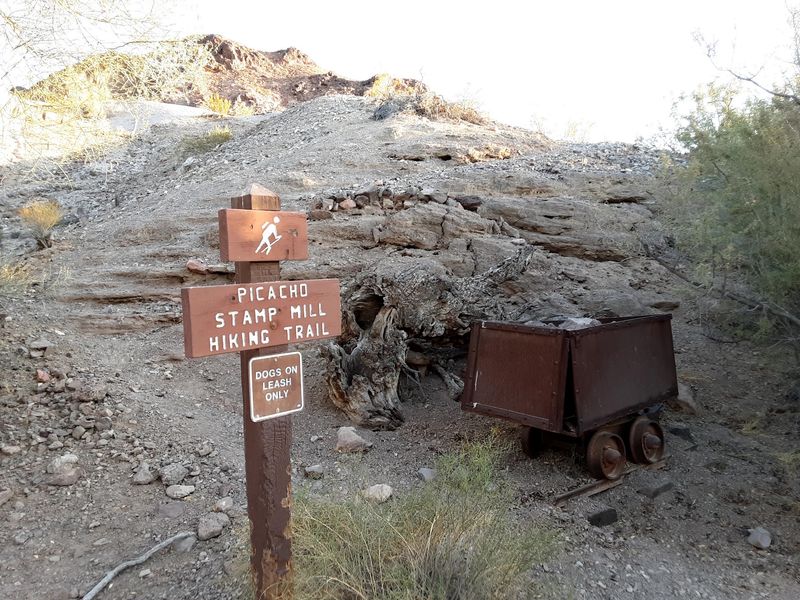
Following the Stamp Mill Trail felt less like hiking and more like reading a story with half the pages torn out. The path leads toward abandoned mill sites, and along the way you pass prospect pits, old shafts, and rock piles that were clearly moved by human hands.
Every hundred feet there is something small worth stopping for.
Rusted bolts, chunks of concrete footing, and dark openings in hillsides all show up if you are looking. Some visitors also mention seeing the remains of an old jail, which is a strange thing to stumble across in an empty desert.
Mine shafts are genuinely dangerous, so stay well back from any opening.
Morning is the smart time to walk it. Shade is scarce, the rock reflects heat, and even in cool months the sun feels close.
Bring more water than you think you need, wear real shoes, and tell someone at camp your rough plan.
Hikers also head into the nearby washes and narrow squeezes, where smooth rock walls curve overhead and the temperature drops a few degrees. That contrast between crumbling industry and quiet canyon is my favorite part of the whole park.
You leave with dust on your boots and a much better sense of how hard people worked here.
Where the Town Went, Under the Imperial Reservoir
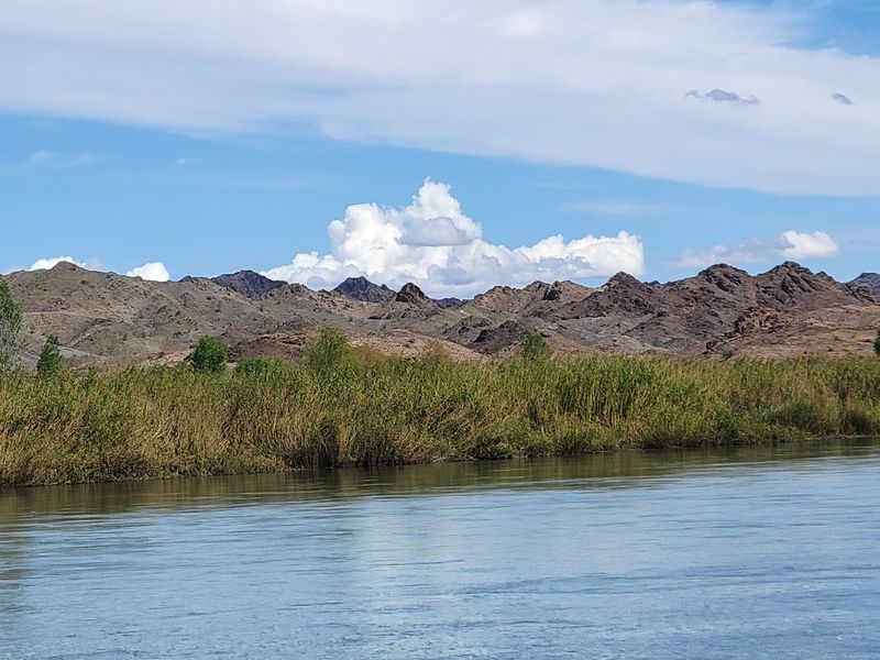
Here is the twist that surprises most first-time visitors. The original Picacho townsite is not just ruined, it is largely underwater.
After the Imperial Dam was completed in 1938, the rising Imperial Reservoir swallowed the flats where homes, stores, and streets once stood.
Some ore mill remnants still poke above the waterline, which creates an odd sight when you are out on a boat. Stone shapes that clearly were not made by a river sit half in and half out of the current.
I kept squinting at them, trying to imagine roads and rooftops down below.
Water is also what ended the town’s economy years before the flooding. Steamboats on the Colorado once carried supplies, ore, and passengers between mining camps, and that cheap river transport kept Picacho alive.
When the Laguna Dam went in, steamboat access was cut off and costs climbed.
Add in declining ore quality and mill accidents, and the decline that started around 1910 became permanent. The post office hung on until 1926, which feels like the town’s final signature on the paperwork.
Kayakers and boaters get the best angle on all this history. Floating over a buried town is a quiet, slightly eerie feeling that no museum display can copy.
A Desert Oasis Where the River Turns Everything Green
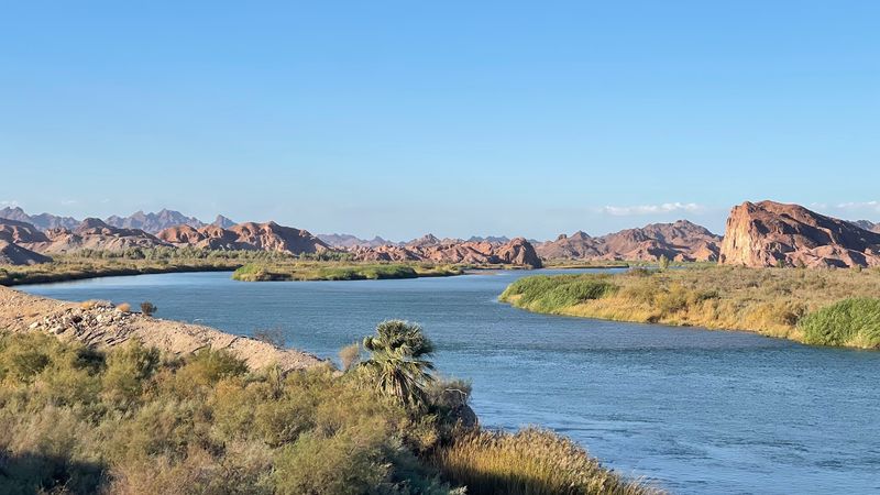
Nothing prepares you for the color. You spend an hour surrounded by beige rock and brittle brush, then the road drops and suddenly there are cattails, willows, and water moving slowly between green banks.
That contrast is the reason I would drive back tomorrow.
These riparian wetlands support a serious amount of life. Herons stalk the shallows, songbirds work the reeds, and fish break the surface close enough to shore that you can watch them from a picnic table.
Bring binoculars and a bird guide, because you will use both more than expected.
Early morning and the last half hour before dark are when the place really performs. Light hits the volcanic peaks, the water goes glassy, and the temperature finally becomes pleasant.
I sat still for twenty minutes once and heard nothing but wings and current.
Wild burros roam the area and are often heard before they are seen, especially at night when their calls carry across camp. Raccoons are bold around food, so store everything sealed and inside.
Mosquitoes can be aggressive near the wetlands in warmer stretches, so pack repellent without thinking twice.
The mix of harsh desert and thriving marsh in one view is genuinely unusual, and it makes the long approach feel earned.
Camping Beside a Ghost Town With Actual Hot Showers
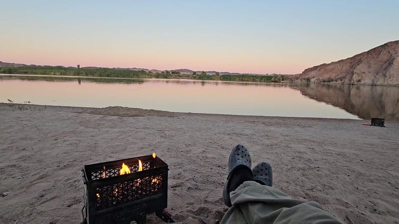
My expectations for a place this remote were low, and then I found clean restrooms and warm solar showers. The main campground has a generous number of sites, many with shade from trees or shelter from big rock outcrops.
Potable water is available, which changes the whole trip.
Most sites work on a first come, first served basis, while the group campsite needs a reservation ahead of time. Camp hosts and rangers are around, and visitors consistently describe them as helpful.
Boat-in campsites sit further up the river for people who want more solitude.
Reaching those upriver sites usually means four wheel drive and patience, so know your vehicle before committing. The main campground is the sensible choice for a first visit.
Pack like you are going off grid, because you basically are. Food, water, fuel, ice, tools, and a spare tire all belong in the vehicle, since the closest store is roughly an hour of dirt road away.
Fire restrictions come and go depending on conditions, so check before planning a campfire.
Nights out here are absurdly dark and quiet, apart from burros announcing themselves. Waking up to river mist against desert cliffs, with mill ruins a short walk away, is the kind of morning that sticks with you.
Gold Fever, Blankets, and a Polo Field in the Desert
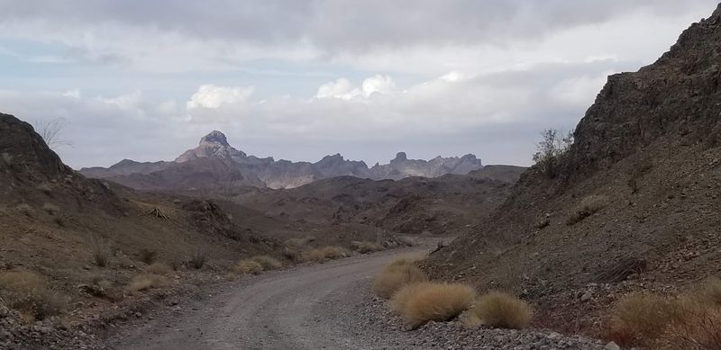
Gold hunting here goes back further than most people guess. Placer miners were likely working these sands as early as 1780, and Spanish prospectors were among the first to try.
Water was so scarce that early miners used dry placering, sifting sand and gravel across blankets to separate out gold particles.
The real rush arrived in the early 1860s when Jose Maria Mendivil found gold veins in the surrounding hills. Word spread, machinery arrived, and a camp turned into a town.
By its peak between the 1870s and early 1900s, the population reached roughly 2,500.
Picture the details for a second. Three stores, three elementary schools with around 90 children enrolled by one account, and a post office running from 1894 to 1926.
There was even a polo field, which strikes me as the most unexpected fact in the entire story.
Roughly 700 men worked the mines at the busiest stretch, and steamboats kept the whole operation supplied. The town was first called Rio before being renamed Picacho, meaning big peak in Spanish, after the mountain nearby.
Knowing all that while standing in near total silence rearranges how the landscape looks. Empty ground stops feeling empty once you know what used to fill it.
Timing, Temperatures, and Practical Planning Notes
Season choice matters more here than almost anywhere else I have visited. Summer temperatures can climb to 120 degrees Fahrenheit, which turns a scenic outing into a serious risk.
Winter nights can drop close to 20 degrees, so a warm sleeping bag is not optional in January.
Mid-October through April is the sweet spot. Days sit comfortable, hiking is pleasant, and the drive in is far less punishing without extreme heat working against your tires.
Locals who have been coming since the 1980s tend to recommend winter without hesitation.
The park is open around the clock, and day use plus camping fees apply at the entrance. There is a boat ramp, fishing docks, and river access, so a fishing license belongs in your pack if you plan to cast a line.
Cell service should be treated as nonexistent, so download maps first.
Off road enthusiasts find good routes nearby, including Indian Pass Road, though high clearance four wheel drive is genuinely needed on the rougher trails. Turning around when a track looks beyond your rig is smart, not embarrassing.
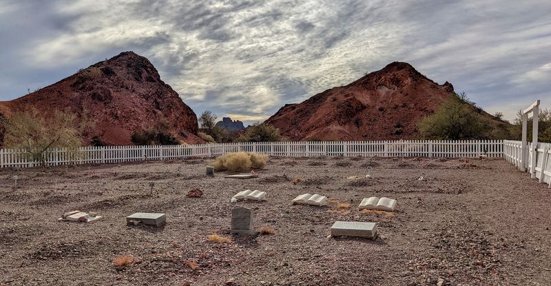
Leave everything as you found it, especially around the ruins and the old Picacho cemetery. This is one of those rare spots where the effort to get there is exactly what preserves it.
Address: Picacho Rd, Winterhaven, California 92283
