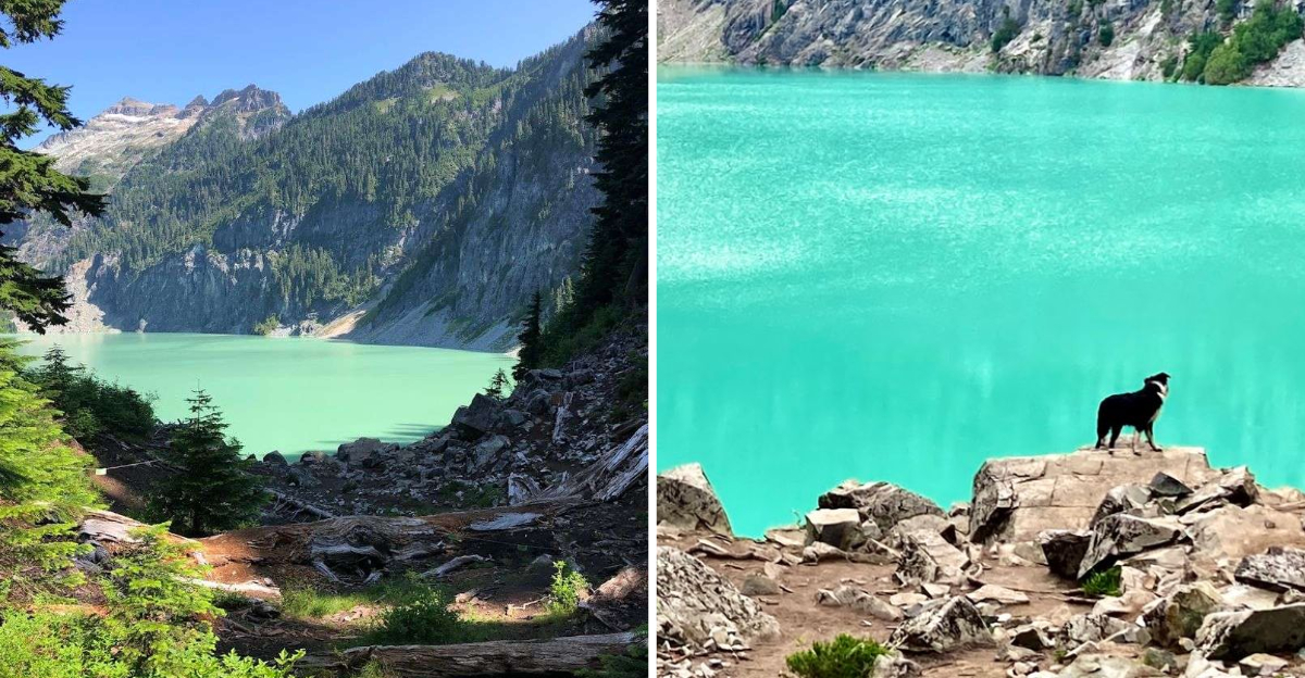
That first photo I saw of this Washington lake made me think it had been edited. That shade of blue, so vivid and electric against the raw mountain rock, looked like something out of a fantasy novel.
But it is completely real, tucked inside the Central Cascades, waiting for anyone willing to earn it with their legs.
The hike clocks in at roughly nine miles round trip, with a serious elevation gain that will test even seasoned hikers. What you get at the end, though, is one of the most striking alpine lakes in the entire Pacific Northwest.
I made the trip, and I can tell you without hesitation, it changed how I think about what a hike can give you.
The Journey Begins: Ascending Through Verdant Forests
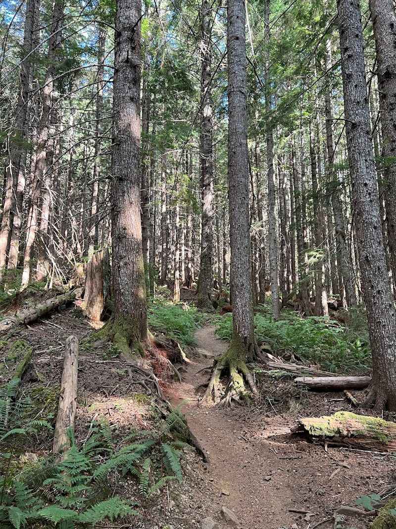
Before the lake even enters the picture, the forest has something to say. The Blanca Lake Trail, designated as Trail 1052, begins in a thick second-growth forest of Douglas-firs and hemlocks that feel ancient and quiet.
The canopy closes overhead almost immediately, and the air drops a few degrees the moment you step beneath it.
Getting to the trailhead itself requires some navigation. From US Highway 2, you turn north onto Beckler River Road, also known as Forest Service Road 65, and follow it for roughly 12 to 15 miles before turning right onto Forest Service Road 63.
The gravel road is passable but a little rough, so drive with care.
Once you are on the trail, the real work begins fast. The path launches into a series of switchbacks almost immediately, and there is no gentle warm-up phase to ease you in.
Roots crisscross the trail surface constantly, and the damp understory keeps everything slick even on dry days.
Moss clings to every boulder and fallen log in thick green layers. The sounds of the forest, birdsong drifting between the trees, the occasional rustle in the undergrowth, create a steady rhythm that helps you settle into your pace.
I found myself focusing on the small details around me rather than the relentless uphill grade.
This section is about getting your body into the groove of the hike. It rewards patience over speed, and the forest itself feels like a living, breathing welcome mat for everything that comes next.
The Relentless Climb: 37 Switchbacks and 2,700 Feet of Elevation
There is a moment somewhere around switchback fifteen when your legs start having a very serious conversation with your brain. The Blanca Lake Trail gains approximately 2,700 feet of elevation in the first three miles, and those 37 switchbacks are not gentle suggestions.
They are a full-on negotiation between your willpower and gravity.
Trekking poles make a genuine difference here. The trail surface is loaded with exposed roots and loose rocks, and the grade stays steep enough that your knees will feel every downhill step on the return trip too.
Sturdy hiking boots are not optional on this trail, they are the whole plan.
As elevation builds, the forest begins to shift almost imperceptibly. The trees thin just enough in spots to let you catch glimpses of distant ridgelines through the gaps.
Those small previews of the world opening up around you are surprisingly motivating when your lungs are burning.
On a clear day, the outline of Glacier Peak appears to the east, one of Washington’s active volcanoes rising above the surrounding ranges. Seeing it through a break in the trees feels like a secret reward the trail hands out to people who keep moving.
The climb is hard, no way around it. But there is a particular kind of quiet confidence that builds inside you as you work through each switchback.
By the time the trail finally levels toward the ridge, you feel it, a solid, earned sense that you belong exactly where you are.
Sub-Alpine Meadows and the Calm of Virgin Lake
After the relentless switchbacks, the trail finally exhales. The path softens into a more gentle traverse across open sub-alpine terrain, and the shift in landscape feels almost theatrical, like the trail is deliberately giving you a moment to breathe and look around.
Rocky patches and low-growing plants dot the meadows between scattered trees. The views open up in every direction, and the sense of being genuinely high up in the mountains settles in.
It is quieter up here, and the wind carries a clean, sharp edge that feels different from the dense air of the lower forest.
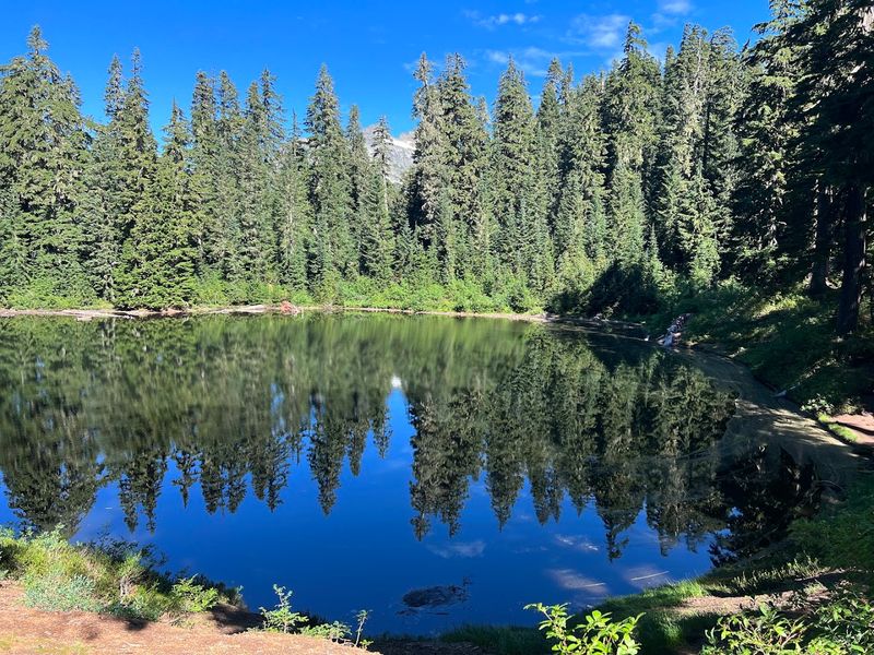
Virgin Lake sits at roughly 4,600 feet elevation and marks the high point of the hike before the final descent. The lake is fed mainly by snowmelt and rainwater, so it lacks the dramatic color of Blanca Lake below.
But it has its own kind of calm, a still, reflective surface surrounded by the kind of high-country silence that is hard to find anywhere else.
Established campsites exist near Virgin Lake and along the ridge, making this a viable overnight option for backpackers. Camping is strictly prohibited within a half-mile of Blanca Lake itself, so if you plan to sleep under the stars, this is your spot.
I sat near the water for a few minutes and let the stillness land.
This section of the hike rewards observation. Small birds dart between rocks, and the light shifts quickly at this elevation, casting the meadows in constantly changing tones of gold and green.
The Rocky Descent: When the Trail Gets Technical
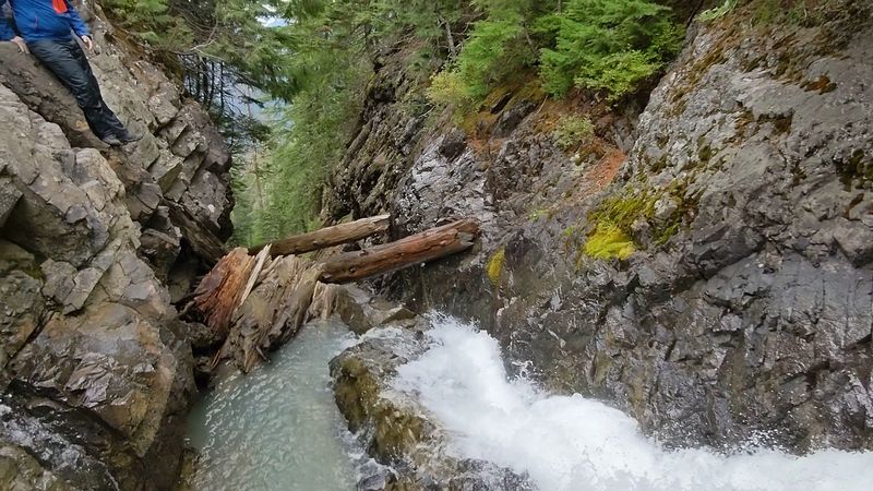
Just when you think the hard part is behind you, the trail reminds you it is not quite done. Leaving Virgin Lake, the path drops sharply toward the Blanca Lake basin, losing somewhere between 500 and 650 feet of elevation in roughly half a mile.
The terrain turns rocky and technical, demanding full attention with every footstep.
Loose rocks and thick root systems cover the trail surface through this section. Wet conditions make it significantly more challenging, and even on dry days, some spots require you to slow down and think about your footing.
Rushing this descent is how ankles get twisted, so patience pays off here.
The anticipation builds fast during this stretch. You know the lake is close.
The trees start to hint at something beyond them, a brightness, a change in the quality of light filtering through the canopy. Your body is tired, but your curiosity is fully awake.
I noticed the air changing as I descended. It carried a faint coolness that felt different from the meadow wind above, something crisper, almost mineral.
That is the glacial meltwater making itself known before you can even see the lake.
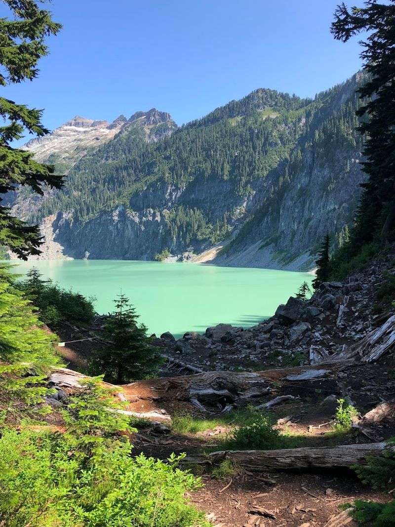
The trail delivers its reward without fanfare. One moment you are picking your way through boulders and roots, and then suddenly the trees part and the lake is right there.
There is no gradual reveal, just a sudden, full-force encounter with one of the most vivid bodies of water you are ever likely to see in your life.
The Unforgettable Blue: What Makes Blanca Lake So Remarkable
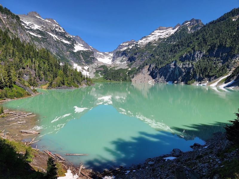
The color of Blanca Lake is not something you can fully prepare yourself for. Photographs get close, but they do not capture the way the light moves across that water, shifting from electric turquoise to deep jade depending on where the sun sits in the sky.
It genuinely looks like something that should not exist in nature.
The science behind it is fascinating. The Columbia Glacier, which feeds the lake from the northwest, grinds rock into ultrafine particles as it moves.
Those particles, often called glacial flour or rock flour, stay suspended in the meltwater. When sunlight hits the lake, those suspended minerals scatter the light in a way that produces that extraordinary, milky blue-green glow.
A twin waterfall carries the glacial meltwater into the lake, and you can hear it before you see it clearly. The sound adds to the atmosphere of the basin, a constant, low rush that fills the space between the surrounding peaks of Monte Cristo, Kyes, and Columbia.
Swimming is allowed, and the water is bracingly cold even in August. People do get in, some with full enthusiasm, some with a more cautious approach involving slow wading.
The cold hits immediately and completely, but it is the kind of cold that makes you feel sharply, vividly alive.
Blanca Lake earns its reputation honestly. Every challenging mile of the hike dissolves the moment you are standing at its edge, looking out at that impossible blue.
It is one of those rare places that fully delivers on what it promises.
Practical Tips to Make the Most of Your Blanca Lake Adventure
The window for hiking Blanca Lake runs from roughly July through October, once the snowpack has cleared enough to make the trail passable. Early summer often means snow patches linger on the upper sections, so checking current conditions with the Skykomish Ranger District before heading out is genuinely worth the effort.
This trail draws significant crowds, especially on sunny weekends. Starting before sunrise is not an exaggeration as a suggestion.
Arriving at the trailhead by 5:30 or 6 in the morning gives you a real chance at a quieter experience, and the early light in the forest is worth it on its own terms.
A Northwest Forest Pass or an Interagency America the Beautiful Pass is required for parking. Neither can be purchased at the trailhead, so buy one in advance online or at a ranger station.
The Washington Discover Pass is not accepted here, which catches people off guard.
Bug spray earns its place in your pack, especially in July and early August when insects can be relentless in the lower forest sections. Plenty of water is non-negotiable on this hike, the elevation gain is dehydrating and the round trip takes most people between six and eight hours.
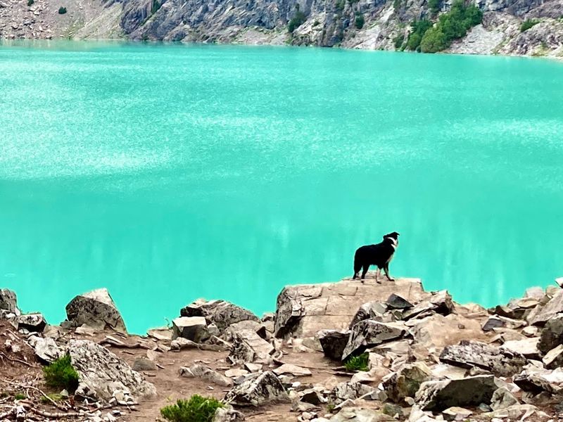
Dogs are welcome on the trail and must be leashed. Wilderness regulations limit group sizes to 12 people within the Henry M.
Jackson and Wild Sky Wilderness areas. Cell service is unreliable near the trailhead, so downloading an offline map before you leave is one of those small steps that makes a big difference when you need it.
