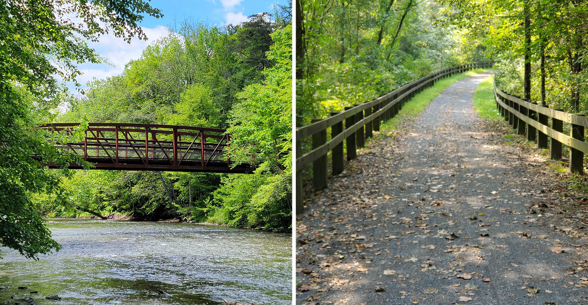
Two entire transportation systems came and went in a green valley between two mountains, leaving behind stone locks, old bridge piers, and fossil beds for anyone curious enough to notice. The flat gravel path running through this corner of Pennsylvania used to be a railroad bed.
Before the railroad, coal boats floated along a canal on the other side of the creek, until a flood in 1862 wiped it out. The railroad took over, hauled coal for about a century, then got abandoned too once the interstate changed how everything moved.
What remains now is a strange and beautiful layering of history, with a cabin set into the woods and a trail that follows the old rail line. The whole place feels like a story that nobody bothered to finish telling.
A quiet bike ride turned into a lesson about how quickly the world can change. Along the way, pieces of both eras keep appearing between the trees, making the trail feel almost like an outdoor timeline.
One mile belongs to canal boats, another to locomotives, while the surrounding forest quietly takes back the ground they once occupied.
The Canal That Took 36 Years to Finish
Some ideas refuse to end quietly. William Penn floated the notion of linking Philadelphia to the Susquehanna River back in 1690, and it took more than a century before anyone actually made it happen.
Digging started in 1792. Money problems, engineering headaches, and general bad luck stretched the project out until 1828, when the Union Canal finally opened for business across roughly 82 miles from Middletown to Reading.
People called it the Golden Link, which sounds dramatic until you realize it genuinely connected two major river systems and gave anthracite coal a path east.
The piece that runs through what is now Swatara State Park was the Branch Canal to Pine Grove, also known as the Swatara Feeder. It stretched about 21.6 miles alongside Swatara Creek and was navigable, not just a water supply ditch.
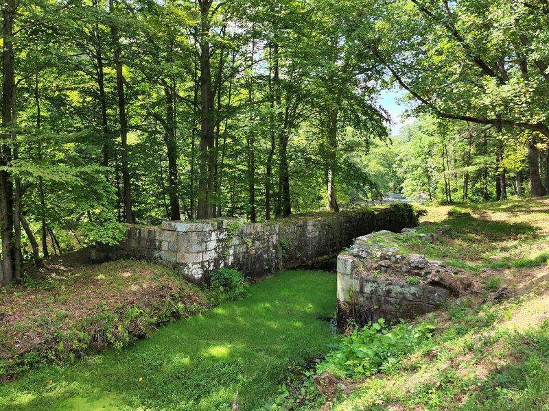
I find the numbers hard to picture until I see the stonework. Fourteen lift locks, one guard lock, six aqueducts, and four sizable dams were built by hand, with animals and simple tools.
Walking the valley today, knowing all that effort sits half-buried in the brush, changes how the quiet feels.
Stone Locks Hiding in the Underbrush
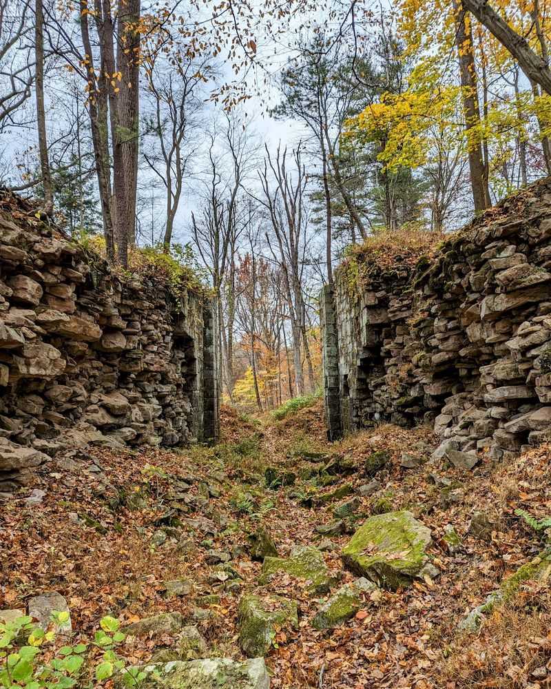
My favorite thing here is not marked with a big sign. Off the Mifflin Trail area, chunks of the old canal system still sit in the woods, and the cut stone is unmistakable once you spot it.
Towpath sections show up as suspiciously straight, raised ridges through the trees. Dam remnants interrupt the creek in odd, squared-off ways that nature would never produce on its own.
Lock walls are the real prize. The blocks are enormous, fitted tight, and still holding their shape almost two centuries after boats last squeezed between them.
Bring decent shoes and some patience, because the growth gets thick in summer and the ruins blend in. Spring and late fall are much better for seeing structures, since bare branches open up sightlines that leaves completely hide.
I missed the lock on my first visit entirely and only heard about it afterward, which is a mistake worth avoiding.
Calling the park office ahead of time helps, since staff can point you toward specific features and explain what you are looking at. Trail signage exists but does not cover every historic remnant scattered across these 3,520 acres.
Pennsylvania’s First Chartered Railroad Started Right Here
Here is the detail that genuinely surprised me: the first railroad ever chartered in Pennsylvania was born out of this canal, in 1828.
The Union Canal Railroad ran just 3.6 miles, pushing north from the Pine Grove Basin up to Lorberry Junction. Its whole purpose was to reach deeper into the coal region and feed the canal boats waiting below.
So the railroad and the canal were partners first, not rivals. Coal came down the short rail line, got loaded onto boats, and floated east toward Philadelphia along with lumber from the mountains.
That partnership did not stay friendly for long. Rail technology improved fast, and what started as a feeder line for boats eventually became the thing that made boats pointless.
I like standing near the north end of the park thinking about that irony. A canal company chartered the railroad that helped end canals across the state.
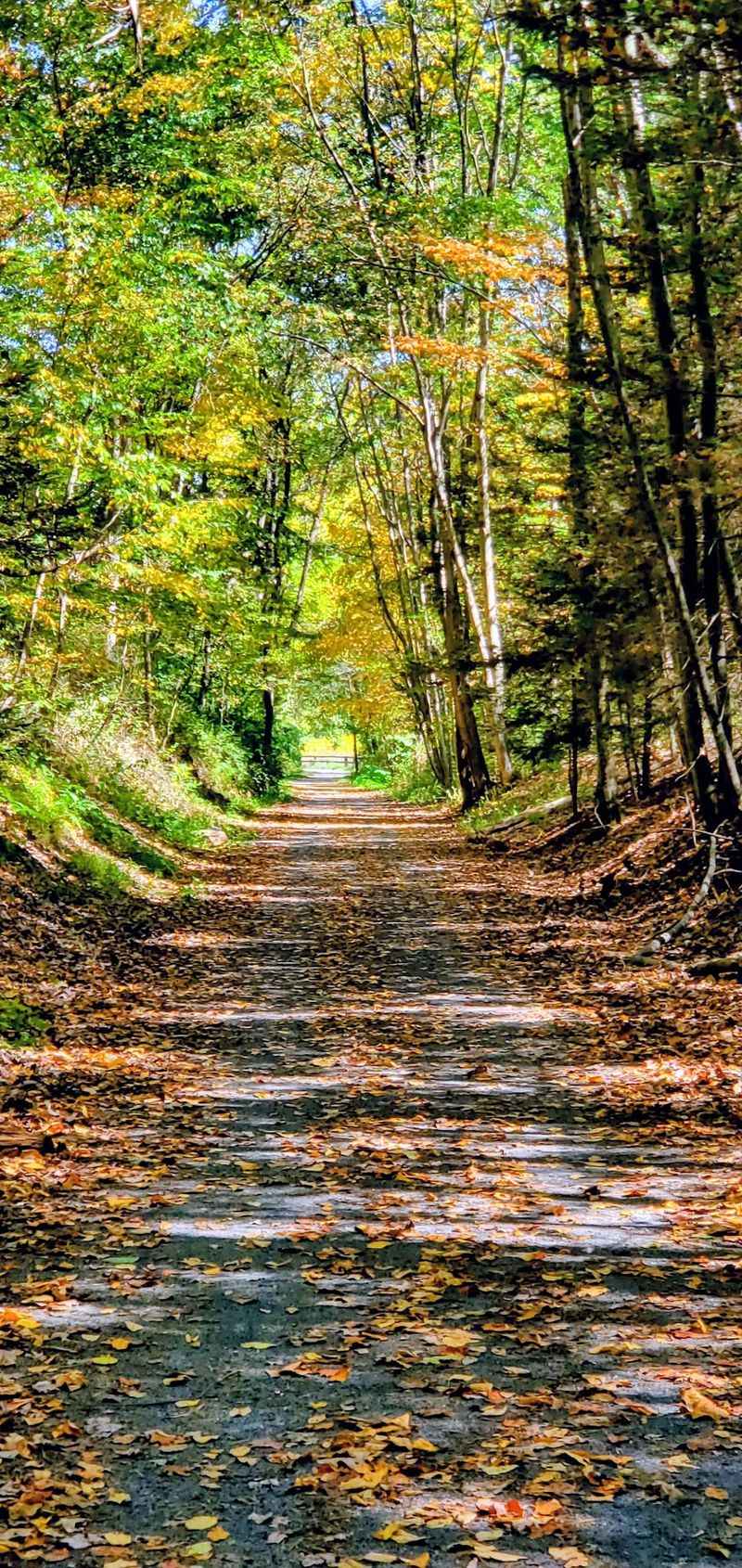
Nothing dramatic marks the spot, and most visitors pedal right past without knowing. Knowing it anyway makes the ordinary-looking grade under your tires feel considerably more important than gravel usually does.
The Flood of 1862 Changed Everything
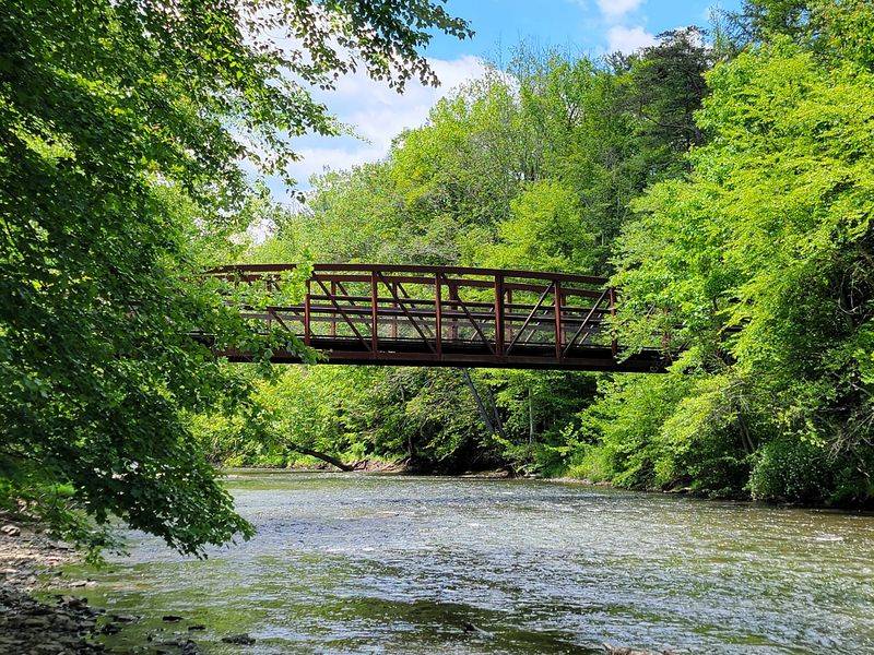
June 1862 is the month the valley lost its canal. A powerful flood tore down Swatara Creek and destroyed both the Pine Grove feeder canal and its dam.
Nobody rebuilt it. That single decision explains almost everything you see in the park today, because the branch canal simply stopped existing as a working waterway.
Railroads had already proven themselves faster and cheaper, so pouring money into wet stonework made no business sense anymore. Within a few years, trains were running along the opposite bank of the same creek.
The main Union Canal limped along for a couple more decades before shutting down somewhere between 1881 and 1885, finally beaten by rail competition.
Standing near the creek on a calm day, the water looks harmless and shallow enough to wade. It is easy to forget what it can do when storms stack up over the mountains.
Plenty of visitors float or splash here in summer, and I get why. Just keep an eye on conditions, because this creek has a documented history of rearranging the landscape when it wants to.
Coal Trains, Then Silence
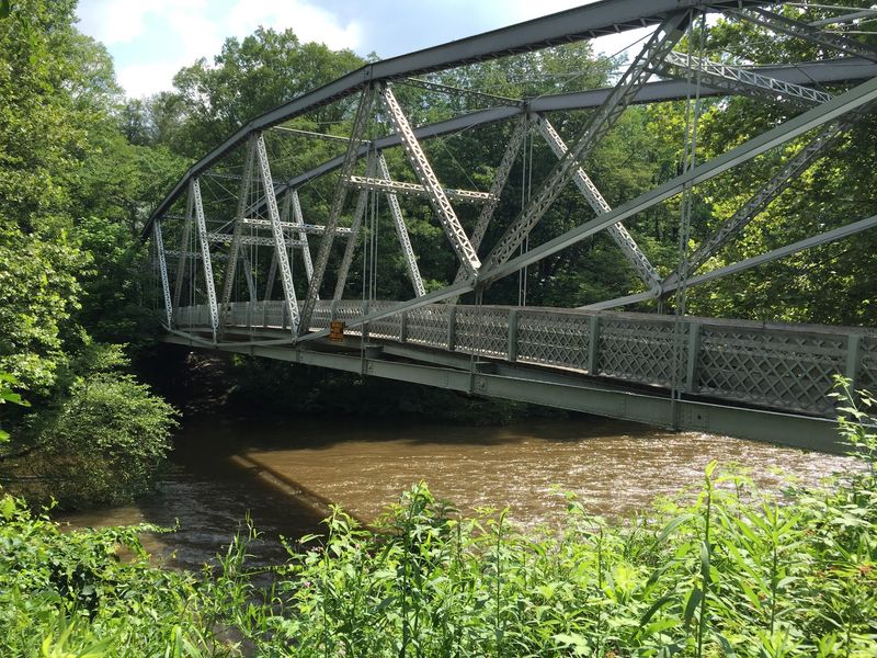
Around 1870, the Philadelphia and Reading Railroad opened a spur linking Lebanon to Pine Grove, and the valley got a second act.
Known as the Lebanon and Tremont Branch, the line tied the West End coalfields of Schuylkill County to Lebanon. For roughly ninety years it was the backbone of moving coal through these mountains.
Then highways happened. Interstate 81 arrived in the 1960s with a level of convenience trains could not match for many shippers, and the branch started shedding track.
The northern stretch inside what is now the park was abandoned by 1965. The rest, from Suedberg south to Lebanon, was pulled between 1978 and 1981.
After Conrail walked away, the roadbed went to the state, which is the only reason the corridor stayed intact instead of being carved into private lots.
You can still hear traffic from I-81 on certain trails, which honestly makes the history land harder. The road that replaced the railroad is audible from the railroad’s own grave, and the trail underfoot used to carry coal instead of bicycles.
Riding the Swatara Rail Trail
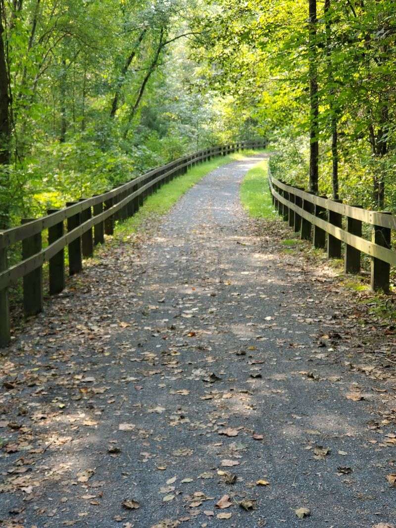
Ten point two miles of old railroad corridor now make up the Swatara Rail Trail, and it is the easiest introduction to the whole park.
The surface mixes gravel and packed dirt, and the grade stays almost perfectly flat because trains hated hills. That makes it forgiving for families, casual riders, and anyone who wants scenery without suffering.
Swatara Creek meanders about eight miles through the park, and the trail keeps crossing paths with it. The bridges are the highlight for me, especially the one connecting the Sand Siding area toward Bear Hole Trail.
Parking is free and spread across several trailheads, which means you can pick your starting point based on how far you feel like going. Some lots have restrooms, others have a portable toilet, so plan accordingly.
Side trails branch off constantly, letting you swap flat cruising for hillier, curvier routes whenever the mood strikes.
Horseback riders share certain sections, and most trails welcome dogs. I have seen deer, wild turkey, rabbits, and enough chipmunks to lose count on a single afternoon ride here.
Bordner Cabin, Fossils, and the Appalachian Trail
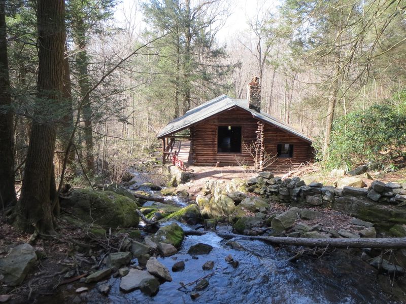
Bordner Cabin caught me off guard. After an easy three-mile walk from the Sand Siding parking area, a genuinely handsome cabin appears in a clearing, and you can walk through it.
People eat lunch there, poke around the rooms, and linger longer than they planned. It has become the single most recommended destination in the park for good reason.
Fossil hunting is the other unexpected draw. The bedrock here is mostly sedimentary and formed around 375 million years ago, and exposed fossils turn up in the designated fossil pit area.
Kids lose their minds over this, and honestly so do adults. Finding something ancient with your own hands beats reading about it.
The Appalachian Trail also clips through a portion of the park, and the Waterville Bridge nearby is worth the detour if you have time.
Small waterfalls run better in spring when water is high, so time your visit if that matters to you. Hunting seasons overlap with hiking here, so wear blaze orange in fall and check the park calendar first.
Address: 1450 Suedberg Rd, Pine Grove, PA 17963, United States
