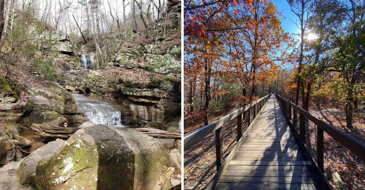
Someone says, “It’s only a mile.” That sentence usually requires clarification. Only a mile through what?
Up a mountain? Across mud?
Through twelve switchbacks? Not this time.
These Alabama trails keep the numbers mercifully small, with routes under two miles leading to waterfalls, canyon overlooks, creekside wildflowers, mountaintop rocks, and shaded forest pockets.
The short distances make them especially handy for families, travelers with limited time, or anyone whose idea of recreation does not include negotiating with their knees.
You can walk out, take the photo, admire the view, and still have enough energy left for lunch. That may be the smartest hiking strategy in the state.
1. Noccalula Falls Park in Gadsden
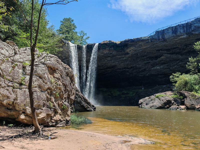
The roar reaches visitors before the water does. Noccalula Falls announces itself with sound, then delivers a 90-foot curtain of water dropping straight into an ancient gorge carved by Black Creek.
Most people head first to the overlook, which sits only a short stroll from the parking area at 1500 Noccalula Road in Gadsden. The payoff arrives almost immediately, which feels slightly unfair to anyone who has hiked hard for lesser views.
Those wanting more can follow the Black Creek Trail, roughly 1.7 miles of easy going that dips down into the gorge itself. Down there the perspective flips completely.
Canyon walls rise overhead, huge boulders sit scattered like forgotten furniture, and a rock overhang tucks in behind the falling water.
A swinging bridge crosses the creek, and it bounces just enough to make kids shriek with delight and adults grip the railing.
Spring and early summer bring the strongest flow, though the gorge stays cool and shady even in August. Sturdy shoes help on the damp stone near the bottom.
Fun bit of local lore: the falls carry the name of a Cherokee legend tied to the cliff above, and a statue near the overlook keeps that story visible for every passing visitor.
For a first stop on a north Alabama trip, few places pack so much drama into so little walking.
2. Little River Falls near Fort Payne
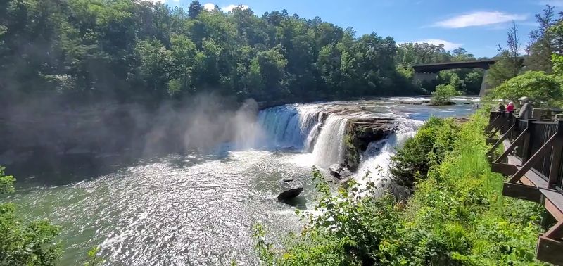
Some views arrive without asking much in return. Little River Falls sits inside Little River Canyon National Preserve near Fort Payne, and the main overlook waits just steps from the lot along Highway 35.
Water spills over a wide shelf of sandstone into a broad rocky basin below. The sound carries across the whole area, bouncing off stone in a way that makes the falls feel taller than the map suggests.
What makes this spot special is the canyon behind it. Little River Canyon ranks among the deepest in the eastern United States, and the river that cut it flows almost entirely along the top of Lookout Mountain, which is genuinely unusual.
A paved path and viewing deck handle the short walk to the falls. Extra pull-offs stretch along the canyon rim drive, each one offering a fresh angle without a single switchback.
Rainy seasons turn the falls thunderous, while late summer reveals wide slabs of exposed rock where the water thins out. Both versions are worth seeing.
Keep an eye on kids near the smooth stone edges, since it stays slick long after rain passes.
Travelers who want raw scale, wind through the canyon, and open sky will get all three here, and still have plenty of daylight left for the next stop nearby.
3. DeSoto Falls at Mentone
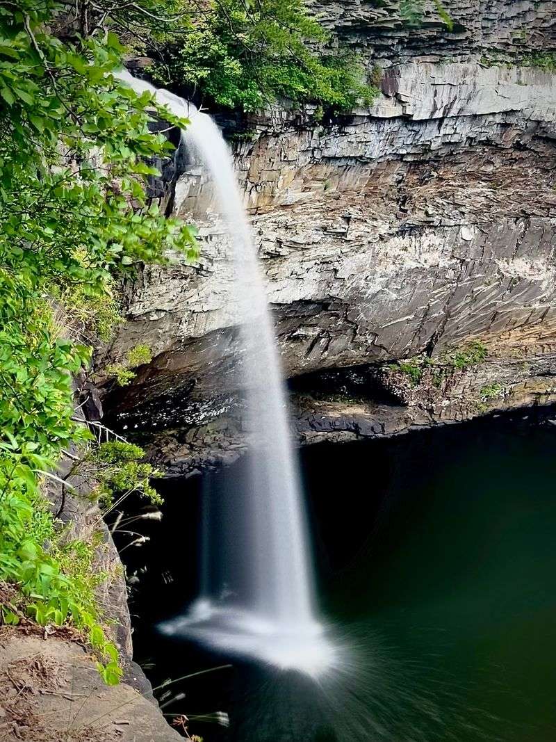
Not many waterfalls give travelers a choice of viewing angles, but DeSoto Falls, located at Mentone, AL 35984, does. The upper overlook, reached by a brief walk from the parking area, delivers the classic postcard shot straight away.
Water drops about 90 feet in tiers, landing in a pool ringed by sandstone walls and dense hardwoods. Green in summer, gold in October, and surprisingly moody on cloudy days.
Anyone curious about the base can take the maintained woodland trail that descends toward the bottom, where the falls look completely different from below. The ridge route, roughly a mile round trip, adds yet another perspective across the gorge.
Worth knowing before setting the navigation: the falls sit at the DeSoto Falls Picnic Area, about seven miles north of the main entrance to DeSoto State Park, so plugging in the park address alone can lead somewhere else entirely.
Mentone itself makes the trip better. The little mountain town nearby has a slow, cool-air feel that pairs nicely with a morning at the falls.
Rock steps near the lower path can be uneven, so shoes with grip beat sandals.
The whole outing takes under an hour if energy runs low, which makes it one of the easiest big-payoff stops on Lookout Mountain and a favorite for travelers piecing together a scenic loop.
4. Peavine Falls Trail at Oak Mountain State Park
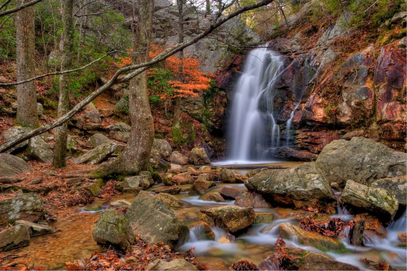
Pine needles underfoot, filtered sunlight, and the slow build of water sound in the distance. The Peavine Falls Trail inside Oak Mountain State Park runs about 1.9 miles through a comfortable mix of hardwood and pine, ending at a rocky cascade that spills into a quiet pool.
Autumn is the showstopper here. Maples and hickories light up the ridge, and the trail turns into a tunnel of color that photographs almost too easily.
The route begins near the park office at 200 Terrace Drive in Pelham, and staff there can point out current conditions and the best approach for the day.
Oak Mountain happens to be the largest state park in Alabama, so the falls trail is only one thread in a much bigger web of paths, lakes, and picnic spots.
Flow at Peavine depends heavily on recent rain. After a dry spell the cascade slims down to a trickle, while a good storm turns it lively again, so timing matters if the waterfall is the main goal.
Rocks near the pool get slippery, and scrambling around them is where most twisted ankles happen.
Sitting roughly twenty miles south of Birmingham, the park works beautifully as a half-day escape for city visitors who want forest quiet without driving deep into the mountains.
5. Moss Rock Preserve in Hoover
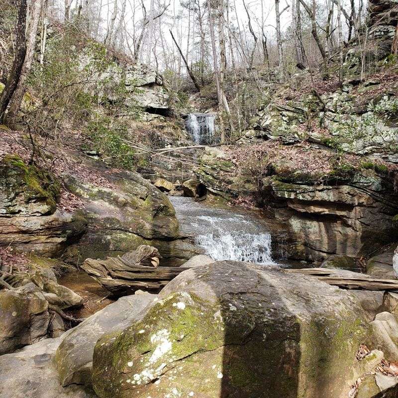
Boulder fields, tucked-away streams, and a waterfall that appears without warning. Moss Rock Preserve spreads across 349 acres in Hoover, and its trail system lets walkers pick segments anywhere from one to two miles depending on mood and energy.
The Moss Rock Waterfall, draws the biggest crowd, a modest cascade that slides over layered stone into a shaded pocket of forest. Quiet, cool, and easy to linger beside.
Trailheads are reachable from the Simmons Middle School area along Preserve Parkway in Hoover, and signage at the kiosks helps first-timers choose a route.
Terrain is mostly packed dirt with rocky stretches, especially where paths thread between sandstone outcrops. Nothing punishing, though a walking stick can be handy after rain.
Geology fans get a treat here. The preserve protects a rare glade habitat where thin soil over sandstone supports unusual plants that struggle to grow anywhere else in the region.
Boulder gardens near the middle of the preserve have made the area popular with climbers, and watching them work a route adds unexpected entertainment to a family walk.
Located at 617 Preserve Wy, Hoover, AL 35226, Moss Rock feels far more remote than the map admits, which is exactly why locals treat it as a standing weekend habit rather than a one-time visit.
6. Wildflower Trail at Monte Sano Nature Preserve
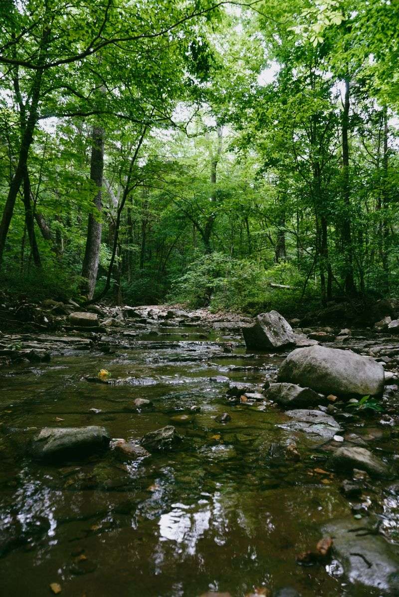
April turns this one into something close to a garden. The Wildflower Trail inside Monte Sano Nature Preserve runs about a mile out and back, tracing Fagan Creek closely enough that water sounds follow hikers the entire way.
Spring brings trilliums, phlox, and dozens of other native blooms scattered along the banks. Even outside bloom season the creek keeps things interesting, especially for kids who cannot resist tossing pebbles.
The path ends near Fagan Spring, a calm spot where water emerges from the mountain, and three smaller waterfalls sit within easy reach nearby.
Access begins near 506 Cleermont Drive in Huntsville, a residential-feeling start that surprises visitors expecting a big park entrance.
Mostly flat, though roots and loose rock near the creek demand attention. Closed-toe shoes work far better than flip-flops here.
Monte Sano means mountain of health, a name tied to the era when people came up the slope believing the cooler air helped them recover from illness. That history still lingers in how restful the place feels.
Land Trust of North Alabama maintains this network, and volunteer crews keep the blazes clear and the footing manageable.
For travelers based in Huntsville who want green space without a long drive, few short walks deliver this much variety in under an hour.
7. Alum Hollow Trail on Green Mountain
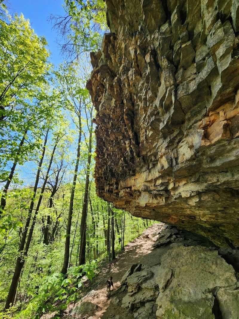
Winter is secretly the best season for this trail. Once the leaves drop, the bluff line at Green Mountain Nature Preserve opens up toward the Tennessee River valley, and views appear where summer showed only foliage.
A beginner-friendly loop of roughly a mile links part of the Alum Hollow Trail with the East Plateau Loop. Flat for most of its length, which makes it an easy pick for short legs and unhurried walkers.
Benches show up regularly along the forested route, positioned just where a person might want to sit and listen to nothing much at all.
Alum Hollow itself holds a tiered waterfall around thirty feet tall, fed by seasonal runoff and best visited after a rainy stretch.
The preserve sits along Green Mountain Road in Huntsville, near the Madison County Nature Trail, so two stops can easily be combined into one relaxed morning.
Rock ledges along the bluff edge are gorgeous and also unforgiving, so keeping children close is smart.
Fossils turn up in the exposed limestone here, leftovers from an era when this ridge sat under a shallow sea. Look, admire, leave them where they are.
Quiet, shaded, and refreshingly uncrowded, this loop rewards anyone content with small discoveries rather than grand exertion.
8. Pond Way Trail at Kreher Preserve and Nature Center
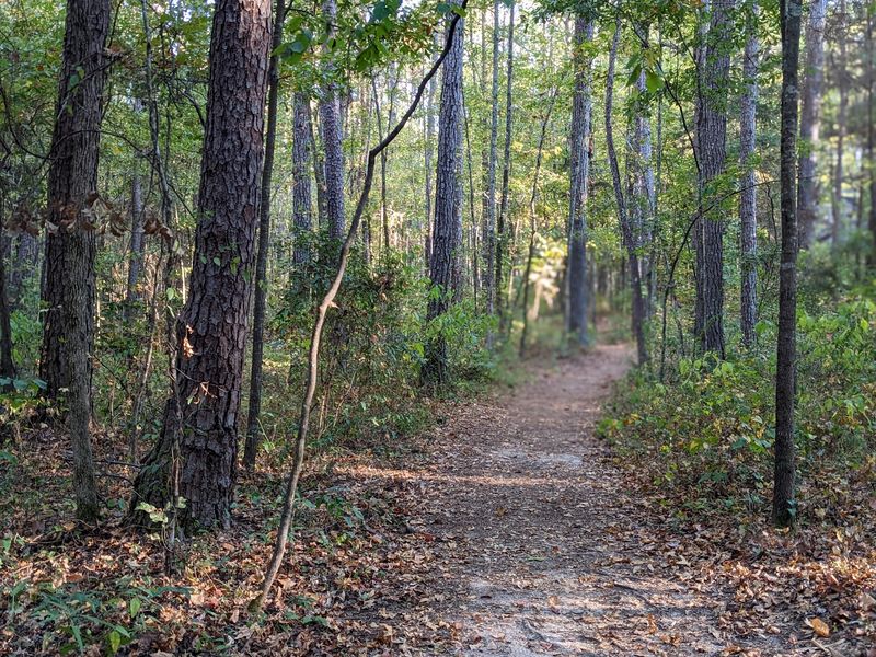
Old trees do something to the light. Along the Pond Way Trail at Kreher Preserve and Nature Center in Auburn, a 1.5-mile loop curls through mature hardwood forest where the canopy sits high and the shade runs deep.
The route passes a still pond, open meadows that fill with wildflowers in warmer months, and a rustic homestead complete with a vegetable garden. Odd combination on paper, lovely in practice.
A short spur called the Hidden Falls Trail branches off toward gentle falls that reward the detour with a few minutes of pure calm.
Stepping stones handle the stream crossings, and stepping across them is somehow the part kids talk about afterward.
Enclosures near the main area house turtles and alligators, giving the walk an educational streak that helps hold young attention spans.
Auburn University manages the preserve, located at 2222 North College Street in Auburn, and its trail system stays well marked and easy to follow.
Bug spray earns its keep here in late spring and summer.
Programs and guided walks run through the year, so checking the schedule before arriving can turn a simple stroll into something more.
For travelers moving through east Alabama, this stop trades big overlooks for intimacy, and it works beautifully as a change of pace between mountain viewpoints.
9. Doug Ghee Accessible Trail at Cheaha State Park
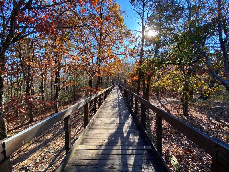
Alabama’s highest ground comes with a boardwalk, which sounds too easy until the view arrives. The Doug Ghee Accessible Trail, known locally as the Bald Rock Boardwalk, covers about 0.6 miles out and back inside Cheaha State Park.
Smooth decking runs the whole way, making the route workable for strollers, wheelchairs, and anyone who would rather not negotiate roots and rocks.
At the end sits an observation platform perched on Bald Rock, part of Cheaha Mountain, the highest natural point in the state. Ridges roll outward in layers, fading pale blue toward the horizon.
Wildflowers line the boardwalk in season, and mountain laurel adds bursts of white and pink in late spring.
The park address is 19644 Highway 281 in Delta, reached by a winding drive up through the Talladega National Forest that counts as scenery in its own right.
Sunset draws a small, happy crowd, and the platform handles it well. Bring a layer, since wind up top runs cooler than the parking lot suggests.
Fall color peaks here later than in the valleys below, stretching the leaf season a little longer for anyone chasing it.
Of every short walk in Alabama, none trades so little effort for so much sky.
