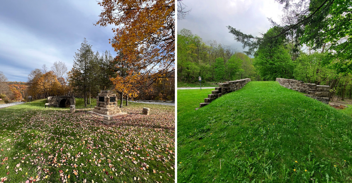
Built in 1833, a stone arch sits in a wedge of grass and trees where two lanes split, and it looks like it was built yesterday by someone with far too much patience.
Walking thirty steps off a tiny gravel pull-off brings you to the crossing point of two vanished worlds: a turnpike full of horses above and a railroad below that once dragged canal boats up a mountainside.
The stones are laid on a slant, spiraling under the arch in a way that makes you tilt your head like a confused dog. It is small, quiet, and weirdly moving.
This Pennsylvania arch is easy to miss, which is what most people do. The history here is not behind glass.
You can touch the stone, trace the spiral, and imagine the horses and the canal boats and the workers who built this thing by hand.
A visit takes only a few minutes, but the memory lingers longer than expected.
A Bridge Built on a Slant, and Why That Matters
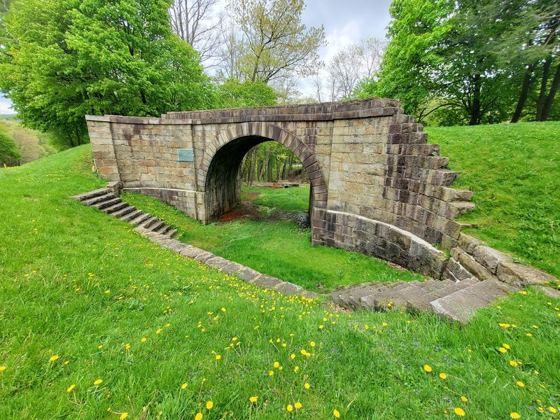
The first thing my eyes noticed was that nothing lines up the way a bridge normally does. The stones run diagonally across the arch, curving underneath in a spiral pattern that looks almost hand-drawn.
That slanted design is exactly what gives the bridge its name. A skew arch crosses at an angle instead of a right angle, which is much harder to build because every single stone has to be cut and fitted to follow a twisting curve.
Back in 1833, the Huntington, Cambria and Indiana Turnpike had a natural bend right at this spot. Instead of forcing wagons and horses to make a sharp turn, the builders angled the entire bridge to match the road.
Walk under the arch and look straight up. The spiraling courses of stone are still clearly visible, and you can trace how each block leans slightly differently than its neighbor.
Bring waterproof shoes if you plan to stand underneath, because the ground there stays damp most of the year. I learned that the slightly squishy way.
For a structure nearly two centuries old, the masonry is remarkably tight and clean.
The Railroad That Carried Boats Up a Mountain
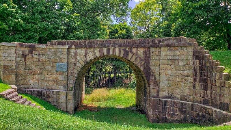
Here is the part that made me stop and reread the sign twice. The tracks that once ran beneath this arch belonged to the Allegheny Portage Railroad, and their job was to move canal boats over a mountain.
Canals were the highways of the early 1800s, but nobody could dig a canal through the Allegheny Mountains. So engineers came up with a workaround that sounds almost like a joke.
Boats were built in sections, lifted onto flat railcars, and hauled up a series of ten inclined planes using stationary engines and long ropes. At the top, they rolled down the other side and floated on again.
The whole system stretched 36.65 miles between Hollidaysburg and Johnstown, and it operated from 1834 until 1854.
Standing in that quiet green hollow, it is genuinely hard to picture boats sliding uphill through the trees. But that is exactly what happened here, over and over, for twenty years.
Pennsylvania’s Skew Arch Bridge crossed directly over Incline Plane No. 6, one of the steepest sections of the climb.
Once you know that, the bridge stops being cute and starts being astonishing.
Torn Down and Rebuilt Over a Road Dispute
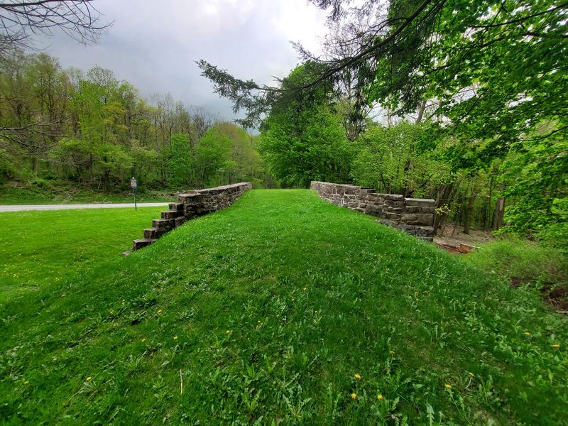
Turns out even 1830s construction projects had paperwork problems. The state originally began building this crossing at a normal right angle to the railroad, which would have been far simpler and cheaper.
The turnpike was privately run, though, and its owners insisted the road keep its existing curve. A dispute followed, and the partly built masonry had to come back apart.
A construction journal entry dated May 21, 1833 records the cost for taking up and relaying the masonry because of the change in placement. I find that oddly comforting, honestly.
Someone had to demolish their own finished stonework and rebuild it at a much harder angle because of a disagreement about a road bend.
The stones themselves came from broken stone and stone sleepers recycled from the railroad, which means the bridge is partly built from the railway it crossed.
Some accounts note that portions were fitted without mortar, relying purely on the precision of the cuts. That level of skill with hand tools is hard to wrap your head around.
Reading the plaques with that story in mind changed how I looked at every joint in the arch.
Small Numbers, Big Impression
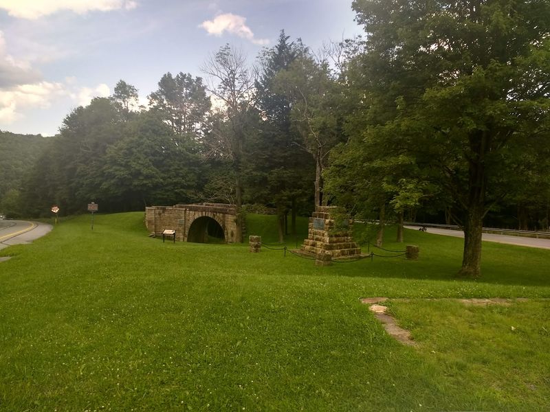
Measure it out and the bridge is not huge. The south elevation runs 60 feet 5 inches long, the north side measures 54 feet 11 inches, and the whole thing stands 22 feet 2 inches high.
Those uneven lengths are a direct result of the skew. One face of the bridge is simply longer than the other because of the angle it crosses at.
Photos do not really capture the scale, which surprised me. It felt bigger in person than the numbers suggest, probably because it sits in a low hollow with the road banked above it.
Walk from one end to the other and you can feel the slight mismatch between the two faces.
The arch opening frames the trees behind it nicely, which explains why locals have long used this spot for prom and wedding photos.
I spent maybe twenty minutes there and took more pictures than I expected to. Morning light hits the stone face well, and late afternoon gives the joints deeper shadow.
For a roadside stop, it delivers a surprising amount of visual character in a very small footprint.
Finding the Parking Spot Without Losing Your Mind
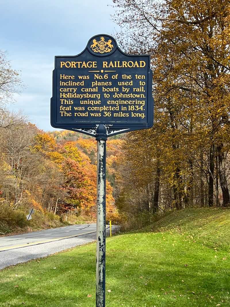
Let me save you the lap I had to make. The parking area sits on a small traffic island where old US Route 22 splits into separate lanes, and it holds roughly two cars.
Coming downhill, the pull-off is on the left, just after the road divides. It appears fast and disappears faster.
GPS was not especially helpful for me, and signage pointing toward parking is thin. Several visitors end up pulling onto the shoulder instead, which is not ideal.
Winter complicates things further, since the pull-off is not maintained for cold-weather parking.
The good news is that the site is reachable from both directions because of the split lanes, so an accidental overshoot is easy to fix with a short loop.
Alternatively, you can walk down from the Allegheny Portage Railroad visitor center area on a trail running roughly a third of a mile to three quarters of a mile. It is scenic and steep, and I mean actually steep.
If your knees prefer a gentler day, drive to the bridge and save your legs for the trails up at the summit.
Life After the Railroad Closed
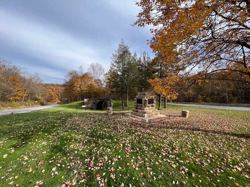
Most transportation relics get abandoned the moment their purpose disappears. That is not what happened here.
When the Allegheny Portage Railroad shut down in 1854, the tracks below the arch went silent, but the road above kept right on working. The turnpike later became a forerunner of US Route 22.
Horses and wagons gave way to early automobiles, and the bridge carried car traffic into the early twentieth century. An 1833 stone arch built for a canal-boat railway ended up hosting Model T era travelers.
Eventually the highway was realigned and the old alignment became a bypassed stretch of pavement, which is why the bridge now sits in a quiet green pocket instead of beside roaring traffic.
Stabilization work in 1979 included extensive repointing of the exterior and some facade mortaring to keep everything sound.
The preservation effort clearly paid off, because the structure looks solid rather than propped up.
Something about a bridge that outlived two entire transportation systems and then got quietly retired into a park struck me as a pretty good outcome. Not every old stonework survives its own obsolescence that gracefully.
Pairing the Bridge With the Rest of the Portage Story
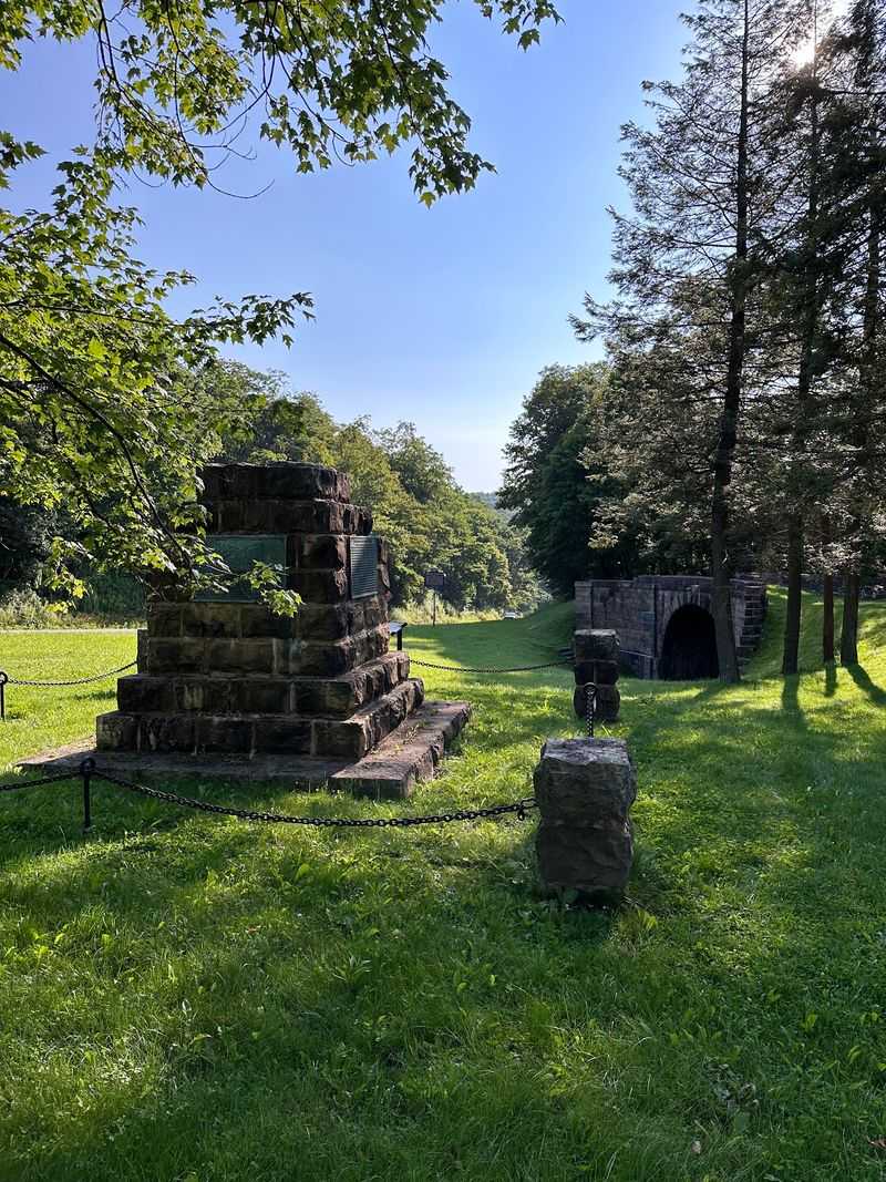
Honestly, the bridge alone is a fifteen minute stop. Combine it with the rest of the historic site and you have an easy half day.
Up at the summit sits the visitor center, where a short film and museum exhibits explain how the incline system actually functioned. The staff there know the details well, and the film helped the whole boats-over-mountains concept finally click for me.
Nearby you will find Engine House No. 6 and the Lemon House, a stone building that once served travelers along the portage route.
There is also a railroad observation area in the region, which makes this stretch of the Alleghenies a genuine treat for anyone who likes trains.
Park grounds stay open daily from sunrise to sunset, and entrance costs nothing.
I would suggest starting at the visitor center for context, then driving down to the bridge so the stonework means something when you see it. Doing it in reverse works too, just with more head-scratching.
Pack water and decent shoes, since the trails here climb more than the flat map suggests.
Address: 2892 Old Rte 22 #2610, Duncansville, Pennsylvania
