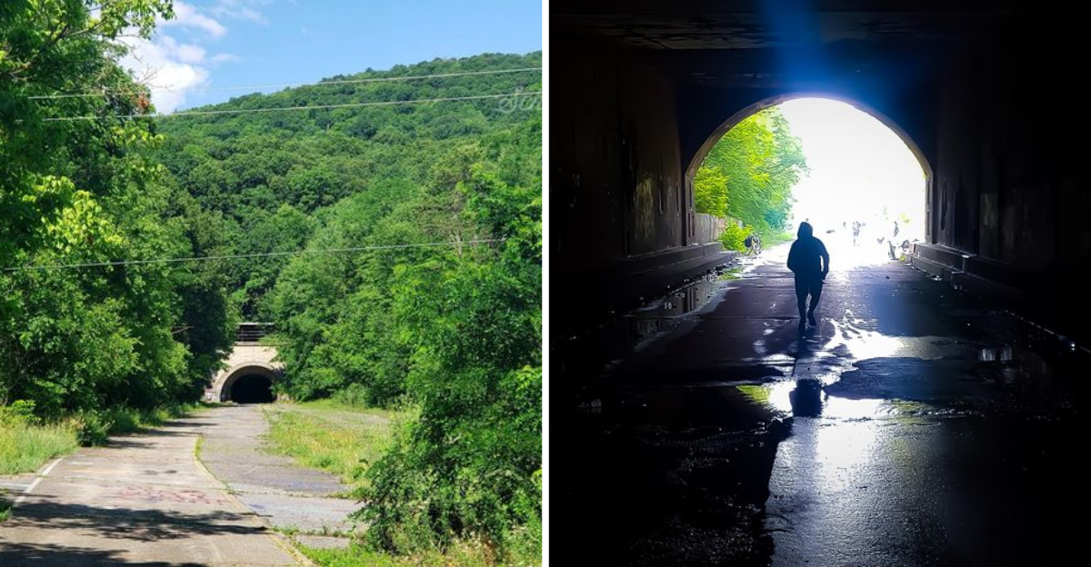
Cracked pavement that once carried thousands of cars a day now holds nothing but wind in the trees, and I still remember the first time I walked that stretch in Pennsylvania. Thirteen miles of the country’s very first superhighway simply stopped being a highway, and nobody ever tore it out.
Two long tunnels still cut straight through the mountains, unlit and echoing, swallowing hikers and cyclists into total darkness before spitting them out on the other side.
What makes the route special is not just the eeriness, but the layers of history stacked underneath it, from an unfinished 1880s railroad to the traffic jams of the 1960s that doomed the whole stretch.
The concrete is cracked and weathered, and the paint lines have long since faded, but the road still holds its shape, a ghost of the optimism that built it. Walking it feels like reading an old book somebody left out in the rain, pages faded but still legible.
I have gone back more than once, and every visit turns up something I missed before.
Where the Ghost Road Begins Near Breezewood
Breezewood is famous for being the town where a highway refuses to connect, so it feels almost too fitting that a whole turnpike hides just outside it. The access point sits near where Tannery Road meets US 30, and there is no grand entrance waiting for you.
I parked, followed a worn gravel path, and within two minutes the trees opened onto four lanes of pavement going absolutely nowhere.
The silence is the first thing that hits. Grass pushes up through the seams, saplings crowd the shoulders, and the yellow lines have faded into ghost stripes you can still trace with your eyes.
Locals call it The Old PA Pike Trail, or TOPP Trail for short, though the federal transportation folks are careful to say it is not officially open and visitors come at their own risk.
What surprised me most was the scale. Highways feel narrow when you drive them, but standing in the middle of one, with nothing coming, it looks impossibly wide.
Bring a flashlight from the start, because the darkness ahead is not the kind you can squint through.
Address: Tannery Road at US 30, Breezewood, Pennsylvania
Rays Hill Tunnel and Its Faint Pinprick of Light
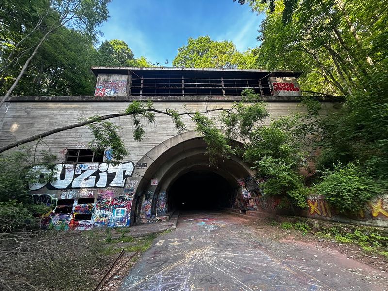
Of the two tunnels along this stretch, Rays Hill is the friendlier one, and I mean that literally. At roughly 3,532 feet, about seven tenths of a mile, it is the shortest of the seven original tunnels ever built for the Pennsylvania Turnpike.
Because the bore runs straight, you can spot a small coin of daylight at the far end the whole way through, and that little glow does wonders for your nerves.
Inside, sound behaves strangely. A cough bounces back at you three times, and footsteps sound like somebody walking a few yards behind.
Water drips from the ceiling in slow, unpredictable taps, and the temperature drops enough that I was glad for a jacket even in July.
A quirky detail I love: when the tunnel was fitted out for cars, ventilation fans were installed only at the western portal, an asymmetry that engineers argued about for years.
It started life as a railroad tunnel back in 1881, was reworked in 1938, carried traffic from 1940, and went quiet in 1968.
Walk it slowly. The middle section is genuinely, completely dark.
Sideling Hill Tunnel, the Long Dark Curve
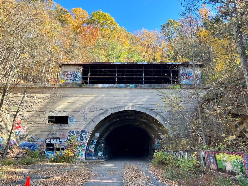
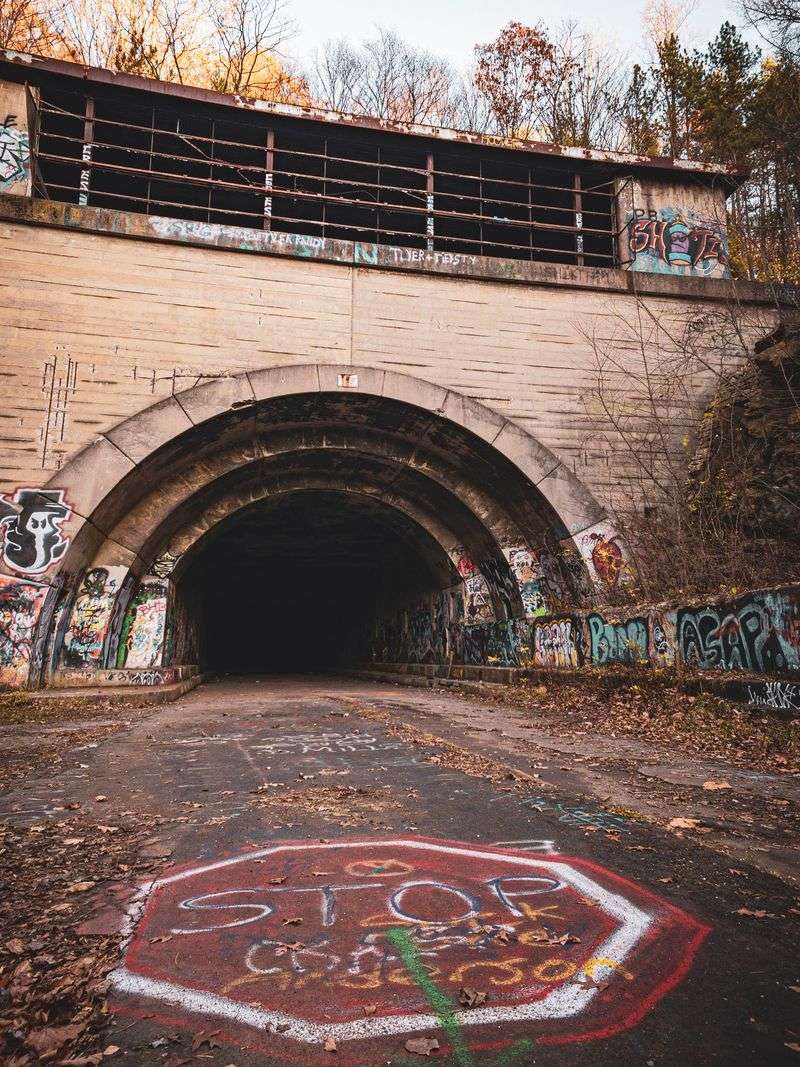
Nothing prepared me for the middle of Sideling Hill. At about 1.3 miles, or 6,782 feet, it is the longest tunnel of the original seven, and the bore curves ever so slightly as it passes through the mountain.
That gentle arc means the light behind you vanishes before any light appears ahead, leaving a stretch where your flashlight is the only proof the world still exists.
I stopped, switched my light off for maybe ten seconds, and honestly that was plenty. The dark is total, the kind where your eyes never adjust because there is simply nothing to adjust to.
Air moves through the tunnel in a slow, steady drift, carrying a mineral smell like wet stone and old concrete.
Decades after closing, the structure still feels solid. Portals show plenty of graffiti and crumbling edges, but the tunnel itself has held up remarkably well for something nobody maintains.
Puddles collect in low spots, so waterproof shoes earn their keep here.
My advice: carry a backup light, walk near the center, and take your time. Rushing ruins the whole strange spell of the place.
An 1880s Railroad Dream Buried Underneath
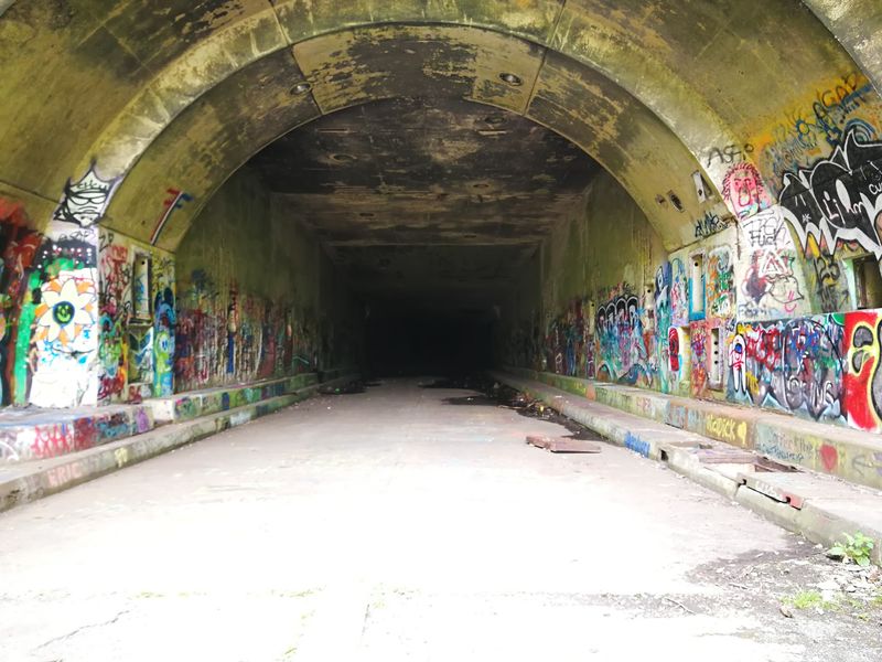
Long before anyone thought about cars here, this route belonged to trains that never came. The South Pennsylvania Railroad broke ground in the 1880s, boring tunnels through ridge after ridge in an attempt to open a competing rail line across the mountains.
Money ran out, rival interests intervened, and the project collapsed before a single scheduled train rolled through.
For roughly fifty years those half finished tunnels just sat there in the dark, filling with water and bats. Then in 1937 the newly formed Pennsylvania Turnpike Commission looked at the abandoned grade and saw a bargain.
Engineers adapted seven of the old railroad tunnels for automobiles, which is why the tunnels feel oddly narrow and cathedral-like rather than modern and boxy.
Knowing that backstory changes how the walk feels. You are not just exploring an abandoned highway, you are walking through a failed railroad wearing a highway costume.
Two generations of big ambition, stacked in the same hole in the mountain.
I keep thinking about the workers who cut these bores by hand and never saw them used. History rarely gives you a second act this literal.
October 1940 and America’s First Superhighway
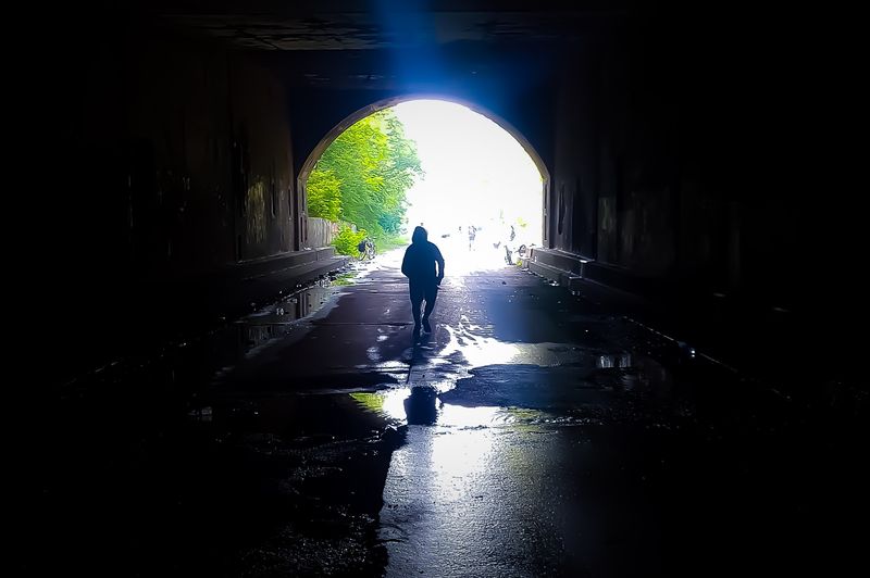
Picture opening day in October 1940, when drivers lined up to try something the United States had never had before. The Pennsylvania Turnpike was billed as the nation’s first superhighway, with no traffic lights, no crossroads, and gentle curves that let cars hold speed for miles.
People drove it just to say they had, treating a highway like an amusement park ride.
Service plazas, tunnel lighting, and long sweeping grades were genuine novelties then. Families packed picnics and made a whole day out of a road that mostly went between farm country and coal country.
Traffic beat every projection almost immediately, which turned out to be the seed of the problem.
Those adapted railroad tunnels only had room for two lanes, one in each direction, so four lanes of cars had to squeeze down to two at every mountain.
Walking the abandoned stretch, you can still see where the roadway pinches toward the portals.
It is a physical reminder that even brilliant engineering can be outgrown. What thrilled drivers in 1940 was frustrating them badly within twenty years.
The Traffic Jams That Cut Thirteen Miles
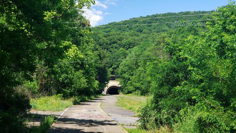
Five miles of backed up cars. That was reality at these tunnels by the 1960s, when bumper to bumper lines formed as four lanes funneled into two, and vacationing families sat baking in the sun waiting their turn.
Engineers studied the mess and reached a straightforward conclusion: stop trying to fix the tunnels and go around them instead.
Recommendations called for bypasses at Sideling Hill, Rays Hill, and Laurel Hill. New wider roadway was cut nearby with full four-lane width and open sky overhead.
In November 1968, this thirteen mile section was taken out of service and left behind, tunnels and all.
Nobody bothered demolishing it, which is exactly why we can walk it today. Removing that much concrete and rock would have cost far more than simply letting the forest move in.
In 2005 the Turnpike Commission demolished overpasses over US 30 and Pump Station Road, mainly to keep motorized vehicles out and to make property boundaries clear.
The result is a highway preserved by neglect. Traffic congestion, of all things, is why this quiet place exists.
Cove Valley Travel Plaza and the Slow Return of the Forest
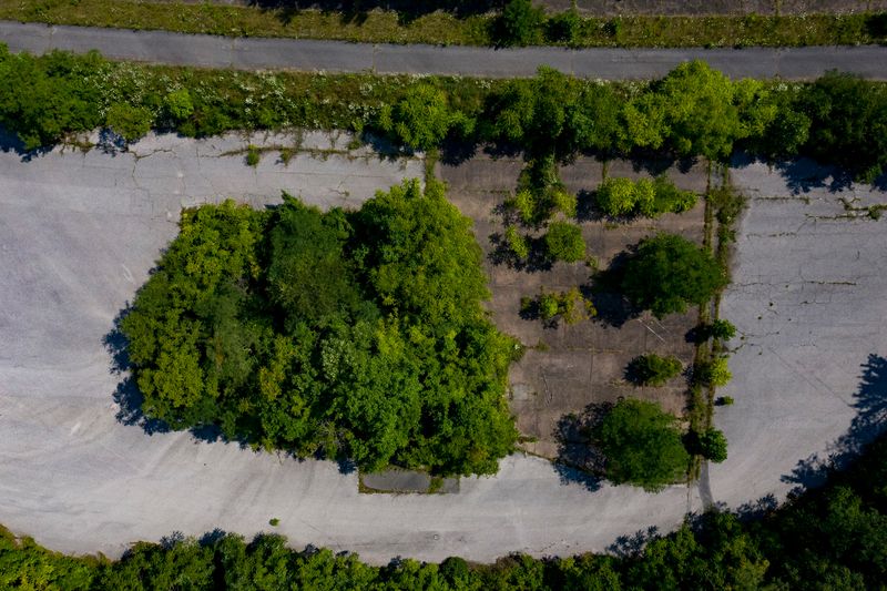
Somewhere along the forgotten miles sits the site of the Cove Valley Travel Plaza, which once handed out maps and hot coffee to travelers heading east and west. When the road closed, the plaza closed with it, and now the pavement out front hosts nothing but weeds and the occasional deer.
Finding it feels like spotting a rest stop in a dream you half remember.
Nature has been patient and thorough here. Moss fills the cracks, vines climb the concrete, and young trees have taken root right where cars used to park.
Folks often describe the whole stretch as post-apocalyptic, and honestly that word fits better than anything I can come up with.
Practical notes matter on this section, because there are no restrooms, no water fountains, and no help nearby. The other access point is near Sideling Hill, reachable from Pump Station Road or Oregon Road.
Pack water, wear real shoes, and carry lights for both tunnels.
What stays with me is how quickly a busy place can go quiet, and how gracefully the woods take it back.
