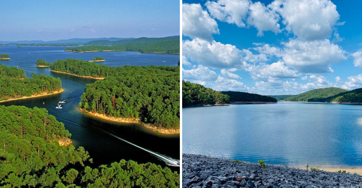
Arkansas has a place where the water runs so clear you can see straight to the bottom, and the mountains wrap around you like they have been keeping a secret for centuries.
I stumbled onto that lake almost by accident, and I am genuinely glad I did. Deep into the Ouachita Mountains, it is the largest in the state, covering roughly 40,000 acres of water that locals sometimes call the Caribbean of Arkansas.
The name alone made me curious, but nothing really prepares you for the moment you actually see it. I spent an afternoon paddling across the glassy surface, passing uninhabited islands and watching the dense greenery of the national forest rise up on every side.
That shoreline stretches for hundreds of miles, and the quiet, steady beauty of everything around it earns its reputation without any flashy marketing at all.
The Lake That Was Built by Hand and Filled by History
Most lakes you visit just exist, like they have always been there. Lake Ouachita is different because you can actually trace its birthday back to a specific moment in time.
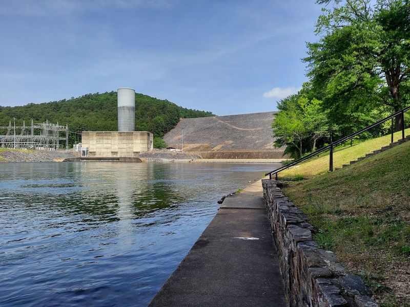
The U.S. Army Corps of Engineers broke ground on Blakely Mountain Dam in 1948, and by July 1952 the floodgates closed, letting the Ouachita River valley slowly fill with water.
The dam was officially dedicated on July 4, 1956, a fitting date for something that would become a landmark of public life in Arkansas. Its original purpose was flood control and hydroelectric power generation, though recreation and water supply were added to that list as the years passed.
What makes this history feel so vivid is what lies beneath the surface. Entire forests were submerged when the valley flooded, and some of those trees stood over 60 feet tall before the water claimed them.
Small communities were relocated, including the town of Buckville in Garland County, whose cemetery was carefully moved to higher ground and is now listed on the National Register of Historic Places. Knowing all of that while floating above it gives the lake a kind of quiet depth that goes well beyond its recorded maximum of around 406 feet near the dam itself.
Crystal-Clear Water and the Science Behind the Sparkle
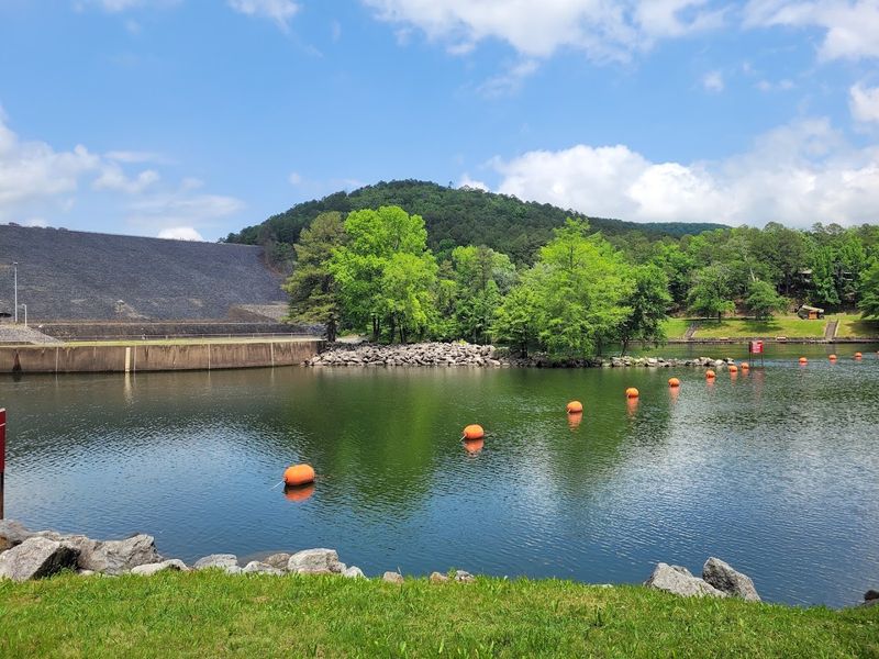
People throw around the phrase “clear water” pretty loosely when talking about lakes, but Lake Ouachita genuinely earns it. The lake consistently ranks among the cleanest freshwater lakes in the entire United States, and the visibility underwater can be striking enough to make snorkeling feel almost surreal.
By midsummer, surface water temperatures typically climb to somewhere between 77 and 84 degrees Fahrenheit, which makes it warm enough to swim comfortably for long stretches. Because of the lake’s sheer size, it never freezes, so the water stays in a constant state of slow, natural circulation throughout the year.
Part of what keeps the lake so pristine is the largely undeveloped shoreline. With somewhere between 690 and 975 miles of shoreline and more than 200 uninhabited islands, there is very little human development close to the water’s edge.
The surrounding Ouachita National Forest acts as a natural buffer, filtering runoff before it ever reaches the lake. One of the most unexpected rewards of that clarity is the rare freshwater jellyfish that live here.
Non-stinging and nearly translucent, they drift through the water like something out of a nature documentary, making every swim feel like a small, surprising adventure.
Islands, Caves, and Crystals Hiding in Plain Sight
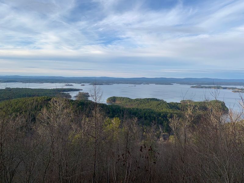
Hotel Island is the kind of place that sounds made up until you actually pull your kayak onto its soft sand shore. It sits quietly in the middle of Lake Ouachita, offering natural caves to explore and a beach that feels almost impossibly peaceful for somewhere so easy to reach by water.
Crystal Island tells a completely different story. Named for the milky quartz deposits scattered along its banks, it gives geology enthusiasts a reason to get genuinely excited.
The Ouachita Mountains sit above one of the largest known crystal veins in the world, and this island is one of the more accessible places to see that up close without needing a mining permit.
Bird Island rounds out the trio with something a little more alive. It serves as Arkansas’s largest known purple martin roost, and during migration season, thousands of birds descend on it at dusk in a spectacle that is hard to describe without sounding dramatic.
Each of these islands is reachable by boat, and primitive camping is allowed on many of them. Spending a night anchored off one of these shores, with nothing but forest sounds and starlight around you, is exactly the kind of experience that makes Lake Ouachita so hard to forget once you have been there.
The Geo-Float Trail: Where Geology Becomes an Adventure
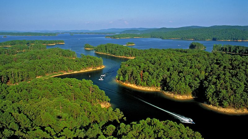
Not every lake has a trail that doubles as a geology lesson, but Lake Ouachita is not every lake. The Geo-Float Trail is a 16-mile water-based interpretive trail with 12 marked stops, designed to guide paddlers and boaters through some of the most geologically interesting spots on the lake.
One of the most photographed stops is Zebra Rock, a formation of dark sandstone dramatically streaked with white quartz veins. It looks almost architectural, like something designed rather than naturally formed.
The Ouachita Mountains themselves are fold-mountains that took shape roughly 250 to 300 million years ago when continental plates collided, and the Geo-Float Trail puts you right in the middle of that ancient story.
What makes this trail especially notable is its designation as the first water-based interpretive trail to be recognized as a National Recreation Trail in the United States. That is not a small distinction.
Paddlers can move at their own pace, stopping to read interpretive signs, peer into the water below, or simply sit with the silence for a while. For anyone who thinks geology sounds dry, this trail has a way of changing that opinion almost immediately.
It is one of those rare experiences that manages to be educational and genuinely enjoyable at the same time.
Fishing, Boating, and Every Reason to Get on the Water
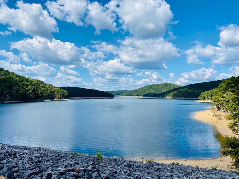
Lake Ouachita has a reputation among anglers that stretches well beyond Arkansas state lines. The lake holds an impressive variety of fish species, including largemouth bass, smallmouth bass, striped bass, crappie, bream, catfish, walleye, and even rainbow trout.
Submerged timber and quiet coves create ideal habitat, and early mornings on the water here have a particular kind of stillness that serious fishers tend to love.
Boating options are wide open. Several marinas around the lake offer rentals ranging from motorboats and party barges to kayaks and canoes, so you do not need to haul your own gear to enjoy a full day out.
Houseboating is especially popular here, giving families a way to spend multiple days exploring the lake’s far corners without rushing back to shore each evening.
For those who prefer something quieter, paddleboarding and kayaking are ideal for slipping into the smaller coves where motorboats rarely venture. The lake’s calm sections feel almost meditative in the early hours before the wind picks up.
There are also approximately 30 designated scuba diving spots, making Lake Ouachita one of the more unusual freshwater diving destinations in the South. The combination of warm water, high clarity, and underwater timber makes those dives genuinely memorable.
Trails, Camping, and the Forest That Wraps Around Everything
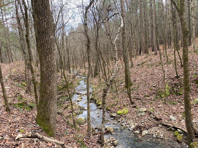
Lake Ouachita State Park sits right along the southern shore, and it serves as a solid base for anyone who wants to explore the surrounding forest on foot. The Caddo Bend Trail runs four miles through a mix of pine and hardwood forest, following the shoreline closely enough that you catch frequent glimpses of the water between the trees.
Quartz formations appear along parts of the trail, which adds a small element of treasure-hunting to what is already a beautiful walk.
The Dogwood Trail is shorter at just half a mile, but it does a nice job of introducing visitors to the local plants and wildlife in a manageable stretch. For those who want something more demanding, the Lake Ouachita Vista Trail, known locally as LOViT, covers 40 miles through the Ouachita National Forest with sweeping views of the lake from elevated ridges.
Camping options here are genuinely plentiful. The Corps of Engineers manages over 1,100 campsites around the lake, and the state park adds another 93 sites with full hook-ups available.
Primitive island camping is allowed on many of the uninhabited islands, which is about as close to off-grid as most people ever get. Year-round interpretive programs at the park, including guided hikes, eagle cruises, and kayak tours, give every visit a different texture depending on the season.
The Native History and the River That Came Before the Lake
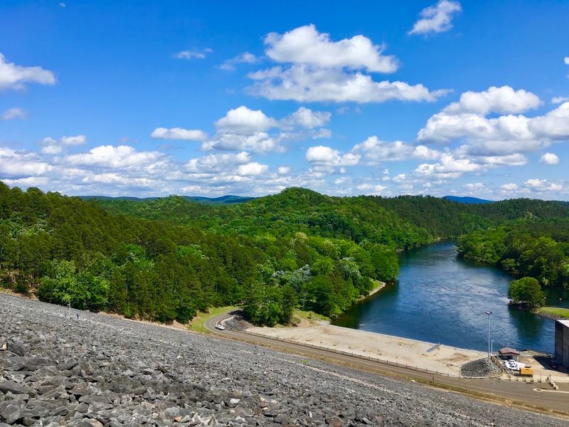
Before the dam, before the reservoir, before the first boat ramp was ever poured, the Ouachita River ran freely through this valley and carried centuries of human history along with it. The river was a vital route for transportation and trade, especially after Arkansas became a state in 1836, when steamboat travel along its length was common enough to shape entire communities.
The name Ouachita itself traces back much further. It comes from the French spelling of the Native American word Washita, which is derived from two Choctaw words, Owa Chito, meaning big hunt.
Various tribes called this region home over the centuries, including the Caddo, Osage, Chickasaw, Cherokee, Choctaw, Tensas, and Washita peoples. Their presence here left a cultural imprint that the rising water of 1952 could not erase.
What strikes me most about this place is how layered it feels. You are swimming above submerged forests.
You are paddling over towns that no longer exist on any current map. You are moving through a landscape shaped by millions of years of geology and thousands of years of human life.
Lake Ouachita is not just a beautiful body of water. It is an archive, and every visit gives you a new page to read.
Address: 1201 Blakely Dam Rd, Royal, AR 71968
