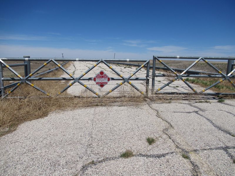
Somewhere out in the far western stretch of Oklahoma, there is a concrete boat ramp that slopes down into knee-high prairie grass instead of water. I went looking for a lake and found a wide grassy basin, a dam the size of a small mountain, and a story that says more about groundwater than any textbook ever could.
It costs nothing to walk out there, and the quiet is the kind that makes you talk softer without meaning to. If you like places that surprise you sideways, this one delivers in a way no postcard lake ever could.
A Reservoir On The Panhandle Map That Holds Almost No Water
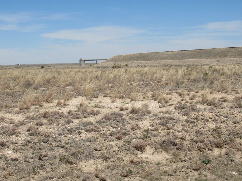
Out in Texas County, north of Hardesty and east of Guymon, the map still shows a lake. Drive there and you find Optima Lake, a federal reservoir project that was built, finished, signed off on, and then simply never filled the way anyone planned.
The basin is real. The dam is real, and it is enormous.
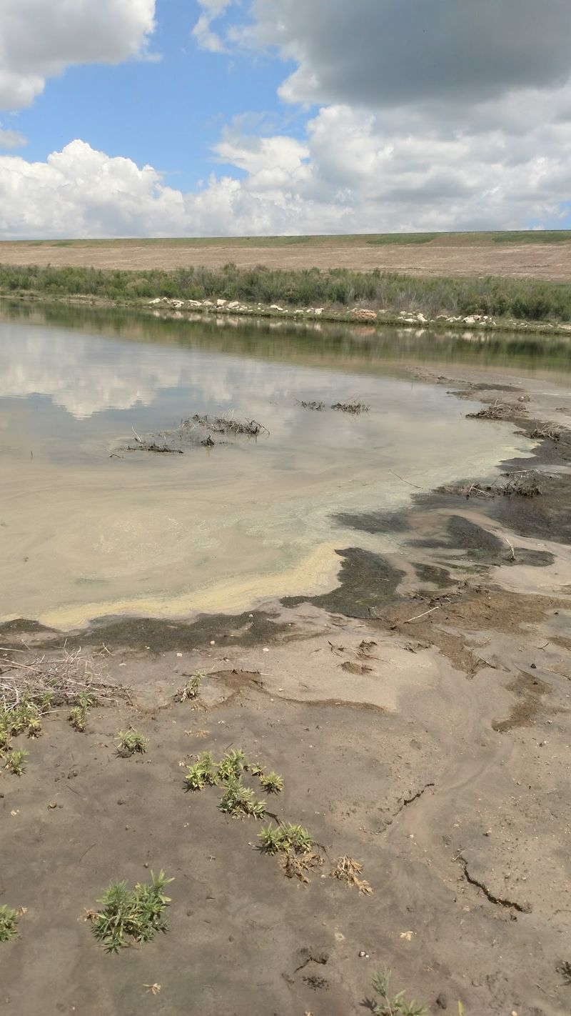
What is missing is the water, which has never reached more than about five percent of the lake’s designed capacity since the project wrapped up in 1978.
Instead of a shoreline, you get grass. Instead of docks bobbing in the chop, you get concrete ramps angling down into weeds and open ground, with the occasional shallow puddle where a deep channel was supposed to be.
The U.S. Army Corps of Engineers still owns and watches over the dam, though it runs under minimal caretaker status these days.
Public use areas are marked as land access only, which is a polite way of saying leave the boat trailer at home.
For a state full of big, busy reservoirs, Optima stands alone as the one that stayed empty, and that alone makes the drive interesting.
From A 1936 Flood Control Act To A 1978 Ribbon Cutting
Back in the 1930s, when the Panhandle was still shaking Dust Bowl dirt out of its collars, planners started sketching a reservoir on the Beaver River. Congress authorized the idea under the Flood Control Act of 1936, and then the project sat on a shelf for decades.
Construction finally started in 1966. Crews spent twelve years piling up an earthen dam, laying access roads, pouring ramps, and building the camping and day-use facilities a new lake would need.
The goals were exactly what you would expect: control floods, supply drinking water, feed irrigation, offer recreation, and give fish and wildlife a boost. On paper it was a win for every community in the region.
The final bill landed somewhere between roughly $46.1 million and $50 million, depending on which accounting you read. In 1970s dollars, that was serious money for a corner of the state with more cattle than people.
Work wrapped in 1978. The infrastructure was ready, the ramps were graded, the signs were posted, and everyone waited for the Beaver River to do its part.
That is where the plan and the weather stopped agreeing.
The Ogallala Aquifer Quietly Rewrote The Whole Plan
Groundwater is the real main character here. While crews were busy building the dam between 1966 and 1978, farms across the Panhandle and neighboring states were pumping hard from the Ogallala Aquifer for irrigation and drinking supplies.
Pull enough water out of the ground and the rivers above it thin out. The Beaver River, which becomes the North Canadian downstream and was supposed to be the lake’s main source, saw its flow drop sharply during those same construction years.
There was a second factor too, and it is almost poetic. After the Dust Bowl, farmers across the region adopted terracing, no-till methods, and other conservation practices designed to keep soil and moisture on their own land.
Those practices worked. Less runoff washed into the creeks and the river, which was great for topsoil and rough for a reservoir waiting to be fed.
By the mid-1980s, the Corps of Engineers accepted that the reduced flow was not a dry spell but a permanent condition. The lake was never going to fill, and the math was not going to change.
A Dam 120 Feet Tall Guarding A Field
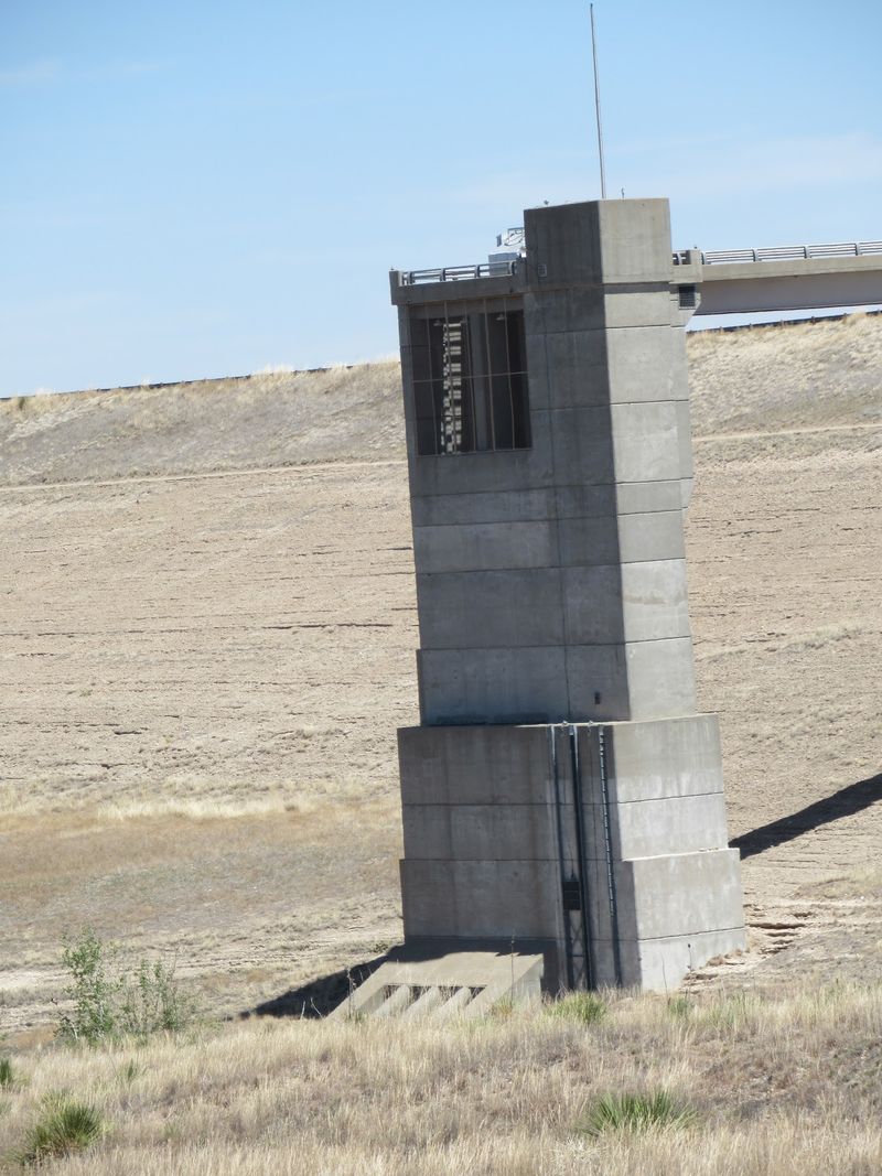
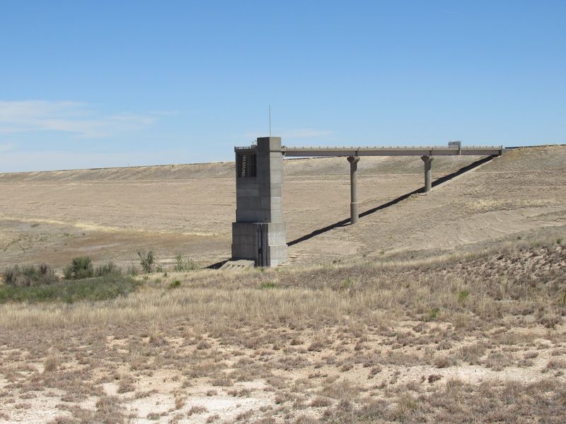
Standing at the base of it, you feel small. The Optima dam rises 120 feet and stretches more than 16,000 feet long, which works out to over three miles of engineered earth across the valley.
Walk the top of it and the view splits in two. On one side, the rolling grassland of the Panhandle.
On the other, the basin that was meant to be covered in open water, now looking like an unusually flat pasture.
Scale is the thing that gets visitors. Photos flatten it, and there is no boat, no dock, and no shoreline to give your eye a sense of distance, so the structure reads even stranger in person.
The Corps ended onsite operations in 1995 but still maintains the dam under caretaker status. It is inspected and kept sound, because a dam does not stop being a dam just because the lake declined to show up.
Bring a hat and expect wind. The Panhandle rarely holds still, and there is nothing between you and Colorado to slow it down.
Concrete Ramps That End In Weeds
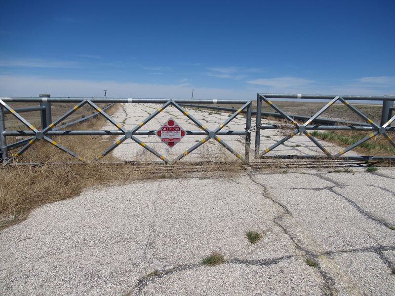
Here is the image everybody comes for. A proper boat ramp, wide and grooved and built to last, slanting down toward the basin and then just stopping in a tangle of grass and sagebrush.
No water. No mud line.
No stranded dock. Just pale concrete meeting prairie like the two were never introduced.
People who wander out there tend to describe the feeling as cinematic, and one visitor joked that the setting would suit a movie about the end of the world. It is not spooky exactly, but it does rearrange your expectations fast.
The ramps were built correctly, which is the part that sticks with you. Somebody surveyed the grade, poured the slab, painted the lines, and imagined families backing trailers down on a Saturday in July.
Bring a camera with a wide lens if you have one. Shooting from the bottom of the ramp looking up at the dam gives you the full contradiction in a single frame.
Sturdy shoes help, since the grass around the concrete hides uneven ground, old curbs, and the occasional prickly pear.
What The Corps Took Down In 2010
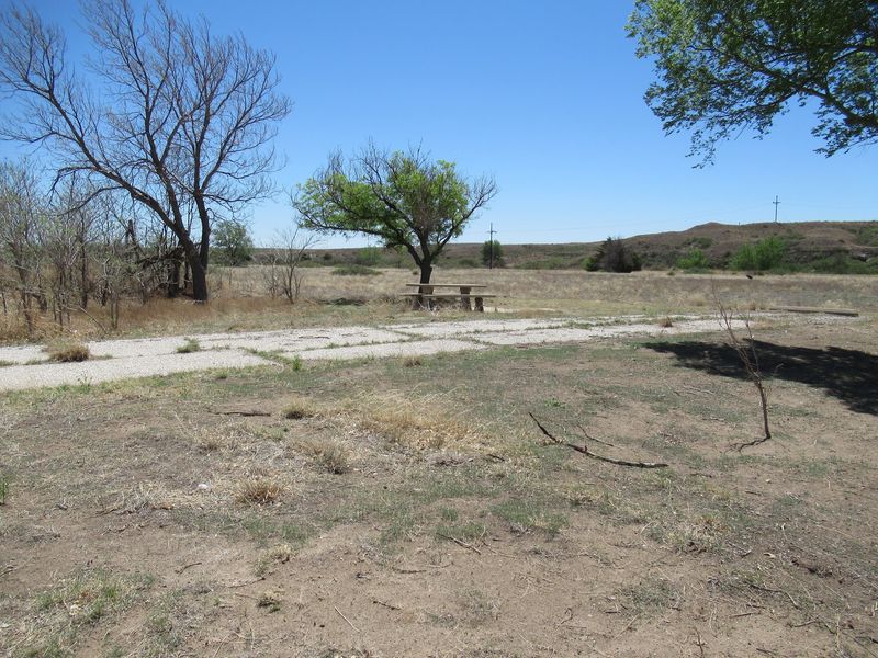
Once upon a time there were campgrounds here, with restrooms, shelters, and the usual recreation-area buildings a new federal lake receives. They were built for crowds that never had a reason to arrive.
Years of sitting unused took their toll. In 2010, the Corps of Engineers dismantled many of the original camping facilities and structures, citing public safety as the reason.
What remains reads like an outline. Old roads, concrete pads, curb stubs, and posts stand where picnic tables and bathhouses used to be, slowly getting reclaimed by grass and blowing sand.
Walking through it is oddly moving. You can trace the loops where RV pads were planned and see the logic of a layout designed for a busy summer weekend that never came.
The Corps is direct about current conditions: public use areas are land access only, and the agency states plainly that swimming, boating, fishing, and camping are not offered because of the consistently low water. Plan accordingly rather than showing up with a tent and hopeful intentions.
Treat the leftovers as history to observe, not playground equipment to climb.
Grassland, Turkeys, And A Wildlife Management Area
Nature filled the gap water left behind. The land around the basin is now managed as a state wildlife management area, opened for public hunting of species such as deer, duck, and quail in their proper seasons.
Results vary, honestly. Some accounts note that wildlife numbers are limited precisely because the water never arrived, and a duck hunt at a lake with no lake has obvious challenges.
Turkeys, though, seem to have found it agreeable. One longtime visitor mentioned a large wild turkey population, and birders have reported the kind of grassland species that thrive where nobody mows.
Wander the edges at sunrise and you may hear meadowlarks, see mule deer tracks, or watch a hawk work the thermals over the empty basin. The absence of crowds is a genuine advantage for anyone with binoculars.
Anyone planning to hunt should check current Oklahoma Department of Wildlife Conservation regulations, seasons, and license requirements before heading out, since rules for management areas change from year to year.
For everyone else, it is simply good, quiet prairie walking with big sky overhead.
The Sound Of Nothing At All
Silence out here has texture. No boat motors, no generators humming from a campground loop, no radio drifting across the water because there is no water to carry it.
Mostly you hear wind moving through grass, which in the Panhandle is less a breeze and more a constant conversation. Add a few grasshoppers in late summer and that is the full soundtrack.
Sunsets are the payoff. With a horizon this unobstructed, evening light spreads across the basin and turns the dry grass copper, and the dam becomes a long dark line against the color.
Night skies deserve a mention too. Distance from any big city keeps light pollution low, and on a clear, moonless night the star count is genuinely impressive.
The Corps encourages visitors to appreciate the quiet natural setting regardless of water levels, and that phrasing turns out to be accurate rather than promotional. Quiet is the actual attraction.
Bring a folding chair, a thermos, and zero agenda. Some places reward activity, and this one rewards sitting still.
Getting There From Guymon, Tulsa, Or Oklahoma City
Let’s be honest about the drive, because this is not a Saturday-morning detour for most Oklahomans. The site sits in Texas County, north of Hardesty and east of Guymon, deep in the Panhandle.
From Guymon it is a short run, well under an hour. From Oklahoma City you are looking at roughly a five-hour haul northwest, and from Tulsa closer to seven, which puts this firmly in the overnight-trip category.
Most travelers fold it into a bigger Panhandle loop. Black Mesa, the Cimarron County high country, and the small towns along US-54 and US-64 make natural companions for a weekend.
Fuel up in Guymon or Hardesty before heading out. Services near the site are essentially nonexistent, and cell coverage can get patchy once you leave the highway.
Access roads are paved in places and gravel in others, so a normal car usually manages fine in dry weather. After heavy rain, unpaved stretches can get slick, and a higher-clearance vehicle earns its keep.
Pack water, snacks, and a paper map as a backup.
Free Gate, No Concessions, No Rangers On Site
Cost is the easy part: there is no admission, no gate fee, and no parking charge. Federal land access areas here are open for day use without a booth or a payment envelope.
Do not expect amenities, though. Onsite operations ended in 1995, so there is no staffed office, no visitor center, no store, and no reliable restroom.
What that means practically is that everything you need comes with you. Water especially, since Panhandle summers regularly push past 100 degrees and shade is in short supply.
Signage marks the public use areas as land access only, and posted rules reflect that swimming, boating, fishing, and camping are not available. Following those notices keeps the area open for everyone who comes after.
Daylight hours are the sensible window. Navigating unfamiliar gravel roads around a large earthen dam after dark is not a great plan unless you know the route.
For a family, the total budget is gas and sandwiches. For the price of a tank of fuel, you get one of the strangest landscapes the state has to offer.
Best Seasons, Worst Weather, And A Few Safety Notes
Timing changes the experience more than you would think. Spring greens the basin and brings wildflowers, while fall delivers golden grass, mild afternoons, and the clearest air of the year.
Summer is rough. Heat builds fast with no shade and no water to cool the air, and midday visits in July or August can turn unpleasant in a hurry.
Storm season runs spring into early summer, and the Panhandle gets its share of severe weather plus blowing dust. Check the forecast the morning you go, not the night before.
Winter has its own appeal for photographers, with low light, bleached grass, and a stark look that suits the subject. Bring a windproof layer, because there is nothing out there to block a north wind.
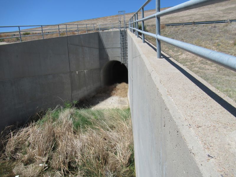
A few practical cautions: watch for snakes in warm months, stay off any remaining structures, and keep kids close near the dam and spillway areas.
Tell somebody your plans before you head out. Traffic is light enough that help may not be passing by anytime soon.
Worth The Drive If You Like Your History Wide Open
So who should actually make this trip? Anyone drawn to engineering stories, water history, ghost-town atmosphere, or landscapes that do not look like anywhere else in the state.
Families with restless little ones may want to pair it with Guymon stops rather than treating it as the day’s main event. There is no playground, no swimming, and nothing to buy.
Photographers, writers, and road-trip types tend to love it. The handful of people who do visit describe it as peaceful and unusual, and the turkey sightings are a nice bonus.
What stays with you is the lesson underneath. A $46 million project, twelve years of construction, a three-mile dam, and a river that quietly ran short because of what was happening hundreds of feet underground.
That is not a failure story so much as a reminder of how much the Ogallala Aquifer shapes life out here. Standing on a dry ramp makes the point better than any chart.
Go for the strangeness, stay for the quiet, and drive home thinking about water.
