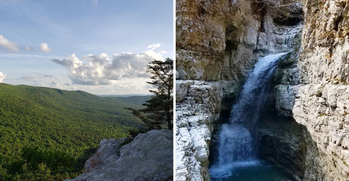
Think Alabama hiking is all flat paths and easy strolls? One trail can change that idea pretty quickly.
Across the state, you’ll find sandstone canyons, rocky ridges, pine-covered mountains, and rushing creeks that make every mile feel a little more rewarding. Some trails lead to waterfalls tumbling over stone ledges.
Others climb high enough to give you sweeping views that stretch far beyond the trees. And if you’re willing to work for the scenery, a few even take you deep into rugged canyons where the landscape feels nothing like you expected.
So, where should you start when you want a hike with a view worth chasing? From the Tennessee line to the highest point in the state, these 9 trails bring plenty of scenery, elevation, and adventure to the table.
Lace up, grab some extra water, and get ready to see what’s waiting beyond the pavement.
1. Stone Cuts Trail, Monte Sano State Park
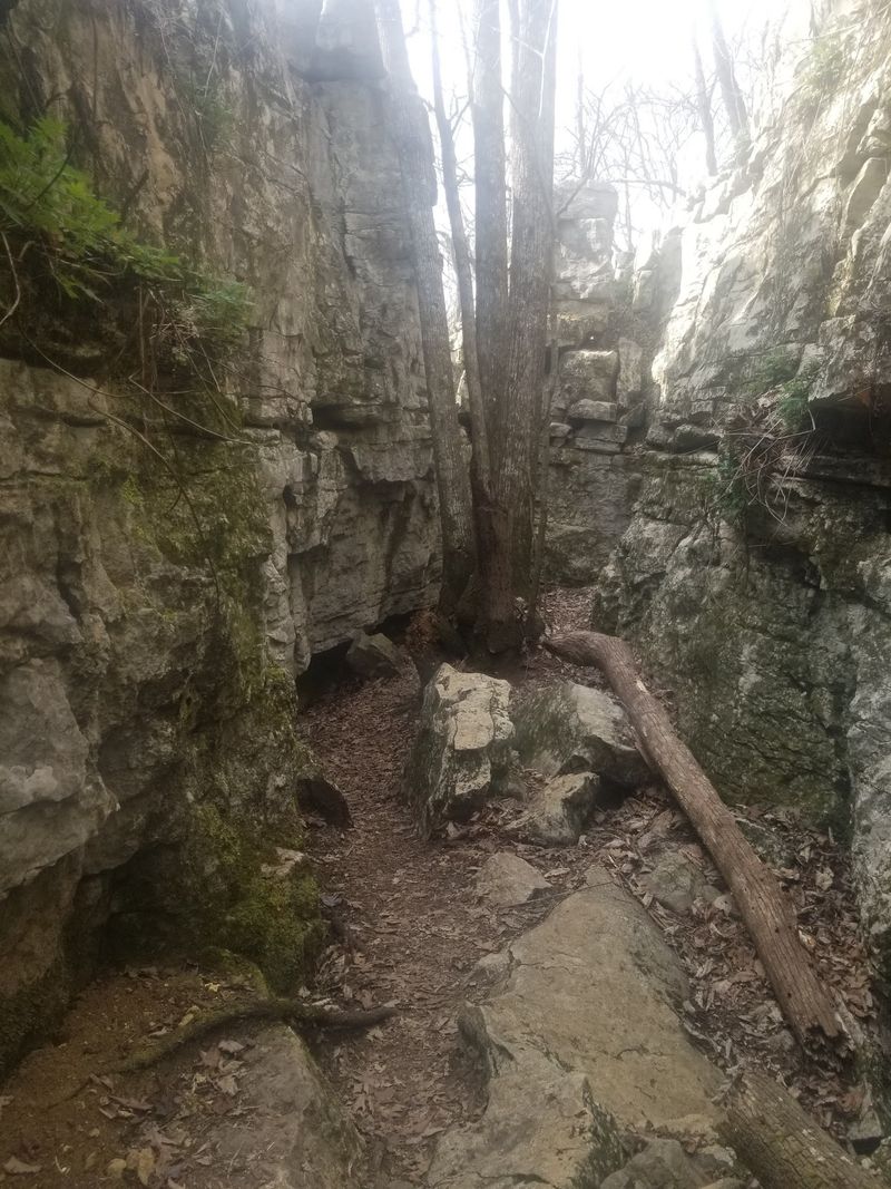
Massive slabs of limestone lean together like a hallway built by giants, and that is the strange charm of this Huntsville favorite. Cool air pours out of the shaded gaps even on muggy August afternoons.
The route runs along the mountain’s flank, weaving through rock corridors and short cave-like tunnels before opening onto ledges that look out across the valley. Rocky switchbacks make up much of the climb, so shoes with real tread matter here more than fancy gear.
Most hikers rate the difficulty as moderate. The distance is manageable for a half day, though the uneven footing slows things down, which is honestly a good excuse to stop and study the fossil patterns pressed into the stone.
Autumn turns the surrounding hardwoods gold and copper, and winter strips the leaves away for the widest overlooks of the year. Spring brings wildflowers tucked into every damp crevice.
Bring a headlamp if exploring the tighter passages, since the rock swallows daylight quickly. Cell service can be spotty along the lower sections.
Families do well here as long as younger hikers are steady on their feet. The mix of squeeze-throughs and big views keeps attention from drifting, and the park’s nearby picnic areas make a comfortable finish to the day.
Address: 5105 Nolen Ave, Huntsville, AL 35801
2. Kings Chair Loop, Oak Mountain State Park
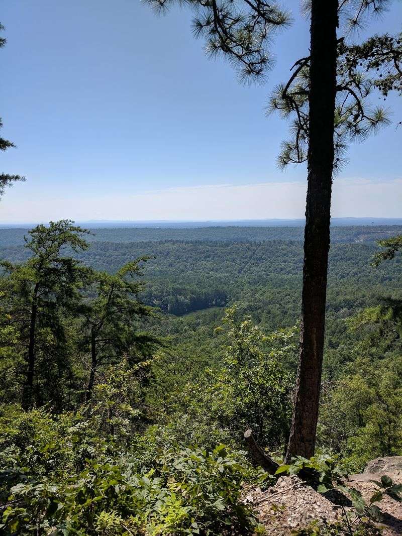
Ask hikers around Birmingham where the best southward view in the state sits, and this rocky perch comes up again and again. The outcropping juts out over a sea of pine and hardwood, and the horizon rolls away in soft blue ridges.
Getting there covers roughly four and a half miles on a loop of rocky dirt path. Steep climbs alternate with knee-testing descents, so pacing beats speed.
Difficulty lands squarely in the moderate range. Nothing technical, but the elevation changes add up, especially in summer humidity when the forest holds heat like a blanket.
Shade covers most of the route, which helps. Trail markers are clear, though the park’s web of connecting paths means glancing at a map now and then saves confusion at junctions.
Morning light softens the valley below, while late afternoon paints the ridgelines in warm orange. Photographers tend to favor the golden hour, and there is usually enough room on the rock for several groups to spread out.
Pack more water than seems necessary. There are no refill points along the loop.
Sturdy footwear helps on the loose gravel sections near the top. Once seated on that broad slab of stone, the whole climb suddenly feels like a bargain.
Address: 200 Terrace Dr, Pelham, AL 35124
3. Eberhart Trail, Little River Canyon National Preserve
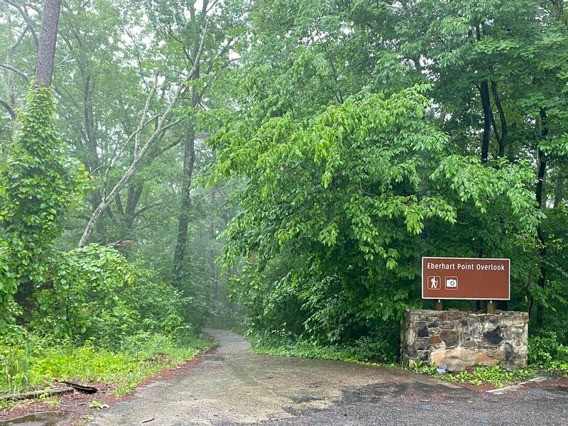
A ghost of an old amusement park still lingers on this hillside. Concrete pillars from a long-gone chairlift stand quietly among the trees, slowly disappearing under moss and vines.
The path drops hard from the rim toward the canyon floor, folding into switchback after switchback. Loose rock and steep grades earn it a moderate to strenuous label, and the climb back out is where legs really get tested.
Down at the bottom, the river runs between walls that tower overhead in layered sandstone. The scale is genuinely startling for anyone expecting flat Southern terrain.
Trekking poles are worth carrying. Ankles appreciate the extra support on the descent.
Water levels shift with the seasons, and after heavy rain the river turns loud and fast. Spring runoff makes the canyon roar.
Start early to leave plenty of daylight for the return trip, since the uphill takes considerably longer than the way down. Heat builds inside the canyon walls by midday.
The rim road nearby offers pull-offs with easier viewpoints for anyone who would rather admire the gorge without the workout. Both experiences pair nicely in a single visit.
Watch footing near wet rock. Slick surfaces near the water catch people off guard.
Address: Eberhart Point Overlook, Little River Canyon Rim Pkwy, Fort Payne, AL 35967
4. Pulpit Rock Trail, Cheaha State Park
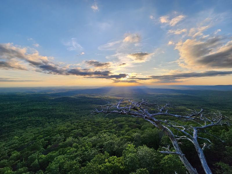
Alabama’s rooftop sits here, on Mount Cheaha, and even a short walk delivers a view that feels borrowed from somewhere farther north. The rock formation at the end juts out over open air like a natural balcony.
Distance is modest, which makes it popular with visitors who want a big payoff without a big commitment. Moderately steep grades and a few rooty steps still keep things interesting.
Sunset draws the biggest crowds. Arriving a bit early secures a comfortable spot along the ledge, and the colors spreading across the Talladega foothills are worth the wait.
Because the park sits at the state’s highest elevation, temperatures often run cooler than the surrounding lowlands. A light layer comes in handy after dark.
Keep a respectful distance from the drop-offs, especially with children or pets along. There are no railings, and the wind can gust unexpectedly.
Fog rolls through some mornings, turning the valley into a soft white ocean with distant ridges poking through. Photographers chase that condition all year.
Nearby park facilities make it easy to build a full day around the hike. Several other short trails branch off close by for anyone wanting more time on the mountain.
Address: 19644 Hwy 281, Delta, AL 36258
5. Point Rock Trail, Buck’s Pocket State Park
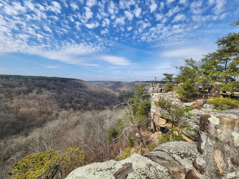
Two creeks meet far below this overlook, and the canyon that holds them stays surprisingly quiet even on busy weekends. Buck’s Pocket has a tucked-away reputation, and the trail leading to Point Rock lives up to it.
The path traces Little Sauty Creek through boulder fields wrapped in thick green moss. Small cascades appear along the way, including a pretty falls that runs strongest after spring rain.
Steep, rocky stretches push the difficulty toward the harder end of moderate. Hands occasionally help with balance on the rougher scrambles.
Wildflowers arrive in waves during spring, dotting the creek banks with color. Summer brings deep shade and the constant sound of water moving over stone.
At the top, the overlook opens onto the whole canyon, with the creek junction visible below and ridgelines stacking into the distance. Benches are scarce, so the flat rock serves as seating.
Footing gets slippery when leaves cover the trail in late fall. Slow steps prevent trouble.
Cell coverage is unreliable inside the canyon, making a printed map or downloaded route a smart backup. Rangers at the park office can point out current conditions before setting out.
Address: 393 Co Rd 174, Groveoak, AL 35975
6. Walls of Jericho Trail
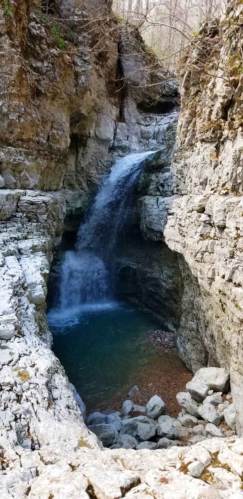
Water carved this place over thousands of years, hollowing out a limestone amphitheater where Turkey Creek spills through in a series of small falls. The rock curves overhead like the inside of a bowl.
Reaching it means descending into the valley first, which feels wonderfully easy until the return trip. That climb back up is the part people remember.
Strenuous is the honest rating. The elevation change is significant, and stream crossings add another layer of effort, particularly when the water runs high.
Waterproof shoes or an extra pair of socks make the day more pleasant. Getting wet feet is close to guaranteed.
The forest along the route is lush and layered, with hardwoods towering above and ferns crowding the trail edges. Birdsong carries well through the ravine.
Plan for a full day. Starting at dawn leaves plenty of margin, and midday heat in summer makes the ascent considerably tougher.
Flash flooding is a real concern after storms, so checking the forecast beforehand is not optional. Rangers occasionally close access when conditions turn dangerous.
Fewer crowds gather here than at roadside overlooks, largely because of the effort involved. That solitude is part of the reward.
Address: Hwy 79 (Alabama-Tennessee State Line), Estillfork, AL 35745
7. McDill Overlook Trail, Talladega National Forest
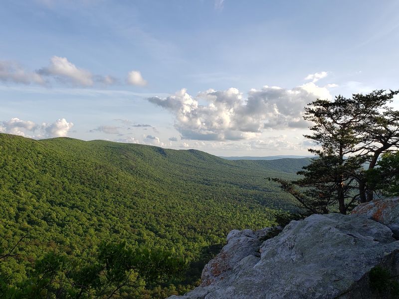
Among longtime Alabama hikers, this outcrop gets named as the finest vista in the state more often than almost any other. High praise, and the rock delivers.
The route connects into the larger Pinhoti Trail network, so signage and blazes guide the way through mature forest. Views stretch across the Talladega Ridge and out over national forest land that seems to go on without end.
Scattered near the point are pieces of wreckage from a small plane crash, weathered and partly buried in leaf litter. Curious hikers often pause there before continuing.
Terrain rolls up and down with a few rocky stretches. Nothing brutal, though the mileage adds up depending on which trailhead is chosen.
Camping spots exist near the outcrop for backpackers wanting to catch both sunset and sunrise. Leave-no-trace habits matter especially in this stretch of forest.
Cooler months offer the crispest visibility, when haze lifts and distant ridges sharpen. Summer views tend to soften into blue layers.
Carry all needed water since reliable sources are limited along the ridge. A map helps at junctions where multiple trails converge.
Sunset here rewards patience. The light drops slowly across the ridges, and the walk back deserves a headlamp.
Address: Cheaha Trailhead, Hwy 281 (Near Cheaha State Park), Delta, AL 36258
8. Sougahoaghee Falls Trail, Bankhead National Forest
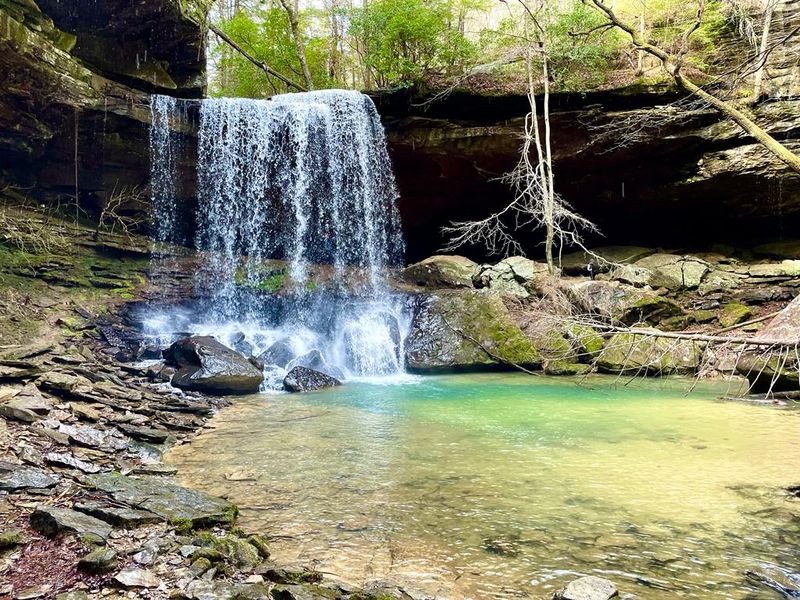
Try saying the name three times fast. Beyond the tongue-twister, this Bankhead gem hides a roughly thirty-foot waterfall that pours over a shaded sandstone lip into a quiet pool.
Round trip runs about four miles, following Brushy Creek for much of the distance. Cliff faces rise along the way, streaked with mineral colors and draped in moss.
Smaller cascades appear well before the main event, which keeps the walk from ever feeling repetitive. Each bend seems to reveal another trickle of water dropping off a ledge.
Rated easy to moderate overall, though parts of the path are unimproved. Creek crossings and loose footing show up without warning.
Rainfall dramatically changes the character of the falls. Dry spells reduce it to a delicate ribbon, while wet weeks turn it thunderous.
Navigation takes a bit of attention since the route is not always heavily marked. Downloading a track before losing signal is wise.
Insect repellent earns its place in the pack during warmer months. The creek corridor stays damp and buggy.
Swimming near the base tempts many visitors, but submerged rocks make caution sensible. Sitting on a boulder with feet in the cold water is reward enough.
Address: Hickory Grove Road (Forest Service Road 246B), Crane Hill, AL 35572
9. Borden Creek Trail, Sipsey Wilderness
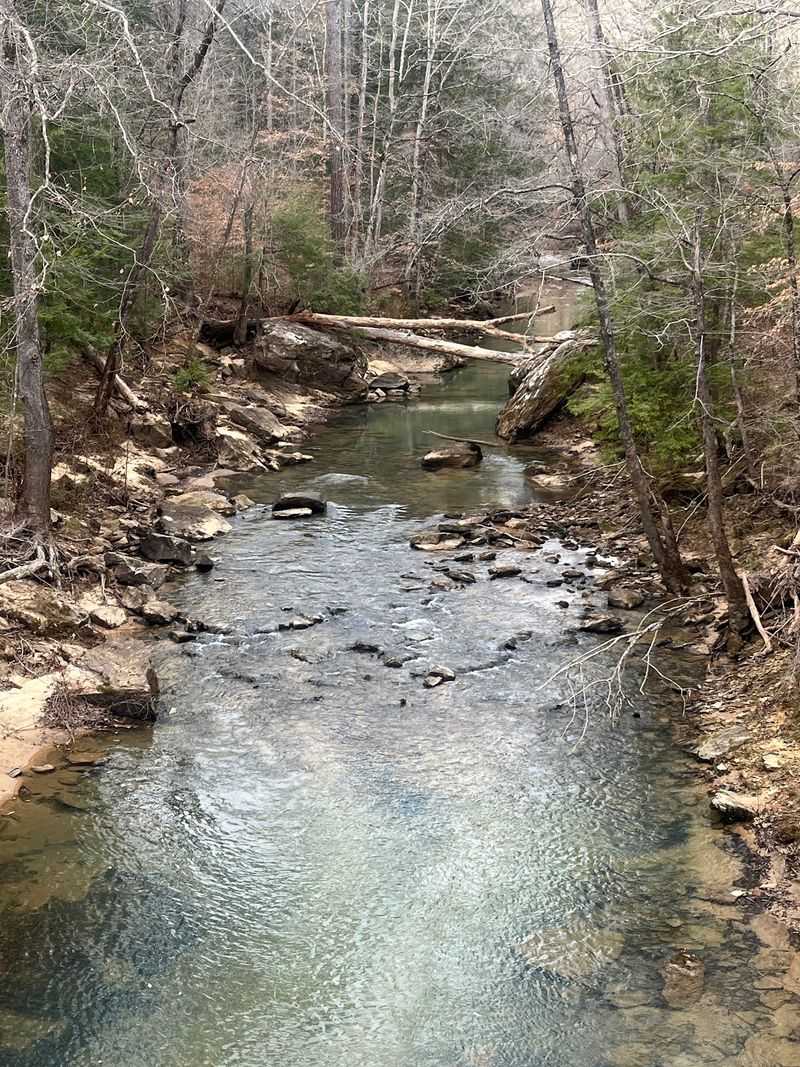
Locals call this region the Land of 1000 Waterfalls, and after a mile along Borden Creek the nickname stops sounding like an exaggeration. Water seeps and spills from cliff faces in every direction.
The trail traces the Sipsey Fork, the only stream in Alabama carrying a Wild and Scenic River designation. Its water runs an almost unreal shade of blue-green over pale stone.
Cliffs of slate and sandstone rise on both sides, sheltering old-growth trees that escaped the loggers long ago. The forest here feels genuinely ancient.
A narrow rock passage nicknamed Fat Man’s Squeeze forces hikers to turn sideways and shuffle through a short cave. Backpacks usually come off first.
Much of the route stays level, which makes it welcoming for families and newer hikers. A few creek crossings add mild adventure.
Water shoes or quick-dry footwear beat heavy boots after rain. Crossings can rise above the knee.
Because this is designated wilderness, signage stays minimal by design. Carrying a map and compass, or a downloaded route, prevents wandering.
Quiet is the real luxury here. Turn off the phone, listen to the creek, and the miles pass without effort.
Address: Borden Creek Trailhead, Cranal Road (County Road 6), Double Springs, AL 35553
