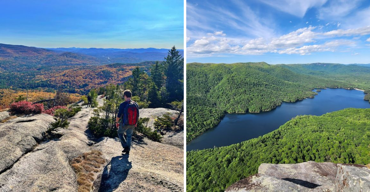
I love a good hike, but I do not always have the time or energy for a long trek. Sometimes I just want a short walk that gives me a spectacular view.
New Hampshire has a collection of trails under five miles that deliver exactly that. I have found a handful of them across the state, and every single one offers breathtaking scenery without requiring a full day of effort.
Some wind through forests and open up to panoramic views of the mountains. Others follow rivers to waterfalls that are hidden in the woods.
A few are steep climbs that are short but intense, with a huge payoff at the top. I took one trail that was just over three miles, and the view at the end was so stunning that I sat on a rock for a long time just taking it in.
That is the thing about these New Hampshire trails. They prove that you do not need to hike all day to see something beautiful.
1. Artist Bluff and Bald Mountain Loop
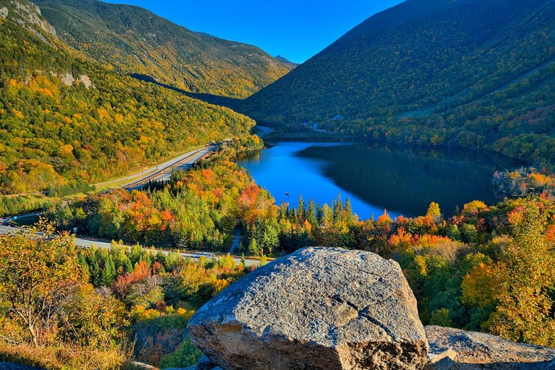
Standing on the edge of Artist Bluff feels like someone handed you a painting and forgot to frame it. This 1.5-mile loop in Franconia Notch packs more visual drama into its short distance than trails twice its length.
Echo Lake shimmers below like a polished mirror, framed by the broad shoulders of Cannon Mountain, and the whole scene is so outrageously pretty that you will want to just stand there grinning like a fool.
The trailhead sits right off NH Route 18 near Exit 34C in Franconia, close to the Cannon Mountain RV Park. Parking lots on either side of NH 18 make access easy, and the loop can be walked in either direction.
Tackling it counter-clockwise knocks out the steepest climbing first, leaving you a smoother, more relaxed descent to finish.
Artist Bluff itself is a celebrated rocky ledge where Eagle Cliff rises dramatically to your left and Mount Lafayette commands the skyline straight ahead. Continuing past the bluff to Bald Mountain rewards your curiosity with a nearly 360-degree panorama.
Vermont ridgelines appear to the west, while the Pliny and Pilot Ranges unfold to the northeast, giving this compact loop a summit experience that feels wildly generous. Fall turns the entire notch into a blazing canvas of orange and red, making this already spectacular loop feel almost unfairly beautiful.
Address: NH-18, Franconia, NH 03580, near Echo Lake State Beach parking area.
2. Mount Willard Trail
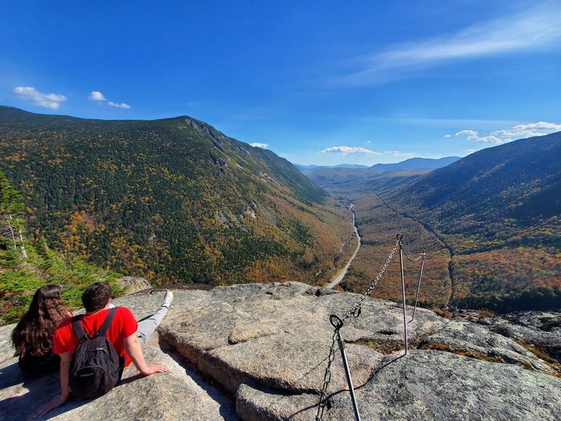
Few trails in New England deliver a view this cinematic for this little effort. The Mount Willard Trail is a 3.2-mile out-and-back path that leads straight to a cliff-top perch overlooking Crawford Notch, one of the most dramatic glacial valleys in all of New Hampshire.
The valley funnels your gaze perfectly southward, framing Mount Webster and the Willey Range in a composition that landscape photographers absolutely lose their minds over.
Everything starts at the historic Crawford Depot on Route 302 in Carroll. Parking is available at the depot lot, and additional spaces line Route 302 for overflow.
Cross the railroad tracks at the depot, pick up the Avalon Trail briefly, then turn onto the clearly signed Mount Willard Trail and let the mountain do the talking.
Early in the hike, the trail follows a cheerful brook and passes a small waterfall spilling into the tranquil Centennial Pool, a lovely warm-up before the steeper upper section. The path gets rockier as the summit draws near, but the anticipation of what waits at the top keeps your legs moving.
That final step onto the open ledge is genuinely breathtaking, a wide cliff face gazing down a perfectly straight notch corridor. On clear days, the Conway Scenic Railroad winds through the valley floor like a toy train, adding a charming sense of scale.
Wind can be fierce at the exposed summit, so a light jacket tucked in your pack is always a smart call. Address: Crawford Depot, Route 302, Carroll, NH 03598.
3. West Rattlesnake Mountain
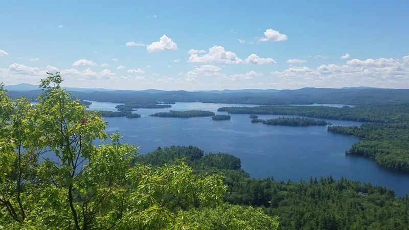
Squam Lake is already one of the prettiest lakes in New England, but seeing it from the summit of West Rattlesnake Mountain takes that beauty to a completely different level.
This 2.0-mile out-and-back trail in Holderness is consistently ranked among the most rewarding short hikes in New Hampshire, and after one look from the top, the reason becomes instantly obvious.
The lake spreads out below in a glorious patchwork of deep blue water and forested islands that seems to go on forever.
Parking is straightforward, with a dedicated trailhead lot right on Route 113 in Holderness. If that lot is full on a busy weekend, a second lot for Mount Morgan sits directly across the street.
The path is well-maintained and consistently uphill, but the grade stays gentle enough to keep the mood light and the conversation flowing throughout the ascent.
The summit ledges are wide and flat, giving everyone plenty of elbow room to spread out, eat lunch, and absorb the view at their own pace. Red Hill rises across the water to the east, and on clear days Lake Winnipesaukee peeks through the haze beyond.
The Belknap Range fills the distant southern horizon, while Copple Crown and Moose Mountains add texture to the northeast. Birders love this spot for the hawks that ride thermals overhead during migration season, turning the summit into a natural observation deck for feathered travelers as well as human ones.
Address: Route 113, Holderness, NH 03245, near Five Finger Point trailhead.
4. Table Rock Trail
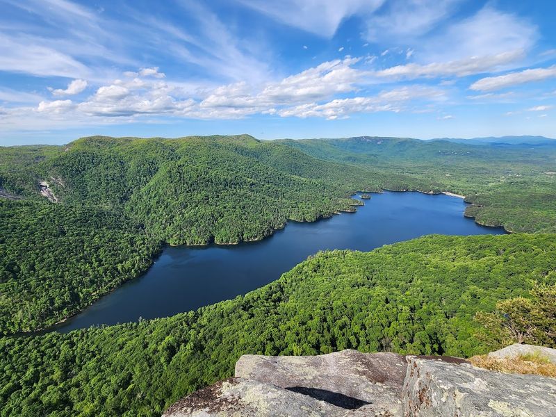
Table Rock is the kind of place that makes your palms tingle a little. This 1.5-mile out-and-back trail in Dixville Notch State Park leads to a narrow, flat ledge jutting out over a sheer drop, with Lake Gloriette sparkling far below and the entire notch spread out in every direction.
The rocky pinnacles surrounding the notch create a landscape so raw and theatrical that it feels more like a movie set than a hiking trail in northern New Hampshire.
The trailhead and parking area are located on Route 26 in Dixville, with a clear Dixville Notch Wayside sign marking the main lot on the south side of the road. A smaller secondary lot sits just west of Lake Gloriette, fitting roughly ten cars, and works perfectly for hikers approaching from the southeast.
The region is also famous for the historic Balsams Grand Resort Hotel, which sits elegantly beside the lake and adds a touch of architectural grandeur to the scenery below.
The main Table Rock Trail climbs steadily for about 0.7 miles, winding upward through forest before breaking out onto the exposed ledge. An alternative approach via the Huntington Cascades Trail starts as a gravel path through a picnic area, then turns to dirt and passes several impressive waterfalls along the way.
Both routes are worth exploring if you have extra time and energy. From the top, Route 26 threads through the notch like a grey ribbon, and the surrounding mountains pile up on the horizon in a dizzying, unforgettable spectacle.
Address: Route 26, Dixville, NH 03576, Dixville Notch Wayside parking area.
5. Welch and Dickey Loop
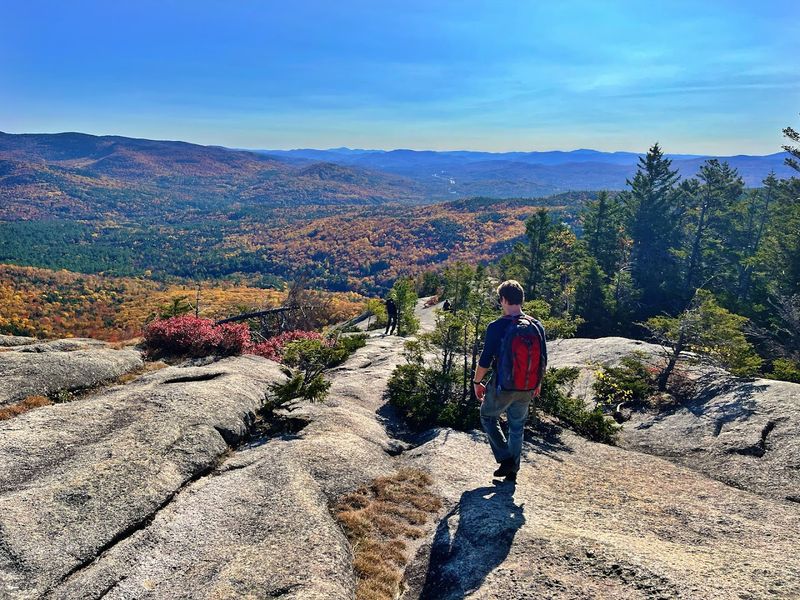
Open granite slabs stretching for over two miles underfoot, mountain ridges rolling out in every direction, and a trail that somehow manages to feel both adventurous and totally manageable. The Welch and Dickey Loop is a 4.2-mile circuit in Thornton that earns its reputation as one of the best reward-to-effort hikes in the entire White Mountains region.
Waterville Valley unfolds below in a sweeping green bowl, and the Southern Whites stack up on the horizon like a mountain range from a fantasy novel.
Orris Road in Thornton is where the adventure begins. Take Upper Mad River Road from Route 49, turn right onto Orris Road after about 0.7 miles, then follow it for roughly another 0.6 miles to the dedicated trailhead parking area.
Most experienced hikers tackle this loop counter-clockwise, which means ascending the broad granite slabs of Welch Mountain rather than descending them, a much safer and more enjoyable arrangement.
The trail alternates between shaded forest corridors and wide-open rock faces, keeping things visually interesting throughout. Rare alpine plants and colorful mosses cling to the exposed ledges, thriving in conditions most plants would find unbearable.
The Welch Ledges reveal the Tripyramids and Sandwich Dome in all their rugged glory, while the summit of Welch Mountain offers a full 360-degree spin of pure mountain joy. Continuing to Dickey Mountain adds another round of commanding views before the trail loops back into the trees.
This one genuinely feels like a gift from the mountains. Address: Orris Road, Thornton, NH 03285.
6. Middle Sugarloaf Trail
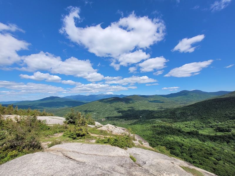
Middle Sugarloaf is the kind of underdog that absolutely steals the show. At 2.6 miles out and back, this hike in Carroll delivers a massive, bald-faced summit dome with views that embarrass many taller peaks.
The Zealand River Valley rolls out below in gorgeous green waves, the Rosebrook and Willey Ranges frame the horizon, and distant summits like North Twin Mountain peek over the ridgelines on clear days. For the effort required, the payoff is almost comically generous.
Zealand Road in Carroll is your starting point, with the parking area located about a mile from Route 302 on the right side, just before a wooden bridge spanning the Zealand River. The trailhead begins directly across that bridge, making it easy to find even on your first visit.
Pit toilets and picnic tables near the Zealand Road entrance add a welcome touch of comfort before you set off.
The trail follows the Zealand River through a peaceful hemlock forest before veering left and beginning its steady climb. Wildflowers dot the trailside in warmer months, and enormous boulders appear along the path, some so massive they create cave-like passages you can actually walk through, which is endlessly fun.
The upper section steepens noticeably, and a sturdy wooden ladder-style structure assists with the final push to the summit. Once you step onto that broad, rocky crown, the views open up in every direction with zero obstruction.
Bring a snack, claim a flat rock, and take your sweet time soaking it all in. Address: Zealand Road, Carroll, NH 03598, approximately 1 mile from Route 302.
7. Mount Major Loop
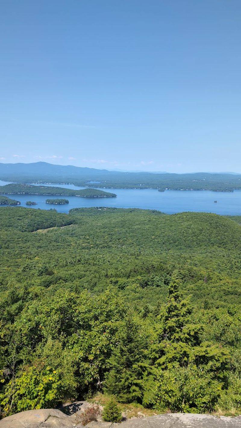
Mount Major is the beloved overachiever of southern New Hampshire hiking, a 3.8-mile loop that packs in rocky scrambles, historic ruins, and one of the most jaw-dropping lake views in the entire state. Lake Winnipesaukee spreads out below the summit in a glittering, island-studded expanse that looks almost too gorgeous to be real.
Mountains stack up in every direction beyond the lake, turning the summit into a panoramic observation deck that rewards every rocky step of the climb.
The trailhead parking lot sits directly on Route 11 in Alton, approximately 4.2 miles north of Alton Bay. It is a large, well-signed lot with a helpful information kiosk and a pavilion at the back, setting you up with everything you need before the hike begins.
Weekends draw significant crowds, so arriving early is genuinely worth the alarm clock sacrifice, especially during summer and fall foliage season.
Multiple trail options make this loop customizable to your mood and energy level. The main Mount Major Trail tackles the summit directly, while the Brook Trail offers a more gradual alternative with lovely woodland scenery and open west ridge views.
The upper half of any route gets progressively rockier, with ledge scrambles that add a satisfying edge of adventure without requiring technical skills. At the 1,786-foot summit, the crumbling stone walls of the old Phippen Hut add a wonderfully quirky historical footnote to your mountain moment.
Standing there with Lake Winnipesaukee glittering below feels like a reward the mountain specifically designed just for you. Address: Route 11, Alton, NH 03809, approximately 4.2 miles north of Alton Bay.
8. Lonesome Lake Trail
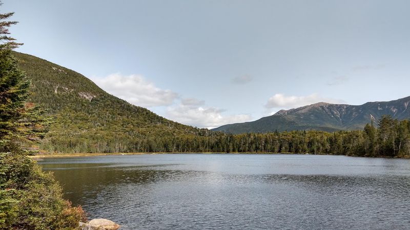
There is something almost magical about cresting a ridge and suddenly finding a lake waiting for you at the top. Lonesome Lake sits at high elevation inside Franconia Notch State Park.
The Franconia Ridge ris ising behind it, with Cannon Mountain, Mount Lafayette, and Mount Lincoln forming a dramatic wall of peaks, creates a reflection in the water that stops people mid-stride every single time.
This 3.1-mile out-and-back trail earns its place as one of New Hampshire’s most beloved short hikes without breaking a sweat about it.
The Lafayette Campground parking area off I-93 South in Lincoln serves as the trailhead, conveniently located within the state park. Parking fills up fast on peak days, but overflow parking near Cannon Mountain ski area connects to a shuttle service that runs hikers to the trailhead smoothly.
Yellow blazes mark the trail clearly from the start, making navigation a non-issue even for first-timers.
The path climbs steadily through open hardwood forest, gaining nearly 1,000 feet over the course of the hike. A junction with the High Cannon Trail appears after about a mile, but staying straight on the Lonesome Lake Trail keeps you on course.
Switchbacks ease the steeper upper sections, and the forest thins just before the lake appears. The AMC Lonesome Lake Hut sits right on the shoreline.
It’s offering a genuinely welcoming rest stop where you can grab a snack, sit on the dock, and watch the peaks reflect in the water below a perfectly blue sky.
Address: Lafayette Campground, I-93 South, Lincoln, NH 03251, Franconia Notch State Park.
9. Mount Pemigewasset Trail
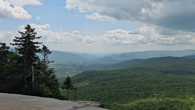
Mount Pemigewasset carries one of the most interesting stories in all of New Hampshire hiking. The cliffs at its summit, when viewed from the south along the highway corridor, form a striking profile resembling a Native American face, earning the peak its beloved nickname, Indian Head.
That geological quirk alone draws curious hikers up the 3.4-mile out-and-back trail, but the sweeping summit views are what keep people coming back. Looking south from the top, Route 93 threads through a broad valley flanked by mountain ridges, creating a perspective that feels genuinely one of a kind.
The trailhead sits within the Flume Gorge complex in Lincoln, just north of I-93 Exit 34A. Park in the large Flume Gorge lot and head toward the northernmost section, closest to the visitor center.
From there, a short stretch of the paved Franconia Notch Recreation Path leads to the signed left turn onto the Mount Pemigewasset Trail. The path immediately ducks beneath both Route 3 and Interstate 93 via underpasses, which is a uniquely amusing way to start a mountain hike.
Beyond the underpasses, the trail settles into a pleasant rhythm, crossing several small brooks and winding through mixed forest as it climbs. The grade alternates between direct uphill pushes and gentler traverses, keeping the ascent from feeling relentless.
A serene conifer forest surrounds the final approach to the Indian Head cliffs, where the panorama suddenly opens up. Loon Mountain and Scar Ridge appear to the east, Mount Osceola frames the treeline, and Mount Moosilauke rises impressively to the southwest behind Mount Wolf.
Address: Flume Gorge Visitor Center, 852 US-3, Lincoln, NH 03251.
