Oh, California! The land of sun-kissed beaches, towering redwoods, and Hollywood dreams.
A place where the open road calls, promising adventure around every scenic bend.
But hold onto your reusable water bottle, intrepid traveler, because a true Golden State journey requires more than just sunscreen and a fun playlist.
We’re about to dive into the real atmospheric secrets of some of the state’s most iconic and, yes, sometimes smoggy spots.
Think of this as your essential, fact-checked, and slightly cheeky guide to breathing easy (or maybe just bringing a high-quality mask) while checking off that California bucket list, getting you ready to explore the must-see locales where the views are often breathtaking, but the air quality requires a knowing glance at the AQI.
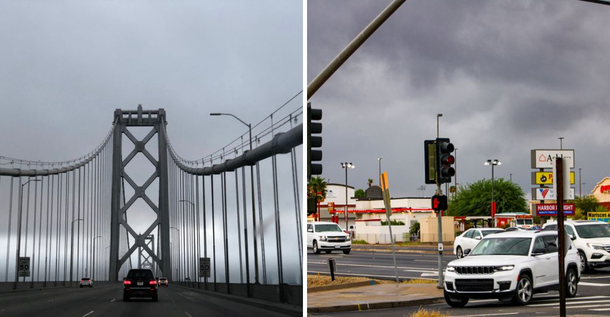
Before we hit the road, let’s understand the facts: California’s air quality issues are a complex cocktail of geography, meteorology, and human activity, with massive population centers, heavy traffic, industrial and agricultural emissions, and recurring wildfires contributing to elevated levels of pollutants like ozone (smog) and fine particulate matter ($PM_{2.5}$).
The Central Valley and the Los Angeles metropolitan area consistently rank among the most polluted in the nation, often due to their topography, they are essentially bowls that trap the pollution, and this guide will focus on spots within these recognized high-risk areas, using official reports from organizations like the American Lung Association and the California Air Resources Board (CARB) to keep it 100% factual, with all listed spots verifiable on Google Maps, and their general regions known air quality hotspots.
1. Bakersfield, Kern County: The Heart of the San Joaquin Valley’s Air
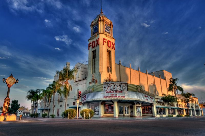
Bakersfield, nestled in the southern end of the vast and geographically unfortunate San Joaquin Valley, often finds itself at the very top of air pollution reports, particularly for short-term and year-round particle pollution ($PM_{2.5}$).
The valley’s bowl shape, surrounded by the Sierra Nevada and coastal mountain ranges, acts as a literal atmospheric lid, trapping vehicular, agricultural, and industrial emissions.
The region is also a major agricultural and oil production center, adding to the localized emission burden.
When you visit, you’re experiencing a city fighting an uphill battle against geography and industry.
Despite the air quality challenges, Bakersfield is a vibrant part of California culture, known for its country music history (the “Bakersfield Sound”) and proximity to natural wonders.
While enjoying the downtown atmosphere or the historic Fox Theater, remember that the air you’re breathing is consistently under federal scrutiny for nonattainment.Verified Hotspot & Address: The Fox Theater, 2001 H St, Bakersfield, CA 93301.
2. Sequoia National Park: Where Majestic Trees Meet Murky Skies
It’s an ironic tragedy: some of California’s most pristine natural treasures are marred by pollution migrating from the Central Valley below.
Sequoia National Park, home to the colossal General Sherman Tree, frequently experiences unhealthy air quality due to ground-level ozone, a pollutant that is created when nitrogen oxides and volatile organic compounds (mostly from vehicles and industry) react in the presence of sunlight.
This air is carried up the Sierra Nevada slopes, affecting both human visitors and the iconic giant sequoia trees, where it can interfere with photosynthesis.
Visitors are often seeking the “fresh mountain air,” only to find the visibility is reduced by haze, which is a visual sign of fine particulate matter.
When planning your hike to the Giant Forest Museum, check the park’s Air Quality Index (AQI) as it can spike to unhealthy levels, particularly during summer afternoons, which is the peak season for ozone formation.
Verified Hotspot & Address: Giant Forest Museum, 47050 Generals Hwy, Three Rivers, CA 93271 (Park entrance address for proximity).
3. Fresno-Hanford-Corcoran, Central Valley: The Particle Trap
The Fresno metropolitan area, along with its neighbors Hanford and Corcoran, consistently ranks among the worst in the nation for both ozone and particle pollution.
This region, also part of the San Joaquin Valley, is dominated by agriculture and is a major corridor for diesel truck traffic.
The cold, stable weather inversions common in winter can trap wood-burning smoke and other particles close to the ground, leading to dangerous spikes in $PM_{2.5}$ – the microscopic particles that are most damaging to human health.
While a visit to the Forestiere Underground Gardens offers a unique and cool subterranean escape from the valley’s heat and air, the surrounding city is battling to meet federal clean air standards year-round.
This is a crucial region for the state’s economy, but the environmental cost is significant and measurable.
Verified Hotspot & Address: Forestiere Underground Gardens, 5021 W Shaw Ave, Fresno, CA 93722.
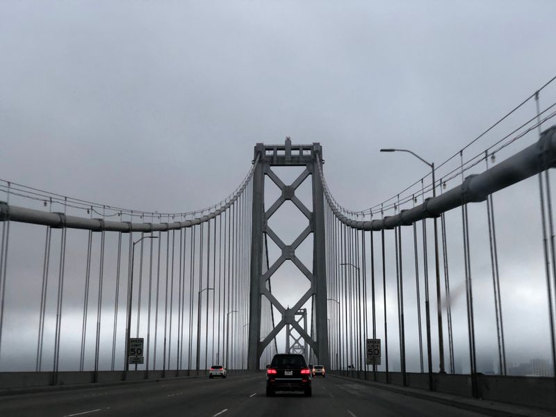
4. Los Angeles-Long Beach: The Smog Capital’s Coastal Embrace
The name “smog” is practically synonymous with Los Angeles.
Despite decades of regulation and vast improvements since the mid-20th century, the Los Angeles-Long Beach metropolitan area still regularly tops the list for the worst ozone pollution in the country.
This isn’t just about car exhaust; the sunny climate is a critical ingredient.
Ozone is not emitted directly but forms in the atmosphere.
The region’s dense population, massive port activity in Long Beach, and the surrounding mountains that create a basin for the air to settle all contribute to the chronic problem.
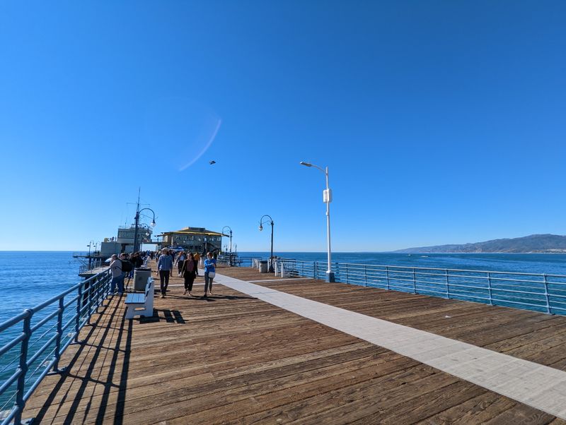
A drive along the historic Route 66 terminus at Santa Monica Pier is an absolute must, but remember that the blue skies overhead can often be deceptive due to the invisible nature of ozone, which is at its worst in the hot summer and fall months.
Verified Hotspot & Address: Santa Monica Pier, 200 Santa Monica Pier, Santa Monica, CA 90401.
5. Joshua Tree National Park: Desert Air with a Downside
Like the Sierra Nevada parks, Joshua Tree National Park, known for its bizarre and beautiful flora, suffers from pollution that drifts eastward from the sprawling Los Angeles metropolitan area and other parts of Southern California.
Ground-level ozone and particulate matter often exceed healthy levels, particularly in the western parts of the park that lie within Riverside County, which is classified as being in “severe nonattainment” for ozone.
The park’s iconic views are frequently obscured by regional haze, and the pollution is harming the sensitive desert ecosystems.
The pollution is also an active threat to the park’s namesake, the Yucca brevifolia, by interfering with plant health.
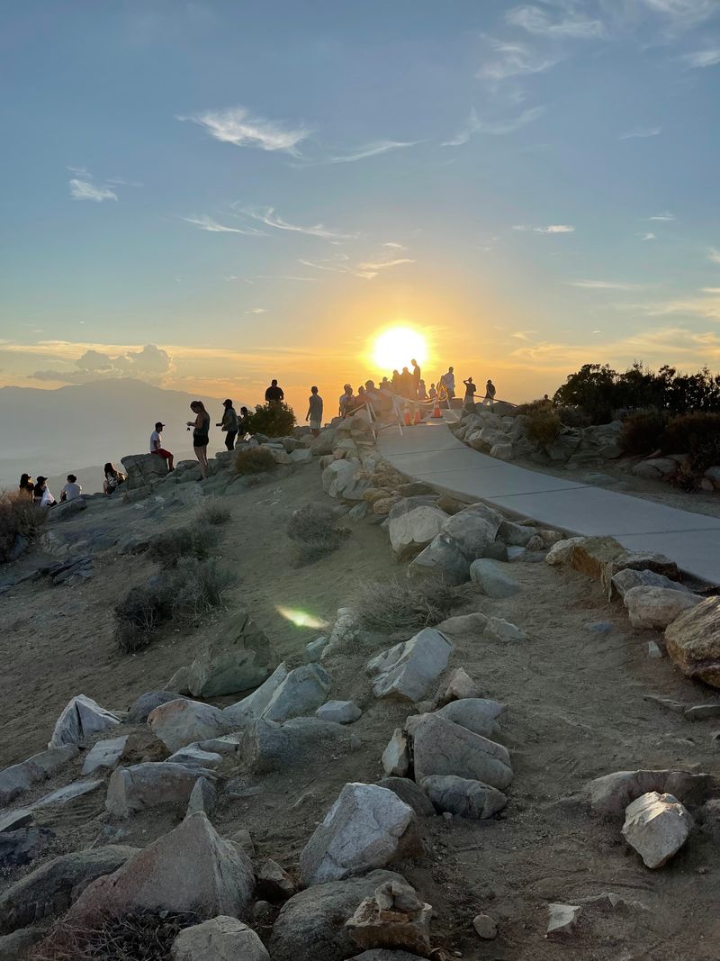
Visiting the popular Keys View offers stunning, panoramic views that, on hazy days, serve as a stark reminder of the air quality challenges facing the entire Southern California region.
Verified Hotspot & Address: Keys View, Joshua Tree National Park, Twentynine Palms, CA 92277 (Closest town for address proximity).
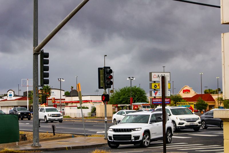
6. Riverside and San Bernardino (Inland Empire): The Traffic Corridor
The Inland Empire, encompassing Riverside and San Bernardino counties, is a vast, fast-growing region east of Los Angeles.
It acts as a massive distribution and logistics hub, and the endless stream of trucks carrying goods from the Ports of Los Angeles and Long Beach contributes heavily to the area’s poor air quality.
Riverside County, in particular, has one of the highest numbers of unhealthy air days in the state.
The combination of traffic, local emissions, and the “blow-over” effect from LA makes the region a chronic hotspot for both ozone and particle pollution.
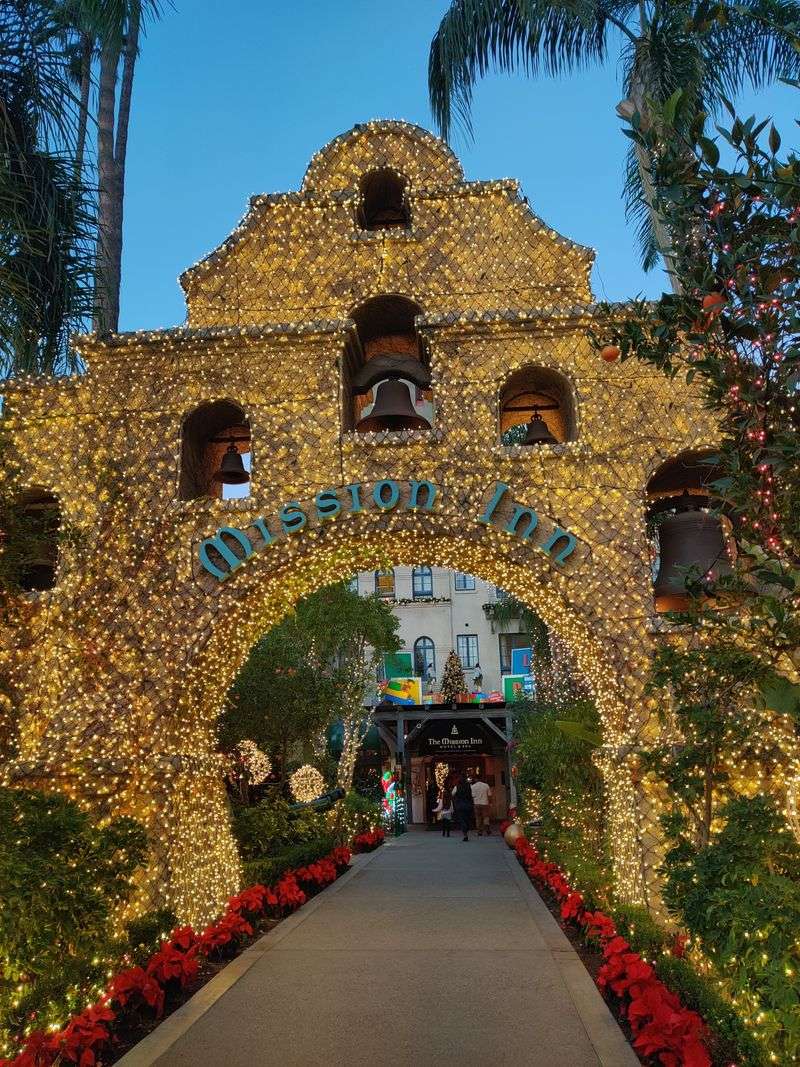
The historic Mission Inn Hotel & Spa in Riverside is a beautiful, architectural gem, but its location is deep within an area that has been struggling with air quality compliance for decades.
Verified Hotspot & Address: The Mission Inn Hotel & Spa, 3649 Mission Inn Ave, Riverside, CA 92501.
7. Visalia, Tulare County: Deep in the Valley’s Smog
Visalia, a charming city in Tulare County, is another geographical and meteorological victim of the Central Valley’s air trap.
It consistently ranks high for year-round particulate matter pollution.
The pollution here is a mixture of agricultural dust, vehicle emissions, and, crucially, wood smoke from residential heating during winter temperature inversions.
The combination of stagnant air and local sources means residents and visitors are regularly exposed to unhealthy $PM_{2.5}$ levels.
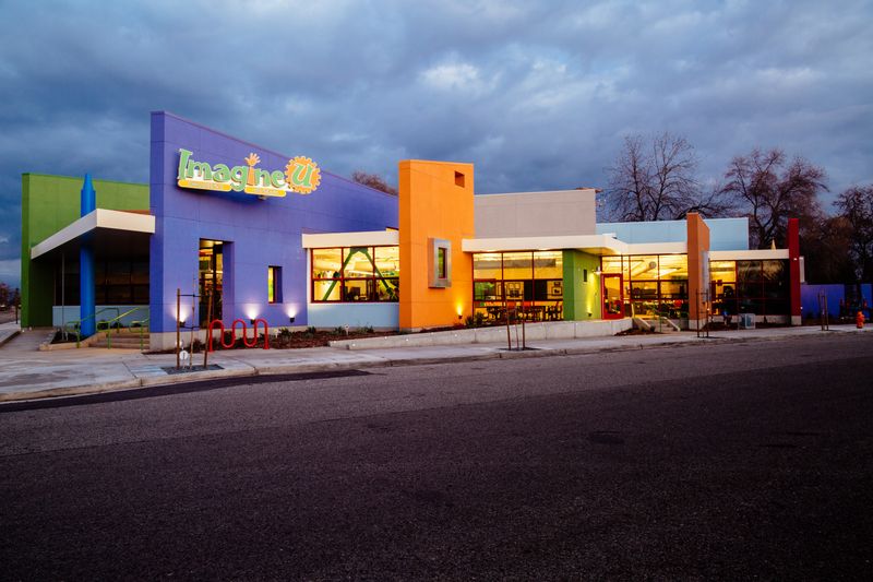
The city’s ImagineU Children’s Museum is a fantastic spot for families, but a wise parent in this region must always keep an eye on the daily air quality forecast before heading out for a day of play.
Verified Hotspot & Address: ImagineU Children’s Museum, 210 N Tipton St, Visalia, CA 93292.
8. San Jose-San Francisco-Oakland (Bay Area): Pollution on the Coast
While often celebrated for its forward-thinking environmental policies, the Bay Area, especially the San Jose-San Francisco-Oakland metropolitan region, still faces significant air quality challenges.
It is classified as an area with high ozone and particle pollution, particularly in the inland areas and the southern part of the Bay.
The issue is often exacerbated by wildfires, which can send smoke pouring into the region and drastically reduce air quality to hazardous levels.
On an average day, however, vehicular traffic remains a major local source.
Tourists flock to the San Jose Museum of Art, which sits in a part of the Bay Area that has to contend with heavy traffic flows and topography that can trap pollutants, particularly in the Santa Clara Valley.
Verified Hotspot & Address: San Jose Museum of Art, 170 S Market St, San Jose, CA 95113.
9. Sacramento-Roseville: The State Capital’s Dirty Secret

Sacramento, the state capital, and its surrounding metro area, including Roseville, frequently contend with air quality nonattainment, ranking among the most polluted in the country for ozone and short-term particle pollution.
The city’s location in the Sacramento Valley and its heavy traffic from commuters and commercial vehicles are the primary culprits.
Furthermore, smoke from northern California wildfires often settles in this valley, making the summer and fall months particularly difficult.
A stroll through Old Sacramento State Historic Park, with its charming riverfront and historic buildings, is a popular activity, but visitors are advised to monitor the air quality, especially during wildfire season when conditions can change rapidly from “moderate” to “unhealthy.”
Verified Hotspot & Address: Old Sacramento State Historic Park, 111 I St, Sacramento, CA 95814.
10. El Centro, Imperial County: The Southern Border’s Air Woes
El Centro, located in the Imperial Valley near the Mexican border, is another California city facing severe air quality issues, ranking high for ozone and particle pollution.
The geography here, a desert basin, contributes to high temperatures and stagnant air, which aids in the formation of ozone.
Local emissions are compounded by dust from the shrinking Salton Sea and air pollution drifting across the border from Mexico, where environmental regulations can be less stringent.
The city’s Imperial County Historical Society Museum offers a fascinating look into the region’s past, but the pervasive air quality risks, which are often tied to unique regional factors, are a very real part of its present.
Verified Hotspot & Address: Imperial County Historical Society Museum, 373 E Aten Rd, Imperial, CA 92251 (Near El Centro).
11. Your Air-Aware Traveler’s Checklist: Safety First!
So, you’re ready to embark on your California adventure, armed with the knowledge that not all is crystal clear in the Golden State.
It’s a journey of breathtaking beauty intertwined with environmental realities.
The key to being a responsible and safe traveler in these incredible but air-stressed areas is to be aware.
Always check the Air Quality Index (AQI) before planning your outdoor excursions, especially for vulnerable groups like children, the elderly, or those with respiratory conditions.
AQI apps and websites are your best friend, and anything above a “Moderate” rating (Yellow) suggests caution for sensitive individuals, while “Unhealthy” (Red) means everyone should limit outdoor activity.
Pack an N95 or KN95 mask, which can filter out fine particulate matter ($PM_{2.5}$), and consider visiting high-elevation parks in the early morning or on days following a heavy storm, when the air tends to be clearer.
By acknowledging the facts and planning ahead, you can still enjoy the stunning scenery, rich history, and vibrant culture that make these ten California hotspots truly unforgettable.
Dear Reader: This page may contain affiliate links which may earn a commission if you click through and make a purchase. Our independent journalism is not influenced by any advertiser or commercial initiative unless it is clearly marked as sponsored content. As travel products change, please be sure to reconfirm all details and stay up to date with current events to ensure a safe and successful trip.