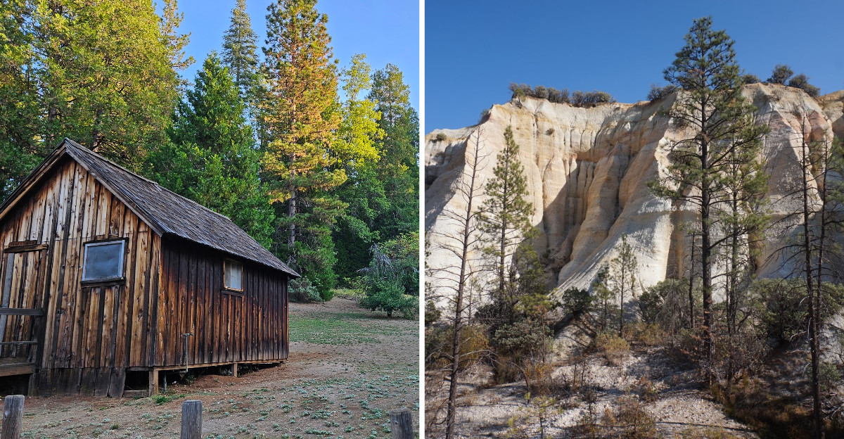
Orange and cream-colored cliffs rise out of the pines, a canyon that looks like someone dropped a chunk of Utah into the California foothills. A gravel road climbs through cedar and pine before the trees suddenly open up, revealing a landscape that feels out of place.
No river carved this. Miners aimed enormous water cannons at a hillside until the hillside was gone, washing away earth and rock in a frenzy of gold fever.
Standing at the overlook for a long time, half impressed and half unsettled, it is hard to picture the noise of it all. A state historic park keeps that story out in the open, and it is one of the most honest places in California.
The cliffs are a monument to what happens when ambition meets nature head-on. The evidence of that struggle is still visible in every scar on the rock face.
Trails now wind through terrain that was once torn apart for profit, passing exposed walls and strange formations left behind by the mining process.
What looks almost natural at first becomes more startling the longer you look, especially once you realize how much earth people managed to move here.
The Overlook That Makes You Rethink the Gold Rush
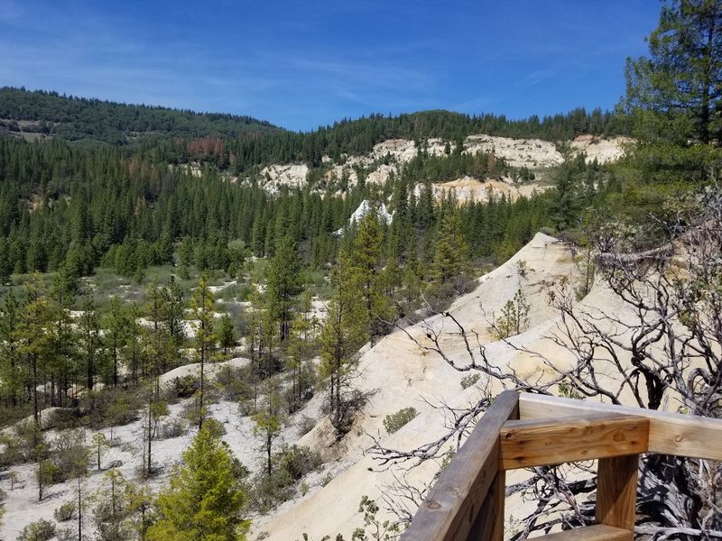
My first look came from the rim, and honestly, my brain took a second to catch up. The cliffs glow in bands of rust, gold, and pale cream, layered like a cake left out too long.
Nothing here was shaped by wind or weather. California miners pointed high-pressure water cannons called monitors at the hillside and simply washed it away.
At its peak, the operation moved roughly 100,000 tons of gravel every single day and swallowed more than 100 million gallons of water to do it. The pit that resulted stretches over a mile long and drops as much as 600 feet in places.
Around 41 million cubic yards of earth were excavated, which is a number I still can’t picture properly.
What stuck with me most was the quiet. Birds, wind in the pines, and a landscape that once roared with water loud enough to drown out conversation.
Bring a hat, because there’s almost no shade at the viewpoints, and the light bounces off those pale cliffs with surprising force. Morning and late afternoon give the rock its richest color, and that’s when photos actually do it justice.
North Bloomfield, the Town That Stayed Behind
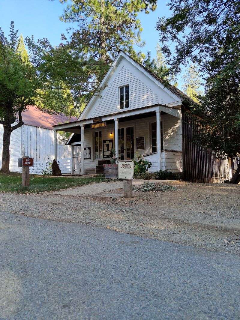
A dirt main street, a row of wooden false-front buildings, and hardly anyone around. North Bloomfield once held around 1,200 residents, and today the population is closer to a dozen.
What a huge drop, huh?
I wandered past the general store, the drugstore, a barber shop, and an old ice cream parlor, peeking through windows at shelves still arranged the way someone left them.
Originally the settlement carried the blunt name Humbug, which locals swapped out for North Bloomfield in 1859. I kind of prefer the original.
The church sits a little apart with its simple steeple, and the schoolhouse still has desks lined up in rows. Kids here grew up knowing their families’ fortunes depended entirely on what came out of that pit.
Remnants of Chinese gardens remind you how many different communities landed in this remote corner chasing the same thing.
Guided walks through town run seasonally, and the rangers I met were genuinely happy to talk. If the buildings are locked, which happens in winter, the street itself is still worth the trip.
Go on a weekday and you may have the whole place to yourself.
Where America’s First Environmental Law Came From
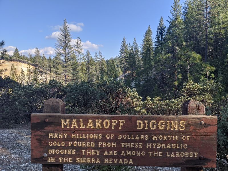
Gold paid well here. Everyone downstream paid the bill.
All that blasted rock and mud, called slickens, had to go somewhere, and it went straight into creeks and rivers. Farmland got buried, riverbeds rose, and towns like Marysville flooded repeatedly.
Sediment traveled far enough to reach San Francisco Bay and interfere with shipping, which is a wild thought when you’re standing this deep in the mountains.
Miners also used mercury to separate gold from gravel, and thousands of pounds of it stayed behind. Traces still seep from the pit toward Humbug Creek and the South Yuba River today.
Farmers eventually fought back in court, and in 1884 the federal Sawyer Decision banned dumping mining debris into rivers, which effectively ended large-scale hydraulic mining.
Historians often point to that ruling as one of the earliest environmental laws in the country.
Reading the interpretive panels while looking at the actual pit made the whole thing click for me in a way a textbook never did.
It’s a good place to slow down and read every sign, even the long ones.
Boots on the Diggins Loop Trail
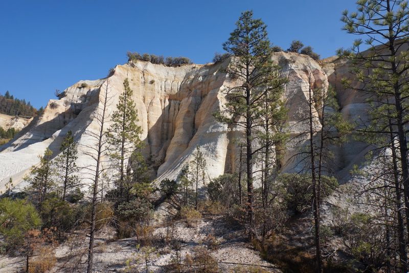
Walking down into the pit beats looking at it from above, no contest. The Diggins Loop runs about three miles and drops you right onto the floor of the old mine.
Underfoot it’s sandy and pale, almost beachy in spots, which feels absurd at 3,000 feet in the Sierra.
Up close, the cliff walls show off their layers, and some of that exposed sediment is tens of millions of years old. Miners uncovered a geology lesson without meaning to.
The trail is mostly level and well marked, and parts of it are firm enough for strollers or wheelchairs, though I’d check current conditions with the rangers first.
In total the park has more than 20 miles of trails spread across elevations from roughly 2,000 to 4,000 feet.
I passed Douglas fir, ponderosa pine, incense cedar, plus madrone and manzanita with that peeling red bark I can never stop touching.
Carry more water than you think you need. There’s no shade in the pit, and the reflected heat sneaks up on you fast in summer.
Humbug Creek and the Cool Green Descent
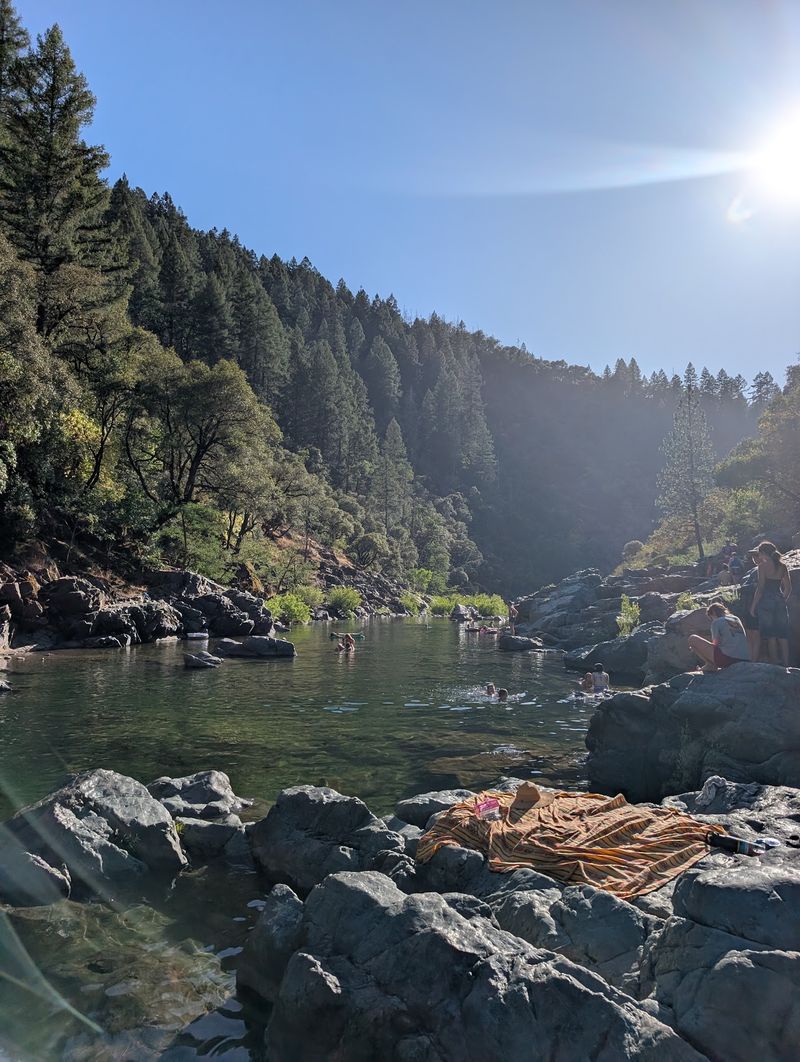
After the glare of the pit, the Humbug Creek Trail felt like walking into a different park entirely. Shade, moss, ferns, and the steady sound of water somewhere below.
The path starts out tidy, then steepens around the one-mile mark as it follows the creek downhill toward the South Yuba River.
Hikers have reported downed trees and washed-out sections along the lower stretch, so treat it as a real hike rather than a stroll. I’d wear proper shoes and ask about trail conditions before committing to the full descent.
Reaching the river rewards you with swimming holes and canyon views, but remember the return trip is all uphill.
Wildlife is genuinely active here. Black-tailed deer, gray foxes, bobcats, jackrabbits, and yes, black bears all live in this watershed.
Bears wander through regularly, so make noise, keep food sealed, and give them room if you spot one.
Bug season brings clouds of no-see-ums and mosquitoes around dusk, and a head net sounds ridiculous until you’ve forgotten yours once.
Spring runoff makes the creek especially loud and lovely.
Quiet Water at Blair Lake
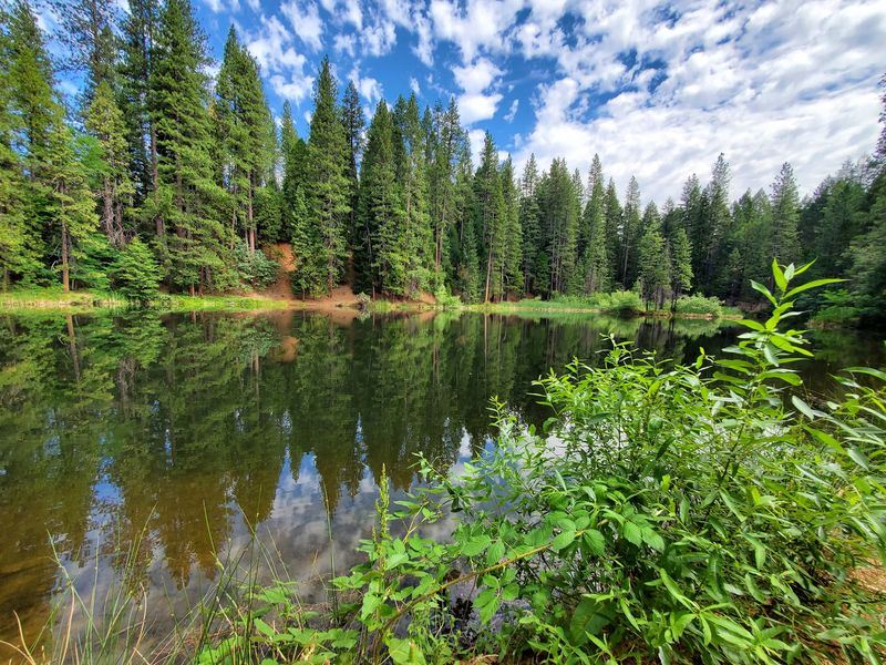
Tucked behind the trees near the campground sits a small lake most day visitors never bother to find. Blair Lake is an easy walk from the camp loop, or a quick drive off North Bloomfield Road.
Still water, pine reflections, and not much else going on. Which was exactly what I wanted after a morning of staring at eroded cliffs.
People fish here, kids splash around on hot afternoons, and the whole scene feels pleasantly ordinary compared to the drama of the mine.
I sat on the bank for a while and noticed how green everything looked, how thoroughly the forest has moved back in.
Somewhere upstream this same water once fed a system built to tear mountains apart. Now it just sits there catching light.
Bring a picnic and a book if you want a low-effort hour. Early morning brings birdsong and mist off the surface.
Mosquitoes show up reliably around six in the evening, so plan your visit earlier or come armed with repellent.
It’s a small spot, but it balances out the day.
Sleeping Among Pines at Chute Hill Campground
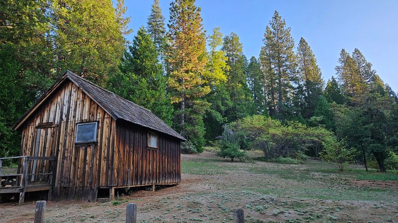
Staying overnight changes the whole trip, and Chute Hill sits just north of the old town among tall pines and cedars. My site had a picnic table, a fire bin, and a metal bear box that is absolutely not decorative.
Potable water is available and the restrooms have flush toilets, sinks, and soap, which felt luxurious for a mountain campground.
There are no RV hookups and no showers, and honestly the simplicity is part of why it’s so peaceful. Midweek visits can feel nearly empty.
Shade varies a lot between sites, so it’s worth reading site details before booking. A few of the higher-numbered spots sit fairly exposed.
Rustic cabins are also available inside the park for anyone who’d rather not pitch a tent.
The nearest store is about twenty minutes away and there’s no fuel up here, so arrive with a full tank and everything you need.
Night skies over the Sierra foothills get seriously dark, and I fell asleep listening to nothing but wind.
Address: 23579 North Bloomfield Road, Nevada City, California
