California’s mountain roads are some of the most beautiful drives in the country.
They wind through towering forests, past sparkling alpine lakes, and over dramatic mountain passes.
What makes these routes special is that they aren’t just about getting from one place to another.
Each corridor is packed with multiple scenic stops, viewpoints, and natural wonders worth exploring.
Whether you’re a local looking for a weekend adventure or a visitor wanting to experience California’s wild beauty, these mountain corridors deliver unforgettable experiences.
From the granite cliffs of Yosemite to the ancient redwood groves of the north, each route tells its own story.
Pack your camera, fill up your gas tank, and get ready to discover some of the most spectacular mountain drives the Golden State has to offer.
These aren’t your average highway trips.
They’re journeys through some of the most breathtaking landscapes on the West Coast.
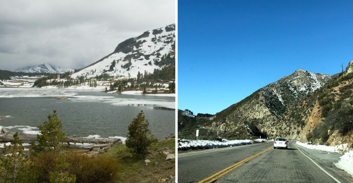
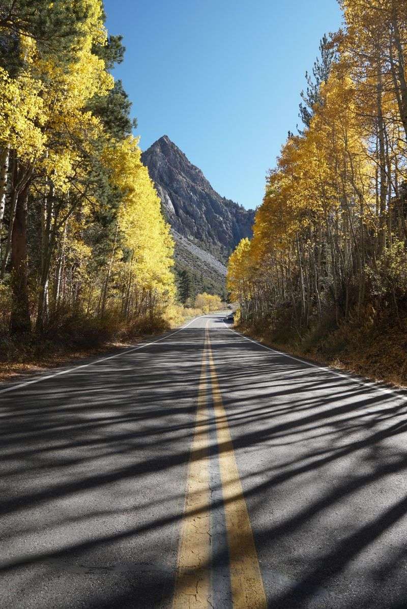
1. Tioga Pass (Highway 120)
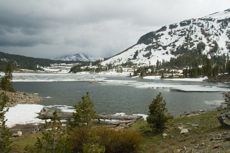
Cutting through the heart of Yosemite National Park, this high-elevation route is a gateway to some of California’s most jaw-dropping scenery.
Tioga Pass reaches elevations that make your ears pop and your heart race with excitement.
The corridor opens seasonally, typically from late spring through fall, depending on snow conditions.
Tunnel View greets visitors with a postcard-perfect panorama of El Capitan, Half Dome, and Bridalveil Fall all in one sweeping vista.
Speaking of Bridalveil Fall, this 620-foot cascade is an easy stop right off the main road.
El Capitan Meadow provides unobstructed views of the world’s most famous rock climbing wall.
Tuolumne Grove offers a peaceful walk among giant sequoias, trees that have stood for thousands of years.
Olmsted Point delivers stunning views of Half Dome from a completely different angle than most visitors see.
Tenaya Lake sparkles like a blue jewel nestled between granite slopes, perfect for a picnic or quick swim.
The road itself becomes an attraction as it climbs through diverse ecological zones.
Alpine meadows burst with wildflowers during summer months.
Granite domes and peaks dominate the skyline in every direction.
Plan for a full day to properly explore this incredible mountain passage.
Address: Highway 120, Yosemite National Park, California.
2. Avenue of the Giants
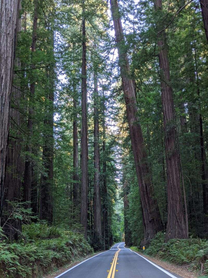
Northern California’s most enchanting forest drive runs parallel to Highway 101 through Humboldt Redwoods State Park.
This 31-mile route feels like entering a cathedral built by nature itself.
Massive coast redwoods tower overhead, some reaching heights of over 300 feet.
The famous drive-through tree lets you literally pass your car through a living giant.
Founders Grove features some of the tallest trees in the park, accessible via an easy loop trail.
Stout Grove showcases redwoods in their most pristine setting, untouched and magnificent.
Rockefeller Forest contains the largest remaining old-growth redwood forest on Earth.
Numerous pullouts and parking areas make it easy to stop whenever something catches your eye.
The dappled sunlight filtering through the canopy creates an almost magical atmosphere.
Small towns dot the route, offering local shops and friendly faces.
Autumn brings a special kind of beauty when the understory plants change color.
Spring wildflowers carpet the forest floor between the massive tree trunks.
Visitor centers along the way provide educational exhibits about these ancient ecosystems.
Take your time here because rushing through would mean missing the forest’s quiet majesty.
Address: Avenue of the Giants, Humboldt County, California.
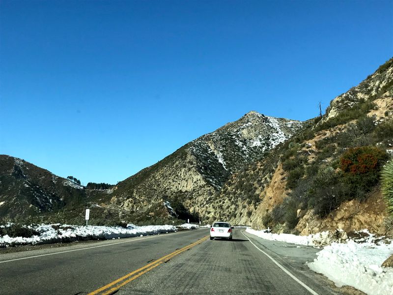
3. Rim of the World Scenic Byway (Highway 18)
Perched high in the San Bernardino Mountains, this aptly named route delivers exactly what it promises.
Views stretch for miles across the San Bernardino Valley below, especially stunning at sunset.
The byway connects several charming mountain communities worth exploring.
Big Bear Lake sits at one end, offering year-round recreation and alpine charm.
Lake Arrowhead provides a more upscale mountain resort experience with boutique shops.
Multiple scenic turnouts line the route, each offering slightly different perspectives.
On clear days, you can see all the way to the desert beyond the valley.
The elevation change means temperatures stay cooler than the valleys below, a welcome relief in summer.
Pine and cedar forests blanket the mountainsides, filling the air with their fresh scent.
Winter transforms the landscape into a snowy wonderland perfect for skiing and snowboarding.
Historic landmarks along the way tell stories of California’s mountain settlement history.
Local cafes and roadside stops offer chances to stretch your legs and grab refreshments.
Hiking trailheads provide access to backcountry adventures for those wanting to explore further.
The winding road itself is an adventure, with curves that reveal new vistas around every bend.
Address: Highway 18, San Bernardino Mountains, California.
4. June Lake Loop (Highway 158)
Locals call this 16-mile circuit one of the Eastern Sierra’s best-kept secrets.
Four pristine alpine lakes grace this loop: June, Gull, Silver, and Grant.
Each lake has its own personality and recreational opportunities.
Autumn transforms the surrounding aspen groves into a golden wonderland that photographers dream about.
The loop branches off Highway 395, making it an easy detour for those traveling the Eastern Sierra.
Fishing enthusiasts find excellent opportunities for catching trout in all four lakes.
Boating and kayaking are popular summer activities on the larger lakes.
The small resort town of June Lake offers lodging, dining, and local charm.
Carson Peak provides a dramatic backdrop, its summit often dusted with snow even in summer.
Several campgrounds along the loop let you wake up to mountain views.
Winter brings cross-country skiing and snowshoeing opportunities around the frozen lakes.
The entire loop can be driven in less than an hour, but you’ll want to spend much longer.
Picnic areas at various points make it easy to enjoy lunch with a view.
Wildflowers bloom prolifically in spring and early summer along the roadsides.
Address: Highway 158, June Lake, California.
5. Kings Canyon Scenic Byway (Highway 180)

Following the Kings River deep into the Sierra Nevada, this byway descends into one of North America’s deepest canyons.
Granite cliffs soar thousands of feet above the road, creating a sense of awe and smallness.
The route passes through magnificent groves of giant sequoias, trees that dwarf everything around them.
Grant Grove features some of the largest and oldest trees in the park.
The General Grant Tree, known as the Nation’s Christmas Tree, stands as a living monument.
As you descend into the canyon, the landscape shifts from mountain forest to river valley.
Numerous pullouts provide safe places to stop and absorb the spectacular scenery.
The Kings River rushes alongside the road in many sections, its white water thrilling to watch.
Cedar Grove marks the end of the road, where civilization gives way to wilderness.
Short hiking trails from Cedar Grove lead to waterfalls and stunning viewpoints.
The drive requires attention as the road winds and climbs through dramatic terrain.
Wildlife sightings are common, including deer, black bears, and various bird species.
Spring runoff makes the river and waterfalls especially impressive.
This corridor closes in winter due to snow, typically reopening in late spring.
Address: Highway 180, Kings Canyon National Park, California.
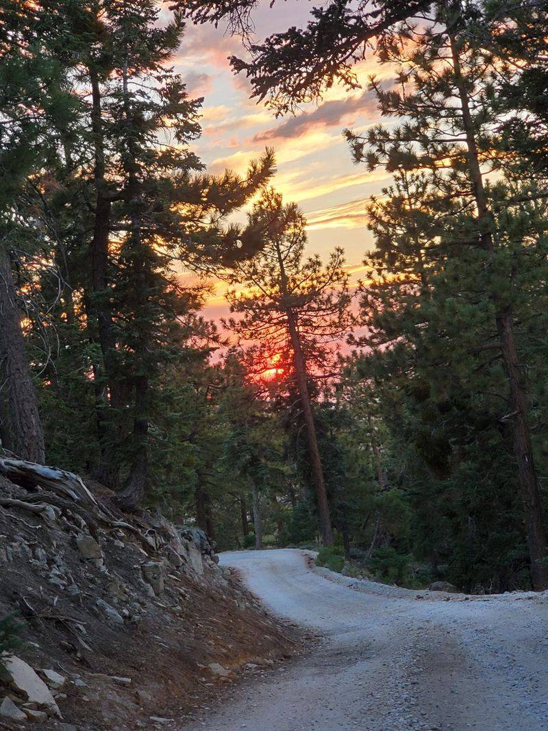
6. Angeles Crest Highway (Highway 2)
Rising from the Los Angeles basin, this scenic escape climbs into the San Gabriel Mountains.
The transformation from urban sprawl to wilderness happens surprisingly quickly.
Countless scenic pullouts offer opportunities to look back at the vast metropolitan area below.
On smog-free days, the Pacific Ocean glimmers in the distance.
Angeles National Forest surrounds the highway, offering trails ranging from easy walks to challenging climbs.
The route passes through several distinct ecological zones as elevation increases.
Chaparral gives way to pine and fir forests as you climb higher.
Chilao Visitor Center provides information and displays about the mountain environment.
Newcomb’s Ranch, a historic rest stop, serves hungry travelers with hearty fare.
Mountain High ski resort operates in winter, adding recreational variety to the corridor.
Wildflower displays in spring paint the mountainsides with vibrant colors.
The highway occasionally closes due to weather or fire danger, so check conditions before traveling.
Local cyclists love this route for its challenging climbs and exhilarating descents.
Sunset drives are particularly stunning when the city lights begin twinkling below.
Address: Highway 2, Angeles National Forest, California.
7. Generals Highway (Highway 198 and 200)
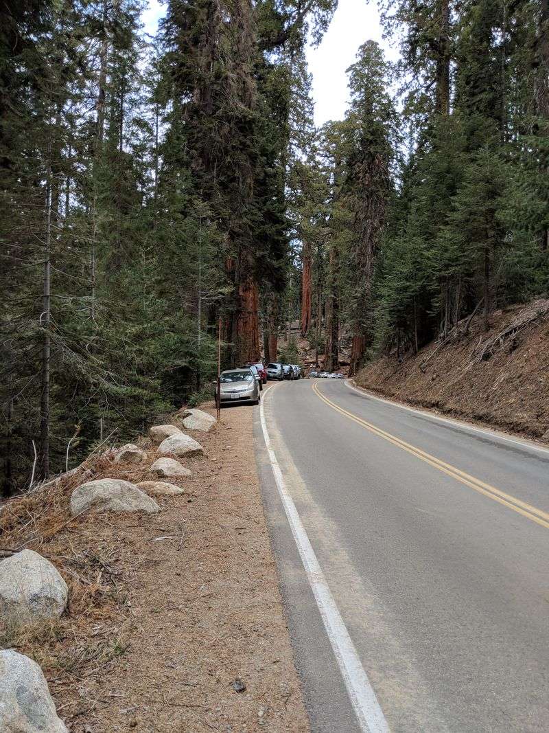
Connecting Sequoia and Kings Canyon National Parks, this route is an adventure in itself.
Hairpin turns and steep grades require careful driving but reward you with incredible access.
The Giant Forest Museum sits along this route, offering insights into sequoia ecology.
Tunnel Log lets you drive through a fallen giant sequoia, a classic photo opportunity.
The General Sherman Tree, the largest tree on Earth by volume, stands just off this highway.
Redwood Mountain Overlook provides sweeping views of the largest sequoia grove in the world.
The road climbs and descends repeatedly, passing through varied mountain landscapes.
Moro Rock, accessible via a short side road, offers 360-degree views from its granite dome summit.
Crescent Meadow, called the Gem of the Sierra by John Muir, lies just off the main route.
The slow pace required by the winding road actually enhances the experience.
You have time to spot wildlife and appreciate the forest details.
Snow closes portions of this highway in winter, limiting access to certain areas.
Summer brings the most reliable access and the warmest weather.
Plan extra time because the 50-mile connection can take several hours with stops.
Address: Highway 198 and 200, Sequoia National Park, California.
8. Feather River Scenic Byway (Highway 70)

Carving through the northern Sierra Nevada, this lesser-known route follows the North Fork of the Feather River.
The dramatic Feather River Canyon creates a spectacular natural corridor.
Sheer rock walls rise hundreds of feet above the rushing river.
Historic railroad sites dot the route, remnants of the Western Pacific Railroad’s engineering marvel.
The byway parallels active railroad tracks in many sections, and you might spot freight trains navigating the canyon.
Fishing access points provide opportunities to try your luck in the productive river waters.
Several small communities along the way offer basic services and local character.
The canyon’s geology tells millions of years of Earth’s history in its layered rocks.
Spring wildflowers cling to rocky slopes, adding splashes of color to the rugged landscape.
Hiking trails branch off from the highway, leading to hidden waterfalls and viewpoints.
The route sees less traffic than more famous California mountain roads.
This means more opportunities for peaceful contemplation and unobstructed photos.
Autumn brings migrating birds to the river corridor, delighting birdwatchers.
The combination of water, rock, and forest creates constantly changing scenery.
Address: Highway 70, Plumas County, California.
9. Mount Shasta-McCloud Scenic Drive (Everitt Memorial Highway/Highway 89)
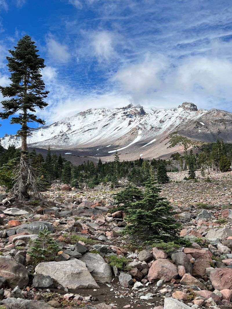
Dominated by the massive presence of Mount Shasta, this corridor offers views of one of California’s most iconic peaks.
The 14,179-foot volcano seems to float above the landscape, its glaciers glinting in the sun.
Everitt Memorial Highway climbs the mountain’s southern slopes to treeline.
Bunny Flat provides access to hiking trails and stunning close-up views of the summit.
The town of McCloud retains its historic lumber town character with preserved buildings.
McCloud Falls features three distinct waterfalls accessible via short trails.
Lower Falls thunders over a wide ledge, creating a powerful display.
Middle Falls offers a more intimate cascade perfect for photography.
Upper Falls provides a peaceful setting surrounded by forest.
The volcanic landscape creates unique soil conditions that support diverse plant communities.
Meadows around the mountain burst with wildflowers during summer months.
Castle Crags, another volcanic formation, adds dramatic scenery to the southern portion of the drive.
The route connects with other scenic highways, making it part of longer loop trips.
Sunrise and sunset paint the mountain in shades of pink and gold.
Address: Everitt Memorial Highway and Highway 89, Siskiyou County, California.
10. The Golden Chain Highway (Highway 49)
Tracing the Sierra Nevada foothills, this historic route connects dozens of Gold Rush era towns.
Each community preserves its own slice of California’s colorful mining history.
Auburn’s Old Town features preserved buildings and museums telling stories of the gold fever days.
Placerville earned the nickname Hangtown during its rough-and-tumble mining camp years.
Sutter Creek charms visitors with its Main Street lined with antique shops and galleries.
Jackson’s historic downtown includes the impressive Kennedy Mine headframe.
Angels Camp celebrates its connection to Mark Twain’s famous jumping frog story.
Murphys offers wine tasting rooms showcasing the region’s growing viticulture.
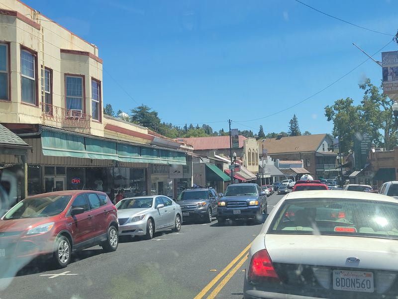
Sonora’s Victorian architecture and historic downtown make it a favorite stop.
Columbia State Historic Park preserves an entire Gold Rush town as a living museum.
The highway itself winds through oak-studded hills and across river valleys.
Spring brings green hillsides dotted with wildflowers.
Fall transforms the landscape with golden grasses and changing leaves.
Plan several days to properly explore this lengthy corridor and its many attractions.
Address: Highway 49, Sierra Nevada Foothills, California.
Dear Reader: This page may contain affiliate links which may earn a commission if you click through and make a purchase. Our independent journalism is not influenced by any advertiser or commercial initiative unless it is clearly marked as sponsored content. As travel products change, please be sure to reconfirm all details and stay up to date with current events to ensure a safe and successful trip.