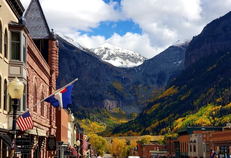
Colorado has always assumed the water would be there. Snowpack in the mountains.
Runoff in the spring. Full reservoirs by summer.
That is how the system was designed. But the assumptions are falling apart.
Less snow. Earlier melt.
Drier soils that soak up what little water arrives before it can reach the rivers. Farmers are watching irrigation schedules shrink. Towns are staring at intakes that sit too high above dropping water levels.
I talked to a rancher who remembers when the creek behind his house never went dry. Now it is a trickle by June.
Colorado is waking up to a future no one planned for. And the hard conversations about who gets water and who does without have barely started.
The 1922 Compact Built on a Lie
Few legal documents have shaped the American West quite like the Colorado River Compact of 1922. Seven states sat down to divide up a river they barely understood, and the numbers they used were wildly optimistic.
The early 20th century happened to be one of the wettest periods in the basin’s recorded history, which made the river look far more generous than it actually is. That miscalculation has haunted the region for over a century.
Experts now estimate the Compact overallocated the river by millions of acre-feet annually. That gap between paper promises and physical reality has been quietly growing for decades as populations exploded across the Southwest.
Las Vegas, Phoenix, Los Angeles, and Denver all grew far beyond what the Compact’s authors could have imagined. It is only now, with reservoirs like Lake Mead and Lake Powell scraping historic lows, that the full weight of that original mistake is finally sinking in.
Renegotiating a century-old agreement involving seven states, two countries, and dozens of tribal nations is enormously complicated. Everyone wants to protect their own share, and no one wants to be the first to give anything up.
Tribal nations, who were entirely left out of the original negotiations, are now asserting their water rights in ways that cannot be ignored.
Yet a new deal is increasingly unavoidable. The river simply cannot deliver what the Compact promised.
Pretending otherwise is no longer a viable strategy for anyone depending on it. The only real question is whether the seven states will voluntarily agree on cuts or wait for the federal government or the Supreme Court to impose a solution for them.
Aridification Is Not Just a Fancy Word for Drought
Most people hear the word drought and picture a temporary dry spell, something that ends when the rains return. What is happening to the Colorado River Basin is fundamentally different, and scientists have a specific term for it: aridification.
This is a permanent shift toward a hotter, drier baseline, not a weather pattern waiting to flip back to normal.
Temperatures across the basin have risen faster than nearly anywhere else in the contiguous United States. Some areas are warming at more than double the global average rate.
Higher temperatures pull more moisture out of soil, plants, and snowpack, meaning even average precipitation years deliver less usable water than they once did. The river is losing water to evaporation and thirsty landscapes before it ever reaches the reservoirs.
Colorado is projected to warm by 2.5 degrees Fahrenheit by 2025 and 4 degrees by 2050. Those numbers might sound small on paper, but their effect on water availability is enormous.
The river is not just running low because of a bad stretch of dry years. The conditions driving reduced flows are baked into the future, and planning has to reflect that reality honestly.
Pretending this is temporary only delays the hard decisions that cannot be avoided much longer.
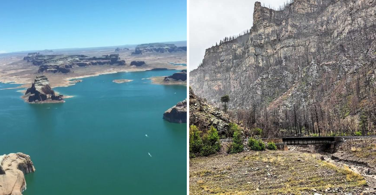
Lake Powell and Lake Mead Hit the Alarm Level
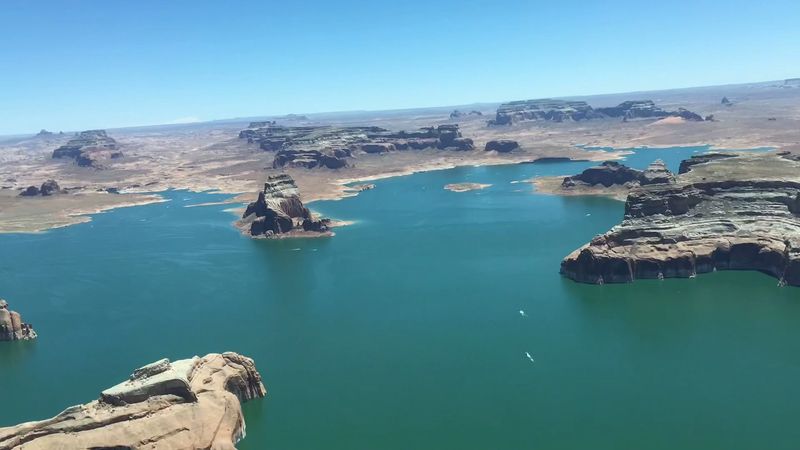
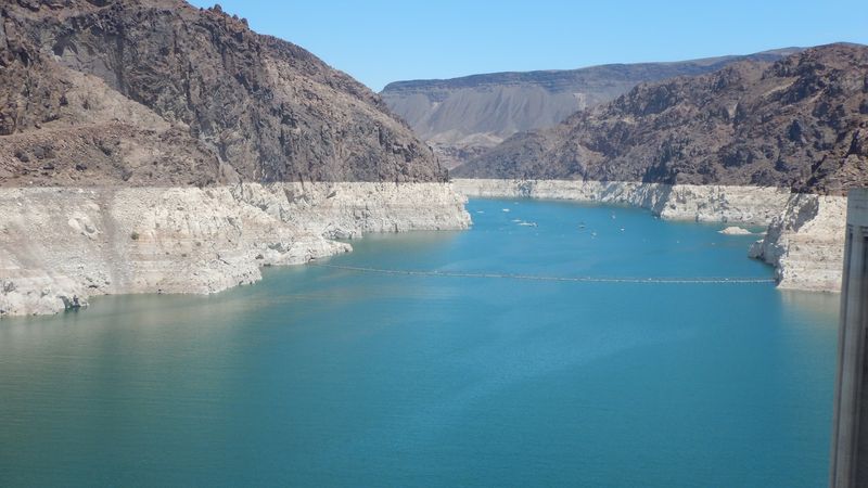
Lake Mead and Lake Powell are the two largest reservoirs in the United States, and together they serve as the primary storage system for the Colorado River. By 2022, Lake Mead had dropped below 27% of capacity.
Lake Powell fell below 24%. Those are not just statistics on a chart; they represent a genuine crisis for the tens of millions of people who rely on this system across seven states.
The bathtub ring left on the canyon walls around Lake Mead became one of the most photographed symbols of Western water stress. Each pale stripe of exposed rock marks years of declining levels.
By April 2026, Lake Powell’s elevation sat at roughly 3,528 feet, with runoff forecasts for the Upper Basin coming in at only 23% of normal. That is dangerously close to the level where Glen Canyon Dam can no longer generate hydroelectric power.
When reservoirs fall this low, hydroelectric power generation suffers alongside water delivery. Communities, farms, and power grids all feel the squeeze simultaneously.
The situation exposed just how dependent the region had become on storage infrastructure that was designed for a wetter, cooler world that no longer exists in the same form. The crisis is no longer coming.
It is already here.
Snowpack and Runoff Are Shifting the Calendar
For most of Colorado’s history, mountain snowpack acted like a natural savings account. Snow accumulated all winter and slowly released water into rivers and streams through the spring and summer, right when farms and cities needed it most.
That reliable schedule is now coming undone at a pace that is difficult to plan around for water managers across the West.
Between 1978 and 2004, the timing of spring runoff shifted earlier by an average of two weeks. By mid-century, projections suggest runoff could arrive one to four weeks earlier than historical norms.
Earlier melt means water rushes downstream before demand peaks, and more of it evaporates or soaks into dry soil before anyone can capture it. Reservoirs are designed to hold water for summer, not release it in early spring.
Reduced snowpack compounds the problem further. Warmer winters mean more precipitation falls as rain instead of snow, and what snow does accumulate often melts faster.
The mountain snowfields that once reliably fed the Colorado River system are shrinking and becoming less predictable. Infrastructure and water agreements designed around the old seasonal rhythm are struggling to adapt to a schedule that keeps shifting forward every year with no sign of stopping.
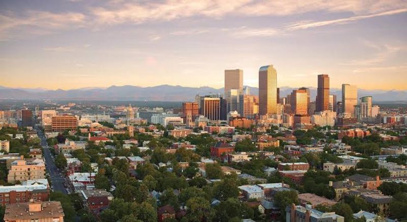
Cities Are Using Less Water, But Population Keeps Growing
Here is something genuinely encouraging buried inside an otherwise sobering story. Cities across the Colorado River Basin have cut water use by 18% since 2000, even as their populations grew by 24% over the same period.
That is a meaningful achievement, driven by outdoor watering restrictions, efficient plumbing standards, and tiered pricing that rewards conservation. Homeowners have replaced thirsty lawns with xeriscaping, farmers have adopted drip irrigation, and cities have cracked down on leaks and waste.
Denver Water launched a formal Climate Change Adaptation Program back in 2008, diversifying its sources and investing heavily in recycled water systems. Those kinds of forward-thinking moves have helped buffer the city against some of the worst near-term impacts.
Other cities across Arizona, Nevada, and California have followed similar paths, proving that conservation is not just a theoretical idea but something that actually works when properly implemented.
But the math still gets harder as Colorado’s population is projected to double by 2050. More people means more demand, full stop.
Conservation gains are real and worth celebrating, but they are not infinite. At some point, efficiency improvements plateau while population growth continues.
You cannot save the same gallon of water twice.
The gap between available supply and projected demand is expected to widen significantly over the coming decades, making expanded storage, alternative sources like desalination and treated wastewater, and continued behavioral change all essential parts of any realistic long-term solution. The good news is that the region has already proven it can do more with less.
The challenge is whether it can keep doing so indefinitely.
The Colorado Water Plan Is Trying to Catch Up
Adopted in 2015, the Colorado Water Plan was one of the first statewide water strategies in the United States to formally integrate climate change projections into its core framework. That alone set it apart from older planning documents that treated historical flow data as a reliable guide to the future.
The plan acknowledged openly that the old assumptions no longer hold.
Key strategies include what planners call No-and-Low-Regrets actions, meaning steps that make sense regardless of how severe climate impacts turn out to be. Limiting the permanent dry-up of agricultural lands protects long-term food production capacity.
Developing additional water supplies and improving storage infrastructure gives the system more flexibility to handle variability.
Still, the scale of the challenge is humbling. Experts project a 20 to 30 percent reduction in Colorado River flows by mid-century, with some models pushing that figure as high as 45 percent for the Upper Basin.
No plan, however thoughtful, can fully offset reductions of that magnitude without transformational changes in how water is valued, allocated, and used across the entire region. The work ahead is generational, not just political.
Address: Colorado River, Grand Junction, Colorado, CO
Dear Reader: This page may contain affiliate links which may earn a commission if you click through and make a purchase. Our independent journalism is not influenced by any advertiser or commercial initiative unless it is clearly marked as sponsored content. As travel products change, please be sure to reconfirm all details and stay up to date with current events to ensure a safe and successful trip.