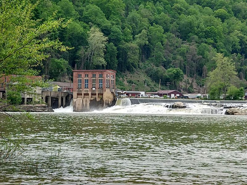
An entire river, not a creek or a trickle, tumbles over a rocky ledge just a couple of miles after it’s born. That river forms when two famous rivers meet, and it starts working almost right away.
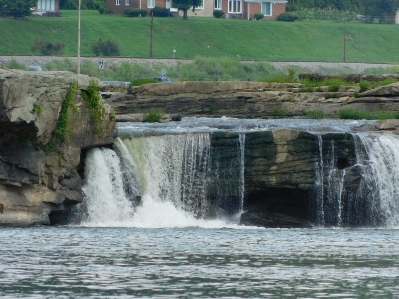
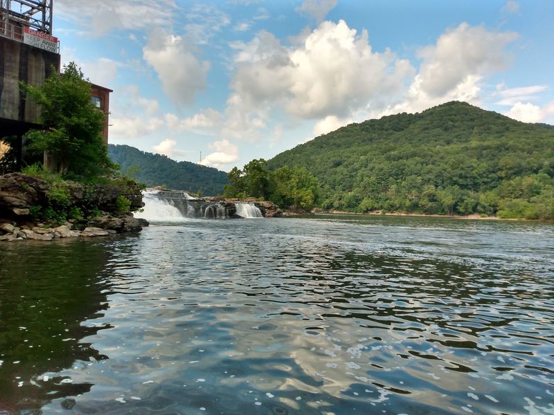
The waterfall here is built for width, not height. Water spreads across a broad stone shelf in sheets and churning white ribbons.
A historic power station sits beside it, and anglers line the banks below.
I like how this spot rewards anyone driving the old roads of West Virginia. You don’t need to hike for an hour or pack climbing gear.
You need a pull-off, a little patience, and maybe a fishing rod.
It also carries a name shared by a tiny community just downstream. So which came first, the falls or the town?
A Young River Takes Its First Big Leap Right Here
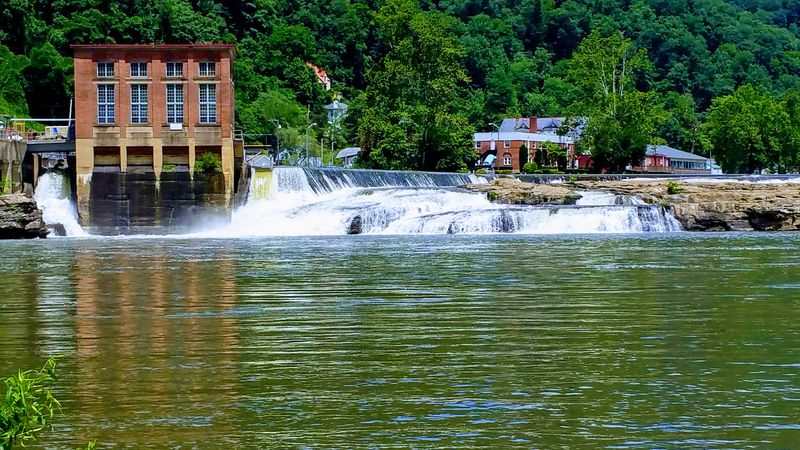
Kanawha Falls sits in Fayette County, West Virginia, on a river that has barely had time to introduce itself. The Kanawha River forms at Gauley Bridge, where the New and Gauley rivers join forces.
Only a short distance downstream, that brand-new river hits a rocky shelf and spills over. The result is a broad waterfall that stretches across the channel instead of plunging from a dizzy height.
The name gets shared, too. Kanawha Falls is also an unincorporated community on the east bank of the river, about 2 miles southwest of Gauley Bridge.
That little community sits roughly 0.6 miles downstream from the waterfall that gave it a name. Easy enough to remember, and handy when you’re reading road signs.
Plenty of waterfalls hide at the end of steep trails. This one parks itself along a working river corridor, close to roads, homes, and history.
That accessibility is a big part of its charm for folks who prefer scenery without a sweaty climb. You get real river power, real mountain views, and a short walk from the car.
Honestly, that’s a fine bargain on any afternoon.
Wide Water Beats Tall Water on This Stretch
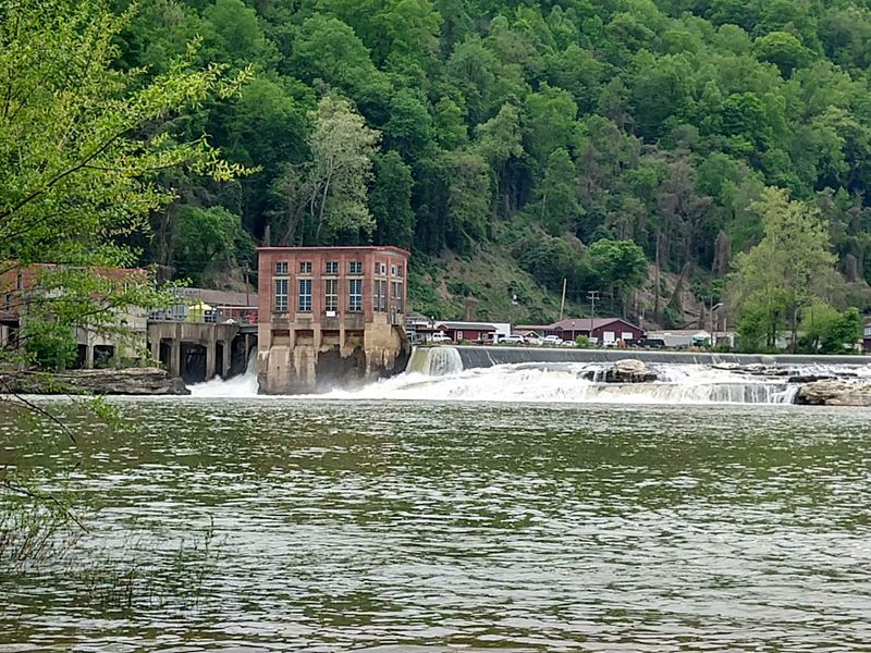
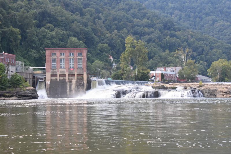
Height grabs headlines, but width steals the show at this river ledge. The water spreads across the Kanawha in a long, uneven line of foam and rock.
Measurements for the drop vary depending on the source and the river level. What stays consistent is the sheer volume, since a full river is doing the falling here.
That’s the key difference from the skinny creek cascades scattered around Fayette County. Those can shrink to a dribble in a dry August.
A river this size usually keeps moving with real muscle. After heavy rain, the whole ledge can turn into a wall of churning white water.
Lower flows reveal more of the stone shelf underneath. You can often trace the cracks and steps in the rock that shape each little channel.
So the scene changes with the weather, which makes repeat visits worthwhile. A spring trip and a fall trip may feel like two different places.
Bring a jacket on cool days, because river air carries a chill. The spray near the edges can surprise anyone dressed for a sunny parking lot.
Where Two Famous Rivers Become One
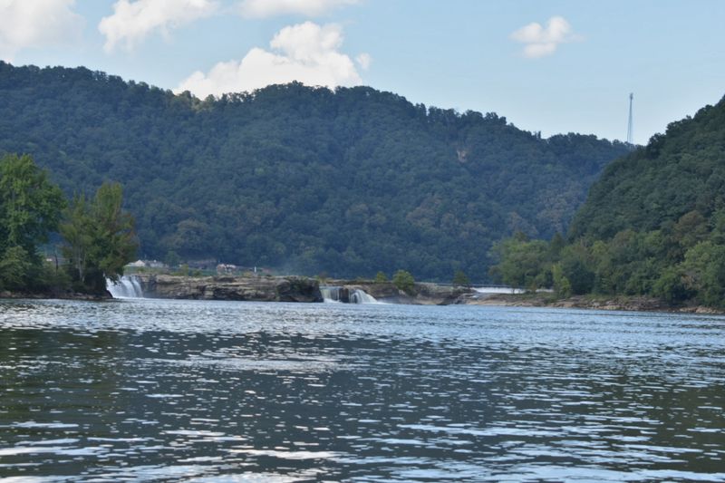
Few rivers get a more dramatic origin story than the Kanawha. It begins at Gauley Bridge, where the New River and the Gauley River meet beneath steep Appalachian hillsides.
Both parent rivers carry big reputations in West Virginia. The New runs through the national park gorge, and the Gauley is famous among whitewater fans.
Their combined water heads downstream and reaches the falls within a couple of miles. That means Kanawha Falls is one of the very first landmarks on the river’s long trip toward the Ohio.
I can’t think of many places where you can follow a river’s birth and first big drop in one short drive. It feels like reading the opening chapter of a great story.
The Kanawha later becomes a working river for towns like Charleston. Up here, though, it still looks wild and rocky.
Spend a few minutes at Gauley Bridge before or after the falls. Seeing the meeting point first makes the waterfall feel even more impressive, since you know exactly where all that water came from.
You Can Thank the Falls for Some Early Mountain Power
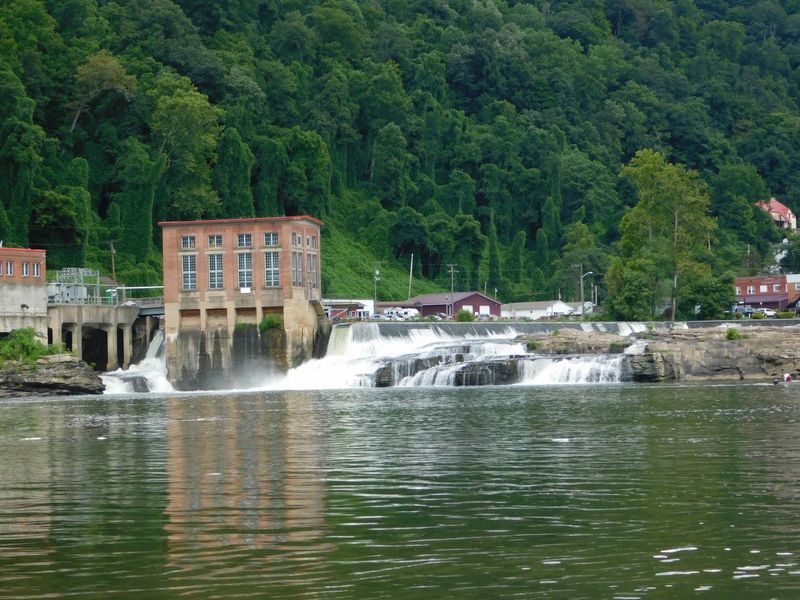
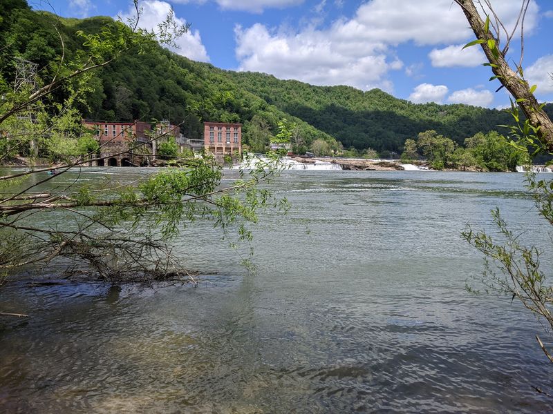
Moving water this strong was never going to stay unnoticed. Across from the falls, at Glen Ferris, a hydroelectric dam and power station harness the river’s energy.
The plant dates back to the early twentieth century, according to regional histories. It reportedly supplied power to industry along the river, a common pattern in the coal and manufacturing era.
That history adds a layer that many scenic stops lack. You get natural rock and human ingenuity sharing the same stretch of water.
For anyone who grew up around mills, mines, or plants, the scene may feel familiar. West Virginia built a lot of its story on rivers that worked hard.
The dam and the natural ledge sit together across the channel. Water spills over both, creating a long line of white that’s easy to spot from shore.
Keep a respectful distance from any operating equipment and posted areas. Utility property isn’t a playground, and the river current near structures can be powerful.
Still, the old industrial backdrop gives your photos a sense of time. It’s a little postcard of mountain grit and beauty side by side.
Bring a Rod, Because the Fish Clearly Like It Here
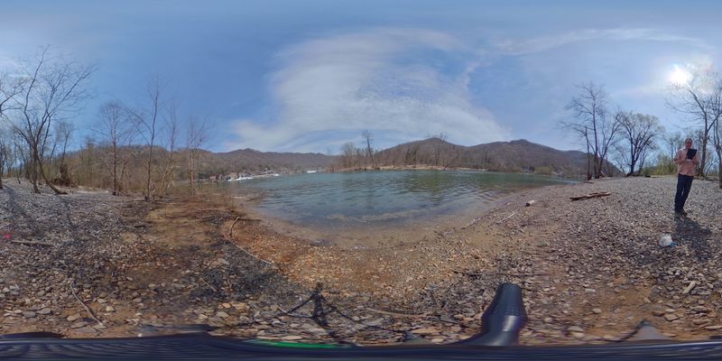
Anglers figured out this spot long ago. The West Virginia Division of Natural Resources maintains the Kanawha Falls Public Fishing Area along the river below the falls.
Churning water below a ledge tends to mix in oxygen and stir up food. Fish often gather in that kind of current, which explains the steady interest from people with tackle boxes.
The Kanawha is known for species like smallmouth bass, walleye, and muskellunge. Catches depend on season, water level, and plenty of luck, of course.
A valid West Virginia fishing license is required for anglers of the appropriate age. Check current DNR regulations before casting, since rules can change.
Even non-anglers can enjoy watching the action from shore. There’s something calming about lines arcing over moving water while the falls roar nearby.
Wear shoes with good grip if you plan to explore the rocks. Wet stone near a river can be slick, and the current deserves respect.
Pack snacks, a folding chair, and patience. The fish keep their own schedule, but the view makes waiting easy.
The Old Midland Trail Delivers You Right to the Edge
Good news for anyone who loves a scenic drive. U.S.
Route 60, the historic Midland Trail, runs along the river near Glen Ferris and the falls.
The Midland Trail is a designated National Scenic Byway across southern West Virginia. It follows old travel routes through mountains, river valleys, and small towns.
That means Kanawha Falls fits neatly into a day of wandering. You can pull over, stretch your legs, and soak in the river before rolling on.
Families with grandparents along will appreciate the short distances. Nobody has to tackle a long trail to enjoy a genuine waterfall.
The road also connects to other stops in Fayette County. Gauley Bridge sits just upstream, and the New River Gorge region lies a bit farther east.
Drive carefully, though, since the route curves with the river. Watch for trucks, local traffic, and anyone else slowing down to admire the view.
A full tank and a loose schedule make this drive better. Rushing past a waterfall is a waste of perfectly good scenery.
Four Seasons of Moods on One Rocky Ledge
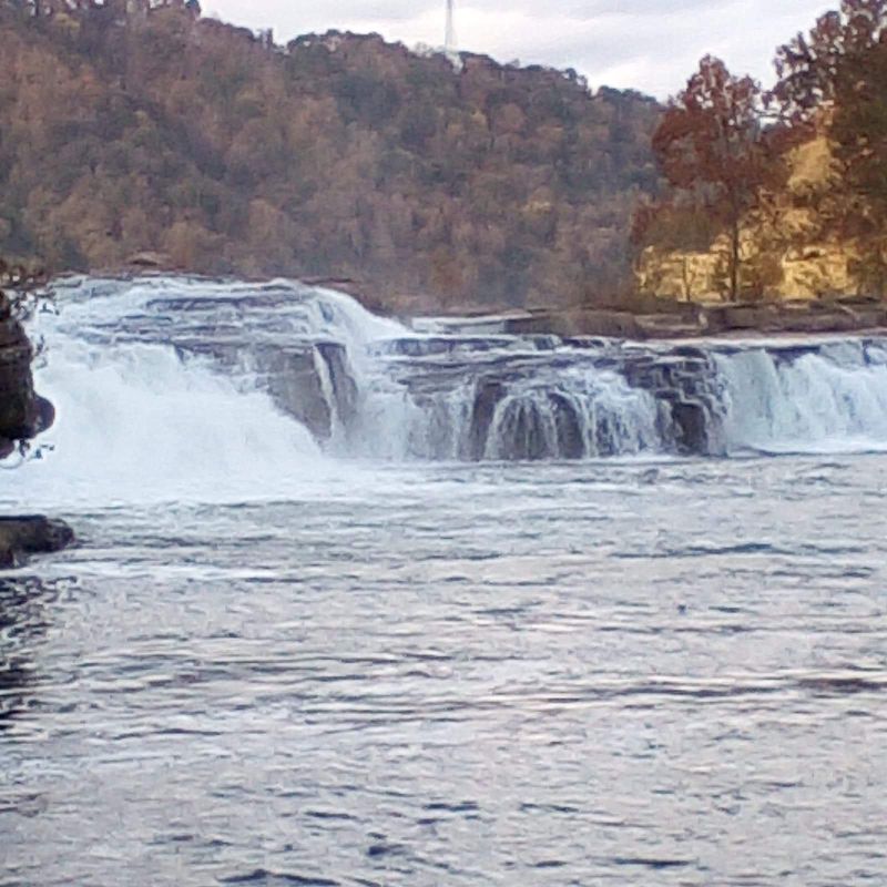
Spring usually brings the biggest show. Rain and snowmelt from upstream rivers swell the Kanawha, and the falls can look downright thunderous.
Summer often settles things down a bit. Green hillsides frame the water, and longer days give you more time to linger along the banks.
Autumn might be the prettiest season of all. The surrounding ridges in Fayette County turn shades of red, orange, and gold.
Those colors reflecting off moving water make for easy photographs. Even a phone camera can come away with something worth framing.
Winter visits feel quieter and more stark. Bare trees open the views, and cold air can make the spray look like smoke.
Each season changes the river level, so no two trips look exactly alike. That’s part of the fun for anyone living within a short drive.
Dress for the weather and the river breeze. A sunny day in town can feel noticeably cooler beside rushing water, especially early in the morning.
A Laid-Back Stop for Grandkids, Grandparents, and Everyone Between
Not every outing needs an itinerary. Kanawha Falls works beautifully as a relaxed stop where everyone sets their own pace.
Older travelers can enjoy the view without a strenuous hike. Kids get the thrill of watching a whole river crash over rocks.
Photographers will find plenty to frame, from the wide falls to the old power station. Anglers, as mentioned, have their own reasons to show up early.
The setting also invites storytelling. Many West Virginia families have memories tied to rivers, fishing trips, and Sunday drives along the Midland Trail.
It’s the kind of place where someone inevitably says, “We used to come here.” Those moments are worth more than any souvenir.
Keep a close eye on little ones near the water. Rocks can be slick, and river currents are stronger than they appear from shore.
Pack a simple lunch and a camera. There’s no need for fancy plans when the main attraction keeps flowing all day, every day, free of charge for anyone willing to stop.
Getting There Without a Single Wrong Turn
Directions are refreshingly simple. Head to Gauley Bridge in Fayette County, then follow the Kanawha River downstream a couple of miles.
The community of Kanawha Falls uses the address West Virginia 25115. For GPS fans, the coordinates land near 38.1426, -81.2065.
The waterfall sits roughly 0.6 miles upstream from that community. Glen Ferris and U.S.
Route 60 sit across the river, offering their own views.
The public fishing area provides river access on the falls side. Signs and parking help point the way, though spaces can vary.
No admission is typically charged to view the falls from public areas. Still, it’s smart to check WVDNR resources for any seasonal notices or access changes.
Cell service can be patchy in river valleys. Download maps ahead of time, just in case your phone decides to take a nap.
Restrooms and services aren’t something to count on at the falls itself. Plan stops in nearby towns, then enjoy the river without worrying about the next gas station.
A River Worth Pulling Over For, Every Single Time
Some landmarks shout for attention, and others simply keep working. Kanawha Falls does both, roaring along while the rest of Fayette County goes about its day.
It isn’t the tallest drop in West Virginia, and it doesn’t need to be. The width, the power, and the history make it memorable in its own right.
You get a young river taking its first big tumble. You get an old power station, a public fishing area, and a scenic byway nearby.
That mix feels very West Virginia. Natural beauty and hardworking history share the same riverbank without any fuss.
I believe the best stops are the ones you can return to again and again. This one changes with every season and every rainstorm upstream.
So next time you’re near Gauley Bridge, give the river a few minutes. Roll down the window, listen for the rumble, and follow it.
Bring someone who remembers the old days, or someone seeing it for the first time. Either way, the falls will hold up their end of the deal.
