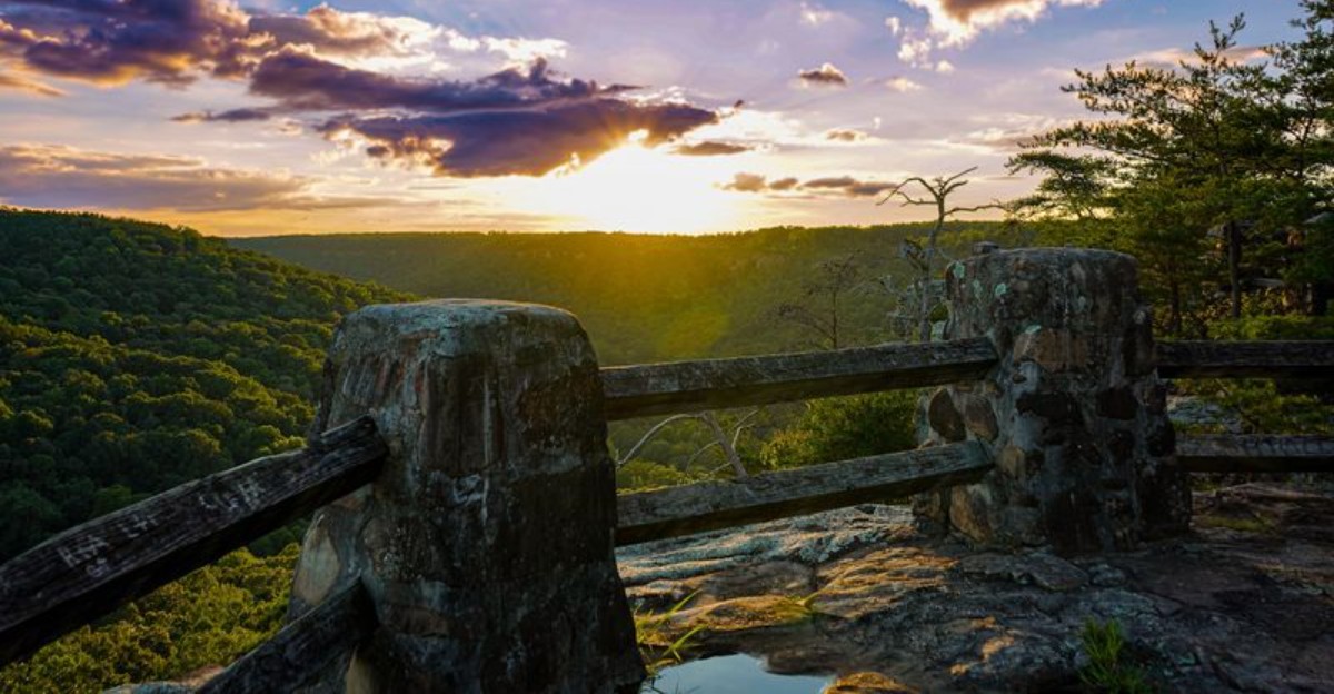
The child asks the question nobody else thought to ask. “Why is the rock bigger than our house?” Unfortunately, there is no particularly satisfying answer.
Some of Alabama’s state parks contain sandstone formations large enough to make people stop comparing them to ordinary objects and start comparing them to castles, towers, and forgotten ruins.
Elsewhere, waterfalls spill through mossy ravines, caves swallow daylight, and coastal oaks bend across trails like enormous wooden doorways. The scenery changes depending on where the trail leads.
So does the imagination. A regular afternoon outside can become a search for whatever looks most impossible around the next corner.
1. Cathedral Caverns State Park, Woodville
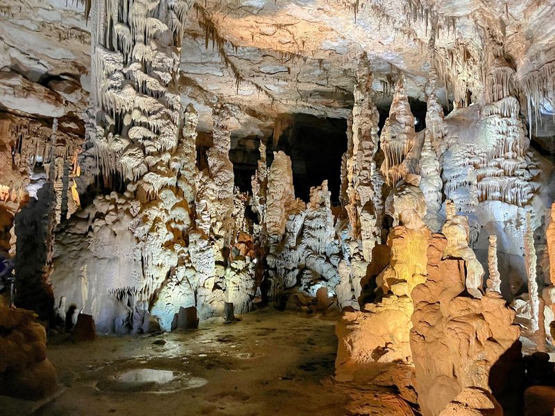
The entrance alone does most of the convincing. At 126 feet across and 25 feet high, it holds a world record for commercial cave openings, and the cool air pouring out of it hits like an open freezer door in July.
Inside, the passages swell into something closer to a buried city than a cave. Goliath, the headline stalagmite, rises 45 feet with a circumference of 243 feet, which puts it among the largest anywhere on the planet.
Nearby, a frozen waterfall formation spreads 32 feet tall and 135 feet long, looking exactly like water paused mid-fall by some quiet spell. A dense stalagmite forest crowds another chamber, and in the Crystal Room the mineral surfaces catch the lighting and throw back a soft glitter.
Watch for the caveman formation perched on a flowstone wall, and the improbable stalagmite that climbs 27 feet at a 45-degree angle while staying only about three inches wide. Physics apparently took the day off.
Temperatures hold near 60 degrees year-round, so a light jacket earns its place in the bag no matter the season. Guided walks follow a paved path, which makes the underground easier to reach than most expect.
Find the park at 637 Cave Road, Woodville, Alabama 35776, roughly an hour from Huntsville along quiet county roads.
2. Rickwood Caverns State Park, Warrior
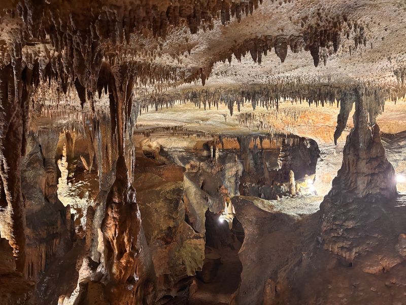
Fossils in the ceiling tell the oldest part of this story. Rickwood sits inside limestone shaped roughly 260 million years ago, back when a shallow sea covered this corner of the continent, and shell fragments still sit embedded overhead like pressed flowers in a book.
Guides call the route the miracle mile, a stretch of chambers where water keeps building formations one slow drip at a time. They are described as living, because the growth never stopped.
Color surprises people here. Mineral-rich water tints the flowstone in soft rusts, creams, and greys that shift as the lighting changes along the path.
Then there are the pools. Blind cave fish drift through the dark water, pale and eyeless after generations underground, and spotting one feels like catching a glimpse of something that should not exist.
The temperature stays between 58 and 62 degrees no matter what August is doing above ground, which makes summer visits especially welcome. Stairs and low ceilings appear in a few spots, so sturdy shoes help more than sandals.
Above ground, the park keeps trails, a picnic area, and shaded space to stretch out after the tour. Rickwood Caverns State Park sits at 370 Rickwood Park Road, Warrior, Alabama 35180, a short detour north of Birmingham.
3. Bald Rock Boardwalk at Cheaha State Park, Delta
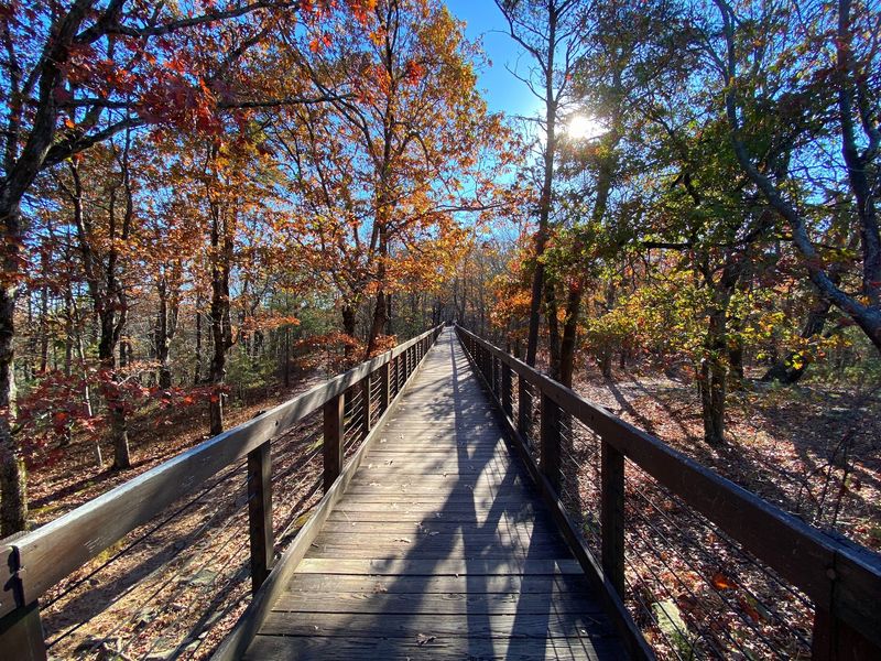
Alabama’s roof sits at 2,407 feet, and the view from up here has earned the nickname island in the sky. Ridgelines roll outward in every direction, layered in blue haze, looking less like a state and more like an ocean of trees.
The Bald Rock Boardwalk makes that view unusually easy to reach. A level wooden path threads through twisted hardwoods and granite boulders, ending at a platform that opens straight over the valley.
Wind does most of the sculpting up here. Trees grow low and gnarled, their branches bent in one direction, which gives the whole ridge the look of a place guarding something.
Fog often pools in the valley at sunrise, leaving the summit floating above a white sea. Photographers show up early for exactly that reason.
Autumn brings the loudest color, though winter has its own appeal when bare branches open longer sightlines across the Talladega National Forest. The park covers roughly 2,799 acres, surrounded on all sides by that national forest.
The boardwalk suits strollers and wheelchairs, a rare thing among mountaintop overlooks. Bring a windbreaker, because the temperature at the top usually runs noticeably cooler than the parking areas below.
4. Pulpit Rock Trail at Cheaha State Park, Delta
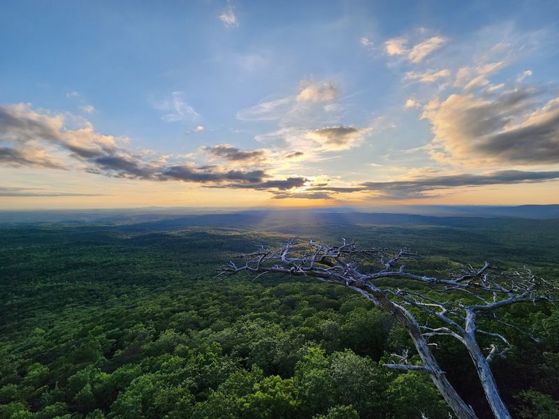
Some overlooks make a person work for the payoff. Pulpit Rock asks for a short but genuinely steep walk, with roots, stone steps, and a few spots where hands come in handy.
The reward arrives quickly. A jutting slab of stone pushes out over the drop, framed by pines, aimed directly at the western horizon.
Sunset is the popular hour, and for good reason, since the light rakes across the Talladega ridges and turns everything gold before it fades. Arrive with a headlamp if planning to stay for the finish.
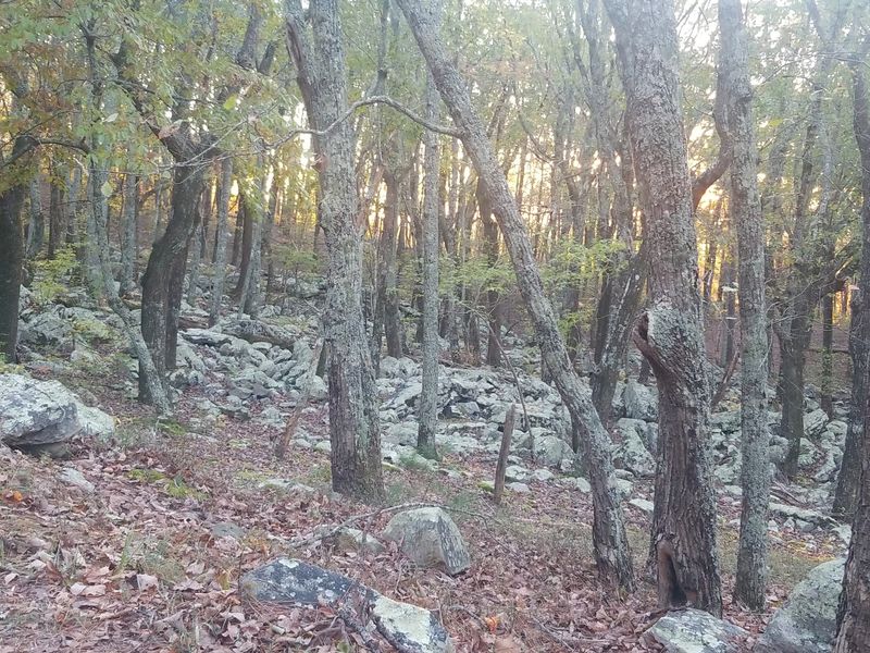
The trail runs under a mile round trip, which sounds gentle until the grade shows up. Take it slow and the walk stays enjoyable.
Edges here are unfenced and the rock can turn slick after rain, so keeping a comfortable distance matters more than a dramatic photo. Children and dogs deserve a close hand.
Sound carries oddly at the outcrop. Wind moves through the pines below and rises up the cliff face, a low steady rush that drowns out almost everything else.
Combine the hike with a stop at Bald Rock and the whole summit area fills an easy half day. Both sit within the same park boundary, minutes apart by car.
5. Angel Falls and the Rock Garden Outlook, Cheaha
Rain changes everything here. Angel Falls, the only natural waterfall inside Cheaha State Park, runs shy during dry spells and turns genuinely lively a day or two after a good storm.
Cheaha Creek does the work, spilling over the Rock Garden Outlook into a shaded pocket of forest below. The sound reaches hikers well before the water comes into view.
Getting there means following the Mountain Laurel Trail, which traces a streambank through a thick laurel tunnel. In late spring the blooms crowd the path, pink and white against dark green leaves.
The footing stays uneven, with slick roots and loose stone near the water. Shoes with grip beat sneakers by a wide margin.
Boulders scattered across the Rock Garden give the area its name, mossy and stacked at odd angles, arranged as if someone was interrupted mid-project. Sitting among them for a while is half the point.
Wildlife tends to be small and quiet. Salamanders hide under damp leaves, and warblers work the canopy overhead during migration seasons.
Crowds thin out considerably compared with the summit overlooks, which makes this the quiet chapter of a Cheaha visit. Pack water, take the trail slowly, and let the forest set the pace.
6. Azalea Cascade and Laurel Falls, DeSoto State Park
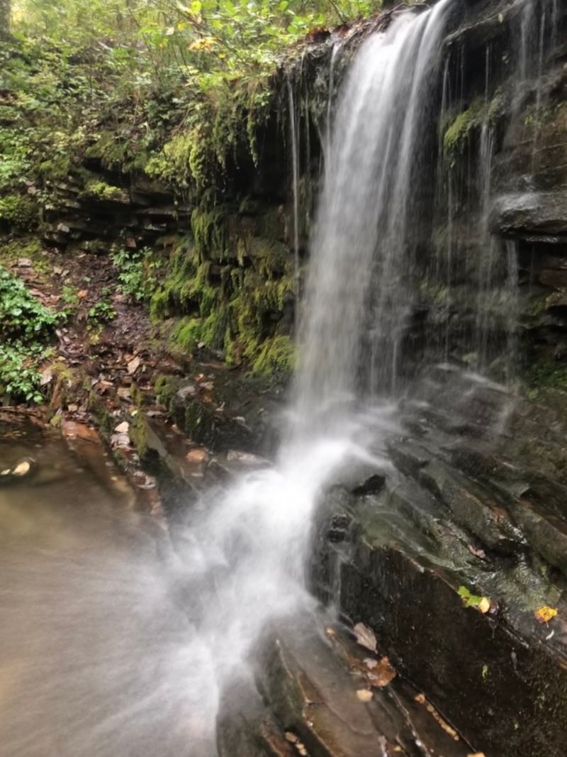
Spring turns this stretch of Lookout Mountain into something close to a garden that planted itself. Wild azaleas bloom along the creeks, and the Talmadge Butler Boardwalk Trail carries walkers straight through the middle of it toward Azalea Cascade.
The boardwalk is short, flat, and lined with ferns. Families with small children manage it easily.
Water tumbles over layered rock at the cascade, framed by moss so thick it looks upholstered. After heavy rain the flow doubles and the whole grotto fills with mist.
Laurel Falls waits along the Lost Falls Trailhead, a slightly rougher walk with more roots and rock underfoot. Seasonal flow means timing matters, and late winter through spring is the sweet spot.
DeSoto is full of these small waterfalls, dozens of them scattered through the woods, fed by streams that drain across the mountaintop. The West Fork of the Little River cuts through the park and keeps everything green.
Native plant communities here are unusually varied, from mountain laurel thickets to sandstone glades holding plants that grow almost nowhere else nearby.
The park sits at 13883 County Road 89, Fort Payne, Alabama 35967, with trailheads well marked from the main park road. Grab a trail map at the entrance and plan on wandering.
7. Jim Lynn Overlook at Buck’s Pocket State Park, Grove Oak
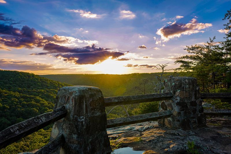
The name fits better than most. Buck’s Pocket really is a pocket, a deep natural bowl folded into the southern end of the Appalachians where the land drops away without much warning.
Northeast Alabama keeps this one fairly quiet. Visitors often have entire overlooks to themselves on weekday mornings.
Jim Lynn Overlook delivers the widest view, staring down into a canyon lined with sandstone bluffs and hardwood slopes that shift color with the seasons. Hawks circle below eye level, which never stops feeling strange.
Trails here range from short strolls to longer routes that drop toward the canyon floor and follow rocky creek beds. Elevation change comes fast, so pacing beats enthusiasm.
Boulder fields, hidden seeps, and stands of old hardwood give the place a wild, unmanaged feel. Wildflowers appear along the lower trails in early spring.
The park has long carried a bit of local folklore as a retreat for defeated politicians, a quirky tradition that says plenty about how solitary the canyon feels.
Cell service gets patchy quickly, so download maps in advance. The park sits near Grove Oak, Alabama, reached by winding two-lane roads that are part of the experience.
8. Peavine Falls and Maggie’s Glen, Oak Mountain State Park
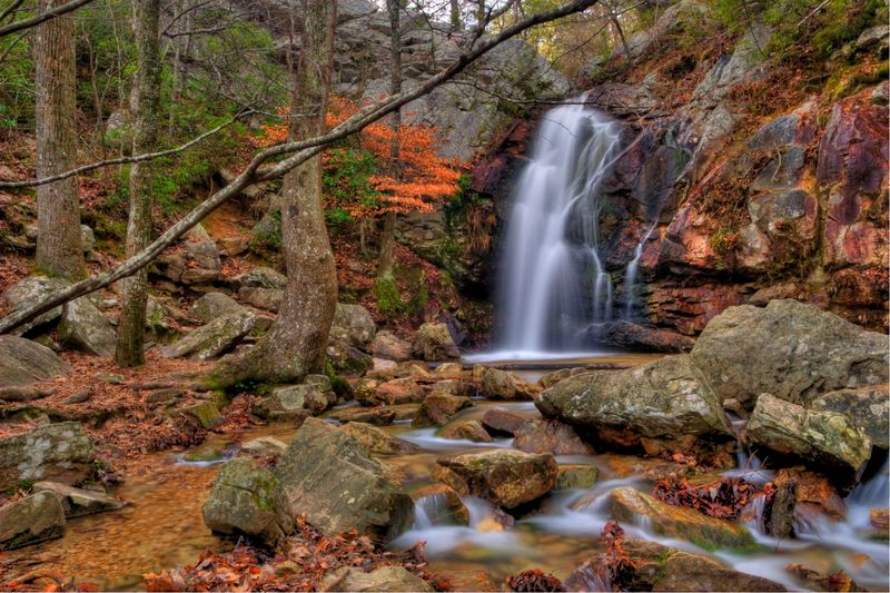
Birmingham traffic disappears about ten minutes into these woods. Oak Mountain is the state’s largest park, and its best corners hide well behind ridges of pine and hardwood.
Peavine Falls drops roughly 65 feet down the park’s upper ridge, fed naturally rather than by any dam or diversion. The trail to the base is short but steep, with rock steps that demand attention on the way down.
Cool spray collects in the gorge, and in warmer months the shallow pool below invites wading. Flow drops in late summer, so plan around recent rain for the full effect.
Maggie’s Glen sits in a different mood entirely. A protected streamside cove deep in the forest, it stays remarkably quiet, the kind of place where footsteps sound loud.
An ancient beech tree stands there, gnarled and twisted into shapes that look deliberate, watching over the creek like something out of an old tale. Plants crowd the banks in layers of green.
Several trails converge nearby, so reaching the glen can be combined with longer loops through the backcountry. Signage at junctions is decent, though a map still helps.
The park entrance is at 200 Terrace Drive, Pelham, Alabama 35124.
9. Backcountry Trails and Freshwater Lakes, Gulf State Park
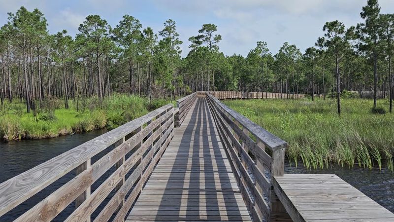
Most people come to Gulf Shores for sand and never learn what sits behind the dunes. Gulf State Park spreads across more than six thousand acres and holds nine distinct ecosystems, which is a lot of variety for one coastal park.
The Hugh S. Branyon Backcountry Trail system covers over 28 miles of paved and natural paths.
Bikes, walkers, and joggers share it without much friction.
Ancient live oaks arch across several sections, their limbs low and twisting, forming shaded green corridors that feel a world away from the beach parking lots. Light filters through in patches.
Freshwater lakes hide inside the park, including Lake Shelby and Middle Lake, sitting close enough to the Gulf that fresh and salt water nearly meet. Herons stalk the shallows at dawn.
Boardwalks lift trails over marsh and swamp, giving clear views of wetland plants and the occasional alligator sunning along a bank. Keep a respectful distance and the sighting stays a highlight rather than a problem.
Songbirds pass through in huge numbers during spring and fall migration, making the trails popular with birders.
Start from the park at 20115 State Park Road, Gulf Shores, Alabama 36542, and bring water plus insect repellent for the marsh sections.
