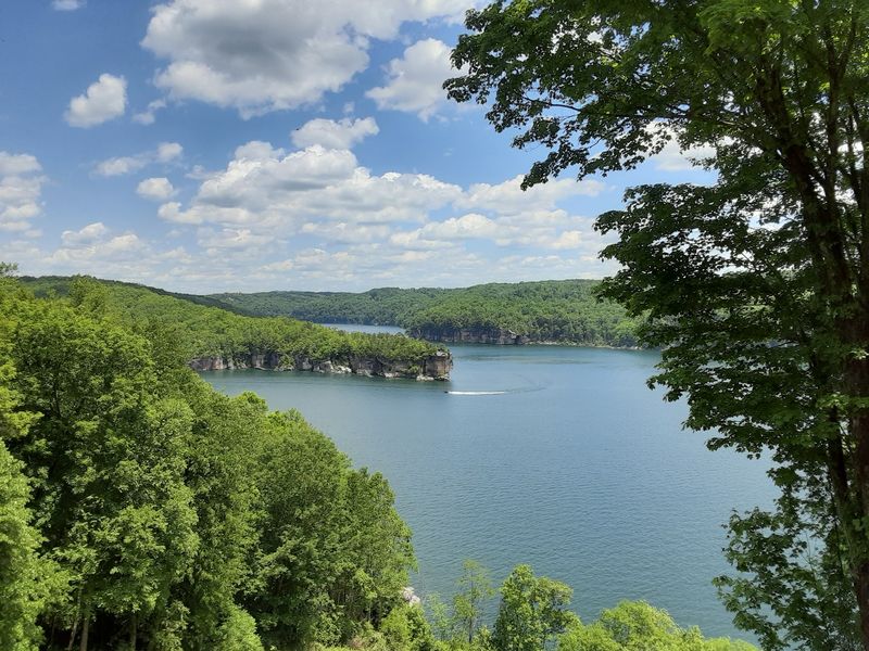
You can stand on a quiet cliff in West Virginia, look down at water so clear it seems fake, and never guess what sits below. Folks who grew up here know the story, but plenty of hikers find out by accident and stop in their tracks.
Under that blue-green surface lies a whole farming community, with old roads and stone foundations still waiting in the deep. It is the kind of place that turns a simple summer swim into a lesson about home, memory, and change.
A Reservoir Hiding in the Mountains
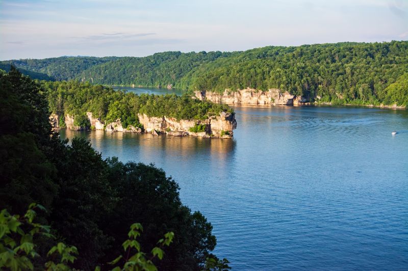
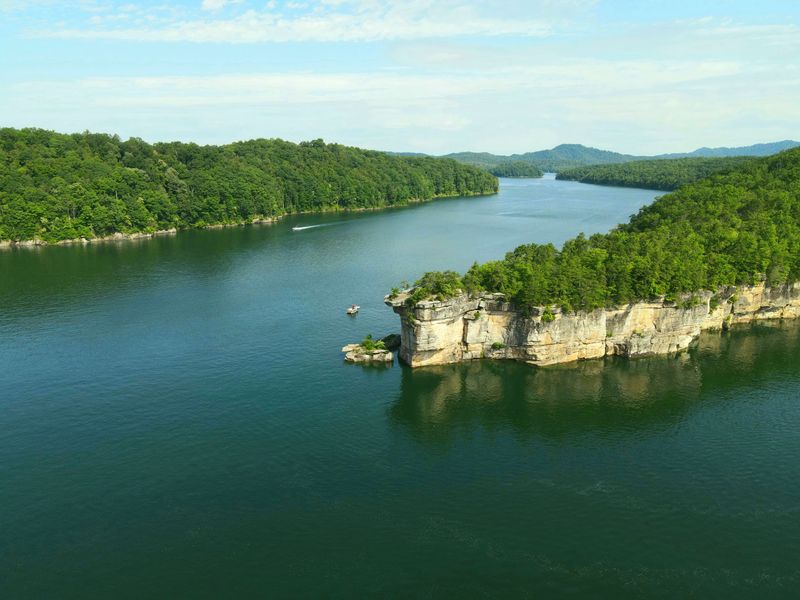
Picture a long ribbon of blue-green water folded between wooded ridges, with sandstone cliffs dropping straight into it. That is the first impression most people get, and it rarely fades.
Visitors often compare the color to the Caribbean, which feels a little wild for a spot tucked deep in Appalachia.
Here is the twist, though. The lake was not carved by nature over thousands of years.
It was made by people, filling a valley in the 1960s when a large dam went up across the river. Before that, families farmed this land, walked these hollows, and gathered at a small store that doubled as the post office.
Today the water stretches across roughly 2,790 acres with about 60 miles of shoreline, making it reportedly the biggest lake in the state. Boaters, swimmers, kayakers, climbers, and campers all share it, and many leave saying it ranks among the prettiest places they have seen anywhere.
For hikers, the surprise usually comes later. They admire a cliff overlook, snap a photo, and then hear that an entire village sits somewhere beneath the reflection.
Suddenly the view feels a whole lot deeper, and the trail back to the car turns into a long, thoughtful walk.
Life in the Old Village of Gad
Long before anyone strapped on a paddle board here, a farming community called Gad filled this valley. From the early 1800s until around 1960, families raised crops and livestock along McKee’s Creek near the Gauley River in Nicholas County.
Life moved at a slower pace back then. The general store was the center of everything, and it also housed the post office, so a trip for flour or coffee often turned into an hour of catching up with neighbors.
A small church stood nearby, along with a school where local children learned their lessons.
Anyone raised in small-town West Virginia can probably picture it without much effort. Front porches, gardens, Sunday dinners, and kids running between farms until supper.
It was the kind of place where everyone knew whose truck was coming down the road.
Names like Gad rarely made the history books, which is part of what makes this story hit home. These were ordinary mountain folks building ordinary, good lives over several generations.
Their roots ran deep in that soil.
So when news came that the government needed the valley, it meant far more than a land sale. It meant saying goodbye to a whole way of living, and that kind of loss lingers in a family’s memory for decades.
The Dam That Changed Everything
Floods were a real worry for communities downstream in the Kanawha Valley, and in the 1960s the U.S. Army Corps of Engineers set out to tame the water.
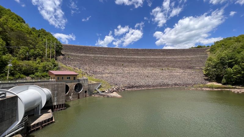
Their answer was a giant rock-fill dam across the Gauley River.
Work began in 1960 and wrapped up in 1966, at a reported cost of nearly $48 million. The finished structure stands about 390 feet tall and stretches roughly 2,280 feet across.
President Lyndon B. Johnson dedicated the dam and lake on September 3, 1966.
Residents of Gad were relocated, and their homes were taken down or moved before the valley filled. It was a hard change for those families, even as the project promised safety for thousands of others.
Now for the part locals love to share with a grin. The Corps usually named dams after the closest community.
Officials reportedly decided calling it Gad Dam would not go over well, so they borrowed the name of Summersville, the next town over.
Visitors today say the dam is worth seeing up close. Drive down to the tailwaters for a view of the towering rock walls and the huge spillway outlet.
Over the years, it has reportedly helped prevent more than $407 million in flood damage.
When the Water Drops and the Past Peeks Out
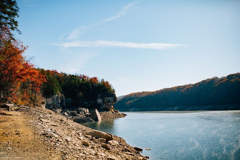
Every fall, something remarkable happens. Usually between October and November, crews lower the lake level, and parts of the old valley floor come back into the light.
Sharp-eyed walkers have spotted remnants of old roadways, stone building foundations, and even rock carvings left behind by former residents. Seeing a roadbed that once carried farm wagons, now stretching out of the mud, can give you chills in the best way.
Every ten years or so, a deeper drawdown for maintenance may reveal even more. Longtime fans of the lake keep an eye on those years and plan their visits around them.
Regulars mention that fall and spring are great times to explore because the low water lets you wander down into the gorge. One local favorite called Pirate’s Cove sits right off the side of the four-lane, and folks say the hike there is well worth the effort.
Scuba divers get another angle on the story. Thanks to the famously clear water, they can sometimes find traces of Gad below the surface during warmer months.
Bring good boots, watch your footing on slick ground, and leave every relic exactly where you find it. Those stones belonged to somebody’s grandparents, after all.
Clear Water and Sandstone Cliffs
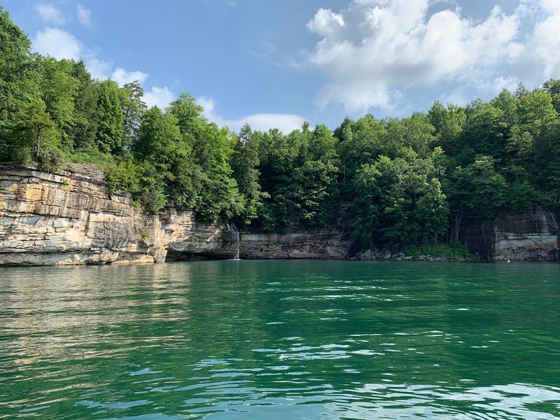
Ever heard a West Virginia lake called the Little Bahamas of the East? People say it about this one, and after one look, the nickname makes sense.
One boater mentioned seeing an anchor line roughly 40 feet down. Others describe a greenish blue tint in certain coves that looks borrowed from a tropical postcard.
Swimming comes up in visitor chatter more than almost anything else, and the main swimming area is described as huge, with plenty of parking close by.
Then there are the cliffs. Tall sandstone walls line long sections of shoreline, drawing rock climbers from all over.
Some folks climb and jump off the rocks, though that is a choice to make carefully, with real knowledge of the depth below.
For a free, adventurous swim, some visitors head down from Whippoorwill Road. The walk to the water is short but steep and muddy, and those who have done it call it totally worth the scramble.
Kayakers and paddle boarders seem especially smitten. Gliding along the base of those cliffs, peering into water you can see straight through, feels downright peaceful.
Just imagine an old farm field resting quietly somewhere beneath your paddle the whole time.
Trails, Overlooks, and Campfire Evenings
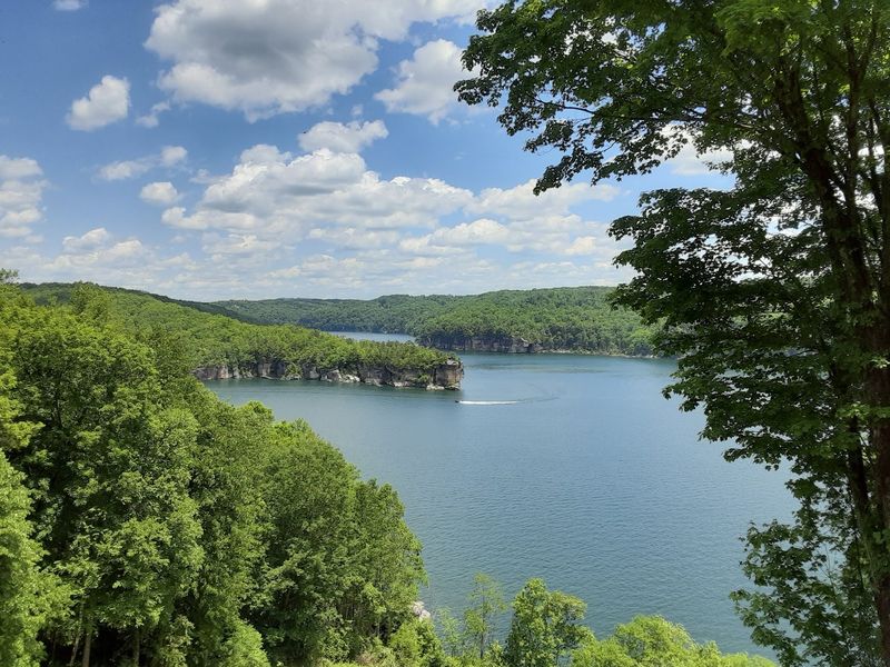
Hikers, this is where the lake really wins hearts. Long Point Trail gets mentioned again and again, and for good reason, since it ends at a sweeping cliff overlook above the water.
One visitor described a four-mile round trip that finished with a spectacular view, while other paths around the lake run closer to one or two miles. Orange Run Trail is another pick for anyone who enjoys rambling along the shoreline.
Wildflowers and plants along the routes add a nice touch in warmer months.
Camping is a big part of the experience, too. Battle Run Campground is a favorite, with a small beach, an island nearby, boat access, and a kayak launch.
Visitors say the grounds feel well kept, and some mention beach volleyball for anyone with energy left after a long day.
Summersville Lake State Park, established in 2023, offers camping that includes RV hookup sites and primitive spots, plus rock climbing. The nearby wildlife management area is popular for hunting, fishing, and camping as well.
A fair heads-up from past guests: one camper felt the bathhouses could use better upkeep for the price. Checking current conditions before you book may save some grumbling later.
Who Feels Right at Home Here
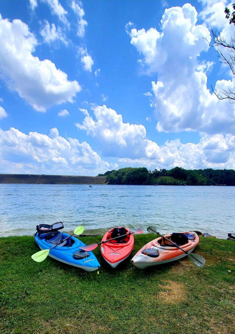
Some places suit one kind of traveler. This lake seems to welcome just about everybody, from thrill seekers to grandparents who want a quiet dock and a fishing pole.
Anglers can cast from provided fishing docks or launch a boat and stay out after dark. Boaters call it some of the finest water in the state, with unlimited horsepower sections for speed and secluded coves for lazy drifting.
Waterskiers enjoy it too.
A few honest tips from regulars are worth passing along. Weekends bring heavy boat traffic, and waves bouncing off the cliffs can build to around three feet on a busy Saturday.
Weekdays tend to be calmer, often closer to a foot and a half in spots.
Watch for floating logs, some reportedly six feet long and drifting upright, which can be tough to spot and hard on propellers. Trailer parking fills fast on weekends, so arriving early makes life easier.
Kayak newcomers often start at Battle Run, where rental outfitters may point first-timers. Paddlers headed for the dramatic rocks and waterfalls should know that Long Point sits a fair distance away.
For retirees and families alike, it is an affordable, easygoing way to soak up some of the finest scenery West Virginia offers.
Planning a Visit to Gad’s Watery Resting Place
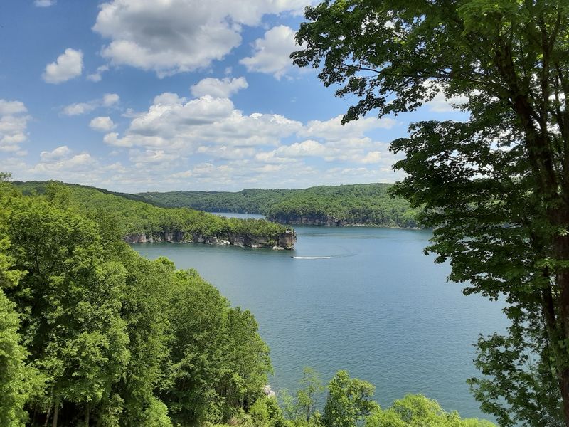
Ready to see it for yourself? Summersville Lake sits in Nicholas County, West Virginia, near the town of Summersville, with GPS coordinates around 38.2261, -80.8807 for getting your bearings.
Visitors mention easily accessible parking at lookouts all around the lake. Salmon Run is a known launch area, though boaters say it gets crowded when kayakers and trailers share the ramp.
Patience goes a long way there.
Timing depends on what you want. Summer brings the clearest water for swimming, snorkeling, and diving.
Fall brings the drawdown, the best chance to spot old Gad roadbeds and foundations, plus Gauley Season, when water releases create famous whitewater downstream.
Specific hours and fees vary by campground and area, so check with the state park or the Corps of Engineers before heading out. Some shoreline swimming spots, like the one off Whippoorwill Road, have been described as free.
Is it worth the drive? Most folks seem to think so, and plenty return year after year.
Few places blend pretty water with a story this touching.
Bring a camera and a little curiosity. And if your family has memories of Gad or the valley before the dam, those stories deserve to be shared and remembered.
