Idaho stretches across the Rocky Mountains like a patchwork of wild rivers and winding highways, each one telling a story carved by water and stone.
Travelers who explore this state quickly discover that geography isn’t just scenery here; it’s the architect of every route and detour.
Massive river systems slice through canyons and valleys, forcing roads to follow their ancient paths with respect and precision.
From the rugged Panhandle to the high desert plains, Idaho offers journeys where rivers dictate the rhythm and roads provide the adventure.
Whether you’re watching whitewater churn beside your window or tracing a river’s path through tribal lands and forests, these regions reveal how nature still commands the map.
Each corridor blends accessibility with wilderness, inviting explorers to witness landscapes that remain as untamed as they are beautiful.
This guide highlights ten remarkable areas where rivers and roads converge, creating unforgettable travel experiences shaped by the land itself.
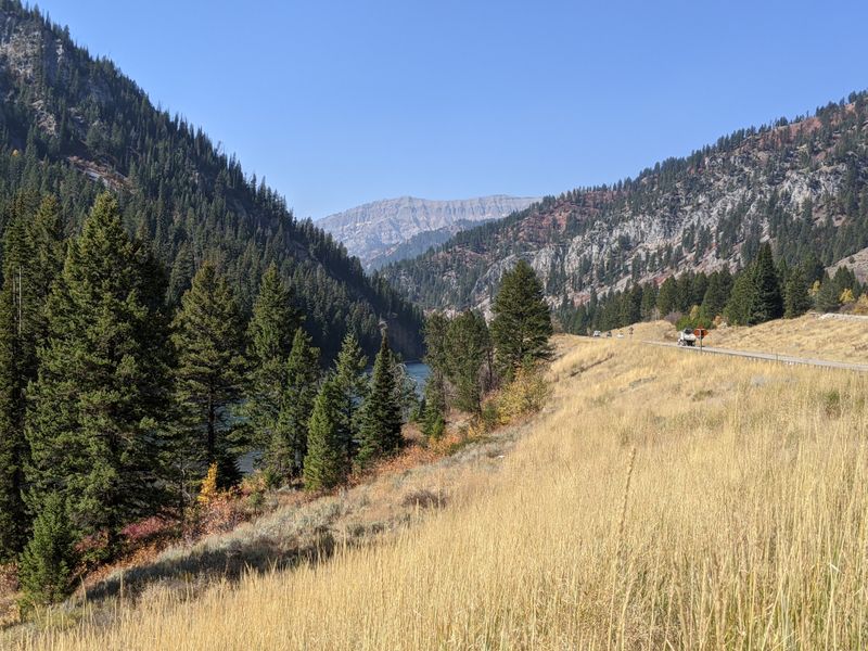
1. Salmon River Canyon Along Highway 95

Highway 95 traces one of the most legendary waterways in the American West, following the Salmon River through a canyon so remote it earned the nickname River of No Return.
This route runs parallel to the river for miles, offering travelers front-row seats to towering canyon walls that seem to rise straight from the water’s edge.
Riggins sits at the heart of this corridor, a small town that serves as a gateway to world-class whitewater rafting and jet boat tours.
Adventure seekers flock here to challenge rapids that range from thrilling to downright terrifying, depending on the season and snowmelt.
The road itself twists and turns with the river’s flow, creating a drive that feels more like a conversation with the landscape than a simple commute.
Pull-offs and viewpoints appear frequently, inviting you to stop and soak in the raw beauty of cliffs, pines, and churning water below.
Wildlife sightings are common, with bighorn sheep, eagles, and deer making appearances along the canyon’s steep slopes.
This stretch of Idaho showcases how a river can dictate not just the path of a road, but the entire culture and economy of a region.
Every mile reveals another layer of geological history, carved over millennia by relentless water and wind.
Location: Highway 95, Riggins, ID 83549
2. Payette River Corridor on Highway 55
Traveling Highway 55 means joining the North Fork of the Payette River on a journey through some of Idaho’s most adrenaline-fueled terrain.
Kayakers and rafters tackle Class V rapids right beside the road, turning the drive into a live-action showcase of extreme water sports.
Windows down, you can hear the roar of the river as it crashes over boulders and through narrow chutes carved into granite.
Small communities like Banks and Garden Valley dot the route, offering rustic lodges and outfitters ready to guide newcomers into the rapids.
The road climbs and dips with the river’s elevation changes, providing constantly shifting perspectives of the water’s power and beauty.
Springtime brings the most dramatic flows, when snowmelt swells the Payette into a churning force that commands respect and awe.
Anglers also find their paradise here, casting lines into calmer stretches where trout hide beneath overhanging willows.
This corridor perfectly demonstrates how a river can shape not only the physical landscape but also the lifestyle and identity of those who live nearby.
Every bend in the road reveals another scene of natural drama, from sun-drenched pools to shadowy gorges.
Location: Highway 55, Banks, ID 83602
3. The Panhandle via Highway 95 and Highways 2 and 57
Northern Idaho’s Panhandle region operates under the rule of two powerful rivers: the Kootenai and the Pend Oreille.
These waterways guide traffic through dense forests and around glacial lakes, creating routes that feel more like nature trails than highways.
Sandpoint emerges as the cultural and geographic heart of this region, nestled beside Lake Pend Oreille and backed by the towering Selkirk Mountains.
Highway 95 serves as the main artery, connecting small towns and wilderness areas that rely on the rivers for both identity and economy.
Highways 2 and 57 branch off, following river valleys into even more remote corners of the Panhandle where civilization feels like a distant memory.
The landscape here shifts from farmland to thick stands of cedar and pine, all shaped by the flow of ancient glacial runoff.
Waterfront access is abundant, with boat launches, fishing spots, and scenic overlooks appearing around nearly every curve.
This part of Idaho showcases how rivers can dictate not just where roads go, but where communities take root and thrive.
Winter transforms the region into a snowy wonderland, while summer brings endless opportunities for paddling, hiking, and exploring.
Location: Highway 95, Sandpoint, ID 83864
4. Snake River Gorge via Highway 30 and Interstate 84
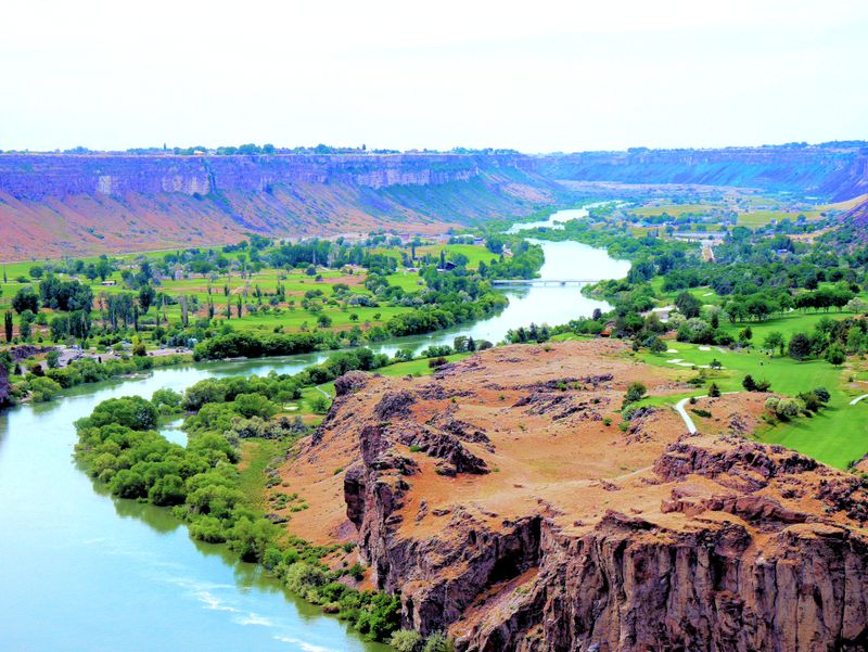
Few places in Idaho blend natural wonder with agricultural innovation quite like the Snake River Gorge.
Highway 30 and Interstate 84 follow the Snake as it carves through basalt cliffs, creating a corridor famous for the Thousand Springs Scenic Byway.
Water gushes from the canyon walls in dramatic waterfalls, fed by the vast Eastern Snake Plain Aquifer hidden beneath the surface.
Hagerman sits at the center of this lush zone, where aquaculture farms raise trout in crystal-clear spring water that flows year-round.
The contrast between the arid high desert and these verdant pockets of green feels almost surreal, a testament to the river’s life-giving power.
Travelers can pull off at multiple viewpoints to watch water cascade into the river below, each spring contributing to the Snake’s mighty flow.
The gorge itself tells a geological story millions of years in the making, with layers of volcanic rock exposed along the canyon walls.
Birdwatchers flock here to spot herons, ospreys, and pelicans that thrive in the river’s abundant ecosystem.
This region proves that rivers don’t just shape roads; they shape entire industries and ways of life.
Location: Highway 30, Hagerman, ID 83332
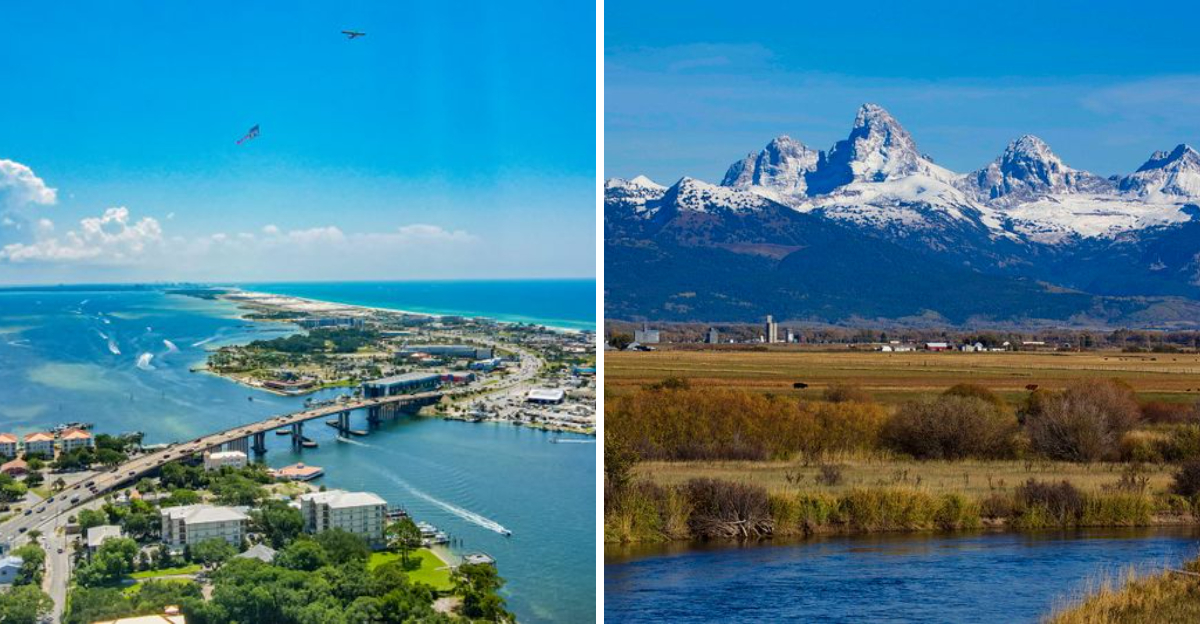
5. Teton Scenic Byway on Highway 33
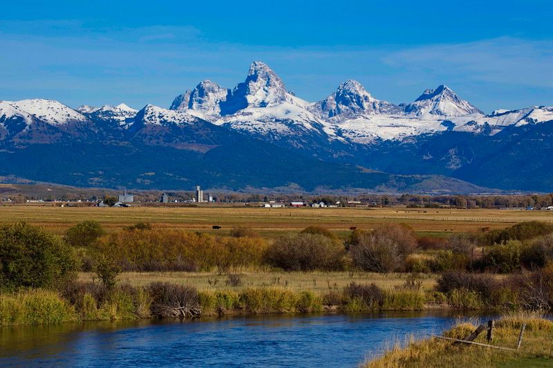
Highway 33 climbs into the Teton Basin, where the Teton River meanders through high-altitude valleys framed by some of the West’s most iconic peaks.
The road follows the river’s gentle curves, offering constant views of the Teton Range rising like cathedral spires against the sky.
This corridor serves as a vital link between Idaho and Wyoming, but it’s far more than just a pass-through route.
River-bottom meadows attract elk, moose, and deer, especially during dawn and dusk when wildlife emerges to graze along the water’s edge.
Small farming communities rely on the river for irrigation, creating a patchwork of green fields that contrast beautifully with the surrounding sagebrush uplands.
Photographers and nature lovers find endless inspiration here, where light and landscape shift dramatically with the seasons.
Winter blankets the basin in snow, turning the route into a quiet wonderland accessible only to those willing to brave the cold.
Summer brings wildflowers and fly-fishers, both drawn to the river’s cool, clear waters.
This region highlights how rivers can define not just geography, but the rhythm and character of an entire valley.
Location: Highway 33, Driggs, ID 83422
6. Clearwater River Valley on Highway 12
Highway 12 retraces the historic path of Lewis and Clark, hugging the Clearwater River through Nez Perce tribal lands and ancient cedar forests.
This route feels like a journey back in time, where the river remains the lifeline it was for indigenous peoples and early explorers.
The Clearwater’s name describes its character perfectly: transparent waters that reveal every stone and trout beneath the surface.
Nez Perce National Historical Park sites dot the corridor, offering insights into a culture deeply connected to these rivers and forests.
The road climbs steadily toward Lolo Pass, following the river’s tributaries into higher elevations where snow lingers well into spring.
Dense stands of western red cedar create a canopy that shades the highway, giving the drive a cathedral-like atmosphere.
Campgrounds and river access points appear frequently, inviting travelers to stop and immerse themselves in the tranquility of the valley.
This region showcases how rivers can preserve history and culture, serving as guides not just for roads but for entire generations.
Wildlife thrives here, with black bears, elk, and bald eagles making regular appearances along the riverbanks.
Location: Highway 12, Orofino, ID 83544
7. Wood River Valley on Highway 75
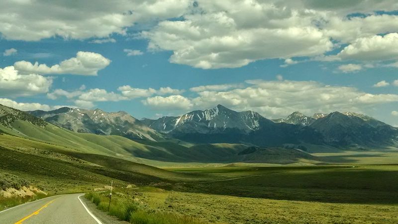
Highway 75 follows the Big Wood River through a valley that balances outdoor adventure with upscale mountain culture.
Ketchum and Sun Valley anchor this corridor, towns known equally for fly-fishing and world-class skiing.
The river serves as the valley’s central artery, providing irrigation for ranches and recreation for visitors seeking escape from city life.
Anglers wade into the Big Wood’s cold currents, casting for rainbow and brown trout that thrive in these high-mountain waters.
The highway climbs alongside the river toward Galena Summit, where views expand to include the jagged peaks of the Sawtooth Range.
Summer transforms the valley into a green oasis, with wildflowers and cottonwoods lining the riverbanks.
Autumn brings golden aspens and the first dusting of snow on the high ridges, signaling the approach of ski season.
This region demonstrates how a river can shape not just the land, but the economy and identity of mountain communities.
Art galleries, boutiques, and outdoor outfitters thrive here, all dependent on the natural beauty the river helps create and sustain.
Location: Highway 75, Ketchum, ID 83340
8. St. Joe River Road
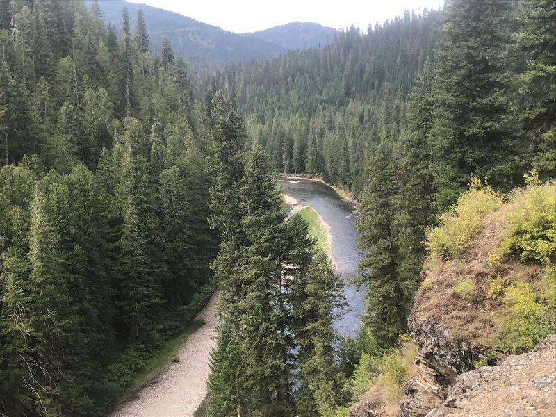
Often called the shadowy St. Joe, this river winds through some of Idaho’s most peaceful and pristine backcountry.
The St. Joe River Road follows what’s known as the highest navigable river in the world, though navigation here means canoes and kayaks, not cargo ships.
Dense National Forest land surrounds the route, creating a tunnel of green where sunlight filters through towering cedars and hemlocks.
The road itself remains unpaved in many sections, adding to the sense of remoteness and adventure.
Campgrounds and trailheads appear sporadically, offering access to hiking routes and fishing spots that see far fewer visitors than more famous Idaho destinations.
The river’s gentle flow makes it ideal for family float trips, where the biggest challenge is deciding which sandbar to stop at for lunch.
Wildlife sightings are common, with moose, otters, and ospreys thriving in the undisturbed habitat along the riverbanks.
This region proves that not all river roads need to be dramatic or extreme to be unforgettable.
Sometimes the quiet beauty of a shadowy forest corridor offers the most profound connection to the natural world.
Location: St. Joe River Road, St. Maries, ID 83861
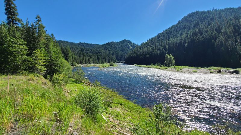
9. South Fork Canyon on Highway 26
Highway 26 carves through the South Fork Canyon, following the Snake River’s South Fork through terrain famous for both raptors and trout.
Bald eagles gather here in impressive numbers, especially during winter months when they hunt for fish in the river’s ice-free stretches.
The South Fork holds legendary status among anglers, who travel from across the country to cast for native cutthroat trout.
The canyon walls rise steeply on both sides of the river, creating a dramatic corridor that feels both intimate and grand.
Access points and boat launches appear regularly, allowing travelers to explore the river by raft, drift boat, or kayak.
Outfitters based in nearby towns offer guided trips that combine fishing instruction with natural history lessons about the canyon’s unique ecosystem.
The road itself provides easy viewing opportunities, with turnouts positioned to maximize wildlife and scenic photography.
This region showcases how rivers can support thriving populations of both fish and the predators that depend on them.
Spring runoff transforms the South Fork into a powerful torrent, while summer brings calmer flows perfect for floating and fishing.
Location: Highway 26, Swan Valley, ID 83449
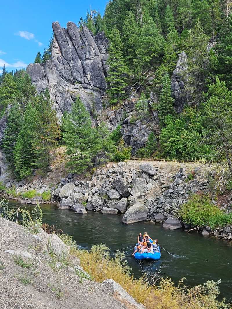
10. Lochsa River Run on Highway 12
East of Lowell, Highway 12 enters one of the most remote and spectacular river corridors in the Lower 48.
The Lochsa River churns beside the road, its whitewater crashing over boulders in a constant display of raw power.
Steep cliffs press in from both sides, leaving just enough room for the highway to squeeze through alongside the river.
This stretch feels wild in a way that few paved roads can match, with civilization seeming impossibly distant despite the smooth asphalt beneath your tires.
Campgrounds tucked into rare flat spots along the river offer base camps for kayakers and rafters tackling some of the West’s most challenging whitewater.
The Lochsa’s name comes from a Nez Perce word meaning rough water, a description that proves accurate mile after mile.
Wildlife thrives in the surrounding wilderness, with elk, mountain goats, and black bears roaming the steep slopes above the river.
This region represents the ultimate expression of how rivers and roads can shape each other, creating journeys that feel equal parts adventure and pilgrimage.
Every turn reveals another scene of natural drama, reminding travelers that Idaho still harbors wild places where nature remains firmly in control.
Location: Highway 12, Lowell, ID 83539
Dear Reader: This page may contain affiliate links which may earn a commission if you click through and make a purchase. Our independent journalism is not influenced by any advertiser or commercial initiative unless it is clearly marked as sponsored content. As travel products change, please be sure to reconfirm all details and stay up to date with current events to ensure a safe and successful trip.