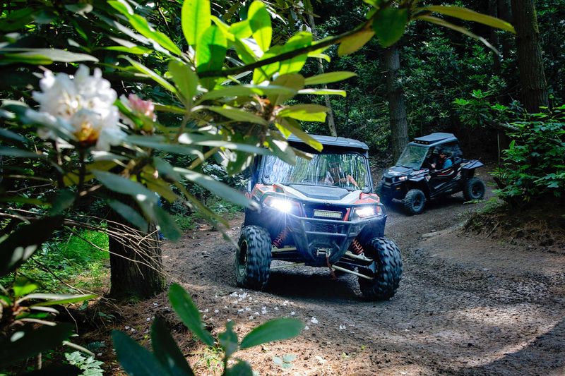
More than 1,000 miles of off-road trail now run through hills that once fed the coal trains. Many of those paths started life as old mine roads, logging roads, and industrial corridors.
One permit covers the whole system for a full calendar year. The trails stay open every day, sunrise to dusk, in all four seasons.
I like how the riders keep getting more varied. Teenagers on dirt bikes share the mountains with retirees cruising wide green trails in side-by-sides.
Some folks come for the rock walls, and some come for the views.
This corner of southern West Virginia used to measure its wealth in coal. Now it measures it in trail miles, small-town diners, and ridge-top overlooks.
So who says the best ride has to belong to the young ones?
A Thousand Miles Of Trail Starting From One Mountain Town
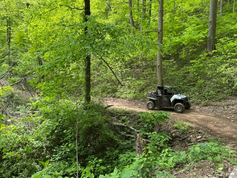
Over 1,000 miles of trail is a lot of dirt to call one place. The Hatfield-McCoy Trails, officially the Hatfield-McCoy Regional Recreation Area, string that mileage across southern West Virginia.
The system spans eight counties, including Boone, Logan, Mingo, and McDowell. Instead of one big loop, it works like a family of separate trail systems, each with its own trailheads.
Names like Pinnacle Creek, Rockhouse, Bearwallow, Buffalo Mountain, Indian Ridge, and Pocahontas show up on the maps. Each has its own personality, from smooth ridge cruising to steep rocky climbs.
The network welcomes ATVs, UTVs, and dirt bikes. Some sections, such as Ivy Branch and Big Coal River, even open to full-sized off-road vehicles like Jeeps.
Mountain bikers, hikers, and equestrian users also get access on the system. That’s a pretty generous guest list for trails carved out of coal country.
The headquarters sits in the small town of Man, in Logan County, along the Guyandotte River corridor. A separate welcome center operates in Julian for riders coming from the north.
Think of it as a regional playground rather than a single park. You pick your trailhead, pick your machine, and start rolling.
Old Mine Roads Got A Second Career
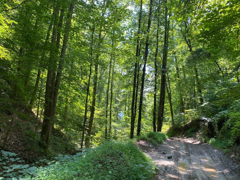
Plenty of these trails weren’t built for fun at all. They began as former mine roads, logging roads, and access corridors left behind by the region’s industries.
That gives every ride a quiet history lesson. You roll along the same routes that once kept the coal economy moving through these hollows.
For older West Virginians, that connection can hit close to home. A grandparent may remember when these hills meant shift whistles and coal trucks, not weekend riders.
Now the same ground supports a different kind of local business. Trail traffic brings riders into town for gas, meals, and places to sleep.
I believe that’s a pretty proud second act for a coal region. The land kept working, just with a new job description.
The scenery adds to the story. Riders describe everything from rock and water crossings to dirt climbs and serious elevation changes along the way.
Those climbs reward you with long mountain views that seem to fold forever. It’s hard to rush past a vista like that, even with the engine idling.
So the next time someone calls it just a trail, gently correct them. It’s a working road with a better retirement plan.
Green, Blue, Black, And Orange Mean Something Here
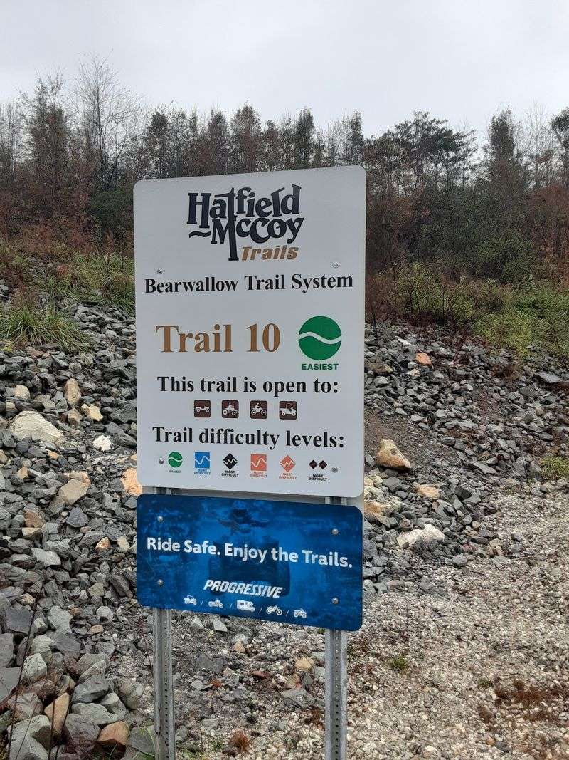
Color coding does a lot of heavy lifting on these mountains. Every trail carries a rating, so you know what you’re signing up for before the wheels turn.
Green marks the easiest routes, which tend to be wider and more level. Blue means more difficult, black means most difficult, and orange signals single track.
That system is exactly why grandparents fit in so well. Riders who prefer an easygoing cruise can stick to greens all day and still see plenty.
One rider even said the main trails were wide enough to drive a semi through. That’s a playful exaggeration, but the point lands about how roomy the easy routes feel.
Thrill seekers aren’t left out either. Black diamond climbs include rock walls and technical sections that test both driver and machine.
Fair warning, though. Some experienced riders caution that blind corners and steep hills call for real attention, especially if you’re new.
Going with someone who knows the trails, or booking a local guide, can make a first trip smoother. Several rental outfits in the area offer machines with or without guides.
Ratings can vary slightly between trail systems. A quick look at the map before heading out saves plenty of guesswork later.
Riding Straight Into Town For Lunch
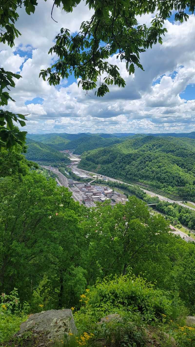
Here’s a perk most trail parks can’t match. Many of the Hatfield-McCoy systems connect directly to ATV-friendly towns.
That means you can ride right into places like Man, Gilbert, and Logan. Gas, a hot meal, and lodging may all be a short roll off the trail.
Small-town Main Streets get a real boost from those visits. For riders, it means no trailer shuffle just to grab a sandwich.
Plenty of riders pack a lunch so they can stay out all day. Others drop down into a town for a bite, then head back up the mountain.
The people get a mention too. Folks across the area have been called about as nice and helpful as you’ll find anywhere.
History fans have a bonus stop in Matewan. The town played a role in the Hatfield-McCoy feud and in the Matewan Massacre of 1920.
The feud itself ran in this region from 1863 to 1891 and gave the trail system its name. Riding through feud country adds a little spice to an ordinary lunch break.
One firm rule stays in place for every outing. No alcohol is allowed on the trails, and patrols do check.
Waterfalls And A Swing With A Famous Name
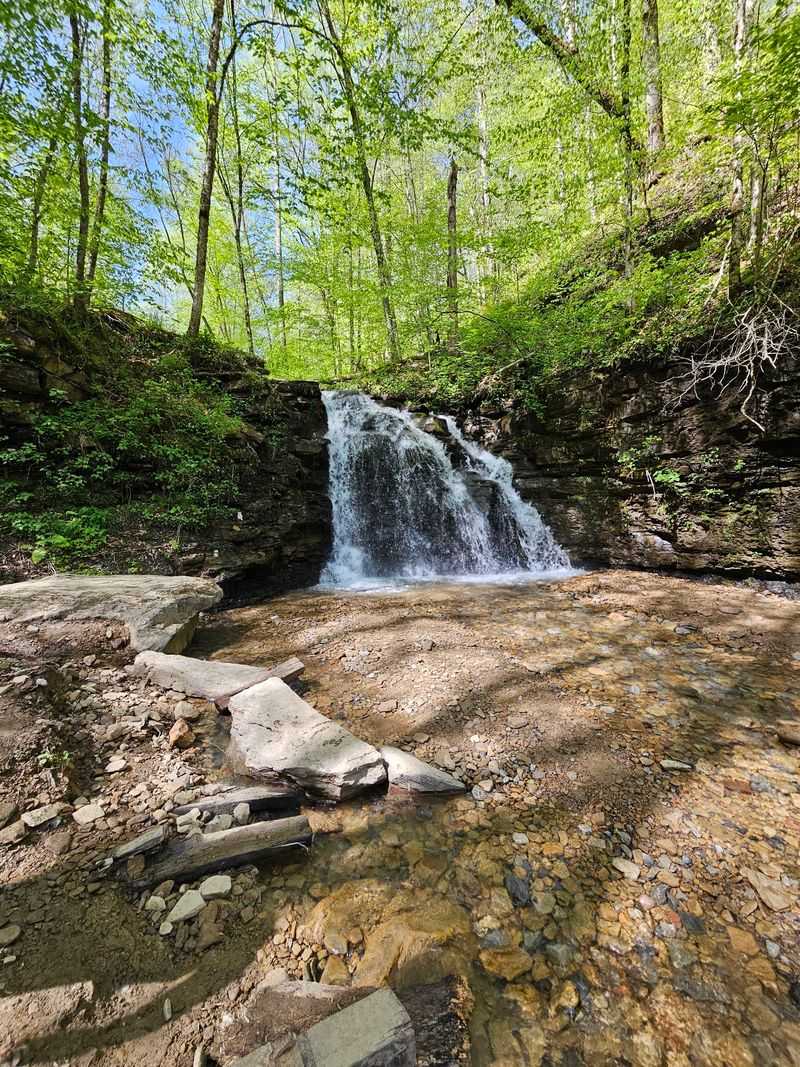
Some trail rewards don’t need horsepower to enjoy. Riders point to a trail leading to waterfalls, plus the much-loved Almost Heaven Swing, as favorite stops.
A swing on a West Virginia mountaintop named after the state’s favorite song? You’d have to try pretty hard to resist sitting on it.
Buffalo Mountain also draws praise for absolutely beautiful scenery. It’s a popular pick for single track fans, too.
Rock House trails get attention for their waterfall route. One rider spent two days on green and blue sections there, about five hours each day.
Small trail tips get passed along as well. One rider suggested trail 42 over trail 41 for a little less rock, and called trail 94 a view worth catching.
Trail numbers and conditions can change, so check the latest maps first. Free maps are available online and at trailheads.
Many riders use the onX maps app to stay on track. That helps, since cell service can be sketchy in the hollers.
Bring a camera with a charged battery. Between the falls, the swing, and the ridge views, your phone storage may file a complaint.
Why Grandparents Keep Showing Up Alongside The Grandkids
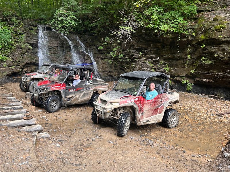
Multigenerational trips feel natural on wide, well-groomed trails. The system’s mostly green routes make it easy for large groups to ride together.
Side-by-sides change the picture for older riders. Grandma can drive, Grandpa can navigate, and the grandkids can point at every overlook.
Some riders have kept returning for 15 years without running out of new trails. Others visit every spring and fall, staying in a different area each time.
Retirees with flexible calendars can take advantage of that rhythm. Year-round access means a quiet weekday ride works as well as a busy holiday weekend.
The friendly atmosphere helps too. Riders mention meeting new friends in town and out on the trails.
There’s also a safety net in place. An emergency team can be reached if something goes wrong, which gives everyone extra peace of mind.
Of course, the tough stuff is still waiting for anyone who wants it. Rock walls, water crossings, and steep climbs keep experienced riders challenged.
I can’t imagine a better place for a family where the youngest wants speed and the oldest wants scenery. Both get their way, and nobody has to sit out.
Permits, Hours, And The Address To Plug Into Your GPS
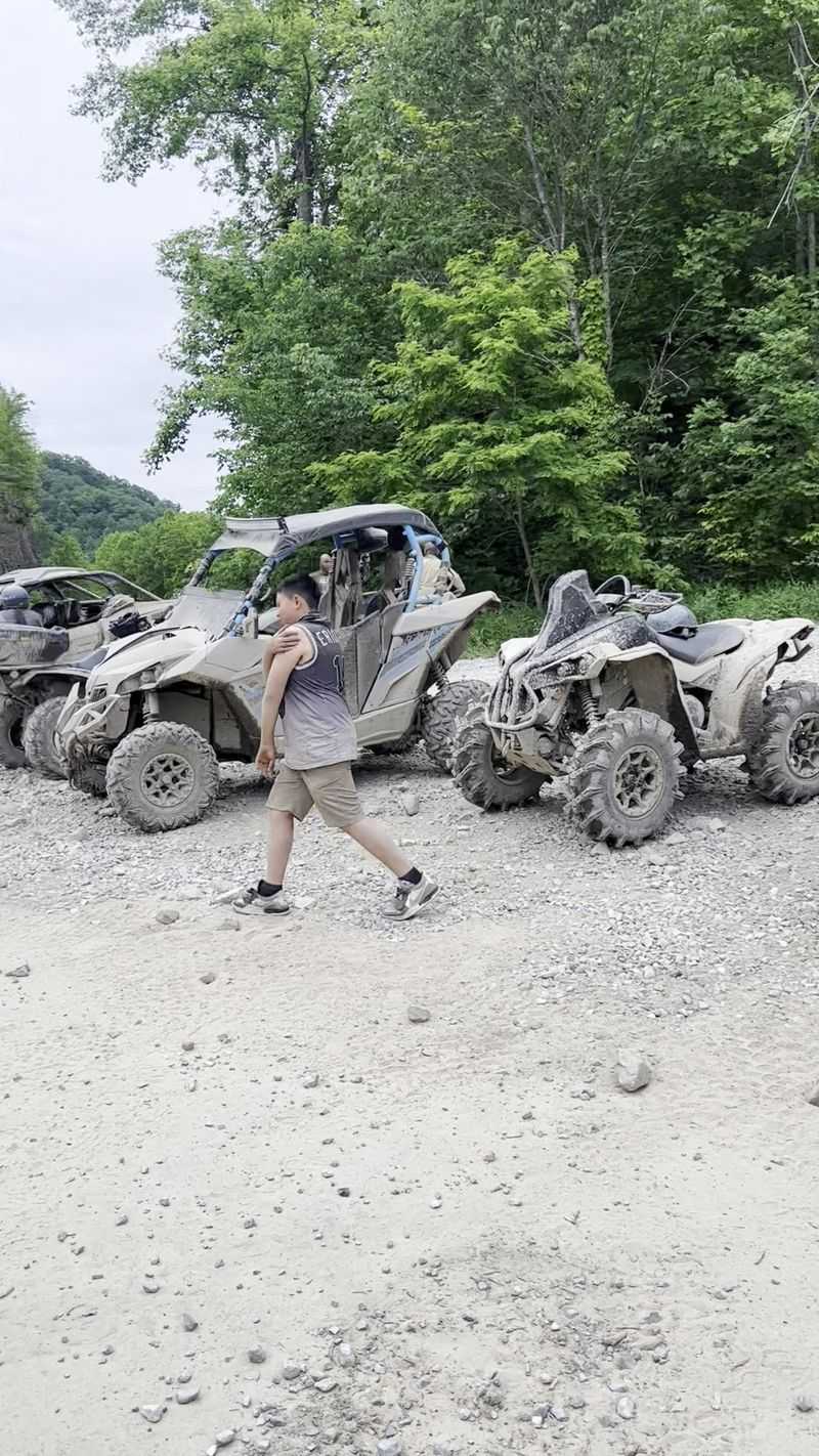
Getting legal on the trails is refreshingly simple. A single permit grants access to the entire system for a full calendar year.
Permits are sold at trailhead facilities and through more than 180 authorized vendors around the region. Riders have called the annual fee well priced, which is a nice surprise for a big system.
Rental machines and guided tours cost more, so budget accordingly. Several companies in the area offer both options.
Trails open every day from sunrise until dusk. That schedule holds through all four seasons.
The Hatfield-McCoy Trails headquarters sits at 180 Appalachian Outpost Trl, Man, WV 25635. It makes a handy home base for the southern systems.
Coming from the north? The welcome center at 28 Big Pinnacle Branch Road in Julian offers permits, maps, brochures, and merchandise.
The Country Roads Byway Visitors Center in Logan shares history and culture too. These centers are staffed seven days a week.
Drive in by daylight if possible. One rider coming from Charlotte warned that the last mountain hour feels slow and winding, especially in rain and fog.
A Coal Country Comeback Worth Riding Together
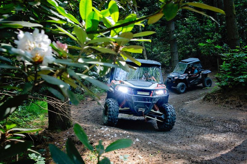
Few places turn a region’s past into this much present-day fun. The Hatfield-McCoy Trails take old industrial roads and hand them back to families.
Lodging choices make the trip easier. Cozy cabins, riding parks, and rentals dot the area, and some sit right near trailheads.
Pinpoint your trailhead before booking a stay. That way you can ride straight out instead of hauling a trailer every morning.
Check for Wi-Fi if you need to work. Spotty cell service in the hollers can turn a quick email into a scavenger hunt.
Treat the land kindly while you’re out there. Pack out every scrap of trash, and a netted bag on your machine makes that easy.
Respect fellow riders too, especially on blind corners. Common courtesy keeps the mountains fun for every generation.
Even after years of visits, some riders still haven’t covered every trail. When the system says over 1,000 miles, it isn’t kidding.
So call up the grandkids, or let them call you. Southern West Virginia has a ridge, a swing, and a diner waiting, and there’s room on the trail for everybody.
