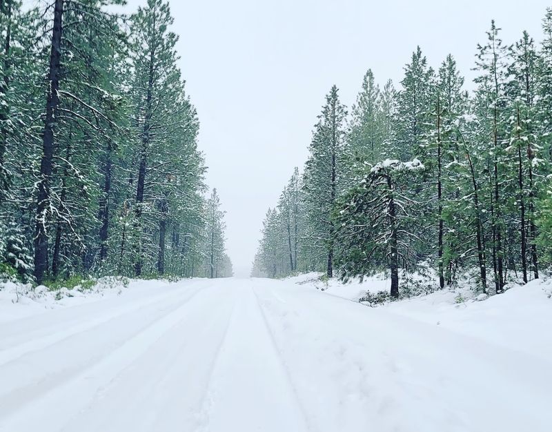
A massive snowstorm is gearing up to slam Oregon’s Cascade Mountains, and it’s not holding back. Forecasters say some areas could see up to 15–25 inches of snow, turning the region into a full-on winter zone almost overnight .
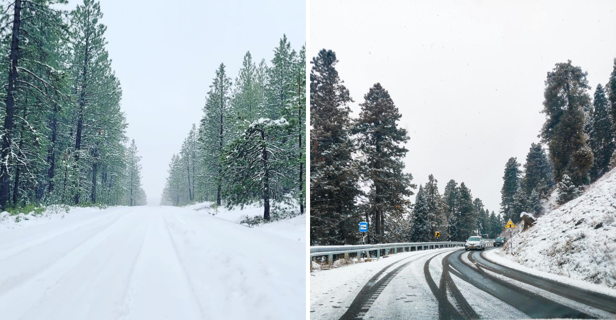
This isn’t light snowfall either. Heavy bursts, strong winds, and low visibility are all part of the mix, which could make travel through mountain passes seriously difficult.
The Cascades are no stranger to snow, but storms like this still hit differently when they pile up fast. Roads can go from manageable to nearly impossible in a matter of hours.
Ski lovers might be thrilled. Drivers, not so much.
Either way, it’s one of those moments where Oregon’s mountains remind everyone who’s really in charge.
The Northern Cascades Take a Heavy Hit
Mt. Hood looked like it had been swallowed whole by a snow cloud.
The Northern Cascades are getting hit with 12 to 19 inches of snowfall during this storm. That is a serious amount for early April, even by Oregon standards.
Government Camp sits right in the thick of it. Timberline Lodge and Mt.
Hood Meadows are both seeing heavy accumulation, and snowfall rates are hitting 1 to 2 inches per hour during the main frontal passage. Highway 26 through Government Camp has chain requirements in place right now.
Wind gusts up to 50 mph are making things worse on exposed ridges. Whiteout conditions are possible on the upper mountain.
Santiam Junction is also seeing significant snowfall, which affects traffic flow on Highway 20. If you have plans to drive through this area today, hold off until Friday when conditions improve dramatically.
The Northern Cascades rarely get this much snow this late in the season, making this storm genuinely historic for spring 2026.
Central Cascades Buried Under Record Spring Snow
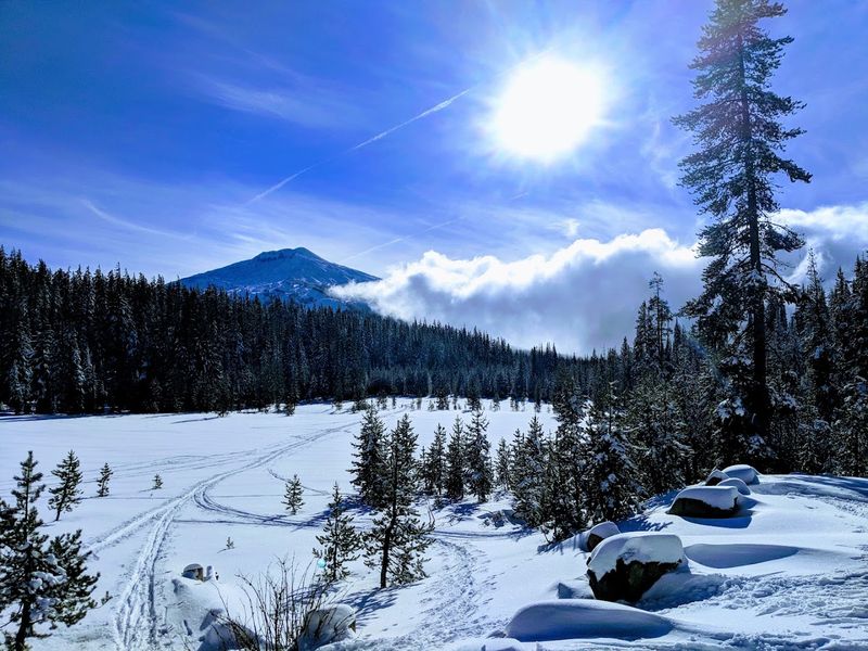
Mt. Bachelor was already bracing for an early closure before this storm rolled in.
Now the Central Cascades are staring down 14 to 22 inches of fresh snow. That is the highest expected total of any region in this storm system.
Willamette Pass on Highway 58 and Santiam Pass on Highway 20 are both under chain requirements. Driving through either pass today is genuinely dangerous.
Forecasters are using the phrase “difficult to impossible” to describe travel conditions.
This snowfall is a surprising lifeline for resorts like Mt. Bachelor.
Heading into April 2026, the snowpack across Oregon sat at less than 50 percent of normal. A warm, dry winter had left the mountains thin and patchy.
This storm will not fix everything, but it gives the summer water supply a much-needed boost. It also likely extends the ski season by at least a few weeks.
For skiers who were mourning an early end, the Central Cascades just delivered an unexpected spring gift worth celebrating.
Winter Storm Warning in Effect Through Thursday
The Winter Storm Warning is not something to brush off. It covers the Northern, Central, and Southern Cascades and runs through Thursday afternoon.
This is an official National Weather Service designation for dangerous conditions.
Snowfall rates of 1 to 2 inches per hour are expected during the peak of the storm on Wednesday night. That kind of rate can bury a road fast.
Visibility drops quickly when snow falls that hard, and wind gusts up to 50 mph are adding blowing snow to the mix.
Tree branches are at risk of coming down under the weight of wet spring snow. Power outages in mountain communities are possible.
If you are in Government Camp, Santiam Junction, or near any of the Cascade passes right now, stay put if you can. Checking TripCheck.com before any mountain travel is essential during a warning like this.
The warning lifts Thursday afternoon, but conditions may stay messy through Thursday evening as residual snow and ice linger on road surfaces in shaded areas.
Southern Cascades See the Deepest Totals
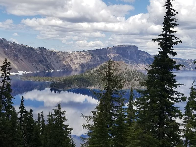
Crater Lake already gets more snow than almost anywhere else in Oregon. During this storm, the Southern Cascades are forecast to receive 12 to 24 inches, with Crater Lake National Park potentially seeing up to 30 inches.
That number stopped me cold when I read it.
Diamond Lake and Union Creek are also in the heavy snow zone. The southern region is taking a serious beating from this system.
Highway 140 has chain requirements and is considered hazardous right now.
Crater Lake sits at over 7,000 feet in elevation, which means snow events hit harder and last longer there. The lake itself rarely freezes, but the surrounding rim turns into a full winter landscape fast.
Visiting during or right after a storm like this is genuinely magical if you can get there safely. The snow-draped caldera walls and silent forests create a scene that feels almost unreal.
Wait until Saturday when the weather flips sunny, and the views will be absolutely stunning against all that fresh white snow.
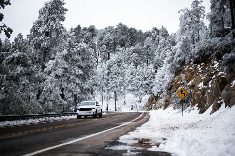
Highway Travel Turns Hazardous Across the Passes
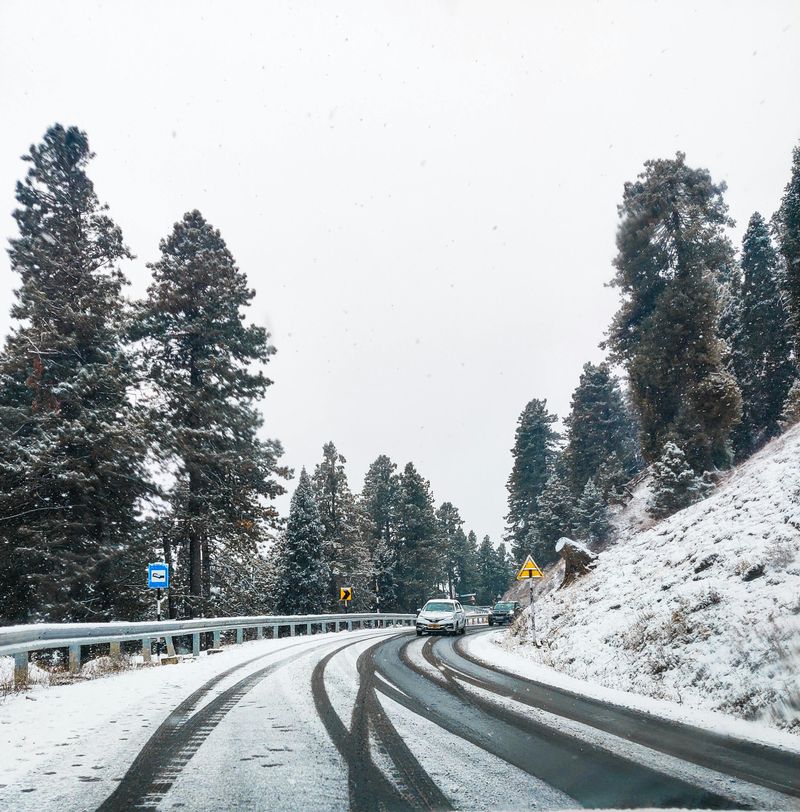
Four major highways are taking the brunt of this storm right now. Highway 26 through Government Camp, Highway 20 over Santiam Pass, Highway 58 through Willamette Pass, and Highway 140 are all under chain requirements.
These roads connect the east and west sides of Oregon, so the disruption is significant.
Spring snowstorms are tricky in a specific way. Road surfaces can feel deceptively warm from recent mild temperatures.
A layer of slush builds up during the day, then turns to black ice after sunset when temperatures drop into the 20s. That combination catches drivers off guard.
Truckers and commuters who regularly cross the Cascades know this pattern well. Recreational drivers heading to ski resorts or camping spots may not.
Always carry chains even if you have all-wheel drive. Check TripCheck.com for live camera feeds and road condition updates before leaving.
The heaviest travel impacts are expected Wednesday afternoon through Thursday evening, with gradual improvement Friday morning as the storm moves east and temperatures begin to recover.
Oregon’s 2026 Snowpack Desperately Needed This Storm
Going into April 2026, Oregon’s statewide snowpack was sitting at less than 50 percent of normal. That is a troubling number.
A warm, dry winter left the mountains looking more like late May than early spring.
Water managers, farmers, and communities across eastern Oregon were already worried about summer water availability. Rivers fed by Cascade snowmelt supply a huge portion of the state’s water.
When snowpack runs low, rivers run low too, and that affects everything from irrigation to fish habitat.
This storm is not a complete fix. One big snowfall cannot erase months of deficit.
But it is a meaningful contribution, especially for the Central and Southern Cascades where totals are highest. Ski resorts like Mt.
Bachelor and Timberline, which were eyeing early closure dates, now have a real shot at staying open longer. Every inch of new snow in April buys time.
Water managers are watching this storm closely and cautiously feeling a little better about what lies ahead for Oregon’s summer water supply.
Mt. Bachelor and Timberline Get a Lifeline
Mt. Bachelor was quietly preparing for an early end to the 2026 ski season.
Then April arrived with a completely different idea. Fresh snow totals of 14 to 22 inches in the Central Cascades mean the slopes are getting a serious restock just when they needed it most.
Timberline Lodge on Mt. Hood is also benefiting.
Timberline is famous for running its ski season well into summer, sometimes even July. But a thin snowpack going into spring had raised questions about whether that was realistic this year.
This storm changes that conversation entirely.
Skiers and snowboarders who had already mentally closed out the season should reconsider. The weekend forecast looks spectacular.
After the storm clears Thursday, Friday and Saturday are expected to bring bluebird skies and fresh powder. That combination is genuinely rare and genuinely wonderful.
Lift lines may actually be shorter than usual since many people have already packed away their gear. Showing up this weekend could mean skiing deep spring snow under a blue sky with half the usual crowd.
Wind Gusts Up to 50 mph Create Whiteout Danger
Snow alone would be enough to make this storm dangerous. Add 50 mph wind gusts on exposed terrain and the situation becomes something else entirely.
Whiteout conditions can develop in minutes on high ridges and open passes.
The wind is most intense on the upper elevations of Mt. Hood, Mt.
Bachelor, and the Crater Lake rim. These are areas where hikers, snowshoers, and backcountry skiers sometimes venture even in bad weather.
Right now, that is a very bad idea. Disorientation in a whiteout happens fast, even to experienced mountain travelers.
Tree branches loaded with wet spring snow are also vulnerable to snapping under strong gusts. Falling debris on forest roads and trails adds another layer of risk.
Power lines in mountain communities face the same threat. The combination of heavy snow and high wind is what makes this storm more than just a typical spring snowfall event.
Respect the forecast. Stay off exposed terrain until the warning lifts and conditions stabilize, which forecasters expect by Friday morning across most of the Cascades.
The Bluebird Weekend Coming Right After the Storm
Patience is going to pay off big this weekend. After the storm clears Thursday, the forecast flips fast.
Friday and Saturday are looking sunny, warm, and absolutely beautiful across the Oregon Cascades. That kind of turnaround is what makes spring mountain weather so dramatic.
Mountain valley temperatures are expected to climb into the 50s by the weekend. Fresh powder will still be sitting on the slopes, but the sky will be clear and the light will be golden.
Hikers, skiers, and photographers are all going to want to be out there.
The rapid warm-up also means snowmelt will start quickly in lower elevation areas. Roads that were buried Thursday could be slushy but passable by Saturday afternoon.
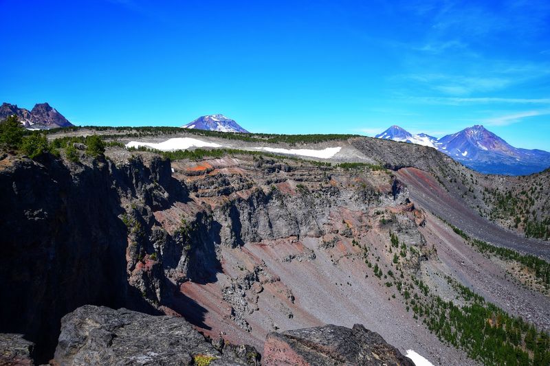
Crater Lake’s rim drive, if accessible, will offer jaw-dropping views of fresh snow against the deep blue of the lake. North Sister and the surrounding Three Sisters Wilderness will look dramatically beautiful from viewpoints near Sisters, Oregon.
The reward for waiting out this storm is a Pacific Northwest spring moment that is hard to beat.
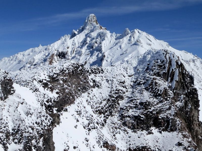
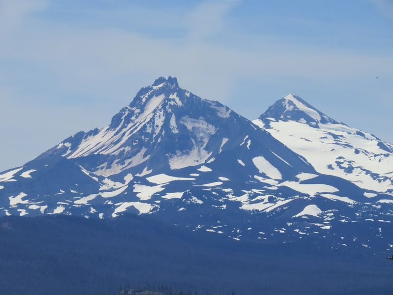
North Sister and the Three Sisters Wilderness in the Storm
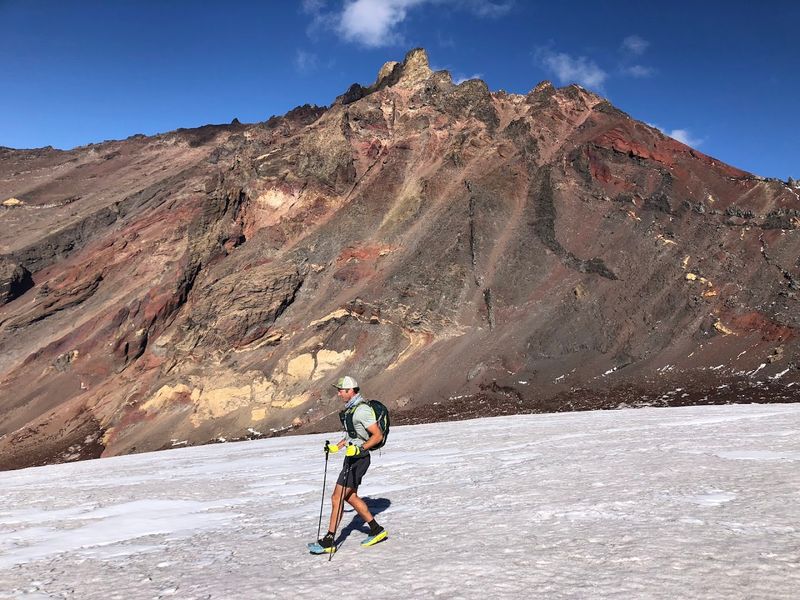
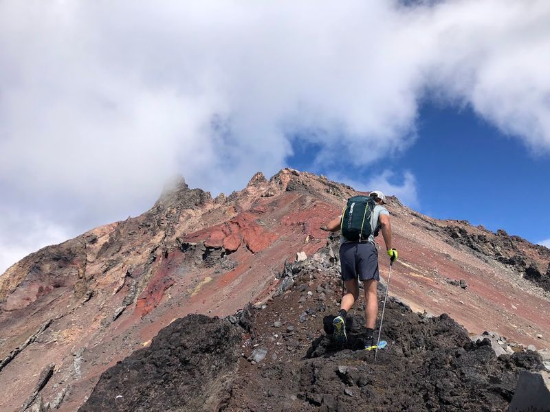
North Sister is one of the most striking peaks in all of Oregon. The jagged volcanic summit rises above the Three Sisters Wilderness in the Central Cascades, and right now it is getting buried.
Snow is piling up across the surrounding wilderness area at a rapid pace.
The Three Sisters peaks, including North Sister, Middle Sister, and South Sister, are all active or recently active volcanoes. Climbers know North Sister as a serious technical challenge even in good conditions.
In a storm like this, the upper mountain is completely off limits. Wet snow, high winds, and poor visibility make the upper ridges genuinely treacherous.
The wilderness trails around the base of North Sister, including routes near Soap Creek and Chambers Lakes, are also inaccessible safely right now. But after the storm clears, the landscape will be transformed.
Fresh snow on the volcanic rock faces and glaciers creates a visual contrast that is hard to describe without seeing it. Views of North Sister from the west side near the Cascades Lakes Highway are worth the drive once roads reopen this weekend.
Dear Reader: This page may contain affiliate links which may earn a commission if you click through and make a purchase. Our independent journalism is not influenced by any advertiser or commercial initiative unless it is clearly marked as sponsored content. As travel products change, please be sure to reconfirm all details and stay up to date with current events to ensure a safe and successful trip.