Montana earns its nickname as Big Sky Country through more than just clever marketing.
The state stretches across landscapes so wide and open that even seasoned travelers from other Western states find themselves awestruck by the sheer scale.
Rolling grasslands extend beyond what the eye can see, mountain ranges rise like ancient fortresses, and entire valleys exist where human presence feels like a whisper against nature’s roar.
Population density drops so low in certain areas that you might drive for an hour without passing another vehicle.
These regions offer something rare in our crowded modern world: genuine emptiness that allows the mind to expand along with the horizon.
Whether you seek solitude, adventure, or simply want to understand what true wilderness feels like, Montana delivers experiences that dwarf expectations.
From the windswept prairies of the east to the alpine wilderness of the west, these ten regions showcase vastness in its purest form.
Each area presents its own character, yet all share that unmistakable sense of endless space that makes Montana legendary among those who crave wide-open country.
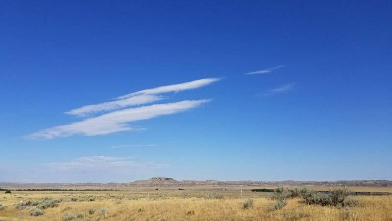
1. Eastern Plains
Grasslands roll across the eastern two-thirds of Montana like an ocean frozen in shades of gold and green.
Standing anywhere in this region, you can spin in a complete circle and see nothing but land meeting sky in every direction.
The Great Plains dominate here with their signature flatness broken only by occasional buttes rising like monuments to geological time.
Ranches spread across thousands of acres, yet houses appear as tiny dots separated by miles of working land.
Agricultural fields create patchwork patterns visible from great distances, their boundaries marked by fence lines that march toward vanishing points.
Towns emerge suddenly from the landscape, offering brief clusters of civilization before the emptiness resumes.
Wind sweeps unobstructed across these plains, carrying scents of sage and wheat while pushing clouds across skies that seem impossibly large.
The sparse population means you might encounter more pronghorn antelope than people during a day’s drive.
Sunsets here last forever, painting the entire dome of heaven in colors that shift and deepen as darkness approaches from the east.
This region teaches patience and perspective, reminding visitors that humans occupy just a small corner of a much larger world.
Highway 2 crosses this territory, offering one of America’s loneliest and most meditative road trips.
2. Missouri River Country

Badlands carved by water and time create a landscape that feels older than memory itself.
The Missouri River winds through this official tourism region, cutting channels through rock layers that tell stories spanning millions of years.
Population density drops to numbers that seem impossible in modern America, with entire counties holding fewer residents than a typical city block elsewhere.
Coulees and draws interrupt the prairie, creating hidden pockets where wildlife thrives far from human eyes.
Rock formations rise in strange shapes, weathered by wind into sculptures that shift appearance depending on the angle of sunlight.
Driving through this country means accepting that services lie far apart and that self-reliance matters more than convenience.
The river itself provides a ribbon of green through otherwise arid terrain, supporting cottonwood groves that offer rare shade.
Lewis and Clark traveled these waters centuries ago, and much of what they saw remains unchanged today.
Silence dominates here, broken only by wind, bird calls, and the occasional distant rumble of thunder.
Stargazing reaches legendary status thanks to minimal light pollution and air so clear that the Milky Way appears as a luminous river overhead.
This region rewards those willing to slow down and observe details that reveal themselves only to patient eyes.
3. Central Montana Front
Where plains meet mountains, a transitional zone creates landscapes of remarkable drama and scale.
Central Montana serves as a bridge between two distinct worlds, borrowing characteristics from each while maintaining its own identity.
Island mountain ranges punch upward from surrounding prairies, their peaks visible from distances that seem to defy logic.
The Highwood Mountains, Little Belts, and Crazies rise as separate massifs, each standing alone like fortresses on an otherwise open plain.
Trees remain scarce across much of this territory, which amplifies the sensation of exposure under that famous big sky.
Weather systems become visible hours before they arrive, rolling across the landscape as you watch clouds build and storms develop.
Ranching operations here require vast acreage to support livestock, resulting in properties measured in sections rather than acres.
Small communities cling to existence, their populations aging as younger generations seek opportunities elsewhere.
Yet those who remain speak of the land with a devotion that borders on spiritual, unable to imagine living anywhere else.
The Front Range of the Rockies rises dramatically to the west, creating a wall of peaks that defines the horizon.
This region offers solitude without complete isolation, vastness without emptiness, and beauty that reveals itself slowly to those who stay long enough to truly see.
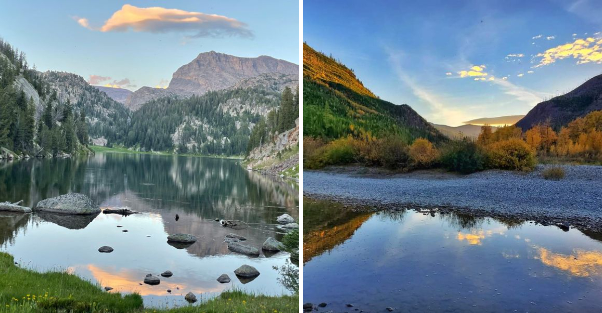
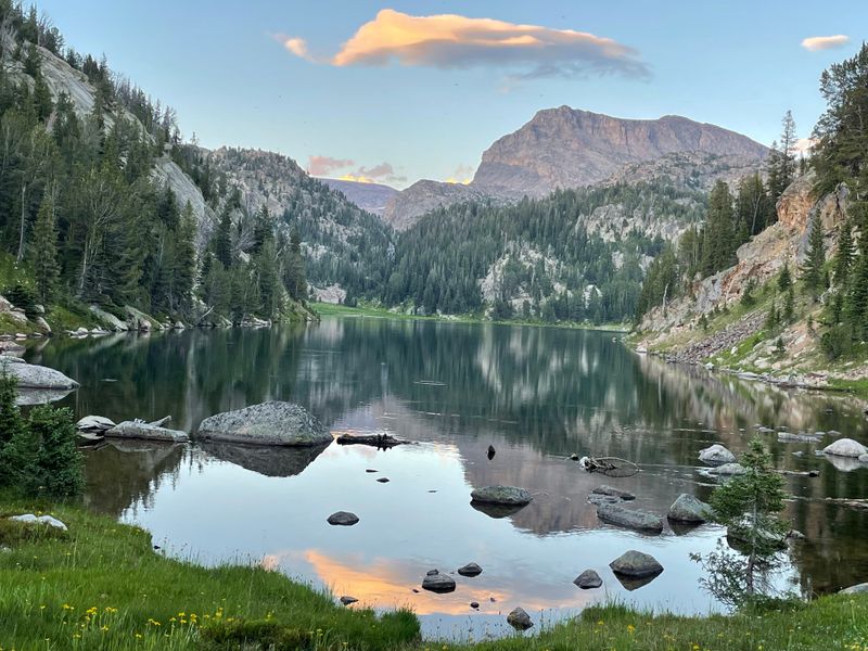
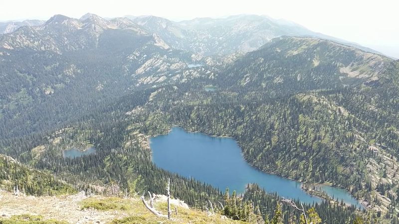
4. Bob Marshall Wilderness Complex

More than a million acres of roadless wilderness stretch across northwestern Montana in a complex bearing the name of a legendary conservationist.
The Bob Marshall, Scapegoat, and Great Bear Wilderness areas combine to form one of the largest protected wild lands in the lower states.
No motorized vehicles penetrate this domain, meaning access comes only by foot or horseback along trails that demand both fitness and determination.
Grizzly bears roam freely here, along with wolves, elk, and mountain goats that navigate cliffs with impossible grace.
River valleys carve deep channels between mountain ranges, their waters running cold and clear through forests that have never known a chainsaw.
The Chinese Wall, a limestone escarpment stretching for miles, rises as one of the most dramatic geological features in the region.
Visitors must prepare for complete self-sufficiency, as rescue lies hours or even days away from most locations.
Weather changes rapidly at these elevations, with snow possible during any month and storms that arrive with little warning.
Yet the rewards match the challenges, offering solitude and natural beauty that feel increasingly rare in our developed world.
Ovando, Montana serves as a common staging point for expeditions into this wilderness, located along Highway 200.
The complex reminds us that true wilderness still exists, waiting for those brave enough to venture beyond the pavement.
5. Big Hole Valley

A high-altitude basin spreads between mountain ranges like a secret kept by the peaks themselves.
The Big Hole Valley earned its nickname as the land of big snows through winters that pile white powder deep enough to reshape the entire landscape.
Elevation keeps temperatures cool even during summer, creating conditions perfect for the hay production that sustains multi-generational ranching operations.
The Big Hole River meanders through this valley, its waters famous among fly fishers who travel from around the world to test their skills against native trout.
Ranches here measure their history in decades and centuries, with families passing land and traditions from one generation to the next.
The valley floor stretches so wide that mountains on the opposite side appear as distant walls rather than immediate neighbors.
Wildlife thrives in this relatively undeveloped landscape, with moose browsing willows along creek bottoms and sandhill cranes stopping during migration.
Small communities like Wisdom and Jackson provide essential services while maintaining populations that barely register on most maps.
The sense of space here comes not from flatness but from the sheer size of the basin and the mountains that frame it.
Montana State Highway 43 runs through the valley, offering access to this remarkable landscape.
Standing in the Big Hole, you understand why some people choose isolation over convenience, space over proximity, and silence over noise.
6. Glacier Country Northwest Montana

Northwest Montana contains landscapes so spectacular that they inspired the creation of one of America’s crown jewel national parks.
Glacier National Park sprawls across more than a million acres, its boundaries encompassing ecosystems that range from prairie grasslands to alpine tundra.
Cities like Missoula and Kalispell provide services and culture while serving as gateways to wilderness that begins just beyond their edges.
The park itself showcases nature at its most dramatic, with peaks that scrape the sky and lakes so clear you can see fish swimming in deep water.
Going-to-the-Sun Road crosses the park, offering one of the most scenic drives on the continent while demonstrating the vertical scale of these mountains.
Glaciers continue to carve the landscape, though climate change has reduced their size significantly compared to historical measurements.
Wildlife viewing opportunities abound, from bighorn sheep posing on cliffsides to mountain goats navigating terrain that seems impossible for any creature.
The Crown of the Continent ecosystem extends beyond park boundaries, connecting protected areas across an enormous landscape.
Flathead Lake spreads to the south, its surface area making it one of the largest natural freshwater lakes in the western United States.
The region demonstrates that vastness comes in vertical as well as horizontal dimensions, with elevation changes that create multiple climate zones within short distances.
This corner of Montana proves that spectacular scenery and genuine wilderness can coexist with human communities when protected thoughtfully.
7. Absaroka Beartooth Wilderness
South of Billings, the landscape erupts upward into some of Montana’s most rugged and remote terrain.
The Absaroka Beartooth Wilderness combines two mountain ranges into a single protected area that challenges even experienced backcountry travelers.
Granite Peak, Montana’s highest point, rises here, its summit requiring technical climbing skills that put it beyond casual hikers.
Alpine plateaus stretch at elevations where trees cannot survive, creating tundra landscapes more common in Arctic regions than temperate zones.
Glaciated valleys cut deep into the mountains, their U-shaped profiles carved by ice that retreated thousands of years ago.
Lakes dot the high country, their waters frigid even during late summer and so clear that depth becomes difficult to judge.
The Beartooth Highway provides vehicle access to high elevations, though the wilderness itself remains roadless and wild.
Solitude comes easily here, as the difficult terrain and remote location keep visitor numbers low compared to more accessible areas.
Weather patterns shift rapidly, with afternoon thunderstorms building quickly over peaks and lightning posing serious danger above treeline.
Wildlife includes species adapted to harsh conditions, from pikas gathering vegetation for winter to mountain goats that treat vertical cliffs as casual trails.
McLeod, Montana sits near the wilderness boundary at 59052, serving as a reference point for those planning expeditions into this remarkable landscape.
8. Upper Missouri River Breaks National Monument

Centuries ago, Lewis and Clark traveled through this region and recorded their awe in journal entries that still resonate today.
The Upper Missouri River Breaks National Monument preserves landscapes that remain remarkably unchanged since that historic expedition.
Badlands rise in layers of sedimentary rock, their colors shifting from cream to rust depending on mineral content and lighting conditions.
The Missouri River carved this canyon over eons, creating a corridor through otherwise impassable terrain.
Rock outcrops take fantastical shapes, weathered into formations that inspire imaginative names and endless photography.
Grasslands carpet the uplands above the breaks, supporting pronghorn and other species adapted to open country.
The monument headquarters sits at 920 NE Main Street, providing information for those planning to explore this protected area.
Floating the river offers the most intimate way to experience the breaks, with multiple days required to cover significant distance.
Silence and solitude define the experience, as motorized access remains limited and visitor numbers stay relatively low.
Night skies explode with stars, the darkness so complete that galaxies become visible to the naked eye.
This region proves that vastness need not mean flatness, as the vertical relief of the breaks creates drama within the broader scale of the plains.
Remoteness here feels authentic rather than manufactured, a genuine experience of wild country that demands respect and preparation.
9. Southeast Montana Prairie
More than thirty-two thousand square miles spread across southeast Montana, creating one of the largest continuous prairie landscapes remaining in North America.
Shortgrass prairie dominates, its vegetation adapted to limited rainfall and temperature extremes that range from bitter winter cold to summer heat.
Public land access reaches impressive levels here, allowing exploration of terrain that feels unchanged since the buffalo herds that once darkened these plains.
The Little Bighorn Battlefield stands as a somber reminder of conflicts that shaped regional history, its rolling hills witnessing events that altered the course of nations.
Towns appear as isolated outposts separated by distances that test both vehicles and patience, their existence testament to human stubbornness in the face of harsh conditions.
Visit Southeast Montana operates from 815 S 27th Street, Suite 4513, promoting tourism in this often-overlooked region.
Ranching remains the primary economic activity, with operations requiring vast acreage to remain viable in this arid environment.
The Powder River flows through the region, its name evoking the dusty conditions that characterize much of the landscape.
Wildlife viewing opportunities include prairie dogs, whose towns create islands of activity in the surrounding grasslands.
Sunrises here arrive with a clarity that urban dwellers rarely witness, the light building gradually across a horizon unobstructed by trees or buildings.
This corner of Montana rewards those who appreciate subtlety over spectacle, finding beauty in space itself rather than dramatic landmarks.
10. Flathead National Forest
Spanning more than two million acres across northwestern Montana, Flathead National Forest contains wilderness that could swallow entire eastern states.
Deep forests of lodgepole pine, Douglas fir, and western larch cover mountainsides, creating corridors where wildlife moves unseen beneath the canopy.
Peaks tower above the tree line, their granite faces carved by ice and time into shapes that challenge climbers and inspire photographers.
Lakes dot the landscape, from tiny alpine tarns to larger bodies of water that support fish populations and provide stunning reflections of surrounding mountains.
The forest surrounds Swan Lake and extends north toward the Canadian border, encompassing diverse ecosystems and elevation zones.
Backcountry opportunities seem endless, with trail systems that could occupy years of exploration without repeating routes.
Grizzly bears roam freely here, requiring visitors to practice proper food storage and maintain awareness while traveling through bear country.
The forest provides critical habitat for species ranging from tiny songbirds to massive bull elk whose bugles echo through valleys during autumn.
Winter transforms the landscape into a snow-covered wilderness where silence deepens and travel becomes more challenging but also more rewarding.
Access points exist throughout the forest, though vast areas remain hours from the nearest road or trailhead.
This national forest demonstrates that Montana’s vastness includes vertical dimensions, with mountains creating a sense of scale that rivals the horizontal expanse of the eastern plains.
Dear Reader: This page may contain affiliate links which may earn a commission if you click through and make a purchase. Our independent journalism is not influenced by any advertiser or commercial initiative unless it is clearly marked as sponsored content. As travel products change, please be sure to reconfirm all details and stay up to date with current events to ensure a safe and successful trip.