Las Cruces sits just forty miles from the Mexican border, where the Rio Grande carves through desert valleys and mountain shadows stretch long across the basin.
This southern New Mexico city carries centuries of history in its street names, each one telling a story of Spanish settlers, frontier life, and the cultures that shaped the Southwest.
Walking through downtown reveals more than old buildings and dusty plazas, it reveals a living map of the past, written in the language of its avenues and boulevards.
Main Street and the Heart of Old Mesilla
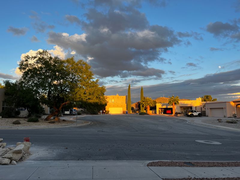
Old Mesilla’s Main Street feels like stepping back into the 1800s, when this area was still part of Mexico and stagecoaches rattled through on their way west.
The street loops around a central plaza where the Gadsden Purchase was signed in 1854, officially making this land part of the United States.
Adobe buildings line the road, their thick walls painted white or left natural brown, with wooden beams jutting out from flat rooftops.
Shops and galleries now occupy spaces that once housed mercantile stores and saloons, but the architecture remains largely unchanged.
Walking along Main Street, you notice how the layout reflects Spanish colonial planning, with streets radiating from a central square.
This design was common in New Spain settlements and helped organize community life around the church and government offices.
The street itself is narrow compared to modern roads, built for horses and foot traffic rather than cars.
Mesilla was actually larger and more important than Las Cruces for decades, serving as a major stop along the Butterfield Overland Mail route.
Billy the Kid was once held in the courthouse here, and his legend still draws visitors curious about frontier justice.
Today, Main Street hosts festivals and markets that celebrate both Hispanic heritage and the Wild West past.
The street name itself is straightforward, reflecting American influence after the territory changed hands.
Yet everything around it whispers of older times, when this was a crossroads between two nations and countless travelers passed through seeking new lives.
The blend of cultures remains visible in every corner, from the architecture to the food served in local restaurants.
Avenida de Mesilla and the Path Between Towns
Avenida de Mesilla translates to Avenue of Mesilla, and it does exactly what the name suggests, connects modern Las Cruces with the historic village of Old Mesilla.
This road traces a path that people have traveled for generations, first on horseback, then by wagon, and now by car.
The Spanish name honors the area’s roots, keeping the language of early settlers alive in everyday navigation.
Driving along this avenue, you pass through a mix of old and new, from chain stores to family-owned businesses that have served the community for decades.
The route itself follows natural contours of the land, winding slightly as it approaches the older settlement.
Mesilla remained separate from Las Cruces for much of history, maintaining its own identity even as the larger city grew around it.
This avenue became the lifeline between the two, allowing them to function as connected communities while preserving distinct characters.
Street names like this one remind residents and visitors alike that Las Cruces didn’t spring up overnight.
It developed gradually, with different neighborhoods and settlements eventually merging into the city we see today.
The use of Spanish in street naming reflects the demographic reality of southern New Mexico, where Spanish has never stopped being spoken.
Many families here trace their ancestry back to Spanish colonial times, long before the United States existed.
Avenida de Mesilla serves as a daily reminder of that continuity, a thread connecting past and present.
The avenue also represents how Las Cruces embraces its bilingual heritage, with signs and businesses often displaying both English and Spanish.
This linguistic blend is part of the city’s identity, woven into street names and community life.
Alameda Boulevard and the Cottonwood Groves
Alameda comes from the Spanish word for a tree-lined walkway or grove, particularly one with cottonwoods or poplars.
These trees were crucial in the desert Southwest, providing shade and marking water sources in an otherwise harsh landscape.
Alameda Boulevard in Las Cruces follows this tradition, running through areas where cottonwoods once grew thick along irrigation ditches and the Rio Grande.
Early settlers planted these trees deliberately, creating green corridors that offered relief from the relentless sun.
The name reflects a time when streets were planned not just for transportation but for comfort and beauty.
Cottonwoods grow quickly and reach impressive heights, their leaves rustling in the slightest breeze and turning golden in autumn.
For Spanish colonists and later Mexican settlers, alamedas were gathering places, shaded paths where people could walk and socialize.
The boulevard today still carries some of that character, with mature trees lining portions of the route.
In New Mexico, water has always shaped where people live and how communities develop.
Streets named Alameda usually indicate proximity to water sources or agricultural areas that relied on irrigation.
Las Cruces sits in the Mesilla Valley, where the Rio Grande provided the lifeblood for farming and ranching.
Alameda Boulevard connects residential neighborhoods with commercial areas, serving as a major thoroughfare through the city.
The name is a subtle nod to the agricultural heritage that defined this region for centuries.
Even as Las Cruces has grown into a modern city, these historical references in street names keep residents connected to the land and its past.
The boulevard represents how infrastructure and nature once worked together, creating livable spaces in an unforgiving climate.
Lohman Avenue and Pioneer Families
Lohman Avenue honors one of the pioneer families who helped shape Las Cruces during its early American period.
Martin Lohman arrived in the area in the late 1800s, establishing himself as a businessman and civic leader.
He ran a mercantile store, invested in real estate, and played a role in bringing the railroad to Las Cruces.
Streets named after individuals like Lohman tell the story of who held influence and power as the town transitioned from Mexican to American control.
These families often came from elsewhere in the United States, drawn by opportunities in the newly acquired territory.
Lohman Avenue runs east to west through the city, passing through commercial and residential zones that have developed over the past century.
The street name serves as a permanent reminder of the contributions made by early Anglo settlers, even as the city’s population remains predominantly Hispanic.
This layering of names reflects the complex history of southern New Mexico, where different groups arrived in waves and left their marks.
Martin Lohman’s legacy includes not just the street bearing his name but also buildings and institutions he helped establish.
Naming streets after prominent citizens was common practice in American towns, a way to honor those who invested in community development.
Today, Lohman Avenue is one of the busiest roads in Las Cruces, lined with shopping centers, restaurants, and services.
Few drivers probably know the history behind the name, but it remains part of the city’s historical record.
The avenue represents a specific chapter in Las Cruces history, when American entrepreneurs saw potential in this border region.
Their influence helped transform a small agricultural community into a growing city with connections to national markets and transportation networks.
Picacho Avenue and the Volcanic Peak
Picacho means peak or summit in Spanish, and Picacho Avenue takes its name from the distinctive volcanic peak that rises west of Las Cruces.
This dark, jagged formation is visible from much of the city, a landmark that has oriented travelers for centuries.
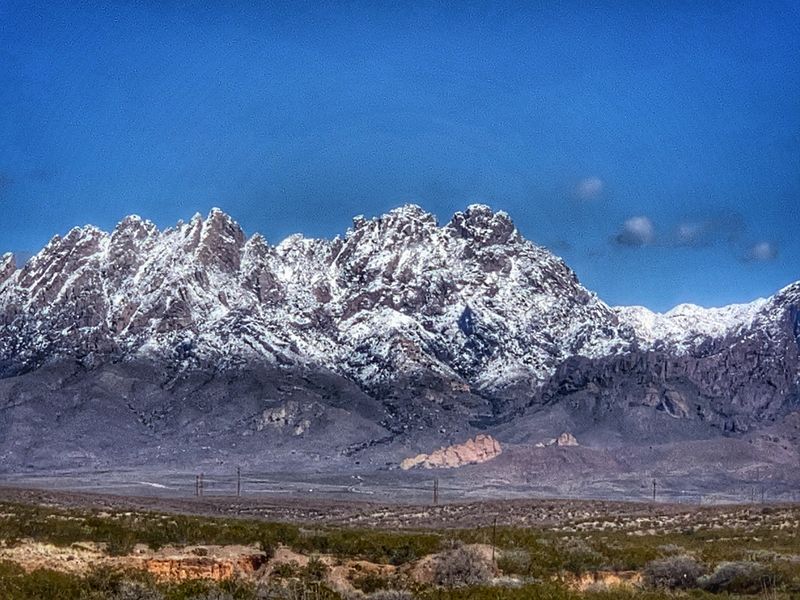
The peak stands as a remnant of ancient volcanic activity that shaped the Rio Grande Rift, the geological feature responsible for the valley where Las Cruces sits.
Native peoples, Spanish explorers, and American settlers all used Picacho Peak as a navigation point when crossing the desert.
Naming a street after this natural feature connects the urban landscape to the dramatic geology surrounding the city.
Picacho Avenue runs roughly parallel to the mountain range, offering occasional views of the peak as you travel along it.
The volcanic rock that forms the peak is dark basalt, contrasting sharply with the lighter desert soil and vegetation.
This geological diversity makes the Las Cruces area visually striking, with mountains, mesas, and river valleys all within view.
Street names referencing natural landmarks remind residents that they live in a landscape shaped by powerful forces over millions of years.
Picacho Avenue also reflects the Spanish practice of naming places after prominent physical features, a tradition that predates American settlement by centuries.
The peak itself has become a symbol of the region, appearing in local art, photography, and promotional materials for New Mexico.
Hikers and outdoor enthusiasts often climb Picacho Peak for panoramic views of the Mesilla Valley and the Rio Grande.
The avenue bearing its name serves residential neighborhoods and provides access to schools and parks.
Using natural features in street naming creates a sense of place, tying human development to the environment that sustains it.
Picacho Avenue is a daily reminder that Las Cruces exists in a dramatic, ancient landscape.
Solano Drive and Spanish Heritage
Solano is a Spanish surname and place name, likely chosen to honor the region’s Hispanic roots and the families who settled here generations ago.
Many streets in Las Cruces carry Spanish names that don’t translate to specific geographic features but instead reference people or cultural heritage.
Solano Drive winds through residential areas, serving neighborhoods built as the city expanded in the mid-twentieth century.
The choice of Spanish names for new developments reflected a desire to maintain cultural continuity even as Las Cruces modernized.
Unlike some Southwestern cities that anglicized their street names, Las Cruces embraced its bilingual identity.
This decision has shaped how residents relate to their city, reinforcing the idea that Spanish and English both belong here.
Solano Drive represents the thousands of families who built lives in this border region, farming the land and raising children in a place where two cultures met.
The name also connects Las Cruces to the broader Spanish-speaking world, from Mexico to Spain to other parts of Latin America.
Street names like Solano serve as quiet affirmations of identity, especially important in a state where Hispanic residents have sometimes faced pressure to assimilate.
New Mexico was part of Mexico until 1848, and even after becoming American territory, the majority population remained Spanish-speaking for decades.
Las Cruces has always been a place where Mexican and American cultures overlapped, creating something distinct from either one alone.
Solano Drive, like many similar streets, doesn’t demand attention or explanation, it simply exists as part of the city’s fabric.
Yet these names collectively tell a story about who lives here and what matters to them.
The drive connects families to schools, parks, and shopping areas, functioning as everyday infrastructure while carrying historical weight.
In this way, street names become living history, used daily but rarely examined closely.
Valley Drive and Agricultural Roots
Valley Drive takes its name from the Mesilla Valley, the fertile floodplain of the Rio Grande that made settlement possible in this desert region.
Without the river and its seasonal floods, Las Cruces would never have developed into more than a rest stop for travelers.
The valley provided rich soil for farming, particularly for crops like chile peppers, cotton, and pecans that thrive in hot, sunny climates.
Valley Drive runs through areas that were once agricultural land, now gradually being converted to residential and commercial use as the city expands.
The name serves as a reminder of what made this location valuable in the first place, not minerals or trade routes, but the ability to grow food.
New Mexico’s agricultural traditions remain strong, with family farms still operating in and around Las Cruces.
The state is famous for its chile production, and much of that crop comes from the Mesilla Valley.
Valley Drive connects different parts of the city while passing through transitional zones where fields meet subdivisions.
This visual juxtaposition tells the story of urban growth consuming agricultural land, a pattern repeated across the American West.
The street name keeps the agricultural heritage visible even as the landscape changes.
Farmers in the Mesilla Valley have used irrigation for centuries, first through acequia systems introduced by Spanish settlers, later through more modern methods.
Water rights remain a contentious issue in New Mexico, where every drop of the Rio Grande is claimed multiple times over.
Valley Drive represents the foundation of the local economy before tourism, military installations, and education became major employers.
The street runs relatively flat, following the contours of the valley floor rather than climbing into the surrounding mountains.
Driving along it, you can still see pecan orchards and fields that have resisted development, holdouts from an earlier era.
Dear Reader: This page may contain affiliate links which may earn a commission if you click through and make a purchase. Our independent journalism is not influenced by any advertiser or commercial initiative unless it is clearly marked as sponsored content. As travel products change, please be sure to reconfirm all details and stay up to date with current events to ensure a safe and successful trip.