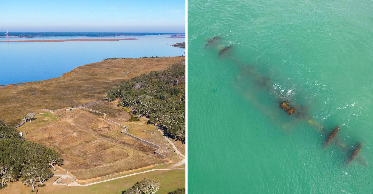
Dark rocks running out from the shore into the water look like a natural reef at first glance. People built that wall, stone by stone, more than a century ago to tame a wild stretch of river.
Today most of it hides under the waves, popping up at low tide like the back of a sleeping sea creature. A whole salty, sunburned day disappeared there, wandering between Civil War earthworks, shady live oaks, and tide pools full of tiny crabs.
Every corner held a story about the ocean winning some battles and people winning others. North Carolina keeps this kind of layered history along its coast, where nature and human effort share the same ground.
Hours pass without notice while exploring the trails and shoreline. History and nature trade punches at this site, and the result is a place worth seeking out.
The wall is only part of the story.
A Sand Fortress Called the Southern Gibraltar
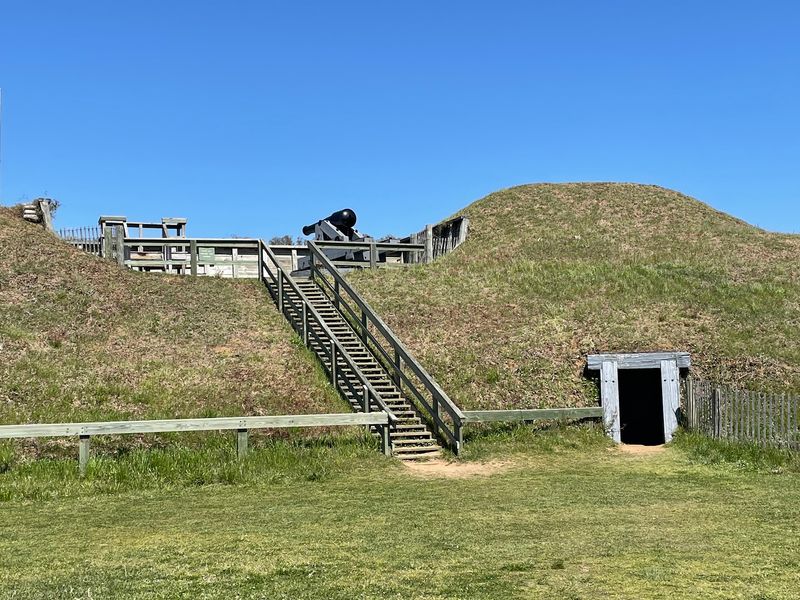
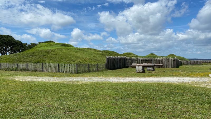
My sneakers hit the paved trail, and the first thing I noticed was how green and soft the old fort looks today. Grass covers the tall mounds now, but during the Civil War they were serious walls of packed sand and earth.
Fort Fisher guarded the port of Wilmington, which was one of the last big supply lines for the Confederacy. Builders shaped it into the largest earthen fort in the South, and people nicknamed it the Southern Gibraltar.
Thousands of workers, including enslaved and free African Americans, moved mountains of sand by hand to create it.
Why sand and not stone? Packed earth soaks up cannon fire much better than brick, which can crack and shatter.
The design borrowed ideas from forts used in the Crimean War overseas.
Wooden stairs let you climb one of the mounds, and the view from the top is worth the short huff and puff. You can see the ocean on one side and imagine cannons pointed at enemy ships on the other.
Here is a helpful tip from the site map. Follow the trail in the right direction, because the signs tell the fort’s story in order, almost like turning the pages of a book.
How the Atlantic Swallowed Most of the Fort
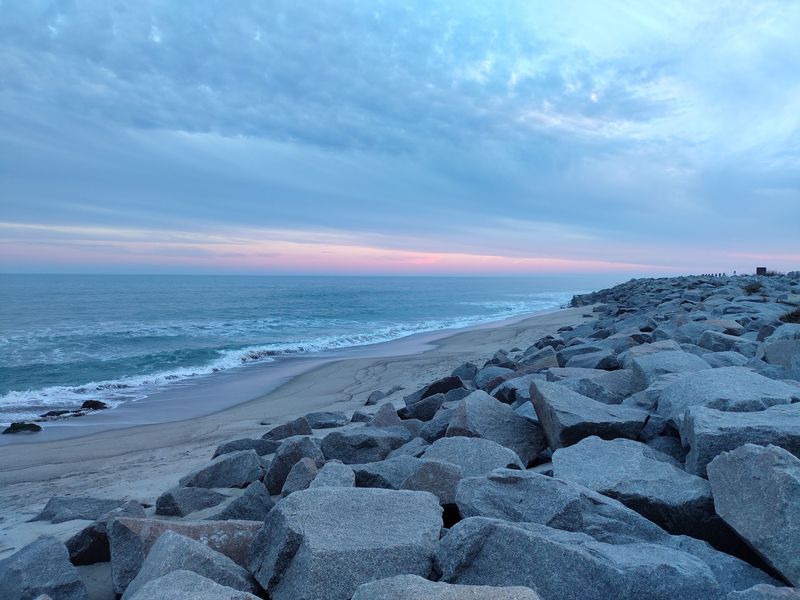
Only about ten percent of the original fort still stands. I had to read that twice on a sign before it sank in, and then I just stared at the water for a while.
The sea never attacked with cannons, but it was far more patient than any army. Year after year, waves and storms nibbled at the shoreline.
Hurricanes took giant bites all at once.
By 1968, more than 200 yards of the fort had disappeared into the Atlantic. Earthworks that once held up under heavy bombing simply melted away, grain by grain, into the surf.
Picture building a sandcastle at the beach, then watching the tide come in. Same idea, only this castle was huge and held real history inside it.
Standing near the edge, you can almost trace where the old walls used to run out past today’s beach. Some of that history now rests on the ocean floor, hidden but not completely gone.
For visitors, this part of the trip feels quieter and more thoughtful. Bring a little patience and let yourself soak it in.
The ocean has a way of making even a giant fort look small.
The Rocks, a Wall Built for Ships
Locals simply call it The Rocks, which is a pretty humble name for such a giant project. I liked that right away.
After the Civil War ended, the U.S. Army Corps of Engineers started building a long stone wall out into the water in 1865.
They finished in 1881, which means crews worked on it for about sixteen years. That is a lot of heavy lifting.
The goal had nothing to do with battles. Sand kept drifting into the Cape Fear River and clogging the shipping channel to Wilmington, so ships had trouble getting in and out.
The wall closed off an opening called New Inlet. Fun fact: during the war, sneaky blockade runner ships used that very inlet to slip past Union warships with supplies.
Today, big sections of the wall dip below the surface when the tide is high. At low tide, you can see the stones lined up like a dotted line heading toward Zeke’s Island.
Watching the water rise and hide it again is oddly relaxing.
It’s a reminder that people have been trying to boss the ocean around for a long time, sometimes with real success.
Calm Water and Birds at The Basin
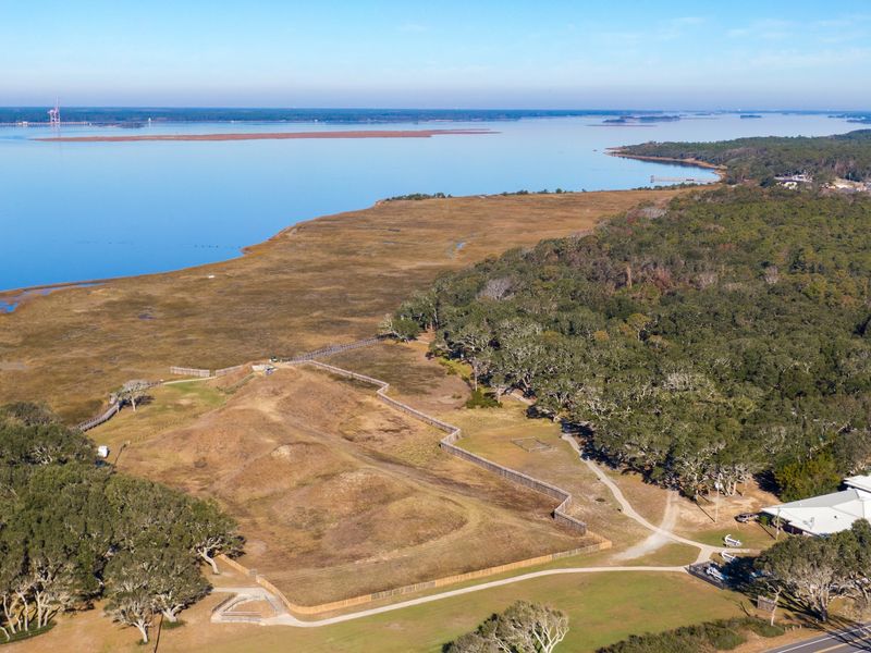
A heron lifted off just as I reached the water, flapping slowly like it had nowhere special to be. That set the mood for the whole hike.
The Basin is a calm lagoon that formed behind The Rocks once the wall blocked the old inlet. So in a funny way, the engineers created a wildlife hangout by accident.
On one side, the ocean churns, and on the other, the water sits almost still.
The Basin Trail runs about 2.2 miles round trip through marsh grasses and sandy paths. It ends at an observation deck with wide views of the Cape Fear River and Zeke’s Island.
Bring binoculars if you have them. Shorebirds, wading birds, and fiddler crabs keep things lively, especially in the morning when it’s cooler.
If you decide to explore the jetty itself at low tide, be careful. Algae makes the stones slippery, and barnacles can scratch, so wear sturdy shoes with good grip instead of flip-flops.
Also pack water and sunscreen, because there’s little shade out there. Summer heat on the marsh can sneak up on you fast, and nobody enjoys a cranky walk back.
A Modern Stone Shield and Rare Coquina Rock
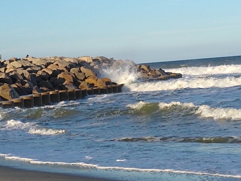
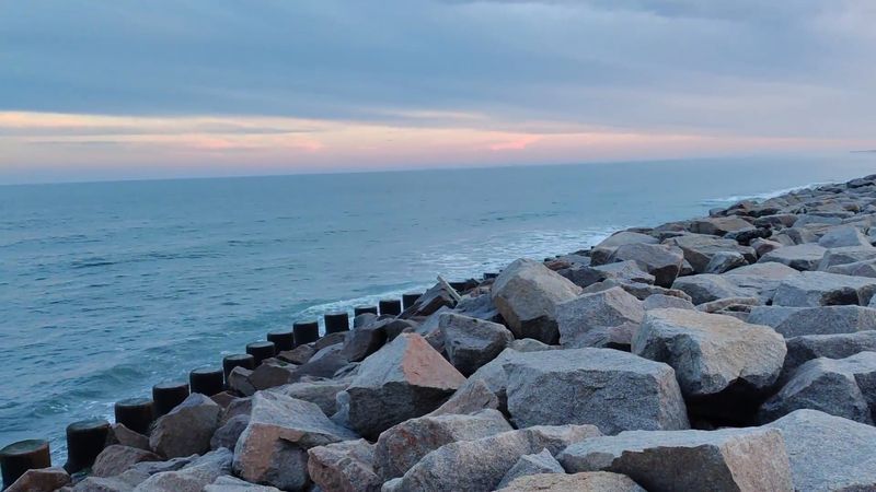
After decades of losing ground, Fort Fisher finally got some backup. In the 1990s, the Army Corps of Engineers designed a 3,040-foot stone revetment, and it was finished in 1996.
A revetment is basically a sloped wall of big rocks that takes the punch from waves before they reach the land. It protects what is left of the fort and the nearby highway.
Without it, even more history might be underwater by now.
I found myself oddly thankful for a pile of rocks. Honestly, that’s not something I expected to say on vacation.
Along the beach, you’ll also spot something natural and rare: coquina rock. It forms from crushed shells and sand pressed together over a very long time, and it looks a bit like a crunchy granola bar.
These outcrops are uncommon on North Carolina’s coast, and they help slow erosion too. At low tide, small pools collect between the rocks.
Kids love poking around these tide pools for little treasures like tiny crabs and snails. Look closely, touch gently, and leave everything where you found it so the next visitors can enjoy them as well.
A Shipwreck Waiting Offshore
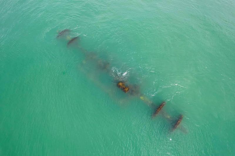
Somewhere out past the breaking waves, a Civil War ship is resting on the sandy bottom. Just knowing that made the ocean look different to me.
The ship is called the Condor, a blockade runner that sank in 1864 while trying to sneak supplies to Wilmington. It lies roughly 700 yards off the beach in about 25 feet of water.
The wreck became North Carolina’s very first Heritage Dive Site. That means trained divers can visit and see history up close, kind of like an underwater museum with fish as the tour guides.
Not a diver? No worries at all.
You can still learn plenty on land, since the state’s Underwater Archaeology office is based right at Fort Fisher.
Experts there study and protect shipwrecks and artifacts pulled from the water along the coast. Their work helps explain how sailors lived, traveled, and sometimes lost everything at sea.
Next time you stand on the sand and watch the waves roll in, think about the Condor. History isn’t only in books and buildings.
Sometimes it’s quietly sitting under 25 feet of seawater, just a short swim from where you’re standing.
Planning a Day at Fort Fisher
Start at the visitor center, and you’ll thank me later. The air conditioning alone is a gift on a summer day.
The updated museum sits upstairs, packed with artifacts, clear displays, and a short film about the fort. Plan on spending around 30 to 45 minutes inside.
There’s also a balcony with a lovely view, plus a gift shop and clean restrooms downstairs.
Admission is free, though a donation box helps with upkeep. The historic site is open Tuesday through Saturday from 9 a.m. to 5 p.m., and it closes Sunday and Monday.
Outside, a paved trail loops past the earthworks under twisty live oaks. You can even step into recreated rooms and a long tunnel inside the fort.
Across the road, the Fort Fisher State Recreation Area offers a wide, peaceful beach for swimming and fishing. Use the crosswalk carefully, since cars can move fast there.
The North Carolina Aquarium at Fort Fisher is close by, which makes an easy pairing for families. Guided tours may be canceled when the heat index climbs, so check ahead.
Address: 1610 Fort Fisher Blvd S, Kure Beach, NC 28449
