When a lake starts pulling back its waters and showing off what has been hiding underneath for decades, something genuinely fascinating happens. This lake in southern Oklahoma has been doing exactly that, and the results are nothing short of extraordinary.
Original creek beds, forgotten contours of the land, and terrain that has not seen daylight in years are slowly coming back into view.
If you have ever wondered what lies beneath the surface of a reservoir, this is your chance to find out.
The Story Behind Waurika Lake and Its Changing Water Levels
Waurika Lake sits in Stephens County in southern Oklahoma, and it was created by the U.S. Army Corps of Engineers in the 1970s when Beaver Creek was dammed to form the reservoir.
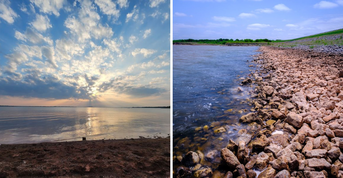
The lake covers roughly 10,100 acres at full pool, making it a significant body of water in this part of the state.
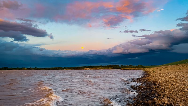
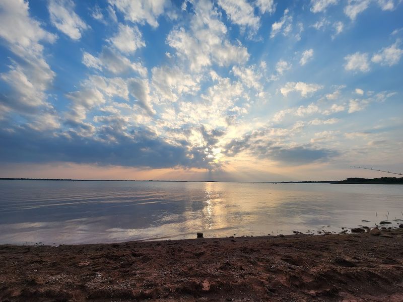
Over time, drought cycles and reduced inflow have caused water levels to drop noticeably. When those levels fall, the landscape beneath the water begins to reveal itself in ways that feel almost cinematic.
Old creek channels that once carved through the terrain before the dam was built start to reappear. The original banks of Beaver Creek and its tributaries become visible again, almost like a map drawn in mud and stone.
This kind of exposure does not happen overnight. It is the slow result of months or even years of below-average rainfall combined with steady evaporation.
For Oklahoma, a state that experiences dramatic weather swings, this cycle of filling and draining is part of the natural rhythm of its reservoirs.
What the Exposed Creek Beds Actually Look Like Up Close
Standing at the edge of the receding waterline at Waurika Lake is a genuinely surreal experience. The ground that appears is not flat or featureless.
Instead, it rolls and winds in ways that mirror how water once naturally moved through this Oklahoma landscape long before the reservoir existed.
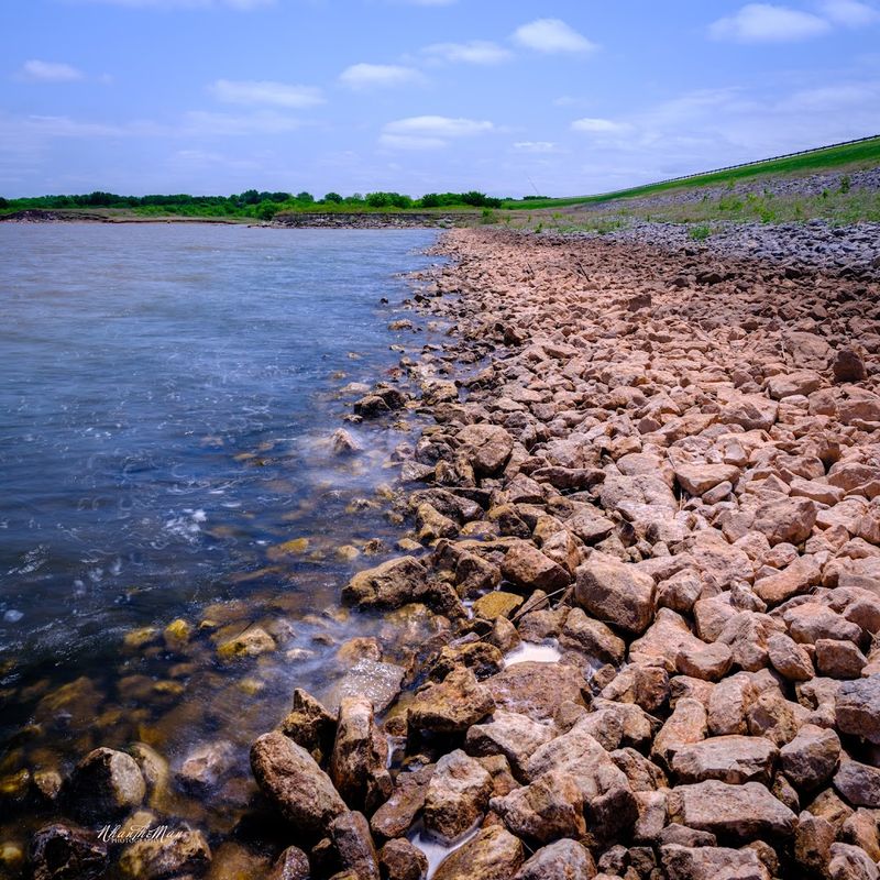
The exposed creek beds show distinct channels, some narrow and others wide, where flowing water once carved its path through soil and bedrock. Layers of sediment are visible in cross-section along the banks of these old channels, telling a quiet geological story in shades of tan, brown, and rust.
Rocks that have been submerged for decades come out looking smoothed and darkened. Driftwood and other organic material appear in unexpected spots, frozen in place from the last time the water retreated years ago.
Walking along these exposed areas feels like stepping through a timeline. The patterns in the soil show how water behaved here before any dam existed, and that kind of raw, unfiltered geography is genuinely hard to find anywhere else in southern Oklahoma without specifically seeking it out.
The Long-Buried Terrain That Has Surprised Everyone
One of the most unexpected aspects of a draining reservoir is just how much terrain gets buried when a lake forms. Before Waurika Lake was filled, the valley that Beaver Creek ran through had hills, meadows, and low-lying fields that are now normally hidden under dozens of feet of water.
When water levels drop significantly, these features come back into view. Gentle slopes that once led down to the creek reappear.
Old fence lines, long-submerged under the reservoir, sometimes poke up through the mud as the water retreats far enough.
The land itself seems to remember its old shape. Depressions that used to collect rainwater, ridgelines that separated one drainage from another, and flat terraces that may have once been farmed are all part of what becomes visible during low-water periods at Waurika Lake.
For anyone interested in the natural or cultural history of Oklahoma, seeing this buried terrain exposed is like finding a photograph of the past. The landscape holds a record of what this corner of the state looked like before it was transformed by the construction of a dam in the early 1970s.
Wildlife That Appears When the Water Retreats

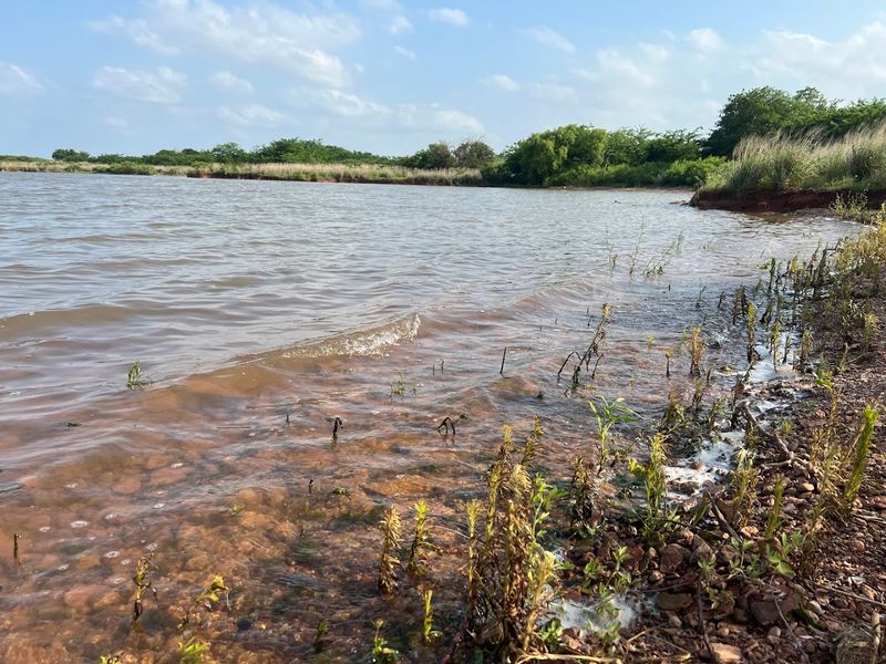
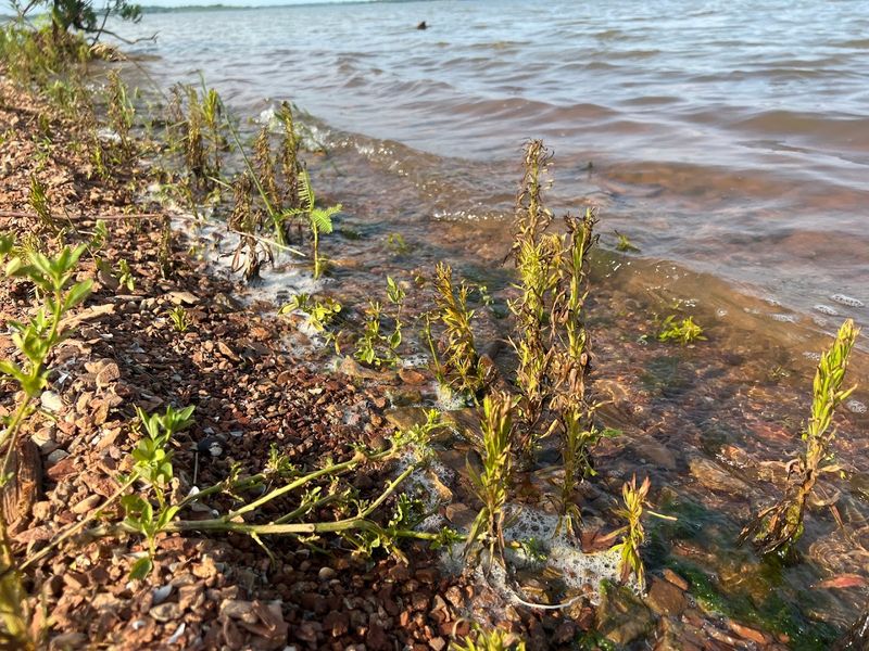
One of the unexpected benefits of falling water levels at Waurika Lake is the wildlife activity it brings to the newly exposed areas. Mudflats and shallow edges that form along the receding shoreline become prime feeding ground for birds and mammals alike.
Shorebirds that would normally have nowhere to land on a full reservoir suddenly have acres of soft, food-rich mud to explore. Herons, egrets, and various migratory species take advantage of these conditions, turning the low-water margins into busy feeding stations.
White-tailed deer are a common presence around Waurika Lake regardless of water levels, but when the shoreline pulls back, they can often be found moving along the exposed flats in the early morning and late evening hours.
Armadillos also appear frequently in the surrounding terrain, rooting through the soft ground near the water’s edge.
The exposed creek beds themselves attract animals that follow the lingering moisture and the insects it supports.
Oklahoma’s southern lakes tend to support rich wildlife communities, and Waurika Lake is no exception, making any visit during a low-water period a rewarding experience for anyone who appreciates nature.
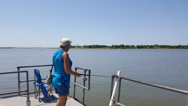
Fishing Changes Dramatically During Low-Water Conditions
Waurika Lake has a well-earned reputation as one of the better fishing destinations in Oklahoma. The lake holds healthy populations of catfish, bass, crappie, walleye, and hybrid stripers, and anglers who know the lake tend to be fiercely loyal to it.
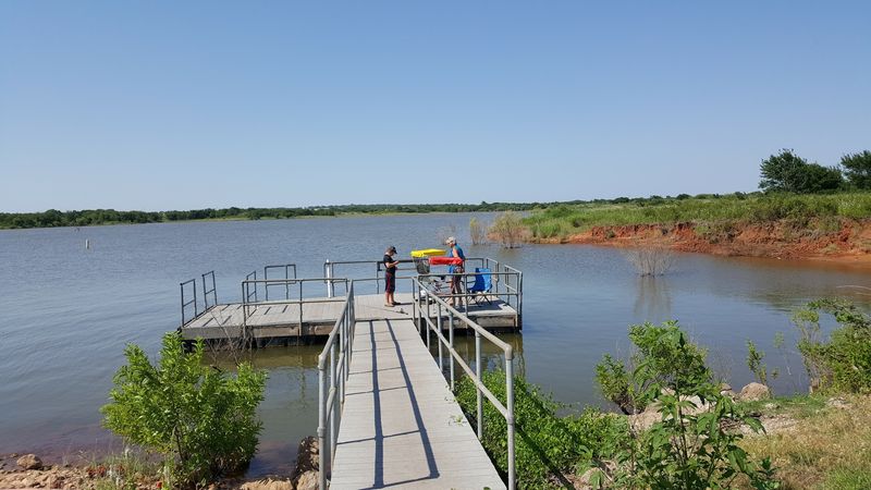
When water levels drop and creek beds are exposed, fishing patterns shift in interesting ways. Fish that were spread across a full reservoir tend to concentrate in the deeper remaining channels, which are often the original creek beds that are now partially or fully visible along the edges.
This concentration effect can actually make fishing more productive during low-water periods, as long as you know where those old channels run. The exposed terrain essentially shows you a map of where the fish are likely holding, which gives a real strategic advantage to anyone paying attention.
Catfish in particular tend to gather in the deeper holes along old creek channels, making those spots extremely productive.
Fishing from the bank becomes more accessible too, since the retreating water opens up shoreline that is normally submerged, giving anglers new positions they simply cannot reach when the lake is at full pool.
Hiking and Exploring the Newly Exposed Shoreline
Low water at Waurika Lake opens up a kind of exploration that simply does not exist when the reservoir is full. The exposed lakebed and creek channels create a natural walking path that winds along the water’s edge, giving hikers access to terrain that is normally off-limits.
The ground underfoot varies considerably as you move along the exposed shoreline. Some sections are firm and rocky, covered in smooth stones that have been tumbled by years of underwater currents.
Other areas are soft mud that requires careful footing, especially after any recent rainfall.
The views from the exposed lakebed looking back toward the treeline and the surrounding Oklahoma hills are genuinely striking.
The contrast between the dry, cracked earth in the foreground and the remaining open water creates a dramatic visual that feels unlike anything you would find at a lake during normal conditions.
The Waurika Lake area includes several established parks and trails managed by the U.S. Army Corps of Engineers, but the low-water exploration adds a spontaneous, off-the-beaten-path quality to any visit.
Just wear boots you do not mind getting muddy, and bring water because the southern Oklahoma sun does not take breaks.
Camping at Waurika Lake While the Water Is Low
Camping at Waurika Lake is available through several parks managed by the U.S. Army Corps of Engineers, including the Kiowa and Moneka campgrounds.
These sites range from primitive spots with no hookups to full RV sites with electric connections, giving campers plenty of flexibility.
Staying at the lake during a low-water period adds an extra layer of interest to a camping trip. The exposed terrain changes the landscape around the campgrounds, and the sounds and smells of the lake shift as the water pulls back from its usual edges.
Morning walks from a campsite down to the waterline take you across ground that might normally be several feet underwater, which adds a genuinely unusual quality to an otherwise familiar outdoor experience.
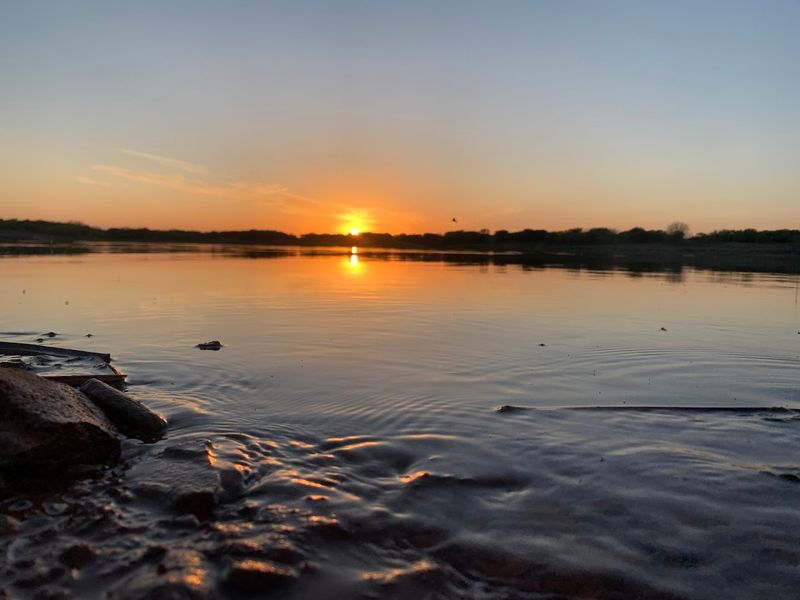
Watching the sunrise from the exposed lakebed with the remaining water stretching out ahead is the kind of moment that makes camping worth all the setup.
The Chisholm Trail RV area near the lake is also a popular option for those who prefer a more developed setting. Oklahoma’s southern lake country is quiet and unhurried, and Waurika Lake in particular has a relaxed atmosphere that suits long, slow camping trips perfectly.
Driving Across the Dam and Understanding the Structure

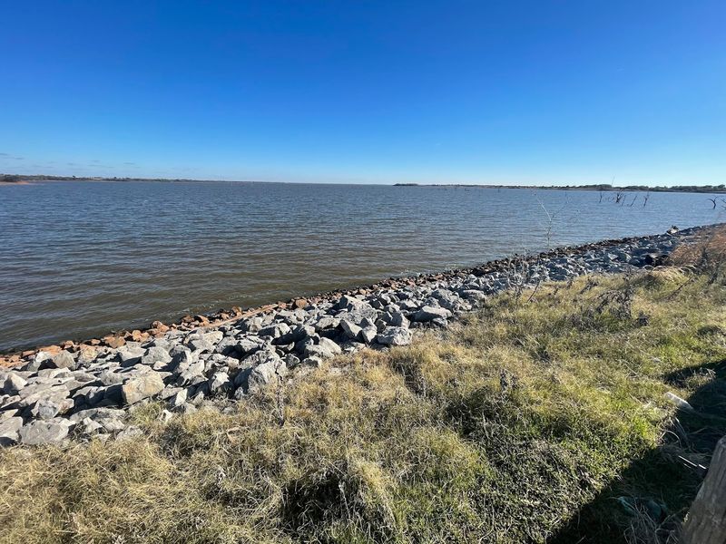
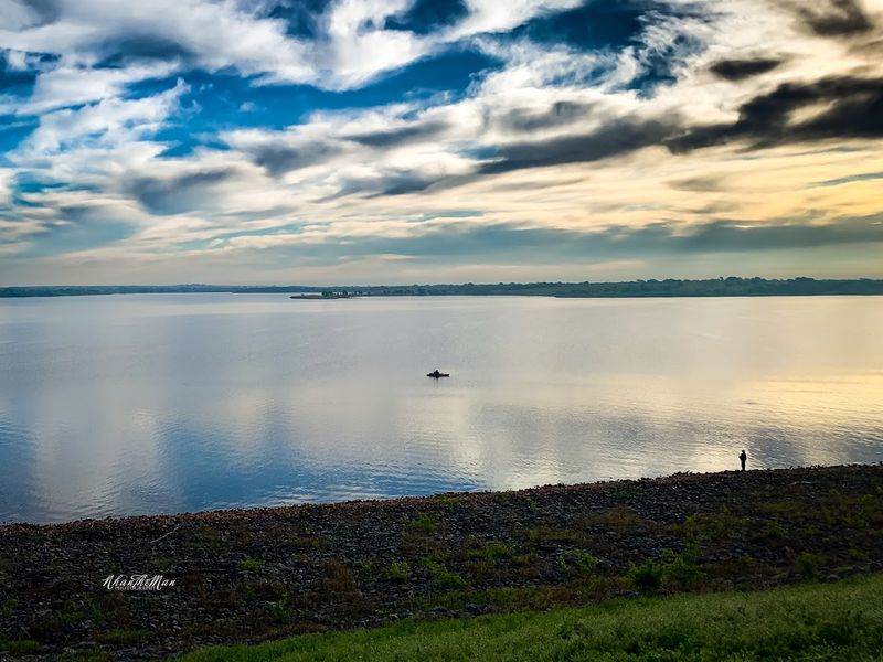
One of the most informative stops at Waurika Lake is the drive across the dam itself. The dam road gives you an elevated perspective on the reservoir and makes the scale of the water level drop immediately obvious when conditions are dry.
From the top of the dam, you can look out over the reservoir and see exactly where the waterline sits in relation to the original shoreline. During low-water periods, the difference is striking.
The exposed margins of the lake stretch out visibly on both sides, and the old creek channel running through the middle of the reservoir is often traceable from this elevated vantage point.
The dam at Waurika Lake was constructed in the 1970s and completed around 1981 by the U.S. Army Corps of Engineers and serves multiple purposes beyond recreation.
It provides flood control for downstream communities and supplies water to several towns in the region, which means the water level is actively managed rather than simply left to nature.
Understanding that management context helps explain why the lake sometimes sits well below full pool. Controlled releases, combined with drought conditions, can expose significant portions of the original valley floor, turning the drive across the dam into an unexpectedly educational experience.
The History Hidden Beneath the Surface of the Reservoir
Before Waurika Lake existed, the valley now filled by the reservoir was a working landscape. Beaver Creek wound through the terrain in a natural pattern that had been established over thousands of years, and the surrounding land was used for ranching and farming by the communities in Stephens County.
When the dam was constructed and the reservoir began to fill in the early 1980s, all of that history went underwater. Fields, fence lines, and the natural course of the creek were submerged beneath what would become a 10,100-acre lake serving the recreational and water supply needs of the region.
Low-water events bring fragments of that buried history back into view. Old fence posts appearing above the mudline are among the most striking reminders that people lived and worked on this land before it became the bottom of a reservoir.
The terrain itself carries the marks of its agricultural past in subtle ways that become readable when the water retreats.
Oklahoma has dozens of reservoirs built during the 20th century, and each one carries a similar layer of submerged history. Waurika Lake is a particularly clear example of how much a landscape can change when a dam is introduced, and how much the original terrain persists beneath the water’s surface.
How Drought Cycles Affect Waurika Lake Specifically
Southern Oklahoma sits in a climatic zone that is no stranger to extended dry spells. The region receives an average of around 30 inches of rain per year, but that total can vary wildly from one year to the next, and multi-year drought cycles are a recurring feature of the local climate.
Waurika Lake depends primarily on runoff from Beaver Creek and its watershed for its water supply. When rainfall is significantly below average for an extended period, the inflow to the reservoir drops sharply while evaporation continues at its usual pace, causing water levels to fall steadily.
The lake has experienced notable low-water periods at various points since it was completed, and each time the water drops, more of the original terrain becomes exposed.
The red Oklahoma clay that characterizes the soil in this part of the state becomes visible along the receding shoreline, giving the exposed lakebed a distinctive rust-colored appearance.
These drought cycles, as challenging as they are for water managers and local communities, create the conditions that make geological and historical exploration of the lakebed possible.
The dry spells essentially open a window into the pre-dam landscape that would otherwise remain permanently hidden beneath the water.
Best Times to Visit and What to Bring Along
Spring and fall are the most rewarding seasons to visit Waurika Lake, especially if the goal is exploring low-water terrain.
Temperatures in southern Oklahoma during these shoulder seasons are manageable, and the light in the early morning and late afternoon hours is particularly beautiful on the exposed lakebed.
Summer visits are absolutely possible, and the lake sees its busiest camping and boating traffic during those months.
The heat, however, can be intense in this part of Oklahoma, and spending time on an exposed, shadeless lakebed in July requires serious preparation with water, sun protection, and appropriate clothing.
For low-water exploration specifically, a pair of waterproof boots is close to essential. The ground near the waterline shifts between firm rock, loose gravel, and deep mud depending on how recently the area has been exposed and whether any rain has fallen.
Lightweight rain pants are also useful for the muddier sections.
Binoculars are worth packing regardless of the season, since the wildlife around Waurika Lake is one of its genuine highlights.
A camera with a zoom lens will serve you well along the exposed shoreline, where the combination of dramatic terrain and active wildlife creates photographic opportunities that are genuinely hard to replicate at a full-pool reservoir.
Why Waurika Lake Deserves More Attention From Oklahoma Explorers
Waurika Lake does not always make the top of Oklahoma’s most-visited reservoir lists, but that relative obscurity is part of what makes it special. The lake sits far enough off the main travel corridors to avoid the weekend crowds that descend on more famous Oklahoma lakes during peak season.
The combination of solid fishing, accessible camping, varied wildlife, and the genuinely unusual experience of exploring exposed creek beds and buried terrain during low-water periods gives Waurika Lake a depth of interest that goes beyond the typical reservoir visit.
There is always something to see here that you would not find at a full, manicured lakeside park.
The landscape around the lake is quintessentially southern Oklahoma, with rolling red-soil terrain, scattered post oak and blackjack trees, and open skies that stretch in every direction.
On a clear day, the views from the dam road or the exposed lakebed reach far enough to remind you just how wide and open this part of the country really is.
For anyone willing to make the drive to Stephens County and spend a day or two exploring, Waurika Lake offers a kind of quiet, unhurried discovery that is increasingly hard to find in a world of overcrowded outdoor destinations. The exposed terrain is just the beginning of what this lake has to offer.
Dear Reader: This page may contain affiliate links which may earn a commission if you click through and make a purchase. Our independent journalism is not influenced by any advertiser or commercial initiative unless it is clearly marked as sponsored content. As travel products change, please be sure to reconfirm all details and stay up to date with current events to ensure a safe and successful trip.