Oklahoma is no stranger to dry spells, but current conditions across parts of the state are putting noticeable pressure on several lakes and reservoirs.
As of early 2026, drought conditions, especially in western and central Oklahoma, have reduced inflow, increased evaporation, and lowered water levels in key water bodies that support recreation, agriculture, and municipal supply.
What follows is a closer look at 9 lakes across the state, how they are being affected, and what visitors and residents should know right now. Conditions vary by region, and while not every lake is critically low, many are showing signs of strain that are worth paying attention to.
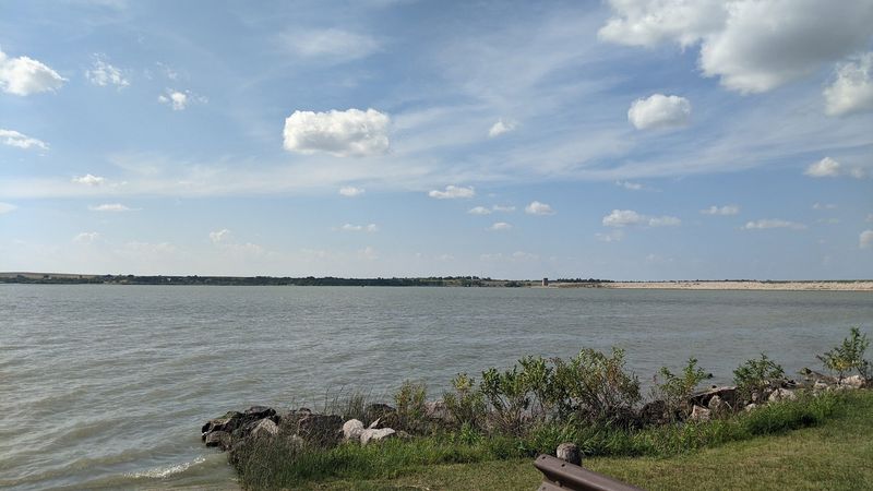
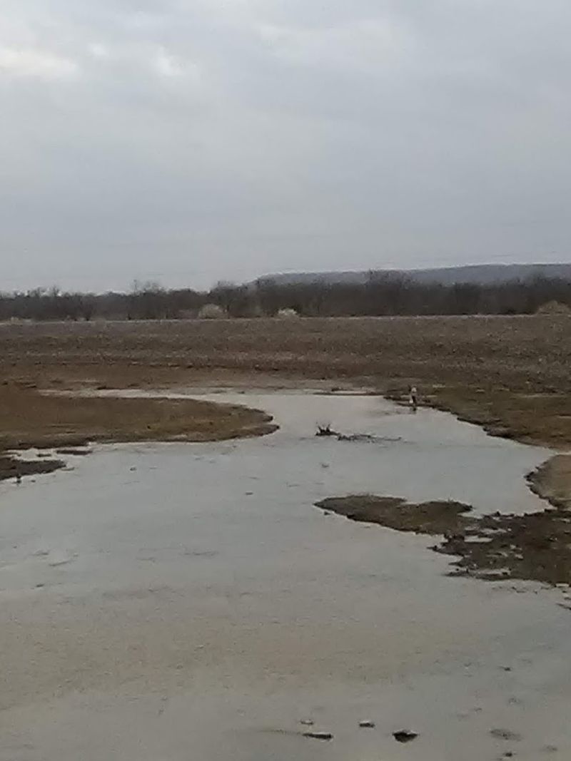
1. Canton Lake, Northwest Oklahoma
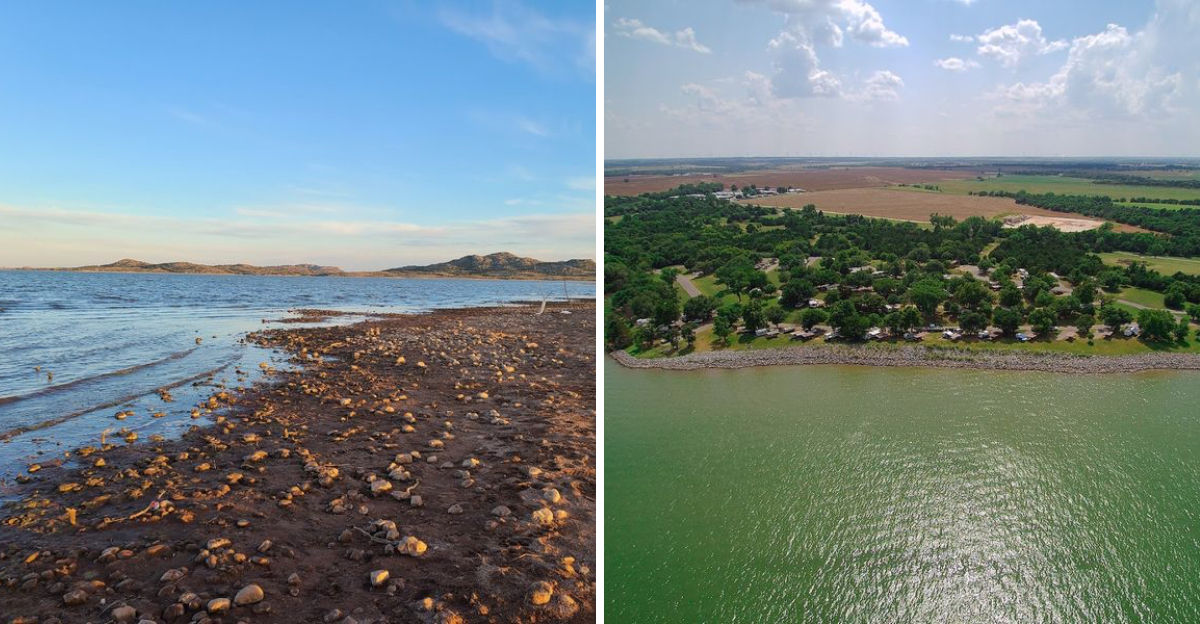
Standing at the edge of Canton Lake in northwest Oklahoma feels strange right now, and not in a good way. The water has pulled back so far from the shoreline that wide stretches of dry, cracked ground are visible where fishing boats once floated freely.
Canton Lake sits in Blaine County and has historically been one of the region’s go-to spots for fishing, camping, and water sports.
But multi-year drought has taken a serious toll, and as of early April 2026, the reservoir is sitting right at its conservation pool elevation of 1,615.76 feet with absolutely zero flood storage being utilized.
What that number means in practical terms is that the lake has no buffer left. There is no cushion of extra water stored above the normal level to absorb the next dry stretch.
The surrounding landscape in northwest Oklahoma already leans toward arid, which makes recovery here especially slow. Even a decent spring rain barely moves the needle when the soil is so parched it soaks up moisture before it ever reaches the lake.
For anglers who have been coming to Canton Lake for decades, the changes are hard to miss. Familiar fishing spots are now exposed sandbars, and boat launches that once sat at the water’s edge now require a longer walk to reach the surface.
If you are planning a visit, check current conditions with the Army Corps of Engineers before heading out. Water levels can shift quickly, and access points may be limited depending on the week.
2. Altus-Lugert Lake, Southwest Oklahoma
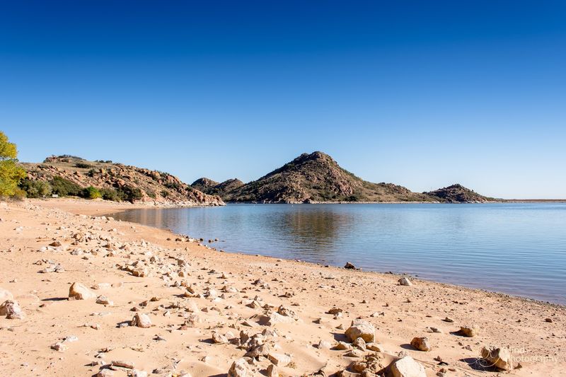
Tucked into the dry, windswept corner of southwest Oklahoma, Altus-Lugert Lake carries a weight that goes far beyond recreation. This reservoir is a lifeline for area farmers and ranchers who depend on it for irrigation water, and right now that lifeline is stretched dangerously thin.
As of early April 2026, the lake sits at an elevation of 1,537.26 feet and is reporting zero percent flood storage utilized. That last detail is particularly sobering when you understand how critical this reservoir is for agricultural operations in the surrounding region.
Altus-Lugert Lake was created by Lugert Dam on the North Fork of the Red River, and it has served as a key irrigation source for southwest Oklahoma for generations.
The communities and farms that rely on it have built their operations around the assumption that water will be available, which makes the current situation feel urgent.
The southwest part of the state has been hammered by consecutive drought years, and the cumulative effect on this lake is visible. The red clay banks that normally sit just below the waterline are now exposed and baking under the Oklahoma sun.
Wildlife that typically congregates near the shoreline has been pushed further out as habitat shrinks. Shorebirds and migratory waterfowl that stop here during seasonal movements are finding far less water than usual.
Conservation efforts and careful water management by the Bureau of Reclamation are helping to stretch remaining supplies, but the situation here demands close attention from state and local water planners heading into summer.
3. Foss Lake, Custer County, Oklahoma
Foss Lake has a personality all its own, sitting quietly in Custer County in western Oklahoma with a calm surface that can be deceptive. Beneath that stillness is a reservoir that has been slowly losing ground to one of the most persistent droughts the region has seen in recent memory.
Right now, Foss Lake is sitting near its base level of 1,641.00 feet, and there has been no significant inflow in recent weeks. That means the lake is essentially running on what it already has, with very little new water coming in to replace what evaporates under the harsh Oklahoma sun.
The lake is managed by the Bureau of Reclamation and serves both recreational and water supply purposes for communities in the area.
Foss State Park, which sits along its shores, draws campers, kayakers, and bass fishermen throughout the warmer months, but low water conditions are making some of those activities more complicated than usual.
One thing that surprises many people about Foss Lake is how quickly conditions here can shift from manageable to critical. Western Oklahoma receives far less annual precipitation than the eastern part of the state, and when drought takes hold, it tends to dig in hard.
The exposed shoreline has expanded noticeably, and some of the coves that anglers love to fish during spring bass season are now barely holding enough water to float a kayak.
Visitors should call ahead to Foss State Park before planning any water-based activities, as conditions are changing from week to week right now.
4. Fort Supply Lake, Northwest Oklahoma
Fort Supply Lake sits in the far northwest corner of Oklahoma, in Woodward County, and it carries a quiet, almost forgotten quality that makes it feel like a well-kept secret. But right now, the secret the lake is keeping is not a pleasant one.
As of early April 2026, Fort Supply Lake is holding at an elevation of 2,004.39 feet and reporting zero percent flood storage utilization. That reading tells you everything you need to know about how tight things have gotten at this reservoir.
Fort Supply Lake was created by the Army Corps of Engineers in the late 1940s as a flood control and water supply project on the North Canadian River. For decades it has served the surrounding communities reliably, but the prolonged drought across the Southern Plains has pushed it to its limits.
Northwest Oklahoma is one of the driest corners of the state to begin with, and consecutive years of below-average rainfall have compounded the stress on this reservoir considerably.
The landscape surrounding Fort Supply Lake is wide open and windswept, which also means higher evaporation rates during the warm months.
Fishing for walleye, catfish, and bass has long been a draw here, and a state park offers camping and boat ramp access. But with water levels where they are, some of the shallower fishing areas are becoming inaccessible.
Local water managers are keeping a close eye on conditions, and any visitor planning a trip to Fort Supply should check current ramp status before making the drive out to this remote part of the state.
5. Tom Steed Lake, Southwest Oklahoma
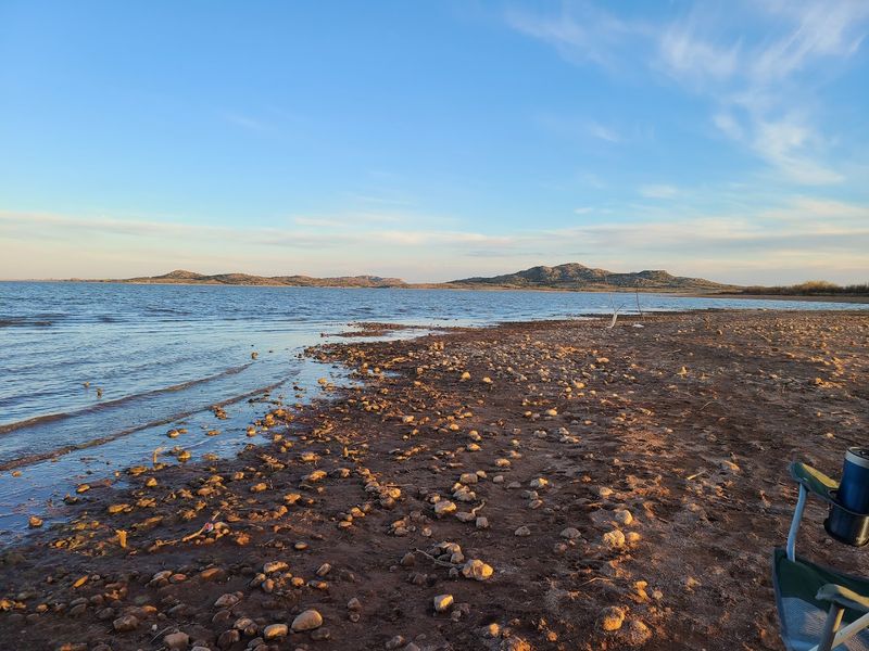
There is something almost melancholy about seeing Tom Steed Lake in its current state. Nestled in southwest Oklahoma near the town of Mountain Park, this reservoir normally offers a scenic backdrop with the Wichita Mountains looming in the distance, but the receding waterline is hard to ignore.
As of early April 2026, Tom Steed Lake sits at an elevation of 1,407.31 feet with zero percent flood storage in use. The lake feeds into a water supply system that serves communities in the region, making its current condition more than just an inconvenience for boaters and fishermen.
Tom Steed Lake was built by the Bureau of Reclamation in the 1970s as part of the Mountain Park Project, which was designed to provide irrigation and municipal water to southwest Oklahoma.
The communities that depend on it have been managing carefully, but continued drought makes that balancing act increasingly difficult.
The shoreline that was once submerged is now dry ground, and the contrast between the lake’s historical high-water marks and its current surface is striking. Old stumps and rock formations that rarely see sunlight are now fully exposed.
Wildlife activity around the lake has shifted noticeably as water levels drop. Shorebirds and wading birds are concentrated in smaller areas near the remaining water, making for interesting wildlife observation even as conditions remain tough.
If you are heading to this part of Oklahoma, the nearby Wichita Mountains Wildlife Refuge offers a worthwhile side trip, and checking current lake conditions ahead of any water-based plans is strongly recommended.
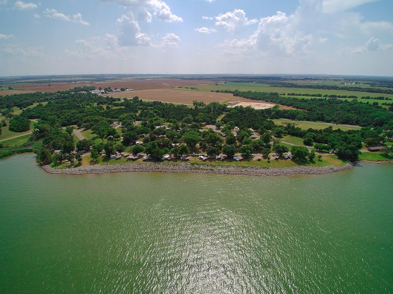
6. Skiatook Lake, Osage County, Oklahoma
Skiatook Lake sits in Osage County in northeastern Oklahoma, roughly 20 miles northwest of Tulsa, and it plays an important dual role as both a water supply reservoir and a popular recreation destination for the Tulsa metro area. Right now, though, it is running lean.
As of early April 2026, Skiatook Lake is at an elevation of 709.37 feet with zero percent flood storage utilized and an inflow rate of just 36 cubic feet per second. That inflow number is particularly telling, because it shows how little new water is actually reaching the lake from its watershed.
The Skiatook Lake watershed spans a large portion of Osage County, but drought conditions have left the land so dry that even moderate rainfall gets absorbed before it can generate meaningful runoff into the lake.
This is a pattern that water managers across the state have been watching with growing concern.
Skiatook Lake State Park offers camping, fishing, swimming, and a marina that has been a gathering point for boaters from Tulsa and surrounding communities for decades. Striped bass, largemouth bass, and catfish are popular targets here, though low water has pushed fish into deeper and fewer areas.
The lake also supports a diverse bird population, and the surrounding upland prairie and cross-timbers habitat make it a worthwhile spot for wildlife observation even when water levels are challenging.
Checking in with the Army Corps of Engineers before a visit is always a good idea, and right now it is especially important given how quickly conditions can shift during an active drought period.
7. Birch Lake, Nowata County, Oklahoma
Birch Lake is one of those smaller reservoirs in northeastern Oklahoma that tends to fly under the radar compared to the bigger, more famous lakes nearby. But what is happening there right now is worth paying attention to, especially for the communities in Nowata County that depend on it.
As of early April 2026, Birch Lake is reporting an elevation of 750.56 feet with zero percent flood storage utilized. Those numbers reflect a reservoir that is operating without any safety margin, sitting right at its baseline with no stored surplus to draw on.
Birch Lake was created by the Army Corps of Engineers on Birch Creek, a tributary of the Verdigris River. It serves flood control and water supply functions for the surrounding area, and it also supports recreational use including fishing and camping at the adjacent state park.
The lake sits in the cross-timbers region of northeastern Oklahoma, where oak woodlands and prairie grasses create a landscape that feels distinctly different from the flat, open terrain of western Oklahoma.
Even in dry years, the scenery here has a rugged, earthy beauty that draws visitors who enjoy quieter, less crowded outdoor spaces.
Fishing for bass and catfish has historically been solid at Birch Lake, but low water concentrates fish in predictable spots and can make some areas difficult to reach by boat. Shallow coves that are normally productive fishing grounds are now barely holding water.
The Nowata County area has felt the drought acutely, and local water officials are carefully managing what remains in the reservoir as the dry season continues to unfold.
8. Copan Lake, Washington County, Oklahoma
Copan Lake sits in Washington County in northeastern Oklahoma, and it has a reputation among local anglers as a reliable producer of largemouth bass and crappie. But reliability is exactly what is being tested right now as drought conditions put pressure on this reservoir from multiple directions.
As of early April 2026, Copan Lake is holding at an elevation of 713.56 feet and using only nine percent of its flood storage capacity.
While that nine percent figure sounds more promising than the zero percent readings at some other lakes on this list, the overall picture is still one of a reservoir operating well below its potential.
The lake sits on the Little Caney River and was built by the Army Corps of Engineers in the late 1970s.
It covers a surface area of about 4,850 acres when full, and the surrounding landscape of cross-timbers woodland gives it a sheltered, scenic quality that makes it a pleasant spot for camping and outdoor recreation.
What makes Copan interesting from a natural history standpoint is the diversity of habitat around its shoreline. The transition zone between prairie and eastern forest creates conditions that support a wide variety of wildlife, from white-tailed deer to migratory songbirds passing through in spring and fall.
A slight 24-hour increase in water level was recorded in early April, which is a small encouraging sign, but water managers caution that a single uptick does not signal a trend. Sustained rainfall across the watershed is what the lake really needs.
Copan Lake State Park offers camping facilities and boat ramps, though visitors should verify current access conditions before making plans.
9. Kaw Lake, Kay County, Oklahoma
Kaw Lake is one of the larger reservoirs in northern Oklahoma, stretching across Kay County along the Arkansas River, and it plays a significant role in the water supply and flood control infrastructure of the region. Right now, it is showing signs of stress that water managers are watching carefully.
As of early April 2026, Kaw Lake sits at an elevation of 1,011.58 feet and recorded a slight decrease in level over the most recent 24-hour period. Small drops like that might seem minor, but in the context of an ongoing multi-year drought, every downward tick matters.
Kaw Lake was completed in 1976 by the Army Corps of Engineers and covers approximately 17,000 acres when at full pool.
The surrounding area is a mix of native prairie, riparian woodland, and open water that creates exceptional habitat for bald eagles, white pelicans, and a wide range of waterfowl during migration seasons.
The lake is named for the Kaw Nation, whose ancestral lands include much of northern Oklahoma and southern Kansas.
The Kaw Nation has a strong cultural and historical connection to the Arkansas River corridor, which gives this reservoir a significance that extends well beyond its practical water supply function.
Recreational use at Kaw Lake is substantial, with boating, fishing, and camping drawing visitors from across northern Oklahoma and southern Kansas throughout the year. Walleye and striped bass fishing here is particularly well regarded among serious anglers.
State drought monitors are closely tracking conditions at Kaw Lake, and anyone planning a visit should check current water levels through the Army Corps of Engineers Tulsa District before heading out.
Dear Reader: This page may contain affiliate links which may earn a commission if you click through and make a purchase. Our independent journalism is not influenced by any advertiser or commercial initiative unless it is clearly marked as sponsored content. As travel products change, please be sure to reconfirm all details and stay up to date with current events to ensure a safe and successful trip.