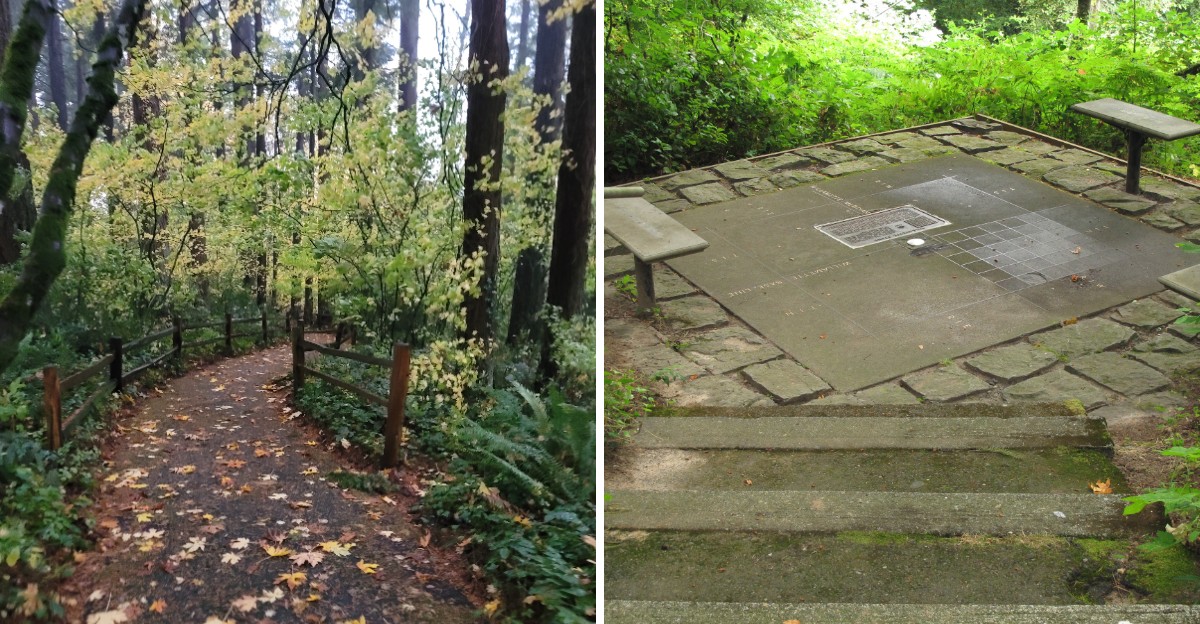
Stone markers rarely change how an entire region gets measured. This one apparently did exactly that, tucked quietly into forest most hikers walk past without noticing.
Surveyors once used this exact point as a reference for mapping enormous stretches of land across the region. Nothing about the marker looks impressive today, just a small stone easy to miss without knowing its significance beforehand.
Historical importance rarely survives this quietly without fading into obscurity eventually. This marker managed to stick around anyway, protected enough to remain exactly where surveyors originally placed it generations ago.
Few landmarks carry this much geographic weight while looking this unassuming. Hidden in Oregon’s woods, this stone quietly shaped maps most people never think to question.
The Point Where Two States Got Their Lines
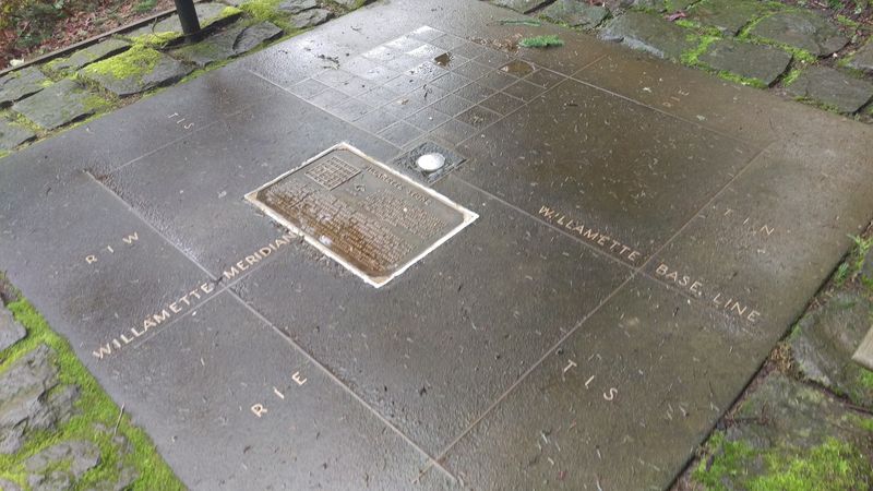
Every deed, fence line, and street grid in Oregon and Washington traces back to one modest marker tucked into the West Hills of Portland. Surveyors call it the Initial Point, and the name fits perfectly.
From this exact spot, two imaginary lines were stretched across the landscape. One runs north and south, the other east and west. Everything measured afterward hung off those two lines like threads on a loom.
What caught me off guard was the scale of the idea compared with the size of the object. A patch of shaded ground in a small ravine ended up shaping how land was divided from northern California to the Canadian border.
The monument sits low, with a brass cap set into stone and a short railing nearby. There is no sweeping plaza or towering statue, just trees leaning in close and the steady sound of branches dripping overhead.
That gap between the tiny marker and its enormous consequence is the part that stays with you on the drive home.
Finding The Turnoff Without Circling Twice
Here is the practical warning nobody gives you: the entrance is easy to miss. Skyline Boulevard curves through thick trees, the shoulder is narrow, and the sign is small and brown rather than bold and obvious.
Heading northwest on Skyline from the Burnside area, look for a small cemetery on the right. Just past a gentle bend, the gravel parking area appears on the left.
Space is limited, so arriving early on weekends makes the whole visit smoother. On a busy afternoon, cars sometimes wait for a spot rather than risk parking along the road.
Mapping apps have historically placed this site in the wrong location, sometimes sending people toward Cornell Road instead. Double-checking the address beforehand saves a frustrating loop through the hills.
Drive slowly through the final stretch. The road bends often, cyclists share it regularly, and the pullout arrives faster than expected. Once parked, the trailhead sits right there, no hunting required. That small bit of preparation turns a confusing detour into an easy stop.
A Short Paved Path That Drops Into The Trees
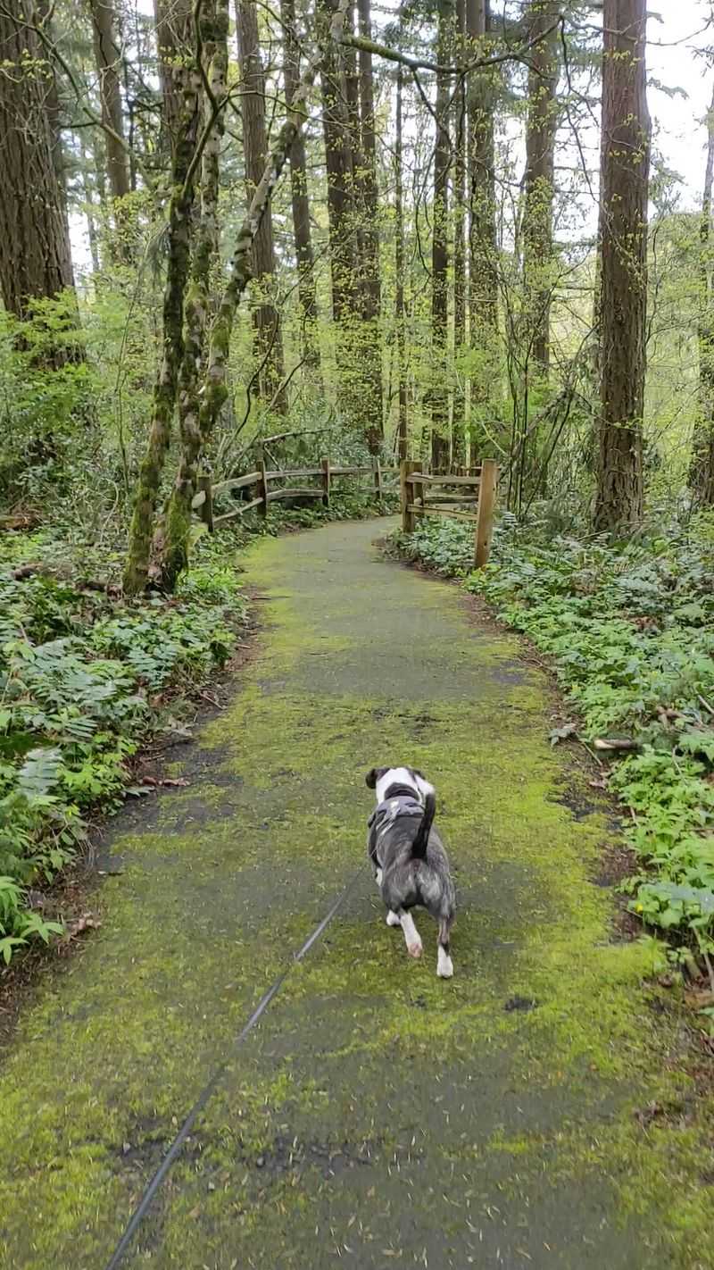
Calling it a hike would oversell things. The walk measures roughly a quarter mile round trip, and most people reach the marker in two or three minutes.
Still, the path earns respect on the way back. It slopes downhill on the approach, which means the return is a steady uphill climb that gets the lungs working a little.
Pavement covers the whole route, though moss creeps across the surface in shaded sections. After rain, those patches turn slick, so shoes with decent grip matter more than you would guess for such a short stroll.
The descent feels surprisingly immersive. Trees close in overhead, road noise fades within a few steps, and the temperature drops noticeably as the trail dips into the ravine.
Anyone with mobility limitations should know the grade is moderately steep and the site is not wheelchair accessible. Strollers can manage it with effort, but the climb back out is the real test. Short walk, big payoff. That trade is hard to beat anywhere in Portland.
Interpretive Signs That Explain Townships And Ranges
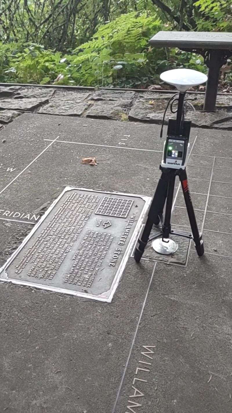
Words like township, range, and section show up constantly in property records, and most of us nod along without really knowing what they mean. The panels along this trail finally make it click.
Diagrams show how the land was chopped into six mile squares called townships, then split into smaller squares called sections. Each one gets a number and a position relative to those two original lines.
Reading them, I finally understood why so many roads in the Willamette Valley run in stubbornly straight north-south and east-west lines. The grid came first, and the pavement followed.
The signs stay refreshingly plain spoken. No dense legal language, just maps, dates, and clear explanations of how measurements were taken with chains and compasses.
Give yourself ten extra minutes to actually read them instead of skimming. The marker means far more once the system behind it makes sense.
Kids studying Oregon history tend to latch onto the map panels quickly. It turns an abstract textbook chapter into something they can stand on.
The 1851 Survey That Started It All
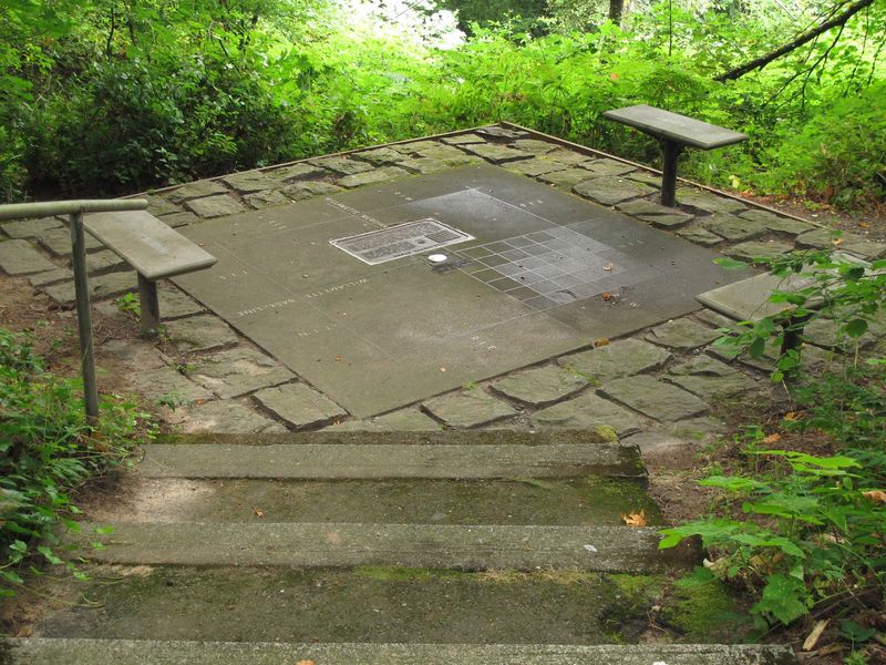
June 1851 marks the moment this hillside became important. John B. Preston, the first Surveyor General of the Oregon Territory, set the initial point here and began running the lines that organized the region.
A wooden stake came first. Stone followed later, and over the years the marker was damaged and replaced, which is why what you see today is a sturdier monument rather than the original.
Imagining the work is the fun part. Crews hauled chains and compasses through unmapped forest, measuring distances by hand across ridges, creeks, and thick undergrowth.
No satellites, no lasers, no shortcuts. Just math, patience, and a willingness to walk enormous distances for accuracy.
Land claims across the territory depended on their precision, which means mistakes would have rippled outward for generations. Knowing that gives the whole clearing a serious, almost respectful atmosphere.
Surveyors still visit as a kind of professional pilgrimage. For them, this quiet ravine is the starting line of their entire profession in the Northwest.
How The Willamette Meridian Still Shapes The Map
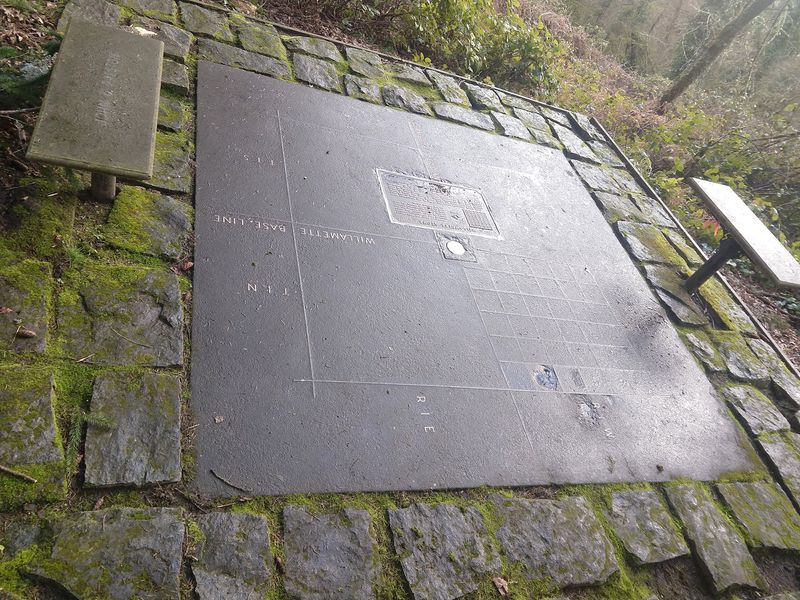
Two invisible lines radiate out from this hillside, and once you know about them, road trips change. The north-south line is the Willamette Meridian. The east-west line is the Willamette Baseline.
Drive between Hillsboro and Forest Grove and you will pass a road literally named Baseline. That stretch roughly follows the survey line drawn from this very point.
Follow it far enough east and you would arrive back at this marker, which is a strangely satisfying geographic loop.
Land records across both states still reference these lines. A legal description written today for a farm in eastern Oregon or a lot outside Seattle ultimately counts outward from this ravine.
That permanence impressed me more than anything else on the visit. Buildings fall, roads get rerouted, cities rename streets, yet these measurements have held steady since the 1850s.
Look at a plat map afterward and the abbreviations suddenly read like sentences. The site rewires how you see the landscape on every future drive.
Mossy Quiet, Ferns, And A Bench To Sit On
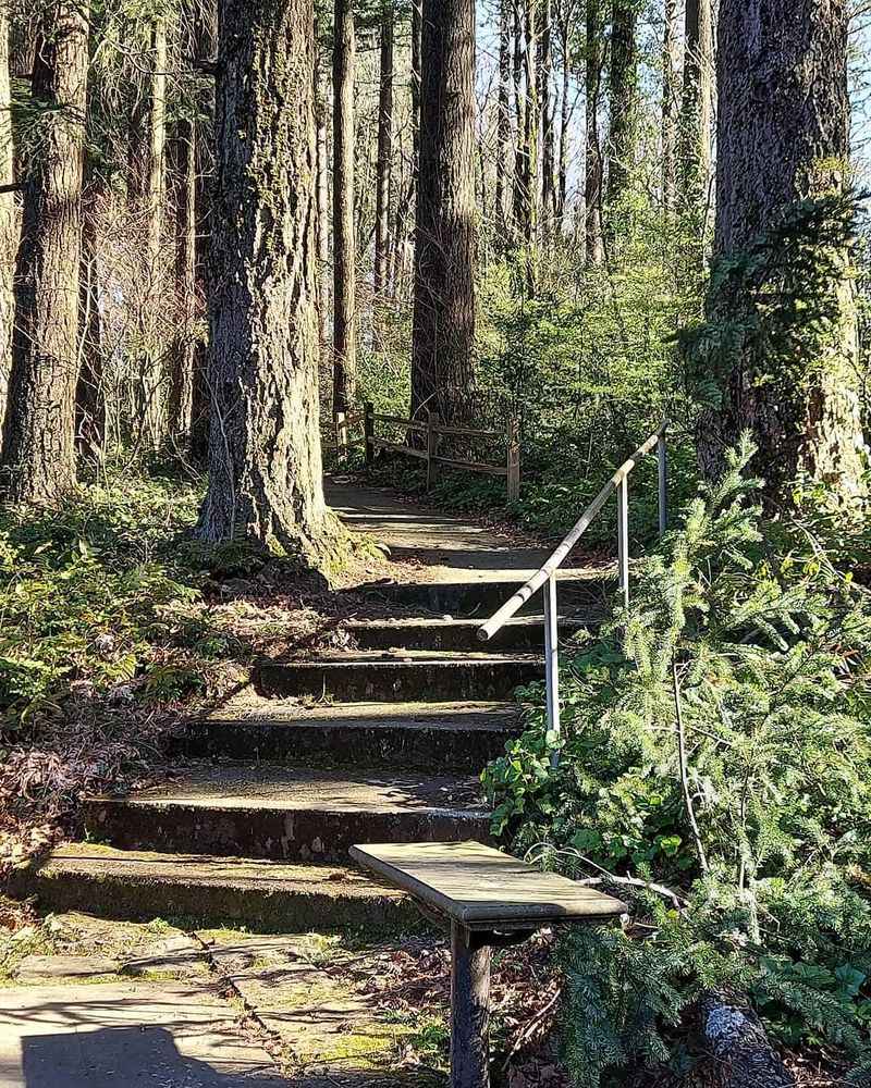
Forget the history for a minute and the place still works. Sword ferns crowd the slope, moss coats nearly every surface, and light filters down in soft green patches.
Benches near the bottom invite you to linger, and one is dedicated to surveyors, which feels fitting in a spot like this. Sitting there, the loudest sounds are birds and the occasional creak of branches.
The whole parcel is small, a tidy pocket of woods rather than a sprawling park. Somehow that intimacy helps. I ended up staying far longer than planned, mostly because the ravine muffles the outside world so effectively. Traffic on Skyline disappears within a few dozen steps.
Photographers will find plenty to work with. Textures of bark, moss, and weathered stone photograph beautifully in overcast light, which Portland supplies generously.
Bring a thermos and treat it as a short pause rather than a quick checkmark. Ten quiet minutes on that bench is the most underrated part of the trip.
Seasons Change The Mood Completely
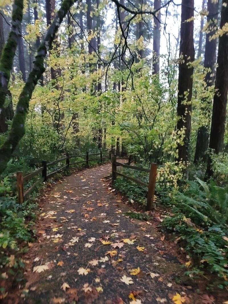
Autumn might be the sweet spot. Leaves turn gold along the path, the air smells like damp earth, and the whole ravine glows in that particular Pacific Northwest way.
Winter brings something moodier. Bare branches let more light through, the moss deepens to vivid green, and rain makes the paved slope genuinely slippery.
Spring wakes up the understory with fresh fern growth and birdsong bouncing around the hillside. Summer offers welcome shade when the rest of the city bakes.
Mist is the secret ingredient here. A gray, drizzly morning suits the place far better than blazing sunshine, at least in my opinion. Fallen needles and leaves can hide slick spots, so watch footing regardless of season. Handrails exist near the monument but not along the whole trail.
Visit twice in different months and it hardly feels like the same location. That variety is a decent excuse to keep coming back, especially for anyone living nearby who wants a reliable five minute reset.
What To Know Before Heading Out
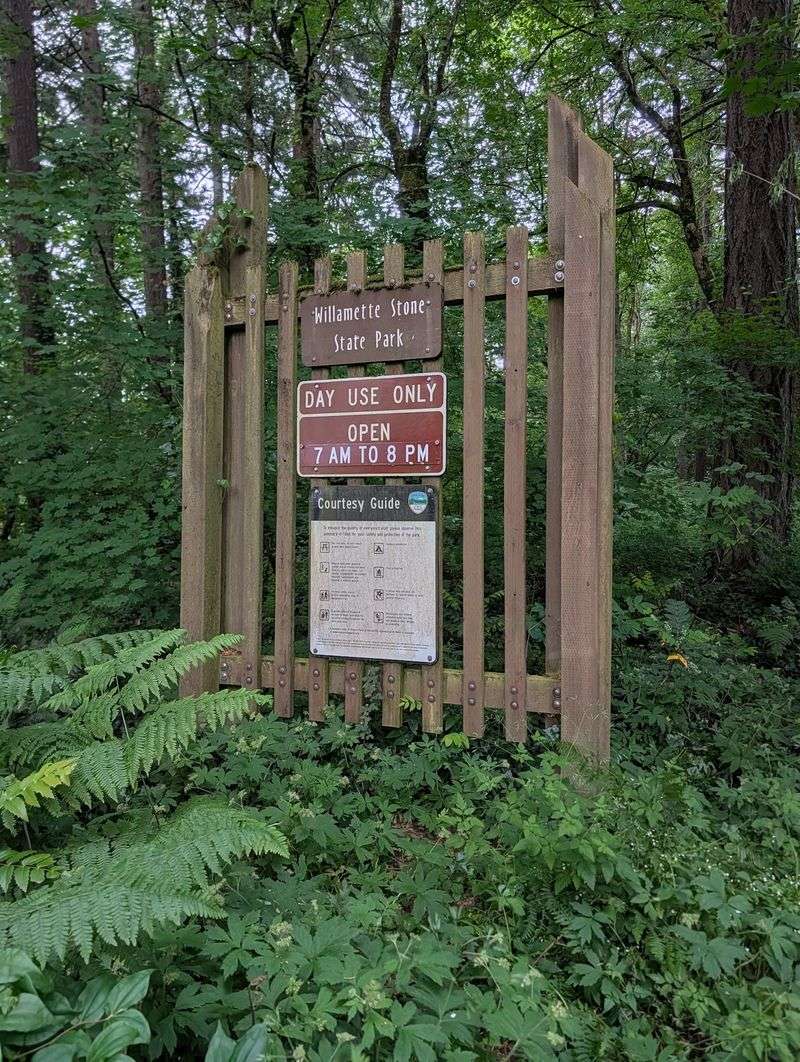
Amenities are basically nonexistent, and that is worth planning around. There are no restrooms, no water fountains, and no shops within walking distance.
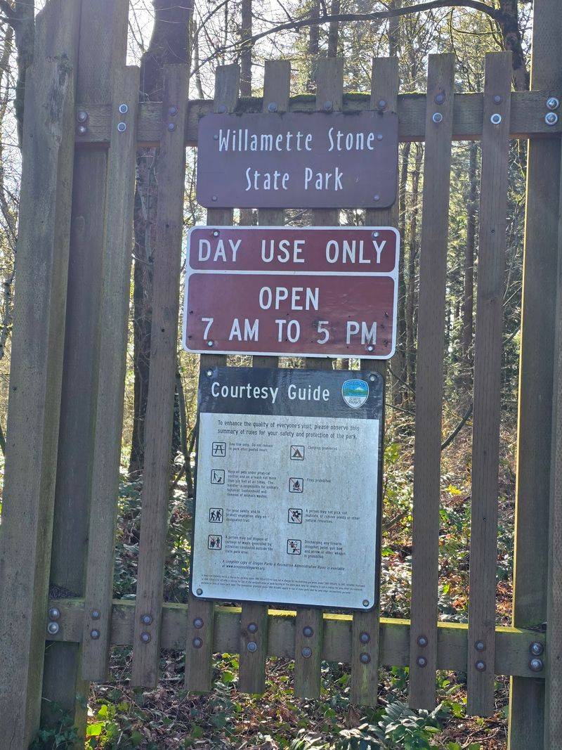
Gates open at 7 AM and the site closes at 9 PM, seven days a week, which leaves plenty of room for a morning detour or an evening stretch of the legs.
Parking is small and gravel, so larger vehicles should approach slowly. Cell service can be patchy under the tree cover in spots. Pack light. Water, sturdy shoes, and maybe a rain shell cover everything the visit demands.
Budget around twenty to thirty minutes total unless you plan to read every panel and rest on the bench. Combining it with other errands in Northwest Portland makes the drive feel worthwhile. Leave the area as you found it. With a parcel this small, even a little litter stands out immediately.
Building A Half Day Around The West Hills
A stop this short pairs naturally with a longer drive, and Skyline Boulevard happens to be one of the prettiest ridge roads near the city. Evergreens line both sides, and gaps in the trees occasionally open toward distant peaks.
On clear days, viewpoints along the ridge reveal snow capped mountains to the north and east. Bring a jacket, because the hills run cooler than downtown.
Forest Park and its trail network sit close by for anyone wanting an actual hike afterward. The contrast works well: history first, miles second.
My suggestion is to go early, when the forest still holds mist and the parking area sits mostly empty. Mornings here feel private in a way afternoons rarely do. Treat the marker as the anchor of the outing rather than the whole event, and the day fills itself in easily.
You will find Willamette Stone State Heritage Site at 253 NW Skyline Blvd, Portland, OR 97210, a small piece of ground with an outsized place in Northwest history.
